Peak Bagging the Mountains, Tops, Peaks and Hills in The Southern Marches area of The Lake District National Park, England
The Southern Marches area of The Lake District National Park is the area enclosed by:
- The Duddon Esturay to the West
- The River Duddon to Seathwaite (Duddon Valley), the Walna Scar Road to Coniston Village and then the A593 to Ambleside to the North West
- Lake Windermere & the A590 to Morecambe Bay to the East
- Then the Irish Sea to the South
There are 37 'tops' to walk up, bag and conquer, the highest point is Walna Scar and the area includes:
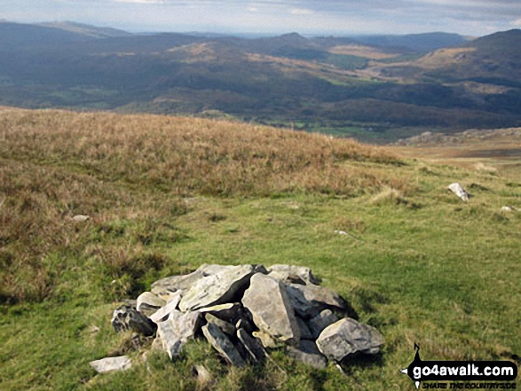 The summit of Walna Scar, the highest point in The Southern Marches area of The Lake District
Photo: Christine Shepherd
| 0 | Wainwrights | |
| 0 | Mountains (aka Hewitts) | |
| 1 | Dewey | |
| 2 | Nuttalls | |
| 34 | Wainwright Outlying Fells | |
| 4 | Marilyns | |
| 1 | Hill (aka Bridget) and | |
| 9 | Mountains, Tops, Peaks or Hills with a Trig Point on or near the top |
See these 37 Mountains, Peaks, Tops and Hills in The Southern Marches area of The Lake District:
- On an Interactive Google Map (loads faster)
- On an Interactive Google Map with a list of tops below it.
(makes it easier to locate a particular top) - On a Detailed List in:
Alphabetical Order | Height Order - On one page with 'yet-to-be-bagged' listed 1st & then 'already-bagged' tops listed 2nd in:
Alphabetical Order | Height Order - On one page with 'already-bagged' tops listed 1st & then 'yet-to-be-bagged' tops listed 2nd in:
Alphabetical Order | Height Order


