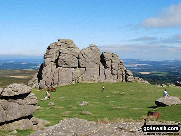
All the Mountains, Peaks, Tops and Hills in Dartmoor, Devon, England as a detailed list

Dartmoor National Park is located in South West England, wholly within the county of Devon.

If you include the Marilyns, the Bridgets (Hills) and all the Mountains, Tops, Peaks and Hills with a Trig Point on them there are 59 tops to climb, bag & conquer and the highest point is High Willhays at 622m (2,041ft).


Wainwright
0/0
Wainwrights
Hewitt
1/0
English
Mountains
Dewey
13/0
English
Deweys
nuttall
2/0
English
Nuttalls
Wainwright Outlying Fell
0/0
Wainwright
Outlying Fells
marilyn
1/0
English
Marilyn
Bridget
51/0
English
Bridgets
Trig Point
20/0
Trig
Points


LOG ON and RELOAD this page to show which Mountains, Peaks, Tops and Hills you have already climbed, bagged & conquered [. . . more details]


Page 1 of 2    Go to page: 1 2


See this list in: Alphabetical Order‡ | Height Order
To reverse the order select the link again.


Mountain, Peak, Top or Hill:

Bagged


1. Auswell Rocks

325m (1,066ft)


Got a good photo of
Auswell Rocks?

Send it in and we'll publish it here.

Photo
Submission
Details

  • Bridget

  • We hope to have walks that climb & bag Auswell Rocks very soon

    Google Maps Icon
    See the location of Auswell Rocks and walks up it on a google Map

    Auswell Rocks is on interactive maps:

  • OS Explorer (Orange Covers): OL28
  • OS Landranger (Pink Covers): 191

  • Auswell Rocks is on downloadable PDF you can Print or Save to your Phone:


    2. Bellever Tor

    443m (1,453ft)


    Got a good photo of
    Bellever Tor?

    Send it in and we'll publish it here.

    Photo
    Submission
    Details

  • Bridget
  • OS Trig Point

  • To walk, climb & bag Bellever Tor use either of these easy to follow walks:

    Google Maps Icon
    See the location of Bellever Tor and walks up it on a google Map

    Bellever Tor is on interactive maps:

  • OS Explorer (Orange Covers): OL28
  • OS Landranger (Pink Covers): 191

  • 3. Belstone Tor

    479m (1,572ft)

  • Bridget

  • To walk, climb & bag Belstone Tor use any of these easy to follow walks:

    Google Maps Icon
    See the location of Belstone Tor and walks up it on a google Map

    Belstone Tor is on interactive maps:

  • OS Explorer (Orange Covers): OL28
  • OS Landranger (Pink Covers): 191

  • 4. Black Hill (Dartmoor)

    412m (1,352ft)


    Got a good photo of
    Black Hill (Dartmoor)?

    Send it in and we'll publish it here.

    Photo
    Submission
    Details

  • Bridget

  • We hope to have walks that climb & bag Black Hill (Dartmoor) very soon

    Google Maps Icon
    See the location of Black Hill (Dartmoor) and walks up it on a google Map

    Black Hill (Dartmoor) is on interactive maps:

  • OS Explorer (Orange Covers): OL28
  • OS Landranger (Pink Covers): 191

  • Black Hill (Dartmoor) is on downloadable PDF you can Print or Save to your Phone:


    5. Blackingstone Rock

    355m (1,165ft)


    Got a good photo of
    Blackingstone Rock?

    Send it in and we'll publish it here.

    Photo
    Submission
    Details

  • Bridget

  • We hope to have walks that climb & bag Blackingstone Rock very soon

    Google Maps Icon
    See the location of Blackingstone Rock and walks up it on a google Map

    Blackingstone Rock is on interactive maps:

  • OS Explorer (Orange Covers): OL28
  • OS Landranger (Pink Covers): 191

  • Blackingstone Rock is on downloadable PDF you can Print or Save to your Phone:


    6. Brent Hill (Beara Common)

    311m (1,020ft)


    Got a good photo of
    Brent Hill (Beara Common)?

    Send it in and we'll publish it here.

    Photo
    Submission
    Details

  • Bridget
  • OS Trig Point

  • We hope to have walks that climb & bag Brent Hill (Beara Common) very soon

    Google Maps Icon
    See the location of Brent Hill (Beara Common) and walks up it on a google Map

    Brent Hill (Beara Common) is on interactive maps:

  • OS Explorer (Orange Covers): OL28
  • OS Landranger (Pink Covers): 191

  • Brent Hill (Beara Common) is on downloadable PDF you can Print or Save to your Phone:


    7. Brent Tor

    334m (1,096ft)


    Got a good photo of
    Brent Tor?

    Send it in and we'll publish it here.

    Photo
    Submission
    Details

  • Bridget
  • OS Trig Point

  • We hope to have walks that climb & bag Brent Tor very soon

    Google Maps Icon
    See the location of Brent Tor and walks up it on a google Map

    Brent Tor is on interactive maps:

  • OS Explorer (Orange Covers): 112
  • OS Landranger (Pink Covers): 191 and 201

  • 8. Butterdon Down

    351m (1,151ft)


    Got a good photo of
    Butterdon Down?

    Send it in and we'll publish it here.

    Photo
    Submission
    Details

  • Bridget

  • We hope to have walks that climb & bag Butterdon Down very soon

    Google Maps Icon
    See the location of Butterdon Down and walks up it on a google Map

    Butterdon Down is on interactive maps:

  • OS Explorer (Orange Covers): OL28
  • OS Landranger (Pink Covers): 191

  • Butterdon Down is on downloadable PDF you can Print or Save to your Phone:


    9. Butterdon Hill

    365m (1,197ft)


    Got a good photo of
    Butterdon Hill?

    Send it in and we'll publish it here.

    Photo
    Submission
    Details

  • Bridget
  • OS Trig Point

  • We hope to have walks that climb & bag Butterdon Hill very soon

    Google Maps Icon
    See the location of Butterdon Hill and walks up it on a google Map

    Butterdon Hill is on interactive maps:

  • OS Explorer (Orange Covers): OL28
  • OS Landranger (Pink Covers): 191

  • 10. Chinkwell Tor

    452m (1,483ft)


    Got a good photo of
    Chinkwell Tor?

    Send it in and we'll publish it here.

    Photo
    Submission
    Details

  • Bridget

  • We hope to have walks that climb & bag Chinkwell Tor very soon

    Google Maps Icon
    See the location of Chinkwell Tor and walks up it on a google Map

    Chinkwell Tor is on interactive maps:

  • OS Explorer (Orange Covers): OL28
  • OS Landranger (Pink Covers): 191

  • 11. Corndon Tor

    434m (1,424ft)


    Got a good photo of
    Corndon Tor?

    Send it in and we'll publish it here.

    Photo
    Submission
    Details

  • Bridget

  • We hope to have walks that climb & bag Corndon Tor very soon

    Google Maps Icon
    See the location of Corndon Tor and walks up it on a google Map

    Corndon Tor is on interactive maps:

  • OS Explorer (Orange Covers): OL28
  • OS Landranger (Pink Covers): 191

  • 12. Cosdon Hill (Cawsand Hill)

    551m (1,808ft)


    Got a good photo of
    Cosdon Hill (Cawsand Hill)?

    Send it in and we'll publish it here.

    Photo
    Submission
    Details

  • Dewey (70th in England, 160th in England & Wales)
  • OS Trig Point

  • To walk, climb & bag Cosdon Hill (Cawsand Hill) use this easy to follow walk:

    Google Maps Icon
    See the location of Cosdon Hill (Cawsand Hill) and walks up it on a google Map

    Cosdon Hill (Cawsand Hill) is on interactive maps:

  • OS Explorer (Orange Covers): OL28
  • OS Landranger (Pink Covers): 191

  • Cosdon Hill (Cawsand Hill) is on downloadable PDF you can Print or Save to your Phone:


    13. Cox Tor

    442m (1,450ft)


    Got a good photo of
    Cox Tor?

    Send it in and we'll publish it here.

    Photo
    Submission
    Details

  • Bridget
  • OS Trig Point

  • We hope to have walks that climb & bag Cox Tor very soon

    Google Maps Icon
    See the location of Cox Tor and walks up it on a google Map

    Cox Tor is on interactive maps:

  • OS Explorer (Orange Covers): OL28
  • OS Landranger (Pink Covers): 191

  • Cox Tor is on downloadable PDF you can Print or Save to your Phone:


    14. Cranbook Castle (Uppacott Down)

    337m (1,106ft)


    Got a good photo of
    Cranbook Castle (Uppacott Down)?

    Send it in and we'll publish it here.

    Photo
    Submission
    Details

  • Bridget

  • We hope to have walks that climb & bag Cranbook Castle (Uppacott Down) very soon

    Google Maps Icon
    See the location of Cranbook Castle (Uppacott Down) and walks up it on a google Map

    Cranbook Castle (Uppacott Down) is on interactive maps:

  • OS Explorer (Orange Covers): OL28
  • OS Landranger (Pink Covers): 191

  • Cranbook Castle (Uppacott Down) is on downloadable PDF you can Print or Save to your Phone:


    15. Cut Hill

    603m (1,979ft)


    Got a good photo of
    Cut Hill?

    Send it in and we'll publish it here.

    Photo
    Submission
    Details

  • Dewey (7th in England, 17th in England & Wales)
  • OS Trig Point

  • We hope to have walks that climb & bag Cut Hill very soon

    Google Maps Icon
    See the location of Cut Hill and walks up it on a google Map

    Cut Hill is on interactive maps:

  • OS Explorer (Orange Covers): OL28
  • OS Landranger (Pink Covers): 191

  • Cut Hill is on downloadable PDF you can Print or Save to your Phone:


    16. Easdon Tor

    439m (1,440ft)


    Got a good photo of
    Easdon Tor?

    Send it in and we'll publish it here.

    Photo
    Submission
    Details

  • Bridget
  • OS Trig Point

  • We hope to have walks that climb & bag Easdon Tor very soon

    Google Maps Icon
    See the location of Easdon Tor and walks up it on a google Map

    Easdon Tor is on interactive maps:

  • OS Explorer (Orange Covers): OL28
  • OS Landranger (Pink Covers): 191

  • 17. Gibbet Hill (Dartmoor)

    353m (1,158ft)

  • Bridget
  • OS Trig Point

  • We hope to have walks that climb & bag Gibbet Hill (Dartmoor) very soon

    Google Maps Icon
    See the location of Gibbet Hill (Dartmoor) and walks up it on a google Map

    Gibbet Hill (Dartmoor) is on interactive maps:

  • OS Explorer (Orange Covers): OL28
  • OS Landranger (Pink Covers): 191

  • 18. Great Links Tor

    587m (1,926ft)


    Got a good photo of
    Great Links Tor?

    Send it in and we'll publish it here.

    Photo
    Submission
    Details

  • Dewey (22nd in England, 56th in England & Wales)
  • OS Trig Point

  • To walk, climb & bag Great Links Tor use this easy to follow walk:

    Google Maps Icon
    See the location of Great Links Tor and walks up it on a google Map

    Great Links Tor is on interactive maps:

  • OS Explorer (Orange Covers): OL28
  • OS Landranger (Pink Covers): 191

  • Great Links Tor is on downloadable PDF you can Print or Save to your Phone:


    19. Great Staple Tor

    455m (1,493ft)

  • Bridget

  • To walk, climb & bag Great Staple Tor use either of these easy to follow walks:

    Google Maps Icon
    See the location of Great Staple Tor and walks up it on a google Map

    Great Staple Tor is on interactive maps:

  • OS Explorer (Orange Covers): OL28
  • OS Landranger (Pink Covers): 191

  • Great Staple Tor is on downloadable PDF you can Print or Save to your Phone:


    20. Gripper's Hill

    398m (1,306ft)


    Got a good photo of
    Gripper's Hill?

    Send it in and we'll publish it here.

    Photo
    Submission
    Details

  • Bridget

  • We hope to have walks that climb & bag Gripper's Hill very soon

    Google Maps Icon
    See the location of Gripper's Hill and walks up it on a google Map

    Gripper's Hill is on interactive maps:

  • OS Explorer (Orange Covers): OL28
  • OS Landranger (Pink Covers): 191

  • Gripper's Hill is on downloadable PDF you can Print or Save to your Phone:


    21. Gutter Tor (Ringmoor Down)

    350m (1,148ft)


    Got a good photo of
    Gutter Tor (Ringmoor Down)?

    Send it in and we'll publish it here.

    Photo
    Submission
    Details

  • Bridget
  • OS Trig Point

  • We hope to have walks that climb & bag Gutter Tor (Ringmoor Down) very soon

    Google Maps Icon
    See the location of Gutter Tor (Ringmoor Down) and walks up it on a google Map

    Gutter Tor (Ringmoor Down) is on interactive maps:

  • OS Explorer (Orange Covers): OL28
  • OS Landranger (Pink Covers): 191

  • 22. Hameldown Tor (Hamel Down)

    532m (1,746ft)


    Got a good photo of
    Hameldown Tor (Hamel Down)?

    Send it in and we'll publish it here.

    Photo
    Submission
    Details

  • Dewey (109th in England, 257th in England & Wales)
  • OS Trig Point

  • We hope to have walks that climb & bag Hameldown Tor (Hamel Down) very soon

    Google Maps Icon
    See the location of Hameldown Tor (Hamel Down) and walks up it on a google Map

    Hameldown Tor (Hamel Down) is on interactive maps:

  • OS Explorer (Orange Covers): OL28
  • OS Landranger (Pink Covers): 191

  • Hameldown Tor (Hamel Down) is on downloadable PDF you can Print or Save to your Phone:


    23. Hanger Down

    233m (764ft)


    Got a good photo of
    Hanger Down?

    Send it in and we'll publish it here.

    Photo
    Submission
    Details

  • Bridget

  • We hope to have walks that climb & bag Hanger Down very soon

    Google Maps Icon
    See the location of Hanger Down and walks up it on a google Map

    Hanger Down is on interactive maps:

  • OS Explorer (Orange Covers): OL28
  • OS Landranger (Pink Covers): 191

  • Hanger Down is on downloadable PDF you can Print or Save to your Phone:


    24. Hayne Down (Bowerman's Nose)

    391m (1,283ft)


    Got a good photo of
    Hayne Down (Bowerman's Nose)?

    Send it in and we'll publish it here.

    Photo
    Submission
    Details

  • Bridget

  • We hope to have walks that climb & bag Hayne Down (Bowerman's Nose) very soon

    Google Maps Icon
    See the location of Hayne Down (Bowerman's Nose) and walks up it on a google Map

    Hayne Down (Bowerman's Nose) is on interactive maps:

  • OS Explorer (Orange Covers): OL28
  • OS Landranger (Pink Covers): 191

  • Hayne Down (Bowerman's Nose) is on downloadable PDF you can Print or Save to your Phone:


    25. Haytor Rocks

    457m (1,499ft)

  • Bridget

  • We hope to have walks that climb & bag Haytor Rocks very soon

    Google Maps Icon
    See the location of Haytor Rocks and walks up it on a google Map

    Haytor Rocks is on interactive maps:

  • OS Explorer (Orange Covers): OL28
  • OS Landranger (Pink Covers): 191

  • 26. Heltor Rock

    312m (1,023ft)


    Got a good photo of
    Heltor Rock?

    Send it in and we'll publish it here.

    Photo
    Submission
    Details

  • Bridget

  • We hope to have walks that climb & bag Heltor Rock very soon

    Google Maps Icon
    See the location of Heltor Rock and walks up it on a google Map

    Heltor Rock is on interactive maps:

  • OS Explorer (Orange Covers): OL28
  • OS Landranger (Pink Covers): 191

  • Heltor Rock is on downloadable PDF you can Print or Save to your Phone:


    27. High Willhays

    622m (2,041ft)

  • Mountain (166th in England, 289th in England & Wales)
  • Nuttall (228th in England, 397th in England & Wales)
  • Marilyn (49th in England, 727th in GB)
  • High Willhays is the highest point in Dartmoor National Park and and the highest point in the county of Devon.


    To walk, climb & bag High Willhays use any of these easy to follow walks:

    Google Maps Icon
    See the location of High Willhays and walks up it on a google Map

    High Willhays is on interactive maps:

  • OS Explorer (Orange Covers): OL28
  • OS Landranger (Pink Covers): 191

  • High Willhays is on downloadable PDF you can Print or Save to your Phone:


    28. Holne Chase

    198m (649ft)


    Got a good photo of
    Holne Chase?

    Send it in and we'll publish it here.

    Photo
    Submission
    Details

  • Bridget

  • We hope to have walks that climb & bag Holne Chase very soon

    Google Maps Icon
    See the location of Holne Chase and walks up it on a google Map

    Holne Chase is on interactive maps:

  • OS Explorer (Orange Covers): OL28
  • OS Landranger (Pink Covers): 191

  • Holne Chase is on downloadable PDF you can Print or Save to your Phone:


    29. Hound Tor (Bonehill Down)

    414m (1,358ft)


    Got a good photo of
    Hound Tor (Bonehill Down)?

    Send it in and we'll publish it here.

    Photo
    Submission
    Details

  • Bridget

  • To walk, climb & bag Hound Tor (Bonehill Down) use this easy to follow walk:

    Google Maps Icon
    See the location of Hound Tor (Bonehill Down) and walks up it on a google Map

    Hound Tor (Bonehill Down) is on interactive maps:

  • OS Explorer (Orange Covers): OL28
  • OS Landranger (Pink Covers): 191

  • Hound Tor (Bonehill Down) is on downloadable PDF you can Print or Save to your Phone:


    30. Hunter's Tor

    326m (1,069ft)


    Got a good photo of
    Hunter's Tor?

    Send it in and we'll publish it here.

    Photo
    Submission
    Details

  • Bridget

  • To walk, climb & bag Hunter's Tor use this easy to follow walk:

    Google Maps Icon
    See the location of Hunter's Tor and walks up it on a google Map

    Hunter's Tor is on interactive maps:

  • OS Explorer (Orange Covers): OL28
  • OS Landranger (Pink Covers): 191

  • Page 1 of 2    Go to page: 1 2


    # Whether you print a copy or download it to your phone, this Peak Baggers' Map will prove incredibly useful if you want to know what's what when you are up in the mountains and cannot get a phone signal


    Is there a Mountain, Peak, Top or Hill missing from the above google map or list?

    Let us know an we will add it to our database.


    Do not miss our pick of the Best Walks in Britain


    Follow go4awalk.com on Twitter Follow go4awalk.com on Facebook


    Home


    Find new Friends to go walking with

    Walk all 214 Wainwrights in just 59 Walks. Download GPS Waypoints - Great Walks you must not miss!

    Walk The Yorkshire Three Peaks Challenge Walk - All the Latest Route Information, GPS Waypoints and Split Times to keep you on Schedule

    Walk The British Three Peaks Challenge Walk - All the Latest Route Information and GPS Waypoints

    See our pick of The Best Walks in The Lake District - Great Walks you must not miss!

    Walk our pick of the Best Lake District Ridge Walks - Great Walks you must not miss!

    Walk our pick of the Best Lake District Walks to do in the rain - Great Walks you must not miss!

    Walk our pick of The Best Walks in Snowdonia - Great Walks you must not miss!

    Walk our pick of The Best Ridge Walks in Wales - Walks you must not miss!

    Walk our pick of The Best Walks in The Brecon Beacons - Great Walks you must not miss!

    Walk our pick of The Best Walks in The Yorkshire Dales - Walks you must not miss!

    Walk our pick of The Best Walks in The Peak District - Walks you must not miss!

    Walk our pick of The Best Walks in The Forest of Bowland - Walks you must not miss!

    Walk our pick of The Best Walks in Shropshire - Walks you must not miss!

    Walk our pick of The Best Walks in Cheshire - Walks you must not miss!

    Walk our pick of The Best Walks in Lancashire - Walks you must not miss!

    Not sure where to walk next? Try Peak Bagging - Great Walks you must not miss!

    Not sure where to walk next? Walk part of a National Trail - Great Walks you must not miss!

    Walks with Downloadable and Uploadable GPS Waypoint Data

    Walking Kit and Gear Tested by Walkers

    Full Site Search