The Brecon Beacons Area of Bannau Brycheiniog (The Brecon Beacons National Park) - a fully detailed list of all the Mountains, Peaks, Tops and Hills
The Brecon Beacons Area of Bannau Brycheiniog (The Brecon Beacons National Park) is the Western half of the National Park. It is enclosed by:
- the Park Boundary to the North, West & South
- the B4558 from Brecon to Talybont-on-Usk and then a minor road south past Talybont Reservoir, Pentwyn Reservoir and Pontsticill Reservoir to Pontsticill to the East
If you count only the Deweys there are 12 tops to climb, bag & conquer and the highest point is Yr Allt (Forest Fawr) at 604m (1,982ft).
To see these Mountains, Peaks, Tops and Hills displayed in different ways - see the options in the left-hand column and towards the bottom of this page.
LOG ON and RELOAD this page to show which Mountains, Peaks, Tops and Hills you have already climbed, bagged & conquered [. . . more details]
See this list in: Alphabetical Order‡
| Height Order
To reverse the order select the link again.
Mountain, Peak, Top or Hill:
Bagged
1. Allt Forgan
513m (1,684ft)
Allt Forgan is on interactive maps:
Allt Forgan is on downloadable PDF you can Print or Save to your Phone: |
2. Bryn (Waun Rydd)
562m (1,844ft)
See the location of Bryn (Waun Rydd) and walks up it on a google Map Bryn (Waun Rydd) is on interactive maps:
Bryn (Waun Rydd) is on downloadable PDF you can Print or Save to your Phone: |
3. Carn Pen-rhiw-ddu
534m (1,752ft)
Carn Pen-rhiw-ddu is on interactive maps:
Carn Pen-rhiw-ddu is on downloadable PDF you can Print or Save to your Phone: |
4. Carreg Cadno
538m (1,765ft)
See the location of Carreg Cadno and walks up it on a google Map Carreg Cadno is on interactive maps:
Carreg Cadno is on downloadable PDF you can Print or Save to your Phone: |
5. Carreg Goch
558m (1,831ft)
Carreg Goch is on interactive maps:
Carreg Goch is on downloadable PDF you can Print or Save to your Phone: |
6. Cefn y Cylchau
556m (1,825ft)
Cefn y Cylchau is on interactive maps:
Cefn y Cylchau is on downloadable PDF you can Print or Save to your Phone: |
7. Disgwylfa (Waun Fignen Felen)
544m (1,785ft)
Send it in and we'll publish it here.
Disgwylfa (Waun Fignen Felen) is on interactive maps:
Disgwylfa (Waun Fignen Felen) is on downloadable PDF you can Print or Save to your Phone: |
8. Foel Fraith
602m (1,975ft)
Foel Fraith is on interactive maps:
Foel Fraith is on downloadable PDF you can Print or Save to your Phone: |
9. Moel Feity
591m (1,939ft)
Moel Feity is on interactive maps:
Moel Feity is on downloadable PDF you can Print or Save to your Phone: |
10. Pant y Creigiau
565m (1,854ft)
See the location of Pant y Creigiau and walks up it on a google Map Pant y Creigiau is on interactive maps:
Pant y Creigiau is on downloadable PDF you can Print or Save to your Phone: |
11. Waun Leuci (Cefn Cul)
562m (1,844ft)
Send it in and we'll publish it here.
Waun Leuci (Cefn Cul) is on interactive maps:
Waun Leuci (Cefn Cul) is on downloadable PDF you can Print or Save to your Phone: |
12. Yr Allt (Forest Fawr)
604m (1,982ft)
See the location of Yr Allt (Forest Fawr) and walks up it on a google Map Yr Allt (Forest Fawr) is on interactive maps:
Yr Allt (Forest Fawr) is on downloadable PDF you can Print or Save to your Phone: |
View these 12 Mountains, Peaks, Tops and Hills:
- On a Downloadable PDF you can Print or Save to your Phone#
- On an Interactive Google Map (loads faster)
- On an Interactive Google Map with a list of tops below it.
(makes it easier to locate a particular top) - On a Detailed List in:
Alphabetical Order | Height Order - On one page with 'yet-to-be-bagged' listed 1st & then 'already-bagged' tops listed 2nd in:
Alphabetical Order | Height Order - On one page with 'already-bagged' tops listed 1st & then 'yet-to-be-bagged' tops listed 2nd in:
Alphabetical Order | Height Order
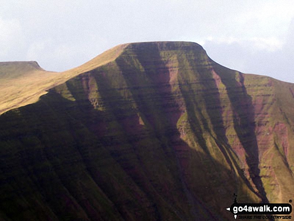
 Pen y Fan in The Brecon Beacons Area of The Brecon Beacons
Photo: Paul Holroyd
Is there a Mountain, Peak, Top or Hill missing from the above google map or list?
Let us know an we will add it to our database.


