The Mountains, Peaks, Tops and Hills in the North East region of England
The North East region of England comprises the traditional counties of County Durham, Tyne and Wear and Northumberland and includes most of Northumberland National Park and The Northern Pennines.
If you include all the Mountains (Hewitts), the Deweys, the Nuttalls, the Marilyns, the Bridgets (Hills) and all the Mountains, Tops, Peaks and Hills with a Trig Point on them there are 85 tops to climb, bag & conquer and the highest point is The Cheviot at 815m (2,674ft).
To see these Mountains, Peaks, Tops and Hills displayed in different ways - see the options in the left-hand column and towards the bottom of this page.
![]() Your Personal Bagging Record for North East of
Your Personal Bagging Record for North East of
LOG ON and RELOAD this page to show which Mountains, Peaks, Tops and Hills you have already climbed, bagged & conquered [. . . more details]
NB. If a Google Map does not appear below, or the icons do not respond, click here to refresh the page. If that doesn't work, try deleting your browser's cache.
Scroll down this list of mountains, peaks, tops & hills below and tap/click on each name (in blue) to locate it's position on the map above.
See this list in: Alphabetical Order | Height Order‡
To reverse the order select the link again.
Mountain, Peak, Top or Hill:
Bagged

![]()
1. The Cheviot
815m (2,674ft)
Mountain (Hewitt), Nuttall, Marilyn and Trig Point
See more details, photos, trip reports and easy-to-follow walks up The Cheviot

![]()
2. Mickle Fell
788m (2,586ft)
Mountain (Hewitt), Nuttall and Marilyn
See more details, photos, trip reports and easy-to-follow walks up Mickle Fell

![]()
3. Mickle Fell (East Top)
758m (2,487ft)
Bridget and Trig Point
See more details, photos, trip reports and easy-to-follow walks up Mickle Fell (East Top)

![]()
4. Redgleam (Harwood Common)
715m (2,346ft)
Nuttall
See more details, photos, trip reports and easy-to-follow walks up Redgleam (Harwood Common)

![]()
5. Hedgehope Hill
714m (2,343ft)
Mountain (Hewitt), Nuttall and Trig Point
See more details, photos, trip reports and easy-to-follow walks up Hedgehope Hill
![]()
6. Great Stony Hill
708m (2,323ft)
Mountain (Hewitt), Nuttall and Trig Point
See more details, photos, trip reports and easy-to-follow walks up Great Stony Hill

![]()
7. Chapelfell Top
700m (2,298ft)
Mountain (Hewitt) and Nuttall
See more details, photos, trip reports and easy-to-follow walks up Chapelfell Top

![]()
8. Fendrith Hill
697m (2,287ft)
Nuttall and Trig Point
See more details, photos, trip reports and easy-to-follow walks up Fendrith Hill
![]()
9. Westernhope Moor
675m (2,215ft)
Mountain (Hewitt), Nuttall and Trig Point
See more details, photos, trip reports and easy-to-follow walks up Westernhope Moor
![]()
10. Killhope Law
673m (2,208ft)
Mountain (Hewitt), Nuttall and Trig Point
See more details, photos, trip reports and easy-to-follow walks up Killhope Law
![]()
11. Grey Nag
656m (2,153ft)
Mountain (Hewitt), Nuttall and Trig Point
See more details, photos, trip reports and easy-to-follow walks up Grey Nag
![]()
12. Comb Fell
652m (2,139ft)
Mountain (Hewitt) and Nuttall
See more details, photos, trip reports and easy-to-follow walks up Comb Fell
![]()
13. Three Pikes
650m (2,134ft)
Mountain (Hewitt) and Nuttall
See more details, photos, trip reports and easy-to-follow walks up Three Pikes
![]()
14. Viewing Hill
649m (2,130ft)
Mountain (Hewitt) and Nuttall
See more details, photos, trip reports and easy-to-follow walks up Viewing Hill
![]()
15. Tom Smith's Stone Top
637m (2,091ft)
Nuttall
See more details, photos, trip reports and easy-to-follow walks up Tom Smith's Stone Top
![]()
16. Bink Moss
619m (2,032ft)
Mountain (Hewitt) and Nuttall
See more details, photos, trip reports and easy-to-follow walks up Bink Moss
![]()
17. Windy Gyle
619m (2,031ft)
Mountain (Hewitt), Nuttall and Trig Point
See more details, photos, trip reports and easy-to-follow walks up Windy Gyle
![]()
18. Cushat Law
616m (2,022ft)
Mountain (Hewitt) and Nuttall
See more details, photos, trip reports and easy-to-follow walks up Cushat Law
![]()
19. The Dodd
614m (2,015ft)
Mountain (Hewitt) and Nuttall
See more details, photos, trip reports and easy-to-follow walks up The Dodd
![]()
20. Middlehope Moor
612m (2,008ft)
Mountain (Hewitt), Nuttall and Trig Point
See more details, photos, trip reports and easy-to-follow walks up Middlehope Moor
![]()
21. Bloodybush Edge
610m (2,001ft)
Mountain (Hewitt), Nuttall and Trig Point
See more details, photos, trip reports and easy-to-follow walks up Bloodybush Edge

![]()
22. Peel Fell
602m (1,975ft)
Dewey and Marilyn
See more details, photos, trip reports and easy-to-follow walks up Peel Fell

![]()
23. The Schil
601m (1,972ft)
Dewey
See more details, photos, trip reports and easy-to-follow walks up The Schil
![]()
24. Raven Seat (Harnisha Hill)
589m (1,933ft)
Bridget and Trig Point
See more details, photos, trip reports and easy-to-follow walks up Raven Seat (Harnisha Hill)

![]()
25. Carter Bar (Carter Fell)
579m (1,900ft)
Dewey and Trig Point
See more details, photos, trip reports and easy-to-follow walks up Carter Bar (Carter Fell)
![]()
26. Deadwater Fell
569m (1,867ft)
Dewey and Trig Point
See more details, photos, trip reports and easy-to-follow walks up Deadwater Fell
![]()
27. Dunmoor Hill
569m (1,867ft)
Dewey
See more details, photos, trip reports and easy-to-follow walks up Dunmoor Hill
![]()
28. Dry Rigg (Redburn Common)
566m (1,857ft)
Dewey and Trig Point
See more details, photos, trip reports and easy-to-follow walks up Dry Rigg (Redburn Common)

![]()
29. Monk's Moor
565m (1,854ft)
Bridget
See more details, photos, trip reports and easy-to-follow walks up Monk's Moor
![]()
30. Wether Cairn (Wholhope Hill)
563m (1,847ft)
Dewey and Trig Point
See more details, photos, trip reports and easy-to-follow walks up Wether Cairn (Wholhope Hill)
![]()
31. Beefstand Hill
562m (1,844ft)
Dewey
See more details, photos, trip reports and easy-to-follow walks up Beefstand Hill
![]()
32. Blackhill Edge (Westernhope Moor)
559m (1,834ft)
Bridget and Trig Point
See more details, photos, trip reports and easy-to-follow walks up Blackhill Edge (Westernhope Moor)
![]()
33. Thirl Moor
558m (1,831ft)
Dewey and Trig Point
See more details, photos, trip reports and easy-to-follow walks up Thirl Moor
![]()
34. Windy Hill (Lintzgarth Common)
554m (1,818ft)
Bridget and Trig Point
See more details, photos, trip reports and easy-to-follow walks up Windy Hill (Lintzgarth Common)
![]()
35. Wool Meath
552m (1,811ft)
Dewey
See more details, photos, trip reports and easy-to-follow walks up Wool Meath
![]()
36. Black Hag (Hethpool)
549m (1,801ft)
Dewey
See more details, photos, trip reports and easy-to-follow walks up Black Hag (Hethpool)
![]()
37. Yarnspath Law
543m (1,782ft)
Dewey
See more details, photos, trip reports and easy-to-follow walks up Yarnspath Law
![]()
38. Bolt's Law (Hunstanworth)
541m (1,776ft)
Dewey and Trig Point
See more details, photos, trip reports and easy-to-follow walks up Bolt's Law (Hunstanworth)
![]()
39. Bollihope Carrs
541m (1,775ft)
Bridget and Trig Point
See more details, photos, trip reports and easy-to-follow walks up Bollihope Carrs
![]()
40. Newton Tors
537m (1,762ft)
Dewey and Trig Point
See more details, photos, trip reports and easy-to-follow walks up Newton Tors

![]()
41. White Crags (Girdle Fell)
536m (1,759ft)
Trig Point
See more details, photos, trip reports and easy-to-follow walks up White Crags (Girdle Fell)
![]()
42. Brownley Hill (Kevelin Moor)
533m (1,749ft)
Dewey and Trig Point
See more details, photos, trip reports and easy-to-follow walks up Brownley Hill (Kevelin Moor)
![]()
43. King's Seat
532m (1,746ft)
Bridget and Trig Point
See more details, photos, trip reports and easy-to-follow walks up King's Seat
![]()
44. Shill Moor
528m (1,732ft)
Dewey and Trig Point
See more details, photos, trip reports and easy-to-follow walks up Shill Moor
![]()
45. Ravens Knowe
527m (1,729ft)
Dewey
See more details, photos, trip reports and easy-to-follow walks up Ravens Knowe
![]()
46. Preston Hill
526m (1,726ft)
Dewey
See more details, photos, trip reports and easy-to-follow walks up Preston Hill
![]()
47. Pike Rigg (Whitfield Common)
525m (1,723ft)
Dewey and Trig Point
See more details, photos, trip reports and easy-to-follow walks up Pike Rigg (Whitfield Common)
![]()
48. Ayle Common
524m (1,720ft)
Dewey
See more details, photos, trip reports and easy-to-follow walks up Ayle Common
![]()
49. Raven Hills (Monk's Moor)
522m (1,713ft)
Bridget and Trig Point
See more details, photos, trip reports and easy-to-follow walks up Raven Hills (Monk's Moor)

![]()
50. Sighty Crag
520m (1,706ft)
Dewey, Marilyn and Trig Point
See more details, photos, trip reports and easy-to-follow walks up Sighty Crag
![]()
51. Horseshoe Hill
519m (1,703ft)
Dewey and Trig Point
See more details, photos, trip reports and easy-to-follow walks up Horseshoe Hill
![]()
52. Collier Law
517m (1,697ft)
Dewey and Trig Point
See more details, photos, trip reports and easy-to-follow walks up Collier Law
![]()
53. Broadhope Hill
517m (1,696ft)
Dewey
See more details, photos, trip reports and easy-to-follow walks up Broadhope Hill
![]()
54. The Grun (Grey Mares Knowe)
516m (1,693ft)
Bridget and Trig Point
See more details, photos, trip reports and easy-to-follow walks up The Grun (Grey Mares Knowe)
![]()
55. Glendhu Hill
514m (1,686ft)
Dewey and Trig Point
See more details, photos, trip reports and easy-to-follow walks up Glendhu Hill
![]()
56. Monkside
513m (1,683ft)
Dewey and Trig Point
See more details, photos, trip reports and easy-to-follow walks up Monkside
![]()
57. Lamb Hill
511m (1,677ft)
Bridget and Trig Point
See more details, photos, trip reports and easy-to-follow walks up Lamb Hill
![]()
58. Lint Lands
510m (1,673ft)
Dewey
See more details, photos, trip reports and easy-to-follow walks up Lint Lands
![]()
59. Birnie Brae
508m (1,667ft)
Dewey
See more details, photos, trip reports and easy-to-follow walks up Birnie Brae
![]()
60. Brownhart Law
508m (1,667ft)
Dewey
See more details, photos, trip reports and easy-to-follow walks up Brownhart Law
![]()
61. Harwood Side
502m (1,647ft)
Bridget and Trig Point
See more details, photos, trip reports and easy-to-follow walks up Harwood Side
![]()
62. Hungry Law
501m (1,644ft)
Dewey and Trig Point
See more details, photos, trip reports and easy-to-follow walks up Hungry Law
![]()
63. Shillhope Law
501m (1,644ft)
Dewey, Marilyn and Trig Point
See more details, photos, trip reports and easy-to-follow walks up Shillhope Law
![]()
64. Islington Hill
492m (1,614ft)
Bridget
See more details, photos, trip reports and easy-to-follow walks up Islington Hill
![]()
65. Eggleston Common
488m (1,601ft)
Bridget
See more details, photos, trip reports and easy-to-follow walks up Eggleston Common
![]()
66. Five Pikes
478m (1,568ft)
Bridget and Trig Point
See more details, photos, trip reports and easy-to-follow walks up Five Pikes
![]()
67. Grey Carrs (Eggleston Moor)
461m (1,513ft)
Bridget and Trig Point
See more details, photos, trip reports and easy-to-follow walks up Grey Carrs (Eggleston Moor)
![]()
68. Shacklesborough
454m (1,490ft)
Bridget and Trig Point
See more details, photos, trip reports and easy-to-follow walks up Shacklesborough

![]()
69. Tosson Hill
440m (1,444ft)
Marilyn and Trig Point
See more details, photos, trip reports and easy-to-follow walks up Tosson Hill
![]()
70. Bulbeck Common
427m (1,401ft)
Bridget and Trig Point
See more details, photos, trip reports and easy-to-follow walks up Bulbeck Common
![]()
71. Catterick Moss
426m (1,398ft)
Bridget and Trig Point
See more details, photos, trip reports and easy-to-follow walks up Catterick Moss
![]()
72. Steppleknoll
365m (1,197ft)
Bridget
See more details, photos, trip reports and easy-to-follow walks up Steppleknoll
![]()
73. Winshield Crags
345m (1,132ft)
Bridget and Trig Point
See more details, photos, trip reports and easy-to-follow walks up Winshield Crags
![]()
74. Great Hetha
343m (1,125ft)
Bridget
See more details, photos, trip reports and easy-to-follow walks up Great Hetha
![]()
75. Long Crag
319m (1,046ft)
Marilyn and Trig Point
See more details, photos, trip reports and easy-to-follow walks up Long Crag
![]()
76. Ros Castle (Ross Castle)
315m (1,033ft)
Marilyn and Trig Point
See more details, photos, trip reports and easy-to-follow walks up Ros Castle (Ross Castle)
![]()
77. Pontop Pike
312m (1,023ft)
Bridget and Trig Point
See more details, photos, trip reports and easy-to-follow walks up Pontop Pike
![]()
78. Whittington Fell
268m (879ft)
Bridget and Trig Point
See more details, photos, trip reports and easy-to-follow walks up Whittington Fell

![]()
79. Housedon Hill
266m (873ft)
Marilyn
See more details, photos, trip reports and easy-to-follow walks up Housedon Hill
![]()
80. Currock Hill
259m (850ft)
Bridget
See more details, photos, trip reports and easy-to-follow walks up Currock Hill
![]()
81. The Bell
247m (810ft)
Bridget
See more details, photos, trip reports and easy-to-follow walks up The Bell
![]()
82. Moneylaws Hill
246m (807ft)
Bridget and Trig Point
See more details, photos, trip reports and easy-to-follow walks up Moneylaws Hill
![]()
83. Titlington Pike
233m (764ft)
Bridget and Trig Point
See more details, photos, trip reports and easy-to-follow walks up Titlington Pike
![]()
84. Dod Law (Doddington Moor)
200m (656ft)
Bridget and Trig Point
See more details, photos, trip reports and easy-to-follow walks up Dod Law (Doddington Moor)
![]()
85. Strawberry Hill
193m (633ft)
Bridget and Trig Point
See more details, photos, trip reports and easy-to-follow walks up Strawberry Hill
See this list in: Alphabetical Order | Height Order‡
To reverse the order select the link again.
View these 85 Mountains, Peaks, Tops and Hills:
- On an Interactive Google Map (loads faster)
- On an Interactive Google Map with a list of tops below it.
(makes it easier to locate a particular top) - On a Detailed List in:
Alphabetical Order | Height Order - On one page with 'yet-to-be-bagged' listed 1st & then 'already-bagged' tops listed 2nd in:
Alphabetical Order | Height Order - On one page with 'already-bagged' tops listed 1st & then 'yet-to-be-bagged' tops listed 2nd in:
Alphabetical Order | Height Order
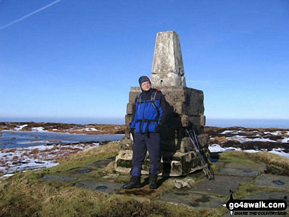 The summit of The Cheviot in North East
Photo: Julian Whitley
Is there a Mountain, Peak, Top or Hill missing from the above google map or list?
Let us know an we will add it to our database.

To contribute to go4awalk.com or to contact us about anything at all - see Talk To Us.
For help see Help.
go4awalk.com and go4awalk.co.uk are registered trademarks of TMDH Limited.
Copyright © 2000-2025 TMDH Limited. All rights reserved.
Copyright Terms & Conditions Privacy Statement
A - Z Walks Home Log On/Accounts Photo Gallery Walk Ideas and Collections Fell Facts Hill Skills Walking Questions and Answers Your Stories News Competitions Product Reviews/Gear Tests Walking Gear Guides Peaks and Mountains Peak Bagging Find New Walking Friends Camping GPS Waypoints for Walking Contents Walk Search Talk To Us go4awalk.com Help Free Example Walks Newsletter


