
![]()
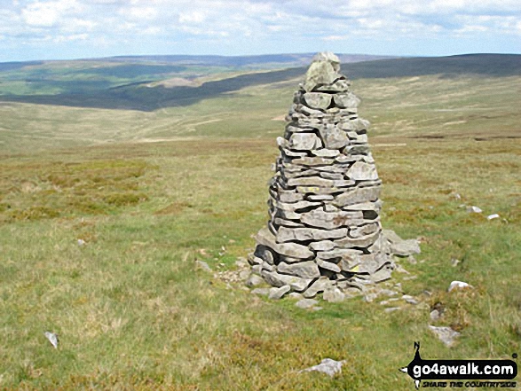
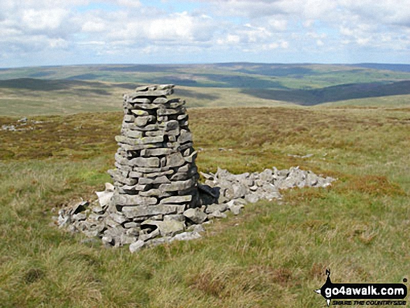
Westernhope Moor
675m (2215ft)
The North Pennines, County Durham, England
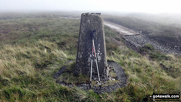
The summit of Westernhope Moor is marked by an Ordnance Survey Trig Point.

Not familiar with this top?
You can walk/hike to the top of Westernhope Moor by using this easy‑to‑follow route map:
Walk du145 Chapelfell Top from St John's Chapel
Wild moorland walking with fine views
   |
|---|
Vital Statistics:
| Length: | 14ml (22.5km) |
|---|---|
| Ascent: | 1,979ft (603m) |
| Time: | 7 hrs |
| Grade: |  (Hard) (Hard) |

Route Summary:
St John's Chapel - Thatch Mires - Chapelfell Top - Fendrith Hill - Swinhope Moor - Dora's Seat - Swinhope Head - Westernhope Moor - Black Hill (Westernhope Moor) - Littlewood Farm - Brotherlee - Shield - River Wear - Weardale - The Weardale Way - Westgate - Daddry - St John's Chapel
See Westernhope Moor and the surrounding tops on our free-to-access 'Google Style' Peak Bagging Map:
The North Pennines
Less data - quicker to download
See Westernhope Moor and the surrounding tops on our unique, downloadable, PDF Peak Bagging Map:

NB: Whether you print off a copy or download it to your phone, this PDF Peak Baggers' Map might prove incredibly useful when your are up there on the tops and you cannot get a phone signal.
You can find Westernhope Moor & all the walks that climb it on these unique free-to-access Interactive Walk Planning Maps:
1:25,000 scale OS Explorer Map (orange/yellow covers):
1:50,000 scale OS Landranger Maps (pink/magenta covers):
 Fellow go4awalkers who have already walked, climbed, scaled, summited, hiked & bagged Westernhope Moor
Caroline Winter walked up Westernhope Moor on July 20th, 2022 [from/via/route] Parked at pull in by cattle grid on Swinhope head & direct line along fence to the top to trig [with] Solo [weather] Warm & humid - Hot spell of weather, meant peat dried out & relatively easy walking. A party balloon stuck in fencing is maybe the very same one we spotted last year, as it had a birth date of 2021 printed on it.
Kevin Foster climbed it on September 15th, 2018 [from/via/route] Walk du145 from Saint John's Chapel. [with] Henry. [weather] Sunny to start but then clouded over. - The walk begins with a direct but very pleasant approach to Chapelfell Top via a lane immediately behind the Golden Lion pub. After the lane is left the going does get tough for a while but eases a bit when the man made gulley cut through the peat hags directs you to the small summit cairn itself. This gutter which is very wide in places is then followed to a shallow col & a slight rise of barely 50 feet to the next top, Fendrith Hill,which has the nicest views of the whole walk into Teesdale. The second half of the walk over Westernhope Moor & the descent over Black Hill is a bit of a slog but the return along the river Wear to the starting point following the Weardale Way more than compensates for it.
Darren Mortimer bagged it on July 21st, 2018 [from/via/route] Road side [with] Dermot Palmer [weather] Overcast & warm
Mark Davidson hiked Westernhope Moor on May 25th, 2007 [with] Alone [weather] Sunny, warm & dry - just lovely
Christine Shepherd summited on September 14th, 2016 [from/via/route] Walked from St. John's Chapel using walks du145 & du129 [with] On my own [weather] Warm but the mist swirled around me all day. - As the weather was deteriorating & I could hardly see the fence I made the decision to retrace my steps from this summit back to the road at Swinhope Head & went down from there instead of going over Black Hill.
Ray O'hara conquered it on February 4th, 2013 [weather] 60 MPH winds, ground frozen, a little lying snow.
Patrick Rogozinski, Paul Booth and Trevor Williams have all walked, climbed & bagged Westernhope Moor.
To add (or remove) your name and experiences on this page - Log On and edit your Personal Mountain Bagging Record
More Photographs & Pictures of views from, on, or of, Westernhope Moor


Send us your photographs and pictures on, of, or from Westernhope Moor
If you would like to add your walk photographs and pictures to this page, please send them as email attachments (configured for any computer) along with your name to:
and we shall do our best to publish them.
(Guide Resolution = 300dpi. At least = 660pixels (wide) x 440 pixels (high).)

You can also submit photos via our Facebook Page.
NB. Please indicate where each photo was taken and whether you wish us to credit your photos with a Username or your First Name/Last Name.


