
![]()
Tom Smith's Stone Top
637m (2091ft)
The North Pennines, Northumberland, England
Not familiar with this top?
   |
|---|
Vital Statistics:
| Length: | 10ml (16km) |
|---|---|
| Ascent: | 1,628ft (496m) |
| Time: | 5.25hrs |
| Grade: |  (Moderate) (Moderate) |
Route Summary:
Gilderdale Bridge - The Pennine Way - Black Hill (Whitley Common) - Grey Nag - Tom Smith's Stone Top - Tom Smith's Stone - Croglin Water - Haresceugh Fell - Black Fell (Haresceugh Fell) - Woldgill Moss - Gilderdale Burn - Gilderdale Bridge
See Tom Smith's Stone Top and the surrounding tops on our free-to-access 'Google Style' Peak Bagging Map:
The North Pennines
Less data - quicker to download
See Tom Smith's Stone Top and the surrounding tops on our downloadable Peak Bagging Map in PDF format:

NB: Whether you print off a copy or download it to your phone, this PDF Peak Baggers' Map might prove incredibly useful when your are up there on the tops and you cannot get a phone signal.
You can find Tom Smith's Stone Top & all the walks that climb it on these unique free-to-access Interactive Walk Planning Maps:
1:25,000 scale OS Explorer Map (orange/yellow covers):
1:50,000 scale OS Landranger Map (pink/magenta covers):
 Fellow go4awalkers who have already walked, climbed, summited & bagged Tom Smith's Stone Top
David Peebles walked up Tom Smith's Stone Top on July 13th, 2024 [from/via/route] Bridge Near Gilderdale [with] Solo [weather] Rain & cloud all walk. - New Boots & sore heels by the end.
Sam Jones climbed Tom Smith's Stone Top on July 16th, 2022 [from/via/route] From Hartside [with] Solo [weather] mix of sun & cloud - Awesome views good visibility
Mark Davidson bagged Tom Smith's Stone Top on March 23rd, 2007 [from/via/route] Extension to Walk c337 Black Fell (Haresceugh Fell) & Benty Hill from Hartside Top Cafe [with] alone [weather] Bright & sunny - lovely summer's day - The route between Black Fell (Haresceugh Fell) to Grey Nag crosses some of the boggiest ground I have ever come across - despite it being a hot & dry summer day (can't remember what the rest of that summer (2007) was like though). If you are thinking of doing it this way instead of climbing up from Gilderdale Bridge - don't!
Darren Mortimer hiked Tom Smith's Stone Top on September 29th, 2018 [with] Dermot Palmer [weather] very windy
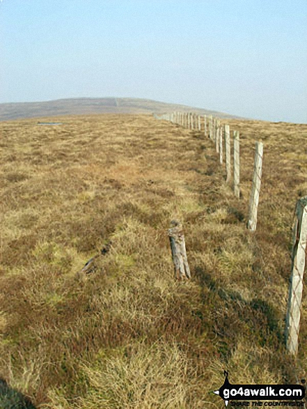
Kevin Foster summited Tom Smith's Stone Top on July 21st, 2018 [from/via/route] Grey Nag [with] Henry. [weather] Overcast becoming sunny. - A pleasant ramble following the wall then fence over rough grass & the occasional dried up bog to the slight bump of Tom Smith's Stone Top. Having straightened up the white pole that marks the top itself I carried on to locate Tom Smith's Stone in a bend in the fence line. From here I was able to make out Thack Moor, Watch Hill & Black Fell which I had done in a previous walk. Beyond these Cross Fell & the Dun fells were becoming visible as the clouds started to lift. I then turned around to retrace my steps first to Grey Nag then over Black Hill to rejoin the Pennine way back to my car parked in the lay-by at Gilderdale bridge.
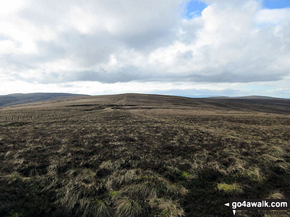
Christine Shepherd conquered Tom Smith's Stone Top on March 5th, 2017 [from/via/route] Walked from Gilderdale Bridge using walk c114. [with] On my own [weather] A fine spring day with plenty of sunshine. - Not a very inspiring summit but easy enough to find. Didn't go on from here to Black Fell as the ground was very wet. Retraced my steps to Grey Nag. Missed the path down from there but soon heard traffic on the 689 & made my way there & walked back to the Bridge on the road.
Iain Taylor scaled Tom Smith's Stone Top on August 3rd, 2012 [from/via/route] Hartside Cross (NY 64640 41858)
Ray O'hara walked up Tom Smith's Stone Top on August 20th, 2012 [from/via/route] N114 [weather] Dry & clear. - The route from here to Black Fell was the boggiest that I have ever seen anywhere. Take waders & a snorkel.
Percival Dawson, Patrick Rogozinski, Matthew Thomas and Trevor Williams have all walked, climbed & bagged Tom Smith's Stone Top.
To add (or remove) your name and experiences on this page - Log On and edit your Personal Mountain Bagging Record
More Photographs & Pictures of views from, on or of Tom Smith's Stone Top
Send us your photographs and pictures on, of, or from Tom Smith's Stone Top
If you would like to add your walk photographs and pictures featuring views from, on or of Tom Smith's Stone Top to this page, please send them as email attachments (configured for any computer) along with your name to:
and we shall do our best to publish them.
(Guide Resolution = 300dpi. At least = 660pixels (wide) x 440 pixels (high).)

You can also submit photos via our Facebook Page.
NB. Please indicate where each photo was taken and whether you wish us to credit your photos with a Username or your First Name/Last Name.
Not familiar with this top?


