
![]()
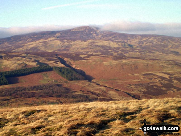
Shill Moor
528m (1732ft)
Northumberland National Park, Northumberland, England
The summit of Shill Moor is marked by an Ordnance Survey Trig Point.
Not familiar with this top?
   |
|---|
Vital Statistics:
| Length: | 10.5ml (16.5km) |
|---|---|
| Ascent: | 2,244ft (684m) |
| Time: | 6 hrs |
| Grade: |  (Moderate) (Moderate) |
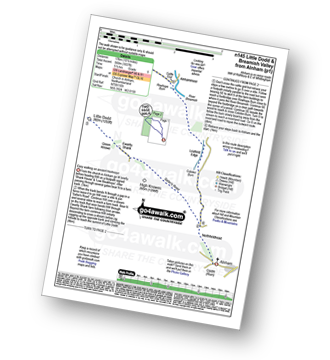
Route Summary:
Alnham - Salter's Road - Northfieldhead - White Gate - High Knowes - Ewartly Shank - Shank Burn - Little Dod - Shill Moor - Breamish Valley - Meggrim's Knowe - Alnhammoor Farm - Rowhope Burn - Leafield Edge - Deb Cleugh - Northfieldhead - Alnham
See Shill Moor and the surrounding tops on our free-to-access 'Google Style' Peak Bagging Map:
You can find Shill Moor & all the walks that climb it on these unique free-to-access Interactive Walk Planning Maps:
1:25,000 scale OS Explorer Map (orange/yellow covers):
1:50,000 scale OS Landranger Map (pink/magenta covers):
 Fellow go4awalkers who have already walked, climbed, summited & bagged Shill Moor
To add (or remove) your name and experiences on this page - Log On and edit your Personal Mountain Bagging Record
Send us your photographs and pictures on, of, or from Shill Moor
If you would like to add your walk photographs and pictures featuring views from, on or of Shill Moor to this page, please send them as email attachments (configured for any computer) along with your name to:
and we shall do our best to publish them.
(Guide Resolution = 300dpi. At least = 660pixels (wide) x 440 pixels (high).)

You can also submit photos via our Facebook Page.
NB. Please indicate where each photo was taken and whether you wish us to credit your photos with a Username or your First Name/Last Name.
Not familiar with this top?


