
![]()
Sergeant Man
736m (2416ft)
The Central Fells, The Lake District, Cumbria, England
Tap/mouse over a coloured circle (1-3 easy walks, 4-6 moderate walks, 7-9 hard walks) and click to select.
Not familiar with this top?
   |
|---|
Vital Statistics:
| Length: | 7.25ml (11.5km) |
|---|---|
| Ascent: | 3,046ft (928m) |
| Time: | 5.75hrs |
| Grade: |  (Moderate) (Moderate) |
Route Summary:
Great Langdale - The New Dungeon Ghyll - Stickle Ghyll - Whitegill Crag - Blea Rigg - Sergeant Man - High Raise (Langdale) - The Langdale Pikes - Thunacar Knott - Pavey Ark - Harrison Stickle - Pike of Stickle (Pike O' Stickle) - Loft Crag - Mark Gate - The New Dungeon Ghyll - Great Langdale
|
|---|
Vital Statistics:
| Length: | 10ml (16km) |
|---|---|
| Ascent: | 2,635ft (803m) |
| Time: | 6.25hrs |
| Grade: | (Moderate) |
Route Summary:
Dob Gill Car Park (Thirlmere) - Harrop Tarn - Standing Crag - Ullscarf - Greenup Edge - Low White Stones - High Raise (Langdale) - Sergeant Man - Codale Head - Broadstone Head - Mere Beck - Brownrigg Moss - Calf Crag - Wyth Burn - Stockhow Bridge - Thirlmere
|
|---|
Vital Statistics:
| Length: | 10ml (16km) |
|---|---|
| Ascent: | 2,936ft (895m) |
| Time: | 6½ hrs |
| Grade: |  (Hard) (Hard) |
Route Summary:
Grasmere - Sour Milk Gill - Sourmilk Gill Falls - Tarn Crag (Easedale) - Sergeant Man - Blea Rigg - Great Castle How - Little Castle How - Raw Pike - Swinescar Pike - Lang How - Silver How - Spedding Crag - Dow Bank - Huntingstile Crag - Grasmere
|
|---|
Vital Statistics:
| Length: | 10.25ml (16.5km) |
|---|---|
| Ascent: | 3,128ft (953m) |
| Time: | 6.75hrs |
| Grade: | (Hard) |
Route Summary:
Grasmere - Goody Bridge - High Raven Crag - Helm Crag - The Lion and The Lamb - The Howitzer - Gibson Knott - Calf Crag - Brownrigg Moss - Greenup Edge - High Raise (Langdale) - Sergeant Man - Belles Knott - Coledale Tarn - Easedale Tarn - Sour Milk Gill - Easedale - Grasmere
|
|---|
Vital Statistics:
| Length: | 13.75ml (22km) |
|---|---|
| Ascent: | 3,991ft (1,216m) |
| Time: | 9 hrs |
| Grade: |  (Hard) (Hard) |
Route Summary:
Grasmere - Allan Bank - Wray Gill - Silver How - Lang How - Sinescar Pike - Little Castle How - Great Castle How - Blea Rigg - Sergeant Man - Thunacar Knott - Pavey Ark - Harrison Stickle - Loft Crag - Pike of Stickle (Pike O' Stickle) - High Raise (Langdale) - Codale Head - Tarn Crag (Easedale) - Far Easedale Gill - Sourmilk Falls - Far Easedale Beck - Goody Bridge - Grasmere
See Sergeant Man and the surrounding tops on our free-to-access 'Google Style' Peak Bagging Maps:
The Central Fells of The Lake District National Park
Less data - quicker to download
The Whole of The Lake District National Park
More data - might take a little longer to download
See Sergeant Man and the surrounding tops on our downloadable Peak Bagging Maps in PDF format:

NB: Whether you print off a copy or download it to your phone, these PDF Peak Baggers' Maps might prove incredibly useful when your are up there on the tops and you cannot get a phone signal.
*This version is marked with the walk routes you need to follow to Walk all 214 Wainwrights in just 59 walks.
You can find Sergeant Man & all the walks that climb it on these unique free-to-access Interactive Walk Planning Maps:
1:25,000 scale OS Explorer Map (orange/yellow covers):
1:50,000 scale OS Landranger Maps (pink/magenta covers):
 Fellow go4awalkers who have already walked, climbed, summited & bagged Sergeant Man
Iain Jones walked up Sergeant Man on July 5th, 2014 [from/via/route] Great Langdale National Trust Campsite (Trail Run) - 29 July 2025 - walked from Great Langdale via Whitegill Crag
James Hughes climbed Sergeant Man on March 9th, 2025 [from/via/route] c144 Sergeant Man from Grasmere [weather] Glorious warm, cloudless day with breeze on tops. - Missed turn to Tarn Crag on way up following Coast to Coast route. Ended up going to High Raise & High White Stones before heading for Sergeant Man. Returned down via Tarn Crag.
Pete George bagged Sergeant Man on February 22nd, 2025 [from/via/route] Grasmere [with] Roco [weather] Good but wet underneath meant crossings in spate
David Higginbottom hiked Sergeant Man on October 3rd, 2024 [from/via/route] C144 [with] Carolyn [weather] Clear - A little boggy miserable walk
David Peebles summited Sergeant Man on June 2nd, 2024 [from/via/route] Langdale Campsite Carpark [with] Group [weather] Great Weather. Sun & not too cold or windy.
Tim Winn conquered Sergeant Man on October 23rd, 2023 [with] Steve, John, Andy, Dave and Darrell [weather] Sunny Day
Angeline Grieveson scaled Sergeant Man on February 26th, 2023 [with] Dotty
Christine Shepherd walked up Sergeant Man on April 5th, 2007 [from/via/route] Walked from Grasmere using walk c302 [with] On my own [weather] A lovely spring day with great views. - Climbed Sergeant Man again on 2.9.10 using walk c144 on another lovely clear day. Climbed from Stickle Ghyll Car Park on 15.01.23 with a group from Head4theHills.
Richard Fulcher climbed Sergeant Man on October 2nd, 2022 [from/via/route] Parked in the layby on the A591 opposite a footpath down to Grasmere. Set off through Grasmere & the Easedale Road & then followed the bridle path to Stythwaite Steps, turned left up Stenners Crag & then left up Greathead Crag & on to Tarn Crag. From there we followed a stream up to Codale Head. I continued on up to High Raise (because it was there!) & then joined Jen at Sergeant Man. We then descended down & across to Blea Rigg. The descent from Blea Rigg was initially tricky (probably went the wrong way) but became more manageable as we reached Easedale Tarn. The walk from the tarn & back to the car was on well made paths (Lakes style i.e. boulders) & was a slog! [with] Jen [weather] Sunshine & showers, occasional gusts of wind. At times I was hot, freezing cold, battered by wind & then sometimes no wind & just right! - A tiring but rewarding walk.
Martyn Atherton bagged Sergeant Man on March 14th, 2022 [from/via/route] c206 Blea Rigg, Sergeant Man, High Raise, Thunacar Knot, Pavey Ark, Harrison Stickle, Pike of Stickle & Loft Crag [with] Self [weather] Dry & cloudy ath first then sunny & then raining - A really good & varied walk
To add (or remove) your name and experiences on this page - Log On and edit your Personal Mountain Bagging Record
. . . [see more walk reports]
More Photographs & Pictures of views from, on or of Sergeant Man
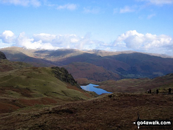
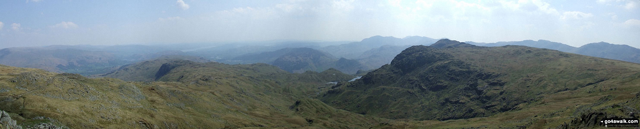
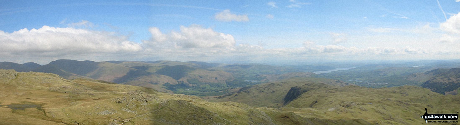
*The view from Sergeant Man featuring Blea Rigg (centre left), Lingmoor Fell (centre distance), Stickle Tarn (partially hidden) and Pavey Ark with Harrison Stickle beyond (The Langdale Pikes) (centre right)
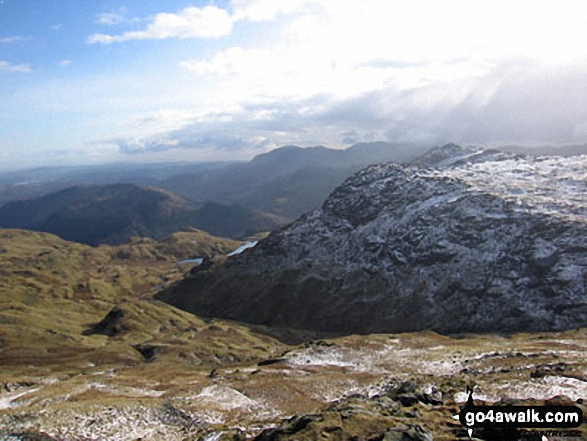
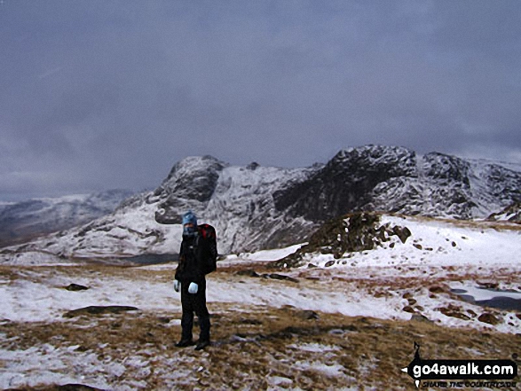
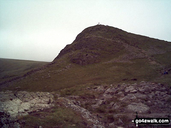
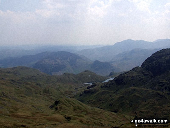
The Langdale Pikes with Wetherlam and Swirl How in the distance from Sergeant Man summit
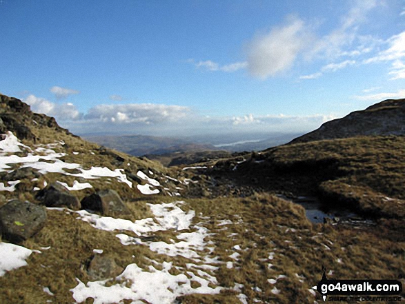
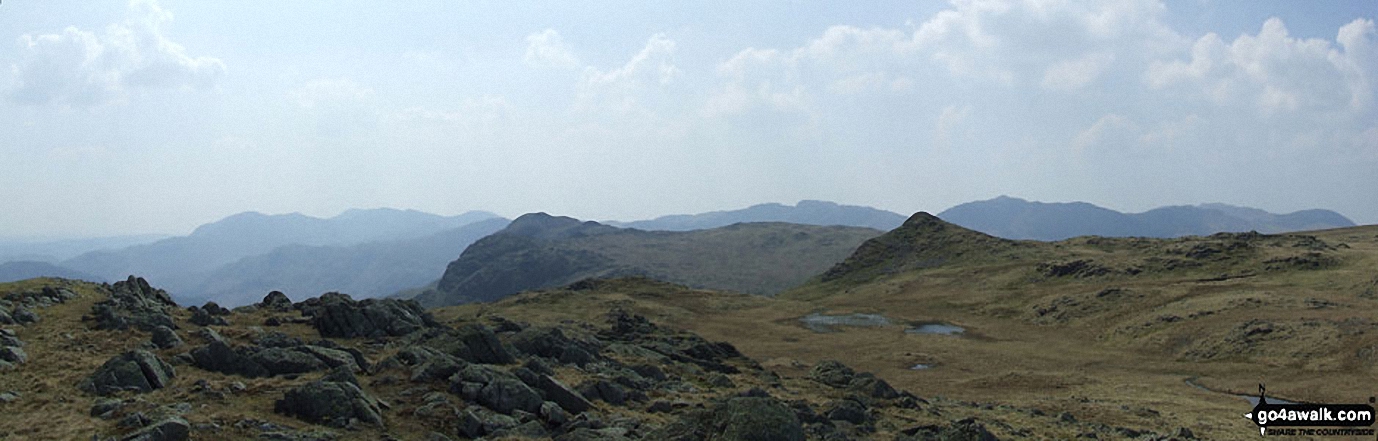
The view from Sergeant Man featuring Blea Rigg (centre left),Lingmoor Fell (distance centre), Stickle Tarn (partially hidden) and the shoulder of Pavey Ark (The Langdale Pikes) (right)
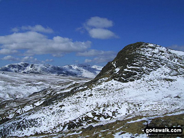
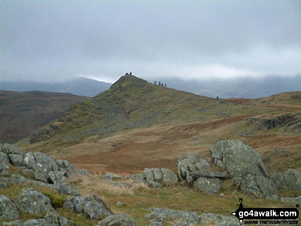
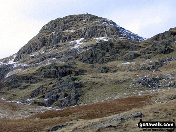
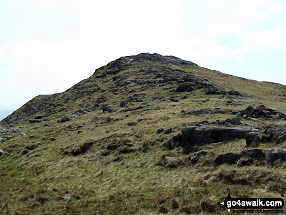
*The view from Codadle Head featuring Pavey Ark (The Langdale Pikes) (centre left) and Sergeant Man (centre right)
Send us your photographs and pictures on, of, or from Sergeant Man
If you would like to add your walk photographs and pictures featuring views from, on or of Sergeant Man to this page, please send them as email attachments (configured for any computer) along with your name to:
and we shall do our best to publish them.
(Guide Resolution = 300dpi. At least = 660pixels (wide) x 440 pixels (high).)

You can also submit photos via our Facebook Page.
NB. Please indicate where each photo was taken and whether you wish us to credit your photos with a Username or your First Name/Last Name.
Not familiar with this top?


