
![]()
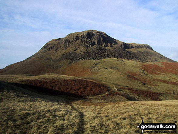
Silver How
395m (1296ft)
The Central Fells, The Lake District, Cumbria, England
Not familiar with this top?
   |
|---|
Vital Statistics:
| Length: | 4.5ml (7.5km) |
|---|---|
| Ascent: | 1,296ft (395m) |
| Time: | 3 hrs |
| Grade: |  (Moderate) (Moderate) |
|
|---|
Vital Statistics:
| Length: | 10ml (16km) |
|---|---|
| Ascent: | 2,936ft (895m) |
| Time: | 6½ hrs |
| Grade: |  (Hard) (Hard) |
Route Summary:
Grasmere - Sour Milk Gill - Sourmilk Gill Falls - Tarn Crag (Easedale) - Sergeant Man - Blea Rigg - Great Castle How - Little Castle How - Raw Pike - Swinescar Pike - Lang How - Silver How - Spedding Crag - Dow Bank - Huntingstile Crag - Grasmere
|
|---|
Vital Statistics:
| Length: | 13.75ml (22km) |
|---|---|
| Ascent: | 3,991ft (1,216m) |
| Time: | 9 hrs |
| Grade: |  (Hard) (Hard) |
Route Summary:
Grasmere - Allan Bank - Wray Gill - Silver How - Lang How - Sinescar Pike - Little Castle How - Great Castle How - Blea Rigg - Sergeant Man - Thunacar Knott - Pavey Ark - Harrison Stickle - Loft Crag - Pike of Stickle (Pike O' Stickle) - High Raise (Langdale) - Codale Head - Tarn Crag (Easedale) - Far Easedale Gill - Sourmilk Falls - Far Easedale Beck - Goody Bridge - Grasmere
See Silver How and the surrounding tops on our free-to-access 'Google Style' Peak Bagging Maps:
The Central Fells of The Lake District National Park
Less data - quicker to download
The Whole of The Lake District National Park
More data - might take a little longer to download
See Silver How and the surrounding tops on our downloadable Peak Bagging Maps in PDF format:

NB: Whether you print off a copy or download it to your phone, these PDF Peak Baggers' Maps might prove incredibly useful when your are up there on the tops and you cannot get a phone signal.
*This version is marked with the walk routes you need to follow to Walk all 214 Wainwrights in just 59 walks.
You can find Silver How & all the walks that climb it on these unique free-to-access Interactive Walk Planning Maps:
1:25,000 scale OS Explorer Map (orange/yellow covers):
1:50,000 scale OS Landranger Map (pink/magenta covers):
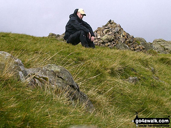
 Fellow go4awalkers who have already walked, climbed, summited & bagged Silver How
James Hughes walked up Silver How on March 16th, 2025 [from/via/route] c144 Sergeant Man from Stickle Tarn [weather] Cloudy & cold on tops - Climbed to Stickle Tarn & then up to Sergeant Man. Descended over Blea Rigg & then Silver How. Pleasant descent back into Langdale Valley before returning to New Dungeon Ghyll.
Pete George climbed Silver How on February 22nd, 2025 [from/via/route] Grasmere [with] Roco [weather] Good but wet underneath meant crossings in spate
Claire Kirk bagged Silver How on November 28th, 2024 [from/via/route] Grasmere [with] Self [weather] Cold but sunny, windy at the summit
David Higginbottom hiked Silver How on October 3rd, 2024 [from/via/route] C144 [with] Carolyn [weather] Clear - A little boggy miserable walk
Andrew Gayne summited Silver How on September 4th, 2024 [from/via/route] From Grasmere [with] Becky [weather] Sunny day - Walked up from Grasmere on a circular route from the Bridge Hotel
Angeline Grieveson conquered Silver How on June 1st, 2024 [with] Rick
Christine Shepherd scaled Silver How on October 31st, 2008 [from/via/route] Walked from Grasmere [with] On my own [weather] Sunshine,showers & rainbows - Bagged again on 2.9.10 Climbed again 30.5.18 from Allen Banks the with a group from Head 4 the Hills on 31.5.21 Climbed again on 9.10.23 using walk c195 but done in reverse. The day was glorious until we walked into cloud as we approached the summit. walked out of the mist on the descent back to Grasmere.
Andrew Thornton walked up Silver How on August 5th, 2023 [from/via/route] Grasmere [with] Jenny [weather] Overcast
Steve Cookson climbed Silver How on March 23rd, 2022 [from/via/route] C105 from Grasmere [with] Gillie [weather] Sunny hot & calm.
Martin Hartshorne bagged Silver How on May 14th, 2023 [from/via/route] Underherron cottage past Allan Banks circular [with] finley [weather] Cloud over the higher tops, very light drizzle, breaks of sunshine. Late afternoon walk - Lovely little afternoon walk
To add (or remove) your name and experiences on this page - Log On and edit your Personal Mountain Bagging Record
. . . [see more walk reports]
More Photographs & Pictures of views from, on or of Silver How
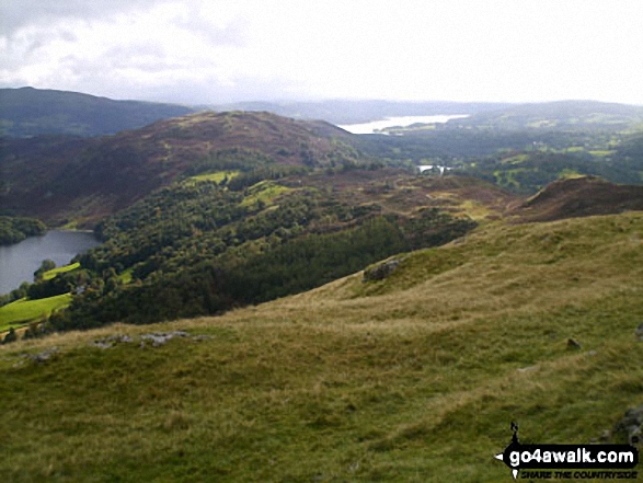
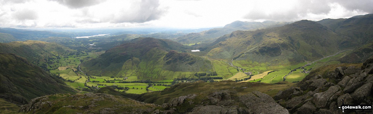
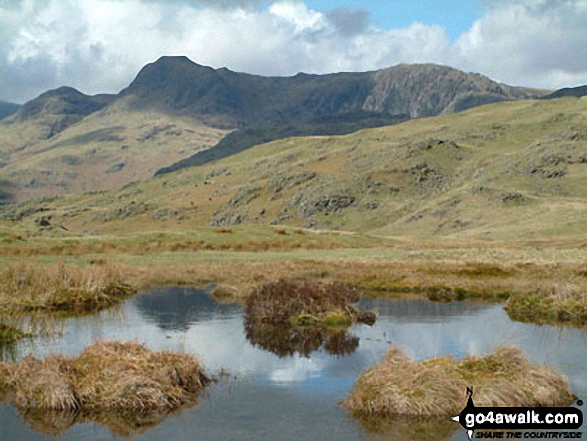
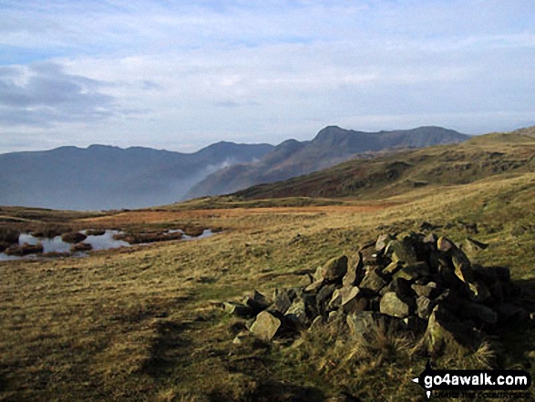
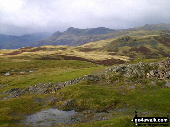
Great Langdale with Blea Rigg, Lang How and Silver How (left) and Lingmoor Fell (right) from the foot of Oxendale
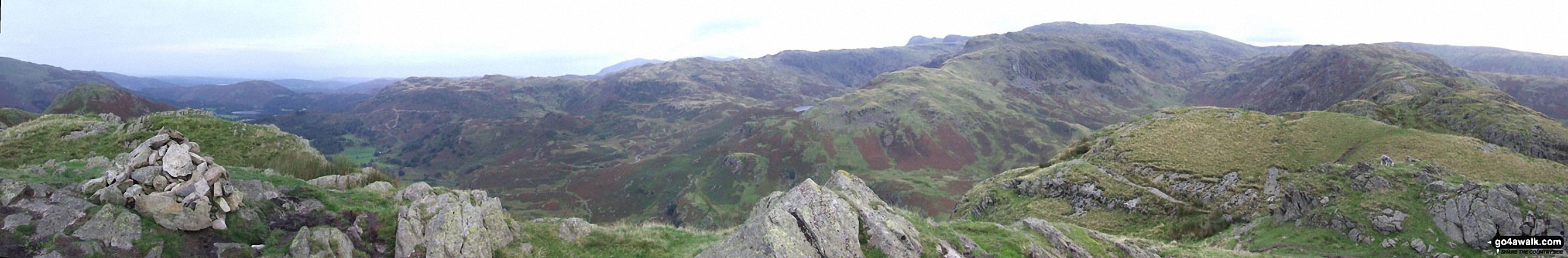
Blea Rigg, Castle How, Lang How and Silver How (far left) Great Langdale, Windermere and Elter Water (left), Lingmoor Fell and Side Pike (centre left), Blea Tarn and Little Langdale (centre right), Pike of Blisco (Pike o' Blisco) right and Crickle Crags (far right) from the summit of Harrison Stickle, The Langdale Pikes
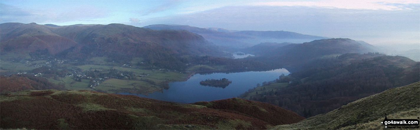
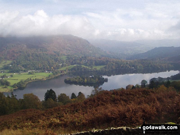
Grasmere, Silver How, Lang How, Blea Rigg, Easedale Tarn, The LAngdale Pikes, Codale Head, Gibson Knott and Calf Crag from Helm Crag summit cairn
Send us your photographs and pictures on, of, or from Silver How
If you would like to add your walk photographs and pictures featuring views from, on or of Silver How to this page, please send them as email attachments (configured for any computer) along with your name to:
and we shall do our best to publish them.
(Guide Resolution = 300dpi. At least = 660pixels (wide) x 440 pixels (high).)

You can also submit photos via our Facebook Page.
NB. Please indicate where each photo was taken and whether you wish us to credit your photos with a Username or your First Name/Last Name.
Not familiar with this top?


