The North Pennines - a fully detailed list of all the Mountains, Peaks, Tops and Hills (Page 1 of 2)
The North Pennines is located in Northern England covering parts of Cumbria, County Durham and Northumberland.
If you include the Marilyns, the Bridgets (Hills) and all the Mountains, Tops, Peaks and Hills with a Trig Point on them there are 59 tops to climb, bag & conquer and the highest point is Cross Fell at 893m (2,931ft).
To see these Mountains, Peaks, Tops and Hills displayed in different ways - see the options in the left-hand column and towards the bottom of this page.
![]() Your Personal Bagging Record for The North Pennines
Your Personal Bagging Record for The North Pennines
LOG ON and RELOAD this page to show which Mountains, Peaks, Tops and Hills you have already climbed, bagged & conquered [. . . more details]
Page 1 of 2 Go to page: 1 2 |
See this list in: Alphabetical Order‡
| Height Order
To reverse the order select the link again.
Mountain, Peak, Top or Hill:
Bagged

![]()
1. Windy Hill (Lintzgarth Common)
554m (1,818ft)
Send it in and we'll publish it here.
Windy Hill (Lintzgarth Common) is on interactive maps:
|

![]()
2. Westernhope Moor
675m (2,215ft)
Westernhope Moor is on interactive maps:
Westernhope Moor is on downloadable PDF you can Print or Save to your Phone: |

![]()
3. Watch Hill (Graystone Edge)
602m (1,975ft)
Watch Hill (Graystone Edge) is on interactive maps:
Watch Hill (Graystone Edge) is on downloadable PDF you can Print or Save to your Phone: |
![]()
4. Talkin Fell (Kelky Fell)
381m (1,250ft)
Send it in and we'll publish it here.
Talkin Fell (Kelky Fell) is on interactive maps:
Talkin Fell (Kelky Fell) is on downloadable PDF you can Print or Save to your Phone: |
![]()
5. Staneshaw Rigg
596m (1,956ft)
Staneshaw Rigg is on interactive maps:
|
![]()
6. Shacklesborough
454m (1,490ft)
Shacklesborough is on interactive maps:
Shacklesborough is on downloadable PDF you can Print or Save to your Phone: |
![]()
7. Renwick Fell (Thack Moor)
609m (2,000ft)
Renwick Fell (Thack Moor) is on interactive maps:
Renwick Fell (Thack Moor) is on downloadable PDF you can Print or Save to your Phone: |
![]()
8. Raven Seat (Harnisha Hill)
589m (1,933ft)
Send it in and we'll publish it here.
Raven Seat (Harnisha Hill) is on interactive maps:
Raven Seat (Harnisha Hill) is on downloadable PDF you can Print or Save to your Phone: |
![]()
9. Raven Hills (Monk's Moor)
522m (1,713ft)
Send it in and we'll publish it here.
Raven Hills (Monk's Moor) is on interactive maps:
|
![]()
10. Pike Rigg (Whitfield Common)
525m (1,723ft)
Send it in and we'll publish it here.
Pike Rigg (Whitfield Common) is on interactive maps:
Pike Rigg (Whitfield Common) is on downloadable PDF you can Print or Save to your Phone: |
![]()
11. Park Fell (Gilderdale Forest)
511m (1,677ft)
Send it in and we'll publish it here.
Park Fell (Gilderdale Forest) is on interactive maps:
Park Fell (Gilderdale Forest) is on downloadable PDF you can Print or Save to your Phone: |

![]()
12. Nine Standards Rigg
662m (2,172ft)
Nine Standards Rigg is on interactive maps:
Nine Standards Rigg is on downloadable PDF you can Print or Save to your Phone: |
![]()
13. Murton Pike
594m (1,950ft)
Murton Pike is on interactive maps:
Murton Pike is on downloadable PDF you can Print or Save to your Phone: |
![]()
14. Monk's Moor
565m (1,854ft)
Monk's Moor is on interactive maps:
Monk's Moor is on downloadable PDF you can Print or Save to your Phone: |
![]()
15. Middlehope Moor
612m (2,008ft)
Middlehope Moor is on interactive maps:
Middlehope Moor is on downloadable PDF you can Print or Save to your Phone: |
![]()
16. Middle Fell (Alston Moor)
580m (1,904ft)
Send it in and we'll publish it here.
Middle Fell (Alston Moor) is on interactive maps:
Middle Fell (Alston Moor) is on downloadable PDF you can Print or Save to your Phone: |
![]()
17. Mickle Fell (East Top)
758m (2,487ft)
Send it in and we'll publish it here.
Mickle Fell (East Top) is on interactive maps:
Mickle Fell (East Top) is on downloadable PDF you can Print or Save to your Phone: |

![]()
18. Mickle Fell
788m (2,586ft)
Mickle Fell is on interactive maps:
Mickle Fell is on downloadable PDF you can Print or Save to your Phone: |
![]()
19. Meldon Hill (Dufton Fell)
767m (2,517ft)
Meldon Hill (Dufton Fell) is on interactive maps:
Meldon Hill (Dufton Fell) is on downloadable PDF you can Print or Save to your Phone: |
![]()
20. Little Fell (Burton Fell)
748m (2,455ft)
Little Fell (Burton Fell) is on interactive maps:
Little Fell (Burton Fell) is on downloadable PDF you can Print or Save to your Phone: |
![]()
21. Knock Pike (Dufton)
398m (1,306ft)
Send it in and we'll publish it here.
Knock Pike (Dufton) is on interactive maps:
Knock Pike (Dufton) is on downloadable PDF you can Print or Save to your Phone: |
![]()
22. Killhope Law
673m (2,208ft)
Killhope Law is on interactive maps:
Killhope Law is on downloadable PDF you can Print or Save to your Phone: |
![]()
23. Islington Hill
492m (1,614ft)
Islington Hill is on interactive maps:
Islington Hill is on downloadable PDF you can Print or Save to your Phone: |
![]()
24. Horseshoe Hill
519m (1,703ft)
Horseshoe Hill is on interactive maps:
Horseshoe Hill is on downloadable PDF you can Print or Save to your Phone: |
![]()
25. Highwatch Currick
639m (2,097ft)
Highwatch Currick is on interactive maps:
|
![]()
26. High Greygrits (Grey Grit)
522m (1,713ft)
Send it in and we'll publish it here.
High Greygrits (Grey Grit) is on interactive maps:
High Greygrits (Grey Grit) is on downloadable PDF you can Print or Save to your Phone: |
![]()
27. Harwood Side
502m (1,647ft)
Harwood Side is on interactive maps:
Harwood Side is on downloadable PDF you can Print or Save to your Phone: |
![]()
28. Hard Rigg (Mohope Moor)
546m (1,792ft)
Send it in and we'll publish it here.
Hard Rigg (Mohope Moor) is on interactive maps:
Hard Rigg (Mohope Moor) is on downloadable PDF you can Print or Save to your Phone: |
![]()
29. Hard Hill (Gilburn Forest)
678m (2,225ft)
Send it in and we'll publish it here.
Hard Hill (Gilburn Forest) is on interactive maps:
|
![]()
30. Grey Nag
656m (2,153ft)
Grey Nag is on interactive maps:
Grey Nag is on downloadable PDF you can Print or Save to your Phone: |
Page 1 of 2 Go to page: 1 2 |
View these 59 Mountains, Peaks, Tops and Hills:
- On a Downloadable PDF you can Print or Save to your Phone#
- On an Interactive Google Map with a list of tops below it.
(makes it easier to locate a particular top) - On a Detailed List in:
Alphabetical Order | Height Order - On one page with 'yet-to-be-bagged' listed 1st
& then 'already-bagged' tops listed 2nd in:
Alphabetical Order | Height Order - On one page with 'already-bagged' tops listed 1st
& then 'yet-to-be-bagged' tops listed 2nd in:
Alphabetical Order | Height Order
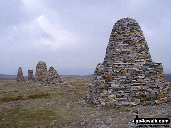
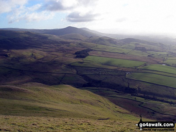
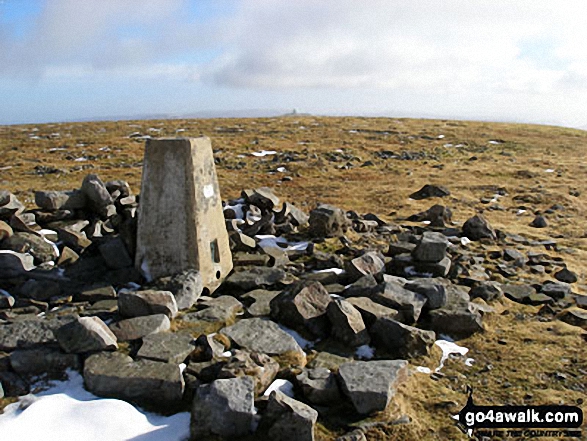 The summit of Cross Fell in The North Pennines
Photo: Ryan Pearson
# Whether you print a copy or download it to your phone, this Peak Baggers' Map will prove incredibly useful if you want to know what's what when you are up in the mountains and cannot get a phone signal.
Is there a Mountain, Peak, Top or Hill missing from the above google map or list?
Let us know an we will add it to our database.
To contribute to go4awalk.com or to contact us about anything at all - see Talk To Us.
For help see Help.
go4awalk.com and go4awalk.co.uk are registered trademarks of TMDH Limited.
Copyright © 2000-2026 TMDH Limited. All rights reserved.
Copyright Terms & Conditions Privacy Statement
A - Z Walks Home Log On/Accounts Photo Gallery Walk Ideas and Collections Fell Facts Hill Skills Walking Questions and Answers Your Stories News Competitions Product Reviews/Gear Tests Walking Gear Guides Peaks and Mountains Peak Bagging Find New Walking Friends Camping GPS Waypoints for Walking Contents Walk Search Talk To Us go4awalk.com Help Free Example Walks Newsletter


