Snowdonia National Park - a fully detailed list of all the Mountains, Peaks, Tops and Hills (Page 3 of 4)
Snowdonia National Park in Clwyd, Conwy, Gwynedd and Powys is the area of Wales within the Snowdonia National Park boundary including the non-National Park 'island' around Blaenau Ffestiniog.
If you include the Marilyns, the Bridgets (Hills) and all the Mountains, Tops, Peaks and Hills with a Trig Point on them there are 91 tops to climb, bag & conquer and the highest point is Snowdon (Yr Wyddfa) at 1,085m (3,561ft).
To see these Mountains, Peaks, Tops and Hills displayed in different ways - see the options in the left-hand column and towards the bottom of this page.
LOG ON and RELOAD this page to show which Mountains, Peaks, Tops and Hills you have already climbed, bagged & conquered [. . . more details]
See this list in: Alphabetical Order
| Height Order‡
To reverse the order select the link again.
Mountain, Peak, Top or Hill:
Bagged
61. Mynydd Cwmcelli (Craig Goch)
469m (1,539ft)
Send it in and we'll publish it here.
Mynydd Cwmcelli (Craig Goch) is on interactive maps:
Mynydd Cwmcelli (Craig Goch) is on downloadable PDF you can Print or Save to your Phone: |
62. Cefn y Capel
460m (1,510ft)
See the location of Cefn y Capel and walks up it on a google Map Cefn y Capel is on interactive maps:
Cefn y Capel is on downloadable PDF you can Print or Save to your Phone: |
63. Foel Ddu (Llyn Mwyngil)
448m (1,470ft)
Send it in and we'll publish it here.
Foel Ddu (Llyn Mwyngil) is on interactive maps:
Foel Ddu (Llyn Mwyngil) is on downloadable PDF you can Print or Save to your Phone: |
64. Foel Dugoed
439m (1,441ft)
Foel Dugoed is on interactive maps:
Foel Dugoed is on downloadable PDF you can Print or Save to your Phone: |
65. Moel Hafodowen
435m (1,428ft)
Moel Hafodowen is on interactive maps:
Moel Hafodowen is on downloadable PDF you can Print or Save to your Phone: |
66. Moelfre (Carneddau)
435m (1,428ft)
Send it in and we'll publish it here.
Moelfre (Carneddau) is on interactive maps:
Moelfre (Carneddau) is on downloadable PDF you can Print or Save to your Phone: |
67. Pen y Benar
431m (1,415ft)
Pen y Benar is on interactive maps:
Pen y Benar is on downloadable PDF you can Print or Save to your Phone: |
68. Moel Pen-y-bryn
428m (1,405ft)
Moel Pen-y-bryn is on interactive maps:
Moel Pen-y-bryn is on downloadable PDF you can Print or Save to your Phone: |
69. Moel Tryfan
427m (1,401ft)
Moel Tryfan is on interactive maps:
Moel Tryfan is on downloadable PDF you can Print or Save to your Phone: |
70. Corlan Fraith
406m (1,332ft)
Corlan Fraith is on interactive maps:
Corlan Fraith is on downloadable PDF you can Print or Save to your Phone: |
71. Foel Offrwm
405m (1,329ft)
Foel Offrwm is on interactive maps:
Foel Offrwm is on downloadable PDF you can Print or Save to your Phone: |
72. Mynydd Deulyn
400m (1,312ft)
Mynydd Deulyn is on interactive maps:
Mynydd Deulyn is on downloadable PDF you can Print or Save to your Phone: |
73. Bryn Brith
383m (1,257ft)
Bryn Brith is on interactive maps:
Bryn Brith is on downloadable PDF you can Print or Save to your Phone: |
74. Pared y Cefn hir
383m (1,257ft)
See the location of Pared y Cefn hir and walks up it on a google Map Pared y Cefn hir is on interactive maps:
Pared y Cefn hir is on downloadable PDF you can Print or Save to your Phone: |
75. Moel y Dyniewyd
382m (1,254ft)
Moel y Dyniewyd is on interactive maps:
Moel y Dyniewyd is on downloadable PDF you can Print or Save to your Phone: |
76. Foel Cae'rberllan
380m (1,247ft)
Foel Cae'rberllan is on interactive maps:
Foel Cae'rberllan is on downloadable PDF you can Print or Save to your Phone: |
77. Iwerddon (Betws-y-coed)
363m (1,191ft)
Send it in and we'll publish it here.
Iwerddon (Betws-y-coed) is on interactive maps:
Iwerddon (Betws-y-coed) is on downloadable PDF you can Print or Save to your Phone: |
78. Foel Lus
362m (1,188ft)
Foel Lus is on interactive maps:
Foel Lus is on downloadable PDF you can Print or Save to your Phone: |
79. Mynydd Cribau
345m (1,132ft)
Mynydd Cribau is on interactive maps:
Mynydd Cribau is on downloadable PDF you can Print or Save to your Phone: |
80. Craig-y-garn
343m (1,126ft)
Craig-y-garn is on interactive maps:
Craig-y-garn is on downloadable PDF you can Print or Save to your Phone: |
81. Y Figra (Uwch-mynydd)
328m (1,076ft)
Send it in and we'll publish it here.
Y Figra (Uwch-mynydd) is on interactive maps:
Y Figra (Uwch-mynydd) is on downloadable PDF you can Print or Save to your Phone: |
82. Foel Cynwch
326m (1,070ft)
Foel Cynwch is on interactive maps:
Foel Cynwch is on downloadable PDF you can Print or Save to your Phone: |
83. Craig y Castell
321m (1,054ft)
Craig y Castell is on interactive maps:
Craig y Castell is on downloadable PDF you can Print or Save to your Phone: |
84. Grib Ddu
318m (1,044ft)
See the location of Grib Ddu and walks up it on a google Map Grib Ddu is on interactive maps:
Grib Ddu is on downloadable PDF you can Print or Save to your Phone: |
85. Ffridd Cocyn
313m (1,027ft)
Ffridd Cocyn is on interactive maps:
Ffridd Cocyn is on downloadable PDF you can Print or Save to your Phone: |
86. Gamallt (Abergynolwyn)
288m (945ft)
Send it in and we'll publish it here.
Gamallt (Abergynolwyn) is on interactive maps:
Gamallt (Abergynolwyn) is on downloadable PDF you can Print or Save to your Phone: |
87. Moel Isallt
286m (939ft)
Moel Isallt is on interactive maps:
Moel Isallt is on downloadable PDF you can Print or Save to your Phone: |
88. Tyddynbriddell Hill
280m (918ft)
Send it in and we'll publish it here.
Tyddynbriddell Hill is on interactive maps:
|
89. Ffridd-yr-Ychen
278m (912ft)
Ffridd-yr-Ychen is on interactive maps:
Ffridd-yr-Ychen is on downloadable PDF you can Print or Save to your Phone: |
90. Llechwedd Melyn
196m (643ft)
Llechwedd Melyn is on interactive maps:
|
View these 91 Mountains, Peaks, Tops and Hills:
- On Ten Downloadable PDFs you can Print or save to your phone covering:
- The Arans #
- The Arenigs #
- The Berwyns #
- The Cadair Idris Area #
- The Carneddau #
- The Glyderau #
- The Moel Hebog #
- The Moelwyns #
- The Snowdon Area # and
- The Rhinogs #
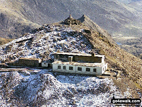
 Snowdon (Yr Wyddfa) in The Cadair Idris areaSnowdonia
Photo: Don Williams
- On an Interactive Google Map (loads faster)
- On an Interactive Google Map with a list of tops below it.
(makes it easier to locate a particular top) - On a Detailed List in:
Alphabetical Order | Height Order - On one page with 'yet-to-be-bagged' listed 1st & then 'already-bagged' tops listed 2nd in:
Alphabetical Order | Height Order - On one page with 'already-bagged' tops listed 1st & then 'yet-to-be-bagged' tops listed 2nd in:
Alphabetical Order | Height Order
# Whether you print copies or download them to your phone, these Peak Baggers' Maps will prove incredibly useful if you want to know what's what when you are up in the mountains and cannot get a phone signal.
Is there a Mountain, Peak, Top or Hill missing from the above google map or list?
Let us know an we will add it to our database.


