All The Mountains, Peaks, Tops and Hills in Scottish Region : as a detailed list

Loch Lomond and The Trossachs National Park is located in Central Scotland, covering parts of Argyll and Bute, Perth and Kinross, Stirlingshire and West Dumbartonshire.

If you include all the Munros, the Corbetts, the Grahams, the Donalds, the Murdos, the Marilyns, the Bridgets (Hills) and all the Mountains, Tops, Peaks and Hills with a Trig Point on them there are 74 tops to climb, bag & conquer and the highest point is Ben More (The Crianlarich Hills) at 1,174m (3,853ft).

munro
21/0
Munros

corbett
15/0
Corbetts

graham
19/0
Grahams

donald
0/0
Donalds

murdo
26/0
Murdos

marilyn
64/0
Scottish
Marilyns

Bridget
2/0
Scottish
Bridgets

Trig Point
18/0
Trig
Points


To see all Mountains, Peaks, Tops and Hills displayed in different ways - see the options in the left-hand column and towards the bottom of this page.


LOG ON and RELOAD this page to show which Mountains, Peaks, Tops and Hills you have already climbed, bagged & conquered [. . . more]


Page 1 of 3    Go to page: 1 2 3


See this list in: Alphabetical Order | Height Order
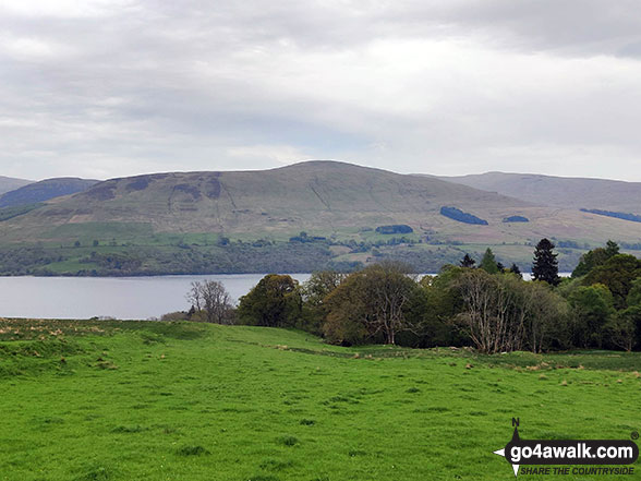
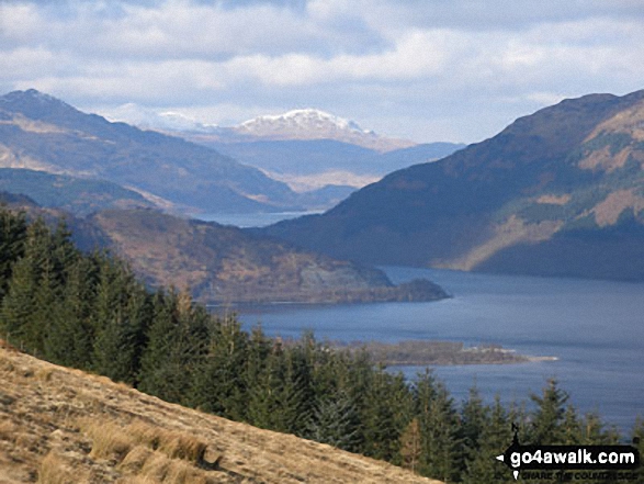
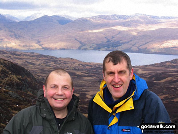
To reverse the order select the link again.


Mountain, Peak, Top or Hill:

Bagged


1. Ben Bowie

313m (1,027ft)

  • Marilyn (1092nd in Scotland, 1362nd in GB)
  • OS Trig Point

  • We hope to have walks that climb & bag Ben Bowie very soon

    Google Maps Icon
    See the location of Ben Bowie and walks up it on a google Map

    Ben Bowie is on interactive maps:

  • OS Explorer (Orange Covers): OL38
  • OS Landranger (Pink Covers): 56

  • A go4awalk.com Peak Bagging Map and Hill Tick List featuring Ben Bowie will be available soon.


    2. Callander Craig

    343m (1,125ft)

  • Bridget

  • To walk, climb & bag Callander Craig use this easy to follow walk:

    Google Maps Icon
    See the location of Callander Craig and walks up it on a google Map

    Callander Craig is on interactive maps:

  • OS Explorer (Orange Covers): OL46 and OL47
  • OS Landranger (Pink Covers): 57

  • A go4awalk.com Peak Bagging Map and Hill Tick List featuring Callander Craig will be available soon.


    3. Conic Hill

    361m (1,184ft)

  • Marilyn (1050th in Scotland, 1282nd in GB)

  • To walk, climb & bag Conic Hill use this easy to follow walk:

    Google Maps Icon
    See the location of Conic Hill and walks up it on a google Map

    Conic Hill is on interactive maps:

  • OS Explorer (Orange Covers): OL39
  • OS Landranger (Pink Covers): 56

  • A go4awalk.com Peak Bagging Map and Hill Tick List featuring Conic Hill will be available soon.


    4. The Fruin

    361m (1,185ft)

  • Marilyn (1049th in Scotland, 1281st in GB)

  • We hope to have walks that climb & bag The Fruin very soon

    Google Maps Icon
    See the location of The Fruin and walks up it on a google Map

    The Fruin is on interactive maps:

  • OS Explorer (Orange Covers): OL38
  • OS Landranger (Pink Covers): 56

  • A go4awalk.com Peak Bagging Map and Hill Tick List featuring The Fruin will be available soon.


    5. Craig of Monievreckie

    400m (1,313ft)

  • Marilyn (994th in Scotland, 1205th in GB)
  • OS Trig Point

  • We hope to have walks that climb & bag Craig of Monievreckie very soon

    Google Maps Icon
    See the location of Craig of Monievreckie and walks up it on a google Map

    Craig of Monievreckie is on interactive maps:

  • OS Explorer (Orange Covers): OL46
  • OS Landranger (Pink Covers): 57

  • A go4awalk.com Peak Bagging Map and Hill Tick List featuring Craig of Monievreckie will be available soon.


    6. Cruach Tairbeirt

    415m (1,362ft)

  • Marilyn (972nd in Scotland, 1176th in GB)
  • OS Trig Point

  • We hope to have walks that climb & bag Cruach Tairbeirt very soon

    Google Maps Icon
    See the location of Cruach Tairbeirt and walks up it on a google Map

    Cruach Tairbeirt is on interactive maps:

  • OS Explorer (Orange Covers): OL39
  • OS Landranger (Pink Covers): 56

  • A go4awalk.com Peak Bagging Map and Hill Tick List featuring Cruach Tairbeirt will be available soon.


    7. Beinn Dearg (Loch Venachar)

    427m (1,401ft)

  • Marilyn (950th in Scotland, 1148th in GB)

  • We hope to have walks that climb & bag Beinn Dearg (Loch Venachar) very soon

    Google Maps Icon
    See the location of Beinn Dearg (Loch Venachar) and walks up it on a google Map

    Beinn Dearg (Loch Venachar) is on interactive maps:

  • OS Explorer (Orange Covers): OL46
  • OS Landranger (Pink Covers): 57

  • A go4awalk.com Peak Bagging Map and Hill Tick List featuring Beinn Dearg (Loch Venachar) will be available soon.


    8. Ben A'an

    454m (1,490ft)

  • Bridget

  • To walk, climb & bag Ben A'an use either of these easy to follow walks:

    Google Maps Icon
    See the location of Ben A'an and walks up it on a google Map

    Ben A'an is on interactive maps:

  • OS Explorer (Orange Covers): OL46
  • OS Landranger (Pink Covers): 57

  • A go4awalk.com Peak Bagging Map and Hill Tick List featuring Ben A'an will be available soon.


    9. Beinn Dubh (Loch Chon)

    508m (1,667ft)

  • Marilyn (813th in Scotland, 972nd in GB)

  • We hope to have walks that climb & bag Beinn Dubh (Loch Chon) very soon

    Google Maps Icon
    See the location of Beinn Dubh (Loch Chon) and walks up it on a google Map

    Beinn Dubh (Loch Chon) is on interactive maps:

  • OS Explorer (Orange Covers): OL39
  • OS Landranger (Pink Covers): 56

  • A go4awalk.com Peak Bagging Map and Hill Tick List featuring Beinn Dubh (Loch Chon) will be available soon.


    10. Meall Gainmheich

    566m (1,858ft)

  • Marilyn (712th in Scotland, 833rd in GB)

  • To walk, climb & bag Meall Gainmheich use this easy to follow walk:

    Google Maps Icon
    See the location of Meall Gainmheich and walks up it on a google Map

    Meall Gainmheich is on interactive maps:

  • OS Explorer (Orange Covers): OL38 and OL39
  • OS Landranger (Pink Covers): 57

  • A go4awalk.com Peak Bagging Map and Hill Tick List featuring Meall Gainmheich will be available soon.


    11. Beinn an t-Sidhein

    572m (1,877ft)

  • Marilyn (691st in Scotland, 812th in GB)

  • To walk, climb & bag Beinn an t-Sidhein use this easy to follow walk:

    Google Maps Icon
    See the location of Beinn an t-Sidhein and walks up it on a google Map

    Beinn an t-Sidhein is on interactive maps:

  • OS Explorer (Orange Covers): OL46
  • OS Landranger (Pink Covers): 57

  • A go4awalk.com Peak Bagging Map and Hill Tick List featuring Beinn an t-Sidhein will be available soon.


    12. Binnean nan Gobhar

    586m (1,923ft)

  • Marilyn (676th in Scotland, 791st in GB)

  • We hope to have walks that climb & bag Binnean nan Gobhar very soon

    Google Maps Icon
    See the location of Binnean nan Gobhar and walks up it on a google Map

    Binnean nan Gobhar is on interactive maps:

  • OS Explorer (Orange Covers): OL46
  • OS Landranger (Pink Covers): 56

  • A go4awalk.com Peak Bagging Map and Hill Tick List featuring Binnean nan Gobhar will be available soon.


    13. Beinn Uamha

    597m (1,959ft)

  • Marilyn (662nd in Scotland, 774th in GB)

  • We hope to have walks that climb & bag Beinn Uamha very soon

    Google Maps Icon
    See the location of Beinn Uamha and walks up it on a google Map

    Beinn Uamha is on interactive maps:

  • OS Explorer (Orange Covers): OL39
  • OS Landranger (Pink Covers): 56

  • A go4awalk.com Peak Bagging Map and Hill Tick List featuring Beinn Uamha will be available soon.


    14. Beinn Uird

    597m (1,959ft)

  • Marilyn (663rd in Scotland, 775th in GB)

  • We hope to have walks that climb & bag Beinn Uird very soon

    Google Maps Icon
    See the location of Beinn Uird and walks up it on a google Map

    Beinn Uird is on interactive maps:

  • OS Explorer (Orange Covers): OL39
  • OS Landranger (Pink Covers): 56

  • A go4awalk.com Peak Bagging Map and Hill Tick List featuring Beinn Uird will be available soon.


    15. Cruinn a' Bheinn

    632m (2,074ft)

  • Graham (193rd)
  • Marilyn (618th in Scotland, 714th in GB)

  • We hope to have walks that climb & bag Cruinn a' Bheinn very soon

    Google Maps Icon
    See the location of Cruinn a' Bheinn and walks up it on a google Map

    Cruinn a' Bheinn is on interactive maps:

  • OS Explorer (Orange Covers): OL39
  • OS Landranger (Pink Covers): 56

  • A go4awalk.com Peak Bagging Map and Hill Tick List featuring Cruinn a' Bheinn will be available soon.


    16. Tullich Hill

    632m (2,074ft)

  • Graham (194th)
  • Marilyn (620th in Scotland, 716th in GB)

  • We hope to have walks that climb & bag Tullich Hill very soon

    Google Maps Icon
    See the location of Tullich Hill and walks up it on a google Map

    Tullich Hill is on interactive maps:

  • OS Explorer (Orange Covers): OL39
  • OS Landranger (Pink Covers): 56

  • A go4awalk.com Peak Bagging Map and Hill Tick List featuring Tullich Hill will be available soon.


    17. Sgiath a' Chaise

    645m (2,117ft)

  • Graham (179th)
  • Marilyn (605th in Scotland, 697th in GB)

  • We hope to have walks that climb & bag Sgiath a' Chaise very soon

    Google Maps Icon
    See the location of Sgiath a' Chaise and walks up it on a google Map

    Sgiath a' Chaise is on interactive maps:

  • OS Explorer (Orange Covers): OL46
  • OS Landranger (Pink Covers): 57

  • A go4awalk.com Peak Bagging Map and Hill Tick List featuring Sgiath a' Chaise will be available soon.


    18. Fiarach

    652m (2,139ft)

  • Graham (171st)
  • Marilyn (597th in Scotland, 689th in GB)

  • We hope to have walks that climb & bag Fiarach very soon

    Google Maps Icon
    See the location of Fiarach and walks up it on a google Map

    Fiarach is on interactive maps:

  • OS Explorer (Orange Covers): OL39 and 377
  • OS Landranger (Pink Covers): 50

  • A go4awalk.com Peak Bagging Map and Hill Tick List featuring Fiarach will be available soon.


    19. Meall Odhar (Glen Lochy)

    656m (2,152ft)

  • Graham (169th)
  • Marilyn (595th in Scotland, 686th in GB)

  • We hope to have walks that climb & bag Meall Odhar (Glen Lochy) very soon

    Google Maps Icon
    See the location of Meall Odhar (Glen Lochy) and walks up it on a google Map

    Meall Odhar (Glen Lochy) is on interactive maps:

  • OS Explorer (Orange Covers): OL39 and 377
  • OS Landranger (Pink Covers): 50

  • A go4awalk.com Peak Bagging Map and Hill Tick List featuring Meall Odhar (Glen Lochy) will be available soon.


    20. Mid Hill (Beinn Dubh)

    657m (2,156ft)

  • Graham (167th)
  • Marilyn (592nd in Scotland, 682nd in GB)

  • We hope to have walks that climb & bag Mid Hill (Beinn Dubh) very soon

    Google Maps Icon
    See the location of Mid Hill (Beinn Dubh) and walks up it on a google Map

    Mid Hill (Beinn Dubh) is on interactive maps:

  • OS Explorer (Orange Covers): OL39
  • OS Landranger (Pink Covers): 56

  • A go4awalk.com Peak Bagging Map and Hill Tick List featuring Mid Hill (Beinn Dubh) will be available soon.


    21. Creag Mhor (Loch Voil)

    658m (2,160ft)

  • Graham (164th)
  • Marilyn (589th in Scotland, 679th in GB)

  • We hope to have walks that climb & bag Creag Mhor (Loch Voil) very soon

    Google Maps Icon
    See the location of Creag Mhor (Loch Voil) and walks up it on a google Map

    Creag Mhor (Loch Voil) is on interactive maps:

  • OS Explorer (Orange Covers): OL46
  • OS Landranger (Pink Covers): 57

  • A go4awalk.com Peak Bagging Map and Hill Tick List featuring Creag Mhor (Loch Voil) will be available soon.


    22. Beinn Bhreac (Invergroin)

    681m (2,233ft)

  • Graham (127th)
  • Marilyn (553rd in Scotland, 625th in GB)
  • OS Trig Point

  • We hope to have walks that climb & bag Beinn Bhreac (Invergroin) very soon

    Google Maps Icon
    See the location of Beinn Bhreac (Invergroin) and walks up it on a google Map

    Beinn Bhreac (Invergroin) is on interactive maps:

  • OS Explorer (Orange Covers): OL39
  • OS Landranger (Pink Covers): 56

  • A go4awalk.com Peak Bagging Map and Hill Tick List featuring Beinn Bhreac (Invergroin) will be available soon.


    23. Beinn Damhain

    684m (2,245ft)

  • Graham (122nd)
  • Marilyn (548th in Scotland, 620th in GB)

  • We hope to have walks that climb & bag Beinn Damhain very soon

    Google Maps Icon
    See the location of Beinn Damhain and walks up it on a google Map

    Beinn Damhain is on interactive maps:

  • OS Explorer (Orange Covers): OL39
  • OS Landranger (Pink Covers): 50 and 56

  • A go4awalk.com Peak Bagging Map and Hill Tick List featuring Beinn Damhain will be available soon.


    24. Cruach an t-Sidhein

    684m (2,245ft)

  • Graham (124th)
  • Marilyn (549th in Scotland, 621st in GB)

  • We hope to have walks that climb & bag Cruach an t-Sidhein very soon

    Google Maps Icon
    See the location of Cruach an t-Sidhein and walks up it on a google Map

    Cruach an t-Sidhein is on interactive maps:

  • OS Explorer (Orange Covers): OL39
  • OS Landranger (Pink Covers): 56

  • A go4awalk.com Peak Bagging Map and Hill Tick List featuring Cruach an t-Sidhein will be available soon.


    25. Stob Breac

    688m (2,258ft)

  • Graham (121st)
  • Marilyn (547th in Scotland, 618th in GB)

  • We hope to have walks that climb & bag Stob Breac very soon

    Google Maps Icon
    See the location of Stob Breac and walks up it on a google Map

    Stob Breac is on interactive maps:

  • OS Explorer (Orange Covers): OL46
  • OS Landranger (Pink Covers): 57

  • A go4awalk.com Peak Bagging Map and Hill Tick List featuring Stob Breac will be available soon.


    26. Beinn Eich

    703m (2,307ft)

  • Graham (96th)
  • Marilyn (521st in Scotland, 585th in GB)

  • We hope to have walks that climb & bag Beinn Eich very soon

    Google Maps Icon
    See the location of Beinn Eich and walks up it on a google Map

    Beinn Eich is on interactive maps:

  • OS Explorer (Orange Covers): OL38 and OL39
  • OS Landranger (Pink Covers): 56

  • A go4awalk.com Peak Bagging Map and Hill Tick List featuring Beinn Eich will be available soon.


    27. Beinn a' Mhanaich

    709m (2,327ft)

  • Graham (84th)
  • Marilyn (509th in Scotland, 569th in GB)

  • We hope to have walks that climb & bag Beinn a' Mhanaich very soon

    Google Maps Icon
    See the location of Beinn a' Mhanaich and walks up it on a google Map

    Beinn a' Mhanaich is on interactive maps:

  • OS Explorer (Orange Covers): OL38 and OL39
  • OS Landranger (Pink Covers): 56

  • A go4awalk.com Peak Bagging Map and Hill Tick List featuring Beinn a' Mhanaich will be available soon.


    28. Beinn Chaorach (Glen Luss)

    713m (2,340ft)

  • Graham (74th)
  • Marilyn (499th in Scotland, 557th in GB)
  • OS Trig Point

  • We hope to have walks that climb & bag Beinn Chaorach (Glen Luss) very soon

    Google Maps Icon
    See the location of Beinn Chaorach (Glen Luss) and walks up it on a google Map

    Beinn Chaorach (Glen Luss) is on interactive maps:

  • OS Explorer (Orange Covers): OL38
  • OS Landranger (Pink Covers): 56

  • A go4awalk.com Peak Bagging Map and Hill Tick List featuring Beinn Chaorach (Glen Luss) will be available soon.


    29. Meall Buidhe (Glen Ogle)

    719m (2,360ft)

  • Graham (66th)
  • Marilyn (492nd in Scotland, 549th in GB)

  • We hope to have walks that climb & bag Meall Buidhe (Glen Ogle) very soon

    Google Maps Icon
    See the location of Meall Buidhe (Glen Ogle) and walks up it on a google Map

    Meall Buidhe (Glen Ogle) is on interactive maps:

  • OS Explorer (Orange Covers): OL46
  • OS Landranger (Pink Covers): 51

  • A go4awalk.com Peak Bagging Map and Hill Tick List featuring Meall Buidhe (Glen Ogle) will be available soon.


    30. Ben Venue

    729m (2,393ft)

  • Graham (54th)
  • Marilyn (478th in Scotland, 531st in GB)
  • OS Trig Point

  • To walk, climb & bag Ben Venue use this easy to follow walk:

    Google Maps Icon
    See the location of Ben Venue and walks up it on a google Map

    Ben Venue is on interactive maps:

  • OS Explorer (Orange Covers): OL46
  • OS Landranger (Pink Covers): 57

  • A go4awalk.com Peak Bagging Map and Hill Tick List featuring Ben Venue will be available soon.


    Page 1 of 3    Go to page: 1 2 3


    View all 74 Mountains, Peaks, Tops and Hills in Ben Lomond Scottish Region : Loch Lomond and The Trossachs to Loch Tay:


    Is there a Mountain, Peak, Top or Hill missing from the above google map or list?

    Let us know an we will add it to our database.


    Follow go4awalk.com on Twitter Follow go4awalk.com on Facebook


    Home


    Find new Friends to go walking with

    Walk all 214 Wainwrights in just 59 Walks. Download GPS Waypoints - Great Walks you must not miss!

    Walk The Yorkshire Three Peaks Challenge Walk - All the Latest Route Information, GPS Waypoints and Split Times to keep you on Schedule

    Walk The British Three Peaks Challenge Walk - All the Latest Route Information and GPS Waypoints

    See our pick of The Best Walks in The Lake District - Great Walks you must not miss!

    Walk our pick of the Best Lake District Ridge Walks - Great Walks you must not miss!

    Walk our pick of the Best Lake District Walks to do in the rain - Great Walks you must not miss!

    Walk our pick of The Best Walks in Snowdonia - Great Walks you must not miss!

    Walk our pick of The Best Ridge Walks in Wales - Walks you must not miss!

    Walk our pick of The Best Walks in The Brecon Beacons - Great Walks you must not miss!

    Walk our pick of The Best Walks in The Yorkshire Dales - Walks you must not miss!

    Walk our pick of The Best Walks in The Peak District - Walks you must not miss!

    Walk our pick of The Best Walks in The Forest of Bowland - Walks you must not miss!

    Walk our pick of The Best Walks in Shropshire - Walks you must not miss!

    Walk our pick of The Best Walks in Cheshire - Walks you must not miss!

    Walk our pick of The Best Walks in Lancashire - Walks you must not miss!

    Not sure where to walk next? Try Peak Bagging - Great Walks you must not miss!

    Not sure where to walk next? Walk part of a National Trail - Great Walks you must not miss!

    Walks with Downloadable and Uploadable GPS Waypoint Data

    Walking Kit and Gear Tested by Walkers

    Full Site Search