UK Postcode DG1 - The 30 nearest easy-to-follow, circular walk route maps to you
The thirty nearest easy-to-follow, circular walk route maps to you in UK Postcode DG1 in Walk Grade Order
The UK cities, towns and villages in Dumfries and Galloway, Scotland that have DG1 in their UK Postcode include:
• Ae Village • Amisfield Town • Bankend • Blackshaw • Carrutherstown • Clarencefield • Cleuchbrae • Collin • Dumfries • Duncow • Glenae • Glencaple • Kelton • Kingholm Quay • Kirkton • Locharbriggs • Mouswald • Nethermill • Netherwood • Noblehill • Parkgate • Racks • Ruthwell • Shearington • Tinwald • Torthorwald • Woodside •
Not familiar with the area around DG1?
See these 30 nearest walks to UK Postcode DG1 on a google map
   |
Vital Statistics:
| Length: | 6.25 miles (10 km) |
| Ascent: | 2,091ft (637m) |
| Time: | 4½ hrs |
| Grade: |  |
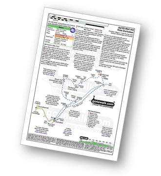
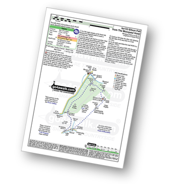
Route Summary:
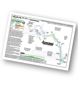
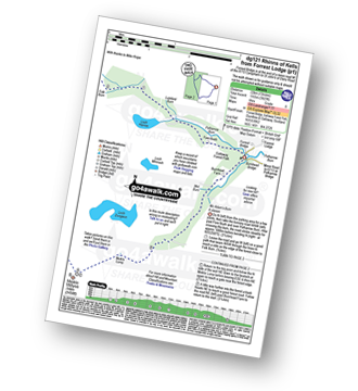
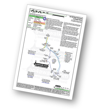
Durisdeer - The Well Path - Well Hill - Penbane - Black Hill - Roman Fortlet - Roman Road - Durisdeer
|
Vital Statistics:
| Length: | 12.25 miles (19.5 km) |
| Ascent: | 2,750ft (838m) |
| Time: | 7½ hrs |
| Grade: |  |
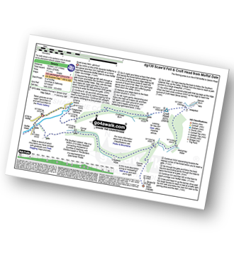
Route Summary:
Parking Area A708 NE of Moffat - Moffat Water - Moffat Dale - The Southern Upland Way - Cornal Burn - Craigbeck Hope - Coomb Cairn - Scaw'd Fell - Eskdalemuir - Wamphrey Burn - Sheepfold - Slecoth Burn - Croft Head - Corfthead Burn - Craiglochan Gardens - Parking Area.
|
Vital Statistics:
| Length: | 14.5 miles (23 km) |
| Ascent: | 3,781ft (1,152m) |
| Time: | 9 hrs |
| Grade: |  |
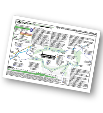
Route Summary:
Parking Area A708 NE of Moffat - Moffat Water - Moffat Dale - The Southern Upland Way - Cornal Burn - Craigbeck Hope - Coomb Cairn - Scaw'd Fell - Eskdalemuir - Wamphrey Burn - Sheepfold - Slecoth Burn - Loch Fell - Croft Head - Corfthead Burn - Craiglochan Gardens - Parking Area.
|
Vital Statistics:
| Length: | 9.75 miles (15.5 km) |
| Ascent: | 2,206ft (672m) |
| Time: | 5.75hrs |
| Grade: |  |
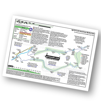
Route Summary:
Parking Area A708 NE of Moffat - Moffat Water - Moffat Dale - The Southern Upland Way - Cornal Burn - Craigbeck Hope - Eskdalemuir - Wamphrey Burn - Sheepfold - Slecoth Burn - Croft Head - Corfthead Burn - Craiglochan Gardens - Parking Area.
|
Vital Statistics:
| Length: | 8.75 miles (14 km) |
| Ascent: | 3,236ft (986m) |
| Time: | 6½ hrs |
| Grade: | |
Route Summary:
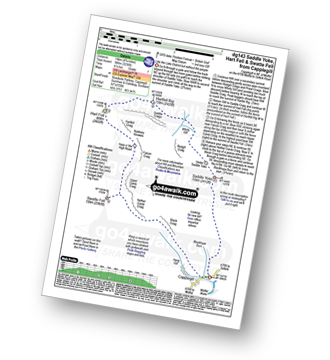
Capplegill - Blackhope Burn - Saddle Yoke - Under Saddle Yoke - Whirly Gill - Saddle Craigs - Harfell Rig - Hart Fell (Moffat) - Hartfell Craig - Falcon Craig - Upper Comb Craig - Swatte Fell - Nether Comb Craig - Black Craig - Hang Burn - Hang Gill - Capplegill
|
Vital Statistics:
| Length: | 4 miles (6.5 km) |
| Ascent: | 958ft (292m) |
| Time: | 2½ hrs |
| Grade: |  |
Route Summary:
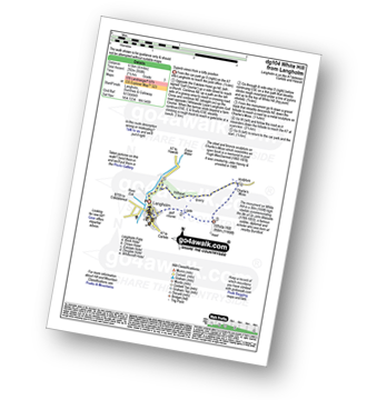
Langholm - Ewes Water - River Esk - Whita Hill - Sir John Malcolm Monument Obelsik - Charlie's Moss - Hugh MacDiarmid Memorial - Hillhead - Ewes Water - Langholm
|
Vital Statistics:
| Length: | 13.25 miles (21 km) |
| Ascent: | 2,586ft (788m) |
| Time: | 7.25hrs |
| Grade: | |
Route Summary:
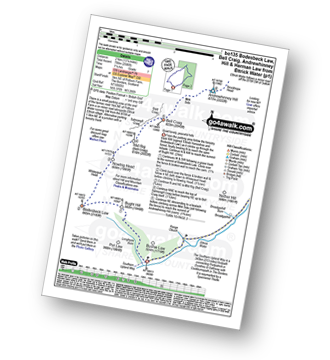
Ettrick Water,Longhope Burn - Bught Hill - Bodesbeck Law - Nowtrig Head - Mid Rig (Bell Craig) - Salmongill Craig - Bald Craig - Bell Craig - Mirk Side - Andrewhinney Hill - Brockhope Head - Trowgrain Middle - Herman Law - Fala Grain - Back Beck - Brockhoperig - Ettrick Water
|
Vital Statistics:
| Length: | 13.75 miles (22 km) |
| Ascent: | 3,206ft (977m) |
| Time: | 8.25hrs |
| Grade: | |
Route Summary:
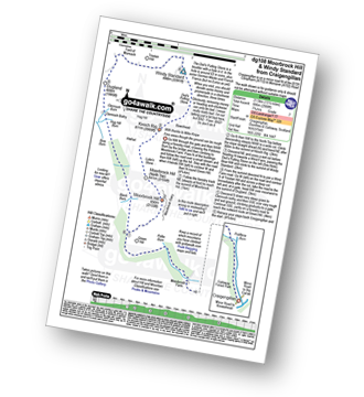
Craigengillan - Craigengillan Bridge - Galloway Forest Park - Polifferie Burn - Poldores Burn - Tup Knowe - Soms Knowe - Scar Knowe - Moorbrock Farm - Poltie Burn - Green Hill (Moorbrock) - Moorbrock Hill - Moorbrock Hill (North Top) - Luke's Stone - Keoch Rig - Deil's Putting Stone - Chapman's Cleugh - Windy Standard - Trostan Hill - Dugland - Clennoch Bothy - Green Hill (Moorbrock) - Craigengillan
|
Vital Statistics:
| Length: | 9.75 miles (15.5 km) |
| Ascent: | 2,881ft (878m) |
| Time: | 6½ hrs |
| Grade: | |
Route Summary:
Craigengillan - Craigengillan Bridge - Galloway Forest Park - Polifferie Burn - Poldores Burn - Tup Knowe - Soms Knowe - Scar Knowe - Moorbrock Farm - Poltie Burn - Green Hill (Moorbrock) - Poldores Burn - Beninne Gairy - Beninner - Nick of The Lochans - Cairnsmore of Carsphairn - Green Hill (Moorbrock) - Craigengillan
|
Vital Statistics:
| Length: | 10.25 miles (16.5 km) |
| Ascent: | 1,917ft (584m) |
| Time: | 5.75hrs |
| Grade: | |
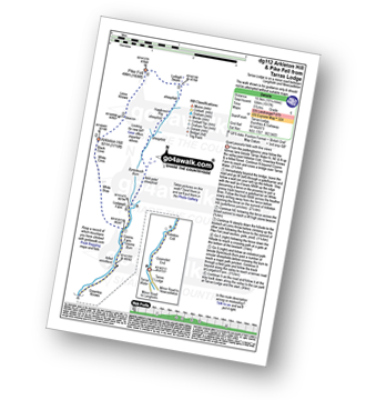
Route Summary:
Tarras Lodge - Tarras Water - Coomsfell End - Arkleton Cottage - Greenlea Knowe - Cooms Farm - White Brae - White Cove - Black Cove - Arkleton Hill - Linns Knowe - Pike Fell - Ludsgill Sware - Hawknest Rig - Byrecleuch Burn - Lodgegill Farm - Cooms Farm - Greenlea Knowe - Arkleton Cottage - Coomsfell End - Tarras Lodge
|
Vital Statistics:
| Length: | 14.75 miles (23.5 km) |
| Ascent: | 2,609ft (795m) |
| Time: | 8 hrs |
| Grade: | |
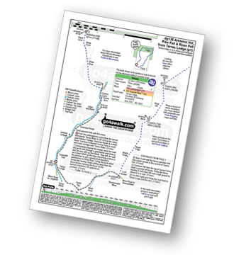
Route Summary:
Tarras Lodge - Tarras Water - Arkleton Cottage - Greenlea Knowe - Cooms Farm - White Brae - White Cove - Black Cove - Arkleton Hill - Linns Knowe - Pike Fell - Ludsgill Sware - Watch Knowe - Scawd Bank - The Pikes - Hartsgarth Fell - Roan Fell - Millstone Edge (Roan Fell) - Watch Hill - Strait Hill - Cooms Fell - Black Edge - Watch Crags - Loch Knowe - Burrowstown Moss - Perter Rig - Tarras Lodge
|
Vital Statistics:
| Length: | 13.75 miles (22 km) |
| Ascent: | 1,861ft (567m) |
| Time: | 6.75hrs |
| Grade: | |
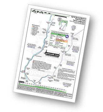
Route Summary:
Tarras Lodge - Tarras Water - Coomsfell End - Arkleton Cottage - Greenlea Knowe - Cooms Farm - Lodgegill Farm - Byrecleuch Burn - Hawknest Rig - Ludsgill Sware - Watch Knowe - Scawd Bank - The Pikes - Hartsgarth Fell - Roan Fell - Millstone Edge (Roan Fell) - Watch Hill - Strait Hill - Cooms Fell - Black Edge - Watch Crags - Loch Knowe - Burrowstown Moss - Perter Rig - Tarras Lodge
|
Vital Statistics:
| Length: | 13 miles (22 km) |
| Ascent: | 3,823ft (1,165m) |
| Time: | 8 hrs |
| Grade: | |
Route Summary:
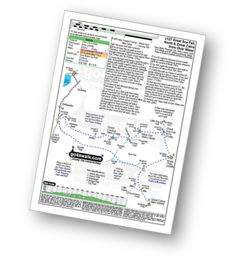
Forrest Lodge - Galloway Forest Park - Fore Bush - Polharrow Burn - Lumford Burn - Craignelden - Craigrine - Corserine - Carlin's Cairn - Corserine - Millfire - Milldown - Rhinns of Kells - Meikle Millyea - Meikle Lump - Burnhead - Forrest Lodge - Galloway Forest Park.
|
Vital Statistics:
| Length: | 8.75 miles (14 km) |
| Ascent: | 3,482ft (1,061m) |
| Time: | 7 hrs |
| Grade: | |
Route Summary:
Mosspaul Hotel - Wisp Hill (Teviothead) - Ewenshope Fell - Ewes Doors - Pikethaw Hill - Frodaw Height - Dan's Hags - Upper Hill (Fiddleton Cottage) - Fiddleton Cottage - Glenrief Cottage - Castlewink - Ellson Fell - Glenrief Rig - Mosspaul Burn - Mosspaul Hotel
|
Vital Statistics:
| Length: | 8.5 miles (13.5 km) |
| Ascent: | 2,832ft (863m) |
| Time: | 5.75hrs |
| Grade: | |
Route Summary:
Mosspaul Hotel - Wisp Hill (Teviothead) - Ewenshope Fell - Ewes Doors - Pikethaw Hill - Frodaw Height - Dan's Hags - Upper Hill (Fiddleton Cottage) - Fiddleton Cottage - Bught Knowe - Glenrief Rig - Mosspaul Burn - Mosspaul Hotel
Not familiar with the area around DG1?
See these 30 nearest walks to UK Postcode DG1 on a google map
|
Vital Statistics:
| Length: | 7.5 miles (12 km) |
| Ascent: | 2,018ft (615m) |
| Time: | 4.75hrs |
| Grade: | |
Route Summary:
Mosspaul Hotel - Wisp Hill (Teviothead) - Ewenshope Fell - Ewes Doors - Ewelees Farm - Fiddleton Cottage - Bught Knowe - Glenrief Rig - Mosspaul Burn - Mosspaul Hotel
|
Vital Statistics:
| Length: | 5.75 miles (9 km) |
| Ascent: | 1,877ft (572m) |
| Time: | 4 hrs |
| Grade: | |
Route Summary:
Mosspaul Hotel - Mosspaul Burn - Glenrief Rig - Ellson Fell - Castlewink - Glenrief Cottage - Bught Knowe - Glenrief Rig - Mosspaul Burn - Mosspaul Hotel
|
Vital Statistics:
| Length: | 4.5 miles (7 km) |
| Ascent: | 630ft (192m) |
| Time: | 2.25hrs |
| Grade: | |
Route Summary:
Cockermouth - Watch Hill (Cockermouth) - Hay - Setmurthy Plantation - Setmurthy Common (Watch Hill) - Peel Wood - Long Bottom - Greenlands - Cockermouth
|
Vital Statistics:
| Length: | 7.25 miles (11.5 km) |
| Ascent: | 2,009ft (612m) |
| Time: | 4.75hrs |
| Grade: | |
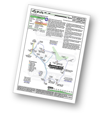
Route Summary:
Linhope Farm - Lightning Hill - Wether Law (Teviothead) - Crummiecleuch Rig - Millstone Edge (Tudhope Hill) - Tudhope Hill - Little Tudhope Hill - Sunhope Hass - Elygrain Farm - Linhope Burn - Linhope Farm
|
Vital Statistics:
| Length: | 8.75 miles (14 km) |
| Ascent: | 2,793ft (851m) |
| Time: | 6 hrs |
| Grade: | |
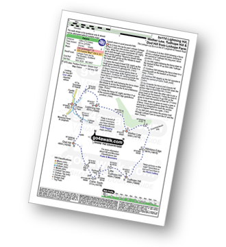
Route Summary:
Linhope Farm - Lightning Hill - Wether Law (Teviothead) - Crummiecleuch Rig - Millstone Edge (Tudhope Hill) - Tudhope Hill - Little Tudhope Hill - Sunhope Hass - Carlin Tooth (Teviothead) - Bye Hill - Dod Hill (Teviothead) - Linhope Burn - Linhope Farm
|
Vital Statistics:
| Length: | 4.5 miles (7 km) |
| Ascent: | 1,503ft (458m) |
| Time: | 3.25hrs |
| Grade: |  |
Route Summary:
Linhope Farm - Linhope Burn - Dod Hill (Teviothead) - Bye Hill - Carlin Tooth (Teviothead) - Sunhope Hass - Linhope Burn - Elygrain Farm - Linhope Farm
|
Vital Statistics:
| Length: | 12.25 miles (19.5 km) |
| Ascent: | 3,062ft (933m) |
| Time: | 7½ hrs |
| Grade: | |
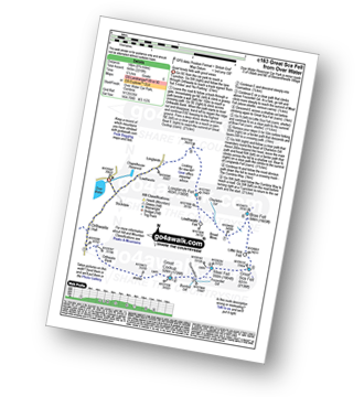
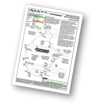
Route Summary:
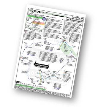
Over Water Reservoir - Waterside Wood - Whitefield Cottage - Binsey Cottage - Binsey - Dogkennel Wood - Overwater Hall - Black Wood - Orthwaite - Orthwaite Bank - Uldale Fells - Great Cockup - Meal Fell - Great Sca Fell - Little Sca Fell - Brae Fell - Broad Moss - Charleton Gill - Langlands Fell - The Cumbria Way - Lowthwaite - Chapelhouse Reservoir - Over Water
|
Vital Statistics:
| Length: | 10.5 miles (17 km) |
| Ascent: | 2,903ft (885m) |
| Time: | 6.75hrs |
| Grade: | |
Route Summary:
Over Water Reservoir - Orthwaite - Orthwaite Bank - Uldale Fells - Great Cockup - Frozenfell Gill - Trusmadoor - Meal Fell - Little Sca Fell - Great Sca Fell - Knott (Uldale Fells) - Little Calva - Great Calva - Hause Gill - Burn Tod - Burntod Gill - Brockle Crags - Orthwaite - Over Water
|
Vital Statistics:
| Length: | 7.75 miles (12.5 km) |
| Ascent: | 1,292ft (394m) |
| Time: | 4 hrs |
| Grade: | |
Route Summary:
Over Water Reservoir - Binsey Cottage - Binsey - Whittas Park - High House - High Ireby - Ruthwaite - Scawthwaite Mire - Over Water
|
Vital Statistics:
| Length: | 9 miles (14.5 km) |
| Ascent: | 2,624ft (800m) |
| Time: | 6 hrs |
| Grade: | |
Route Summary:
Over Water - Orthwaite - Orthwaite Bank - Uldale Fells - Great Cockup - Trusmadoor - Meal Fell - Great Sca Fell - Little Sca Fell - Brae Fell - Broad Moss - Lowthwaite Fell - Longlands Fell - The Cumbria Way - Longlands - Lowthwaite - Over Water
|
Vital Statistics:
| Length: | 4.5 miles (7 km) |
| Ascent: | 584ft (178m) |
| Time: | 2.25hrs |
| Grade: | |
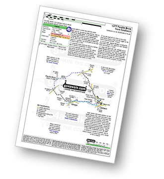
Route Summary:
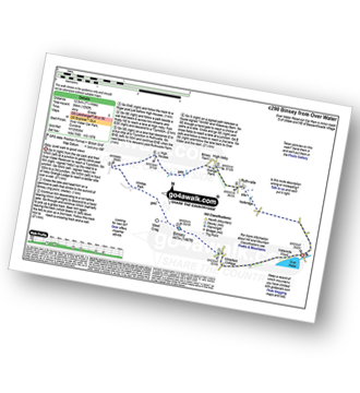
Caldbeck - Caldbeck Duck Pond - Ratten Row - Grange View - Knocker House - Faulds Brow - Whelpo - Whelpo Bridge - Whelpo Beck - Howk Bobbin Mill - Caldbeck
|
Vital Statistics:
| Length: | 7.75 miles (12.5 km) |
| Ascent: | 2,198ft (670m) |
| Time: | 5 hrs |
| Grade: | |
Route Summary:
Fell Side - Dale Beck - Brae Fell - Little Sca Fell - Great Sca Fell - Knott (Uldale Fells) - Grainsgill Beck - The Cumbria Way - Lingy Hut - Miller Moss - Great Lingy Hill - Hare Stones - High Pike (Caldbeck) - Long Grain Beck - Fell Side
|
Vital Statistics:
| Length: | 7.5 miles (12 km) |
| Ascent: | 2,091ft (637m) |
| Time: | 5 hrs |
| Grade: | |
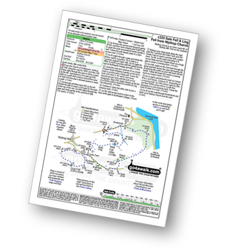
Route Summary:
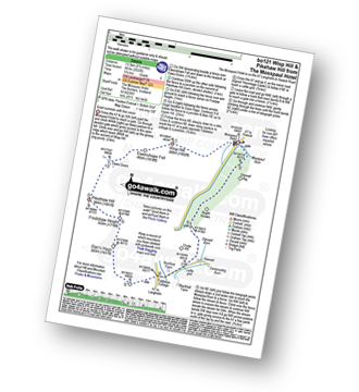
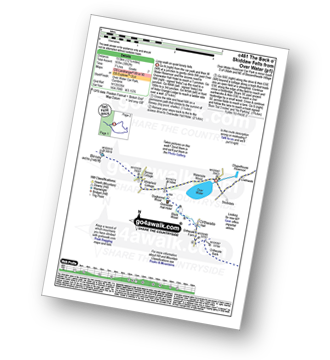
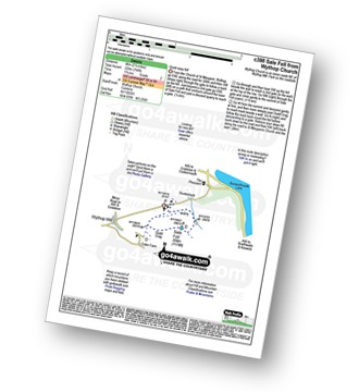
Church of St Margaret - Wythop Mill - Sale Fell - Dodd Crag - Wythop Beck - Esking Farm - Corpse Road - Ling Fell (Wythop) - Burthwaite Cottage - Old Scale - Chapel Wood - Routenbeck - Wythop.
|
Vital Statistics:
| Length: | 2.5 miles (4 km) |
| Ascent: | 748ft (228m) |
| Time: | 1.75hrs |
| Grade: |  |
|
Vital Statistics:
| Length: | 6.25 miles (10 km) |
| Ascent: | 758ft (231m) |
| Time: | 3 hrs |
| Grade: | |
Route Summary:
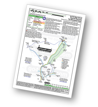
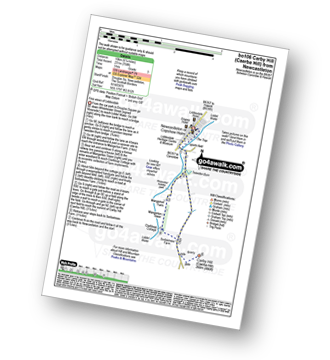
Newcastleton - Liddesdale - Liddel Water - Tweeden Burn - Mangerton Tower - Sorbietrees Farm - Carby Hill (Caerba Hill) - Newcastleton or Copshaw Holme.
Not familiar with the area around DG1?
See these 30 nearest walks to UK Postcode DG1 on a google map


