Unclassified Icon

Arkleton Hill
521m (1710ft)


The Border Hills, The Scottish Borders, Dumfries and Galloway, Scotland

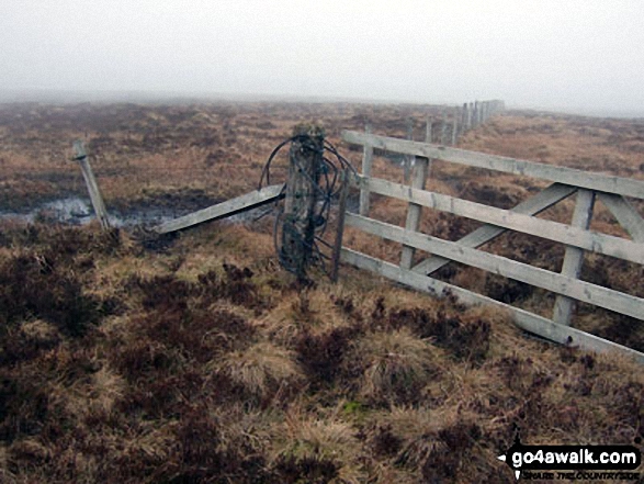
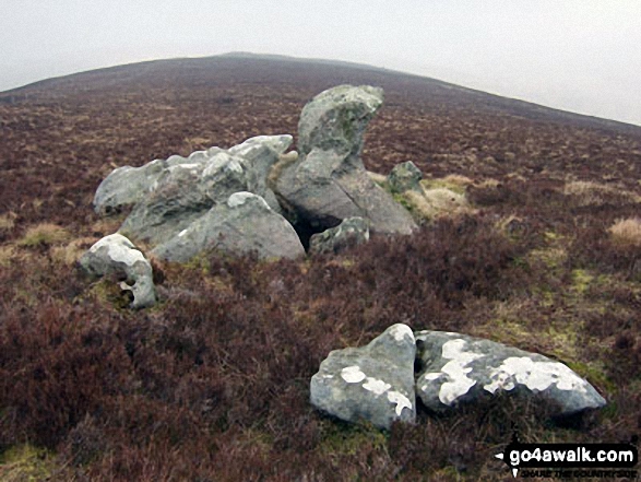
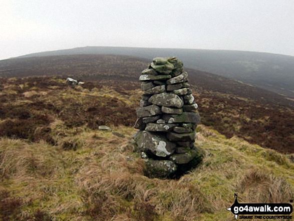
The summit of Arkleton Hill is unmarked.


Record Arkleton Hill as Bagged, Climbed & Conquered

Unclassified


Unclassified

Walk Arkleton Hill walking UK Mountains in The Scottish Borders  Dumfries and Gallowayn, Scotland

Arkleton Hill Summit

Photo: Ian Leighton


Not familiar with this top?

How is Arkleton Hill classified?

Download 2 easy-to-follow, circular walks that include Arkleton Hill

See the location of Arkleton Hill and both walks on an interactive Google Map

See the location of Arkleton Hill on an interactive Google Bagging Map

See the location of Arkleton Hill and both walks on our unique free-to-access Interactive Walk Planning Maps (worth a look if you've never seen these)

View more photographs & pictures of views from, on or of Arkleton Hill


You can walk to the top of Arkleton Hill by using either of these 2 easy‑to‑follow route maps:
Walking Boot Print Icon

Walk dg112 Arkleton Hill, Pike Fell from Tarras Lodge

Quiet peaceful fells with fine views

Walk GPS Icon
Walk GPX Icon
Walk PDF Icon

Vital Statistics:

Length: 10.25ml (16.5km)
Ascent:1,917ft (584m)
Time:5.75hrs
Grade:Walk Grade 6 Icon (Moderate)
Walking Boot Print Icon

Walk dg136 Arkleton Hill, Pike Fell and Roan Fell from Tarras Lodge

Quiet peaceful fells with fine views

Walk GPS Icon
Walk GPX Icon
Walk PDF Icon

Vital Statistics:

Length: 14.75ml (23.5km)
Ascent:2,609ft (795m)
Time:8 hrs
Grade:Walk Grade 7 Icon (Hard)

See Arkleton Hill and the surrounding tops on our free-to-access 'Google Style' Peak Bagging Maps:

Find Google Maps Peak Bagging Map Icon

The Border Hills area of Scottish Region 28: The Scottish Borders
Less data - quicker to download

Find Google Maps Peak Bagging Map Icon

Scottish Region 27: The Scottish Borders
Less data - quicker to download


A go4awalk.com downloadable Peak Bagging Map in PDF format featuring Arkleton Hill should be available soon.


You can find Arkleton Hill & all the walks that climb it on these unique free-to-access Interactive Walk Planning Maps:


1:25,000 scale OS Explorer Maps (orange/yellow covers):

An Interactive Walk Planning Map for OS Explorer 323 Eskdale and Castle o’er Forest is not currently available


OS Explorer 324 Liddesdale & Kershope Forest


1:50,000 scale OS Landranger Map (pink/magenta covers):

OS Landranger 79 Hawick & Eskdale, Langholm


Top


Other walkers who hiked, climbed, bagged and summited Arkleton Hill Fellow go4awalkers who have already walked, climbed, summited & bagged Arkleton Hill

To add (or remove) your name and experiences on this page - Log On and edit your Personal Mountain Bagging Record

Top


More Photographs & Pictures of views from, on or of Arkleton Hill

Rocks on the ridge between Arkleton Hill and Linns Knowe

Rocks on the ridge between Arkleton Hill and Linns Knowe

Photo: Ian Leighton (64)

Top

Beacon North East of Arkleton Hill

Beacon North East of Arkleton Hill

Photo: Ian Leighton (65)

Top


Send us your photographs and pictures on, of, or from Arkleton Hill

If you would like to add your walk photographs and pictures featuring views from, on or of Arkleton Hill to this page, please send them as email attachments (configured for any computer) along with your name to:


and we shall do our best to publish them.

(Guide Resolution = 300dpi. At least = 660pixels (wide) x 440 pixels (high).)

Send us your photographs and pictures on, of, or from Arkleton Hill via Facebook

You can also submit photos via our Facebook Page.

NB. Please indicate where each photo was taken and whether you wish us to credit your photos with a Username or your First Name/Last Name.

Top


Not familiar with this top?

How is Arkleton Hill classified?

Download 2 easy-to-follow, circular walks that include Arkleton Hill

See the location of Arkleton Hill and both walks on an interactive Google Map

See the location of Arkleton Hill on an interactive Google Bagging Map

See the location of Arkleton Hill and both walks on our unique free-to-access Interactive Walk Planning Maps (worth a look if you've never seen these)

View more photographs & pictures of views from, on or of Arkleton Hill


Do not miss our pick of the Best Walks in Britain


Follow go4awalk.com on Twitter Follow go4awalk.com on Facebook


Home


Find new Friends to go walking with

Walk all 214 Wainwrights in just 59 Walks. Download GPS Waypoints - Great Walks you must not miss!

Walk The Yorkshire Three Peaks Challenge Walk - All the Latest Route Information, GPS Waypoints and Split Times to keep you on Schedule

Walk The British Three Peaks Challenge Walk - All the Latest Route Information and GPS Waypoints

See our pick of The Best Walks in The Lake District - Great Walks you must not miss!

Walk our pick of the Best Lake District Ridge Walks - Great Walks you must not miss!

Walk our pick of the Best Lake District Walks to do in the rain - Great Walks you must not miss!

Walk our pick of The Best Walks in Snowdonia - Great Walks you must not miss!

Walk our pick of The Best Ridge Walks in Wales - Walks you must not miss!

Walk our pick of The Best Walks in The Brecon Beacons - Great Walks you must not miss!

Walk our pick of The Best Walks in The Yorkshire Dales - Walks you must not miss!

Walk our pick of The Best Walks in The Peak District - Walks you must not miss!

Walk our pick of The Best Walks in The Forest of Bowland - Walks you must not miss!

Walk our pick of The Best Walks in Shropshire - Walks you must not miss!

Walk our pick of The Best Walks in Cheshire - Walks you must not miss!

Walk our pick of The Best Walks in Lancashire - Walks you must not miss!

Not sure where to walk next? Try Peak Bagging - Great Walks you must not miss!

Not sure where to walk next? Walk part of a National Trail - Great Walks you must not miss!

Walks with Downloadable and Uploadable GPS Waypoint Data

Walking Kit and Gear Tested by Walkers

Full Site Search
Do not miss our pick of the Best Walks in Britain