UK Postcode LA7 - The 30 nearest easy-to-follow, circular walk route maps to you
The thirty nearest easy-to-follow, circular walk route maps to you in UK Postcode LA7 in Walk Grade Order
The UK cities, towns and villages in Cumbria, England that have LA7 in their UK Postcode include:
• Beetham • Crooklands • Heversham • Hincaster • Leasgill • Milnthorpe • Storth • Woodhouse •
Tap/mouse over a coloured circle (1-3 easy walks, 4-6 moderate walks, 7-9 hard walks) and click to select.
Scroll down the list of walks below & click on each walk title (in blue) to locate it on the map above.
   |
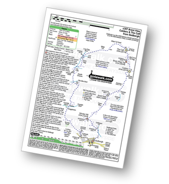
Vital Statistics:
| Length: | 3.75 miles (6 km) |
| Ascent: | 627ft (191m) |
| Time: | 2 hrs |
| Grade: |  |
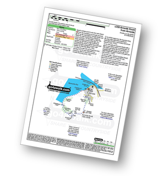
Route Summary:
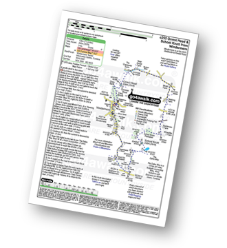
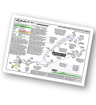
Arnside (Morecambe Bay) - Red Hills Wood - Arnside Knott - Copridding Wood - Grubbins Wood - Morecambe Bay - The Cumbria Coastal Way - Arnside (Morecambe Bay)
|
Vital Statistics:
| Length: | 6.75 miles (11 km) |
| Ascent: | 1,243ft (379m) |
| Time: | 3.75hrs |
| Grade: |  |
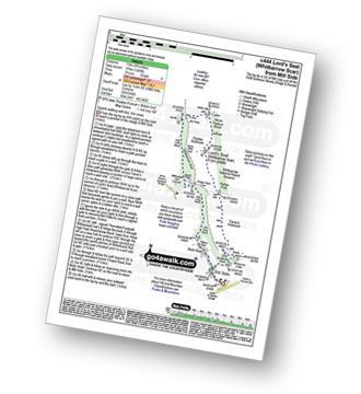
Route Summary:
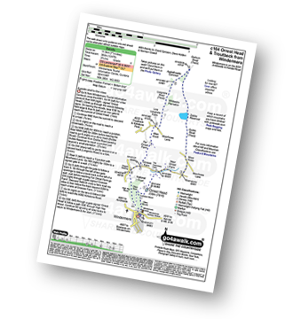
Mill Side - Buckhouse Wood - Farrar's Allotment - Pether Pots. Whitbarrow National Nature Reserve - Lord's Seat (Whitbarrow Scar) - Flodder Allotment - Bell Rake - High Park Wood - Black Yew Scars - Witherslack Hall School - Chapel Head Scar - High Crag Wood - Low Crag Wood - Beck Head - Mill Side
|
Vital Statistics:
| Length: | 4.75 miles (7.5 km) |
| Ascent: | 945ft (288m) |
| Time: | 2.75hrs |
| Grade: |  |
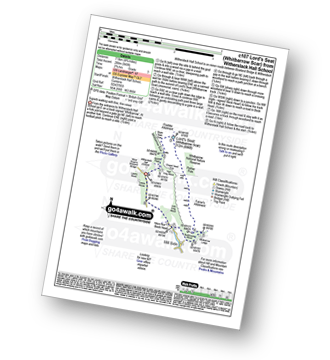
Route Summary:
Witherslack Hall School - Black Yews Scar - Flodder Allotment - Lord's Seat (Whitbarrow Scar) - Farrar's Allotment - Whitbarrow Scar - Buckhouse Wood - Beck Head (Witherslack) - Witherslack Hall School
|
Vital Statistics:
| Length: | 6.5 miles (10.5 km) |
| Ascent: | 1,076ft (328m) |
| Time: | 3.75hrs |
| Grade: | |
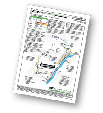
Route Summary:
Grange-over-Sands - Eggerslack Wood - Hampsfell - Fell End - High Fell Gate Farm - Allithwaite - The Cumbria Coastal Way - Kents Bank - Morecambe Bay - Grange-over-Sands
|
Vital Statistics:
| Length: | 10.25 miles (16.5 km) |
| Ascent: | 1,375ft (419m) |
| Time: | 5.25hrs |
| Grade: |  |
Route Summary:
Grange-over-Sands - Eggerslack Wood - Hampsfell - Fell End - High Fell Gate Farm - Allithwaite - Wraysholme Tower - The Cumbria Coastal Way - Humphrey Head - Humphrey Head Wood - Wyke Farm - Kirkhead End - Allithwaite - Kents Bank - Morecambe Bay - Grange-over-Sands
|
Vital Statistics:
| Length: | 10 miles (16 km) |
| Ascent: | 1,496ft (456m) |
| Time: | 5.25hrs |
| Grade: | |
Route Summary:
Underbarrow - Hagg Cottage - Gambleshire Lane - Gambleshire Lane - Cunswick Fell - Cunswick Scar - Scout Scar (Barrowfield) - Hodgeson's Leap - Bradleyfield - Helsington Barrows - Windy Howe - Helsington Church - Honeybee Wood - Barrowfield Farm - Barrowfield Lot - Copeland Wood - Hollinwood - Cooper Tenement - Rockyfield - Underbarrow
|
Vital Statistics:
| Length: | 5.75 miles (9 km) |
| Ascent: | 932ft (284m) |
| Time: | 3 hrs |
| Grade: | |
Route Summary:
Underbarrow - Hagg Cottage - Gambleshire Lane - Gambleshire Lane - Cunswick Fell - Scout Scar (Barrowfield) - Hodgeson's Leap - Bradleyfield - Helsington Barrows - Barrowfield Farm - Barrowfield Lot - Copeland Wood - Hollinwood - Cooper Tenement - Rockyfield - Underbarrow
|
Vital Statistics:
| Length: | 7.25 miles (11.5 km) |
| Ascent: | 1,053ft (321m) |
| Time: | 3.75hrs |
| Grade: | |
Route Summary:
Kendal - Kendal Fell - Kettlewell Crag - Cunswick Fell - Cunswick Scar - Scout Scar (Barrowfield) - Helsington Barrows - Bradleyfield - Brigsteer Road - Larch How - Kendal
|
Vital Statistics:
| Length: | 3.75 miles (6 km) |
| Ascent: | 309ft (94m) |
| Time: | 1.75hrs |
| Grade: | |
Route Summary:
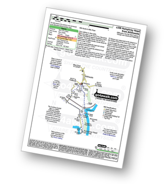
Allithwaite - Wraysholme Tower - The Cumbria Coastal Way - Humphrey Head - Humphrey Head Wood - Wyke Farm - Kirkhead End - Allithwaite
|
Vital Statistics:
| Length: | 13.5 miles (21.5 km) |
| Ascent: | 2,317ft (706m) |
| Time: | 7.25hrs |
| Grade: |  |
Route Summary:
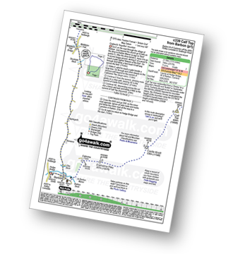
Hodge Bridge - Barbon - Thorn Moor - Eskholme Pike - Castle Knott - Calf Top - Barkin Top - Longbank Peat Moss - Long Bank - Fellside Farm - River Lune - Low Waterside Farm - Middleton Hall Bridge - Stockdale Beck - Applegarth - Borwens - Eller Beck - Barbon - Hodge Bridge
|
Vital Statistics:
| Length: | 7 miles (11 km) |
| Ascent: | 1,218ft (371m) |
| Time: | 3.75hrs |
| Grade: | |
Route Summary:
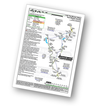
Winster Church - Winster House - Birkett Houses Allotments - Ghyll Head Reservoir - Great Ludderburn Moss - Little Ludderburn Moss - Ludderburn Hill - The Oaks - Intake Wood - High Hartbarrow - Lound Cottage - Strawberry Bank - Hollins Farm - Great Hartbarrow - Wood Farm - River Winster - Bryan House Farm - Winster Church
|
Vital Statistics:
| Length: | 3.25 miles (5 km) |
| Ascent: | 131ft (40m) |
| Time: | 1.25hrs |
| Grade: |  |
Route Summary:
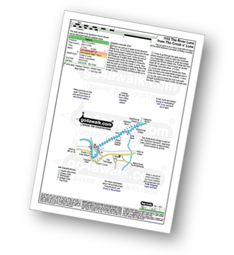
Crook o' Lune - Caton - The River Lune - Crook o' Lune Wood - Artle Beck - Waterworks Bridge - Applehouse Wood - Highfield Beck - Crook o' Lune
|
Vital Statistics:
| Length: | 5.25 miles (8.5 km) |
| Ascent: | 899ft (274m) |
| Time: | 3 hrs |
| Grade: | |
|
Vital Statistics:
| Length: | 8.5 miles (13.5 km) |
| Ascent: | 1,653ft (504m) |
| Time: | 4.75hrs |
| Grade: | |
Route Summary:
Leck Fell House - The Three Men of Gragareth - Gragareth - Green Hill (Gragareth) - Lancashire County Stone - Great Coum - Crag Hill - Casterton Fell - Ease Gill - Leck Fell House
|
Vital Statistics:
| Length: | 5.5 miles (8.5 km) |
| Ascent: | 974ft (297m) |
| Time: | 3 hrs |
| Grade: | |
Route Summary:
Staveley - Barley Bridge - Craggy Plantation - Spy Crag - Littlewood Farm - Birk Field Farm - Potter Tarn - Ghyll Pool - Hundhowe - Hagg Foot - The River Kent - The Dales Way - Beckmickle Ing - Staveley
|
Vital Statistics:
| Length: | 6 miles (9.5 km) |
| Ascent: | 531ft (246m) |
| Time: | 2½ hrs |
| Grade: | |
Route Summary:
Ings - High Fairbank - The Dales Way - Crag House Farm - Outrun Nook - Hag End Farm - School Knott - Schoolknott Plantation - Whasdike Farm - Ings
|
Vital Statistics:
| Length: | 8.5 miles (13.5 km) |
| Ascent: | 1,644ft (501m) |
| Time: | 4.75hrs |
| Grade: | |
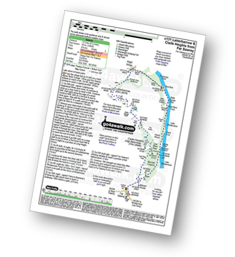
Route Summary:
Far Sawrey - Mitchell Knotts - Low Pate Crag - Claife Heights (High Blind How) - The Heald - High Moss - Belle Grange Beck - Long Height - Latterbarrow - High Wray - Red Nap Car Park - Lake Windermere - Belle Grange Bay - Bark Barn Ferry - Slape Scar - Strawberry Gardens - Far Sawrey
|
Vital Statistics:
| Length: | 7 miles (11 km) |
| Ascent: | 945ft (288m) |
| Time: | 3½ hrs |
| Grade: | |
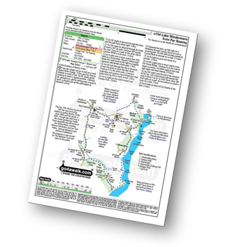
Route Summary:
Far Sawrey - Mitchell Knotts - Fellborough - Lake Windermere Shore - Rawlinson Nab - Low Cunsey Farm - Cunsey Wood - The Forge - Great Ore Gate - Cunsey Beck - Eel House Bridge - Dub How Farm - Near Sawrey - Hill Top (former Home of Beatrix Potter) - Wilfin Beck - Far Sawrey
|
Vital Statistics:
| Length: | 6 miles (9.5 km) |
| Ascent: | 699ft (213m) |
| Time: | 2.75hrs |
| Grade: | |
Route Summary:
Oxen Park - Furness - Abbot Park - Lord Ling - The Riggs - High Ickenthwaite - Low Ickenthwaite - Big Plantation - Glass Knott - The Syke - Rusland Cross - Rusland Hall - Rusland Moss Nature Reserve - Hulleter Moss - Low Hay Bridge Nature Reserve - Crooks Pastures - Black Knotts Plantation - Moss Wood - Oxen Park
|
Vital Statistics:
| Length: | 9.5 miles (15 km) |
| Ascent: | 3,114ft (949m) |
| Time: | 6½ hrs |
| Grade: | |
Route Summary:
Sedbergh - Settlebeck Gill - Winder Hill - Arant Haw - Calders - Bram Rigg Top - The Calf - White Fell Head - Long Rigg Beck - Ivy Crag - Eller Mire - Crosdale Beck - Nursery Wood - Lockbank Farm - Sedbergh
|
Vital Statistics:
| Length: | 7.5 miles (12 km) |
| Ascent: | 787ft (240m) |
| Time: | 3½ hrs |
| Grade: | |
Route Summary:
Windermere - Ellery Woods - Orrest Head - Near Orrest Farm - Mislet Farm - Heaning Farm - Blackmoss Farm - School Knott Plantation - School Knott - The Dales Way - High Cleabarrow Farm - Matson Ground - Heaththwaite Manor - Windermere
|
Vital Statistics:
| Length: | 7.25 miles (11.5 km) |
| Ascent: | 1,247ft (380m) |
| Time: | 3.75hrs |
| Grade: | |
Route Summary:
Windermere - Orrest Head - Moorhowe - Dubbs Road - Garburn Road - Longmire Road - Far Orrest Farm - Orrest Head - Windermere
|
Vital Statistics:
| Length: | 12.25 miles (19.5 km) |
| Ascent: | 1,568ft (478m) |
| Time: | 6 hrs |
| Grade: |  |
Route Summary:
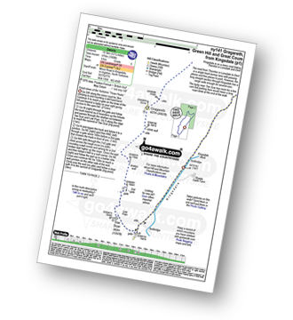
Kingsdale - Tow Scar - Gragareth - Green Hill (Gragareth) - Lancashire County Stone - High Pike - Kingsdale Beck - Kingsdale
|
Vital Statistics:
| Length: | 4.75 miles (7.5 km) |
| Ascent: | 984ft (300m) |
| Time: | 3 hrs |
| Grade: | |
Route Summary:
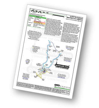
Ingleton - The Ingleton Waterfalls Trail - River Twiss - Swilla Glen - The Money Tree - Helks - Mount - Manor Bridge - Constitution Hill - Pecca Bridge - Pecca Falls - Thornton Force - Raven Ray Bridge - Kingsdale - Twistleton Hall - River Doe - Beezley Falls - Rival Falls - Snow Falls - Ingleton
|
Vital Statistics:
| Length: | 16.5 miles (26 km) |
| Ascent: | 2,447ft (746m) |
| Time: | 8½ hrs |
| Grade: | |
Route Summary:
Ingleton - Thornton Hall Farm - Tow Scar - Gragareth - Green Hill (Gragareth) - Lancashire County Stone - High Pike - Kingsdale Beck - Braida Garth Farm - Twistleton Hall Farm - The Ingleton Waterfalls Trail - Beezley Falls - River Doe - Snow Falls - Ingleton
|
Vital Statistics:
| Length: | 10 miles (16 km) |
| Ascent: | 2,244ft (684m) |
| Time: | 5.75hrs |
| Grade: | |
Route Summary:
Ingleton - Fell Lane - Crina Bottom Farm - Quaking Pot - Ingleborough - Humphrey Bottom - Ingleborough Nature Reserve - Braithwaite Wife Hole - Souther Scales Farm - Chapel-le-Dale - Twistleton Scars - Oddies Lane - The Ingleton Waterfalls Trail - Beezley Falls - Snow Falls - Ingleton
|
Vital Statistics:
| Length: | 9.5 miles (15 km) |
| Ascent: | 2,250ft (686m) |
| Time: | 5½ hrs |
| Grade: | |
Route Summary:
Ingleton - Ingleton Information Centre - Richmond House - Fell Lane - Crina Bottom Farm - Quaking Pot - Ingleborough - Little Ingleborough - Newby Moss - Newby Cote - Bleak Bank - Duck Dub - Holly Platt - Slatenber - Jenkin Bridge - Ingleton
|
Vital Statistics:
| Length: | 5 miles (8 km) |
| Ascent: | 961ft (293m) |
| Time: | 3 hrs |
| Grade: | |
Route Summary:
Ingleton - Thornton Hall Farm - Kingsdale - River Dow - The Ingleton Waterfalls Trail Beezley Falls - Rival Falls - Snow Falls - Ingleton
|
Vital Statistics:
| Length: | 9.5 miles (15 km) |
| Ascent: | 2,362ft (720m) |
| Time: | 5.75hrs |
| Grade: | |
Route Summary:
Ingleton - Ingleton Tourist Information Centre - Fell Lane - Crina Bottom Farm - Quaking Pot - Ingleborough - Humphrey Bottom - Ingleborough Nature Reserve - Raven Scar - High Howeth - Harry Hallam's Moss - White Scars - Ingleton
|
Vital Statistics:
| Length: | 11 miles (17.5 km) |
| Ascent: | 2,310ft (704m) |
| Time: | 6.25hrs |
| Grade: | |
Route Summary:
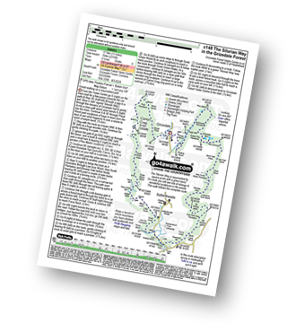
Grizedale Forest Visitor Centre - Silurian Way - Priest Wood - Ridding Wood - Braithwaite Plantation - Potato Peg Plantation - Grisedale Tarn - The Connob - Low Scar Wood - Beck Side Intake - Great Wood - New South Wales Plantation - Breasty Haw - Lawrence Scar Wood - Dale Park Scar - Blind Lane Wood - Force Knott - Swainsley Hill - Force Beck - Farce Falls - Low Bowkerstead Hob Gill Plantation - Satterthwaite - Scale Green Wood - Scale Green Intake - Carron Crag - Park Plantation - Broad Piece - Grizedale Forest Visitor Centre


