Walks on Ordnance Survey Maps
Sorry but we do not have any walks on:
Ordnance Survey Landranger Map 80 Cheviot Hills & Kielder Water at the moment.
Please choose another Ordnance Survey Walking Map from the links below:
OS Explorer Maps | OS Landranger Maps
Walks in Ordnance Survey 1:25,000 Scale Explorer Maps
(the ones with Orange Covers)
1:25 000 Scale - 4cm to 1km or
2½ inches to 1 mile
See all 87 walks on an OS Explorer Map
OL1 The Peak District - Dark Peak area:
on our unique Animated Map of OS Map OL1
as an interactive Google Map of OS Map OL1
See all 56 walks on an OS Explorer Map
OL2 Yorkshire Dales - Southern & Western areas:
on our unique Animated Map of OS Map OL2
as an interactive Google Map of OS Map OL2

See the 1 walk on an OS Explorer Map
OL3 Meon Valley, Portsmouth, Gosport & Fareham:
View as an interactive Google Map of OS Map OL3
See all 121 walks on an OS Explorer Map
OL4 The English Lakes - North Western area:
on our unique Animated Map of OS Map OL4
as an interactive Google Map of OS Map OL4
See all 86 walks on an OS Explorer Map
OL5 The English Lakes - North Eastern area:
on our unique Animated Map of OS Map OL5
as an interactive Google Map of OS Map OL5
See all 81 walks on an OS Explorer Map
OL6 The English Lakes - South Western area:
on our unique Animated Map of OS Map OL6
as an interactive Google Map of OS Map OL6
See all 69 walks on an OS Explorer Map
OL7 The English Lakes - South Eastern area:
on our unique Animated Map of OS Map OL7
as an interactive Google Map of OS Map OL7
See all 7 walks on an OS Explorer Map
OL9 Exmoor:
on our unique Animated Map of OS Map OL9
as an interactive Google Map of OS Map OL9
See all 15 walks on an OS Explorer Map
OL10 Arundel & Pulborough:
on our unique Animated Map of OS Map OL10
as an interactive Google Map of OS Map OL10
See all 4 walks on an OS Explorer Map
OL11 Brighton & Hove:
on our unique Animated Map of OS Map OL11
as an interactive Google Map of OS Map OL11
See all 31 walks on an OS Explorer Map
OL12 Brecon Beacons National Park - Western & Central areas:
on our unique Animated Map of OS Map OL12
as an interactive Google Map of OS Map OL12
See all 22 walks on an OS Explorer Map
OL13 Brecon Beacons National Park - Eastern area:
on our unique Animated Map of OS Map OL13
as an interactive Google Map of OS Map OL13
See all 3 walks on an OS Explorer Map
OL14 Wye Valley and Forest of Dean:
View as an interactive Google Map of OS Map OL14
See all 15 walks on an OS Explorer Map
OL15 Purbeck and South Dorset:
on our unique Animated Map of OS Map OL15
as an interactive Google Map of OS Map OL15
See all 33 walks on an OS Explorer Map
OL16 The Cheviot Hills:
on our unique Animated Map of OS Map OL16
as an interactive Google Map of OS Map OL16
See all 72 walks on an OS Explorer Map
OL17 Snowdon/Yr Wyddfa and Conwy Valley/Dyffryn Conwy:
on our unique Animated Map of OS Map OL17
as an interactive Google Map of OS Map OL17
See all 26 walks on an OS Explorer Map
OL18 Harlech, Porthmadog & Bala/Y Bala:
on our unique Animated Map of OS Map OL18
as an interactive Google Map of OS Map OL18
See all 37 walks on an OS Explorer Map
OL19 Howgill Fells and Upper Eden Valley:
on our unique Animated Map of OS Map OL19
as an interactive Google Map of OS Map OL19
See the 1 walk on an OS Explorer Map
OL20 South Devon - Brixham to Newton Ferrers:
View as an interactive Google Map of OS Map OL20
See all 41 walks on an OS Explorer Map
OL21 South Pennines:
on our unique Animated Map of OS Map OL21
as an interactive Google Map of OS Map OL21

See the 1 walk on an OS Explorer Map
OL22 New Forest:
View as an interactive Google Map of OS Map OL22

See all 22 walks on an OS Explorer Map
OL23 Cadair Idris & Bala Lake/Llyn Tegid:
on our unique Animated Map of OS Map OL23
as an interactive Google Map of OS Map OL23
See all 185 walks on an OS Explorer Map
OL24 The Peak District - White Peak area:
on our unique Animated Map of OS Map OL24
as an interactive Google Map of OS Map OL24
See all 12 walks on an OS Explorer Map
OL25 Eastbourne & Beachy Head:
on our unique Animated Map of OS Map OL25
as an interactive Google Map of OS Map OL25
See all 7 walks on an OS Explorer Map
OL26 North York Moors - Western area:
on our unique Animated Map of OS Map OL26
as an interactive Google Map of OS Map OL26
See all 4 walks on an OS Explorer Map
OL27 North York Moors - Eastern area:
on our unique Animated Map of OS Map OL27
as an interactive Google Map of OS Map OL27
See all 26 walks on an OS Explorer Map
OL28 Dartmoor:
on our unique Animated Map of OS Map OL28
as an interactive Google Map of OS Map OL28
See both 2 walks on an OS Explorer Map
OL29 Isle of Wight:
View as an interactive Google Map of OS Map OL29
See all 29 walks on an OS Explorer Map
OL30 Yorkshire Dales - Northern & Central areas:
on our unique Animated Map of OS Map OL30
as an interactive Google Map of OS Map OL30
See all 37 walks on an OS Explorer Map
OL31 North Pennines - Teesdale & Weardale:
on our unique Animated Map of OS Map OL31
as an interactive Google Map of OS Map OL31
See all 8 walks on an OS Explorer Map
OL32 Winchester:
View as an interactive Google Map of OS Map OL32
See all 4 walks on an OS Explorer Map
OL33 Haslemere & Petersfield:
View as an interactive Google Map of OS Map OL33
See both 2 walks on an OS Explorer Map
OL34 Crawley & Horsham:
on our unique Animated Map of OS Map OL34
as an interactive Google Map of OS Map OL34
See all 21 walks on an OS Explorer Map
OL35 North Pembrokeshire/Gogledd Sir Benfro:
on our unique Animated Map of OS Map OL35
as an interactive Google Map of OS Map OL35

See both 2 walks on an OS Explorer Map
OL36 South Pembrokeshire/De Sir Benfro:
View as an interactive Google Map of OS Map OL36
See the 1 walk on an OS Explorer Map
OL37 Cowal East:
View as an interactive Google Map of OS Map OL37
See all 8 walks on an OS Explorer Map
OL39 Loch Lomond North:
on our unique Animated Map of OS Map OL39
as an interactive Google Map of OS Map OL39
See all 12 walks on an OS Explorer Map
OL40 The Broads:
on our unique Animated Map of OS Map OL40
as an interactive Google Map of OS Map OL40
See all 25 walks on an OS Explorer Map
OL41 Forest of Bowland & Ribblesdale:
on our unique Animated Map of OS Map OL41
as an interactive Google Map of OS Map OL41
See all 3 walks on an OS Explorer Map
OL42 Kielder Water:
on our unique Animated Map of OS Map OL42
as an interactive Google Map of OS Map OL42
See all 6 walks on an OS Explorer Map
OL43 Hadrian’s Wall:
on our unique Animated Map of OS Map OL43
as an interactive Google Map of OS Map OL43

See all 15 walks on an OS Explorer Map
OL45 The Cotswolds:
on our unique Animated Map of OS Map OL45
as an interactive Google Map of OS Map OL45
See all 6 walks on an OS Explorer Map
OL46 The Trossachs - Callander, Aberfoyle & Balquhidder & Strathyre:
on our unique Animated Map of OS Map OL46
as an interactive Google Map of OS Map OL46
See the 1 walk on an OS Explorer Map
OL48 Ben Lawers & Glen Lyon:
View as an interactive Google Map of OS Map OL48
See the 1 walk on an OS Explorer Map
OL51 Atholl:
View as an interactive Google Map of OS Map OL51
See the 1 walk on an OS Explorer Map
OL52 Glen Shee & Braemar:
View as an interactive Google Map of OS Map OL52
See all 13 walks on an OS Explorer Map
OL57 Cairn Gorm & Aviemore:
on our unique Animated Map of OS Map OL57
as an interactive Google Map of OS Map OL57
See both 2 walks on an OS Explorer Map
102 Land’s End:
View as an interactive Google Map of OS Map 102
See all 3 walks on an OS Explorer Map
104 Redruth & St Agnes:
View as an interactive Google Map of OS Map 104
See all 9 walks on an OS Explorer Map
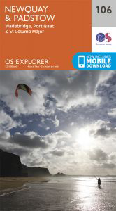
106 Newquay & Padstow:
View as an interactive Google Map of OS Map 106
See all 8 walks on an OS Explorer Map
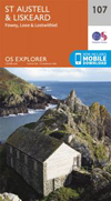
107 St Austell & Liskeard:
on our unique Animated Map of OS Map 107
as an interactive Google Map of OS Map 107
See both 2 walks on an OS Explorer Map
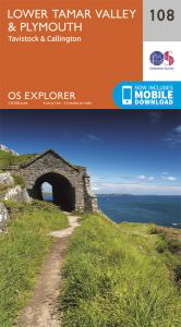
108 Lower Tamar Valley & Plymouth:
View as an interactive Google Map of OS Map 108
See all 6 walks on an OS Explorer Map
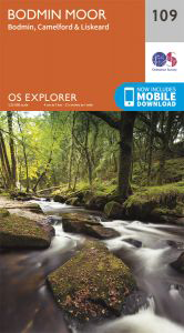
109 Bodmin Moor:
View as an interactive Google Map of OS Map 109
See all 8 walks on an OS Explorer Map
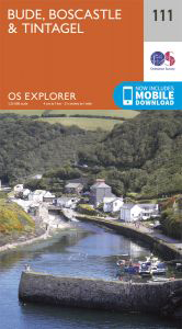
111 Bude, Boscastle & Tintagel:
View as an interactive Google Map of OS Map 111

See the 1 walk on an OS Explorer Map
114 Exeter & the Exe Valley:
View as an interactive Google Map of OS Map 114
See the 1 walk on an OS Explorer Map
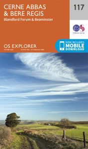
117 Cerne Abbas & Bere Regis:
View as an interactive Google Map of OS Map 117
See the 1 walk on an OS Explorer Map
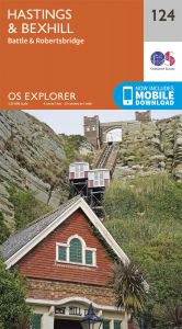
124 Hastings & Bexhill:
View as an interactive Google Map of OS Map 124
See the 1 walk on an OS Explorer Map
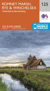
125 Romney Marsh, Rye & Winchelsea:
View as an interactive Google Map of OS Map 125
See both 2 walks on an OS Explorer Map
130 Salisbury & Stonehenge:
View as an interactive Google Map of OS Map 130
See the 1 walk on an OS Explorer Map
137 Ashford, Headcorn, Chilham & Wye:
View as an interactive Google Map of OS Map 137
See both 2 walks on an OS Explorer Map
138 Dover, Folkestone & Hythe:
View as an interactive Google Map of OS Map 138
See the 1 walk on an OS Explorer Map
140 Quantock Hills & Bridgwater:
View as an interactive Google Map of OS Map 140
See the 1 walk on an OS Explorer Map
141 Cheddar Gorge & Mendip Hills West:
View as an interactive Google Map of OS Map 141
See the 1 walk on an OS Explorer Map
142 Shepton Mallet & Mendip Hills East:
View as an interactive Google Map of OS Map 142
See the 1 walk on an OS Explorer Map
144 Basingstoke, Alton & Whitchurch:
View as an interactive Google Map of OS Map 144
See all 5 walks on an OS Explorer Map
145 Guildford & Farnham:
on our unique Animated Map of OS Map 145
as an interactive Google Map of OS Map 145

See all 26 walks on an OS Explorer Map
146 Dorking, Box Hill & Reigate:
on our unique Animated Map of OS Map 146
as an interactive Google Map of OS Map 146
See all 5 walks on an OS Explorer Map
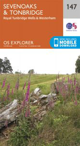
147 Sevenoaks & Tonbridge:
View as an interactive Google Map of OS Map 147
See the 1 walk on an OS Explorer Map
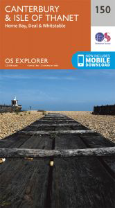
150 Canterbury & the Isle of Thanet:
View as an interactive Google Map of OS Map 150
See the 1 walk on an OS Explorer Map
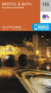
155 Bristol & Bath, Keynsham & Marshfield:
View as an interactive Google Map of OS Map 155
See all 5 walks on an OS Explorer Map
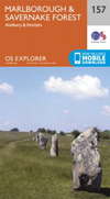
157 Marlborough & Savernake Forest:
on our unique Animated Map of OS Map 157
as an interactive Google Map of OS Map 157

See the 1 walk on an OS Explorer Map
160 Windsor, Weybridge & Bracknell:
View as an interactive Google Map of OS Map 160
See the 1 walk on an OS Explorer Map
161 London South, Croydon & Esher:
View as an interactive Google Map of OS Map 161
See all 3 walks on an OS Explorer Map
164 Gower:
View as an interactive Google Map of OS Map 164
See the 1 walk on an OS Explorer Map
167 Thornbury, Dursley & Yate:
View as an interactive Google Map of OS Map 167
See the 1 walk on an OS Explorer Map
170 Abingdon, Wantage & Vale of White Horse:
View as an interactive Google Map of OS Map 170
See the 1 walk on an OS Explorer Map
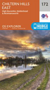
172 Chiltern Hills East, High Wycombe, Maidenhead:
on our unique Animated Map of OS Map 172
as an interactive Google Map of OS Map 172
See the 1 walk on an OS Explorer Map
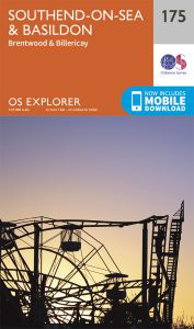
175 Southend-on-Sea & Basildon:
View as an interactive Google Map of OS Map 175
See both 2 walks on an OS Explorer Map
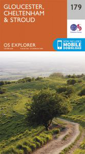
179 Cheltenham, Gloucester & Stroud:
View as an interactive Google Map of OS Map 179
See all 3 walks on an OS Explorer Map
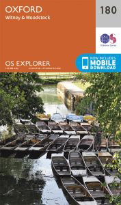
180 Oxford:
on our unique Animated Map of OS Map 180
as an interactive Google Map of OS Map 180
See all 11 walks on an OS Explorer Map
181 Chiltern Hills North, Aylesbury:
on our unique Animated Map of OS Map 181
as an interactive Google Map of OS Map 181

See the 1 walk on an OS Explorer Map
183 Chelmsford & The Rodings:
View as an interactive Google Map of OS Map 183
See the 1 walk on an OS Explorer Map
186 Llandeilo & Brechfa Forest / Fforest Brechfa:
View as an interactive Google Map of OS Map 186
See the 1 walk on an OS Explorer Map
190 Malvern Hills & Bredon Hill:
View as an interactive Google Map of OS Map 190
See all 7 walks on an OS Explorer Map
191 Banbury, Bicester & Chipping Norton:
on our unique Animated Map of OS Map 191
as an interactive Google Map of OS Map 191
See the 1 walk on an OS Explorer Map
192 Buckingham & Milton Keynes:
View as an interactive Google Map of OS Map 192
See the 1 walk on an OS Explorer Map
193 Luton & Stevenage:
View as an interactive Google Map of OS Map 193
See all 3 walks on an OS Explorer Map
194 Hertford & Bishop’s Stortford:
View as an interactive Google Map of OS Map 194
See the 1 walk on an OS Explorer Map
195 Braintree & Saffron Walden:
View as an interactive Google Map of OS Map 195
See the 1 walk on an OS Explorer Map
197 Ipswich, Felixstowe & Harwich:
View as an interactive Google Map of OS Map 197
See all 5 walks on an OS Explorer Map
200 Llandrindod Wells & Elan Valley:
View as an interactive Google Map of OS Map 200
See both 2 walks on an OS Explorer Map
201 Knighton Presteigne:
View as an interactive Google Map of OS Map 201
See the 1 walk on an OS Explorer Map
202 Leominster & Bromyard:
View as an interactive Google Map of OS Map 202
See both 2 walks on an OS Explorer Map
203 Ludlow, Tenbury Wells & Cleobury Mortimer:
View as an interactive Google Map of OS Map 203
See the 1 walk on an OS Explorer Map
205 Stratford-upon-Avon & Evesham:
View as an interactive Google Map of OS Map 205
See the 1 walk on an OS Explorer Map
206 Edge Hill & Fenny Compton:
View as an interactive Google Map of OS Map 206
See both 2 walks on an OS Explorer Map
207 Newport Pagnell & Northampton South:
View as an interactive Google Map of OS Map 207

See both 2 walks on an OS Explorer Map
208 Bedford & St Neots:
View as an interactive Google Map of OS Map 208
See the 1 walk on an OS Explorer Map
209 Cambridge:
View as an interactive Google Map of OS Map 209
See the 1 walk on an OS Explorer Map
212 Woodbridge & Saxmundham:
View as an interactive Google Map of OS Map 212
See the 1 walk on an OS Explorer Map
213 Aberystwyth & Cwm Rheidol:
View as an interactive Google Map of OS Map 213
See all 3 walks on an OS Explorer Map
216 Welshpool & Montgomery:
on our unique Animated Map of OS Map 216
as an interactive Google Map of OS Map 216
See all 15 walks on an OS Explorer Map
217 The Long Mynd & Wenlock Edge:
on our unique Animated Map of OS Map 217
as an interactive Google Map of OS Map 217
See all 3 walks on an OS Explorer Map
218 Kidderminster & Wyre Forest:
on our unique Animated Map of OS Map 218
as an interactive Google Map of OS Map 218
See all 4 walks on an OS Explorer Map
223 Northampton & Market Harborough:
View as an interactive Google Map of OS Map 223
See the 1 walk on an OS Explorer Map
224 Corby, Kettering & Wellingborough:
View as an interactive Google Map of OS Map 224
See the 1 walk on an OS Explorer Map
237 Norwich:
View as an interactive Google Map of OS Map 237
See both 2 walks on an OS Explorer Map
240 Oswestry:
View as an interactive Google Map of OS Map 240

See all 17 walks on an OS Explorer Map
241 Shrewsbury:
on our unique Animated Map of OS Map 241
as an interactive Google Map of OS Map 241
See the 1 walk on an OS Explorer Map
242 Telford, Ironbridge & The Wrekin:
View as an interactive Google Map of OS Map 242
See both 2 walks on an OS Explorer Map
245 The National Forest, Burton upon Trent & Swadlincote:
View as an interactive Google Map of OS Map 245
See the 1 walk on an OS Explorer Map
247 Grantham, Bottesford & Colsterworth:
View as an interactive Google Map of OS Map 247
See the 1 walk on an OS Explorer Map
251 Norfolk Coast Central:
View as an interactive Google Map of OS Map 251
See both 2 walks on an OS Explorer Map
252 Norfolk Coast East:
View as an interactive Google Map of OS Map 252
See the 1 walk on an OS Explorer Map
253 Lleyn Peninsula West / Pen Llyn Ardal Orllewinol:
View as an interactive Google Map of OS Map 253
See all 5 walks on an OS Explorer Map
254 Lleyn Peninsula East / Pen Llyn Ardal Ddwreiniol:
View as an interactive Google Map of OS Map 254
See all 12 walks on an OS Explorer Map
255 Llangollen & Berwyn:
on our unique Animated Map of OS Map 255
as an interactive Google Map of OS Map 255
See all 7 walks on an OS Explorer Map
257 Crewe & Nantwich:
on our unique Animated Map of OS Map 257
as an interactive Google Map of OS Map 257
See the 1 walk on an OS Explorer Map
258 Stoke-on-Trent & Newcastle-under-Lyme:
View as an interactive Google Map of OS Map 258
See all 8 walks on an OS Explorer Map
259 Derby, Uttoxeter, Ashbourne & Cheadle:
View as an interactive Google Map of OS Map 259
See the 1 walk on an OS Explorer Map
264 Vale of Clwyd / Dyffryn Clwyd:
View as an interactive Google Map of OS Map 264
See all 16 walks on an OS Explorer Map
265 Clwydian Range / Bryniau:
on our unique Animated Map of OS Map 265
as an interactive Google Map of OS Map 265
See all 16 walks on an OS Explorer Map
267 Northwich & Delamere Forest, Winsford & Middlewich:
on our unique Animated Map of OS Map 267
as an interactive Google Map of OS Map 267
See all 31 walks on an OS Explorer Map
268 Wilmslow, Macclesfield & Congleton, Altrincham, Knutsford & Sandbach:
on our unique Animated Map of OS Map 268
as an interactive Google Map of OS Map 268
See the 1 walk on an OS Explorer Map
269 Chesterfield & Alfreton:
View as an interactive Google Map of OS Map 269
See the 1 walk on an OS Explorer Map
270 Sherwood Forest:
View as an interactive Google Map of OS Map 270
See the 1 walk on an OS Explorer Map
273 Lincolnshire Wolds South:
View as an interactive Google Map of OS Map 273

See all 7 walks on an OS Explorer Map
276 Bolton, Wigan & Warrington:
on our unique Animated Map of OS Map 276
as an interactive Google Map of OS Map 276
See all 3 walks on an OS Explorer Map
279 Doncaster, Conisborough, Maltby and Thorne:
View as an interactive Google Map of OS Map 279
See both 2 walks on an OS Explorer Map
285 Southport & Chorley, Wigan, Formby & Ormskirk:
View as an interactive Google Map of OS Map 285
See all 11 walks on an OS Explorer Map
287 West Pennine Moors, Blackburn, Darwen & Accrington:
on our unique Animated Map of OS Map 287
as an interactive Google Map of OS Map 287
See the 1 walk on an OS Explorer Map
289 Leeds, Harrogate, Wetherby & Pontefract:
View as an interactive Google Map of OS Map 289
See the 1 walk on an OS Explorer Map
292 Withernsea & Spurn Head:
View as an interactive Google Map of OS Map 292
See all 3 walks on an OS Explorer Map
297 Lower Wharfedale & Washburn Valley:
View as an interactive Google Map of OS Map 297
See both 2 walks on an OS Explorer Map
301 Scarborough, Bridlington & Flamborough Head:
View as an interactive Google Map of OS Map 301
See both 2 walks on an OS Explorer Map
303 Whitehaven & Workington, Cockermouth & Egremont:
View as an interactive Google Map of OS Map 303
See all 3 walks on an OS Explorer Map
307 Consett & Derwent Reservoir, Stanhope:
View as an interactive Google Map of OS Map 307
See the 1 walk on an OS Explorer Map
309 Stranraer & The Rhins:
View as an interactive Google Map of OS Map 309
See the 1 walk on an OS Explorer Map
311 Wigtown, Whithorn & The Machars:
View as an interactive Google Map of OS Map 311

See the 1 walk on an OS Explorer Map
316 Newcastle Upon Tyne:
View as an interactive Google Map of OS Map 316
See the 1 walk on an OS Explorer Map
318 Galloway Forest Park North:
on our unique Animated Map of OS Map 318
as an interactive Google Map of OS Map 318
See all 3 walks on an OS Explorer Map
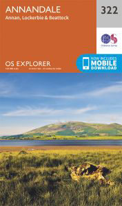
322 Annandale, Annan, Lockerbie & Beattock:
View as an interactive Google Map of OS Map 322
See all 5 walks on an OS Explorer Map
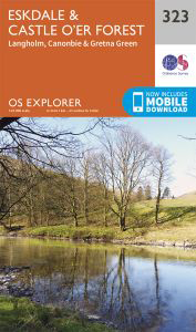
323 Eskdale and Castle o’er Forest:
View as an interactive Google Map of OS Map 323
See all 11 walks on an OS Explorer Map
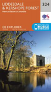
324 Liddesdale & Kershope Forest:
on our unique Animated Map of OS Map 324
as an interactive Google Map of OS Map 324
See both 2 walks on an OS Explorer Map
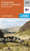
328 Sanquhar & New Cumnock:
on our unique Animated Map of OS Map 328
as an interactive Google Map of OS Map 328
See the 1 walk on an OS Explorer Map
329 Lowther Hills, Sanquhar & Leadhills:
on our unique Animated Map of OS Map 329
as an interactive Google Map of OS Map 329
See all 5 walks on an OS Explorer Map
330 Moffat & St Mary’s Loch:
on our unique Animated Map of OS Map 330
as an interactive Google Map of OS Map 330
See all 4 walks on an OS Explorer Map
331 Teviotdale South:
View as an interactive Google Map of OS Map 331
See all 9 walks on an OS Explorer Map
332 Alnwick & Amble Craster & Whittingham:
on our unique Animated Map of OS Map 332
as an interactive Google Map of OS Map 332
See both 2 walks on an OS Explorer Map
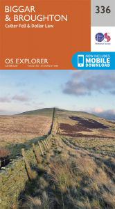
336 Biggar & Broughton:
View as an interactive Google Map of OS Map 336
See both 2 walks on an OS Explorer Map
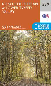
339 Kelso, Coldstream & Lower Tweed Valley:
View as an interactive Google Map of OS Map 339
See all 16 walks on an OS Explorer Map
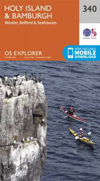
340 Holy Island & Bamburgh:
on our unique Animated Map of OS Map 340
as an interactive Google Map of OS Map 340
See the 1 walk on an OS Explorer Map
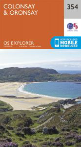
354 Colonsay & Oronsay:
View as an interactive Google Map of OS Map 354
See the 1 walk on an OS Explorer Map
359 Oban South, Kerrera & Loch Melfort:
View as an interactive Google Map of OS Map 359
See the 1 walk on an OS Explorer Map
366 Stirling & Ochil Hills West:
View as an interactive Google Map of OS Map 366
See all 4 walks on an OS Explorer Map
377 Ben Cruachan, Loch Etive & Glen Orchy:
on our unique Animated Map of OS Map 377
as an interactive Google Map of OS Map 377

See the 1 walk on an OS Explorer Map
379 Dunkeld, Aberfeldy & Glen Almond:
View as an interactive Google Map of OS Map 379
See all 19 walks on an OS Explorer Map
384 Glen Coe:
on our unique Animated Map of OS Map 384
as an interactive Google Map of OS Map 384

See all 3 walks on an OS Explorer Map
392 Ben Nevis:
on our unique Animated Map of OS Map 392
as an interactive Google Map of OS Map 392
See the 1 walk on an OS Explorer Map
396 Stonehaven, Inverbervie & Laurencekirk:
View as an interactive Google Map of OS Map 396
See the 1 walk on an OS Explorer Map
407 Skye - Dunvegan:
View as an interactive Google Map of OS Map 407
See all 3 walks on an OS Explorer Map
408 Skye - Trotternish & The Storr:
View as an interactive Google Map of OS Map 408
See both 2 walks on an OS Explorer Map
411 Skye - Cuillin Hills:
View as an interactive Google Map of OS Map 411
See both 2 walks on an OS Explorer Map
412 Skye - Sleat:
View as an interactive Google Map of OS Map 412
See the 1 walk on an OS Explorer Map
432 Black Isle:
View as an interactive Google Map of OS Map 432
See the 1 walk on an OS Explorer Map
437 Ben Wyvis & Strathpeffer:
View as an interactive Google Map of OS Map 437
See the 1 walk on an OS Explorer Map
438 Dornoch & Tain:
View as an interactive Google Map of OS Map 438
See the 1 walk on an OS Explorer Map
442 Assynt & Lochinver:
View as an interactive Google Map of OS Map 442
See the 1 walk on an OS Explorer Map
447 Ben Hope, Ben Loyal & Kyle of Tongue:
on our unique Animated Map of OS Map 447
as an interactive Google Map of OS Map 447
See the 1 walk on an OS Explorer Map
449 Strath Halladale & Strathy Point:
View as an interactive Google Map of OS Map 449
See the 1 walk on an OS Explorer Map
450 Wick & The Flow Country:
View as an interactive Google Map of OS Map 450
See the 1 walk on an OS Explorer Map
466 Shetland - Mainland South:
View as an interactive Google Map of OS Map 466
OS Explorer Maps | OS Landranger Maps
Walks in Ordnance Survey 1:50,000 Scale Landranger Maps
(the ones with Pink/Magenta Covers)
1:50 000 Scale - 2cm to 1km or
1¼ inches to 1 mile
See the 1 walk on an OS Landranger Map
4 Shetland, South Mainland:
View as an interactive Google Map of OS Map 4
See the 1 walk on an OS Landranger Map
9 Cape Wrath, Durness & Scourie:
View as an interactive Google Map of OS Map 9
See the 1 walk on an OS Landranger Map
10 Strathnaver, Bettyhill & Tongue:
View as an interactive Google Map of OS Map 10
See the 1 walk on an OS Landranger Map
12 Thurso & Wick, John O’Groats:
View as an interactive Google Map of OS Map 12
See the 1 walk on an OS Landranger Map
15 Loch Assynt, Lochinver & Kylesku:
View as an interactive Google Map of OS Map 15
See the 1 walk on an OS Landranger Map
20 Beinn Dearg & Loch Broom, Ben Wyvis:
View as an interactive Google Map of OS Map 20
See the 1 walk on an OS Landranger Map
21 Dornoch & Alness, Invergordon & Tain:
View as an interactive Google Map of OS Map 21
See all 4 walks on an OS Landranger Map
23 North Skye, Dunvegan & Portree:
View as an interactive Google Map of OS Map 23
See the 1 walk on an OS Landranger Map
27 Nairn & Forres, River Findhorn:
View as an interactive Google Map of OS Map 27
See all 4 walks on an OS Landranger Map
32 South Skye & Cuillin Hills:
View as an interactive Google Map of OS Map 32
See all 12 walks on an OS Landranger Map
36 Grantown & Aviemore, Cairngorm Mountains:
on our unique Animated Map of OS Map 36
as an interactive Google Map of OS Map 36
See the 1 walk on an OS Landranger Map
40 Mallaig & Glenfinnan, Loch Shiel:
View as an interactive Google Map of OS Map 40
See all 22 walks on an OS Landranger Map
41 Ben Nevis, Fort William & Glen Coe:
on our unique Animated Map of OS Map 41
as an interactive Google Map of OS Map 41
See all 4 walks on an OS Landranger Map
43 Braemar & Blair Atholl:
View as an interactive Google Map of OS Map 43
See the 1 walk on an OS Landranger Map
45 Stonehaven & Banchory:
View as an interactive Google Map of OS Map 45
See the 1 walk on an OS Landranger Map
51 Loch Tay & Glen Dochart:
View as an interactive Google Map of OS Map 51
See the 1 walk on an OS Landranger Map
52 Pitlochry to Crieff:
View as an interactive Google Map of OS Map 52
See all 7 walks on an OS Landranger Map
57 Stirling & The Trossachs:
on our unique Animated Map of OS Map 57
as an interactive Google Map of OS Map 57
See all 228 walks on an OS Landranger Map
90 Penrith & Keswick, Ambleside:
on our unique Animated Map of OS Map 90
as an interactive Google Map of OS Map 90
See all 21 walks on an OS Landranger Map
102 Preston & Blackpool, Lytham St Anne’s:
View as an interactive Google Map of OS Map 102
See all 48 walks on an OS Landranger Map
103 Blackburn & Burnley, Clitheroe & Skipton:
on our unique Animated Map of OS Map 103
as an interactive Google Map of OS Map 103
See all 12 walks on an OS Landranger Map
104 Leeds & Bradford, Harrogate & Ilkley:
View as an interactive Google Map of OS Map 104
See all 3 walks on an OS Landranger Map
108 Liverpool, Southport & Wigan:
View as an interactive Google Map of OS Map 108

See all 35 walks on an OS Landranger Map
109 Manchester, Bolton & Warrington:
on our unique Animated Map of OS Map 109
as an interactive Google Map of OS Map 109
See all 12 walks on an OS Landranger Map
117 Chester & Wrexham, Ellesmere Port:
on our unique Animated Map of OS Map 117
as an interactive Google Map of OS Map 117
See all 32 walks on an OS Landranger Map
124 Dolgellau & Porthmadog:
on our unique Animated Map of OS Map 124
as an interactive Google Map of OS Map 124

See all 23 walks on an OS Landranger Map
125 Bala & Lake Vyrnwy, Berwyn:
on our unique Animated Map of OS Map 125
as an interactive Google Map of OS Map 125
See the 1 walk on an OS Landranger Map
130 Grantham, Sleaford & Bourne:
View as an interactive Google Map of OS Map 130
See all 15 walks on an OS Landranger Map
137 Ludlow & Church Stretton, Wenlock Edge:
on our unique Animated Map of OS Map 137
as an interactive Google Map of OS Map 137
See all 11 walks on an OS Landranger Map
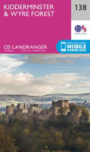
138 Kidderminster & Wyre Forest:
on our unique Animated Map of OS Map 138
as an interactive Google Map of OS Map 138

See all 3 walks on an OS Landranger Map
140 Leicester, Coventry & Rugby:
View as an interactive Google Map of OS Map 140
See the 1 walk on an OS Landranger Map
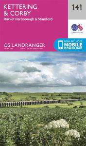
141 Kettering and Corby:
View as an interactive Google Map of OS Map 141
See all 7 walks on an OS Landranger Map
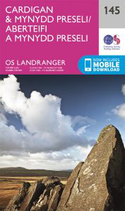
145 Cardigan & Mynydd Preseli:
on our unique Animated Map of OS Map 145
as an interactive Google Map of OS Map 145
See all 3 walks on an OS Landranger Map
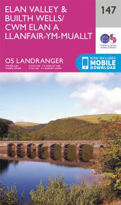
147 Elan Valley & Builth Wells:
View as an interactive Google Map of OS Map 147
See the 1 walk on an OS Landranger Map
150 Worcester & The Malverns, Evesham & Tewkesbury:
View as an interactive Google Map of OS Map 150
See all 17 walks on an OS Landranger Map
157 St David’s & Haverfordwest:
on our unique Animated Map of OS Map 157
as an interactive Google Map of OS Map 157
See all 31 walks on an OS Landranger Map
160 Brecon Beacons:
on our unique Animated Map of OS Map 160
as an interactive Google Map of OS Map 160
See all 23 walks on an OS Landranger Map
161 Abergavenny & The Black Mountains:
on our unique Animated Map of OS Map 161
as an interactive Google Map of OS Map 161

See all 9 walks on an OS Landranger Map
164 Oxford, Chipping Norton & Bicester:
on our unique Animated Map of OS Map 164
as an interactive Google Map of OS Map 164
See the 1 walk on an OS Landranger Map
167 Chelmsford, Harlow & Bishop’s Stortford:
View as an interactive Google Map of OS Map 167

See the 1 walk on an OS Landranger Map
172 Bristol & Bath, Thornbury & Chew Magna:
View as an interactive Google Map of OS Map 172
See the 1 walk on an OS Landranger Map
175 Reading & Windsor, Henley-on-Thames & Bracknell:
View as an interactive Google Map of OS Map 175
See all 3 walks on an OS Landranger Map
179 Canterbury & East Kent, Dover & Margate:
View as an interactive Google Map of OS Map 179
See both 2 walks on an OS Landranger Map
180 Barnstaple & Ilfracombe, Lynton & Bideford:
View as an interactive Google Map of OS Map 180
See all 6 walks on an OS Landranger Map
181 Minehead & Brendon Hills, Dulverton & Tiverton:
on our unique Animated Map of OS Map 181
as an interactive Google Map of OS Map 181
See the 1 walk on an OS Landranger Map
183 Yeovil & Frome, Shaftesbury & Shepton Mallet:
View as an interactive Google Map of OS Map 183
See all 8 walks on an OS Landranger Map
186 Aldershot & Guildford, Camberley & Haslemere:
on our unique Animated Map of OS Map 186
as an interactive Google Map of OS Map 186
See all 4 walks on an OS Landranger Map
190 Bude and Clovelly:
View as an interactive Google Map of OS Map 190
See all 27 walks on an OS Landranger Map
191 Okehampton & North Dartmoor:
on our unique Animated Map of OS Map 191
as an interactive Google Map of OS Map 191
See the 1 walk on an OS Landranger Map
192 Exeter & Sidmouth, Exmouth & Teignmouth:
View as an interactive Google Map of OS Map 192
See all 14 walks on an OS Landranger Map
194 Dorchester & Weymouth, Cerne Abbas & Bere Regis:
on our unique Animated Map of OS Map 194
as an interactive Google Map of OS Map 194
See all 3 walks on an OS Landranger Map
195 Bournemouth & Purbeck, Wimborne Minster & Ringwood:
View as an interactive Google Map of OS Map 195
See all 13 walks on an OS Landranger Map
197 Chichester & The South Downs, Bognor Regis & Arundel:
on our unique Animated Map of OS Map 197
as an interactive Google Map of OS Map 197
See all 17 walks on an OS Landranger Map
200 Newquay & Bodmin, Camelford & St Austell:
View as an interactive Google Map of OS Map 200
See all 14 walks on an OS Landranger Map
201 Plymouth & Launceston, Tavistock & Looe:
on our unique Animated Map of OS Map 201
as an interactive Google Map of OS Map 201
See all 4 walks on an OS Landranger Map
202 Torbay & South Dartmoor, Totnes & Salcombe:
View as an interactive Google Map of OS Map 202
See both 2 walks on an OS Landranger Map
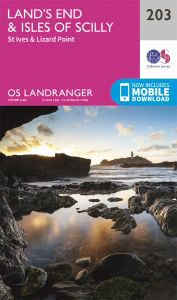
203 Land’s End & Isles of Scilly, St Ives & Lizard Point:
View as an interactive Google Map of OS Map 203
. . . more soon


