8 easy-to-follow walk, route maps of all grades on OS Explorer Map OL32 Winchester
Eight easy-to-follow walk, route maps of all grades on OS Explorer Map OL32 Winchester in Walk Grade OrderTap/mouse over a coloured circle (1-3 easy walks, 4-6 moderate walks, 7-9 hard walks) and click to select.
You can use these checkboxes to show only the grades of walk you are interested in:-
Eight easy-to-follow walk, route maps of all grades on OS Explorer Map OL32 Winchester in Walk Grade Order
Scroll down the list of walks below & click on each walk title (in blue) to locate it on the map above.
See this list of walks, routes & maps in:
Grade Order | Length Order | Time Order | Walk Number or Start Location Order
NB. To reverse (toggle) this order, click Grade Order again
   |
Vital Statistics:
| Length: | 5.5 miles (9 km) |
| Ascent: | 738ft (225m) |
| Time: | 2.75hrs |
| Grade: |  |
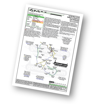
Route Summary:
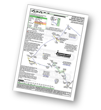
Selborne - The Hangers Way - High Common - High Wood Hanger - Noar Hill - Noar Hill Hanger - Bridleway Wood - Selborne Common - Coneycroft Hill - Selborne
|
Vital Statistics:
| Length: | 9.75 miles (15.5 km) |
| Ascent: | 1,126ft (343m) |
| Time: | 4.75hrs |
| Grade: |  |
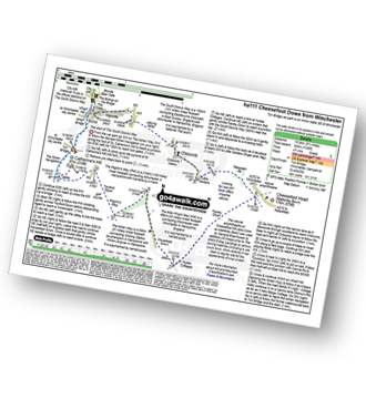
Route Summary:
Winchester - Tun Bridge - The Itchen Way - Itchen Navigation - St Catherine's Hill - Pilgrims' Trail - Twyford Down - Morestead Down - Hydes Cottages - Fawley Down - The Allan King's Way - Cheesefoot Head Car Park - Cheesefoot Head (Matterley Bowl) - The South Downs Way - The Pilgrim's Way - Telegraph Hill - Little Golders - Chilcomb - Highcliffe - The Soke - City Mill - Wharf Bridge - Tun Bridge - Winchester
|
Vital Statistics:
| Length: | 5 miles (8 km) |
| Ascent: | 374ft (114m) |
| Time: | 2.25hrs |
| Grade: |  |
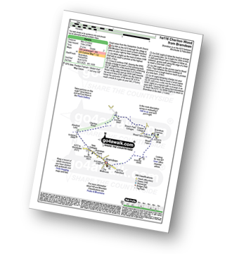
Route Summary:
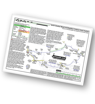
Bramdean - Alresford Lane - Cheriton Wood - Copwer Cottage - Bramdean Common - Wood Farm - Bramdean
|
Vital Statistics:
| Length: | 7.5 miles (12 km) |
| Ascent: | 673ft (205m) |
| Time: | 3.75hrs |
| Grade: | |
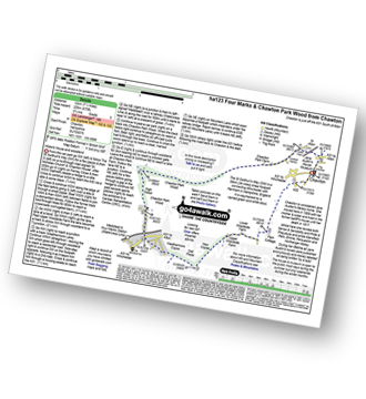
Route Summary:
Chawton - Alton - Jane Austen's House Museum - The St Swithun's Way - Park Cottage - Upper Woodside Farm - New Copse - Dell Piece - Weathermore Copse - Medstead and Four Marks - Watercress Railway Line - Chawton Park Wood - Alton - Chawton
|
Vital Statistics:
| Length: | 7.75 miles (12.5 km) |
| Ascent: | 610ft (186m) |
| Time: | 3½ hrs |
| Grade: | |
Route Summary:
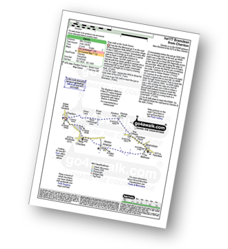
Cheriton - The Wayfarer's Walk - Hinton Lane - Upper Lamborough Lane - Broad Lane - Cheriton Wood - Alresford Lane - Copwer Cottage - Bramdean Common - Wood Farm - Bramdean - Hinton Ampner - New Cheriton - Cheriton
|
Vital Statistics:
| Length: | 10 miles (16 km) |
| Ascent: | 985ft (300m) |
| Time: | 4.75hrs |
| Grade: | |
Route Summary:
Cheesefoot Head Car Park - Cheesefoot Head (Matterley Bowl) - Fawley Down - Hydes Cottages - Morestead - Old Down Copse - Bushy Copse - Longwood House - Longwood Dead Farm - Lane End - The South Downs Way - Holden Farm - Gander Down - Temple Valley - Cheesefoot Head Car Park
|
Vital Statistics:
| Length: | 4.75 miles (7.5 km) |
| Ascent: | 443ft (135m) |
| Time: | 2.25hrs |
| Grade: | |
Route Summary:
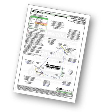
Morestead - Old Copse Down - Old Down Wood - Old Down Plantation - Longwood Warren - The Allan King's Way - Cheesefoot Head (Matterley Bowl) - Fawley Down - Morestead Down - Morestead
|
Vital Statistics:
| Length: | 5 miles (8 km) |
| Ascent: | 387ft (118m) |
| Time: | 2.25hrs |
| Grade: | |
Route Summary:
Cheriton - The Wayfarer's Walk - Hinton Lane - Upper Lamborough Lane - Broad Lane - Cheriton Wood - Alresford Lane - New Cottages - Bramdean House - Bramdean - Hinton Ampner - New Cheriton - Cheriton
See this list of walks, routes & maps in:
Grade Order | Length Order | Time Order | Walk Number or Start Location Order
NB. To reverse (toggle) this order, click Grade Order again


