16 easy-to-follow walk, route maps of all grades on OS Explorer Map 267 Northwich & Delamere Forest, Winsford & Middlewich
Sixteen easy-to-follow walk, route maps of all grades on OS Explorer Map 267 Northwich & Delamere Forest, Winsford & Middlewich in Walk Grade OrderTap/mouse over a coloured circle (1-3 easy walks, 4-6 moderate walks, 7-9 hard walks) and click to select.
You can use these checkboxes to show only the grades of walk you are interested in:-
Sixteen easy-to-follow walk, route maps of all grades on OS Explorer Map 267 Northwich & Delamere Forest, Winsford & Middlewich in Walk Grade Order
Scroll down the list of walks below & click on each walk title (in blue) to locate it on the map above.
See this list of walks, routes & maps in:
Grade Order | Length Order | Time Order | Walk Number or Start Location Order
NB. To reverse (toggle) this order, click Grade Order again
   |
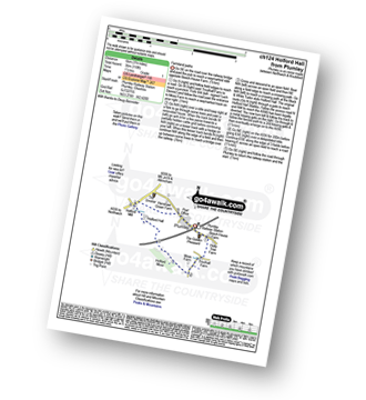
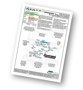
Vital Statistics:
| Length: | 5 miles (8 km) |
| Ascent: | 226ft (69m) |
| Time: | 2.25hrs |
| Grade: |  |
Route Summary:
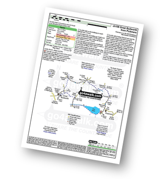
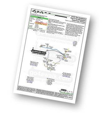
Pickmere - Wathall Farm - Moss End - Hilltop Farm - The North Cheshire Way - Great Budworth - Pick Mere - Pickmere
|
Vital Statistics:
| Length: | 6.25 miles (10 km) |
| Ascent: | 1,254ft (382m) |
| Time: | 3½ hrs |
| Grade: |  |
Route Summary:
Frodsham - Beacon Hill (Frodsham) - Frodsham Golf Course - Dunsdale Wood - Tong Dean - Helsby Hill Fort - Helsby Hill - The Longster Trail - Harmers Wood - The Sandstone Trail - Snidley Moor and Woodhouse Hill - Snidley Moor Wood - Beacon Hill (Frodsham) - Frodsham
|
Vital Statistics:
| Length: | 6 miles (9.5 km) |
| Ascent: | 295ft (90m) |
| Time: | 2½ hrs |
| Grade: | |
Route Summary:
Tarpoley - The Sandstone Trail - Ferney Lees - Wharton's Bridge - The Shorpshire Union Canal - Wharton's Lock - A49 - Tiverton - Tarpoley
|
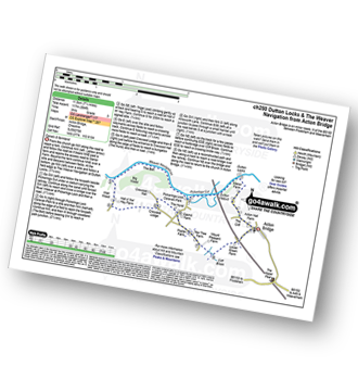
Vital Statistics:
| Length: | 4 miles (6.5 km) |
| Ascent: | 233ft (71m) |
| Time: | 1.75hrs |
| Grade: |  |
Route Summary:
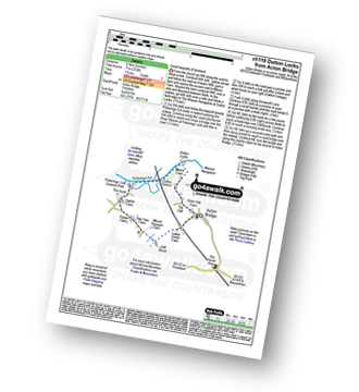
Acton Bridge - Manor Farm - Dutton Locks - River Weaver - Pickerings Cut - Dutton Viaduct - Pickerings Lock - Oakhill Farm - Cliff Brook - Lower Green Farm - Acton Bridge
|
Vital Statistics:
| Length: | 3.75 miles (6 km) |
| Ascent: | 118ft (36m) |
| Time: | 1½ hrs |
| Grade: | |
|
Vital Statistics:
| Length: | 6 miles (9.5 km) |
| Ascent: | 479ft (146m) |
| Time: | 2.75hrs |
| Grade: |  |
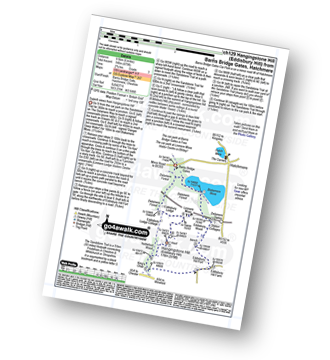
Route Summary:
Hatchmere - Barns Bridge Gate - Delamere Forest - The Sandstone Way - The Delamere Way - Blakemere Moss - Linmere Visitor Centre - Eddisbury Hill - Eddisbury Hill Fort - Eddisbury Hill Farm - Hangingstone Hill (Eddisbury Hill) - Nettleford Wood - The Sandstone Way - Eddisbury Lodge Cottage - Eddisbury Lodge - Delamere Forest - Barns Bridge Gate - Hatchmere
|
Vital Statistics:
| Length: | 3.75 miles (6 km) |
| Ascent: | 197ft (60m) |
| Time: | 1.75hrs |
| Grade: | |
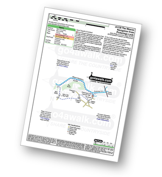
Route Summary:
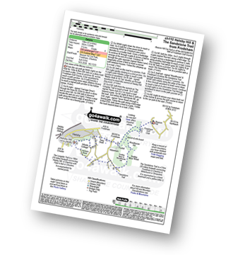
Pickerings Lock - The Weaver Navigation - The Belt - Hall O' The' Hey Farm - Crewood Lodge - The Hurst - Oakwell Farm - Pickerings Lock
|
Vital Statistics:
| Length: | 11.25 miles (18 km) |
| Ascent: | 883ft (269m) |
| Time: | 5 hrs |
| Grade: |  |
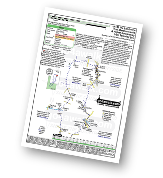
Route Summary:
Tarpoley - The Sandstone Trail - Ferney Lees - Wharton's Bridge - The Shorpshire Union Canal - Wharton's Lock - Beeston Castle - Beeston - Peckforton Woods - Higher Burwardsley - Waste Hill - Peckforton Hills - Peckforton Castle Lodge - Willis's Wood - Beeston - A49 - Tiverton - Tarpoley
|
Vital Statistics:
| Length: | 3.5 miles (5.5 km) |
| Ascent: | 286ft (87m) |
| Time: | 1.75hrs |
| Grade: | |
Route Summary:
Tiverton - The Shropshire Union Canal - Wharton's Lock - The Sandstone Trail - Beeston Castle - Beeston - Beeston Hall Farm - Tiverton
|
Vital Statistics:
| Length: | 5.5 miles (8.5 km) |
| Ascent: | 158ft (48m) |
| Time: | 2.25hrs |
| Grade: | |
Route Summary:
Arley - Arley Hall - Arley Brook - Hollies Farm - Antrobus - Budworth Heath - Great Budworth - Stockley Farm - Arley
|
Vital Statistics:
| Length: | 6 miles (9.5 km) |
| Ascent: | 164ft (50m) |
| Time: | 2½ hrs |
| Grade: | |
|
Vital Statistics:
| Length: | 5 miles (8 km) |
| Ascent: | 338ft (103m) |
| Time: | 2.25hrs |
| Grade: | |
Route Summary:
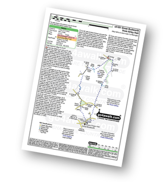
Little Leigh - Friar's Rough - Trent and Mersey Canal - Bardleymeadow Wood - Daleford House - Saltersford Tunnel - Barnton - Stone Heyes Farm - Desley Heath Farm - Claterwick Farm - Little Leigh
|
Vital Statistics:
| Length: | 3.75 miles (6 km) |
| Ascent: | 253ft (77m) |
| Time: | 2 hrs |
| Grade: | |
Route Summary:
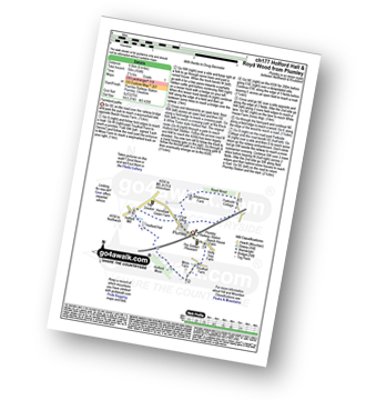
Marbury Country Park - Forge Brook - Big Wood - Trent and Mersey Canal - The Cheshire Ring Walk - Anderton - Anderton Boat Lift - Kennel Wood - The North Cheshire Way - Marbury Country Park.
|
Vital Statistics:
| Length: | 8.25 miles (13 km) |
| Ascent: | 295ft (90m) |
| Time: | 3½ hrs |
| Grade: | |
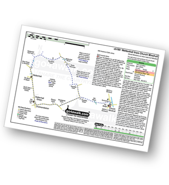
Route Summary:
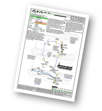
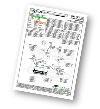
Church Minshull - Sunnyside - Eel Brook - Paradise Green - Paradise Wood - Wettenhall Green - Wettenhall - Stockerlane - Bankside Farm - Brookside Wood - Wettenhall Brook - Darnall Radio Telescope - Paradise Farm - Paradise Green - Eel Brook - Sunnyside - Church Minshull
|
Vital Statistics:
| Length: | 5.25 miles (8.5 km) |
| Ascent: | 417ft (127m) |
| Time: | 2½ hrs |
| Grade: | |
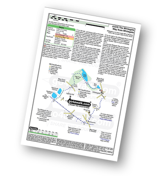
Route Summary:
Whitegate - New Pool - Petty Pool - Pettypool Wood - Newchurch Common - Whitegate Way (Dismantled Railway) - Whitegate Station - Martonsands - Foxwist Green - Whitegate
|
Vital Statistics:
| Length: | 7.25 miles (11.5 km) |
| Ascent: | 384ft (117m) |
| Time: | 3 hrs |
| Grade: | |
Route Summary:
Acton Bridge - Manor Farm - Dutton Locks - River Weaver - Pickerings Cut - Dutton Viaduct - Pickerings Lock - The Weaver Navigation - The Belt - Hall O' The' Hey Farm - Crewood Lodge - Oakhill Farm - Cliff Brook - Lower Green Farm - Acton Bridge
See this list of walks, routes & maps in:
Grade Order | Length Order | Time Order | Walk Number or Start Location Order
NB. To reverse (toggle) this order, click Grade Order again


