All the Mountains, Peaks, Tops and Hills in Wales, Wales as a detailed list (Page 5 of 5)
Wales is defined as the whole of the principality of Wales which includes the National Parks of Snowdonia, Bannau Brycheiniog (The Brecon Beacons) and The Pembrokeshire Coast as well as Mynyddoedd Cambria (The Cambrian Mountains), Radnor Forest, Anglesey, The Llynn Peninsula, The Preseli Mountains and The Gower Peninsula.
If you count only the Mountains (Hewitts) there are 136 tops to climb, bag & conquer and the highest point is Snowdon (Yr Wyddfa) at 1,085m (3,561ft).
To see these Mountains, Peaks, Tops and Hills displayed in different ways - see the options in the left-hand column and towards the bottom of this page.
![]() Your Personal Bagging Record for Wales
Your Personal Bagging Record for Wales
LOG ON and RELOAD this page to show which Mountains, Peaks, Tops and Hills you have already climbed, bagged & conquered [. . . more details]
See this list in: Alphabetical Order‡
| Height Order
To reverse the order select the link again.
Mountain, Peak, Top or Hill:
Bagged

![]()
121. Carnedd y Filiast (Arenigs)
669m (2,195ft)
Carnedd y Filiast (Arenigs) is on interactive maps:
Carnedd y Filiast (Arenigs) is on downloadable PDF you can Print or Save to your Phone: |
![]()
122. Carnedd Moel Siabod
872m (2,861ft)
Carnedd Moel Siabod is on interactive maps:
Carnedd Moel Siabod is on downloadable PDF you can Print or Save to your Phone: |
![]()
123. Carnedd Llewelyn
1,064m (3,492ft)
Carnedd Llewelyn is on interactive maps:
Carnedd Llewelyn is on downloadable PDF you can Print or Save to your Phone: |
![]()
124. Carnedd Gwenllian (Carnedd Uchaf)
926m (3,039ft)
Carnedd Gwenllian (Carnedd Uchaf) is on interactive maps:
Carnedd Gwenllian (Carnedd Uchaf) is on downloadable PDF you can Print or Save to your Phone: |
![]()
125. Carnedd Dafydd
1,040m (3,413ft)
Carnedd Dafydd is on interactive maps:
Carnedd Dafydd is on downloadable PDF you can Print or Save to your Phone: |
![]()
126. Cadair Idris (Penygadair)
892m (2,929ft)
Cadair Idris (Penygadair) is on interactive maps:
Cadair Idris (Penygadair) is on downloadable PDF you can Print or Save to your Phone: |
![]()
127. Cadair Bronwen
783m (2,570ft)
Cadair Bronwen is on interactive maps:
Cadair Bronwen is on downloadable PDF you can Print or Save to your Phone: |
![]()
128. Cadair Berwyn
832m (2,730ft)
Cadair Berwyn is on interactive maps:
Cadair Berwyn is on downloadable PDF you can Print or Save to your Phone: |
![]()
129. Black Mountain
703m (2,307ft)
Black Mountain is on interactive maps:
Black Mountain is on downloadable PDF you can Print or Save to your Phone: |
![]()
130. Black Mixen
650m (2,133ft)
Black Mixen is on interactive maps:
A downloadable go4awalk.com PDF Peak Bagging Map featuring Black Mixen will be available soon. |
![]()
131. Bache Hill
610m (2,002ft)
Bache Hill is on interactive maps:
A downloadable go4awalk.com PDF Peak Bagging Map featuring Bache Hill will be available soon. |
![]()
132. Arenig Fawr (Moel Yr Eglwys)
854m (2,802ft)
Arenig Fawr (Moel Yr Eglwys) is on interactive maps:
Arenig Fawr (Moel Yr Eglwys) is on downloadable PDF you can Print or Save to your Phone: |
![]()
133. Arenig Fach
689m (2,261ft)
Arenig Fach is on interactive maps:
Arenig Fach is on downloadable PDF you can Print or Save to your Phone: |
![]()
134. Aran Fawddwy
905m (2,970ft)
Aran Fawddwy is on interactive maps:
Aran Fawddwy is on downloadable PDF you can Print or Save to your Phone: |
![]()
135. Aran Benllyn
885m (2,905ft)
Aran Benllyn is on interactive maps:
Aran Benllyn is on downloadable PDF you can Print or Save to your Phone: |
![]()
136. Allt-fawr (Moelwyns)
698m (2,291ft)
Allt-fawr (Moelwyns) is on interactive maps:
Allt-fawr (Moelwyns) is on downloadable PDF you can Print or Save to your Phone: |
View these 136 Mountains, Peaks, Tops and Hills:
- On an Interactive Google Map (loads faster)
- On an Interactive Google Map with a list of tops below it.
(makes it easier to locate a particular top) - On a Detailed List in:
Alphabetical Order | Height Order - On one page with 'yet-to-be-bagged' listed 1st & then 'already-bagged' tops listed 2nd in:
Alphabetical Order | Height Order - On one page with 'already-bagged' tops listed 1st & then 'yet-to-be-bagged' tops listed 2nd in:
Alphabetical Order | Height Order
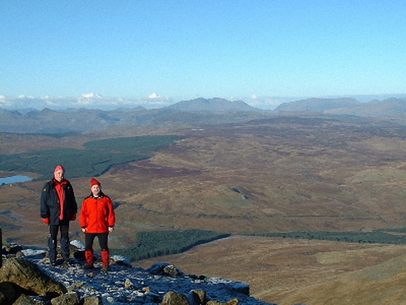
 Snowdon (Yr Wyddfa) in The MoelwynsWales
Photo: Don Williams
Is there a Mountain, Peak, Top or Hill missing from the above google map or list?
Let us know an we will add it to our database.
To contribute to go4awalk.com or to contact us about anything at all - see Talk To Us.
For help see Help.
go4awalk.com and go4awalk.co.uk are registered trademarks of TMDH Limited.
Copyright © 2000-2025 TMDH Limited. All rights reserved.
Copyright Terms & Conditions Privacy Statement
A - Z Walks Home Log On/Accounts Photo Gallery Walk Ideas and Collections Fell Facts Hill Skills Walking Questions and Answers Your Stories News Competitions Product Reviews/Gear Tests Walking Gear Guides Peaks and Mountains Peak Bagging Find New Walking Friends Camping GPS Waypoints for Walking Contents Walk Search Talk To Us go4awalk.com Help Free Example Walks Newsletter


