UK Postcode LL18 - The 30 nearest easy-to-follow, circular walk route maps to you
The thirty nearest easy-to-follow, circular walk route maps to you in UK Postcode LL18 in Walk Grade Order
The UK cities, towns and villages in Denbighshire, Wales that have LL18 in their UK Postcode include:
• Bodelwyddan • Cwm • Dyserth • Gwaenysgor • Marian Cwm • Pengwern • Plas Llwyd • Rhuddlan • Rhyl • Trelawnyd •
Not familiar with the area around LL18?
See these 30 nearest walks to UK Postcode LL18 on a google map
   |
Vital Statistics:
| Length: | 9.75 miles (15.5 km) |
| Ascent: | 1,303ft (397m) |
| Time: | 4.75hrs |
| Grade: |  |
Route Summary:
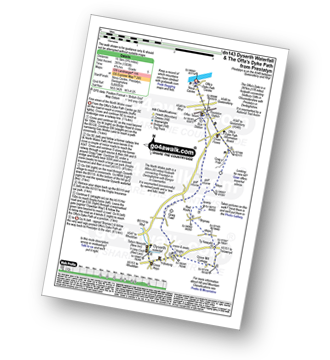
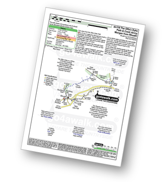
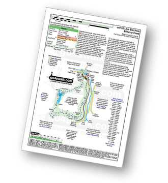
Prestatyn - The North Wales Path - Dyserth - Dyserth Waterfall - The Offa's Dyke Path - Ty Newydd - Bryniau - Red Roofs - Crag y Fran - Prestatyn
|
Vital Statistics:
| Length: | 10.75 miles (17 km) |
| Ascent: | 916ft (279m) |
| Time: | 4.75hrs |
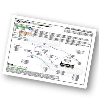
| Grade: | |
Route Summary:
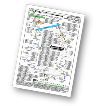
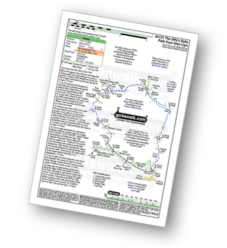
Prestatyn - Ffrith Beach - Plas Newydd Farm - Rhydorddwy Goch Farm - Aberkinsey Farm - Dyserth - Dyserth Waterfall - The Offa's Dyke Path - Ty Newydd - Bryniau - Red Roofs - Crag y Fran - Prestatyn
|
Vital Statistics:
| Length: | 7.5 miles (12 km) |
| Ascent: | 962ft (293m) |
| Time: | 3.75hrs |
| Grade: |  |
Route Summary:
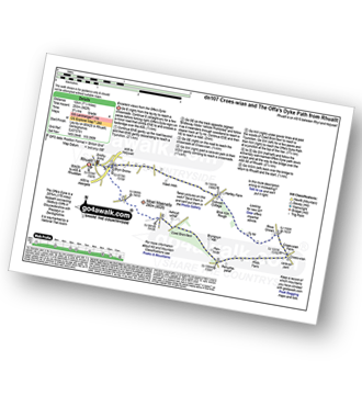
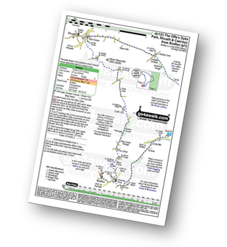
Rhuallt - The Offa's Dyke Path - A55 - Bryn Gronw - Cobweb Cottage - Ty Hir - Rhos Onnen - Croes-wian - Ffrith Farm - Bryngwyn Hall - Coed Bron-fawr - The Offa's Dyke Path - Bryn Gronw - A55 - Rhuallt
|
Vital Statistics:
| Length: | 9.5 miles (15 km) |
| Ascent: | 1,359ft (141m) |
| Time: | 4.75hrs |
| Grade: | |
Route Summary:
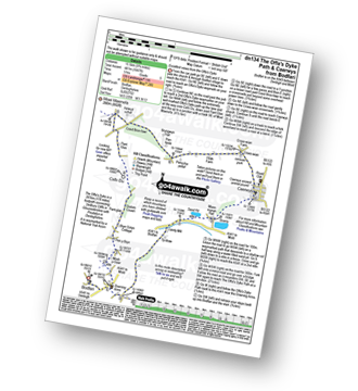
Rhuallt - The Offa's Dyke Path - Brynllithrig Hall - Pen-y-mynydd - Coed Rhedyn-coch - Mynydd y Cwm (Coed Cwm) - Marian Cwm - Marian Ffrith - Bryn Cnewyllyn - Marian Mill Trout Farm - Henfryn Hall - The Clwydian Way - Swyn y Mynydd - Hendre Fawr - Glan Llyn - Bryn Gronw - Rhuallt
|
Vital Statistics:
| Length: | 4 miles (6.5 km) |
| Ascent: | 715ft (218m) |
| Time: | 2.25hrs |
| Grade: |  |
Route Summary:
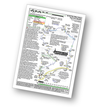
Rhuallt - The Offa's Dyke Path - Brynllithrig Hall - Pen-y-mynydd - Coed Jenny Morgan - Glan Llyn - Bryn Gronw - Rhuallt
|
Vital Statistics:
| Length: | 7 miles (11 km) |
| Ascent: | 847ft (258m) |
| Time: | 3½ hrs |
| Grade: | |
Route Summary:
Glan Llyn - Coed Jenny Morgan - The Offa's Dyke Path - Coed Rhedyn-coch - Mynydd y Cwm (Coed Cwm) - Marian Cwm - Marian Ffrith - Bryn Cnewyllyn - Marian Mill Trout Farm - Henfryn Hall - The Clwydian Way - Swyn y Mynydd - Hendre Fawr - Glan Llyn
|
Vital Statistics:
| Length: | 12.25 miles (19.5 km) |
| Ascent: | 1,874ft (571m) |
| Time: | 6.25hrs |
| Grade: |  |
Route Summary:
Bodfari - The Offa's Dyke Path - Moel-y-Gaer - Pen y Bryn - Sodom Covert - Cefn Du - Pant Glas - Moel Maenefa - Bryn Gronw - Cobweb Cottage - Brick Kiln Rough - Ty Hir - Rhos Onnen - Croes-wian - Caerwys - Maes-mynan Hall - Candy Mill - Ty-draw - The Offa's Dyke Path - Bodfari
|
Vital Statistics:
| Length: | 9.75 miles (15.5 km) |
| Ascent: | 1,447ft (441m) |
| Time: | 5 hrs |
| Grade: | |
Route Summary:
Bodfari - The Offa's Dyke Path - Moel-y-Gaer - Pen y Bryn - Sodom Covert - Cefn Du - Pant Glas - Coed Bron-fawr - Bryngwyn Hall - Ffrith Farm - Croes-wian - Caerwys - Maes-mynan Hall - Candy Mill - Ty-draw - The Offa's Dyke Path - Bodfari
|
Vital Statistics:
| Length: | 5 miles (8 km) |
| Ascent: | 994ft (303m) |
| Time: | 3 hrs |
| Grade: | |
|
Vital Statistics:
| Length: | 4 miles (6.5 km) |
| Ascent: | 1,086ft (331m) |
| Time: | 2½ hrs |
| Grade: | |
|
Vital Statistics:
| Length: | 7.5 miles (12 km) |
| Ascent: | 1,746ft (532m) |
| Time: | 4½ hrs |
| Grade: | |
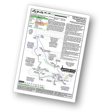
Route Summary:
Bwlch Arthur - Moel Arthur - Coed Llangwyfan - Penycloddiau - Nant Coed-y-mynydd - Pen-y-bryn - Bwlch Arthur
|
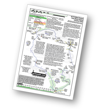
Vital Statistics:
| Length: | 8.25 miles (13 km) |
| Ascent: | 1,943ft (592m) |
| Time: | 5 hrs |
| Grade: | |
Route Summary:
Cilcain - Y Pentre - Crug Farm - Ffrith - Bryn Fynnon - Moel Famau Country Park - Moel Famau - The Offa's Dyke Path - Moel Dywyll - Moel Llys-y-coed - Bwlch Arthur - Gronfoel Farm - Cilcain
|
Vital Statistics:
| Length: | 5.5 miles (9 km) |
| Ascent: | 1,362ft (415m) |
| Time: | 3½ hrs |
| Grade: | |
|
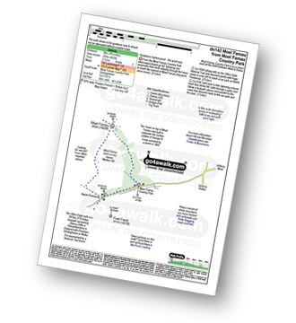
Vital Statistics:
| Length: | 12 miles (19 km) |
| Ascent: | 2,409ft (734m) |
| Time: | 6.75hrs |
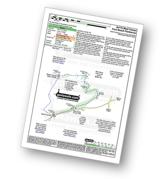
| Grade: |  |
Route Summary:
Bwlch Penbarras - The Offa's Dyke Path - Moel Famau - Moel Dywyll - Moel Llys-y-coed - Bwlch Arthur - Gronfoel Farm - Cilcain - Y Pentre - Crug Farm - Ffrith - Bryn Fynnon - Moel Famua Country Park - Bwlch Penbarras
|
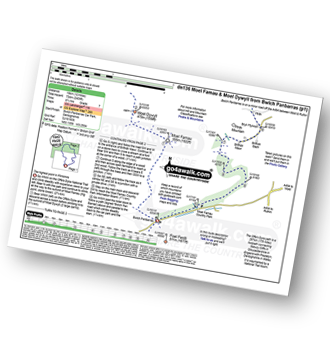
Vital Statistics:
| Length: | 11 miles (17.5 km) |
| Ascent: | 2,389ft (728m) |
| Time: | 6½ hrs |
| Grade: | |
Route Summary:
Moel Famau Country Park - Moel Famau - The Offa's Dyke Path - Moel Dywyll - Moel Llys-y-coed - Bwlch Arthur - Gronfoel Farm - Cilcain - Y Pentre - Crug Farm - Ffrith - Bryn Fynnon - Moel Famau Country Park
Not familiar with the area around LL18?
See these 30 nearest walks to UK Postcode LL18 on a google map
|
Vital Statistics:
| Length: | 3.75 miles (6 km) |
| Ascent: | 961ft (293m) |
| Time: | 2½ hrs |
| Grade: | |
|
Vital Statistics:
| Length: | 3 miles (5 km) |
| Ascent: | 542ft (165m) |
| Time: | 2 hrs |
| Grade: |  |
Route Summary:
Maenan - Cadair Ifan Goch - Bryn Hyfryd - Pant-yr-ych Bach Farm - Maes-yr-Groes - Tyn-y-graig - Maenan
|
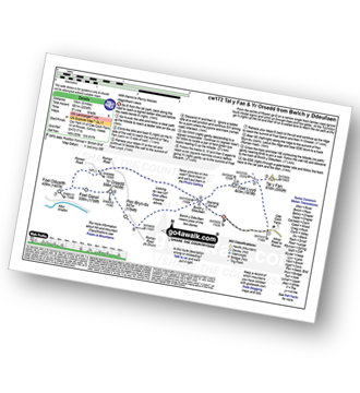
Vital Statistics:
| Length: | 8.75 miles (14 km) |
| Ascent: | 2,736ft (834m) |
| Time: | 6 hrs |
| Grade: | |
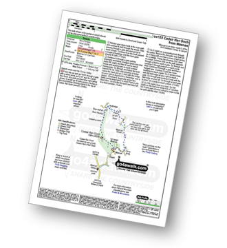
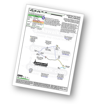
Route Summary:
Cae Coch - Tal y Fan - Foel Lwyd - Bwlch y Ddeufaen - Carnedd y Ddelw - Drum (Carneddau) - Pen y Castell - Bron-y-Gadair - Cae Coch
|
Vital Statistics:
| Length: | 12.25 miles (19.5 km) |
| Ascent: | 3,529ft (1,076m) |
| Time: | 8 hrs |
| Grade: |  |
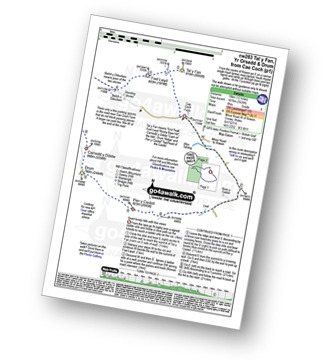
Route Summary:
Cae Coch - Tal y Fan - Foel Lwyd - Bwlch y Ddeufaen - Foel Dduarth - Foel-ganol - Yr Orsedd - Pen Bryn-du - Carnedd y Ddelw - Drum (Carneddau) - Pen y Castell - Bron-y-Gadair - Cae Coch
|
Vital Statistics:
| Length: | 8.25 miles (13 km) |
| Ascent: | 1,906ft (581m) |
| Time: | 4.75hrs |
| Grade: | |
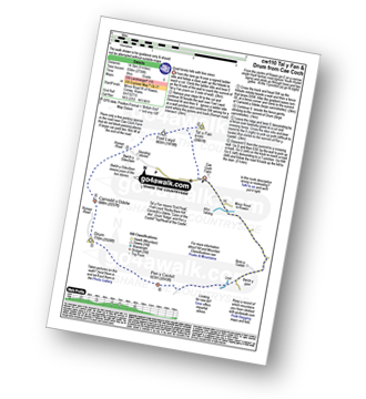
Route Summary:
Bwlch y Ddeufaen - Carnedd y Ddelw - Drum (Carneddau) - Pen y Castell - Bron-y-Gadair - Cae Coch - Bwlch y Ddeufaen
|
Vital Statistics:
| Length: | 4 miles (6.5 km) |
| Ascent: | 1,023ft (312m) |
| Time: | 2½ hrs |
| Grade: | |
Route Summary:
Bwlch y Ddeufaen Car Park - Cae Coch Farm - Tal y Fan - Foel Lwyd - Bwlch y Ddeufaen Car Park.
|
Vital Statistics:
| Length: | 6 miles (9.5 km) |
| Ascent: | 1,346ft (410m) |
| Time: | 3½ hrs |
| Grade: | |
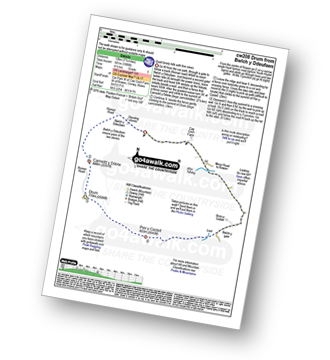
Route Summary:
Bwlch y Ddeufaen - Foel Dduarth - Foel-ganol - Yr Orsedd - Pen Bryn-du - Bwlch y Ddeufaen
|
Vital Statistics:
| Length: | 8.25 miles (13 km) |
| Ascent: | 2,234ft (681m) |
| Time: | 5.25hrs |
| Grade: | |
Route Summary:
Bwlch y Ddeufaen - Cae Coch - Tal y Fan - Foel Lwyd - Bwlch y Ddeufaen - Foel Dduarth - Foel-ganol - Yr Orsedd - Pen Bryn-du - Bwlch y Ddeufaen
|
Vital Statistics:
| Length: | 11 miles (17.5 km) |
| Ascent: | 3,641ft (1,110m) |
| Time: | 7.75hrs |
| Grade: | |
Route Summary:
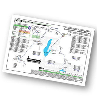
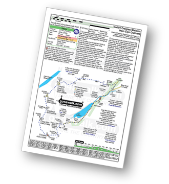
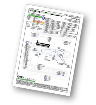
Llyn Eigiau - Craig Eigiau - Gwaun Y Garnedd - Foel Grach - Carnedd Llewelyn - Craig Yr Ysfa - Bwlch Eryl Farchog - Pen yr Helgi Du - Bwlch y Tri Marchog - Pen Llithrig y Wrach - Cedryn - Hafod-y-rhrw - Llyn Eigiau
|
Vital Statistics:
| Length: | 10 miles (16 km) |
| Ascent: | 3,027ft (923m) |
| Time: | 6½ hrs |
| Grade: | |
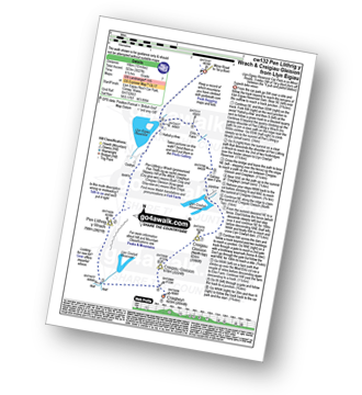
Route Summary:
Llyn Eigiau - Hafod-y-rhrw - Cedryn - Pen Llithrig y Wrach - Llyn Colwyd Reservoir - Craiglwyn - Creigiau Gleision - Creigiau Gleision (North Top) - Eilio Farm - Llyn Eigiau
|
Vital Statistics:
| Length: | 9.5 miles (15 km) |
| Ascent: | 2,714ft (827m) |
| Time: | 6.25hrs |
| Grade: | |
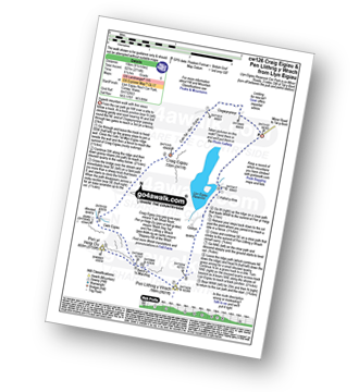
Route Summary:
Llyn Eigiau - Craig Eigiau - Cwm Eigiau - Pen Yr Helgi Du - Bwlch Tri y Marchog - Pen Llithrig y Wrach - Cedryn - Hafod-y-rhrw - Llyn Eigiau
|
Vital Statistics:
| Length: | 13.5 miles (21.5 km) |
| Ascent: | 4,477ft (1,364m) |
| Time: | 9½ hrs |
| Grade: | |
Route Summary:
Llyn Eigiau - Craig Eigiau - Cwm Eigiau - Pen Yr Helgi Du - Bwlch Tri Marchog - Pen Llithrig y Wrach - Llyn Colwyd Reservoir - Craiglwyn - Creigiau Gleision - Creigiau Gleision (North Top) - Eilio Farm - Llyn Eigiau
|
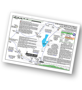
Vital Statistics:
| Length: | 7.75 miles (12.5 km) |
| Ascent: | 2,785ft (849m) |
| Time: | 5.75hrs |
| Grade: | |
Route Summary:
Llyn Crafnant - Crimpiau - Craig Wen - Craiglwyn - Creigiau Gleision - Creigiau Gleision (North Top) - Lledwigan - Llyn Crafnant
|
Vital Statistics:
| Length: | 5.5 miles (9 km) |
| Ascent: | 1,250ft (381m) |
| Time: | 3½ hrs |
| Grade: | |
|
Vital Statistics:
| Length: | 6 miles (9.5 km) |
| Ascent: | 1,621ft (494m) |
| Time: | 4 hrs |
| Grade: | |
Route Summary:
Hafod-y-gelyn - Roman Road - Foel Dduarth - Foel-ganol - Yr Orsedd - Pen Bryn-du - Roman Road - Hafod-y-gelyn
Not familiar with the area around LL18?
See these 30 nearest walks to UK Postcode LL18 on a google map


