
![]()
Branstree (Artlecrag Pike)
713m (2340ft)
The Far Eastern Fells, The Lake District, Cumbria, England
Tap/mouse over a coloured circle (1-3 easy walks, 4-6 moderate walks, 7-9 hard walks) and click to select.
Not familiar with this top?
   |
|---|
Vital Statistics:
| Length: | 10.5ml (17km) |
|---|---|
| Ascent: | 3,417ft (1,041m) |
| Time: | 7.25hrs |
| Grade: |  (Hard) (Hard) |
Route Summary:
Stockdale - Sadgill Bridge - Stockdale Beck - Great Howe - Grey Crag (Sleddale) - Tarn Crag (Sleddale) - Sleddale Fell - Selside Brow - Branstree (Artlecrag Pike) - Gatescarth Pass - Adam Seat - Harter Fell (Mardale) - Kentmere Pike - Goat Scar - Shipman Knotts - Wray Crag - Stockdale
|
|---|
Vital Statistics:
| Length: | 11mls (17.5km) |
|---|---|
| Ascent: | 2,655ft (809m) |
| Time: | 6.75hrs |
| Grade: | (Hard) |
Route Summary:
Swindale - Swindale Foot Farm - Swindale Beck - Starling Gill - Stubby Hest - Bracken Howe - Thiefstead - Langhowe Pike - High Katelade - Rowantree Crag - Blea Moss - Stone Howe - Glede Howe - Willy Winder Hill - Haskew Beck - Fewling Stones - Swindale Common - Mosedale Beck (Swindale) - Nabs Moor - Nabs Crag - Howes (Mosedale) - Captain Whelter Bog - Branstree (North East Top) - Branstree (Artlecrag Pike) - Swirle Crag - Selside Pike - High Blake Dodd - Selside End - High Birkin Knott - Low Birkin Knott - Old Corpse Road - Thorny Knott - Swindale Head Farm - Truss Gap - Swindale Foot Farm - Swindale
|
|---|
Vital Statistics:
| Length: | 11.25ml (18km) |
|---|---|
| Ascent: | 3,436ft (1,047m) |
| Time: | 7½ hrs |
| Grade: | (Hard) |
Route Summary:
Mardale Head - Haweswater Reservoir - Rowantreethwaite Beck - Old Corpse Road - Selside Pike - Branstree (North East Top) - Branstree (Artlecrag Pike) - Gatescarth Pass - Adam Seat - Harter Fell (Mardale) - Nan Bield Pass - Mardale Ill Bell - High Street - Riggindale Crag - Caspel Gate - Rough Crag (Riggindale) - Eagle Crag (Riggindale) - Heron Crag (Riggindale) - Swine Crag (Riggindale) - Dudderwick - The Rigg - Mardale Head
|
|---|
Vital Statistics:
| Length: | 12.5ml (20km) |
|---|---|
| Ascent: | 3,814ft (1,162m) |
| Time: | 8½ hrs |
| Grade: |  (Hard) (Hard) |
Route Summary:
Mardale Head - Haweswater - Rowantreethwaite Beck - Old Corpse Road - Selside Pike - Branstree (North East Top) - Branstree (Artlecrag Pike) - Gatescarth Pass - Adam Seat - Harter Fell (Mardale) - Nan Bield Pass - Mardale Ill Bell - High Street - Riggindale - Rampsgill Head - Wainwright's Coast to Coast Walk - Kidsty Pike - Kidsty Howes - Bowderthaite Bridge - The Rigg - Mardale Head
See Branstree (Artlecrag Pike) and the surrounding tops on our free-to-access 'Google Style' Peak Bagging Maps:
The Far Eastern Fells of The Lake District National Park
Less data - quicker to download
The Whole of The Lake District National Park
More data - might take a little longer to download
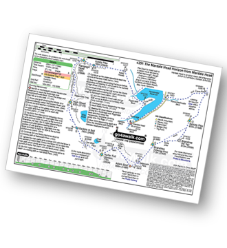
See Branstree (Artlecrag Pike) and the surrounding tops on our downloadable Peak Bagging Maps in PDF format:

NB: Whether you print off a copy or download it to your phone, these PDF Peak Baggers' Maps might prove incredibly useful when your are up there on the tops and you cannot get a phone signal.
*This version is marked with the walk routes you need to follow to Walk all 214 Wainwrights in just 59 walks.
You can find Branstree (Artlecrag Pike) & all the walks that climb it on these unique free-to-access Interactive Walk Planning Maps:
1:25,000 scale OS Explorer Maps (orange/yellow covers):
1:50,000 scale OS Landranger Map (pink/magenta covers):
 Fellow go4awalkers who have already walked, climbed, summited & bagged Branstree (Artlecrag Pike)
Mr M A Blanchard walked up Branstree (Artlecrag Pike) on November 25th, 2025 [with] The mutts
Pete George climbed Branstree (Artlecrag Pike) on September 27th, 2025 [from/via/route] Mardale [with] Roco [weather] Chilly & foggy on tops, pleasant down below
David Higginbottom bagged Branstree (Artlecrag Pike) on April 27th, 2025 [from/via/route] Half of 204 poor weather [with] Carolyn [weather] Very cloudy & wet at top - Miserable walk
Steve Cookson hiked Branstree (Artlecrag Pike) on March 2nd, 2024 [from/via/route] Haweswater Hotel [with] Gillie [weather] Cold & sunny
Ian Ashton summited Branstree (Artlecrag Pike) on November 16th, 2024 [with] Jph
James Hughes conquered Branstree (Artlecrag Pike) on June 24th, 2024 [from/via/route] c204 The Longsleddale Horizon from Stockdale Bridge [weather] Beautiful warm sunny day - Very warm day with bad start hiking through Bracken.
Martyn Howarth scaled Branstree (Artlecrag Pike) on April 1st, 2024 [from/via/route] From Mardale Head, up to Gatesgarth Pass, over Branstree, onto Selside Pike & down via the Old Corpse Road. [with] Tilly Howarth & Archie Howarth (and Barnaby the dog). [weather] Rather bleak, with drizzly rain & low cloud. Very little in teh way of views of the tops - just across Haweswater & Riggindale.
Tim Winn walked up Branstree (Artlecrag Pike) on May 15th, 2023 [from/via/route] Haweswater [with] Barry [weather] Very wet
Christine Shepherd climbed Branstree (Artlecrag Pike) on March 15th, 2009 [from/via/route] Walked from Stockdale using walk c204 'The Longsleddale Horizon' [with] On my own [weather] Fine - Climbed again from Mardale Head using walk c251 on a glorious May day on 24.5.10 Made my third ascent of this peak on 16.7.20 using route 204 again. Finally did walk c204 in sunshine on 24.5.23 Such much easier when you can see the paths & the ground is dry.
Paul Macey bagged Branstree (Artlecrag Pike) on July 24th, 2018 [from/via/route] From Brothers Water using walks c251 & c204
To add (or remove) your name and experiences on this page - Log On and edit your Personal Mountain Bagging Record
. . . [see more walk reports]
More Photographs & Pictures of views from, on or of Branstree (Artlecrag Pike)
High Street (left), Kidsty Pike (centre), High Raise (Mardale) and Raven Howe on the horizon with Riggindale Crag in the mid-distance from Branstree (Artlecrag Pike)
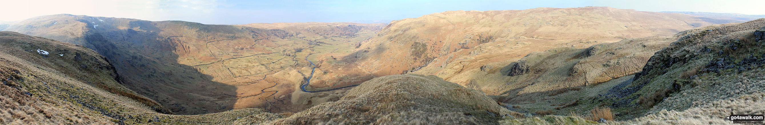
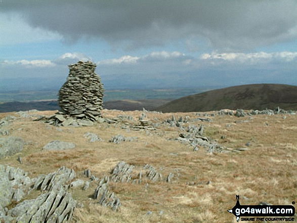
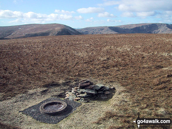
Nabs Moor and Nabs Crag with Branstree (Artlecrag Pike) (on the horizon right) from Fewling Stones
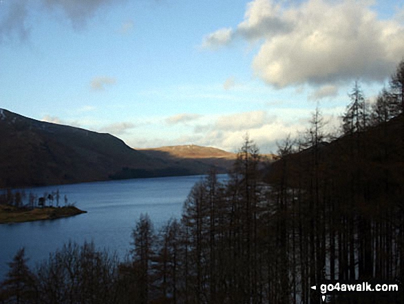
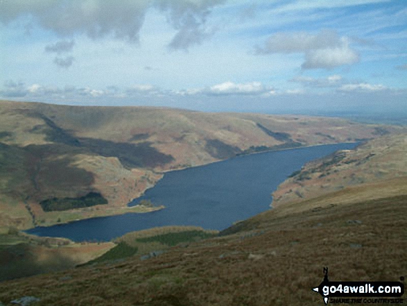
The Rigg and Haweswater Reservoir from the lower slopes of Branstree (Artlecrag Pike)
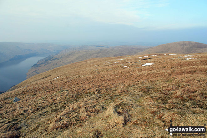
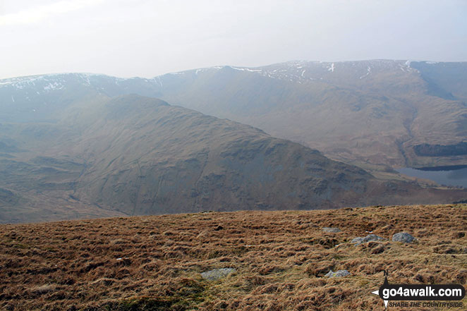
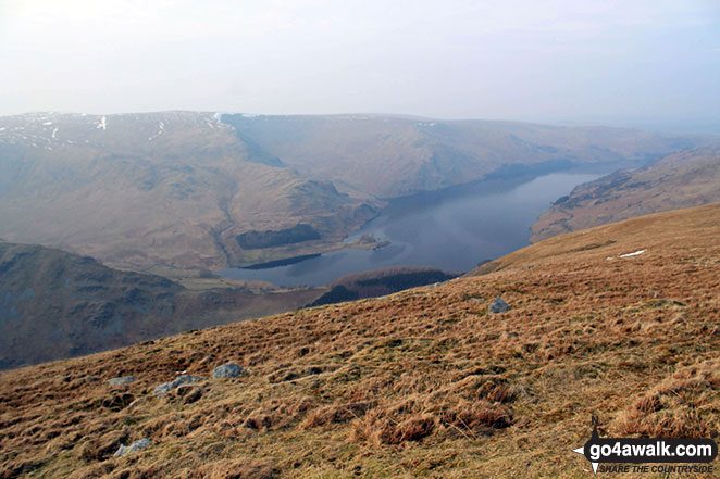
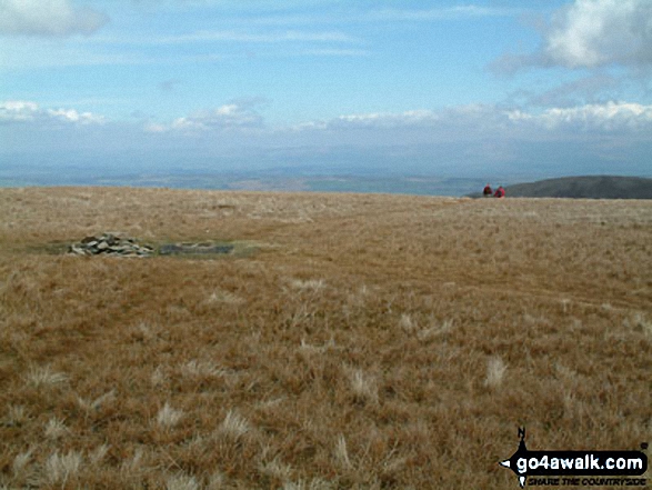
Haweswater Reservoir (left) and Selside Pike (right) from Branstree (Artlecrag Pike)
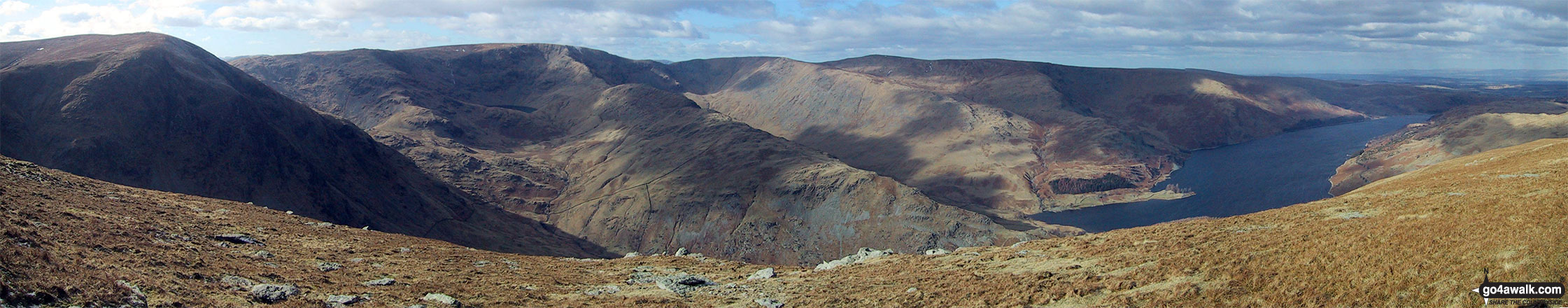
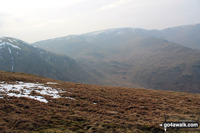
The view from the summit of Branstree (Artlecrag Pike) featuring Harter Fell (Mardale) (left), High Street, Rough Crag, High Raise (Mardale) and Whether How above Haweswater Reservoir
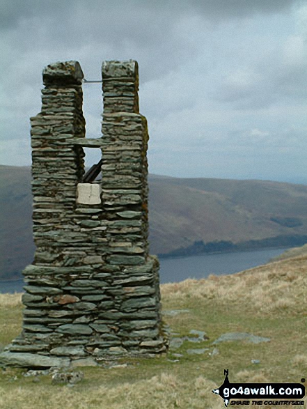
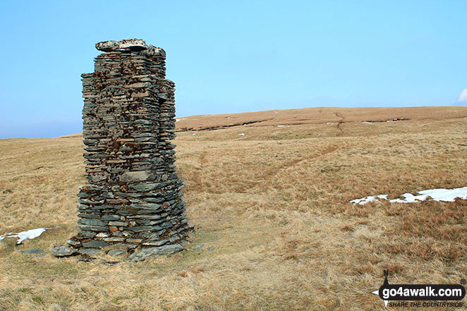
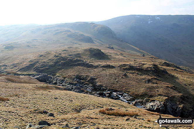
Pillar/Currick between Branstree (North East Top) and Branstree (Artlecrag Pike)
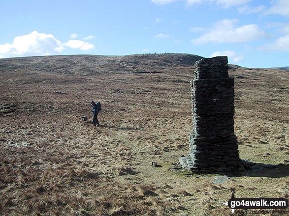
Stone pillar in the col between Branstree (North East Top) and Branstree (Artlecrag Pike)
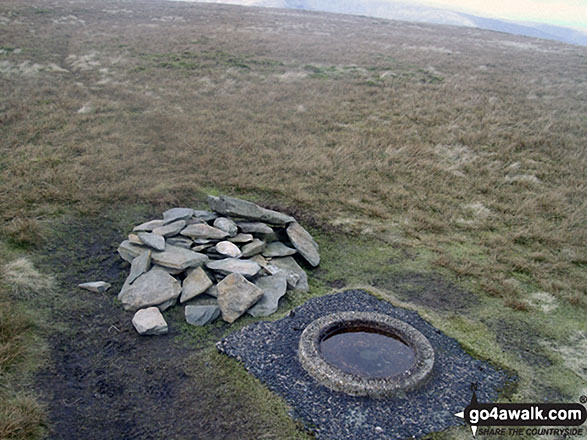
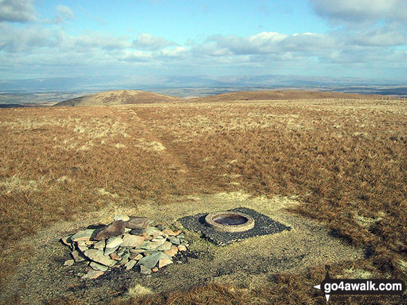
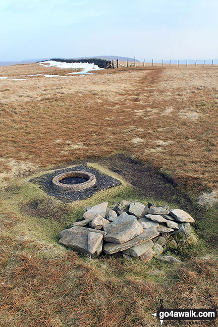
The Ordnance Survey Concrete Ring on the summit of Branstree (Artlecrag Pike)
Harter Fell (Mardale) (left) and High Street from Branstree (Artlecrag Pike)
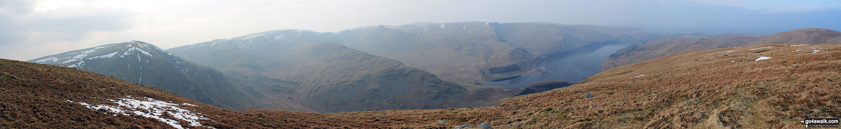
Harter Fell (Mardale) (left), High Street, Kidsty Pike, High Raise (Mardale), Haweswater Reservoir and Selside Pike (far right) from Branstree (Artlecrag Pike)
. . . see all 22 walk photographs & pictures of views from, on or of Branstree (Artlecrag Pike)
Send us your photographs and pictures on, of, or from Branstree (Artlecrag Pike)
If you would like to add your walk photographs and pictures featuring views from, on or of Branstree (Artlecrag Pike) to this page, please send them as email attachments (configured for any computer) along with your name to:
and we shall do our best to publish them.
(Guide Resolution = 300dpi. At least = 660pixels (wide) x 440 pixels (high).)

You can also submit photos via our Facebook Page.
NB. Please indicate where each photo was taken and whether you wish us to credit your photos with a Username or your First Name/Last Name.
Not familiar with this top?


