UK Postcode DE4 - The 30 nearest easy-to-follow, circular walk route maps to you
The thirty nearest easy-to-follow, circular walk route maps to you in UK Postcode DE4 in Walk Grade Order
The UK cities, towns and villages in Derbyshire, England that have DE4 in their UK Postcode include:
• Aldwark • Beeley • Birchover • Bolehill • Bonsall • Brassington • Brightgate • Carsington • Crich • Crich Carr • Cromford • Darley Dale • Elton • Grangemill • Holloway • Hopton • Ible • Lea • Longcliffe • Matlock • Matlock Bank • Matlock Bath • Middleton • Pikehall • Rowsley • Stanton in Peak • Tansley • Two Dales • Upper Hackney • Wensley • Whatstandwell • Winster • Wirksworth •
Not familiar with the area around DE4?
See these 30 nearest walks to UK Postcode DE4 on a google map
   |
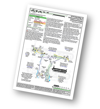
Vital Statistics:
| Length: | 12.75 miles (20.5 km) |
| Ascent: | 1,956ft (596m) |
| Time: | 6.75hrs |
| Grade: |  |
Route Summary:
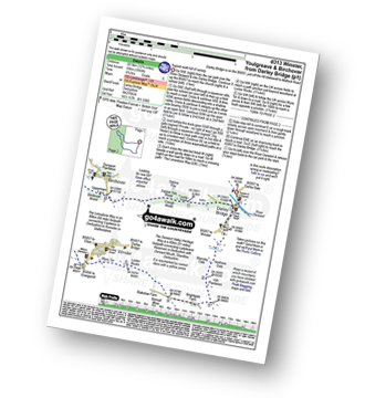
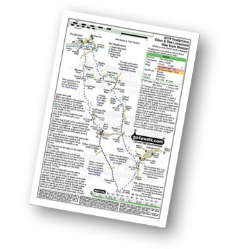
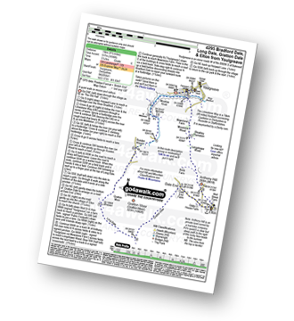
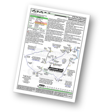
Darley Bridge - Wensley Dale - Northern Dale - Ash Plantation - Brightgate Farm - Bonsall Moor - The Limestone Way - Luntor Rocks - Winster - Westhill Farm - Robin Hood's Stride - Harthill Moor - Harthill Moor Wood - Bleakley Dike - River Bradford - Bradford Dale - Youlgreave - Rhienstor Plantation - Greenfield Farm - Stoney Ley Wood - Rocking Stone Farm - Birchover - Uppertown Farm - Clough Wood - Sabine Hey Wood - Cowley Knowl - Darley Bridge
|
Vital Statistics:
| Length: | 8.25 miles (13 km) |
| Ascent: | 1,358ft (414m) |
| Time: | 4½ hrs |
| Grade: |  |
Route Summary:
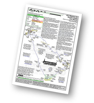
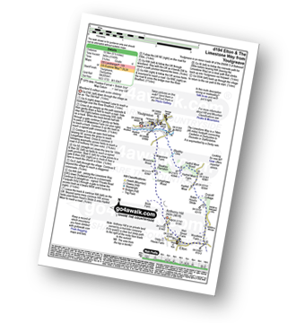
Winster - Luntor Rocks - The Limestone Way - Blakelow Hill - Bonsall Moor - Upper Town - Bonsall - Slaley - Dunsley Springs - Bonsall Wood - Ible Wood - Whitelow Farm - Bonsall Moor - Wyns Tor - Winster
|
Vital Statistics:
| Length: | 5.75 miles (9 km) |
| Ascent: | 1,046ft (319m) |
| Time: | 3.25hrs |
| Grade: |  |
Route Summary:
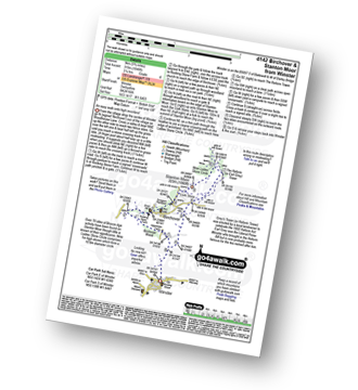
Winster - Upper Town - Uppertown Farm - Rocking Stone Farm - Birchover - Stanton Moor - Cork Stone - Nine Ladies Stone Circle - The Reform Tower (or Earl Grey Tower) - Winster
|
Vital Statistics:
| Length: | 5.75 miles (9 km) |
| Ascent: | 1,217ft (371m) |
| Time: | 3.25hrs |
| Grade: | |
Route Summary:
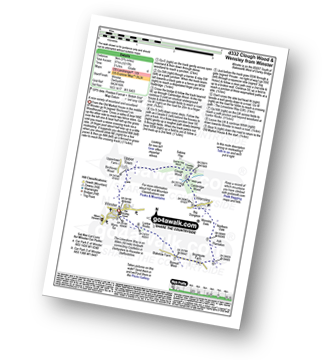
Winster - Upper Town - Clough Wood - Sabine Hay Wood - Cowley Knowl - Cambridge Wood - Wensley - Big Dungeon - Wensley Dale - Northern Dale - Brightgate Farm - The Limestone Way - Luntor Rocks - Winster
|
Vital Statistics:
| Length: | 8.75 miles (14 km) |
| Ascent: | 1,342ft (409m) |
| Time: | 4½ hrs |
| Grade: | |
Route Summary:
Winster - The Limestone Way - Westhill Farm - Robin Hood's Stride - Harthill Moor - Harthill Moor Wood - Bleakley Dike - River Bradford - Bradford Dale - Youlgreave - Mawstone Farm - Bleakley Plantation - Longshawe Wood - Anthony Hill - Elton - Sacheveral Farm - Winster
|
Vital Statistics:
| Length: | 3.25 miles (5.5 km) |
| Ascent: | 367ft (112m) |
| Time: | 1½ hrs |
| Grade: |  |
Route Summary:
Birchover - Stanton Moor - Cork Stone - Nine Ladies Stone Circle - The Reform Tower (or Earl Grey Tower) - Birchover
|
Vital Statistics:
| Length: | 7.25 miles (11.5 km) |
| Ascent: | 1,080ft (329m) |
| Time: | 3.75hrs |
| Grade: | |
Route Summary:
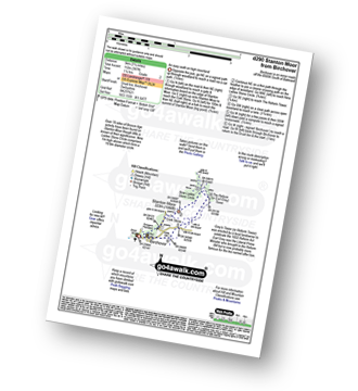
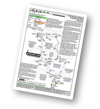
Brassington - The Limestone Way - Rainster Rocks - Longcliffe - Aldwark - Grangemill - The Limestone Way - Grange Mill Quarry - Harboro' Farm - Harboro' Rocks - Bee Nest Mine - Brassington
|
Vital Statistics:
| Length: | 4.5 miles (7 km) |
| Ascent: | 551ft (168m) |
| Time: | 2.25hrs |
| Grade: | |
|
Vital Statistics:
| Length: | 5.5 miles (9 km) |
| Ascent: | 984ft (300m) |
| Time: | 3 hrs |
| Grade: | |
Route Summary:
Elton - The Limestone Way - Dudwood Lane - Birchover - The Mires - Robin Hood's Stride - Harthill Moor Wood - Cliffe Farm - Anthony Hill - Elton
|
Vital Statistics:
| Length: | 3.75 miles (6 km) |
| Ascent: | 660ft (200m) |
| Time: | 3 hrs |
| Grade: |  |
Route Summary:
Elton - The Limestone Way - Dudwood Lane - Robin Hood's Stride - Harthill Moor Wood - Cliffe Farm - Anthony Hill - Elton
|
Vital Statistics:
| Length: | 8.5 miles (13.5 km) |
| Ascent: | 978ft (298m) |
| Time: | 4 hrs |
| Grade: | |
Route Summary:
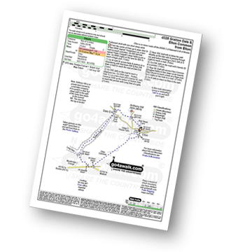
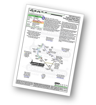
Elton - Anthony Hill - Dale End (Elton) - Gratton Dale - Mouldridge Grange - Rockhurst Farm - Greenlow Farm - Winster - The Limestone Way - Elton
|
Vital Statistics:
| Length: | 7.5 miles (12 km) |
| Ascent: | 1,335ft (407m) |
| Time: | 4.25hrs |
| Grade: | |
Route Summary:
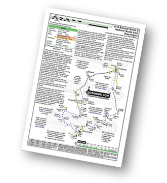
Stanton in Peak - Nine Ladies Stone Circle - The Reform Tower (or Earl Grey Tower) - Cork Stone - Stanton Moor - Birchover - The Limestone Way - Robin Hood's Stride - Harthill Moor - Harthill Moor Farm - River Bradford - Bradford Dale - Rhienstor Plantation - Alport - Tolls Wood - Stanton in Peak
|
Vital Statistics:
| Length: | 6.5 miles (10.5 km) |
| Ascent: | 1,115ft (340m) |
| Time: | 3½ hrs |
| Grade: | |
Route Summary:
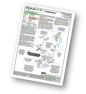
Rowsley - Holly Wood - Stanton Woodhouse Farm - Stanton Moor - The Reform Tower (or Earl Grey Tower) - The Cork Stone - Nine Ladies Stone Circle - Stanton in Peak - Smithy Wood - Congreave Farm - Rowsley
|
Vital Statistics:
| Length: | 8.25 miles (13 km) |
| Ascent: | 843ft (257m) |
| Time: | 3.75hrs |
| Grade: | |
Route Summary:
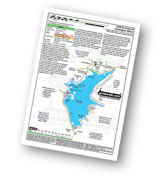
Carsington Water Visitors Centre - Carsington Water Dam - Millfields - 'Wooden' House - Upperfield Farm - Hopton - Hopton Hall - Carsington - Sheepwash - Carsington Wildlife Conservation Centre - Carsington Water Visitors Centre
|
Vital Statistics:
| Length: | 4 miles (6.5 km) |
| Ascent: | 400ft (122m) |
| Time: | 2 hrs |
| Grade: | |
Route Summary:
Hell Bank Plantation - Beeley Plantation - Rabbit Warren - Beeley Brook - Hob Hurst's House - Harland Edge - Beeley Moor - Beeley Moor (South East Top) - Beeley Lane - Harland Sick - Hell Bank Plantation
Not familiar with the area around DE4?
See these 30 nearest walks to UK Postcode DE4 on a google map
|
Vital Statistics:
| Length: | 8.25 miles (13 km) |
| Ascent: | 1,122ft (342m) |
| Time: | 4.25hrs |
| Grade: | |

Route Summary:
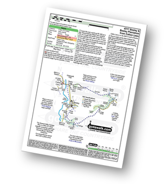
Beeley - Moor Farm - Beeley Plantation - Rabbit Warren - Beeley Brook - Hob Hurst's House - Harland Edge - Beeley Moor - Beeley Moor (South East Top) - Beeley Lane - Harland Sick - Hell Bank Plantation - Fallinge Farm - Smeltingmill Wood - Fold Farm - Beeley
|
Vital Statistics:
| Length: | 5 miles (8 km) |
| Ascent: | 433ft (132m) |
| Time: | 2 hrs |
| Grade: | |
Route Summary:
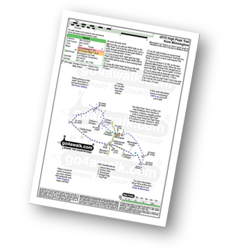
Minninglow - The High Peak Trail - Green Lane - Cobblersnook Lane - Minninglow Lane - The High Peak Trail - Minninglow
|
Vital Statistics:
| Length: | 4 miles (6 km) |
| Ascent: | 610ft (186m) |
| Time: | 2.25hrs |
| Grade: | |

Route Summary:
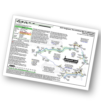
Youlgreave - Bradford Dale - River Bradford - The Limestone Way - River Lathkill - Lathkill Dale - Conksbury Bridge - Youlgreave
|
Vital Statistics:
| Length: | 9.5 miles (15 km) |
| Ascent: | 1,696ft (517m) |
| Time: | 5.25hrs |
| Grade: | |
Route Summary:
Youlgreave - The Limestone Way - Bradford Dale - Moatlow Knob - River Bradford - Rusden Wood - Gratton Moor - Long Dale - Gratton Dale - Dale End (Elton) - Elton - Anthony Hill - Longshawe Wood - Bleakley Plantation - Mawstone Farm - Bradford Dale - River Bradford - Youlgreave
|
Vital Statistics:
| Length: | 6.5 miles (10.5 km) |
| Ascent: | 1,145ft (349m) |
| Time: | 3½ hrs |
| Grade: | |
Route Summary:
Youlgreave - Bradford Dale - River Bradford - Mawstone Farm - Bleakley Plantation - Longshawe Wood - Anthony Hill - Elton - The Limestone Way - Robin Hood's Stride - Harthill Moor - Harthill Moor Wood - Bleakley Dike - River Bradford - Bradford Dale - Youlgreave
|
Vital Statistics:
| Length: | 5.5 miles (8.5 km) |
| Ascent: | 847ft (258m) |
| Time: | 2.75hrs |
| Grade: | |
Route Summary:
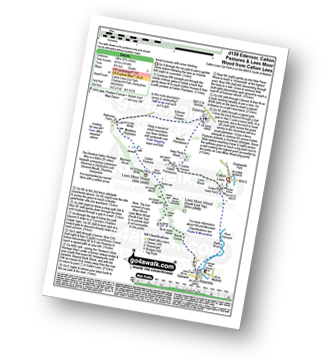
Calton Lees - River Derwent - Beeley Lodge - Beeley Hilltop Farm - Rounds - Beeley Brook - Hell Bank Plantation - Beeley Plantation - Smeltingmill Wood - Burntwood Quarry - Fold Farm - Beeley - River Derwent - Calton Lees
|
Vital Statistics:
| Length: | 8.75 miles (14 km) |
| Ascent: | 1,414ft (431m) |
| Time: | 4.75hrs |
| Grade: | |
Route Summary:
Calton Lees - Lees Wood - Calton Plantation - New Piece Wood - Maud's Plantations - Edensor - Edensor Forest Nursery - Ballcross Farm - Moatless Plantation - Calton Pastures - Manners Wood - Lees Moor Wood - Bouns Corner - Rowsley - The Derwent Valley Heritage Way - River Derwent - Bank Wood - Calton Lees
|
Vital Statistics:
| Length: | 9.75 miles (15.5 km) |
| Ascent: | 1,240ft (378m) |
| Time: | 4.75hrs |
| Grade: | |
Route Summary:
Middleton-by-Youlgreave - River Bradford - Rusden Wood - Gratton Moor - Long Dale - Bolderstone Plantation - Friden Station - The High Peak Trail - Green Lane (Friden) - Mere Farm - Ringham Low (Friden) - Kenslow Farm - Kenslow Knoll - Little Rockery Plantation - Rake Wood - Middleton-by-Youlgreave
|
Vital Statistics:
| Length: | 8 miles (12.5 km) |
| Ascent: | 1,010ft (305m) |
| Time: | 4 hrs |
| Grade: | |
Route Summary:
Kniveton - Whitelands - Wigber Low - Bradbourne Mill - Bletch Brook - Sitterlow Farm - Parwich - Ballidon - Bradbourne - Newhouse Farm - Kniveton
|
Vital Statistics:
| Length: | 7.75 miles (12.5 km) |
| Ascent: | 1,532ft (467m) |
| Time: | 4½ hrs |
| Grade: | |
Route Summary:
Over Haddon - River Lathkill - Conksbury Bridge - Raper Lodge - Youlgreave - River Bradford - The Limestone Way - Bradford Dale - Lomber Dale - Lomberdale Hall - Moor Lane - Low Moor Plantation - Calling Low Farm - Cales Dale - Lathkill Dale - Low Wood - Calling Low Dale - Palmerston Wood - Meadow Place Wood - Twin Dale - Lathkill Lodge - Over Haddon
|
Vital Statistics:
| Length: | 3.5 miles (5.5 km) |
| Ascent: | 528ft (161m) |
| Time: | 2 hrs |
| Grade: | |
Route Summary:
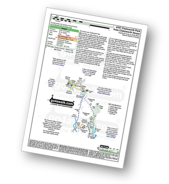
Chatsworth House - Stand Wood Ornamental Waterfall - Chatsworth Elizabethan Hunting Tower - Chatsworth Park - The Cannon Kissing Gate - Baslow - The Derwent Valley Heritage Way - Chatsworth House
|
Vital Statistics:
| Length: | 5 miles (8 km) |
| Ascent: | 607ft (185m) |
| Time: | 2½ hrs |
| Grade: | |
Route Summary:
Chatsworth House - Stand Wood Ornamental Waterfall - Chatsworth Elizabethan Hunting Tower - Dobb Edge - Robin Hood (Baslow) - Birchen Edge Car Park - Jumble Coppice - Jubilee Rock - Chatsworth Park - The Cannon Kissing Gate - Baslow - The Derwent Valley Heritage Way - Chatsworth House
|
Vital Statistics:
| Length: | 9 miles (14.5 km) |
| Ascent: | 1,257ft (383m) |
| Time: | 5 hrs |
| Grade: | |
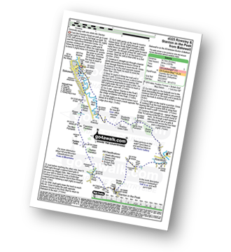
Route Summary:
Bakewell - River Wye - Haddon Park - Shadyside Plantation - Aaron Hole Plantation - Bouns Corner - Rowsley - Congreave Farm - Smithy Wood - Stanton In The Peak - Tolls Wood - Shiningbank Quarry - Haddon Fields - Wigger Dale - Burton Ashes Wood - Bakewell
|
Vital Statistics:
| Length: | 9.5 miles (15 km) |
| Ascent: | 1,332ft (406m) |
| Time: | 4.75hrs |
| Grade: | |
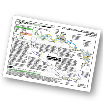
Route Summary:
Bakewell - Noton Barn Farm - Noton Barn - Over Haddon - Bole Hill (Bakewell) - Kirk Dale - Sheldon - Great Shackleton Wood - River Wye - Ashford In The Water - River Wye - Holme Bridge - Bakewell
|
Vital Statistics:
| Length: | 10 miles (16 km) |
| Ascent: | 1,578ft (481m) |
| Time: | 5.25hrs |
| Grade: | |
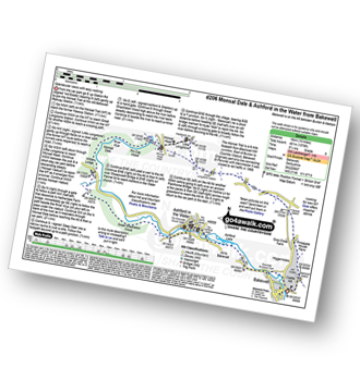
Route Summary:
Bakewell - The Monsal Trail - Hassop Station. Great Longstone Station - Little Longstone - Monsal Head - Monsal Dale - River Wye - Great Shackleton Wood - Magpie Sough - Ashford In The Water - River Wye - Holme Bridge - Bakewell
Not familiar with the area around DE4?
See these 30 nearest walks to UK Postcode DE4 on a google map


