
![]()
Thornthwaite Crag
784m (2573ft)
The Far Eastern Fells, The Lake District, Cumbria, England
Tap/mouse over a coloured circle (1-3 easy walks, 4-6 moderate walks, 7-9 hard walks) and click to select.
Not familiar with this top?
   |
|---|
Vital Statistics:
| Length: | 7.5ml (12km) |
|---|---|
| Ascent: | 3,131ft (954m) |
| Time: | 5.75hrs |
| Grade: |  (Moderate) (Moderate) |
Route Summary:
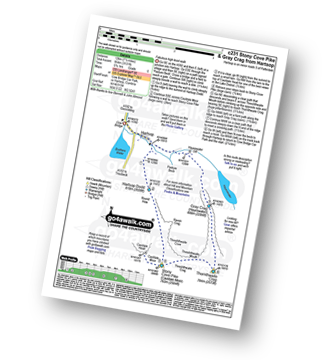
Cow Bridge - Brothers Water - Hartsop - Hartsop Dodd - Caudale Moor - Caudale Head - Stony Cove Pike (Caudale Moor) - Threshthwaite Mouth - Thornthwaite Crag - Gray Crag (Hayeswater) - Hayeswater Gill - Hartsop - Cow Bridge
|
|---|
Vital Statistics:
| Length: | 11.5ml (18.5km) |
|---|---|
| Ascent: | 3,378ft (1,030m) |
| Time: | 7½ hrs |
| Grade: |  (Hard) (Hard) |
Route Summary:
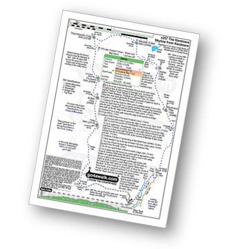
Kentmere - Garburn Pass - Yoke - Ill Bell - Froswick - Thornthwaite Crag - Mardale Ill Bell - Nan Bield Pass - Harter Fell (Mardale) - Kentmere Pike - Brookstones - Kentmere
|
|---|
Vital Statistics:
| Length: | 11.25ml (18km) |
|---|---|
| Ascent: | 3,843ft (1,171m) |
| Time: | 8 hrs |
| Grade: |  (Hard) (Hard) |
Route Summary:
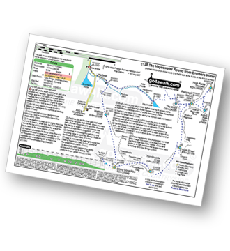
Cow Bridge - Brothers Water - Hartsop - Hartsop Dodd - Caudale Moor - Stony Cove Pike (Caudale Moor) - Caudale Head - Stony Cove Pike - Threshthwaite Mouth - Thornthwaite Crag - High Street - Straits of Riggindale - Rampsgill Head - Kidsty Pike - High Raise (Mardale) - The Knott - Hayeswater Reservoir - Hayeswater Gill - Hartsop - Cow Bridge - Brothers Water.
|
|---|
Vital Statistics:
| Length: | 12.25ml (19.5km) |
|---|---|
| Ascent: | 4,194ft (1,278m) |
| Time: | 8.75hrs |
| Grade: | (Hard) |
Route Summary:
Troutbeck Bridge - Garburn Pass - Yoke - Ill Bell - Froswick - Thornthwaite Crag - Stony Cove Pike (Caudale Moor) - Doup Crag - Trout Beck - Troutbeck Tongue - Hagg Gill - Lowther Brow - Long Green Head - Limefitt Campsite - Troutbeck - Troutbeck Bridge
|
|---|
Vital Statistics:
| Length: | 12.5ml (20km) |
|---|---|
| Ascent: | 3,889ft (1,185m) |
| Time: | 8½ hrs |
| Grade: | (Hard) |
Route Summary:
Cow Bridge - Brothers Water - Hartsop - Hartsop Dodd - Stony Cove Pike - Caudale Head - Caudale Moor - Stony Cove Pike (Caudale Moor) - Threshthwaite Mouth - Thornthwaite Crag - High Street - Straits of Riggindale - The Knott - Angle Tarn (Martindale) - Angletarn Pikes - Boredale Hause - Patterdale
See Thornthwaite Crag and the surrounding tops on our free-to-access 'Google Style' Peak Bagging Maps:
The Far Eastern Fells of The Lake District National Park
Less data - quicker to download
The Whole of The Lake District National Park
More data - might take a little longer to download
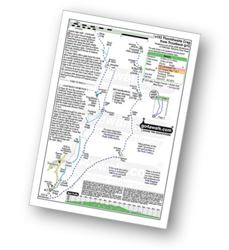
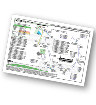
See Thornthwaite Crag and the surrounding tops on our downloadable Peak Bagging Maps in PDF format:

NB: Whether you print off a copy or download it to your phone, these PDF Peak Baggers' Maps might prove incredibly useful when your are up there on the tops and you cannot get a phone signal.
*This version is marked with the walk routes you need to follow to Walk all 214 Wainwrights in just 59 walks.
You can find Thornthwaite Crag & all the walks that climb it on these unique free-to-access Interactive Walk Planning Maps:
1:25,000 scale OS Explorer Maps (orange/yellow covers):
1:50,000 scale OS Landranger Map (pink/magenta covers):
 Fellow go4awalkers who have already walked, climbed, summited & bagged Thornthwaite Crag
David Higginbottom walked up Thornthwaite Crag on April 29th, 2025 [from/via/route] Walk 231 very nice walk [with] Carolyn [weather] Clear & nice
Richard Holmes climbed Thornthwaite Crag on April 7th, 2025 [from/via/route] Troutbeck [with] Myself. [weather] Hot, not a cloud in the sky. Got sunburnt!
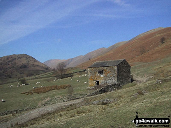
James Hughes bagged Thornthwaite Crag on September 3rd, 2024 [from/via/route] c231 Stony Cove Pike & Gray Crag from Hartsop [weather] Sunny morning turning cloudy by end - Sharp climb up Hartsop Dodd, beautiful views out over Windermere from Stony Cove Pike. Free carpark at Hartsop
Claire Kirk hiked Thornthwaite Crag on December 23rd, 2023 [from/via/route] Cow Bridge car park [with] Sarah and Leigh
Claire Rigg summited Thornthwaite Crag on January 1st, 2010 [with] Heidi [weather] Sunny
Andrew Peate conquered Thornthwaite Crag on August 17th, 2023 [from/via/route] From Hartsop, Cow Bridge Car Park [weather] Clear, breezy
Martyn Howarth scaled Thornthwaite Crag on August 15th, 2023 [from/via/route] From Kentmere Institute, as part of the Kentmere Horseshoe. [with] Tilly Howarth. [weather] Gorgeous August day, after some dreadful weather the days before! - Tough 14.5 mile walk - 3600ft of ascent! Brilliant effort by 14 yr old Tilly!
Tim Winn walked up Thornthwaite Crag on May 14th, 2023 [from/via/route] Cow Bridge car park [with] Mountain Guides Group [weather] Sunny & dry
Ian Ashton climbed Thornthwaite Crag on April 7th, 2023 [with] Solo
Angeline Grieveson bagged Thornthwaite Crag on December 3rd, 2022 [with] Dotty & Paul
To add (or remove) your name and experiences on this page - Log On and edit your Personal Mountain Bagging Record
. . . [see more walk reports]
More Photographs & Pictures of views from, on or of Thornthwaite Crag
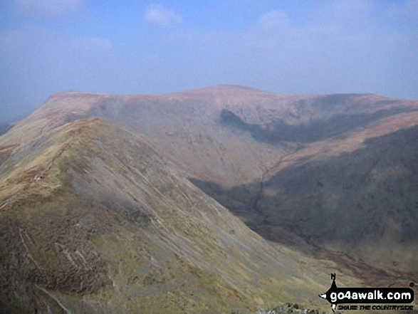
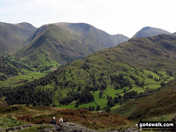
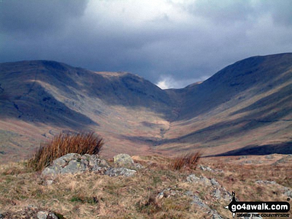
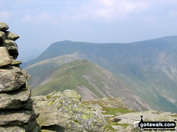
Thornthwaite Crag & High Street from below Stony Cove Pike (Caudale Moor)
The Kentmere Horseshoe (Yoke, Ill Bell, Froswick, Thornthwaite Crag, Kentmere Pike and Shipman Knotts) from Hollow Moor
Kentmere with Yoke, Ill Bell, Froswick and Thornthwaite Crag above from Hollow Moor
*Baystones (Wansfell) in the foreground with Red Screes (left), Stony Cove Pike (Caudale Moor), Thornthwaite Crag and the Froswick, Ill Bell, Yoke ridge silhouetted on the skyline from Wansfell Pike
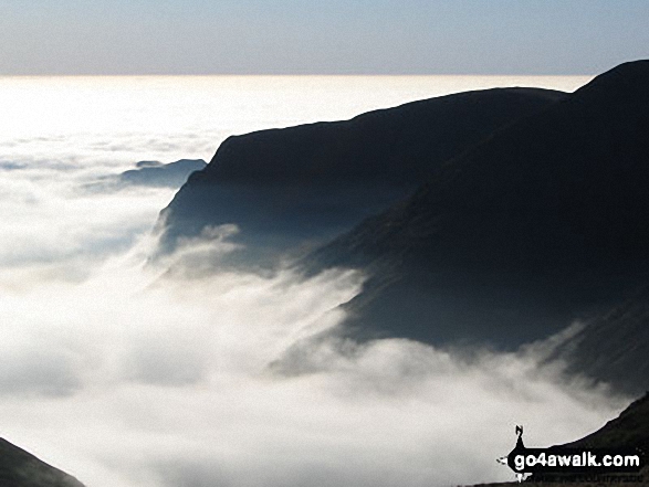
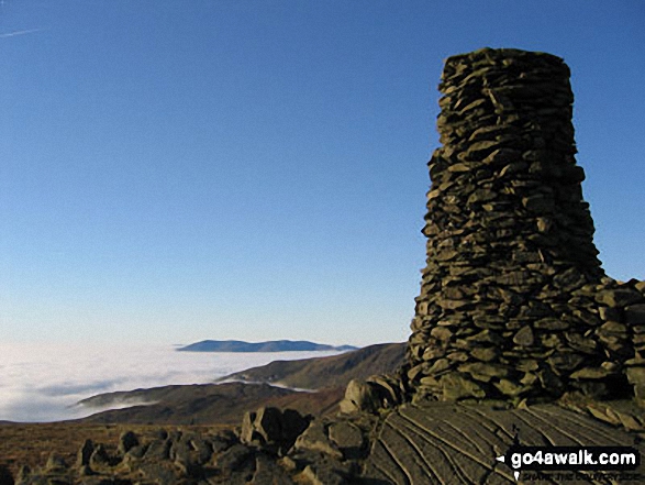
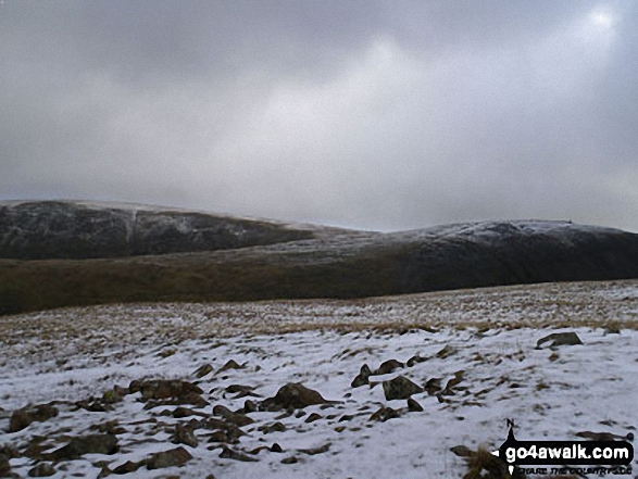
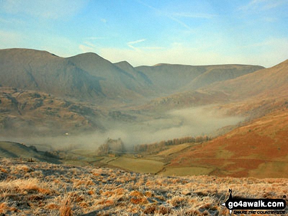
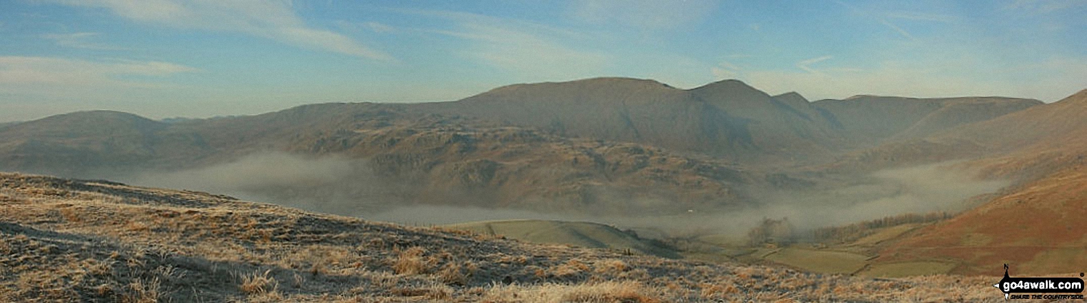
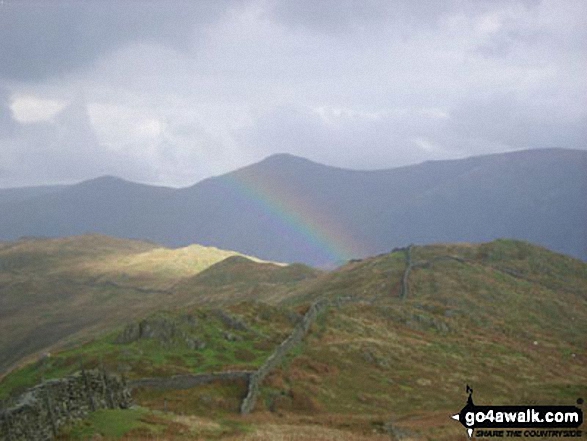
Cloud trapped by a temperature inversion clawing at the eastern slopes of Yoke, Ill Bell and Froswick as seen from Thornthwaite Crag
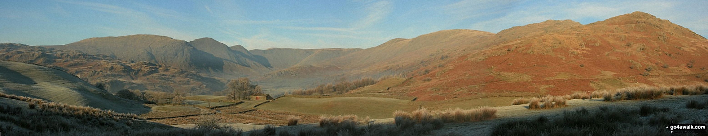
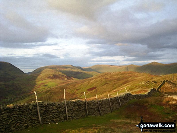
Thornthwaite Crag (left), Hartsop Dodd and Stony Cove Pike (Caudale Moor) (centre), Red Screes (right) and the shoulder of Hartsop above How (foreground) from Arnison Crag, Patterdale
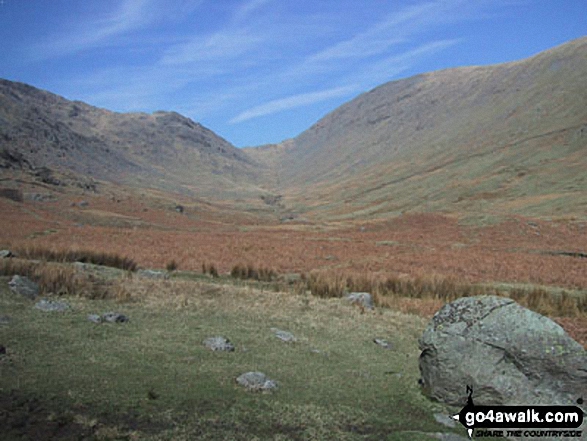
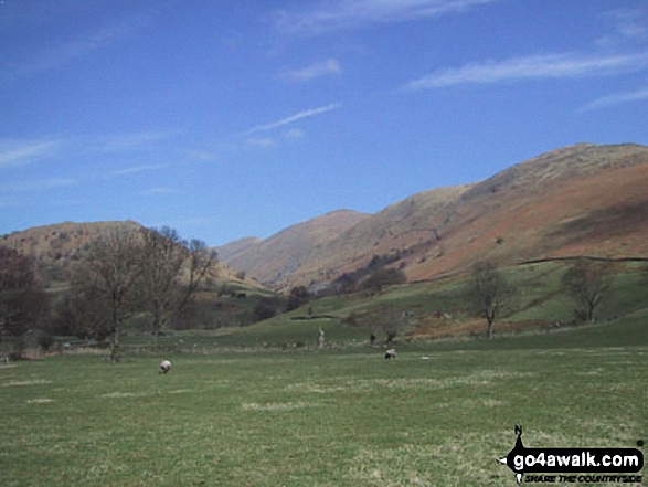
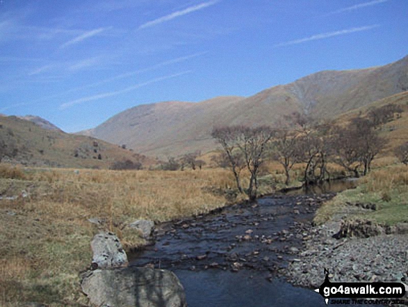
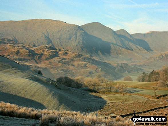
Stony Cove Pike (Caudale Moor), Threshthwaite Mouth and Thornthwaite Crag from Troutbeck Park
Red Screes (left), Thornthwaite Crag, Froswick, Ill Bell and Yoke from Baystones (Wansfell)
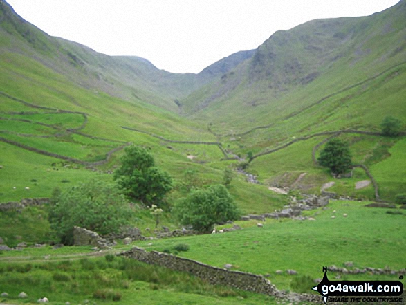
Stony Cove Pike (Caudale Moor) (left), Thresthwaite Mouth and Thornthwaite Crag (right) from the Northern end of Troutbeck Tongue
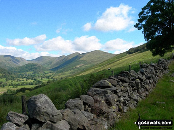
Stony Cove Pike (Caudale Moor) (left), Thornthwaite Crag, Froswick, Ill Bell and Yoke (right) from Garburn Road near Troutbeck Park
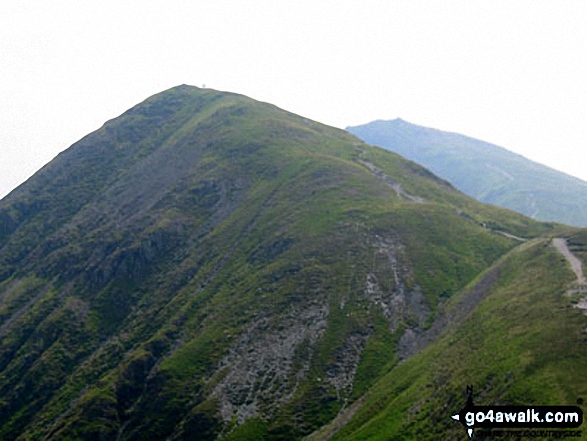
Stony Cove Pike (left) and Thornthwaite Crag (right) from Garburn Pass
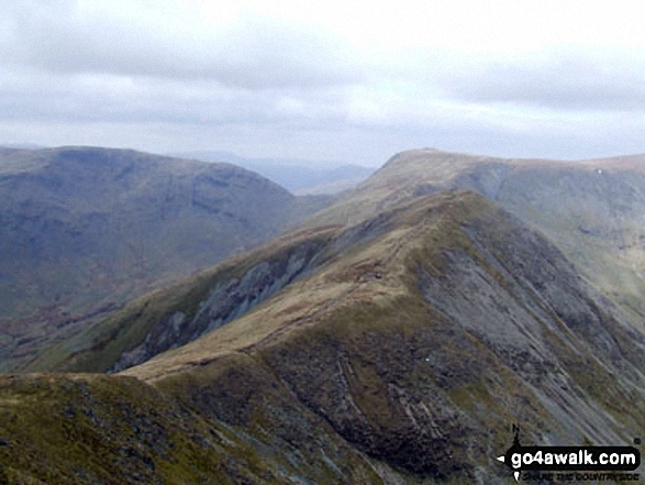
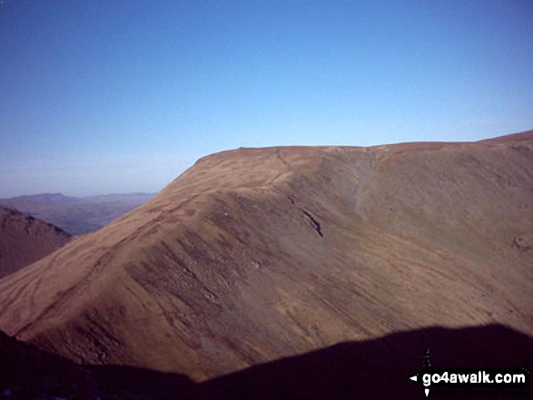
Froswick (foreground - centre right)) with Stony Cove Pike (Caudale Moor) (left), the Threshthwaite Mouth saddle and Thornthwaite Crag (centre back) from the summit of Yoke
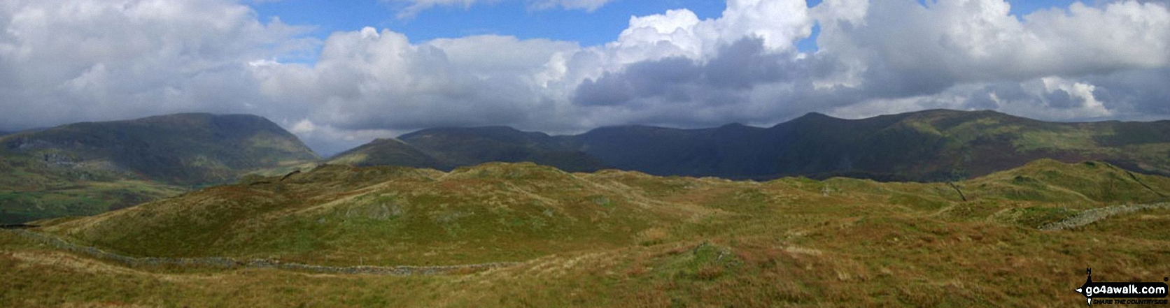
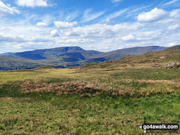
The Westerly aspect from Hollow Moor includes a distant view of Crinkle Crags with Yoke, Ill Bell, Froswick and Thornthwaite Crag above Kentmere
Looking north to Baystones with Thornthwaite Crag (left) and Ill Bell (centre) beyond from Wansfell Pike as the sun catches a passing shower
Stony Cove Pike (left), Threshthwaite Mouth & Thornthwaite Crag (right) from Garburn Pass
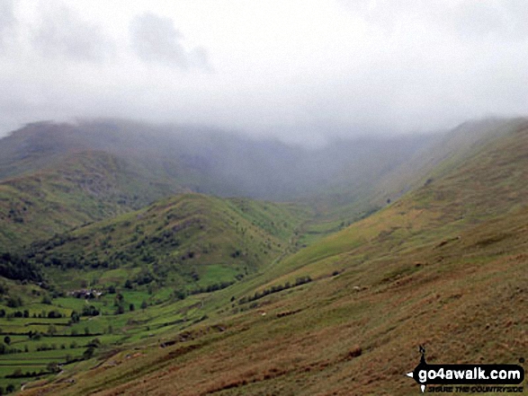
Troutbeck Tongue from Garburn Road with Stony Cove Pike and Thornthwaite Crag beyond covered in cloud
. . . see just 20 walk photographs & pictures of views from, on or of Thornthwaite Crag
Send us your photographs and pictures on, of, or from Thornthwaite Crag
If you would like to add your walk photographs and pictures featuring views from, on or of Thornthwaite Crag to this page, please send them as email attachments (configured for any computer) along with your name to:
and we shall do our best to publish them.
(Guide Resolution = 300dpi. At least = 660pixels (wide) x 440 pixels (high).)

You can also submit photos via our Facebook Page.
NB. Please indicate where each photo was taken and whether you wish us to credit your photos with a Username or your First Name/Last Name.
Not familiar with this top?


