
![]()
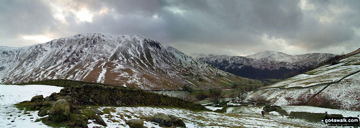
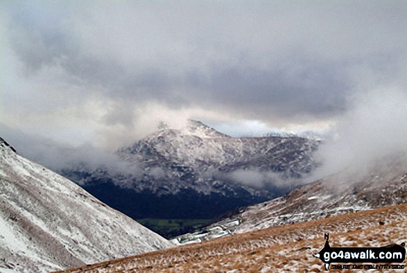
Gray Crag (Hayeswater)
699m (2294ft)
The Far Eastern Fells, The Lake District, Cumbria, England
In February 2022 Gray Crag (Hayeswater) was demoted from 'Nuttall' status due to insufficient prominance.
Not familiar with this top?
   |
|---|
Vital Statistics:
| Length: | 7.5ml (12km) |
|---|---|
| Ascent: | 3,131ft (954m) |
| Time: | 5.75hrs |
| Grade: |  (Moderate) (Moderate) |
Route Summary:
Cow Bridge - Brothers Water - Hartsop - Hartsop Dodd - Caudale Moor - Caudale Head - Stony Cove Pike (Caudale Moor) - Threshthwaite Mouth - Thornthwaite Crag - Gray Crag (Hayeswater) - Hayeswater Gill - Hartsop - Cow Bridge
See Gray Crag (Hayeswater) and the surrounding tops on our free-to-access 'Google Style' Peak Bagging Maps:
The Far Eastern Fells of The Lake District National Park
Less data - quicker to download
The Whole of The Lake District National Park
More data - might take a little longer to download
See Gray Crag (Hayeswater) and the surrounding tops on our downloadable Peak Bagging Maps in PDF format:

NB: Whether you print off a copy or download it to your phone, these PDF Peak Baggers' Maps might prove incredibly useful when your are up there on the tops and you cannot get a phone signal.
*This version is marked with the walk routes you need to follow to Walk all 214 Wainwrights in just 59 walks.
You can find Gray Crag (Hayeswater) & all the walks that climb it on these unique free-to-access Interactive Walk Planning Maps:
1:25,000 scale OS Explorer Map (orange/yellow covers):
1:50,000 scale OS Landranger Map (pink/magenta covers):
 Fellow go4awalkers who have already walked, climbed, summited & bagged Gray Crag (Hayeswater)
Simon Myerscough walked up Gray Crag (Hayeswater) on October 11th, 2025 [from/via/route] In Hartsop used a farmers field to park for £5 just as you go into the village. Had to bag this one on its own as missed last time. Finished walk off with a lap of Brothers Water, had dinner on the banks of Brothers Water. [with] Joanne [weather] No wind & mild & very sunny - gorgeous
David Higginbottom climbed Gray Crag (Hayeswater) on April 29th, 2025 [from/via/route] Walk 231 very nice walk [with] Carolyn [weather] Clear & nice
James Hughes bagged Gray Crag (Hayeswater) on September 3rd, 2024 [from/via/route] c231 Stony Cove Pike & Gray Crag from Hartsop [weather] Sunny morning turning cloudy by end - Sharp climb up Hartsop Dodd, beautiful views out over Windermere from Stony Cove Pike. Free carpark at Hartsop
Claire Kirk hiked Gray Crag (Hayeswater) on December 26th, 2023 [from/via/route] Cow Bridge car park [with] Sarah and Leigh
Andrew Peate summited Gray Crag (Hayeswater) on August 17th, 2023 [from/via/route] From Hartsop, Cow Bridge Car Park [weather] Clear, breezy
Angeline Grieveson conquered Gray Crag (Hayeswater) on June 4th, 2023 [with] Dotty
Tim Winn scaled Gray Crag (Hayeswater) on May 14th, 2023 [from/via/route] Cow Bridge car park [with] Mountain Guides Group [weather] Sunny & dry
Ian Ashton walked up Gray Crag (Hayeswater) on April 7th, 2023 [with] Solo
Christine Shepherd climbed Gray Crag (Hayeswater) on February 20th, 2009 [from/via/route] Walked from Hartsop using walk c231 Walked again with a group from Head 4 the Hills 6.5.21 Finally climbed up the front of Gray Crag solo on 20.04.2022from Hartsop. [with] 1)Jenny 2) With a group 3) solo [weather] Very changeable; snow, mist & winter sunshine in equal measure. - I enjoyed the climb up this fell; much preferred it to Hartsop Dodd
John Ramsbottom has bagged Gray Crag (Hayeswater) [from/via/route] Hartsop,walk c231 [with] Sydney Prince [weather] Sunny, windy - Our first day doing Wainwrights, this was our 4th
To add (or remove) your name and experiences on this page - Log On and edit your Personal Mountain Bagging Record
. . . [see more walk reports]
More Photographs & Pictures of views from, on or of Gray Crag (Hayeswater)
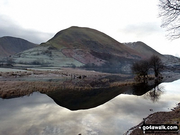
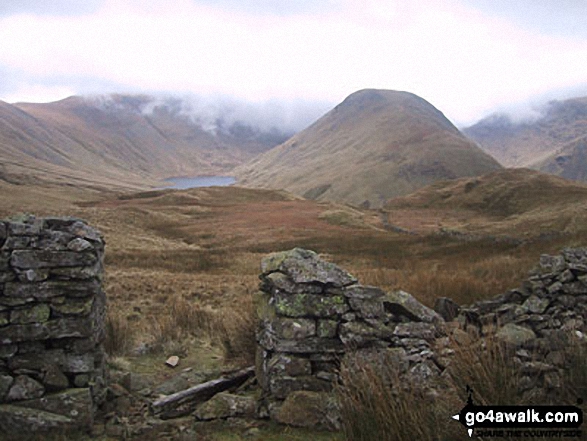
Hartsop Dodd across Brothers Water with Gray Crag (Hayeswater) (far left) and Stony Cove Pike (Caudale Moor) (far right)
Send us your photographs and pictures on, of, or from Gray Crag (Hayeswater)
If you would like to add your walk photographs and pictures featuring views from, on or of Gray Crag (Hayeswater) to this page, please send them as email attachments (configured for any computer) along with your name to:
and we shall do our best to publish them.
(Guide Resolution = 300dpi. At least = 660pixels (wide) x 440 pixels (high).)

You can also submit photos via our Facebook Page.
NB. Please indicate where each photo was taken and whether you wish us to credit your photos with a Username or your First Name/Last Name.
Not familiar with this top?


