
![]()
Snowdon (Yr Wyddfa)
1085m (3561ft)
The Snowdon Area, Snowdonia, Gwynedd, Wales
Snowdon (Yr Wyddfa) is the highest point in the county of Gwynedd, the highest point in Snowdonia National Park and the highest point in England and Wales.
Snowdon (Yr Wyddfa) means 'The Burial Place' in Welsh and is pronounced 'ur-oo-ith-va'.
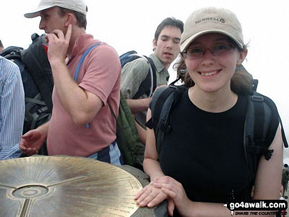
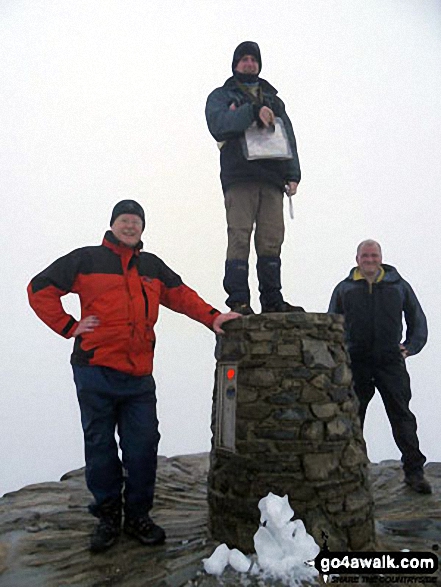
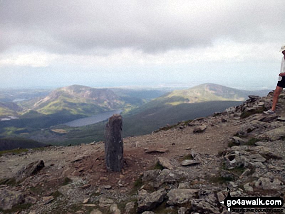
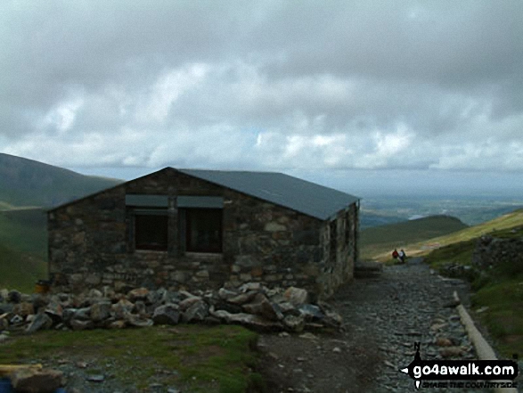
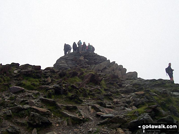
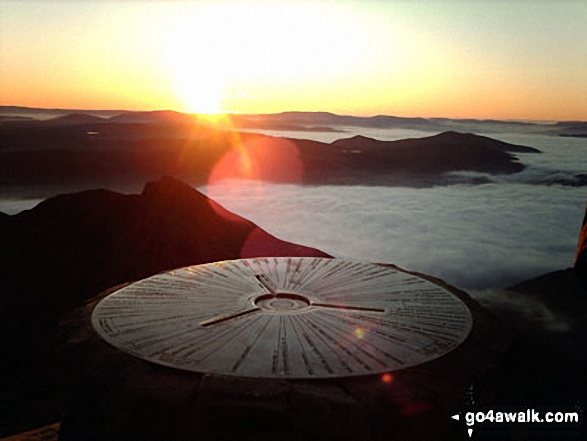
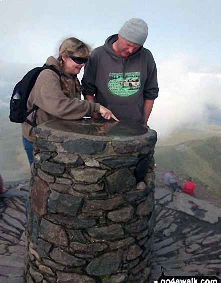
The summit of Snowdon (Yr Wyddfa) is marked by an Ordnance Survey Trig Point.

Not familiar with this top?
   |
|---|
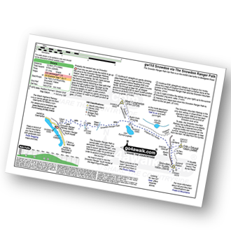
Vital Statistics:
| Length: | 6.5ml (10.5km) |
|---|---|
| Ascent: | 2,938ft (895m) |
| Time: | 5½ hrs |
| Grade: |  (Moderate) (Moderate) |
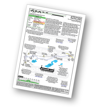
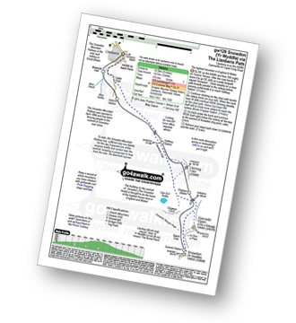
Route Summary:
Pen-y-Pass - Pyg Track - Bwlch y Moch - Miners' Track - Snowdon Mountain Railway - Snowdon (Yr Wyddfa) - Miners' Track - Pyg Track - Bwlch y Moch - Pen-y-Pass
|
|---|
Vital Statistics:
| Length: | 7ml (11km) |
|---|---|
| Ascent: | 3,805ft (1,160m) |
| Time: | 6.25hrs |
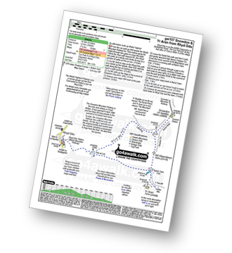
| Grade: | (Moderate) |
Route Summary:
Pen-y-Pass - Pyg Track - Bwlch y Moch - Craig Fach - Crib Goch - Garnedd Ugain (Crib y Ddysgl) - Snowdon Mountain Railway - Snowdon (Yr Wyddfa) - The Scree Path - Bwlch y Saethau - Bwlch Ciliau - Y Lliwedd - Y Lliwedd (East Top) - Lliwedd Bach - Miners' Track - Pen-y-Pass
|
|---|
Vital Statistics:
| Length: | 7.5ml (12km) |
|---|---|
| Ascent: | 3,034ft (925m) |
| Time: | 6 hrs |
| Grade: | (Moderate) |
Route Summary:
Pen-y-Pass - Pyg Track - Bwlch y Moch - Craig Fach - Miners' Track - Snowdon Mountain Railway - Snowdon (Yr Wyddfa) - Miners' Track - Glaslyn - Llyn Llydaw - Pen-y-Pass
|
|---|
Vital Statistics:
| Length: | 8ml (12km) |
|---|---|
| Ascent: | 3,131ft (954m) |
| Time: | 7.75hrs |
| Grade: | (Moderate) |
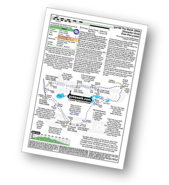
Route Summary:
Rhyd-Ddu - The Rhyd-Ddu Path - Pen Ar Lon - Bwlch Main - Snowdon (Yr Wyddfa) - Bwlch Main - Llechog (Rhydd Ddu Path) - Pen Ar Lon - The Rhyd-Ddu Path - Rhyd-Ddu,.
|
|---|
Vital Statistics:
| Length: | 7.75ml (12.5km) |
|---|---|
| Ascent: | 3,200ft (975m) |
| Time: | 6.25hrs |
| Grade: | (Moderate) |
Route Summary:
Snowdon Ranger Car Park - Snowdon Ranger Railway Station - Llwyn Onn - Maen Bras - Snowdon Ranger Path - Bwlch Cwm Brwynog - Clogwyn Du'r Arddu - Snowdon Mountain Railway - Snowdon (Yr Wyddfa) - Snowdon Ranger Path - Snowdon Ranger Car Park
|
|---|
Vital Statistics:
| Length: | 7.5ml (12km) |
|---|---|
| Ascent: | 4,100ft (1,250m) |
| Time: | 6½ hrs |
| Grade: |  (Hard) (Hard) |
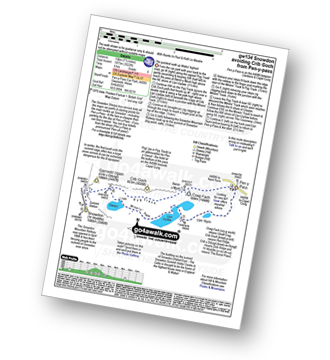
Route Summary:
Pen-y-Pass - Pyg Track - Bwlch y Moch - Craig Fach - Crib Goch - Garnedd Ugain (Crib y Ddysgl) - Snowdon Mountain Railway - Snowdon (Yr Wyddfa) - The Scree Path - Bwlch y Saethau - Bwlch Ciliau - Y Lliwedd - Y Lliwedd (East Top) - Lliwedd Bach - Gallt y Wenallt - Afon Glaslyn - Miners' Track - Pen-y-Pass
|
|---|
Vital Statistics:
| Length: | 7.75ml (12.5km) |
|---|---|
| Ascent: | 3,682ft (1,122m) |
| Time: | 6½ hrs |
| Grade: | (Hard) |
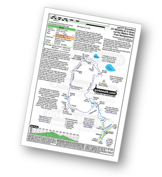
Route Summary:
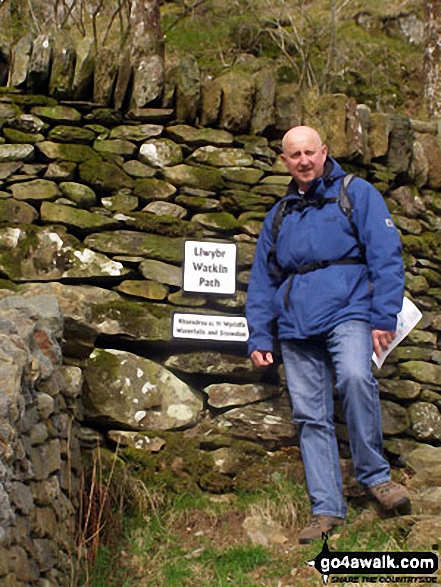
Nantgwynant - Bethania - Castell - Gladstone Rock - The Watkin Path - Bwlch Ciliau - Bwlch y Saethau - The Scree Path - Snowdon (Yr Wyddfa) - The Scree Path - Bwlch y Saethau - Bwlch Ciliau - The Watkin Path - Gladstone Rock - Castell - Bethania - Nantgwynant
|
|---|
Vital Statistics:
| Length: | 9ml (14.5km) |
|---|---|
| Ascent: | 3,982ft (1,214m) |
| Time: | 7½ hrs |
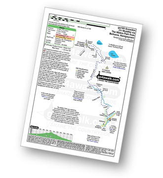
| Grade: | (Hard) |
Route Summary:
Rhyd-Ddu - Rhyd-Ddu Path - Pen Ar Lon - Bwlch Main - Snowdon (Yr Wyddfa) - Allt Maenderyn - Bwlch Cwm Llan - Yr Aran - Pen Ar Lon - Rhyd-Ddu
|
|---|
Vital Statistics:
| Length: | 9.5ml (14.5km) |
|---|---|
| Ascent: | 4,517ft (1,377m) |
| Time: | 8 hrs |
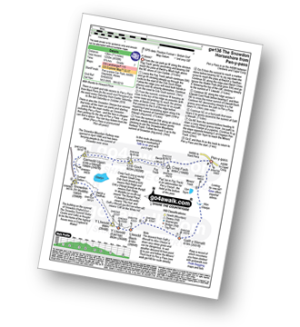
| Grade: | (Hard) |
Route Summary:
Nantgwynant - Bethania - Castell - Gladstone Rock - The Watkin Path - Bwlch Ciliau - Bwlch y Saethau - The Scree Path - Snowdon (Yr Wyddfa) - Rydd Ddu Path - Clogwyn Du - Allt Maenderyn - Yr Aran - Clogwyn Birth - Nantgwynant
|
|---|
Vital Statistics:
| Length: | 9ml (14.5km) |
|---|---|
| Ascent: | 3,344ft (1,019m) |
| Time: | 6.75hrs |
| Grade: | (Hard) |
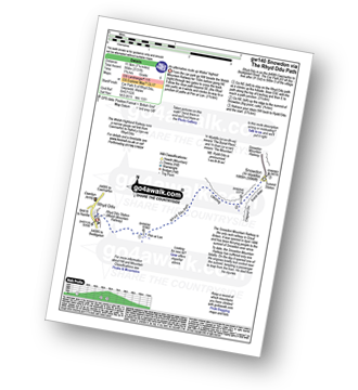
Route Summary:
Snowdon Mountain Railway Llanberis Station - Cader Ellyll - Llanberis Path - Halfway Station - Clogwyn Station - Bwlch Glas - Snowdon (Yr Wyddfa) - Bwlch Glas - Clogwyn Station - Halfway Station - Llanberis Path - Cader Ellyll - Llanberis.
|
|---|
Vital Statistics:
| Length: | 11.5ml (18.5km) |
|---|---|
| Ascent: | 4,179ft (1,346m) |
| Time: | 8.75hrs |
| Grade: |  (Hard) (Hard) |
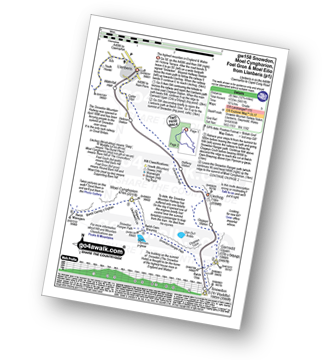
Route Summary:
Snowdon Mountain Railway Llanberis Station - Cader Ellyll - Llanberis Path - Halfway Station - Llechog (Llanberis Path) - Clogwyn Station - Garnedd Ugain (Crib y Ddysgl) - Bwlch Glas - Snowdon (Yr Wyddfa) - Clogwyn Du'r Arddu Path - Snowdon Ranger Path - Moel Cynghorion - Bwlch Maesgwm - Llanberis.
|
|---|
Vital Statistics:
| Length: | 13.25ml (21km) |
|---|---|
| Ascent: | 5,651ft (1,723m) |
| Time: | 10½ hrs |
| Grade: |  (Very Hard) (Very Hard) |
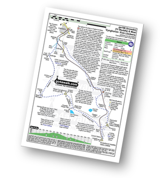
Route Summary:
Snowdon Mountain Railway Llanberis Station - Cader Ellyll - Llanberis Path - Halfway Station - Llechog (Llanberis Path) - Clogwyn Station - Garnedd Ugain (Crib y Ddysgl) - Bwlch Glas - Snowdon (Yr Wyddfa) - Clogwyn Du'r Arddu Path - Snowdon Ranger Path - Moel Cynghorion - Bwlch Maesgwm - Foel Goch (Snowdon) - Foel Gron - Moel Eilio (Llanberis) - Llanberis.
See Snowdon (Yr Wyddfa) and the surrounding tops on our free-to-access 'Google Style' Peak Bagging Maps:
The Snowdon Area of Snowdonia National Park
Less data - quicker to download
The Whole of Snowdonia National Park
More data - might take a little longer to download
See Snowdon (Yr Wyddfa) and the surrounding tops on our downloadable Peak Bagging Map in PDF format:

NB: Whether you print off a copy or download it to your phone, this PDF Peak Baggers' Map might prove incredibly useful when your are up there on the tops and you cannot get a phone signal.
You can find Snowdon (Yr Wyddfa) & all the walks that climb it on these unique free-to-access Interactive Walk Planning Maps:
1:25,000 scale OS Explorer Map (orange/yellow covers):
1:50,000 scale OS Landranger Map (pink/magenta covers):
 Fellow go4awalkers who have already walked, climbed, summited & bagged Snowdon (Yr Wyddfa)
Sarah Culverhouse walked up Snowdon (Yr Wyddfa) on July 18th, 2024 [weather] glorious sunshine
Iain Jones climbed Snowdon (Yr Wyddfa) on April 3rd, 2010 [from/via/route] Llanberris [with] Ben's Stag Do - 12 August 2012 - walked from Llanberris as part of National Three Peaks Challenge; 17 January 2016 - walked from Pen y Pass via Pyg Track/Miners Track; 1 April 2017 - walked from Nant Gywnant via Watkin Path; 6 October 2021 - Trail Run from Pen y Pass to Llanberis via Miners Track & Llanberis Path; 7 March 2025 - walked via Snowdon Ranger Path
Hazel Gilbert bagged Snowdon (Yr Wyddfa) on August 13th, 1989 [with] Lawrence Laura Abigail [weather] Sunny
David Peebles hiked Snowdon (Yr Wyddfa) on February 27th, 2023 [from/via/route] Pen-y-pass Carpark [with] Solo [weather] Poor Weather. Cold at top.
Darren Mortimer summited Snowdon (Yr Wyddfa) on August 17th, 2023 [from/via/route] gw110 via the Ranger path [with] Son,Daughter in law and grandkids [weather] Warm & sunny. - I have been told by many this is the easy way up. Not too bothered seeing as im getting on in years.
Daniel Moran conquered Snowdon (Yr Wyddfa) on January 25th, 1992 [from/via/route] lanberris [with] dad [weather] sunny - wearing a sandy liverpool top
Esther Nagle scaled Snowdon (Yr Wyddfa) on August 15th, 2008 [from/via/route] Youth Hostel [with] Mum, Liam and Jill [weather] wet, misty, no view from the top - I had broken/sprained my arm walking home from the pub, & had my arm in a sling 🤣
hannah1507 walked up Snowdon (Yr Wyddfa) on April 22nd, 2023 [from/via/route] Up Miners Track Down Pyg Track [with] OAG Adventure Girls
Tony Anderton climbed Snowdon (Yr Wyddfa) on March 23rd, 2022 [from/via/route] Rhydd du [with] Trudy [weather] Excellent! - First time clear in a longtime.
Neil Heywood bagged Snowdon (Yr Wyddfa) on August 23rd, 2022 [from/via/route] Llanberis [with] logan Heywood [weather] Mixed
To add (or remove) your name and experiences on this page - Log On and edit your Personal Mountain Bagging Record
. . . [see more walk reports]
More Photographs & Pictures of views from, on or of Snowdon (Yr Wyddfa)

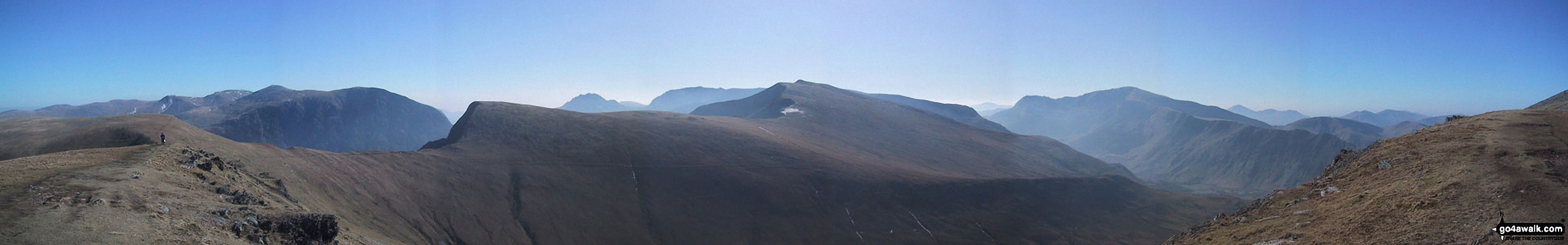
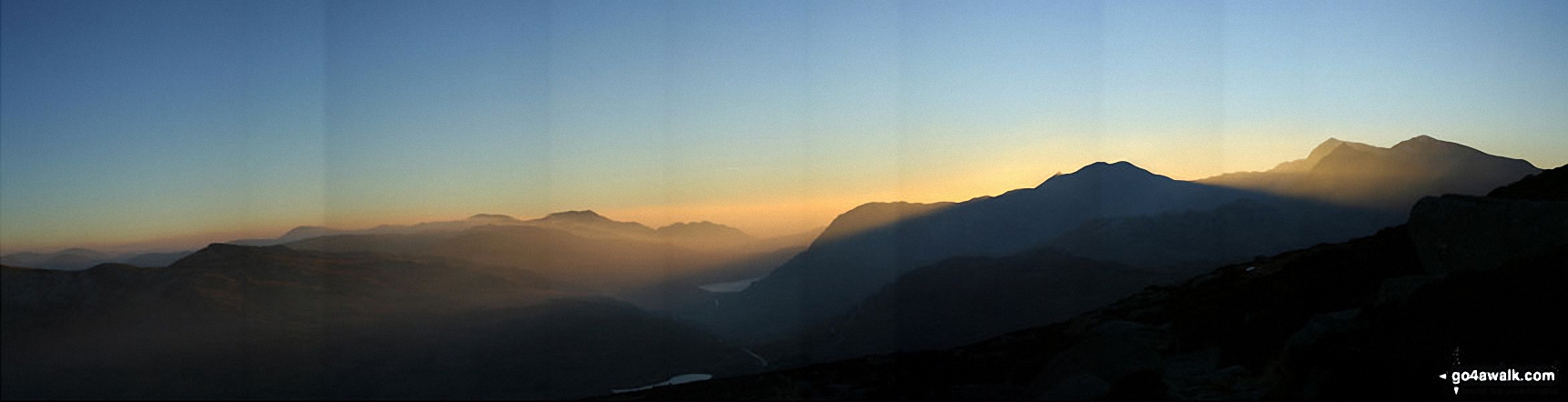
360 degree view from Moel Penamnen summit featuring (from left to right): The Moelwyns - Moelwyn Bach, Craigysgafn & Moelwyn Mawr, Allt-fawr, Moel Druman & Ysgafell Wen, Moel Farlwyd (foreground above/left of blue lake), Yr Aran (pointed peak above Moel Farlwyd), Mount Snowdon (Yr Wyddfa) & Y Lliwedd, The Glyderau - Glyder Fach, Glyder Fawr & Tryfan, Carnedd Moel Siabod, Y Ro Wen, Foel-fras (Moelwyns), Manod Mawr (above two light blue lakes) and The Arenigs - Arenig Fawr & Arenig Fach.
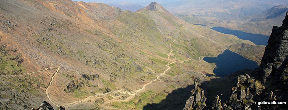
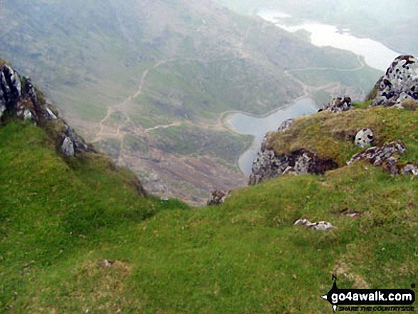
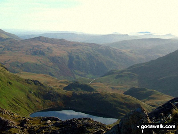
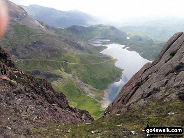
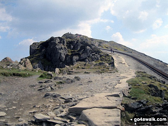
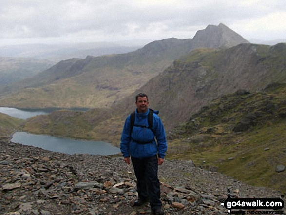
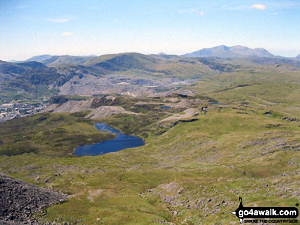
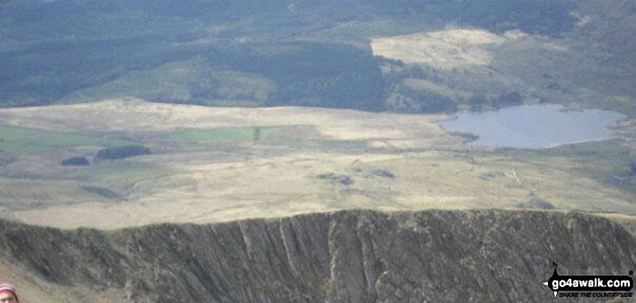
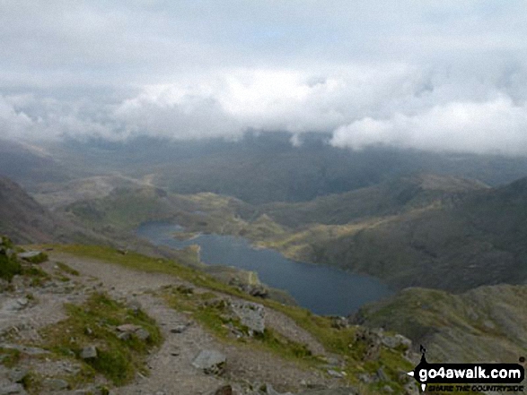
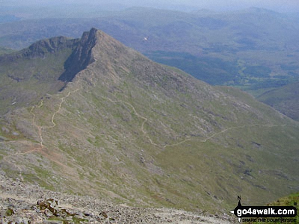
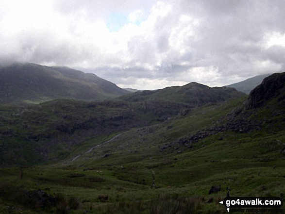
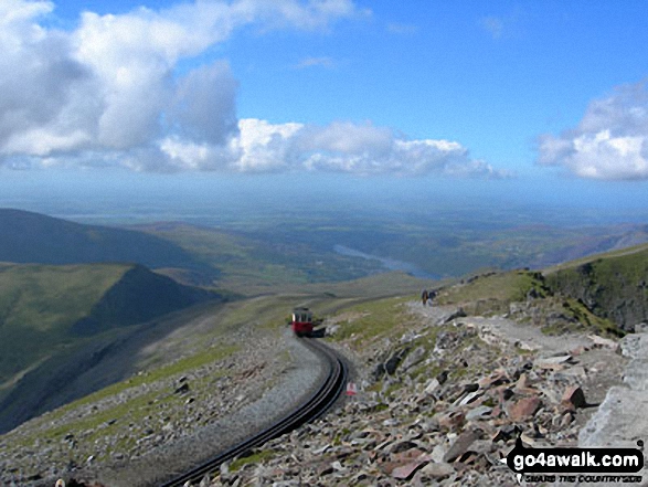
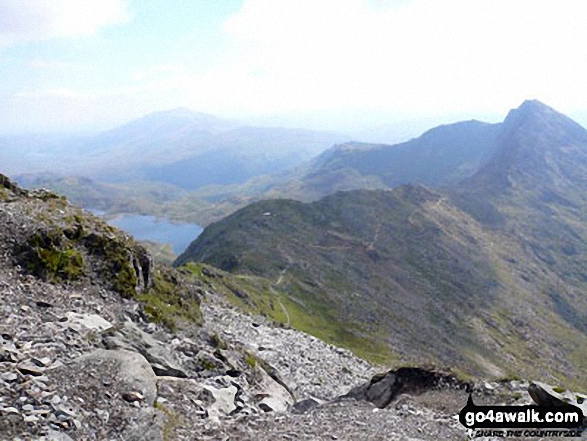
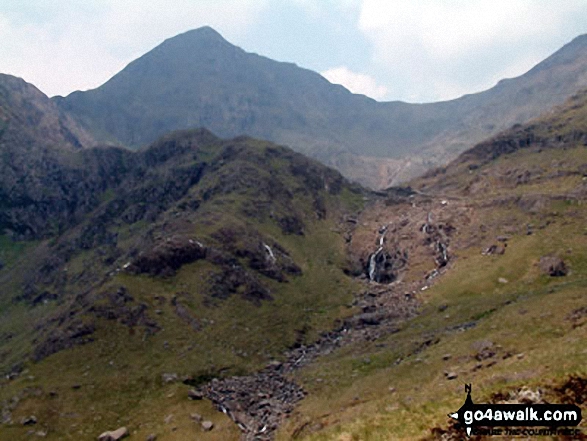
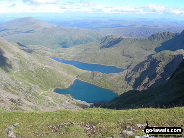
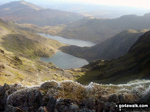
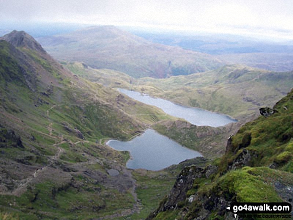
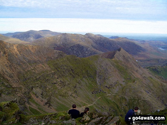
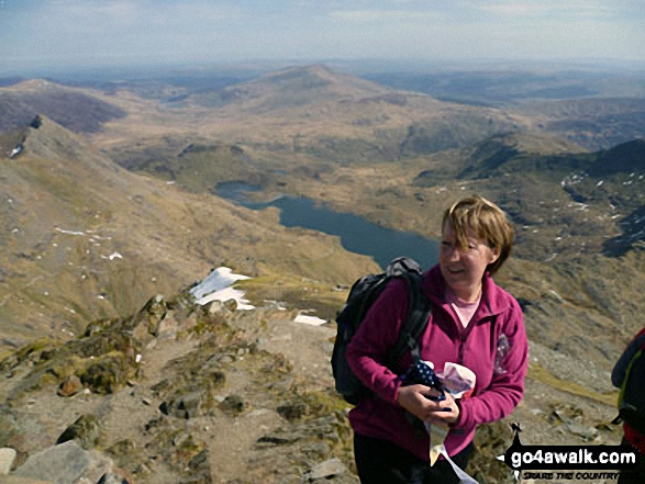
The PYG Track and The Miners' Track, Craig Fach, Llyn Llydaw (top) and Glaslyn (bottom) from Snowdon (Yr Wyddfa)
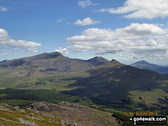
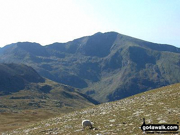
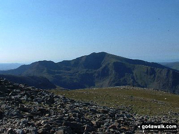
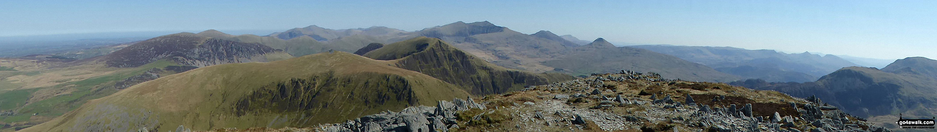
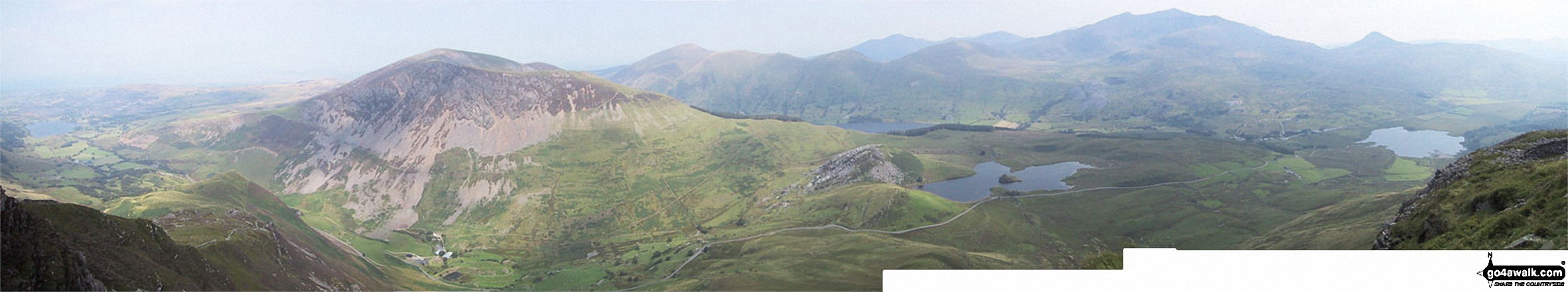
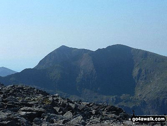
The Snowdon Massif - featuring Garnedd Ugain (Crib y Ddysgl), Snowdon (Yr Wyddfa), Bwlch Main, Llechog (Llanberis Path), Clogwyn Du and Y Lliwedd from Y Garn (Moel Hebog) with Llyn y Dywarchen and Rhyd Ddu in the valley below
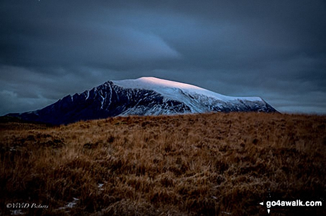
Moel Penamnen summit with Mount Snowdon (Yr Wyddfa) (left) and The Glyderau (Glyder Fach & Glyder Fawr) on the horizon
On the summit of Y Garn (Moel Hebog) with the Snowdon (Yr Wyddfa) group in the background
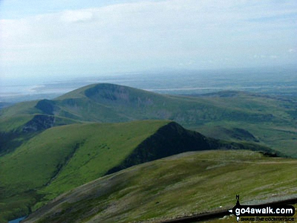
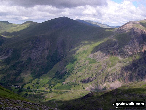
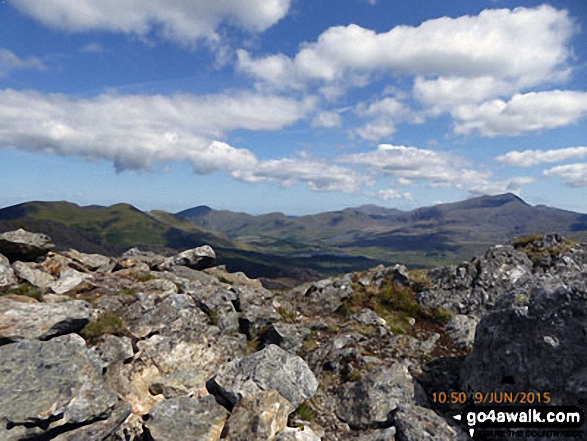
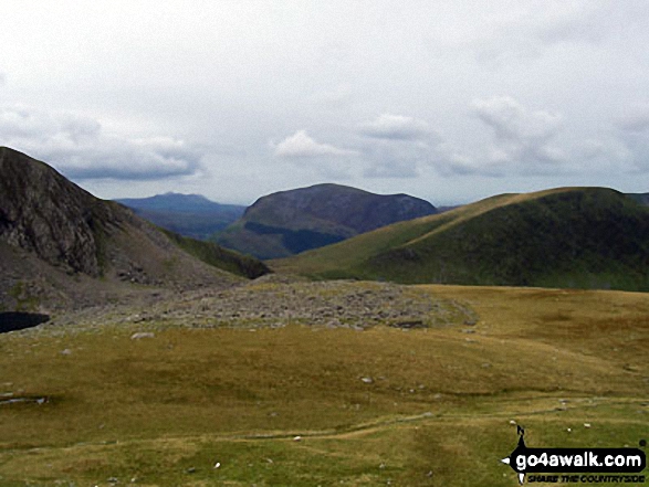
Cefn-Du, Moel Eilio (Llanberis), Foel Gron, Foel Goch and Moel Cynghorion from Snowdon (Yr Wyddfa)
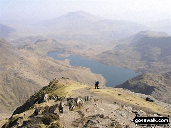
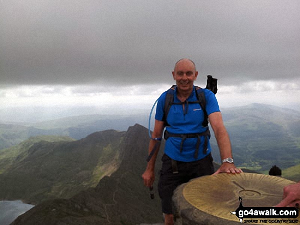
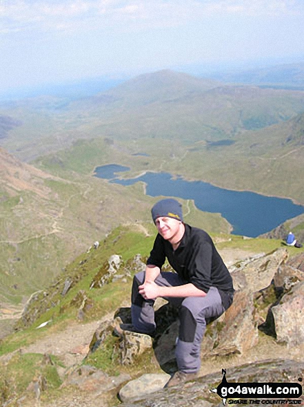
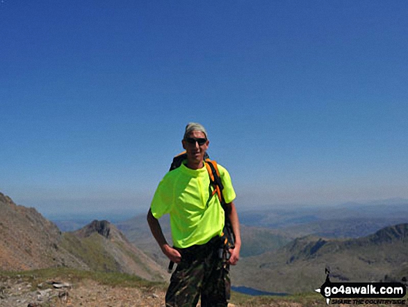
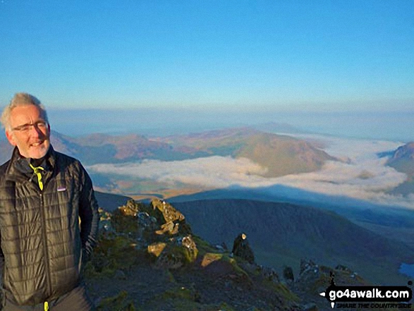
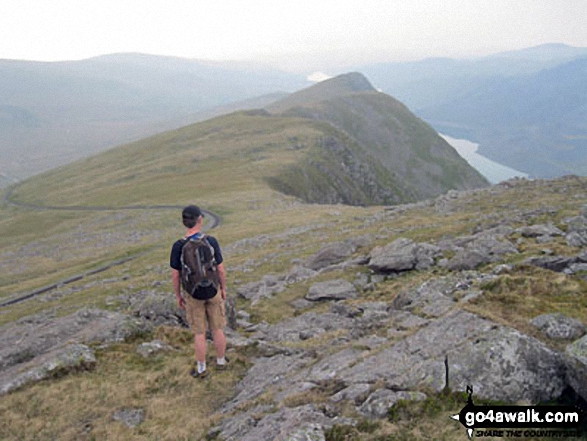
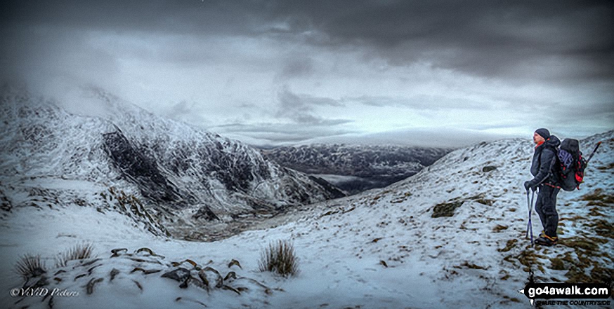
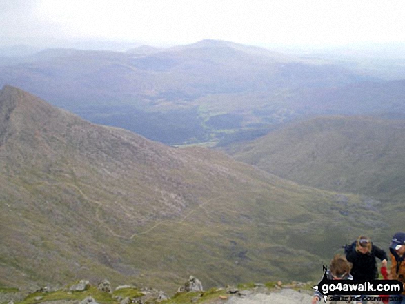
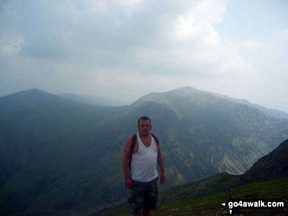
Homeward Bound from the summit of Snowdon (Yr Wyddfa) via the South Ridge
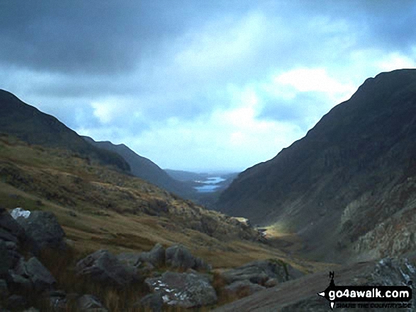
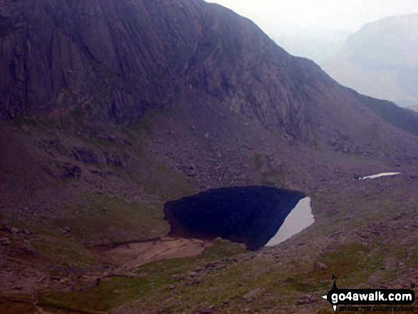
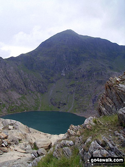
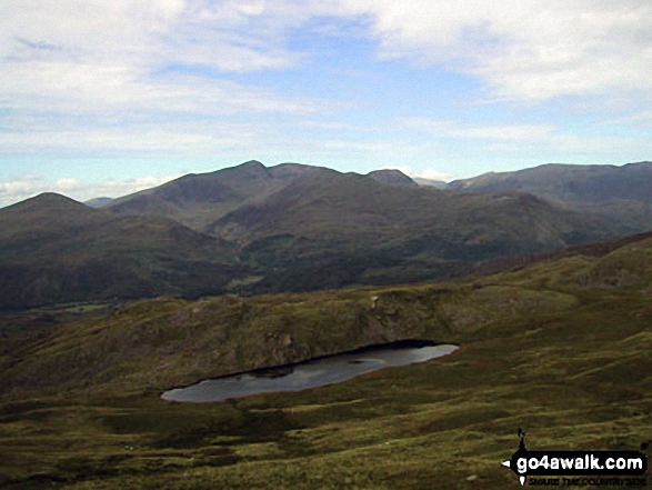
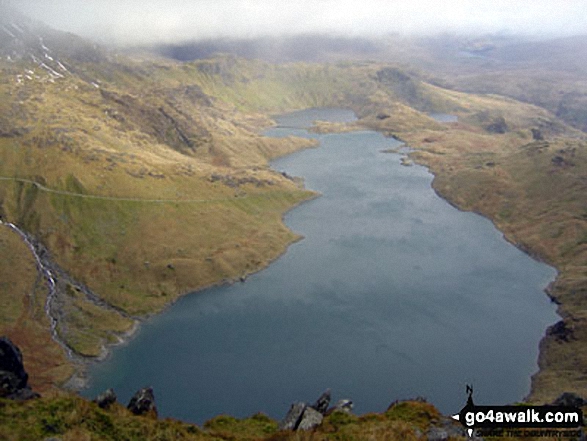
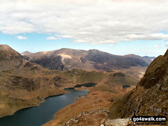
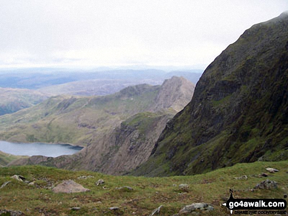
Llyn Llydaw from a gap in the crags near Bwlch y Saethau on the upper slopes of Snowdon (Yr Wyddfa)
Moel Eilio (left), Foel Gron, Moel Cynghorion and Snowdon (Yr Wyddfa) from Moel Yr Ogof
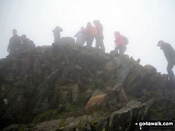
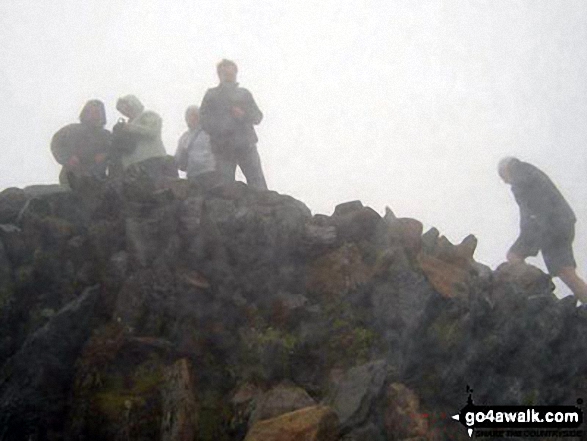
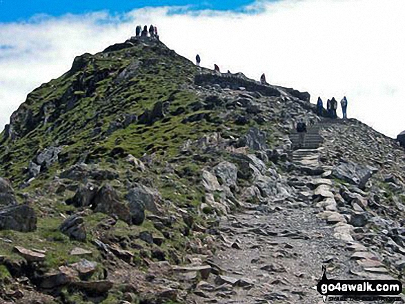
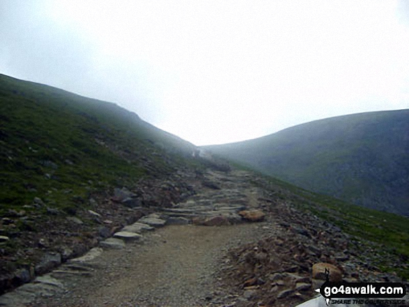
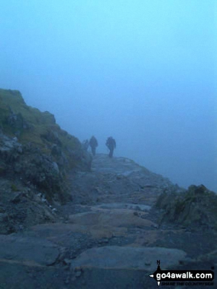
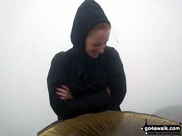
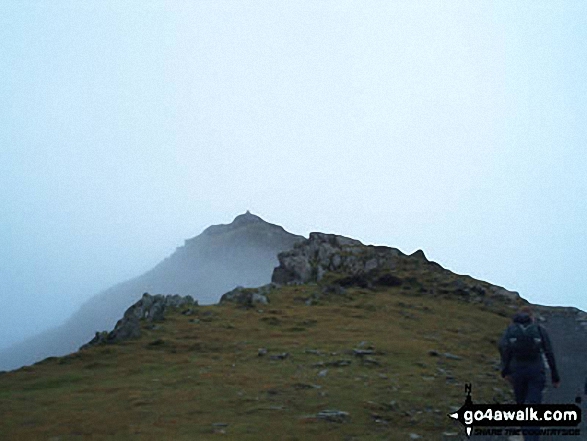
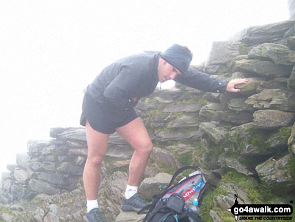
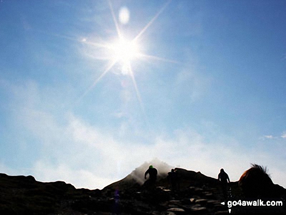
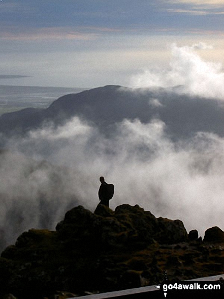
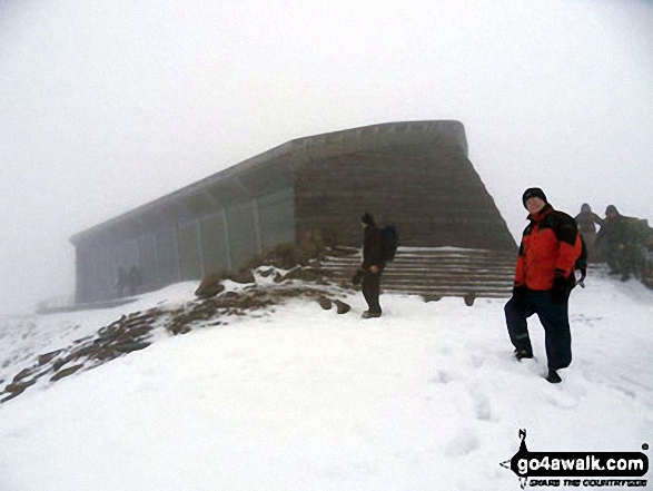
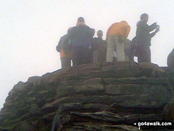
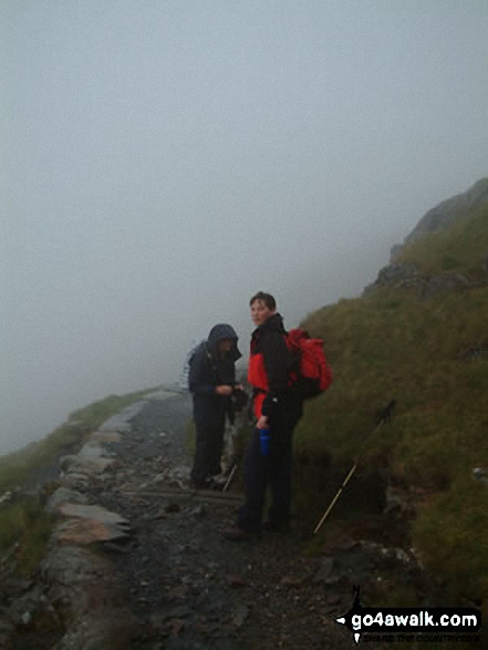
This is a pic of my boyfriend mounting the steps to the summit of Snowdon in rather foggy conditions!
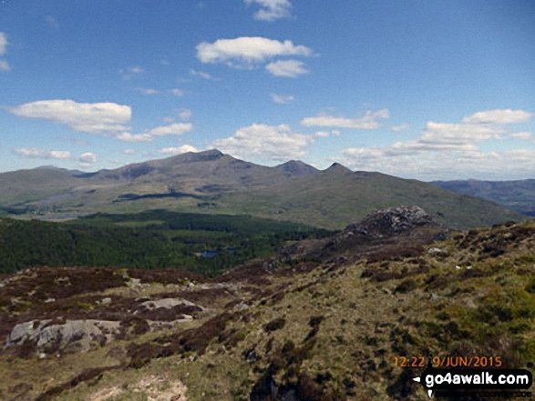
Llyn-y-Gader with Garnedd Ugain (Crib y Ddysgl), Snowdon (Yr Wyddfa), Y Lliwedd & Yr Aran (right) from Beddgelert Forest near Cwm Marchnad
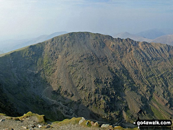
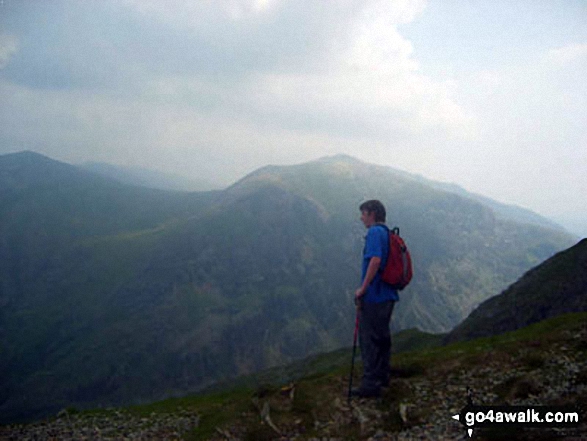
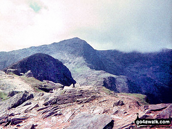
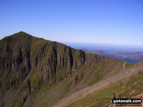
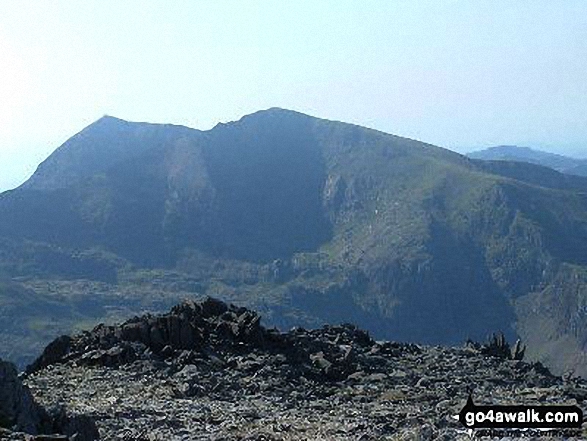
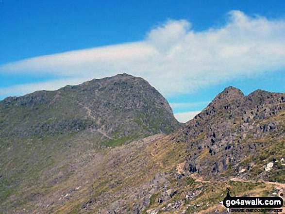
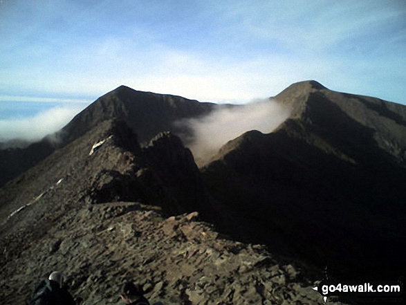
Garnedd Ugain (Crib y Ddysgl) - The 2nd highest mountain in England and Wales from the highest - Mount Snowdon (Yr Wyddfa)
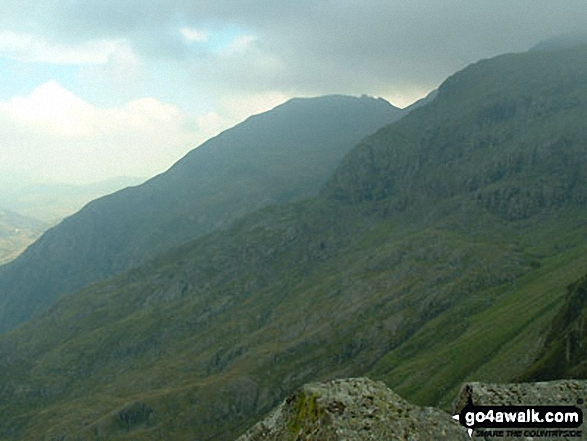
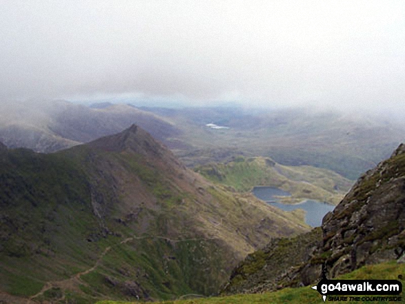
On the way up Snowdon (Yr Wyddfa) on the PYG track with Cribau and Y Lliwedd prominent in the background
Llyn Du-bach & Maen-offeren Quarry (foreground) with Allt-fawr, Moel Druman, Ysgafel Wen in the distance and Yr Aran, Mount Snowdon (Yr Wyddfa) and Y Lliwedd on the horizon from the summit of Manod Mawr (North Top)
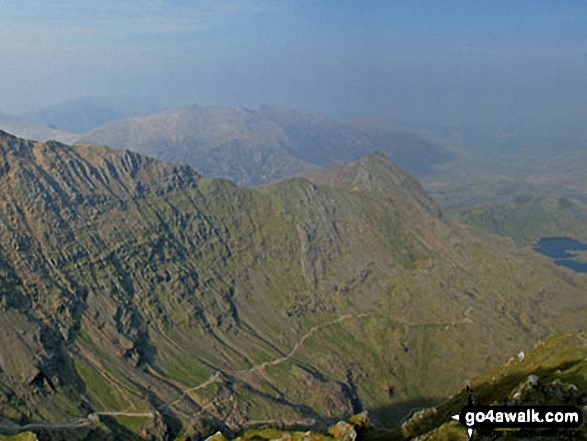
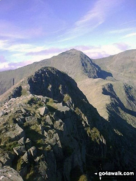
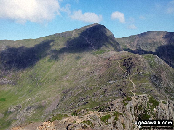
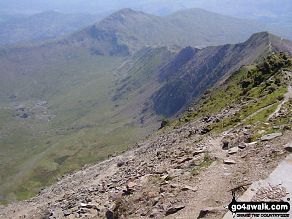
Crib Goch, Craig Fach and The PYG Track from the summit of Mount Snowdon (Yr Wyddfa)
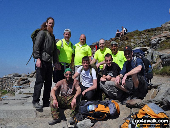
On the summit of Snowdon as part of a sponsored walk for Southmead Hospital, Bristol
Glyder Fawr from Llechog (Llanberis Path) on the way up Snowdon (Yr Wyddfa)
An unscheduled halt on Llechog (Llanberis Path) on the way up Snowdon (Yr Wyddfa)
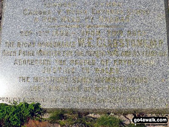
Post marking the pint where the Watkin Path joins Snowdon (Yr Wyddfa)'s South ridge above Bwlch Main - with Mynydd Mawrm Llyn Cwellyn and Moel Eilio in the distance
Snowdon (Yr Wyddfa) (left), Yr Aran and Carnedd Moel Siabod (right) from the summit of Moel Lefn
Llyn-y-Gadar (right) beyond the Rydd Ddu Path/Lechlog ridge from the summit of Mount Snowdon (Yr Wyddfa)
The Snowdon Massif - Garnedd Ugain (Crib y Ddysgl), Snowdon (Yr Wyddfa) & Y Lliwedd beyond Llyn-y-Gader from Cwm Marchnad at the northern edge of Beddgelert Forest
Mynydd Mawr (Llyn Cwellyn), Y Garn (Moel Hebog), The Nantlle Ridge and Mynydd Drws-y-coed from Trum y Ddysgl - with The Snowdon Massif (Moel Eilio (Llanberis), Foel Gron, Moel Cynghorion, Garnedd Ugain (Crib y Ddysgl), Snowdon (Yr Wyddfa), Y Lliwedd and Yr Aran) forming the backdrop
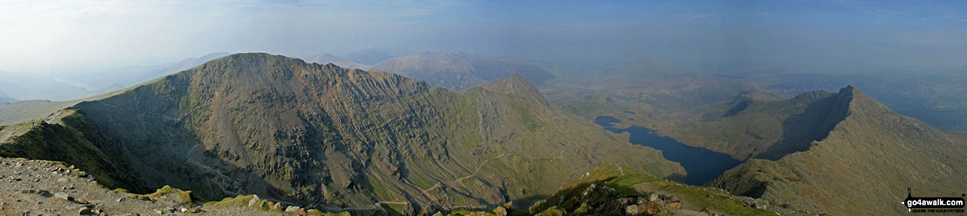
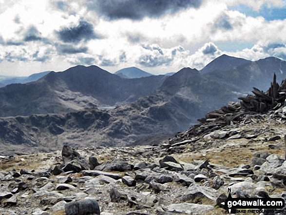
Garnedd Ugain (Crib y Ddysgl), Crib Goch, Craig Fach, The PYG Track, Llyn Llydaw and Y Lliwedd from the summit of Snowdon (Yr Wyddfa)
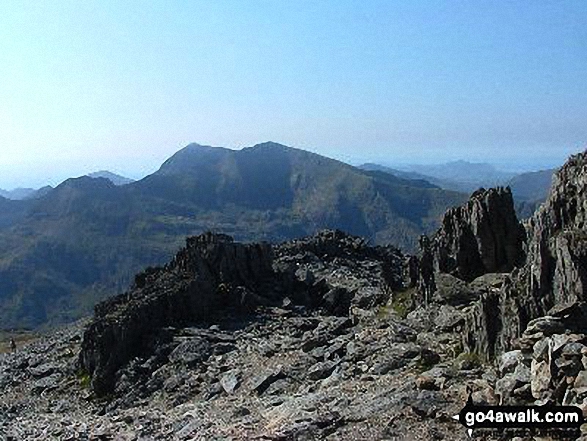
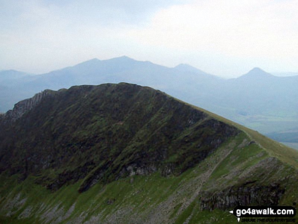
Y Lliwedd summit from Y Lliwedd (East Top) with Snowdon (Yr Wyddfa) in the distance
Garnedd Ugain (Crib y Ddysgl) and Snowdon (Yr Wyddfa) from Glyder Fawr
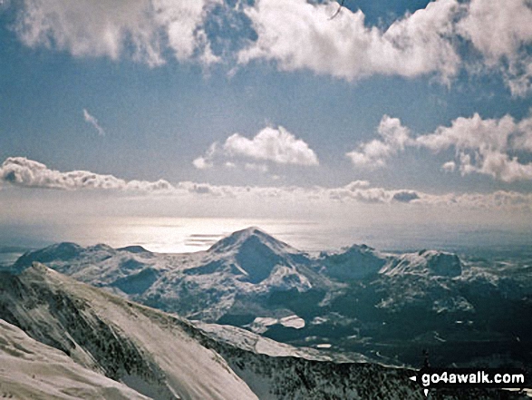
My two nephews, Paul and Nick, on Pen yr Ole Wen in the Carneddau mountains in winter. Prominent in the background is the Snowdon (Yr Wyddfa) and Y Garn (Glyderau) - standing proud in Alpine conditions.
*360 degree panorama featuring Carnedd Dafydd, Foel-Goch (foreground), Tryfan and Glyder Fach, Y Garn (foreground), Crib Goch and Snowdon (Yr Wyddfa) from the summit of Elidir Fawr
On Y Clegyr above Llyn Padarn (Llanberis) with Crib Goch, Garnedd Ugain (Crib y Ddysgl), Snowdon (Yr Wyddfa), Moel Cynghorion, Foel Goch (Snowdon), Foel Gron and Moel Eilio (Llanberis) in the background
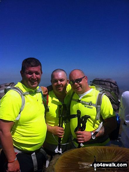
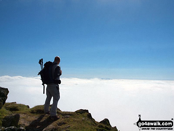
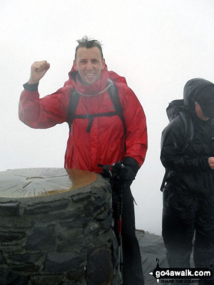
The last of the National 3 Peaks 24hr Challenge before descending to finish in 23 hours 45 minutes.
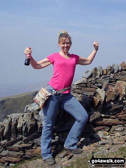
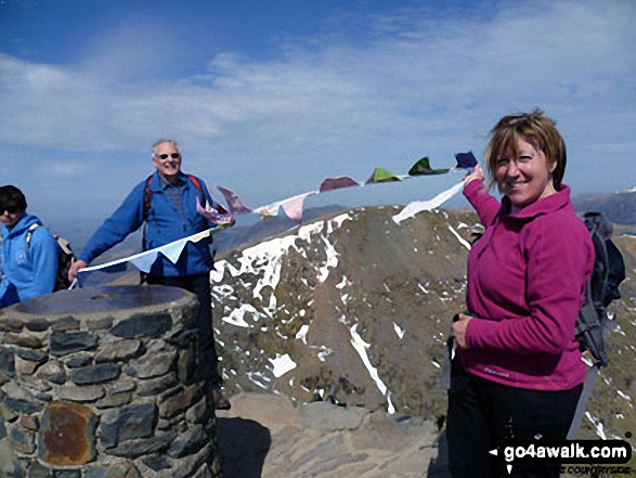
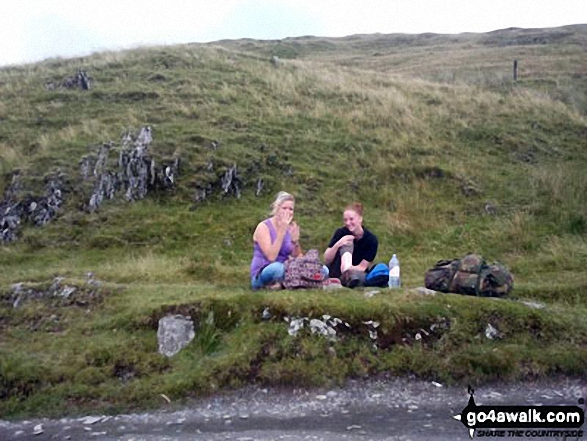
What a tight finish, just time for this photo!
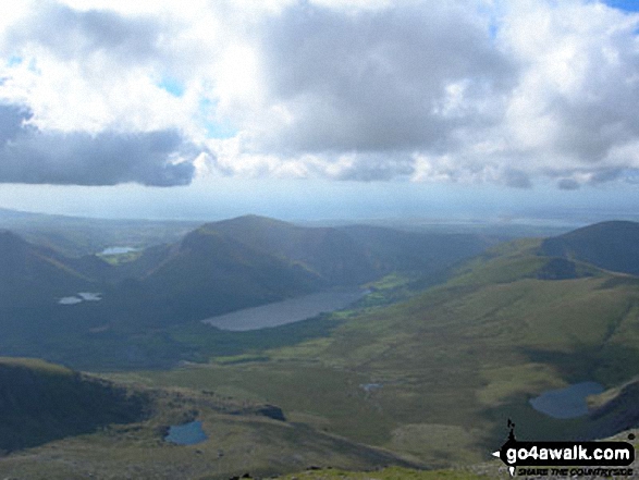
Llyn Cwellyn and Mynydd Mawr (Llyn Cwellyn) (centre left) and Moel Eilio (Llanberis) (far right) from Snowdon (Yr Wyddfa)
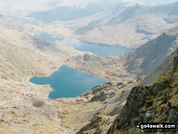
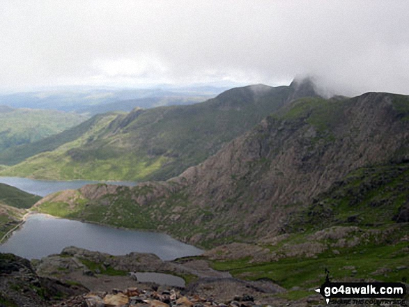
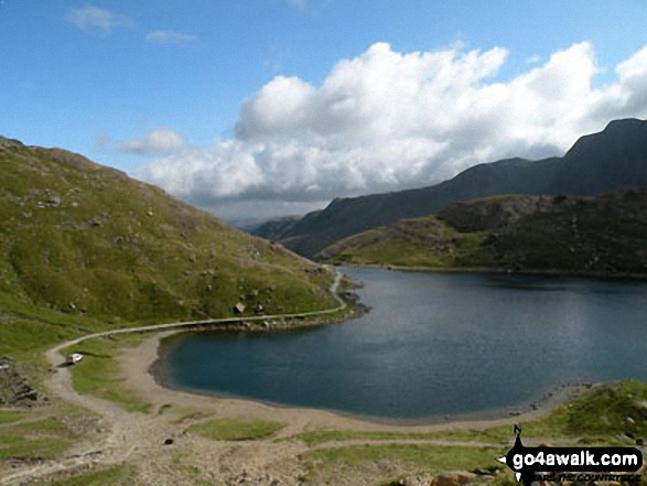
Glaslyn (bottom), Llyn Llydaw and Y Lliwedd (right) from the top of The PYG/Miners' Track, Snowdon
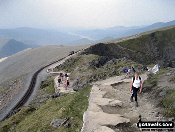
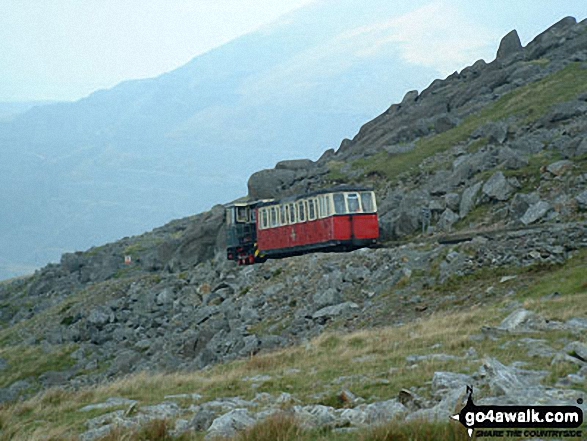
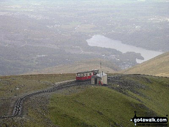
Llyn Peris, Llanberis and the Snowdon Mountain Railway from Snowdon (Yr Wyddfa)
The Watkin Path on Bwlch Ciliau and Y Lliwedd from the top of the Scree Path close to the summit of Snowdon (Yr Wyddfa)
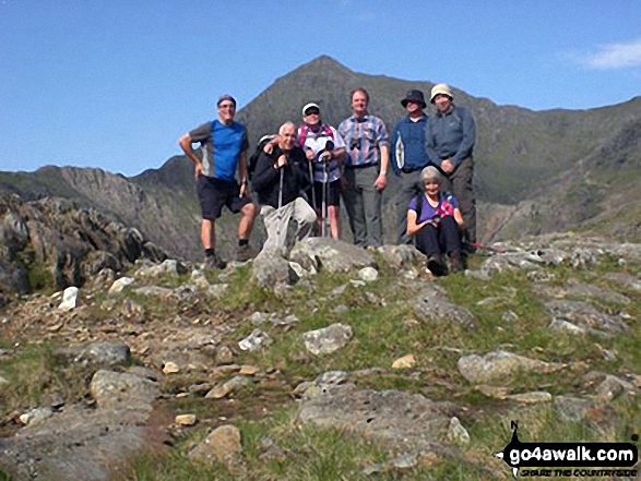
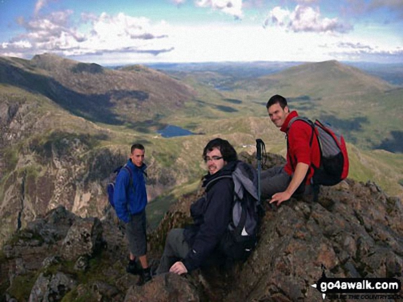
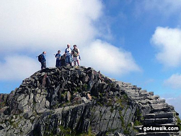
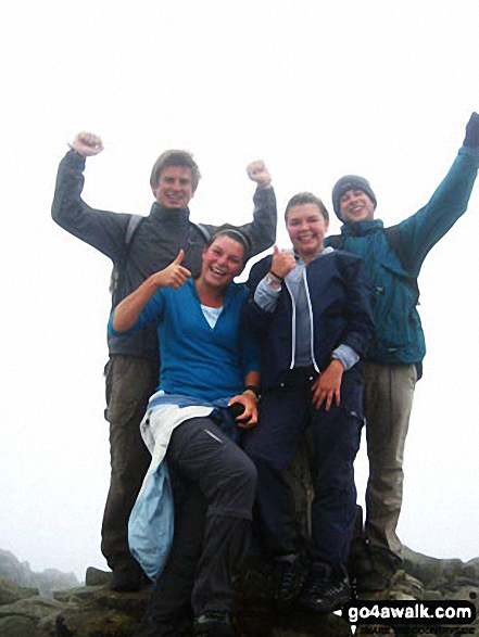
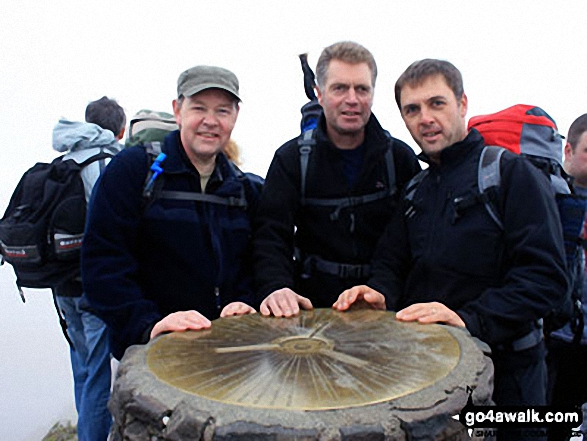
Myself, Willo, Barnsey and Mark at the top of Snowdon (Yr Wyddfa) in September!
Glaslyn (front) and Llyn Llydaw with The Pyg Track (far left) and the Miners' Track (centre left) from Snowdon (Yr Wyddfa)
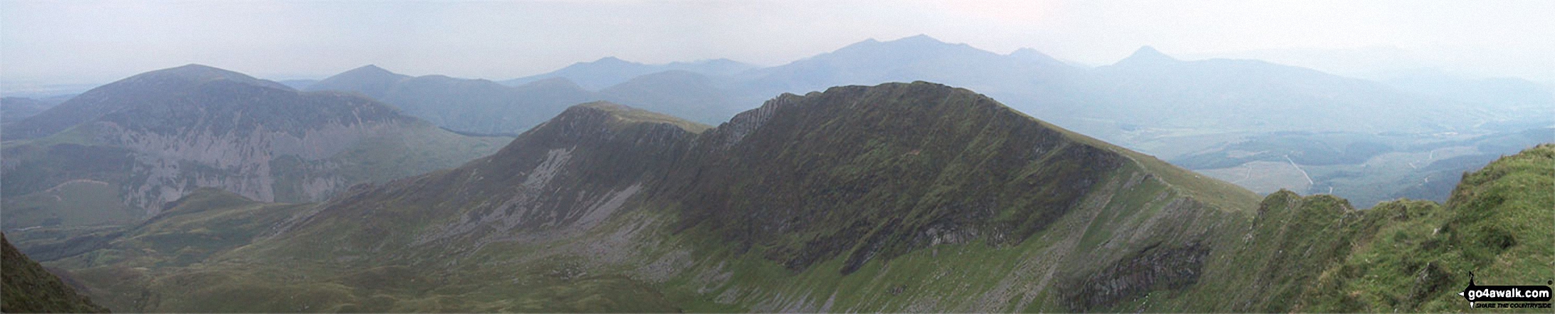
The Snowdon Horseshoe from Glyder Fach - featuring in the mid-distance: Y Lliwedd (centre left), Crib Goch (centre right), Snowdon (Yr Wyddfa) and Garnedd Ugain (Crib y Ddysgl) (far right)
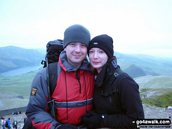
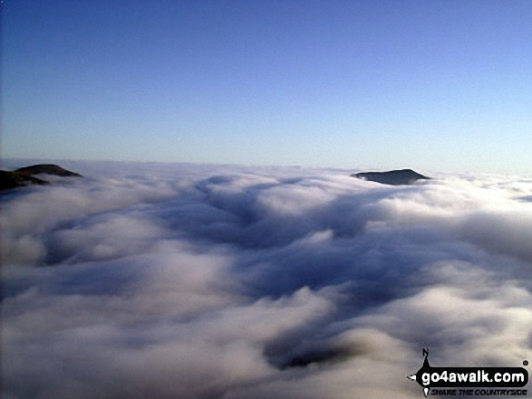
My son in law Mark waking up on the top of Snowdon with fabulous clouds down below
Mynydd Tal-y-mignedd and Mynydd Drws-y-coed (left) with Moel Eilio (in shadow), Foel Gron, Moel Cynghorion and Snowdon (Yr Wyddfa) from the cairn on the summit of Moel Yr Ogof
Andy looking along the ridge towards Llanberis from Llechog (Llanberis Path) on the down from Snowdon (Yr Wyddfa)


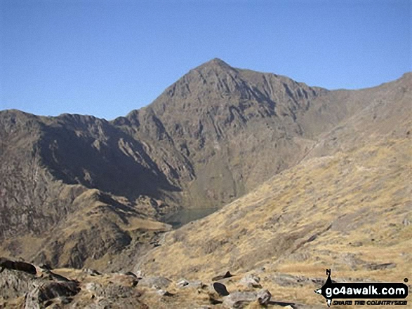
Glaslyn with the shoulder of Y Lliwedd (left) and Snowdon (Yr Wyddfa) on the right
Crib Goch (centre right) with the PYG Track (mid path) and the Miners' Track (coming up the valley) seen from the summit of Snowdon (Yr Wyddfa)
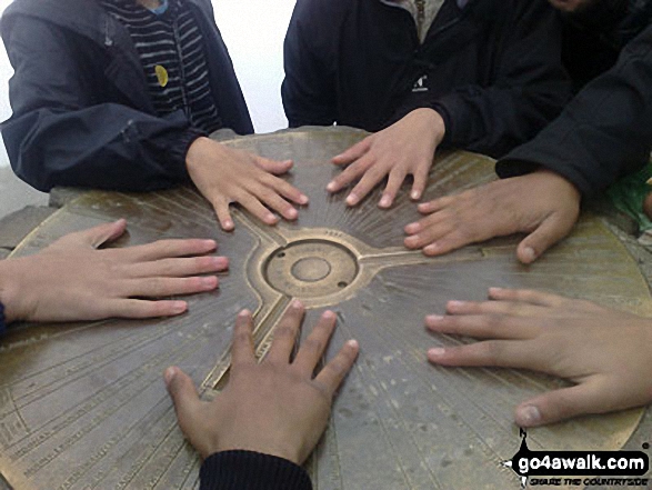
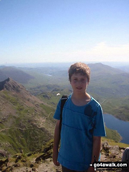
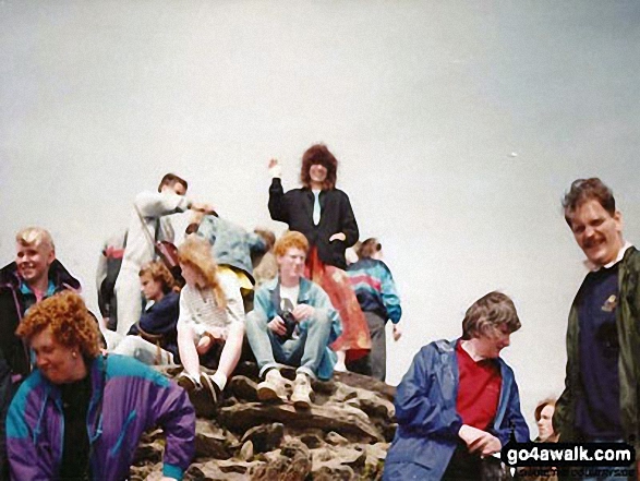
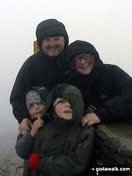
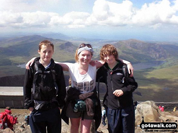
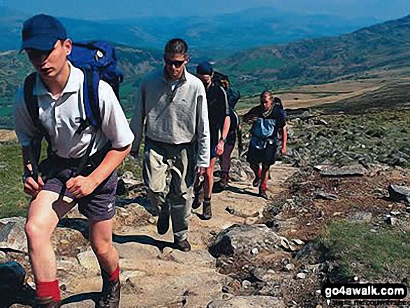
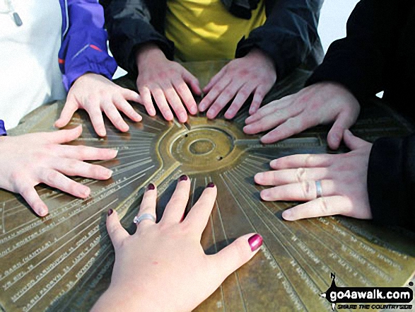
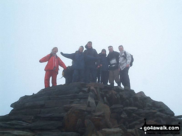
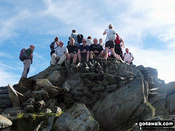
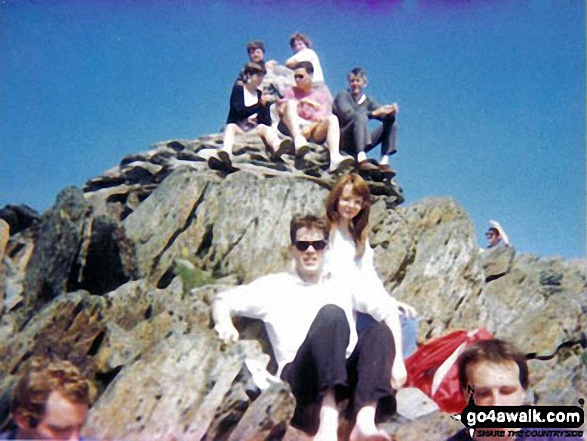
My oldest sons (14 and 15 years old) and some of their mates get hands on at the cairn, on top of Mount Snowdon after doing a charity walk.
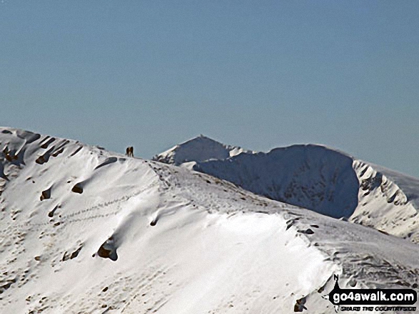
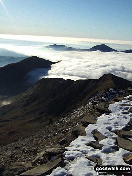
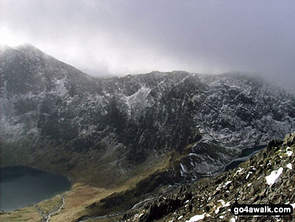
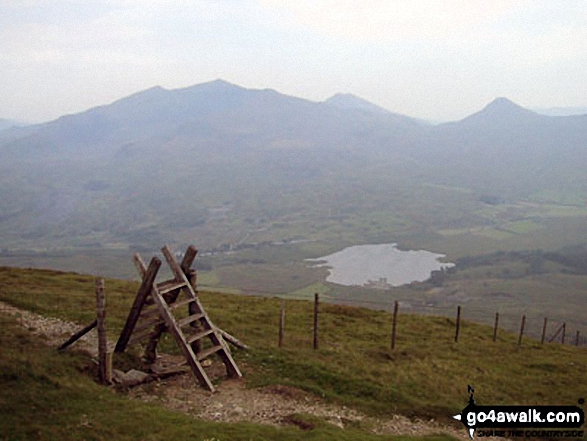
Moel Eilio rising above a temperature inversion from the Llanberis Path up Snowdon (Yr Wyddfa)
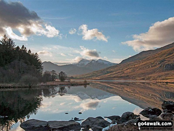
Snowdon Horseshoe reflected in Llynnau Mymbyr near Plas Y Brenin featuring Y Lliwedd (left) and Snowdon (Yr Wyddfa), Crib Goch and Garnedd Ugain (Crib y Ddysgl) (right)
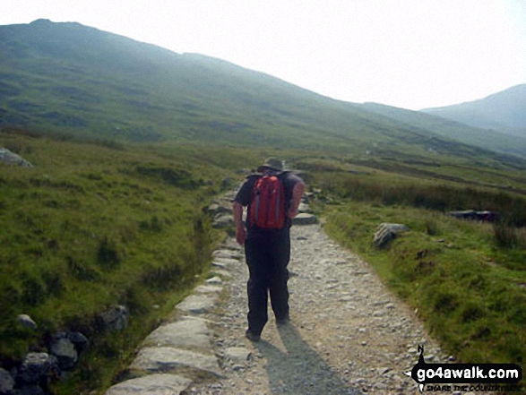
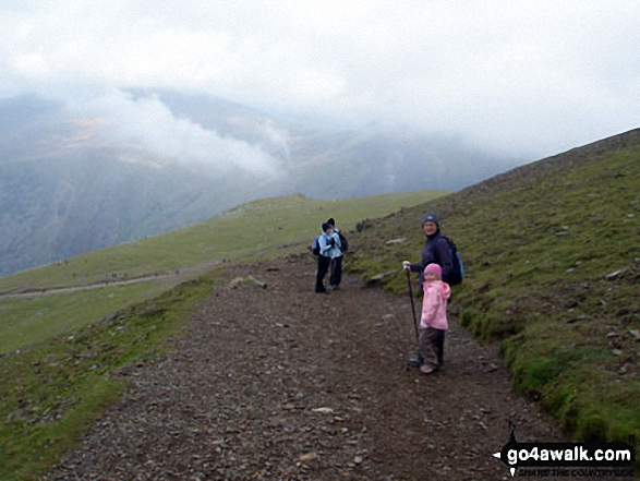
Me and my puppy Freddy, on the Llanberis Path near Halfway Station, half way up Snowdon (Yr Wyddfa)
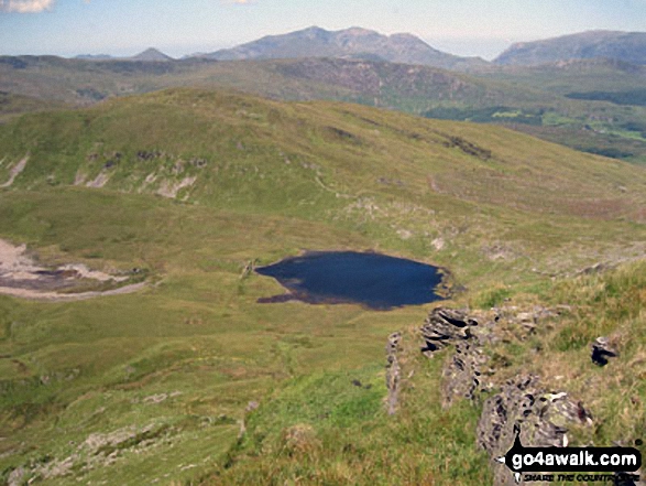
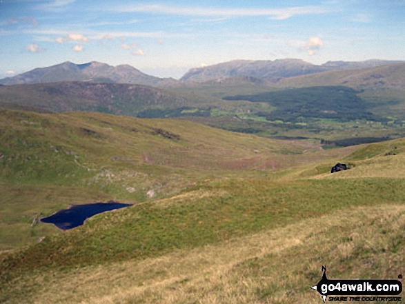
Llyn y Biswail with Snowdon (Yr Wyddfa) in the distance from the summit of Cnicht (North Top)
The Watkin Path from Bwlch Ciliau up to the summit of Snowdon (Yr Wyddfa) with Garnedd Ugain (Crib y Ddysgl) visible (far right) from Y Lliwedd
Garnedd Ugain (Crib y Ddysgl), Snowdon (Yr Wyddfa), Y Lliwedd & Yr Aran from the summit of Craig Cwm Silyn
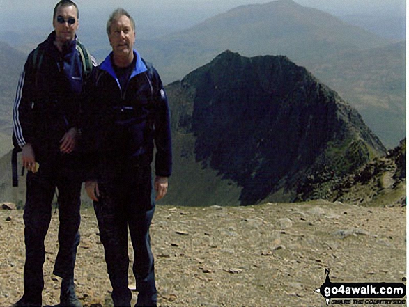
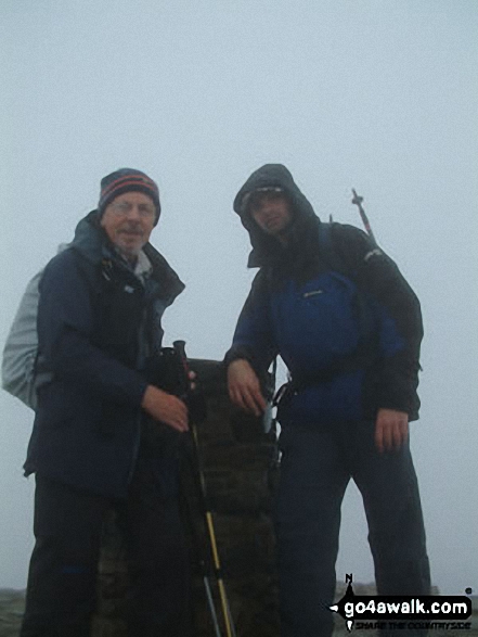
Me and my dad (Dave) on Garnedd Ugain having just climbed across Crib Goch
The view from Mount Snowdon with a touch of hoar frost on the grass making them into white ribbons
The Watkin Path, Nantgwynant and Cnicht on the horizon from the summit of Snowdon (Yr Wyddfa)
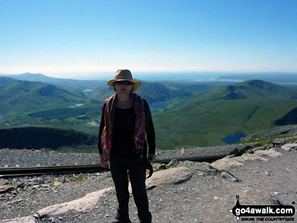
Myself in September on the final approach to Snowdon summit via the Rhyd Ddu path
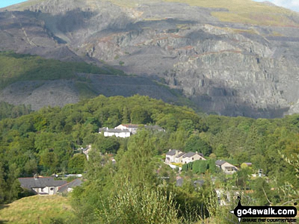
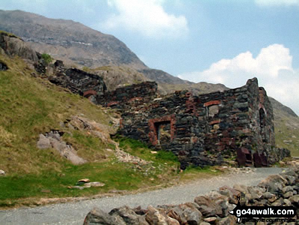
Coed Victoria (with a disused Slate Quarries beyond) from the Llanberis Path up Snowdon (Yr Wyddfa)
The final scree path up to the summit of Snowdon (Yr Wyddfa) from the Watkin Path on Bwlch Ciliau
Glaslyn, Llyn Llydaw and Y Lliwedd from the Miners' Track near the summit of Snowdon (Yr Wyddfa)
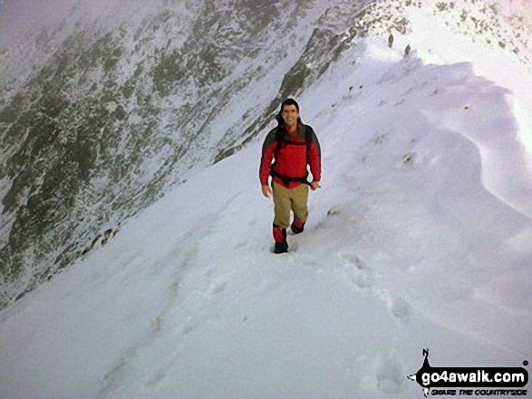
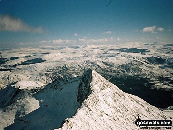
Glaslyn (bottom left) and Snowdon (Yr Wyddfa) from Crib Goch in the snow
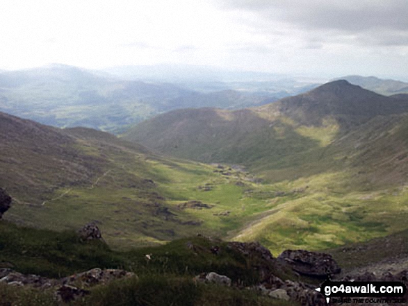
Cwm Llan and Yr Aran (right - in shadow) from Bwlch y Saethau on the upper slopes of Snowdon (Yr Wyddfa)
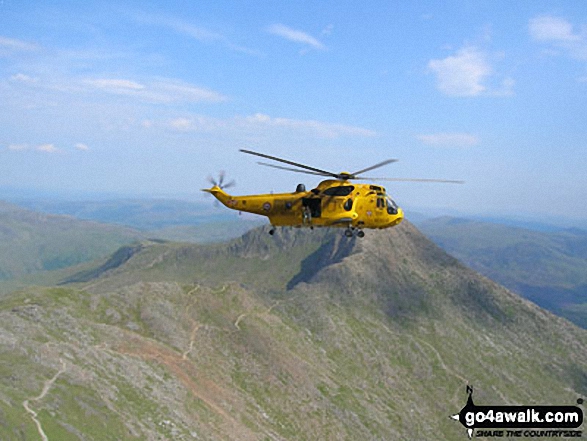
A RAF Helicopter above Y Lliwedd and the Watkin Path from Mount Snowdon (Yr Wyddfa)
Snowdon (Yr Wyddfa) (left), Yr Aran and Carnedd Moel Siabod (right) from the summit of Moel Yr Ogof
Mount Snowdon (Yr Wyddfa) & Y Lliwedd (left) and The Glyderau - Glyder Fach, Glyder Fawr & Tryfan (centre) and Carnedd Moel Siabod (right) with Moel Penamnen and Llyn Newydd & Llyn Bowydd (mid distance right) from the summit of Manod Mawr (North Top)
Mynydd Mawr (Llyn Celyn), Craig y Bera, Mynydd Tal-y-mignedd and Mynydd Drws-y-coed from the summit of Craig Cwm Silyn with Garnedd Ugain (Crib y Ddysgl), Snowdon (Yr Wyddfa), Y Lliwedd & Yr Aran on the horizon (centre) and Moel Lefn, Moel yr Ogof & Moel Hebog on the far left
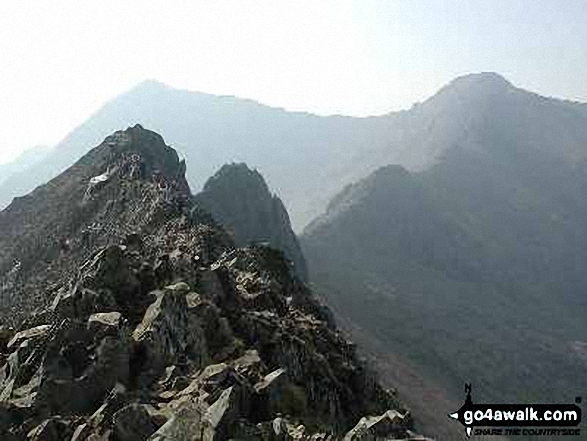
Crib Goch in all its glory with Garnedd Ugain (Crib y Ddysgl) (right) and Snowdon (Yr Wyddfa) (left) beyond from the start of Crib Goch
Llyn Nantlle Uchaf, Dyffryn Nantlle, Mynydd Mawr, Rhyd Ddu, Llyn y Dywarchen, The Snowdon Massif (Moel Eilio (Llanberis), Foel Gron, Moel Cynghorion, Garnedd Ugain (Crib y Ddysgl), Snowdon (Yr Wyddfa), Y Lliwedd and Yr Aran from Y Garn (Moel Hebog)
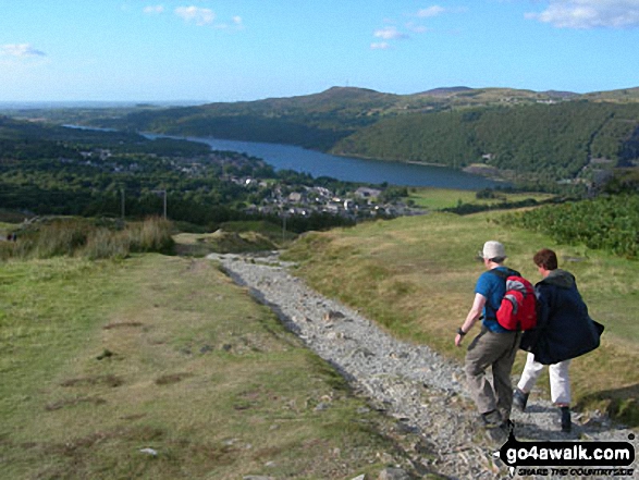
Approcahing Llanberis and Llyn Peris on the Llanberis Path up Snowdon (Yr Wyddfa)
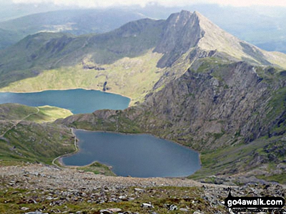
Crib Goch, PYG Track, Miners' Track, Glaslyn and Llyn Llydaw from Bwlch Glas just below the summit of Mount Snowdon (Yr Wyddfa)
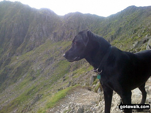
My mountain dog Degla, admiring the view (near the top of the PYG/Miners' Track) off Mount Snowdon
Crib Goch from Llechog (Llanberis Path) on the way up Snowdon (Yr Wyddfa)
Llynnau Barlwyd (foreground), Moel Farlwyd (midground left), Yr Aran (pointed peak above Moel Farlwyd), Mount Snowdon (Yr Wyddfa) & Y Lliwedd from Moel Penamnen
Glaslyn with the lower slopes of Y Lliwedd beyond from The Miners' Track below Mount Snowdon (Yr Wyddfa)
Clogwyn Du'r Arddu (left), Mynydd Mawr (centre) and Moel Cynghorion (right) from near Clogwyn Station on the Llanberis path up Mount Snowdon (Yr Wyddfa)
Snowdon (Yr Wyddfa) (left), Yr Aran and Carnedd Moel Siabod (right) from Bwlch Cwm-trwsgl
The Snowdon (Yr Wyddfa) (left) and Yr Aran (right) from Bwlch Meillionen
Crib Goch (with The PYG Track/Miners' Track running down its east flank) and Llyn Llydaw from Bwlch Glas just below the summit of Mount Snowdon (Yr Wyddfa)
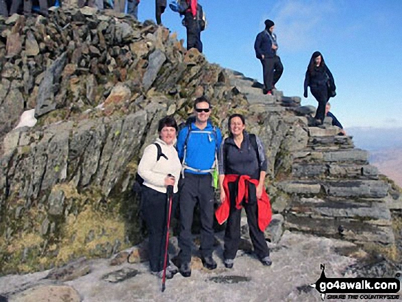
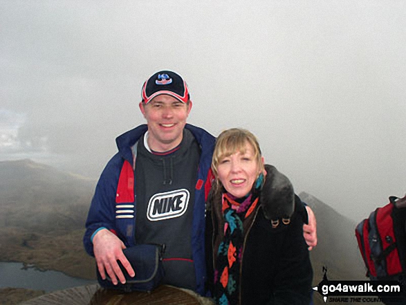
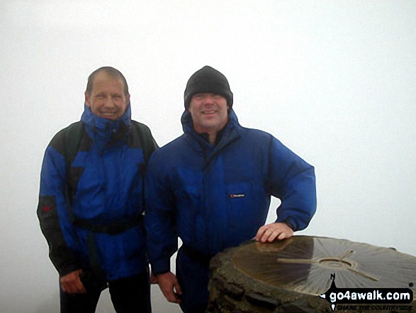
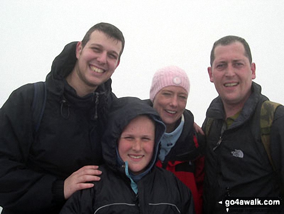
My big sister Louise and my brother-in-law Dave at the top of Snowdon last September
Mynydd Drws-y-coed & The Nantlle Ridge - with The Snowdon Massif (Garnedd Ugain (Crib y Ddysgl), Snowdon (Yr Wyddfa), Y Lliwedd and Yr Aran) beyond from Trum y Ddysgl
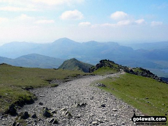
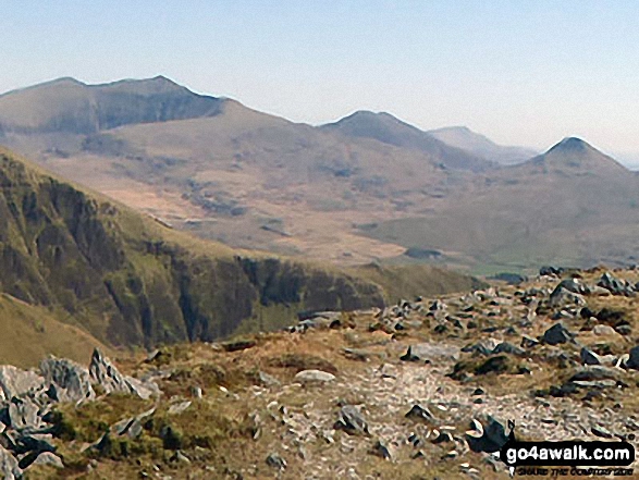
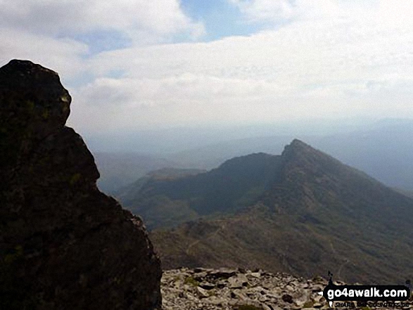
View back down the South Ridge to Yr Aran from the summit of Snowdon (Yr Wyddfa)
On the summit of Snowdon (Yr Wyddfa) with Crib Goch (left) and Llyn Llydaw (right) in the background
Sunset over Llyn Lockwood (centre bottom), Llyn Gywant, Y Lliwedd and Snowdon (Yr Wyddfa) from the Miner's Track near Glyder Fach
Glaslyn and Clogwyn y Garnedd from Bwlch Glas just below the summit of Mount Snowdon (Yr Wyddfa)
Bwlch Ciliau, Y Lliwedd Bach and Y Lliwedd from the Finger Post at top of Scree Path near the summit of Snowdon (Yr Wyddfa)
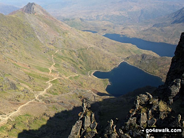
Craig Fach, Llyn Llydaw (top) and Glaslyn (bottom) from Snowdon (Yr Wyddfa)
The Snowdon Massif (Garnedd Ugain (Crib y Ddysgl), Snowdon (Yr Wyddfa), Y Lliwedd & Yr Aran) and Llyn y Dywarchen from Mynydd Drws-y-coed
Snowdon (Yr Wyddfa) and Garnedd Ugain (Crib y Ddysgl) from Glyder Fawr
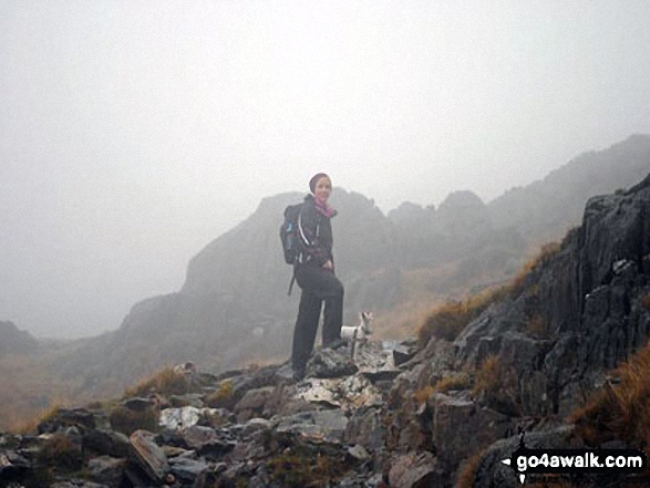
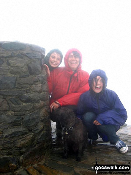
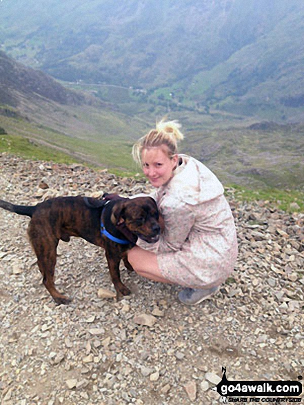
It's a bit foggy but here is a photo of me and our little hiking Jack Russell at the top of Snowdon :)
Mount Snowdon (Yr Wyddfa) & Y Lliwedd (left) and The Glyderau - Glyder Fach, Glyder Fawr & Tryfan (right) from Moel Penamnen
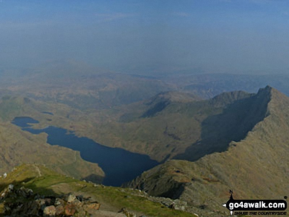
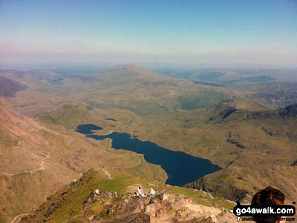
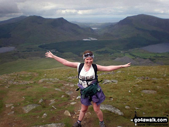
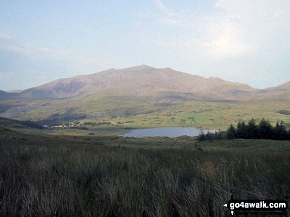
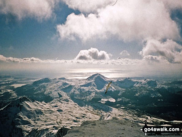
The awe inspiring view from Snowdon's summit featuring Llyn Llydaw with Carnedd Moel Siabod beyond
. . . see just 20 walk photographs & pictures of views from, on or of Snowdon (Yr Wyddfa)
Send us your photographs and pictures on, of, or from Snowdon (Yr Wyddfa)
If you would like to add your walk photographs and pictures featuring views from, on or of Snowdon (Yr Wyddfa) to this page, please send them as email attachments (configured for any computer) along with your name to:
and we shall do our best to publish them.
(Guide Resolution = 300dpi. At least = 660pixels (wide) x 440 pixels (high).)

You can also submit photos via our Facebook Page.
NB. Please indicate where each photo was taken and whether you wish us to credit your photos with a Username or your First Name/Last Name.
Not familiar with this top?


