
![]()
Llechog (Llanberis Path)
720m (2363ft)
The Snowdon Area, Snowdonia, Gwynedd, Wales

Not familiar with this top?
You can walk/hike to the top of Llechog (Llanberis Path) by using any of these 3 easy‑to‑follow route maps:
Walk gw118 Moel Cynghorion, Foel Gron and Moel Eilio from Llanberis
Superb views
   |
|---|
Vital Statistics:
| Length: | 11ml (17.5km) |
|---|---|
| Ascent: | 4,175ft (1,273m) |
| Time: | 8 hrs |
| Grade: |  (Hard) (Hard) |
Route Summary:
Snowdon Mountain Railway Llanberis Station - Cader Ellyll - Llanberis Path - Halfway Station - Llechog (Llanberis Path) - Clogwyn Station - Llyn Du'r Arrdu - Bwlch Cwm Brwynog - Moel Cynghorion - Bwlch Maesgwm - Foel Goch (Snowdon) - Foel Gron - Moel Eilio (Llanberis) - Llanberis.
Walk gw186 Garnedd Ugain, Snowdon (Yr Wyddfa) & Moel Cynghorion from Llanberis
For when climbing just Snowdon is not enough
|
|---|
Vital Statistics:
| Length: | 11.5ml (18.5km) |
|---|---|
| Ascent: | 4,179ft (1,346m) |
| Time: | 8.75hrs |
| Grade: |  (Hard) (Hard) |

Route Summary:
Snowdon Mountain Railway Llanberis Station - Cader Ellyll - Llanberis Path - Halfway Station - Llechog (Llanberis Path) - Clogwyn Station - Garnedd Ugain (Crib y Ddysgl) - Bwlch Glas - Snowdon (Yr Wyddfa) - Clogwyn Du'r Arddu Path - Snowdon Ranger Path - Moel Cynghorion - Bwlch Maesgwm - Llanberis.
Walk gw158 Garnedd Ugain, Snowdon, Moel Cynghorion, Foel Gron and Moel Eilio from Llanberis
Testing hike over Snowdon & her sisters
|
|---|
Vital Statistics:
| Length: | 13.25ml (21km) |
|---|---|
| Ascent: | 5,651ft (1,723m) |
| Time: | 10½ hrs |
| Grade: |  (Very Hard) (Very Hard) |

Route Summary:
Snowdon Mountain Railway Llanberis Station - Cader Ellyll - Llanberis Path - Halfway Station - Llechog (Llanberis Path) - Clogwyn Station - Garnedd Ugain (Crib y Ddysgl) - Bwlch Glas - Snowdon (Yr Wyddfa) - Clogwyn Du'r Arddu Path - Snowdon Ranger Path - Moel Cynghorion - Bwlch Maesgwm - Foel Goch (Snowdon) - Foel Gron - Moel Eilio (Llanberis) - Llanberis.
See Llechog (Llanberis Path) and the surrounding tops on our free-to-access 'Google Style' Peak Bagging Maps:
The Snowdon Area of Snowdonia National Park
Less data - quicker to download
The Whole of Snowdonia National Park
More data - might take a little longer to download
See Llechog (Llanberis Path) and the surrounding tops on our unique, downloadable, PDF Peak Bagging Map:

NB: Whether you print off a copy or download it to your phone, this PDF Peak Baggers' Map might prove incredibly useful when your are up there on the tops and you cannot get a phone signal.
You can find Llechog (Llanberis Path) & all the walks that climb it on these unique free-to-access Interactive Walk Planning Maps:
1:25,000 scale OS Explorer Map (orange/yellow covers):
1:50,000 scale OS Landranger Map (pink/magenta covers):
 Fellow go4awalkers who have already walked, climbed, scaled, summited, hiked & bagged Llechog (Llanberis Path)
David Peebles walked up Llechog (Llanberis Path) on February 27th, 2023 [from/via/route] LLanberis Carpark [with] Solo [weather] Poor Weather. Cold at top.
Christina Lander climbed it on September 13th, 2019 [from/via/route] Rhyd Ddu - Llechog - Snowdon - Garnedd Ugain - back down the Snowdon Ranger to Rhyd Ddu [with] Dick [weather] Sunny day
Melfyn Parry bagged it on March 2nd, 2022 [from/via/route] Started from Llanberis & followed the Llanberis Path up to gate at SH586584, then turned sharp left to ascend the the ridge, initially up Tryfan before following ridge to Llechog. Dropped down to railway line & crossed over to descend to Llyn Du'r Arddu then through Cwm Brwynog to cross stream. Followed 380m contour to go around Moel Cynghorion to Helfa Fawr & then down to Steffan's for tea & bara brith. [with] U3A [weather] Very wet & breezy in the morning. Brightened up after lunch & ended up with nice sunny spells.
Andy Buxton hiked Llechog (Llanberis Path) during August, 1990 [from/via/route] Pen-y-Pass, Crib Goch, Crib y Ddysgyl, Snowdon; down Ranger & under Cloggy. Walk bac to camp site at Cwm y Glo [with] Solo [weather] Very wet
Robert Taylor-Marriott summited on October 26th, 2011 [from/via/route] Route 36: Llechog (LG). [with] Vince Wetton and Robert Taylor-Marriott. [weather] Sunny & cloudy.
Vince Wetton conquered it on October 26th, 2011 [with] RTM
Stephen Lewis scaled it on April 16th, 2014 [from/via/route] gw126, Llanberis [with] Alone [weather] Sun, cloud & wind - Continued to summit Snowdon for fifth time
Christine Shepherd walked up Llechog (Llanberis Path) during April, 2004 [from/via/route] The Rydd-du car park [with] My daughter, Rebecca [weather] Sunny & bright but chilly. - A lovely route up Snowden away from the crowds; until you reach the summit.
Hugh Strickland and Mark Davidson have both walked, climbed & bagged Llechog (Llanberis Path).
To add (or remove) your name and experiences on this page - Log On and edit your Personal Mountain Bagging Record
More Photographs & Pictures of views from, on, or of, Llechog (Llanberis Path)

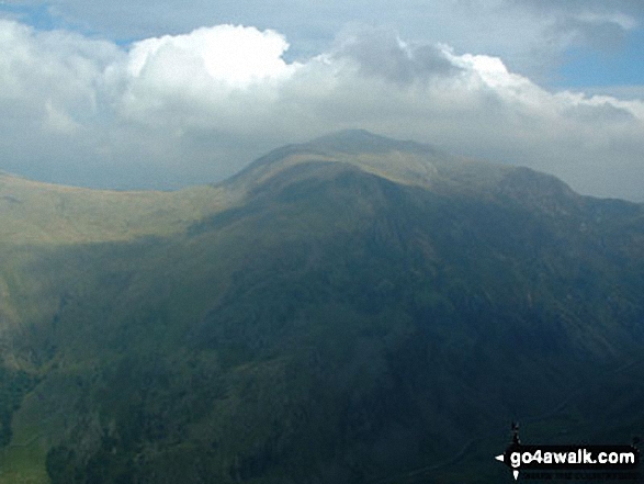
An unscheduled halt on Llechog (Llanberis Path) on the way up Snowdon (Yr Wyddfa)
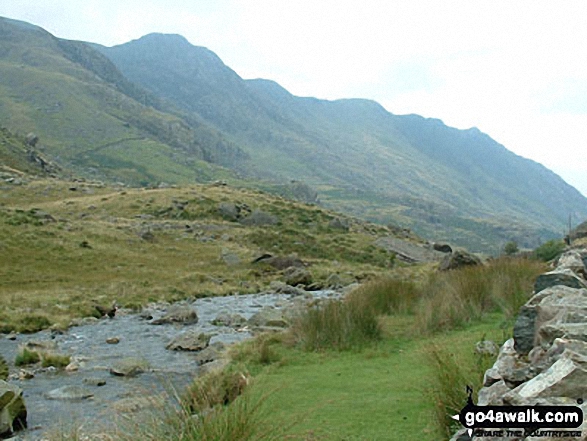
Llechog (Llanberis Path) and the lesser known Tryfan (Snowdon) from The Pass of Llanberis

Crib Goch from Llechog (Llanberis Path) on the way up Snowdon (Yr Wyddfa)
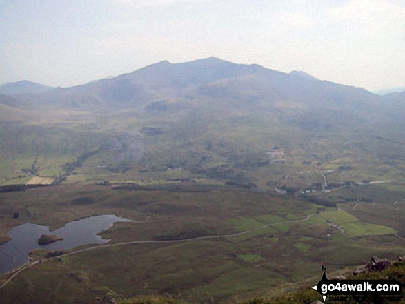
The Snowdon Massif - featuring Garnedd Ugain (Crib y Ddysgl), Snowdon (Yr Wyddfa), Bwlch Main, Llechog (Llanberis Path), Clogwyn Du and Y Lliwedd from Y Garn (Moel Hebog) with Llyn y Dywarchen and Rhyd Ddu in the valley below
Glyder Fawr from Llechog (Llanberis Path) on the way up Snowdon (Yr Wyddfa)
Send us your photographs and pictures on, of, or from Llechog (Llanberis Path)
If you would like to add your walk photographs and pictures to this page, please send them as email attachments (configured for any computer) along with your name to:
and we shall do our best to publish them.
(Guide Resolution = 300dpi. At least = 660pixels (wide) x 440 pixels (high).)

You can also submit photos via our Facebook Page.
NB. Please indicate where each photo was taken and whether you wish us to credit your photos with a Username or your First Name/Last Name.


