The West Midlands region of England - a fully detailed list of all the Mountains, Peaks, Tops and Hills (Page 3 of 3)
The West Midlands region of England comprises the traditional counties of Herefordshire, Shropshire, Staffordshire, Warwickshire, West Midlands, Worcestershire and parts of the Peak District National Park.
If you include all the Mountains (Hewitts), the Deweys, the Nuttalls, the Marilyns, the Bridgets (Hills) and all the Mountains, Tops, Peaks and Hills with a Trig Point on them there are 176 tops to climb, bag & conquer and the highest point is Black Hill (Craswall) at 641m (2,103ft).
To see these Mountains, Peaks, Tops and Hills displayed in different ways - see the options in the left-hand column and towards the bottom of this page.
LOG ON and RELOAD this page to show which Mountains, Peaks, Tops and Hills you have already climbed, bagged & conquered [. . . more details]
Page 3 of 3 Go to page:
1 2 3 |
See this list in: Alphabetical Order
| Height Order‡
To reverse the order select the link again.
Mountain, Peak, Top or Hill:
Bagged
61. View Edge (Weo Edge)
321m (1,054ft)
Marilyn (123rd in England, 1345th in GB)
To walk, climb & bag View Edge (Weo Edge) use either of these easy-to-follow walks:
See the location of View Edge (Weo Edge) and walks up it on a google MapView Edge (Weo Edge) is on interactive maps:
OS Explorer (Orange Covers): 217
OS Landranger (Pink Covers): 137
View Edge (Weo Edge) is on downloadable PDF you can Print or Save to your Phone:
|
62. Earl's Hill
320m (1,050ft)
Bridget
OS Trig Point
We hope to have walks that climb & bag Earl's Hill very soon
See the location of Earl's Hill and walks up it on a google MapEarl's Hill is on interactive maps:
OS Explorer (Orange Covers): 241
OS Landranger (Pink Covers): 126
Earl's Hill is on downloadable PDF you can Print or Save to your Phone:
|
63. Merbach Hill
318m (1,043ft)
Bridget
OS Trig Point
We hope to have walks that climb & bag Merbach Hill very soon
See the location of Merbach Hill and walks up it on a google MapMerbach Hill is on interactive maps:
OS Explorer (Orange Covers): OL13 and
201
OS Landranger (Pink Covers): 148 and
164
|
64. Diddlebury Common
317m (1,040ft)
Bridget
We hope to have walks that climb & bag Diddlebury Common very soon
See the location of Diddlebury Common and walks up it on a google MapDiddlebury Common is on interactive maps:
OS Explorer (Orange Covers): 217
OS Landranger (Pink Covers): 137 and
138
|
65. Walton Hill
316m (1,037ft)
Marilyn (126th in England, 1354th in GB)
OS Trig Point
We hope to have walks that climb & bag Walton Hill very soon
See the location of Walton Hill and walks up it on a google MapWalton Hill is on interactive maps:
OS Explorer (Orange Covers): 219
OS Landranger (Pink Covers): 139
|
66. Alport Height
314m (1,030ft)
Bridget
OS Trig Point
We hope to have walks that climb & bag Alport Height very soon
See the location of Alport Height and walks up it on a google MapAlport Height is on interactive maps:
OS Explorer (Orange Covers): OL24
OS Landranger (Pink Covers): 119
Alport Height is on downloadable PDF you can Print or Save to your Phone:
|
67. Short Wood
313m (1,027ft)
Bridget
We hope to have walks that climb & bag Short Wood very soon
See the location of Short Wood and walks up it on a google MapShort Wood is on interactive maps:
OS Explorer (Orange Covers): 203 and
216
OS Landranger (Pink Covers): 137
Short Wood is on downloadable PDF you can Print or Save to your Phone:
|
68. Oakeley Mynd
309m (1,014ft)
Bridget
OS Trig Point
We hope to have walks that climb & bag Oakeley Mynd very soon
See the location of Oakeley Mynd and walks up it on a google MapOakeley Mynd is on interactive maps:
OS Explorer (Orange Covers):
OS Landranger (Pink Covers): 137
|
69. Croft Ambrey
306m (1,004ft)
Bridget
We hope to have walks that climb & bag Croft Ambrey very soon
See the location of Croft Ambrey and walks up it on a google MapCroft Ambrey is on interactive maps:
OS Explorer (Orange Covers): 201 and
203
OS Landranger (Pink Covers): 137
|
70. Nover's Hill
305m (1,001ft)
Bridget
We hope to have walks that climb & bag Nover's Hill very soon
See the location of Nover's Hill and walks up it on a google MapNover's Hill is on interactive maps:
OS Explorer (Orange Covers): 241
OS Landranger (Pink Covers): 137
Nover's Hill is on downloadable PDF you can Print or Save to your Phone:
|
71. Clunbury Hill
304m (997ft)
Bridget
We hope to have walks that climb & bag Clunbury Hill very soon
See the location of Clunbury Hill and walks up it on a google MapClunbury Hill is on interactive maps:
OS Explorer (Orange Covers): 201
OS Landranger (Pink Covers): 137 and
148
|
72. Lodge Hill (Causeway Wood)
304m (997ft)
Bridget
OS Trig Point
We hope to have walks that climb & bag Lodge Hill (Causeway Wood) very soon
See the location of Lodge Hill (Causeway Wood) and walks up it on a google MapLodge Hill (Causeway Wood) is on interactive maps:
OS Explorer (Orange Covers): 241
OS Landranger (Pink Covers): 137
Lodge Hill (Causeway Wood) is on downloadable PDF you can Print or Save to your Phone:
|
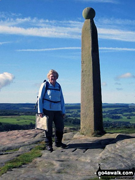
73. Nelson's Monument (Birchen Edge)
302m (991ft)
Bridget
OS Trig Point
To walk, climb & bag Nelson's Monument (Birchen Edge) use either of these easy-to-follow walks:
See the location of Nelson's Monument (Birchen Edge) and walks up it on a google MapNelson's Monument (Birchen Edge) is on interactive maps:
OS Explorer (Orange Covers): OL24
OS Landranger (Pink Covers): 119
Nelson's Monument (Birchen Edge) is on downloadable PDF you can Print or Save to your Phone:
|
74. Pole Wood
302m (991ft)
Bridget
We hope to have walks that climb & bag Pole Wood very soon
See the location of Pole Wood and walks up it on a google MapPole Wood is on interactive maps:
OS Explorer (Orange Covers): 241
OS Landranger (Pink Covers): 137
Pole Wood is on downloadable PDF you can Print or Save to your Phone:
|
75. Topley Plantation
301m (987ft)
Bridget
We hope to have walks that climb & bag Topley Plantation very soon
See the location of Topley Plantation and walks up it on a google MapTopley Plantation is on interactive maps:
OS Explorer (Orange Covers): 241
OS Landranger (Pink Covers): 137
Topley Plantation is on downloadable PDF you can Print or Save to your Phone:
|
76. Bredon Hill
299m (981ft)
Marilyn (131st in England, 1378th in GB)
We hope to have walks that climb & bag Bredon Hill very soon
See the location of Bredon Hill and walks up it on a google MapBredon Hill is on interactive maps:
OS Explorer (Orange Covers): 190
OS Landranger (Pink Covers): 150
|
77. Lynchgate (Edgton Hill)
297m (974ft)
Bridget
We hope to have walks that climb & bag Lynchgate (Edgton Hill) very soon
See the location of Lynchgate (Edgton Hill) and walks up it on a google MapLynchgate (Edgton Hill) is on interactive maps:
OS Explorer (Orange Covers): 203 and
216
OS Landranger (Pink Covers): 137
Lynchgate (Edgton Hill) is on downloadable PDF you can Print or Save to your Phone:
|
78. Burton Hill
294m (964ft)
Marilyn (136th in England, 1389th in GB)
OS Trig Point
We hope to have walks that climb & bag Burton Hill very soon
See the location of Burton Hill and walks up it on a google MapBurton Hill is on interactive maps:
OS Explorer (Orange Covers): 201
OS Landranger (Pink Covers): 148 and
149
|
79. Hill End (Cardington)
294m (964ft)
Bridget
We hope to have walks that climb & bag Hill End (Cardington) very soon
See the location of Hill End (Cardington) and walks up it on a google MapHill End (Cardington) is on interactive maps:
OS Explorer (Orange Covers): 241
OS Landranger (Pink Covers): 137
Hill End (Cardington) is on downloadable PDF you can Print or Save to your Phone:
|
80. Norton Camp
294m (964ft)
Bridget
We hope to have walks that climb & bag Norton Camp very soon
See the location of Norton Camp and walks up it on a google MapNorton Camp is on interactive maps:
OS Explorer (Orange Covers): 217
OS Landranger (Pink Covers): 137
|
81. Anthony Hill
293m (961ft)
Bridget
To walk, climb & bag Anthony Hill use any of these easy-to-follow walks:
See the location of Anthony Hill and walks up it on a google MapAnthony Hill is on interactive maps:
OS Explorer (Orange Covers): OL24
OS Landranger (Pink Covers): 119
Anthony Hill is on downloadable PDF you can Print or Save to your Phone:
|
82. Calton Pastures
289m (948ft)
Bridget
OS Trig Point
To walk, climb & bag Calton Pastures use this easy-to-follow walk:
See the location of Calton Pastures and walks up it on a google MapCalton Pastures is on interactive maps:
OS Explorer (Orange Covers): OL24
OS Landranger (Pink Covers): 119
Calton Pastures is on downloadable PDF you can Print or Save to your Phone:
|
83. Mogg Forest
289m (948ft)
Bridget
OS Trig Point
We hope to have walks that climb & bag Mogg Forest very soon
See the location of Mogg Forest and walks up it on a google MapMogg Forest is on interactive maps:
OS Explorer (Orange Covers): 241
OS Landranger (Pink Covers): 137
Mogg Forest is on downloadable PDF you can Print or Save to your Phone:
|
84. Overmoor
288m (945ft)
Bridget
We hope to have walks that climb & bag Overmoor very soon
See the location of Overmoor and walks up it on a google MapOvermoor is on interactive maps:
OS Explorer (Orange Covers): 258
OS Landranger (Pink Covers): 118
Overmoor is on downloadable PDF you can Print or Save to your Phone:
|
85. Wigmore Rolls
288m (945ft)
Bridget
OS Trig Point
We hope to have walks that climb & bag Wigmore Rolls very soon
See the location of Wigmore Rolls and walks up it on a google MapWigmore Rolls is on interactive maps:
OS Explorer (Orange Covers): 203
OS Landranger (Pink Covers): 137 and
148
|
86. Knoll Hill
287m (941ft)
Bridget
We hope to have walks that climb & bag Knoll Hill very soon
See the location of Knoll Hill and walks up it on a google MapKnoll Hill is on interactive maps:
OS Explorer (Orange Covers): 201
OS Landranger (Pink Covers): 137 and
148 and
149
|
87. Lilywood (Wenlock Edge)
287m (941ft)
Bridget
We hope to have walks that climb & bag Lilywood (Wenlock Edge) very soon
See the location of Lilywood (Wenlock Edge) and walks up it on a google MapLilywood (Wenlock Edge) is on interactive maps:
OS Explorer (Orange Covers): 241
OS Landranger (Pink Covers): 137
Lilywood (Wenlock Edge) is on downloadable PDF you can Print or Save to your Phone:
|
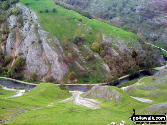
88. Thorpe Cloud
287m (941ft)
Bridget
To walk, climb & bag Thorpe Cloud use any of these easy-to-follow walks:
See the location of Thorpe Cloud and walks up it on a google MapThorpe Cloud is on interactive maps:
OS Explorer (Orange Covers): OL24
OS Landranger (Pink Covers): 119
Thorpe Cloud is on downloadable PDF you can Print or Save to your Phone:
|
89. Abberley Hill (Flagstaff Wood)
285m (935ft)
Bridget
OS Trig Point
Abberley Hill (Flagstaff Wood) was promoted to Marilyn status in 1997 but demoted again in 1999.
We hope to have walks that climb & bag Abberley Hill (Flagstaff Wood) very soon
See the location of Abberley Hill (Flagstaff Wood) and walks up it on a google MapAbberley Hill (Flagstaff Wood) is on interactive maps:
OS Explorer (Orange Covers): 204
OS Landranger (Pink Covers): 138 and
150
|
90. Hopesay Hill
284m (932ft)
Bridget
We hope to have walks that climb & bag Hopesay Hill very soon
See the location of Hopesay Hill and walks up it on a google MapHopesay Hill is on interactive maps:
OS Explorer (Orange Covers): 217
OS Landranger (Pink Covers): 137
Hopesay Hill is on downloadable PDF you can Print or Save to your Phone:
|
91. Roman Bank
279m (915ft)
Bridget
We hope to have walks that climb & bag Roman Bank very soon
See the location of Roman Bank and walks up it on a google MapRoman Bank is on interactive maps:
OS Explorer (Orange Covers): 241
OS Landranger (Pink Covers): 137
Roman Bank is on downloadable PDF you can Print or Save to your Phone:
|
92. Aconbury Hill (Aconbury Camp)
276m (905ft)
Marilyn (143rd in England, 1424th in GB)
OS Trig Point
We hope to have walks that climb & bag Aconbury Hill (Aconbury Camp) very soon
See the location of Aconbury Hill (Aconbury Camp) and walks up it on a google MapAconbury Hill (Aconbury Camp) is on interactive maps:
OS Explorer (Orange Covers): 189
OS Landranger (Pink Covers): 149
|
93. Haven Hill
276m (905ft)
Bridget
We hope to have walks that climb & bag Haven Hill very soon
See the location of Haven Hill and walks up it on a google MapHaven Hill is on interactive maps:
OS Explorer (Orange Covers): OL24
OS Landranger (Pink Covers): 119
Haven Hill is on downloadable PDF you can Print or Save to your Phone:
|
94. Seager Hill (Bunker's Hill)
272m (892ft)
Marilyn (145th in England, 1431st in GB)
OS Trig Point
We hope to have walks that climb & bag Seager Hill (Bunker's Hill) very soon
See the location of Seager Hill (Bunker's Hill) and walks up it on a google MapSeager Hill (Bunker's Hill) is on interactive maps:
OS Explorer (Orange Covers): 189
OS Landranger (Pink Covers): 149
|
95. Turner's Hill
271m (889ft)
Bridget
Turner's Hill is the highest point in the county of West Midlands
We hope to have walks that climb & bag Turner's Hill very soon
See the location of Turner's Hill and walks up it on a google MapTurner's Hill is on interactive maps:
OS Explorer (Orange Covers): 219
OS Landranger (Pink Covers): 139
|
96. Coxall Knoll
262m (859ft)
Bridget
We hope to have walks that climb & bag Coxall Knoll very soon
See the location of Coxall Knoll and walks up it on a google MapCoxall Knoll is on interactive maps:
OS Explorer (Orange Covers): 201
OS Landranger (Pink Covers): 137 and
148
Coxall Knoll is on downloadable PDF you can Print or Save to your Phone:
|
97. Roveries Wood
262m (859ft)
Bridget
We hope to have walks that climb & bag Roveries Wood very soon
See the location of Roveries Wood and walks up it on a google MapRoveries Wood is on interactive maps:
OS Explorer (Orange Covers): 216
OS Landranger (Pink Covers): 137
Roveries Wood is on downloadable PDF you can Print or Save to your Phone:
|
98. Ilmington Down
261m (856ft)
Bridget
OS Trig Point
Ilmington Down is the highest point in the county of Warwickshire.
We hope to have walks that climb & bag Ilmington Down very soon
See the location of Ilmington Down and walks up it on a google MapIlmington Down is on interactive maps:
OS Explorer (Orange Covers): 205
OS Landranger (Pink Covers): 151
|
99. Mere Hill
258m (846ft)
Bridget
We hope to have walks that climb & bag Mere Hill very soon
See the location of Mere Hill and walks up it on a google MapMere Hill is on interactive maps:
OS Explorer (Orange Covers): 203
OS Landranger (Pink Covers): 137 and
148 and
149
|
100. Wolverton Wood
255m (836ft)
Bridget
We hope to have walks that climb & bag Wolverton Wood very soon
See the location of Wolverton Wood and walks up it on a google MapWolverton Wood is on interactive maps:
OS Explorer (Orange Covers): 241
OS Landranger (Pink Covers): 137
Wolverton Wood is on downloadable PDF you can Print or Save to your Phone:
|
101. Hegdon Hill (Lower Hegdon)
254m (833ft)
Marilyn (152nd in England, 1458th in GB)
OS Trig Point
We hope to have walks that climb & bag Hegdon Hill (Lower Hegdon) very soon
See the location of Hegdon Hill (Lower Hegdon) and walks up it on a google MapHegdon Hill (Lower Hegdon) is on interactive maps:
OS Explorer (Orange Covers): 202
OS Landranger (Pink Covers): 149
|
102. Grendon Green (Batchley Farm)
252m (827ft)
OS Trig Point
We hope to have walks that climb & bag Grendon Green (Batchley Farm) very soon
See the location of Grendon Green (Batchley Farm) and walks up it on a google MapGrendon Green (Batchley Farm) is on interactive maps:
OS Explorer (Orange Covers): 202
OS Landranger (Pink Covers): 149
|
103. Broad Heath
245m (804ft)
Bridget
OS Trig Point
We hope to have walks that climb & bag Broad Heath very soon
See the location of Broad Heath and walks up it on a google MapBroad Heath is on interactive maps:
OS Explorer (Orange Covers): 203
OS Landranger (Pink Covers): 138 and
149
|
104. Oaker Wood
243m (797ft)
Bridget
We hope to have walks that climb & bag Oaker Wood very soon
See the location of Oaker Wood and walks up it on a google MapOaker Wood is on interactive maps:
OS Explorer (Orange Covers): 203
OS Landranger (Pink Covers): 137
Oaker Wood is on downloadable PDF you can Print or Save to your Phone:
|
105. Garnons Hill
238m (781ft)
Bridget
We hope to have walks that climb & bag Garnons Hill very soon
See the location of Garnons Hill and walks up it on a google MapGarnons Hill is on interactive maps:
OS Explorer (Orange Covers): 202
OS Landranger (Pink Covers): 148 and
149 and
161
|
106. Bradlow Knoll
237m (777ft)
Bridget
We hope to have walks that climb & bag Bradlow Knoll very soon
See the location of Bradlow Knoll and walks up it on a google MapBradlow Knoll is on interactive maps:
OS Explorer (Orange Covers): 190
OS Landranger (Pink Covers): 149
|
107. Birley Hill
236m (774ft)
Bridget
OS Trig Point
We hope to have walks that climb & bag Birley Hill very soon
See the location of Birley Hill and walks up it on a google MapBirley Hill is on interactive maps:
OS Explorer (Orange Covers): 202
OS Landranger (Pink Covers): 148 and
149
|
108. Credenhill
221m (725ft)
Bridget
We hope to have walks that climb & bag Credenhill very soon
See the location of Credenhill and walks up it on a google MapCredenhill is on interactive maps:
OS Explorer (Orange Covers): 202
OS Landranger (Pink Covers): 148 and
149 and
161
|
109. Little Doward
221m (725ft)
Bridget
OS Trig Point
We hope to have walks that climb & bag Little Doward very soon
See the location of Little Doward and walks up it on a google MapLittle Doward is on interactive maps:
OS Explorer (Orange Covers): OL14
OS Landranger (Pink Covers): 162
|
110. Hawkstone Hill
208m (682ft)
Bridget
We hope to have walks that climb & bag Hawkstone Hill very soon
See the location of Hawkstone Hill and walks up it on a google MapHawkstone Hill is on interactive maps:
OS Explorer (Orange Covers): 241
OS Landranger (Pink Covers): 126
|
111. Chase Hill
203m (666ft)
Bridget
OS Trig Point
We hope to have walks that climb & bag Chase Hill very soon
See the location of Chase Hill and walks up it on a google MapChase Hill is on interactive maps:
OS Explorer (Orange Covers): OL14 and
189
OS Landranger (Pink Covers): 162
|
112. Coppet Hill
200m (656ft)
Bridget
OS Trig Point
We hope to have walks that climb & bag Coppet Hill very soon
See the location of Coppet Hill and walks up it on a google MapCoppet Hill is on interactive maps:
OS Explorer (Orange Covers): 189
OS Landranger (Pink Covers): 162
|
113. Cold Overton Park
197m (646ft)
Bridget
OS Trig Point
Cold Overton Park is the highest point in the county of Rutland
We hope to have walks that climb & bag Cold Overton Park very soon
See the location of Cold Overton Park and walks up it on a google MapCold Overton Park is on interactive maps:
OS Explorer (Orange Covers): 234
OS Landranger (Pink Covers): 141
|
114. Grinshill Hill
192m (630ft)
Bridget
OS Trig Point
We hope to have walks that climb & bag Grinshill Hill very soon
See the location of Grinshill Hill and walks up it on a google MapGrinshill Hill is on interactive maps:
OS Explorer (Orange Covers): 241
OS Landranger (Pink Covers): 126
|
115. Berrow Hill
178m (584ft)
Bridget
OS Trig Point
We hope to have walks that climb & bag Berrow Hill very soon
See the location of Berrow Hill and walks up it on a google MapBerrow Hill is on interactive maps:
OS Explorer (Orange Covers): 204
OS Landranger (Pink Covers): 150
|
116. White Hill (Herefordshire)
173m (567ft)
Bridget
OS Trig Point
We hope to have walks that climb & bag White Hill (Herefordshire) very soon
See the location of White Hill (Herefordshire) and walks up it on a google MapWhite Hill (Herefordshire) is on interactive maps:
OS Explorer (Orange Covers): 202
OS Landranger (Pink Covers): 149
|
Page 3 of 3 Go to page:
1 2 3 |
View these 176 Mountains, Peaks, Tops and Hills:
Is there a Mountain, Peak, Top or Hill missing from the above google map or list?
Let us know an we will add it to our database.


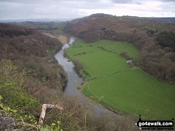
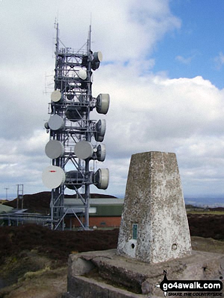 The summit of Brown Clee Hill (Abdon Burf) in The Royal Forest of Dean and The Wye Valley


