Wales - a fully detailed list of all the Mountains, Peaks, Tops and Hills (Page of 6)
Wales is defined as the whole of the principality of Wales which includes the National Parks of Snowdonia,
Bannau Brycheiniog (The Brecon Beacons) and The Pembrokeshire Coast as well as Mynyddoedd Cambria (The Cambrian Mountains), Radnor Forest, Anglesey, The Llynn Peninsula, The Preseli Mountains and The Gower Peninsula.
If you count only the Marilyns there are 159 tops to climb, bag & conquer and the highest point is Snowdon (Yr Wyddfa) at 1,085m (3,561ft).
To see these Mountains, Peaks, Tops and Hills displayed in different ways - see the options in the left-hand column and towards the bottom of this page.
LOG ON and RELOAD this page to show which Mountains, Peaks, Tops and Hills you have already climbed, bagged & conquered [. . . more details]
Page 1 of 6 Go to page:
1 2 3 4 5 6 |
See this list in: Alphabetical Order‡
| Height Order
To reverse the order select the link again.
Mountain, Peak, Top or Hill:
Bagged
1. Aberedw Hill
451m (1,480ft)
Marilyn (100th in Wales, 1101st in GB)
OS Trig Point
We hope to have walks that climb & bag Aberedw Hill very soon
See the location of Aberedw Hill and walks up it on a google MapAberedw Hill is on interactive maps:
OS Explorer (Orange Covers): 188 and
200
OS Landranger (Pink Covers): 147
A downloadable go4awalk.com PDF Peak Bagging Map featuring Aberedw Hill will be available soon. |
2. Allt y Main
356m (1,168ft)
Marilyn (127th in Wales, 1292nd in GB)
OS Trig Point
We hope to have walks that climb & bag Allt y Main very soon
See the location of Allt y Main and walks up it on a google MapAllt y Main is on interactive maps:
OS Explorer (Orange Covers): 239
OS Landranger (Pink Covers): 125
A downloadable go4awalk.com PDF Peak Bagging Map featuring Allt y Main will be available soon. |
3. Allt yr Esgair
393m (1,290ft)
Marilyn (112th in Wales, 1218th in GB)
We hope to have walks that climb & bag Allt yr Esgair very soon
See the location of Allt yr Esgair and walks up it on a google MapAllt yr Esgair is on interactive maps:
OS Explorer (Orange Covers): OL13
OS Landranger (Pink Covers): 161
Allt yr Esgair is on downloadable PDF you can Print or Save to your Phone:
|
4. Allt-fawr (Moelwyns)
698m (2,291ft)
Mountain (68th in Wales, 175th in England & Wales)
Nuttall (88th in Wales, 223rd in England & Wales)
Marilyn (34th in Wales, 599th in GB)
To walk, climb & bag Allt-fawr (Moelwyns) use this easy-to-follow walk:
See the location of Allt-fawr (Moelwyns) and walks up it on a google MapAllt-fawr (Moelwyns) is on interactive maps:
OS Explorer (Orange Covers): OL17
OS Landranger (Pink Covers): 115
Allt-fawr (Moelwyns) is on downloadable PDF you can Print or Save to your Phone:
|
5. Aran Fawddwy
905m (2,970ft)
Mountain (16th in Wales, 23rd in England & Wales)
Nuttall (17th in Wales, 26th in England & Wales)
Marilyn (7th in Wales, 228th in GB)
OS Trig Point
To walk, climb & bag Aran Fawddwy use either of these easy-to-follow walks:
See the location of Aran Fawddwy and walks up it on a google MapAran Fawddwy is on interactive maps:
OS Explorer (Orange Covers): OL23
OS Landranger (Pink Covers): 124
Aran Fawddwy is on downloadable PDF you can Print or Save to your Phone:
|
6. Arenig Fach
689m (2,261ft)
Mountain (73rd in Wales, 184th in England & Wales)
Nuttall (95th in Wales, 239th in England & Wales)
Marilyn (36th in Wales, 613th in GB)
OS Trig Point
To walk, climb & bag Arenig Fach use this easy-to-follow walk:
See the location of Arenig Fach and walks up it on a google MapArenig Fach is on interactive maps:
OS Explorer (Orange Covers): OL18
OS Landranger (Pink Covers): 124 and
125
Arenig Fach is on downloadable PDF you can Print or Save to your Phone:
|
7. Arenig Fawr (Moel Yr Eglwys)
854m (2,802ft)
Mountain (24th in Wales, 46th in England & Wales)
Nuttall (27th in Wales, 53rd in England & Wales)
Marilyn (12th in Wales, 311th in GB)
OS Trig Point
To walk, climb & bag Arenig Fawr (Moel Yr Eglwys) use any of these easy-to-follow walks:
See the location of Arenig Fawr (Moel Yr Eglwys) and walks up it on a google MapArenig Fawr (Moel Yr Eglwys) is on interactive maps:
OS Explorer (Orange Covers): OL18
OS Landranger (Pink Covers): 124 and
125
Arenig Fawr (Moel Yr Eglwys) is on downloadable PDF you can Print or Save to your Phone:
|
8. Banc Llechwedd-mawr
560m (1,837ft)
Dewey (69th in Wales, 123rd in England & Wales)
Marilyn (65th in Wales, 847th in GB)
We hope to have walks that climb & bag Banc Llechwedd-mawr very soon
See the location of Banc Llechwedd-mawr and walks up it on a google MapBanc Llechwedd-mawr is on interactive maps:
OS Explorer (Orange Covers): 213
OS Landranger (Pink Covers): 135
A downloadable go4awalk.com PDF Peak Bagging Map featuring Banc Llechwedd-mawr will be available soon. |
9. Beacon Hill (Beguildy Beacon)
547m (1,795ft)
Dewey (101st in Wales, 176th in England & Wales)
Marilyn (71st in Wales, 886th in GB)
OS Trig Point
We hope to have walks that climb & bag Beacon Hill (Beguildy Beacon) very soon
See the location of Beacon Hill (Beguildy Beacon) and walks up it on a google MapBeacon Hill (Beguildy Beacon) is on interactive maps:
OS Explorer (Orange Covers): 214
OS Landranger (Pink Covers): 136 and
148
A downloadable go4awalk.com PDF Peak Bagging Map featuring Beacon Hill (Beguildy Beacon) will be available soon. |
10. Beacon Ring (Long Mountain)
408m (1,339ft)
Marilyn (108th in Wales, 1187th in GB)
OS Trig Point
We hope to have walks that climb & bag Beacon Ring (Long Mountain) very soon
See the location of Beacon Ring (Long Mountain) and walks up it on a google MapBeacon Ring (Long Mountain) is on interactive maps:
OS Explorer (Orange Covers): 216
OS Landranger (Pink Covers): 126
A downloadable go4awalk.com PDF Peak Bagging Map featuring Beacon Ring (Long Mountain) will be available soon. |
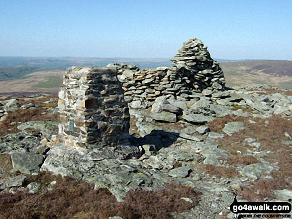
11. Black Mountain
703m (2,307ft)
Mountain (66th in Wales, 169th in England & Wales)
Nuttall (85th in Wales, 212th in England & Wales)
Marilyn (33rd in Wales, 587th in GB)
Black Mountain straddles the border between England and Wales. Although the actual summit of Black Mountain is in the welsh county of Powys by a couple of metres, the upper NW slope of Black Mountain is the highest point in the english county of Herefordshire.
To walk, climb & bag Black Mountain use either of these easy-to-follow walks:
See the location of Black Mountain and walks up it on a google MapBlack Mountain is on interactive maps:
OS Explorer (Orange Covers): OL13
OS Landranger (Pink Covers): 161
Black Mountain is on downloadable PDF you can Print or Save to your Phone:
|
12. Brandy Hill
205m (672ft)
Marilyn (156th in Wales, 1517th in GB)
OS Trig Point
We hope to have walks that climb & bag Brandy Hill very soon
See the location of Brandy Hill and walks up it on a google MapBrandy Hill is on interactive maps:
OS Explorer (Orange Covers): 177
OS Landranger (Pink Covers): 158
A downloadable go4awalk.com PDF Peak Bagging Map featuring Brandy Hill will be available soon. |
13. Bryn Amlwg (Trannon)
488m (1,602ft)
Marilyn (85th in Wales, 1009th in GB)
OS Trig Point
We hope to have walks that climb & bag Bryn Amlwg (Trannon) very soon
See the location of Bryn Amlwg (Trannon) and walks up it on a google MapBryn Amlwg (Trannon) is on interactive maps:
OS Explorer (Orange Covers): 215
OS Landranger (Pink Covers): 136
A downloadable go4awalk.com PDF Peak Bagging Map featuring Bryn Amlwg (Trannon) will be available soon. |
14. Bryn Arw
384m (1,260ft)
Marilyn (114th in Wales, 1234th in GB)
To walk, climb & bag Bryn Arw use this easy-to-follow walk:
See the location of Bryn Arw and walks up it on a google MapBryn Arw is on interactive maps:
OS Explorer (Orange Covers): OL13
OS Landranger (Pink Covers): 161
Bryn Arw is on downloadable PDF you can Print or Save to your Phone:
|
15. Bryn y Fan (Van Hill)
482m (1,582ft)
Marilyn (89th in Wales, 1024th in GB)
OS Trig Point
We hope to have walks that climb & bag Bryn y Fan (Van Hill) very soon
See the location of Bryn y Fan (Van Hill) and walks up it on a google MapBryn y Fan (Van Hill) is on interactive maps:
OS Explorer (Orange Covers): 214
OS Landranger (Pink Covers): 136
A downloadable go4awalk.com PDF Peak Bagging Map featuring Bryn y Fan (Van Hill) will be available soon. |
16. Cadair Berwyn
832m (2,730ft)
Mountain (27th in Wales, 58th in England & Wales)
Nuttall (31st in Wales, 67th in England & Wales)
Marilyn (13th in Wales, 341st in GB)
Cadair Berwyn is the highest point in the county of Denbighshire.
To walk, climb & bag Cadair Berwyn use this easy-to-follow walk:
See the location of Cadair Berwyn and walks up it on a google MapCadair Berwyn is on interactive maps:
OS Explorer (Orange Covers): 255
OS Landranger (Pink Covers): 125
Cadair Berwyn is on downloadable PDF you can Print or Save to your Phone:
|
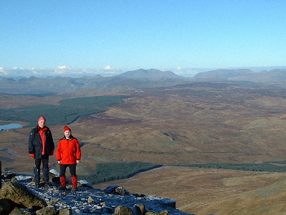
17. Cadair Idris (Penygadair)
892m (2,929ft)
Mountain (18th in Wales, 27th in England & Wales)
Nuttall (20th in Wales, 32nd in England & Wales)
Marilyn (9th in Wales, 247th in GB)
OS Trig Point
To walk, climb & bag Cadair Idris (Penygadair) use any of these easy-to-follow walks:
See the location of Cadair Idris (Penygadair) and walks up it on a google MapCadair Idris (Penygadair) is on interactive maps:
OS Explorer (Orange Covers): OL23
OS Landranger (Pink Covers): 124
Cadair Idris (Penygadair) is on downloadable PDF you can Print or Save to your Phone:
|
18. Caeliber Isaf
355m (1,165ft)
Marilyn (128th in Wales, 1294th in GB)
We hope to have walks that climb & bag Caeliber Isaf very soon
See the location of Caeliber Isaf and walks up it on a google MapCaeliber Isaf is on interactive maps:
OS Explorer (Orange Covers): 216
OS Landranger (Pink Covers): 137
A downloadable go4awalk.com PDF Peak Bagging Map featuring Caeliber Isaf will be available soon. |
19. Carn Fadryn
371m (1,217ft)
Marilyn (120th in Wales, 1267th in GB)
OS Trig Point
To walk, climb & bag Carn Fadryn use this easy-to-follow walk:
See the location of Carn Fadryn and walks up it on a google MapCarn Fadryn is on interactive maps:
OS Explorer (Orange Covers): 253
OS Landranger (Pink Covers): 123
A downloadable go4awalk.com PDF Peak Bagging Map featuring Carn Fadryn will be available soon. |
20. Carn Gafallt
466m (1,529ft)
Marilyn (96th in Wales, 1063rd in GB)
We hope to have walks that climb & bag Carn Gafallt very soon
See the location of Carn Gafallt and walks up it on a google MapCarn Gafallt is on interactive maps:
OS Explorer (Orange Covers): 200
OS Landranger (Pink Covers): 147
A downloadable go4awalk.com PDF Peak Bagging Map featuring Carn Gafallt will be available soon. |
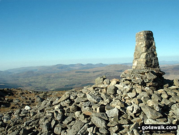
21. Carnedd Llewelyn
1,064m (3,492ft)
Mountain (3rd in Wales, 3rd in England & Wales)
Nuttall (3rd in Wales, 3rd in England & Wales)
Marilyn (2nd in Wales, 57th in GB)
Carnedd Llewelyn is the highest point in the county of Conwy.
To walk, climb & bag Carnedd Llewelyn use any of these easy-to-follow walks:
See the location of Carnedd Llewelyn and walks up it on a google MapCarnedd Llewelyn is on interactive maps:
OS Explorer (Orange Covers): OL17
OS Landranger (Pink Covers): 115
Carnedd Llewelyn is on downloadable PDF you can Print or Save to your Phone:
|
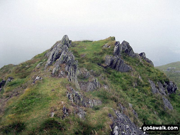
22. Carnedd Moel Siabod
872m (2,861ft)
Mountain (21st in Wales, 36th in England & Wales)
Nuttall (23rd in Wales, 41st in England & Wales)
Marilyn (11th in Wales, 281st in GB)
OS Trig Point
To walk, climb & bag Carnedd Moel Siabod use any of these easy-to-follow walks:
See the location of Carnedd Moel Siabod and walks up it on a google MapCarnedd Moel Siabod is on interactive maps:
OS Explorer (Orange Covers): OL17
OS Landranger (Pink Covers): 115
Carnedd Moel Siabod is on downloadable PDF you can Print or Save to your Phone:
|
23. Carnedd Wen
526m (1,726ft)
Dewey (161st in Wales, 283rd in England & Wales)
Marilyn (77th in Wales, 922nd in GB)
OS Trig Point
We hope to have walks that climb & bag Carnedd Wen very soon
See the location of Carnedd Wen and walks up it on a google MapCarnedd Wen is on interactive maps:
OS Explorer (Orange Covers): OL23 and
255
OS Landranger (Pink Covers): 125
A downloadable go4awalk.com PDF Peak Bagging Map featuring Carnedd Wen will be available soon. |
24. Carnedd y Filiast (Arenigs)
669m (2,195ft)
Mountain (89th in Wales, 217th in England & Wales)
Nuttall (117th in Wales, 287th in England & Wales)
Marilyn (41st in Wales, 652nd in GB)
OS Trig Point
We hope to have walks that climb & bag Carnedd y Filiast (Arenigs) very soon
See the location of Carnedd y Filiast (Arenigs) and walks up it on a google MapCarnedd y Filiast (Arenigs) is on interactive maps:
OS Explorer (Orange Covers): OL18
OS Landranger (Pink Covers): 124 and
125
Carnedd y Filiast (Arenigs) is on downloadable PDF you can Print or Save to your Phone:
|
25. Carneddau (Radnor Forest)
445m (1,460ft)
Marilyn (101st in Wales, 1120th in GB)
OS Trig Point
We hope to have walks that climb & bag Carneddau (Radnor Forest) very soon
See the location of Carneddau (Radnor Forest) and walks up it on a google MapCarneddau (Radnor Forest) is on interactive maps:
OS Explorer (Orange Covers): 200
OS Landranger (Pink Covers): 147
A downloadable go4awalk.com PDF Peak Bagging Map featuring Carneddau (Radnor Forest) will be available soon. |
26. Carneddol
235m (771ft)
Marilyn (153rd in Wales, 1484th in GB)
We hope to have walks that climb & bag Carneddol very soon
See the location of Carneddol and walks up it on a google MapCarneddol is on interactive maps:
OS Explorer (Orange Covers): 253
OS Landranger (Pink Covers): 123
A downloadable go4awalk.com PDF Peak Bagging Map featuring Carneddol will be available soon. |
27. Cefn Cenarth
460m (1,509ft)
Marilyn (99th in Wales, 1081st in GB)
We hope to have walks that climb & bag Cefn Cenarth very soon
See the location of Cefn Cenarth and walks up it on a google MapCefn Cenarth is on interactive maps:
OS Explorer (Orange Covers): 214
OS Landranger (Pink Covers): 136 and
147
A downloadable go4awalk.com PDF Peak Bagging Map featuring Cefn Cenarth will be available soon. |
28. Cefn Eglwysilan
382m (1,253ft)
Marilyn (116th in Wales, 1243rd in GB)
OS Trig Point
We hope to have walks that climb & bag Cefn Eglwysilan very soon
See the location of Cefn Eglwysilan and walks up it on a google MapCefn Eglwysilan is on interactive maps:
OS Explorer (Orange Covers): 166
OS Landranger (Pink Covers): 171
A downloadable go4awalk.com PDF Peak Bagging Map featuring Cefn Eglwysilan will be available soon. |
29. Cefn yr Ystrad
617m (2,025ft)
Mountain (126th in Wales, 297th in England & Wales)
Nuttall (175th in Wales, 413th in England & Wales)
Marilyn (51st in Wales, 738th in GB)
OS Trig Point
To walk, climb & bag Cefn yr Ystrad use this easy-to-follow walk:
See the location of Cefn yr Ystrad and walks up it on a google MapCefn yr Ystrad is on interactive maps:
OS Explorer (Orange Covers): OL12
OS Landranger (Pink Covers): 160
Cefn yr Ystrad is on downloadable PDF you can Print or Save to your Phone:
|
30. Coety Mountain / Mynydd Coety
578m (1,896ft)
Dewey (41st in Wales, 72nd in England & Wales)
Marilyn (61st in Wales, 803rd in GB)
Coity Mountain / Mynydd Coety is the highest point in the county of Blaenau Gwent and the highest point in the county of Torfaen.
We hope to have walks that climb & bag Coety Mountain / Mynydd Coety very soon
See the location of Coety Mountain / Mynydd Coety and walks up it on a google MapCoety Mountain / Mynydd Coety is on interactive maps:
OS Explorer (Orange Covers): OL13
OS Landranger (Pink Covers): 161
A downloadable go4awalk.com PDF Peak Bagging Map featuring Coety Mountain / Mynydd Coety will be available soon. |
Page 1 of 6 Go to page:
1 2 3 4 5 6 |
View these 159 Mountains, Peaks, Tops and Hills:
Is there a Mountain, Peak, Top or Hill missing from the above google map or list?
Let us know an we will add it to our database.

 Snowdon (Yr Wyddfa) in South WalesWales


