Wales - a fully detailed list of all the Mountains, Peaks, Tops and Hills (Page of 9)
Wales is defined as the whole of the principality of Wales which includes the National Parks of Snowdonia, Bannau Brycheiniog (The Brecon Beacons) and The Pembrokeshire Coast as well as Mynyddoedd Cambria (The Cambrian Mountains), Radnor Forest, Anglesey, The Llynn Peninsula, The Preseli Mountains and The Gower Peninsula.
If you count only the Deweys there are 241 tops to climb, bag & conquer and the highest point is Craig Fach at 609m (1,999ft).
To see these Mountains, Peaks, Tops and Hills displayed in different ways - see the options in the left-hand column and towards the bottom of this page.
![]() Your Personal Bagging Record for Wales
Your Personal Bagging Record for Wales
LOG ON and RELOAD this page to show which Mountains, Peaks, Tops and Hills you have already climbed, bagged & conquered [. . . more details]
See this list in: Alphabetical Order‡
| Height Order
To reverse the order select the link again.
Mountain, Peak, Top or Hill:
Bagged

![]()
1. Yr Orsedd
559m (1,835ft)
Yr Orsedd is on interactive maps:
Yr Orsedd is on downloadable PDF you can Print or Save to your Phone: |
![]()
2. Yr Eifl
564m (1,851ft)
Yr Eifl is on interactive maps:
A downloadable go4awalk.com PDF Peak Bagging Map featuring Yr Eifl will be available soon. |
![]()
3. Yr Arddu
589m (1,933ft)
Yr Arddu is on interactive maps:
Yr Arddu is on downloadable PDF you can Print or Save to your Phone: |
![]()
4. Yr Allt (Forest Fawr)
604m (1,982ft)
Yr Allt (Forest Fawr) is on interactive maps:
Yr Allt (Forest Fawr) is on downloadable PDF you can Print or Save to your Phone: |
![]()
5. Y Ro Wen
594m (1,949ft)
Y Ro Wen is on interactive maps:
Y Ro Wen is on downloadable PDF you can Print or Save to your Phone: |
![]()
6. Y Gribin (Arans)
602m (1,975ft)
Y Gribin (Arans) is on interactive maps:
Y Gribin (Arans) is on downloadable PDF you can Print or Save to your Phone: |
![]()
7. Y Garnedd (Llynnau Gamallt)
502m (1,647ft)
Send it in and we'll publish it here.
Y Garnedd (Llynnau Gamallt) is on interactive maps:
Y Garnedd (Llynnau Gamallt) is on downloadable PDF you can Print or Save to your Phone: |
![]()
8. Y Garnedd (Llyn Morwynion)
552m (1,811ft)
Send it in and we'll publish it here.
Y Garnedd (Llyn Morwynion) is on interactive maps:
Y Garnedd (Llyn Morwynion) is on downloadable PDF you can Print or Save to your Phone: |
![]()
9. Y Gamriw
604m (1,982ft)
Y Gamriw is on interactive maps:
Y Gamriw is on downloadable PDF you can Print or Save to your Phone: |
![]()
10. Y Gamallt (Llynnau Gamalt)
589m (1,933ft)
Send it in and we'll publish it here.
Y Gamallt (Llynnau Gamalt) is on interactive maps:
Y Gamallt (Llynnau Gamalt) is on downloadable PDF you can Print or Save to your Phone: |
![]()
11. Y Foel (Pant Mawr)
546m (1,791ft)
Y Foel (Pant Mawr) is on interactive maps:
A downloadable go4awalk.com PDF Peak Bagging Map featuring Y Foel (Pant Mawr) will be available soon. |
![]()
12. Y Domen Fawr
504m (1,654ft)
Y Domen Fawr is on interactive maps:
A downloadable go4awalk.com PDF Peak Bagging Map featuring Y Domen Fawr will be available soon. |
![]()
13. Whimble
599m (1,965ft)
Whimble is on interactive maps:
A downloadable go4awalk.com PDF Peak Bagging Map featuring Whimble will be available soon. |
![]()
14. Werfa (Mynydd Llangeinor)
568m (1,864ft)
Send it in and we'll publish it here.
Werfa (Mynydd Llangeinor) is on interactive maps:
A downloadable go4awalk.com PDF Peak Bagging Map featuring Werfa (Mynydd Llangeinor) will be available soon. |
![]()
15. Waun Leuci (Cefn Cul)
562m (1,844ft)
Send it in and we'll publish it here.
Waun Leuci (Cefn Cul) is on interactive maps:
Waun Leuci (Cefn Cul) is on downloadable PDF you can Print or Save to your Phone: |
![]()
16. Warren Hill (Dildre Bank)
507m (1,663ft)
Send it in and we'll publish it here.
Warren Hill (Dildre Bank) is on interactive maps:
A downloadable go4awalk.com PDF Peak Bagging Map featuring Warren Hill (Dildre Bank) will be available soon. |
![]()
17. Vivod Mountain
559m (1,834ft)
Vivod Mountain is on interactive maps:
Vivod Mountain is on downloadable PDF you can Print or Save to your Phone: |
![]()
18. Twyn Crugyrafan (Crug yr Afan)
559m (1,834ft)
Send it in and we'll publish it here.
Twyn Crugyrafan (Crug yr Afan) is on interactive maps:
A downloadable go4awalk.com PDF Peak Bagging Map featuring Twyn Crugyrafan (Crug yr Afan) will be available soon. |
![]()
19. Twr Pen-cyrn (Mynydd Llangattwg)
529m (1,736ft)
Twr Pen-cyrn (Mynydd Llangattwg) is on interactive maps:
Twr Pen-cyrn (Mynydd Llangattwg) is on downloadable PDF you can Print or Save to your Phone: |
![]()
20. Tor y Foel
551m (1,808ft)
Tor y Foel is on interactive maps:
Tor y Foel is on downloadable PDF you can Print or Save to your Phone: |
![]()
21. Tir Rhiwiog
545m (1,788ft)
Tir Rhiwiog is on interactive maps:
Tir Rhiwiog is on downloadable PDF you can Print or Save to your Phone: |
![]()
22. Tarren Cwm-ffernol
551m (1,818ft)
Tarren Cwm-ffernol is on interactive maps:
Tarren Cwm-ffernol is on downloadable PDF you can Print or Save to your Phone: |
![]()
23. Sugar Loaf (Y Fal)
596m (1,956ft)
Sugar Loaf (Y Fal) is on interactive maps:
Sugar Loaf (Y Fal) is on downloadable PDF you can Print or Save to your Phone: |
![]()
24. Stanky Hill
506m (1,660ft)
Stanky Hill is on interactive maps:
A downloadable go4awalk.com PDF Peak Bagging Map featuring Stanky Hill will be available soon. |
![]()
25. Rhwng y Ddwynant
588m (1,929ft)
Rhwng y Ddwynant is on interactive maps:
Rhwng y Ddwynant is on downloadable PDF you can Print or Save to your Phone: |
![]()
26. Rhobell-y-big
504m (1,654ft)
Rhobell-y-big is on interactive maps:
Rhobell-y-big is on downloadable PDF you can Print or Save to your Phone: |
![]()
27. Rhobell Ganol
521m (1,710ft)
Rhobell Ganol is on interactive maps:
Rhobell Ganol is on downloadable PDF you can Print or Save to your Phone: |
![]()
28. Rhiwaedog-uwch-afon
539m (1,769ft)
Send it in and we'll publish it here.
Rhiwaedog-uwch-afon is on interactive maps:
Rhiwaedog-uwch-afon is on downloadable PDF you can Print or Save to your Phone: |
![]()
29. Rhinog Fawr (North Top) (Craig Llyn Du)
553m (1,815ft)
Send it in and we'll publish it here.
Rhinog Fawr (North Top) (Craig Llyn Du) is on interactive maps:
Rhinog Fawr (North Top) (Craig Llyn Du) is on downloadable PDF you can Print or Save to your Phone: |
![]()
30. Rhialgwm (Rhial Gwm)
540m (1,772ft)
Send it in and we'll publish it here.
Rhialgwm (Rhial Gwm) is on interactive maps:
Rhialgwm (Rhial Gwm) is on downloadable PDF you can Print or Save to your Phone: |
View these 241 Mountains, Peaks, Tops and Hills:
- On an Interactive Google Map (loads faster)
- On an Interactive Google Map with a list of tops below it.
(makes it easier to locate a particular top) - On a Detailed List in:
Alphabetical Order | Height Order - On one page with 'yet-to-be-bagged' listed 1st & then 'already-bagged' tops listed 2nd in:
Alphabetical Order | Height Order - On one page with 'already-bagged' tops listed 1st & then 'yet-to-be-bagged' tops listed 2nd in:
Alphabetical Order | Height Order
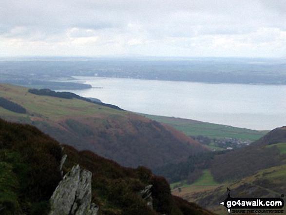
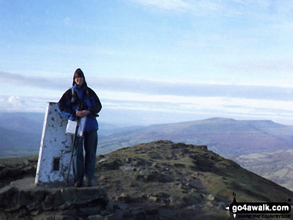
 Snowdon (Yr Wyddfa) in The BerwynsWales
Photo: Don Williams
Is there a Mountain, Peak, Top or Hill missing from the above google map or list?
Let us know an we will add it to our database.
To contribute to go4awalk.com or to contact us about anything at all - see Talk To Us.
For help see Help.
go4awalk.com and go4awalk.co.uk are registered trademarks of TMDH Limited.
Copyright © 2000-2026 TMDH Limited. All rights reserved.
Copyright Terms & Conditions Privacy Statement
A - Z Walks Home Log On/Accounts Photo Gallery Walk Ideas and Collections Fell Facts Hill Skills Walking Questions and Answers Your Stories News Competitions Product Reviews/Gear Tests Walking Gear Guides Peaks and Mountains Peak Bagging Find New Walking Friends Camping GPS Waypoints for Walking Contents Walk Search Talk To Us go4awalk.com Help Free Example Walks Newsletter


