All the Mountains, Peaks, Tops and Hills in Wales, Wales as a detailed list
Wales is defined as the whole of the principality of Wales which includes the National Parks of Snowdonia,
Bannau Brycheiniog (The Brecon Beacons) and The Pembrokeshire Coast as well as Mynyddoedd Cambria (The Cambrian Mountains), Radnor Forest, Anglesey, The Llynn Peninsula, The Preseli Mountains and The Gower Peninsula.
If you count only the Deweys there are 241 tops to climb, bag & conquer and the highest point is Craig Fach at 609m (1,999ft).
To see all Mountains, Peaks, Tops and Hills displayed in different ways - see the options in the left-hand column and towards the bottom of this page.
LOG ON and RELOAD this page to show which Mountains, Peaks, Tops and Hills you have already climbed, bagged & conquered [. . . more]
Page 1 of 9 Go to page:
1 2 3 4 5 6 7 8 9 |
See this list in: Alphabetical Order‡
| Height Order
To reverse the order select the link again.
Mountain, Peak, Top or Hill:
Bagged
1. Allt Forgan
513m (1,684ft)
Dewey (199th in Wales, 353rd in England & Wales)
N.B. The summit of Allt Forgan is on private land.
We hope to have walks that climb & bag Allt Forgan very soon
See the location of Allt Forgan and walks up it on a google MapAllt Forgan is on interactive maps:
OS Explorer (Orange Covers): OL12
OS Landranger (Pink Covers): 160
Allt Forgan is on Peak Bagging Map and Hill Tick List:
|
2. Banc Bugeilyn
551m (1,808ft)
Dewey (89th in Wales, 158th in England & Wales)
We hope to have walks that climb & bag Banc Bugeilyn very soon
See the location of Banc Bugeilyn and walks up it on a google MapBanc Bugeilyn is on interactive maps:
OS Explorer (Orange Covers): 215
OS Landranger (Pink Covers): 135
A go4awalk.com Peak Bagging Map and Hill Tick List featuring Banc Bugeilyn will be available soon. |
3. Banc Bwlchygarreg
516m (1,694ft)
Dewey (190th in Wales, 339th in England & Wales)
We hope to have walks that climb & bag Banc Bwlchygarreg very soon
See the location of Banc Bwlchygarreg and walks up it on a google MapBanc Bwlchygarreg is on interactive maps:
OS Explorer (Orange Covers): OL23
OS Landranger (Pink Covers): 135
A go4awalk.com Peak Bagging Map and Hill Tick List featuring Banc Bwlchygarreg will be available soon. |
4. Banc Bwlchygarreg (West Top)
510m (1,674ft)
Dewey (208th in Wales, 368th in England & Wales)
We hope to have walks that climb & bag Banc Bwlchygarreg (West Top) very soon
See the location of Banc Bwlchygarreg (West Top) and walks up it on a google MapBanc Bwlchygarreg (West Top) is on interactive maps:
OS Explorer (Orange Covers): OL23
OS Landranger (Pink Covers): 135
A go4awalk.com Peak Bagging Map and Hill Tick List featuring Banc Bwlchygarreg (West Top) will be available soon. |
5. Banc Dolwyn
537m (1,762ft)
Dewey (132nd in Wales, 232nd in England & Wales)
We hope to have walks that climb & bag Banc Dolwyn very soon
See the location of Banc Dolwyn and walks up it on a google MapBanc Dolwyn is on interactive maps:
OS Explorer (Orange Covers): 213
OS Landranger (Pink Covers): 135
A go4awalk.com Peak Bagging Map and Hill Tick List featuring Banc Dolwyn will be available soon. |
6. Banc Llechwedd-mawr
560m (1,837ft)
Dewey (69th in Wales, 123rd in England & Wales)
Marilyn (65th in Wales, 847th in GB)
We hope to have walks that climb & bag Banc Llechwedd-mawr very soon
See the location of Banc Llechwedd-mawr and walks up it on a google MapBanc Llechwedd-mawr is on interactive maps:
OS Explorer (Orange Covers): 213
OS Landranger (Pink Covers): 135
A go4awalk.com Peak Bagging Map and Hill Tick List featuring Banc Llechwedd-mawr will be available soon. |
7. Banc yr Wyn
503m (1,651ft)
Dewey (232nd in Wales, 406th in England & Wales)
We hope to have walks that climb & bag Banc yr Wyn very soon
See the location of Banc yr Wyn and walks up it on a google MapBanc yr Wyn is on interactive maps:
OS Explorer (Orange Covers): 213
OS Landranger (Pink Covers): 135
A go4awalk.com Peak Bagging Map and Hill Tick List featuring Banc yr Wyn will be available soon. |
8. Beacon Hill (Beguildy Beacon)
547m (1,795ft)
Dewey (101st in Wales, 176th in England & Wales)
Marilyn (71st in Wales, 886th in GB)
OS Trig Point
We hope to have walks that climb & bag Beacon Hill (Beguildy Beacon) very soon
See the location of Beacon Hill (Beguildy Beacon) and walks up it on a google MapBeacon Hill (Beguildy Beacon) is on interactive maps:
OS Explorer (Orange Covers): 214
OS Landranger (Pink Covers): 136 and
148
A go4awalk.com Peak Bagging Map and Hill Tick List featuring Beacon Hill (Beguildy Beacon) will be available soon. |
9. Blaen Rhestr
547m (1,795ft)
Dewey (102nd in Wales, 179th in England & Wales)
We hope to have walks that climb & bag Blaen Rhestr very soon
See the location of Blaen Rhestr and walks up it on a google MapBlaen Rhestr is on interactive maps:
OS Explorer (Orange Covers): 200
OS Landranger (Pink Covers): 135 and
136 and
147
A go4awalk.com Peak Bagging Map and Hill Tick List featuring Blaen Rhestr will be available soon. |
10. Blorenge (Blorens)
561m (1,841ft)
Dewey (68th in Wales, 121st in England & Wales)
OS Trig Point
We hope to have walks that climb & bag Blorenge (Blorens) very soon
See the location of Blorenge (Blorens) and walks up it on a google MapBlorenge (Blorens) is on interactive maps:
OS Explorer (Orange Covers): OL13
OS Landranger (Pink Covers): 161
Blorenge (Blorens) is on Peak Bagging Map and Hill Tick List:
|
11. Braich Ddu (Craig Cwm-llwyd)
546m (1,791ft)
Dewey (104th in Wales, 185th in England & Wales)
We hope to have walks that climb & bag Braich Ddu (Craig Cwm-llwyd) very soon
See the location of Braich Ddu (Craig Cwm-llwyd) and walks up it on a google MapBraich Ddu (Craig Cwm-llwyd) is on interactive maps:
OS Explorer (Orange Covers): OL23
OS Landranger (Pink Covers): 124
Braich Ddu (Craig Cwm-llwyd) is on Peak Bagging Map and Hill Tick List:
|
12. Brondre-fawr Hill
508m (1,667ft)
Dewey (218th in Wales, 384th in England & Wales)
We hope to have walks that climb & bag Brondre-fawr Hill very soon
See the location of Brondre-fawr Hill and walks up it on a google MapBrondre-fawr Hill is on interactive maps:
OS Explorer (Orange Covers):
OS Landranger (Pink Covers): 147
A go4awalk.com Peak Bagging Map and Hill Tick List featuring Brondre-fawr Hill will be available soon. |
13. Bryn (Waun Rydd)
562m (1,844ft)
Dewey (66th in Wales, 117th in England & Wales)
To walk, climb & bag Bryn (Waun Rydd) use either of these easy to follow walks:
See the location of Bryn (Waun Rydd) and walks up it on a google MapBryn (Waun Rydd) is on interactive maps:
OS Explorer (Orange Covers): OL12
OS Landranger (Pink Covers): 160
Bryn (Waun Rydd) is on Peak Bagging Map and Hill Tick List:
|
14. Bryn Banog
520m (1,707ft)
Dewey (178th in Wales, 316th in England & Wales)
We hope to have walks that climb & bag Bryn Banog very soon
See the location of Bryn Banog and walks up it on a google MapBryn Banog is on interactive maps:
OS Explorer (Orange Covers): OL17 and
OL18
OS Landranger (Pink Covers): 117
Bryn Banog is on Peak Bagging Map and Hill Tick List:
|
15. Bryn Coch
518m (1,700ft)
Dewey (182nd in Wales, 325th in England & Wales)
We hope to have walks that climb & bag Bryn Coch very soon
See the location of Bryn Coch and walks up it on a google MapBryn Coch is on interactive maps:
OS Explorer (Orange Covers): 214
OS Landranger (Pink Covers): 136
A go4awalk.com Peak Bagging Map and Hill Tick List featuring Bryn Coch will be available soon. |
16. Bryn Du (Esgair Ychion)
562m (1,845ft)
Dewey (65th in Wales, 116th in England & Wales)
We hope to have walks that climb & bag Bryn Du (Esgair Ychion) very soon
See the location of Bryn Du (Esgair Ychion) and walks up it on a google MapBryn Du (Esgair Ychion) is on interactive maps:
OS Explorer (Orange Covers): 214
OS Landranger (Pink Covers): 135 and
136
A go4awalk.com Peak Bagging Map and Hill Tick List featuring Bryn Du (Esgair Ychion) will be available soon. |
17. Bryn Du (Y Fawnen)
563m (1,847ft)
Dewey (64th in Wales, 114th in England & Wales)
OS Trig Point
We hope to have walks that climb & bag Bryn Du (Y Fawnen) very soon
See the location of Bryn Du (Y Fawnen) and walks up it on a google MapBryn Du (Y Fawnen) is on interactive maps:
OS Explorer (Orange Covers): 255
OS Landranger (Pink Covers): 125
Bryn Du (Y Fawnen) is on Peak Bagging Map and Hill Tick List:
|
18. Bryn y Fedwen
544m (1,785ft)
Dewey (111th in Wales, 199th in England & Wales)
We hope to have walks that climb & bag Bryn y Fedwen very soon
See the location of Bryn y Fedwen and walks up it on a google MapBryn y Fedwen is on interactive maps:
OS Explorer (Orange Covers): 215
OS Landranger (Pink Covers): 135 and
136
A go4awalk.com Peak Bagging Map and Hill Tick List featuring Bryn y Fedwen will be available soon. |
19. Bryn-llus
549m (1,801ft)
Dewey (95th in Wales, 168th in England & Wales)
We hope to have walks that climb & bag Bryn-llus very soon
See the location of Bryn-llus and walks up it on a google MapBryn-llus is on interactive maps:
OS Explorer (Orange Covers): 255
OS Landranger (Pink Covers): 125
Bryn-llus is on Peak Bagging Map and Hill Tick List:
|
20. Bryn-mawr
511m (1,677ft)
Dewey (205th in Wales, 363rd in England & Wales)
We hope to have walks that climb & bag Bryn-mawr very soon
See the location of Bryn-mawr and walks up it on a google MapBryn-mawr is on interactive maps:
OS Explorer (Orange Covers): OL18
OS Landranger (Pink Covers): 124 and
125
Bryn-mawr is on Peak Bagging Map and Hill Tick List:
|
21. Bryniau Gleision (Talybont Reservoir)
538m (1,766ft)
Dewey (124th in Wales, 221st in England & Wales)
To walk, climb & bag Bryniau Gleision (Talybont Reservoir) use this easy to follow walk:
See the location of Bryniau Gleision (Talybont Reservoir) and walks up it on a google MapBryniau Gleision (Talybont Reservoir) is on interactive maps:
OS Explorer (Orange Covers): OL12
OS Landranger (Pink Covers): 160
Bryniau Gleision (Talybont Reservoir) is on Peak Bagging Map and Hill Tick List:
|
22. Bwlch Mawr
509m (1,670ft)
Dewey (211th in Wales, 375th in England & Wales)
OS Trig Point
We hope to have walks that climb & bag Bwlch Mawr very soon
See the location of Bwlch Mawr and walks up it on a google MapBwlch Mawr is on interactive maps:
OS Explorer (Orange Covers): 254
OS Landranger (Pink Covers): 115 and
123
A go4awalk.com Peak Bagging Map and Hill Tick List featuring Bwlch Mawr will be available soon. |
23. Camlo Hill
509m (1,670ft)
Dewey (212th in Wales, 377th in England & Wales)
We hope to have walks that climb & bag Camlo Hill very soon
See the location of Camlo Hill and walks up it on a google MapCamlo Hill is on interactive maps:
OS Explorer (Orange Covers): 200
OS Landranger (Pink Covers): 136 and
147
A go4awalk.com Peak Bagging Map and Hill Tick List featuring Camlo Hill will be available soon. |
24. Carn Gwilym (Carn Hyddgen)
566m (1,858ft)
Dewey (56th in Wales, 101st in England & Wales)
We hope to have walks that climb & bag Carn Gwilym (Carn Hyddgen) very soon
See the location of Carn Gwilym (Carn Hyddgen) and walks up it on a google MapCarn Gwilym (Carn Hyddgen) is on interactive maps:
OS Explorer (Orange Covers): 215
OS Landranger (Pink Covers): 135
A go4awalk.com Peak Bagging Map and Hill Tick List featuring Carn Gwilym (Carn Hyddgen) will be available soon. |
25. Carn Pen-rhiw-ddu
534m (1,752ft)
Dewey (140th in Wales, 246th in England & Wales)
We hope to have walks that climb & bag Carn Pen-rhiw-ddu very soon
See the location of Carn Pen-rhiw-ddu and walks up it on a google MapCarn Pen-rhiw-ddu is on interactive maps:
OS Explorer (Orange Covers): OL12
OS Landranger (Pink Covers): 160
Carn Pen-rhiw-ddu is on Peak Bagging Map and Hill Tick List:
|
26. Carnedd Das Eithin
521m (1,709ft)
Dewey (175th in Wales, 313th in England & Wales)
We hope to have walks that climb & bag Carnedd Das Eithin very soon
See the location of Carnedd Das Eithin and walks up it on a google MapCarnedd Das Eithin is on interactive maps:
OS Explorer (Orange Covers): 239
OS Landranger (Pink Covers): 125
Carnedd Das Eithin is on Peak Bagging Map and Hill Tick List:
|
27. Carnedd Iago
538m (1,766ft)
Dewey (123rd in Wales, 220th in England & Wales)
We hope to have walks that climb & bag Carnedd Iago very soon
See the location of Carnedd Iago and walks up it on a google MapCarnedd Iago is on interactive maps:
OS Explorer (Orange Covers): OL18
OS Landranger (Pink Covers): 124
Carnedd Iago is on Peak Bagging Map and Hill Tick List:
|
28. Carnedd Wen
526m (1,726ft)
Dewey (161st in Wales, 283rd in England & Wales)
Marilyn (77th in Wales, 922nd in GB)
OS Trig Point
We hope to have walks that climb & bag Carnedd Wen very soon
See the location of Carnedd Wen and walks up it on a google MapCarnedd Wen is on interactive maps:
OS Explorer (Orange Covers): OL23 and
255
OS Landranger (Pink Covers): 125
A go4awalk.com Peak Bagging Map and Hill Tick List featuring Carnedd Wen will be available soon. |
29. Carnedd y Cribau
591m (1,940ft)
Dewey (26th in Wales, 43rd in England & Wales)
We hope to have walks that climb & bag Carnedd y Cribau very soon
See the location of Carnedd y Cribau and walks up it on a google MapCarnedd y Cribau is on interactive maps:
OS Explorer (Orange Covers): OL17
OS Landranger (Pink Covers): 115
Carnedd y Cribau is on Peak Bagging Map and Hill Tick List:
|
30. Carreg Cadno
538m (1,765ft)
Dewey (128th in Wales, 226th in England & Wales)
To walk, climb & bag Carreg Cadno use this easy to follow walk:
See the location of Carreg Cadno and walks up it on a google MapCarreg Cadno is on interactive maps:
OS Explorer (Orange Covers): OL12
OS Landranger (Pink Covers): 160
Carreg Cadno is on Peak Bagging Map and Hill Tick List:
|
Page 1 of 9 Go to page:
1 2 3 4 5 6 7 8 9 |
View all 735 Mountains, Peaks, Tops and Hills in WalesThe Brecon Beacons:
Is there a Mountain, Peak, Top or Hill missing from the above google map or list?
Let us know an we will add it to our database.
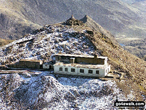 Snowdon (Yr Wyddfa) the highest point in The Brecon Beacons AreaWales
