![]()
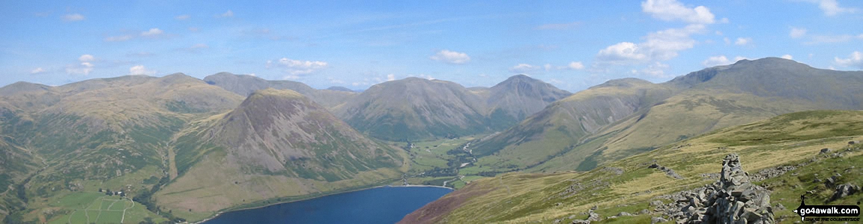
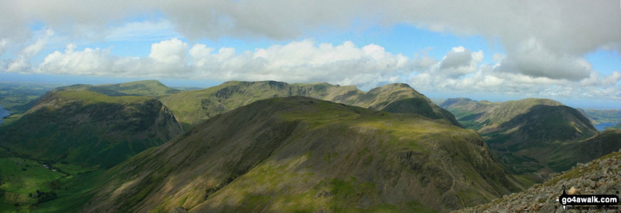
Seatallan
692m (2271ft)
The Western Fells, The Lake District, Cumbria, England
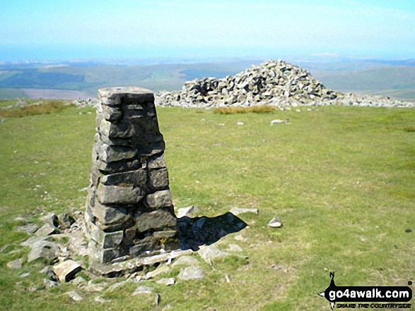
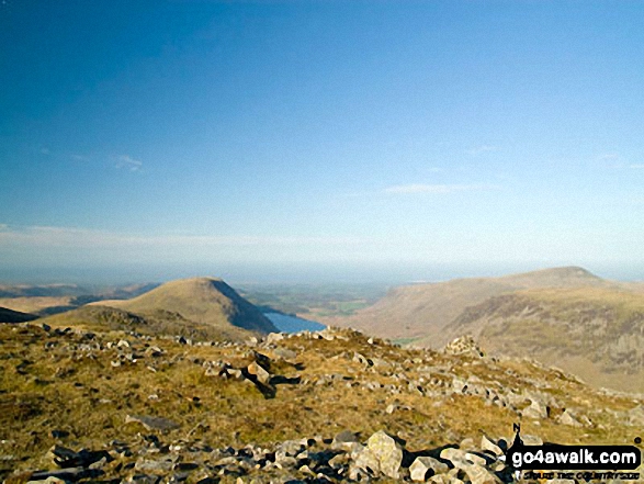
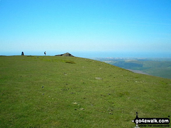
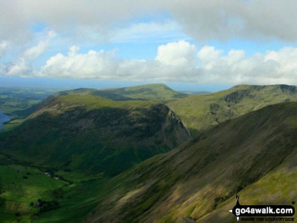
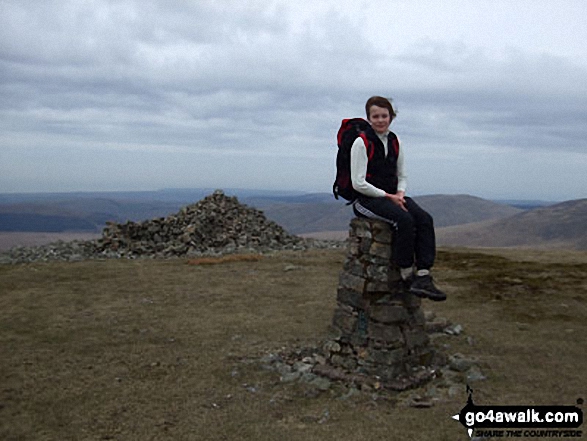
The summit of Seatallan is marked by an Ordnance Survey Trig Point.
Not familiar with this top?
   |
|---|
Vital Statistics:
| Length: | 6ml (9.5km) |
|---|---|
| Ascent: | 2,504ft (763m) |
| Time: | 4.75hrs |
| Grade: |  (Moderate) (Moderate) |
Route Summary:
Greendale Farm - Gill Farm - Gill Beck - Buckbarrow - Glade How - Cat Bields - Nether Wasdale Common - Seatallan - Pots of Ashness - Windscale Hows - Middle Fell (Wasdale) - Greendale Gill - Greendale Farm
|
|---|
Vital Statistics:
| Length: | 9.75ml (15.5km) |
|---|---|
| Ascent: | 3,236ft (986m) |
| Time: | 6.75hrs |
| Grade: |  (Hard) (Hard) |
Route Summary:
Greendale Farm - Gill Farm - Buckbarrow - Seatallan - Pots of Ashness - Gowder Crag - Haycock - Little Lad Crag - Nether Beck - Wast Water - Wasdale - Greendale Farm
|
|---|
Vital Statistics:
| Length: | 11.25ml (18km) |
|---|---|
| Ascent: | 5,100ft (1,554m) |
| Time: | 9.25hrs |
| Grade: |  (Hard) (Hard) |
Route Summary:
Greendale Farm - Middle Fell (Wasdale) - Seatallan - Pots of Ashness - Gowder Crag - Haycock - Great Scoat Fell - Steeple - Scoat Fell (Little Scoat Fell) - Red Pike (Wasdale) - Dore Head - Yewbarrow (North Top) - Yewbarrow - Bell Rib - Dropping Crag - Overbeck Bridge - Wast Water - Greendale Farm
|
|---|
Vital Statistics:
| Length: | 15.25ml (24.5km) |
|---|---|
| Ascent: | 4,841ft (1,475m) |
| Time: | 10½ hrs |
| Grade: |  (Very Hard) (Very Hard) |
Route Summary:
Wasdale Head - (National Trust Campsite) - Wast Water - Lingmell Gill - Illgill Head - Whin Rigg - Greathall Gill - Low Wood - Lund Bridge - Woodhow Farm - Woodhow Tarn - Scale Farm - Tosh Tarn - Gill Farm - Gill Beck - Buckbarrow - Cold Well - Nether Wasdale Common - Seatallan - Windscale Hows - Middle Fell (Wasdale) - Greendale Farm - Nether Beck - Overbeck Bridge - Wasdale Head - Wast Water.
See Seatallan and the surrounding tops on our free-to-access 'Google Style' Peak Bagging Maps:
The Western Fells of The Lake District National Park
Less data - quicker to download
The Whole of The Lake District National Park
More data - might take a little longer to download
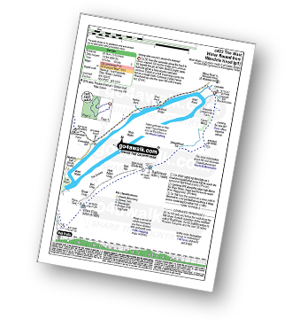
See Seatallan and the surrounding tops on our downloadable Peak Bagging Maps in PDF format:

NB: Whether you print off a copy or download it to your phone, these PDF Peak Baggers' Maps might prove incredibly useful when your are up there on the tops and you cannot get a phone signal.
*This version is marked with the walk routes you need to follow to Walk all 214 Wainwrights in just 59 walks.
You can find Seatallan & all the walks that climb it on these unique free-to-access Interactive Walk Planning Maps:
1:25,000 scale OS Explorer Map (orange/yellow covers):
1:50,000 scale OS Landranger Map (pink/magenta covers):
 Fellow go4awalkers who have already walked, climbed, summited & bagged Seatallan
Caroline Winter walked up it on July 30th, 2020 [from/via/route] Greendale Gill, Middle Fell, Seatallan, Buckbarrow, Tongue Gill. [with] Becky [weather] Rain eased by late morning. Clear views to Ireland on top - Back to bag some fells after nearly a year. Feeling the stiff walk up to Seatallan. Grassy trod down path most of the way. News reporter by greendale cottages on Mountain Rescuers & the prolonged time spent on walkers ill equipped for the hills.
Richard Fulcher climbed it on April 1st, 2025 [from/via/route] We parked near a Roan Wood Cottage & walked up to the base of Middle Fell in Greendale Gill. Straight up the edge to the top & then down the other side to the col & then up a steep climb up to Seatallan. From the trig station we headed off in a curve down to Greendale Gill & back to the car. [with] Jen [weather] Clear sunny day with very blustery strong winds. The winds made certain sections extremely tricky! - Great views from MF.
Ian Ashton bagged it on January 25th, 2025 [with] Ella
John Ramsbottom hiked it on August 18th, 2024 [from/via/route] Greendale horseshoe [with] Teyla/Lola [weather] Changeable - Good day with Teyla & Lola
Christine Shepherd summited on May 9th, 2009 [from/via/route] Walked from Greendale using walk c328 Climbed again on 22.8.21. [with] On my own [weather] Sunny to start with but ended up with mist & hailstone on Nether Wasdale Common - Although I am always prepared for a change in the weather being alone on the moor in mist & hailstone was a bit scary & the appearance of the summit cairn was a welcome relief. Climbed again 22.08.21 The summit was in cloud again so still haven't seen the view.Climbed again on 22.10.23 doing walk c328 in reverse. The climb up Seatallan this was was hard work but it was a change; I finally saw the wonderful views; they were worth waiting for.
Richard Marchant conquered it on October 2nd, 2022 [from/via/route] Parked at Greendale & headed North up alongside Greendale Gill & after 500m followed the ridge NE up onto Middle Fell then carried on NW up onto Seatallan then final headed South down to Buckbarrow, from here I went SW to Gill Beck & down to the road & back to Greendale. [with] On my Own [weather] Misty & low clouds to start with but then the Sun came out mid morning.
Kevin Foster scaled it on June 15th, 2022 [from/via/route] Roadside parking Greendale, Wasdale [with] By myself. [weather] Dry & sunny - A day requiring plenty of water & plenty of sunblock (and midge repellent). The approach via Greendale Tarn was pleasant. The steep climb onto the ridge of Seatallan not so but reward was the view from the top. Especially westward towards the Irish Sea. The Isle of Man was clear as a bell & almost seemed to be floating off the West Cumbrian coast.
Tim Winn walked up it on February 4th, 2022 [from/via/route] Wasdale [with] Barry, Paul and Roger [weather] Sunny
Michael Austin climbed it on June 28th, 2021 [from/via/route] C328
Charlotte Hewson bagged it on September 3rd, 2021 [from/via/route] The flat, across & up buckbarrow, on to seatallan & then middle fell. [with] Cas [weather] Misty - Saw a squirrel on the Seatallan trig point!
To add (or remove) your name and experiences on this page - Log On and edit your Personal Mountain Bagging Record
. . . [see more walk reports]
More Photographs & Pictures of views from, on or of Seatallan
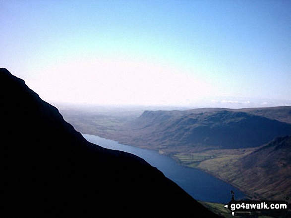
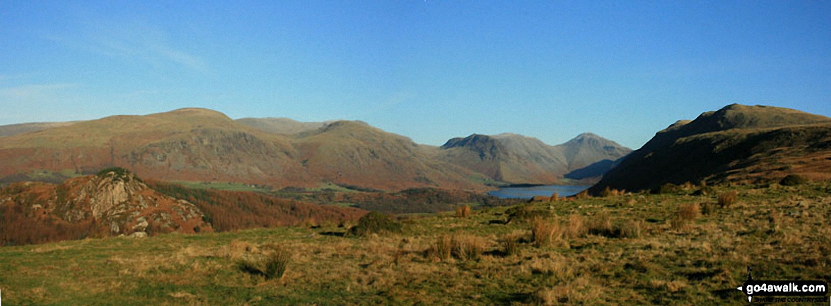
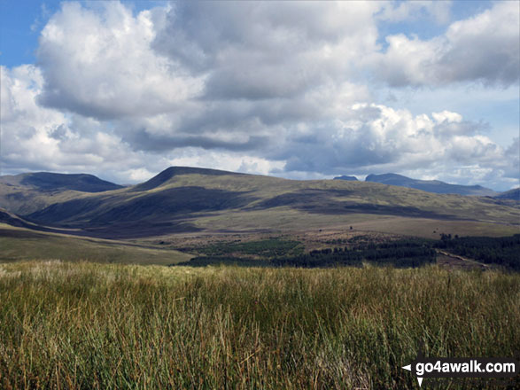
Send us your photographs and pictures on, of, or from Seatallan
If you would like to add your walk photographs and pictures to this page, please send them as email attachments (configured for any computer) along with your name to:
and we shall do our best to publish them.
(Guide Resolution = 300dpi. At least = 660pixels (wide) x 440 pixels (high).)

You can also submit photos via our Facebook Page.
NB. Please indicate where each photo was taken and whether you wish us to credit your photos with a Username or your First Name/Last Name.
Not familiar with this top?