The North Pennines - a fully detailed list of all the Mountains, Peaks, Tops and Hills (Page 1 of 2)
The North Pennines is located in Northern England covering parts of Cumbria, County Durham and Northumberland.
If you include just the Mountains (Hewitts) and the Nuttalls there are 37 tops to climb, bag & conquer and the highest point is Cross Fell at 893m (2,931ft).
To see these Mountains, Peaks, Tops and Hills displayed in different ways - see the options in the left-hand column and towards the bottom of this page.
LOG ON and RELOAD this page to show which Mountains, Peaks, Tops and Hills you have already climbed, bagged & conquered [. . . more details]
Page 1 of 2 Go to page:
1 2 |
See this list in: Alphabetical Order‡
| Height Order
To reverse the order select the link again.
Mountain, Peak, Top or Hill:
Bagged
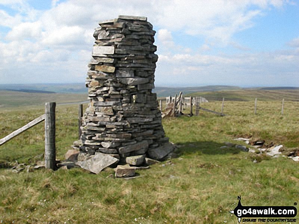
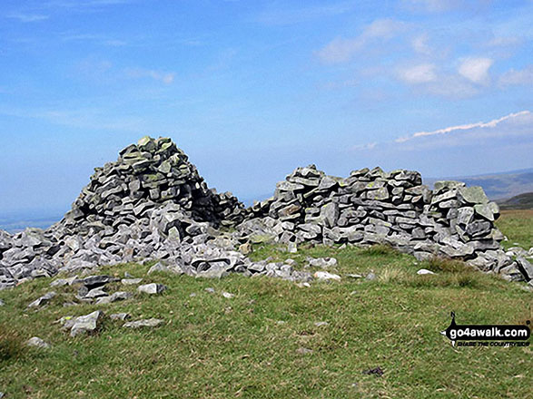
1. Backstone Edge (Dufton Fell)
699m (2,294ft)
Nuttall (135th in England, 222nd in England & Wales)
OS Trig Point
To walk, climb & bag Backstone Edge (Dufton Fell) use either of these easy-to-follow walks:
See the location of Backstone Edge (Dufton Fell) and walks up it on a google MapBackstone Edge (Dufton Fell) is on interactive maps:
OS Explorer (Orange Covers): OL19
OS Landranger (Pink Covers): 91
Backstone Edge (Dufton Fell) is on downloadable PDF you can Print or Save to your Phone:
|
2. Bellbeaver Rigg (Tynehead Fell)
620m (2,035ft)
Nuttall (233rd in England, 405th in England & Wales)
To walk, climb & bag Bellbeaver Rigg (Tynehead Fell) use any of these easy-to-follow walks:
See the location of Bellbeaver Rigg (Tynehead Fell) and walks up it on a google MapBellbeaver Rigg (Tynehead Fell) is on interactive maps:
OS Explorer (Orange Covers): OL31
OS Landranger (Pink Covers): 91
Bellbeaver Rigg (Tynehead Fell) is on downloadable PDF you can Print or Save to your Phone:
|
3. Bink Moss
619m (2,032ft)
Mountain (168th in England, 294th in England & Wales)
Nuttall (234th in England, 406th in England & Wales)
To walk, climb & bag Bink Moss use this easy-to-follow walk:
See the location of Bink Moss and walks up it on a google MapBink Moss is on interactive maps:
OS Explorer (Orange Covers): OL19
OS Landranger (Pink Covers): 91 and
92
Bink Moss is on downloadable PDF you can Print or Save to your Phone:
|
4. Black Fell (Haresceugh Fell)
664m (2,179ft)
Mountain (131st in England, 224th in England & Wales)
Nuttall (176th in England, 298th in England & Wales)
OS Trig Point
To walk, climb & bag Black Fell (Haresceugh Fell) use either of these easy-to-follow walks:
See the location of Black Fell (Haresceugh Fell) and walks up it on a google MapBlack Fell (Haresceugh Fell) is on interactive maps:
OS Explorer (Orange Covers): OL31
OS Landranger (Pink Covers): 86
Black Fell (Haresceugh Fell) is on downloadable PDF you can Print or Save to your Phone:
|
5. Bullman Hills
610m (2,001ft)
Nuttall (251st in England, 439th in England & Wales)
To walk, climb & bag Bullman Hills use this easy-to-follow walk:
See the location of Bullman Hills and walks up it on a google MapBullman Hills is on interactive maps:
OS Explorer (Orange Covers): OL31
OS Landranger (Pink Covers): 91
Bullman Hills is on downloadable PDF you can Print or Save to your Phone:
|
6. Burnhope Seat
747m (2,452ft)
Mountain (70th in England, 123rd in England & Wales)
Nuttall (86th in England, 150th in England & Wales)
Marilyn (22nd in England, 487th in GB)
OS Trig Point
We hope to have walks that climb & bag Burnhope Seat very soon
See the location of Burnhope Seat and walks up it on a google MapBurnhope Seat is on interactive maps:
OS Explorer (Orange Covers): OL31
OS Landranger (Pink Covers): 91
Burnhope Seat is on downloadable PDF you can Print or Save to your Phone:
|
7. Chapelfell Top
700m (2,298ft)
Mountain (105th in England, 173rd in England & Wales)
Nuttall (132nd in England, 218th in England & Wales)
To walk, climb & bag Chapelfell Top use either of these easy-to-follow walks:
See the location of Chapelfell Top and walks up it on a google MapChapelfell Top is on interactive maps:
OS Explorer (Orange Covers): OL31
OS Landranger (Pink Covers): 91 and
92
Chapelfell Top is on downloadable PDF you can Print or Save to your Phone:
|
8. Cold Fell Pike (Geltsdale)
621m (2,038ft)
Mountain (167th in England, 290th in England & Wales)
Nuttall (230th in England, 400th in England & Wales)
Marilyn (48th in England, 725th in GB)
OS Trig Point
To walk, climb & bag Cold Fell Pike (Geltsdale) use either of these easy-to-follow walks:
See the location of Cold Fell Pike (Geltsdale) and walks up it on a google MapCold Fell Pike (Geltsdale) is on interactive maps:
OS Explorer (Orange Covers): OL31
OS Landranger (Pink Covers): 86
Cold Fell Pike (Geltsdale) is on downloadable PDF you can Print or Save to your Phone:
|
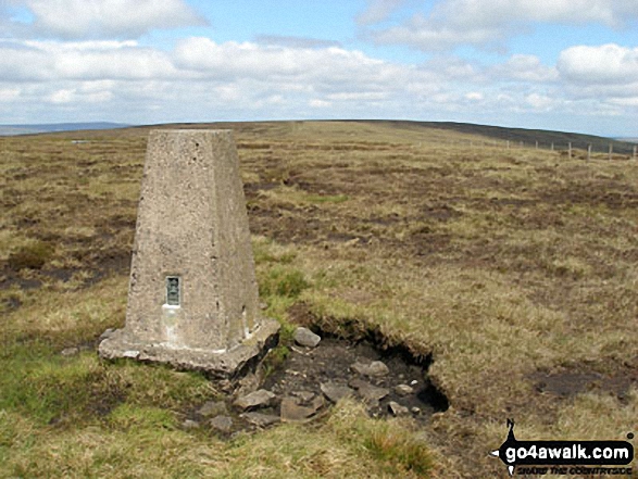
9. Cross Fell
893m (2,931ft)
Mountain (10th in England, 28th in England & Wales)
Nuttall (12th in England, 30th in England & Wales)
Marilyn (5th in England, 248th in GB)
OS Trig Point
To walk, climb & bag Cross Fell use either of these easy-to-follow walks:
See the location of Cross Fell and walks up it on a google MapCross Fell is on interactive maps:
OS Explorer (Orange Covers): OL31
OS Landranger (Pink Covers): 91
Cross Fell is on downloadable PDF you can Print or Save to your Phone:
|
10. Dead Stones
710m (2,330ft)
Mountain (93rd in England, 157th in England & Wales)
Nuttall (117th in England, 199th in England & Wales)
We hope to have walks that climb & bag Dead Stones very soon
See the location of Dead Stones and walks up it on a google MapDead Stones is on interactive maps:
OS Explorer (Orange Covers): OL31
OS Landranger (Pink Covers): 91
Dead Stones is on downloadable PDF you can Print or Save to your Phone:
|
11. Fendrith Hill
697m (2,287ft)
Nuttall (137th in England, 226th in England & Wales)
OS Trig Point
To walk, climb & bag Fendrith Hill use either of these easy-to-follow walks:
See the location of Fendrith Hill and walks up it on a google MapFendrith Hill is on interactive maps:
OS Explorer (Orange Covers): OL31
OS Landranger (Pink Covers): 91 and
92
Fendrith Hill is on downloadable PDF you can Print or Save to your Phone:
|
12. Fiend's Fell
634m (2,081ft)
Nuttall (208th in England, 358th in England & Wales)
OS Trig Point
To walk, climb & bag Fiend's Fell use this easy-to-follow walk:
See the location of Fiend's Fell and walks up it on a google MapFiend's Fell is on interactive maps:
OS Explorer (Orange Covers): OL31
OS Landranger (Pink Covers): 86
Fiend's Fell is on downloadable PDF you can Print or Save to your Phone:
|
13. Flinty Fell
614m (2,016ft)
Mountain (173rd in England, 302nd in England & Wales)
Nuttall (242nd in England, 420th in England & Wales)
OS Trig Point
To walk, climb & bag Flinty Fell use this easy-to-follow walk:
See the location of Flinty Fell and walks up it on a google MapFlinty Fell is on interactive maps:
OS Explorer (Orange Covers): OL31
OS Landranger (Pink Covers): 86 and
87
Flinty Fell is on downloadable PDF you can Print or Save to your Phone:
|
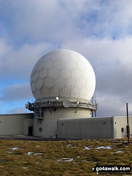
14. Great Dun Fell
848m (2,783ft)
Mountain (24th in England, 50th in England & Wales)
Nuttall (29th in England, 57th in England & Wales)
OS Trig Point
To walk, climb & bag Great Dun Fell use this easy-to-follow walk:
See the location of Great Dun Fell and walks up it on a google MapGreat Dun Fell is on interactive maps:
OS Explorer (Orange Covers): OL31
OS Landranger (Pink Covers): 91
Great Dun Fell is on downloadable PDF you can Print or Save to your Phone:
|
15. Great Stony Hill
708m (2,323ft)
Mountain (98th in England, 164th in England & Wales)
Nuttall (122nd in England, 206th in England & Wales)
OS Trig Point
To walk, climb & bag Great Stony Hill use any of these easy-to-follow walks:
See the location of Great Stony Hill and walks up it on a google MapGreat Stony Hill is on interactive maps:
OS Explorer (Orange Covers): OL31
OS Landranger (Pink Covers): 91 and
92
Great Stony Hill is on downloadable PDF you can Print or Save to your Phone:
|
16. Grey Nag
656m (2,153ft)
Mountain (138th in England, 239th in England & Wales)
Nuttall (185th in England, 320th in England & Wales)
OS Trig Point
To walk, climb & bag Grey Nag use either of these easy-to-follow walks:
See the location of Grey Nag and walks up it on a google MapGrey Nag is on interactive maps:
OS Explorer (Orange Covers): OL31
OS Landranger (Pink Covers): 86
Grey Nag is on downloadable PDF you can Print or Save to your Phone:
|
17. Killhope Law
673m (2,208ft)
Mountain (123rd in England, 207th in England & Wales)
Nuttall (165th in England, 278th in England & Wales)
OS Trig Point
To walk, climb & bag Killhope Law use any of these easy-to-follow walks:
See the location of Killhope Law and walks up it on a google MapKillhope Law is on interactive maps:
OS Explorer (Orange Covers): OL31
OS Landranger (Pink Covers): 86 and
87
Killhope Law is on downloadable PDF you can Print or Save to your Phone:
|
18. Knock Fell
794m (2,606ft)
Mountain (45th in England, 83rd in England & Wales)
Nuttall (54th in England, 101st in England & Wales)
To walk, climb & bag Knock Fell use this easy-to-follow walk:
See the location of Knock Fell and walks up it on a google MapKnock Fell is on interactive maps:
OS Explorer (Orange Covers): OL31
OS Landranger (Pink Covers): 91
Knock Fell is on downloadable PDF you can Print or Save to your Phone:
|
19. Little Dun Fell
842m (2,763ft)
Mountain (26th in England, 52nd in England & Wales)
Nuttall (32nd in England, 60th in England & Wales)
To walk, climb & bag Little Dun Fell use this easy-to-follow walk:
See the location of Little Dun Fell and walks up it on a google MapLittle Dun Fell is on interactive maps:
OS Explorer (Orange Covers): OL31
OS Landranger (Pink Covers): 91
Little Dun Fell is on downloadable PDF you can Print or Save to your Phone:
|
20. Little Fell (Burton Fell)
748m (2,455ft)
Mountain (69th in England, 122nd in England & Wales)
Nuttall (85th in England, 149th in England & Wales)
OS Trig Point
To walk, climb & bag Little Fell (Burton Fell) use this easy-to-follow walk:
See the location of Little Fell (Burton Fell) and walks up it on a google MapLittle Fell (Burton Fell) is on interactive maps:
OS Explorer (Orange Covers): OL19
OS Landranger (Pink Covers): 91
Little Fell (Burton Fell) is on downloadable PDF you can Print or Save to your Phone:
|
21. Long Fell
623m (2,045ft)
Nuttall (226th in England, 391st in England & Wales)
Long Fell was promoted to 'Nuttall' status in November, 2016.
To walk, climb & bag Long Fell use this easy-to-follow walk:
See the location of Long Fell and walks up it on a google MapLong Fell is on interactive maps:
OS Explorer (Orange Covers): OL19
OS Landranger (Pink Covers): 91
Long Fell is on downloadable PDF you can Print or Save to your Phone:
|
22. Long Man Hill
658m (2,159ft)
Nuttall (183rd in England, 318th in England & Wales)
To walk, climb & bag Long Man Hill use either of these easy-to-follow walks:
See the location of Long Man Hill and walks up it on a google MapLong Man Hill is on interactive maps:
OS Explorer (Orange Covers): OL31
OS Landranger (Pink Covers): 91
Long Man Hill is on downloadable PDF you can Print or Save to your Phone:
|
23. Meldon Hill (Dufton Fell)
767m (2,517ft)
Mountain (61st in England, 106th in England & Wales)
Nuttall (75th in England, 130th in England & Wales)
OS Trig Point
To walk, climb & bag Meldon Hill (Dufton Fell) use this easy-to-follow walk:
See the location of Meldon Hill (Dufton Fell) and walks up it on a google MapMeldon Hill (Dufton Fell) is on interactive maps:
OS Explorer (Orange Covers): OL19 and
OL31
OS Landranger (Pink Covers): 91
Meldon Hill (Dufton Fell) is on downloadable PDF you can Print or Save to your Phone:
|
24. Melmerby Fell
709m (2,326ft)
Mountain (96th in England, 162nd in England & Wales)
Nuttall (120th in England, 204th in England & Wales)
To walk, climb & bag Melmerby Fell use this easy-to-follow walk:
See the location of Melmerby Fell and walks up it on a google MapMelmerby Fell is on interactive maps:
OS Explorer (Orange Covers): OL31
OS Landranger (Pink Covers): 91
Melmerby Fell is on downloadable PDF you can Print or Save to your Phone:
|
25. Mickle Fell
788m (2,586ft)
Mountain (49th in England, 88th in England & Wales)
Nuttall (58th in England, 107th in England & Wales)
Marilyn (17th in England, 414th in GB)
Mickle Fell is the highest point in the county of County Durham.
To walk, climb & bag Mickle Fell use this easy-to-follow walk:
See the location of Mickle Fell and walks up it on a google MapMickle Fell is on interactive maps:
OS Explorer (Orange Covers): OL19
OS Landranger (Pink Covers): 91 and
92
Mickle Fell is on downloadable PDF you can Print or Save to your Phone:
|
26. Middlehope Moor
612m (2,008ft)
Mountain (176th in England, 309th in England & Wales)
Nuttall (247th in England, 431st in England & Wales)
OS Trig Point
To walk, climb & bag Middlehope Moor use this easy-to-follow walk:
See the location of Middlehope Moor and walks up it on a google MapMiddlehope Moor is on interactive maps:
OS Explorer (Orange Covers): OL31
OS Landranger (Pink Covers): 87
Middlehope Moor is on downloadable PDF you can Print or Save to your Phone:
|
27. Murton Fell
673m (2,210ft)
Mountain (122nd in England, 206th in England & Wales)
Nuttall (163rd in England, 276th in England & Wales)
To walk, climb & bag Murton Fell use either of these easy-to-follow walks:
See the location of Murton Fell and walks up it on a google MapMurton Fell is on interactive maps:
OS Explorer (Orange Covers): OL19
OS Landranger (Pink Covers): 91
Murton Fell is on downloadable PDF you can Print or Save to your Phone:
|
28. Nine Standards Rigg
662m (2,172ft)
Mountain (134th in England, 229th in England & Wales)
Nuttall (180th in England, 306th in England & Wales)
Marilyn (43rd in England, 673rd in GB)
OS Trig Point
To walk, climb & bag Nine Standards Rigg use any of these easy-to-follow walks:
See the location of Nine Standards Rigg and walks up it on a google MapNine Standards Rigg is on interactive maps:
OS Explorer (Orange Covers): OL19
OS Landranger (Pink Covers): 91 and
92
Nine Standards Rigg is on downloadable PDF you can Print or Save to your Phone:
|
29. Redgleam (Harwood Common)
715m (2,346ft)
Nuttall (114th in England, 193rd in England & Wales)
To walk, climb & bag Redgleam (Harwood Common) use any of these easy-to-follow walks:
See the location of Redgleam (Harwood Common) and walks up it on a google MapRedgleam (Harwood Common) is on interactive maps:
OS Explorer (Orange Covers): OL31
OS Landranger (Pink Covers): 91
Redgleam (Harwood Common) is on downloadable PDF you can Print or Save to your Phone:
|
30. Renwick Fell (Thack Moor)
609m (2,000ft)
Mountain (179th in England, 316th in England & Wales)
Nuttall (254th in England, 443rd in England & Wales)
OS Trig Point
Renwick Fell (Thack Moor) was reclassified from a 'Dewey' to a Mountain (Hewitt) and 'Nuttall' in April 2013. Formerly thought to be fractionally under the 609.6m (2000ft) required for mountain status, the Ordnance Survey has confirmed the height to be 609.62m (2000ft and 3/4 inch).
To walk, climb & bag Renwick Fell (Thack Moor) use either of these easy-to-follow walks:
See the location of Renwick Fell (Thack Moor) and walks up it on a google MapRenwick Fell (Thack Moor) is on interactive maps:
OS Explorer (Orange Covers): OL43
OS Landranger (Pink Covers): 86
Renwick Fell (Thack Moor) is on downloadable PDF you can Print or Save to your Phone:
|
Page 1 of 2 Go to page:
1 2 |
View these 37 Mountains, Peaks, Tops and Hills:
# Whether you print a copy or download it to your phone, this Peak Baggers' Map will prove incredibly useful if you want to know what's what when you are up in the mountains and cannot get a phone signal.
Is there a Mountain, Peak, Top or Hill missing from the above google map or list?
Let us know an we will add it to our database.

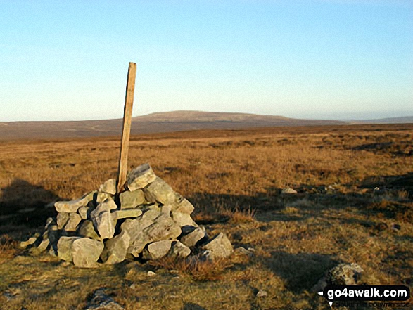


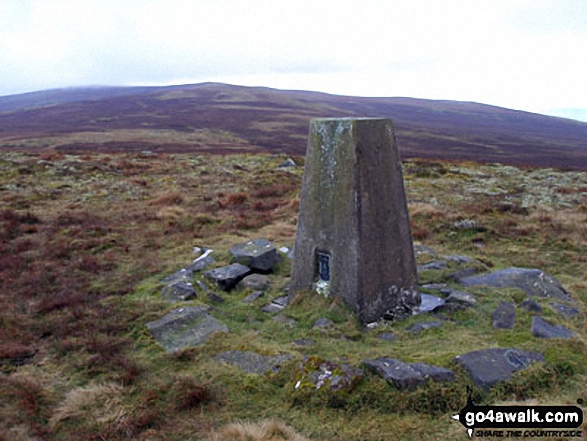
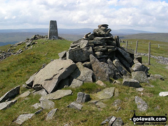


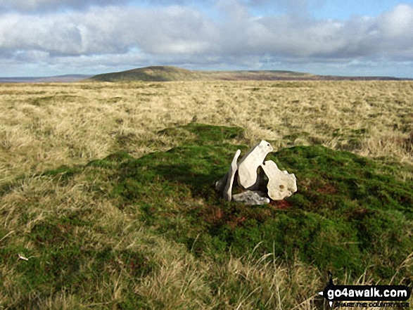
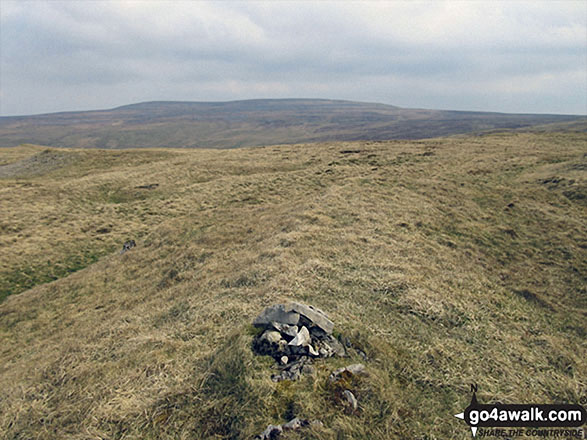
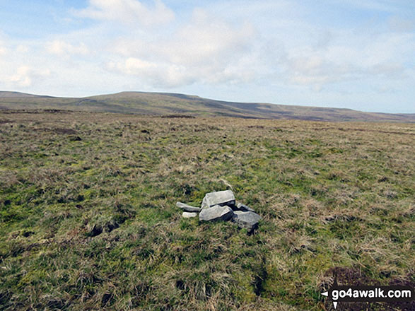
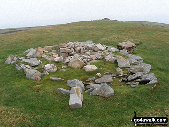


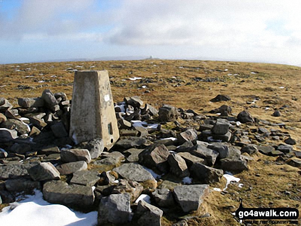 The summit of Cross Fell in The North Pennines