Mynyddoedd Cambria (The Cambrian Mountains) - a fully detailed list of all the Mountains, Peaks, Tops and Hills (Page of 3)
The South Western Area of The South Western Area of Mynyddoedd Cambria (The Cambrian Mountains), Carmarthenshire, Ceredigion and Powys is the area enclosed by:
- the A44 from Aberystwyth to Llangurig to the North; the A470 from Llangurig via Rhayader to Builth Wells to the East;
- the A483 from Builth Wells to Llandovery, and then the Brecon Beacons National Park boundary to Ffairfach to the South East;
- the B4300 from Ffairfach to Caerfyrddin/Carmarthen to the South; the A484 from Caerfyrddin/Carmarthen to Cynwy Elfed, the B4333 to Newcastle Emlyn and then the A484 to Ceredigion/Cardigan to the South West;
- the Irish Sea from Ceredigion/Cardigan to Aberystwyth to the West;
If you include all the Mountains (Hewitts), the Deweys, the Nuttalls, the Marilyns, the Bridgets (Hills) and all the Mountains, Tops, Peaks and Hills with a Trig Point on them there are 66 tops to climb, bag & conquer and the highest point is Drygarn Fawr at 645m (2,116ft).
To see these Mountains, Peaks, Tops and Hills displayed in different ways - see the options in the left-hand column and towards the bottom of this page.
![]() Your Personal Bagging Record for The South Western Area of The South Western Area of Mynyddoedd Cambria (The Cambrian Mountains)
Your Personal Bagging Record for The South Western Area of The South Western Area of Mynyddoedd Cambria (The Cambrian Mountains)
LOG ON and RELOAD this page to show which Mountains, Peaks, Tops and Hills you have already climbed, bagged & conquered [. . . more details]
See this list in: Alphabetical Order‡
| Height Order
To reverse the order select the link again.
Mountain, Peak, Top or Hill:
Bagged

![]()
1. Allt Maestir (Berthlwyd)
278m (912ft)
Send it in and we'll publish it here.
Allt Maestir (Berthlwyd) is on interactive maps:
A downloadable go4awalk.com PDF Peak Bagging Map featuring Allt Maestir (Berthlwyd) will be available soon. |

![]()
2. Allt yr Hebog
342m (1,122ft)
Allt yr Hebog is on interactive maps:
A downloadable go4awalk.com PDF Peak Bagging Map featuring Allt yr Hebog will be available soon. |
![]()
3. Banc Beili-Tew
278m (912ft)
Banc Beili-Tew is on interactive maps:
A downloadable go4awalk.com PDF Peak Bagging Map featuring Banc Beili-Tew will be available soon. |
![]()
4. Banc Cwm-coed-ifor
309m (1,014ft)
Banc Cwm-coed-ifor is on interactive maps:
A downloadable go4awalk.com PDF Peak Bagging Map featuring Banc Cwm-coed-ifor will be available soon. |

![]()
5. Banc Dolwyn
537m (1,762ft)
Banc Dolwyn is on interactive maps:
A downloadable go4awalk.com PDF Peak Bagging Map featuring Banc Dolwyn will be available soon. |
![]()
6. Banc y Garreg
332m (1,089ft)
Banc y Garreg is on interactive maps:
A downloadable go4awalk.com PDF Peak Bagging Map featuring Banc y Garreg will be available soon. |
![]()
7. Banc y Graig
408m (1,339ft)
Banc y Graig is on interactive maps:
|
![]()
8. Black Wood (Allt Ddu)
244m (800ft)
Send it in and we'll publish it here.
Black Wood (Allt Ddu) is on interactive maps:
A downloadable go4awalk.com PDF Peak Bagging Map featuring Black Wood (Allt Ddu) will be available soon. |
![]()
9. Blaen Rhestr
547m (1,795ft)
Blaen Rhestr is on interactive maps:
A downloadable go4awalk.com PDF Peak Bagging Map featuring Blaen Rhestr will be available soon. |
![]()
10. Bryn Du (Esgair Ychion)
562m (1,845ft)
Send it in and we'll publish it here.
Bryn Du (Esgair Ychion) is on interactive maps:
A downloadable go4awalk.com PDF Peak Bagging Map featuring Bryn Du (Esgair Ychion) will be available soon. |
![]()
11. Bryn Ffynnon
440m (1,444ft)
Bryn Ffynnon is on interactive maps:
A downloadable go4awalk.com PDF Peak Bagging Map featuring Bryn Ffynnon will be available soon. |

![]()
12. Carn Gafallt
466m (1,529ft)
Carn Gafallt is on interactive maps:
A downloadable go4awalk.com PDF Peak Bagging Map featuring Carn Gafallt will be available soon. |
![]()
13. Carreg yr Ast
579m (1,900ft)
Carreg yr Ast is on interactive maps:
A downloadable go4awalk.com PDF Peak Bagging Map featuring Carreg yr Ast will be available soon. |
![]()
14. Cefn Coch (Tywi Forest)
500m (1,641ft)
Send it in and we'll publish it here.
Cefn Coch (Tywi Forest) is on interactive maps:
|
![]()
15. Cefn Croes
573m (1,880ft)
Cefn Croes is on interactive maps:
A downloadable go4awalk.com PDF Peak Bagging Map featuring Cefn Croes will be available soon. |
![]()
16. Cefn y Cnwc
527m (1,729ft)
Cefn y Cnwc is on interactive maps:
A downloadable go4awalk.com PDF Peak Bagging Map featuring Cefn y Cnwc will be available soon. |
![]()
17. Cerrig Gwaun-y-llan
538m (1,765ft)
Send it in and we'll publish it here.
Cerrig Gwaun-y-llan is on interactive maps:
A downloadable go4awalk.com PDF Peak Bagging Map featuring Cerrig Gwaun-y-llan will be available soon. |
![]()
18. Cerrig Llwydion
509m (1,670ft)
Cerrig Llwydion is on interactive maps:
A downloadable go4awalk.com PDF Peak Bagging Map featuring Cerrig Llwydion will be available soon. |
![]()
19. Coed Nant-yr-hwch
505m (1,657ft)
Coed Nant-yr-hwch is on interactive maps:
A downloadable go4awalk.com PDF Peak Bagging Map featuring Coed Nant-yr-hwch will be available soon. |
![]()
20. Craig Dyfnant
539m (1,768ft)
Craig Dyfnant is on interactive maps:
A downloadable go4awalk.com PDF Peak Bagging Map featuring Craig Dyfnant will be available soon. |
![]()
21. Craig Fawr
519m (1,703ft)
Craig Fawr is on interactive maps:
A downloadable go4awalk.com PDF Peak Bagging Map featuring Craig Fawr will be available soon. |
![]()
22. Cripiau Eisteddfa-fach
524m (1,719ft)
Send it in and we'll publish it here.
Cripiau Eisteddfa-fach is on interactive maps:
A downloadable go4awalk.com PDF Peak Bagging Map featuring Cripiau Eisteddfa-fach will be available soon. |
![]()
23. Crug Gynon
525m (1,723ft)
Crug Gynon is on interactive maps:
A downloadable go4awalk.com PDF Peak Bagging Map featuring Crug Gynon will be available soon. |

![]()
24. Crugiau Merched (Crugiau Ladis)
462m (1,516ft)
Send it in and we'll publish it here.
Crugiau Merched (Crugiau Ladis) is on interactive maps:
A downloadable go4awalk.com PDF Peak Bagging Map featuring Crugiau Merched (Crugiau Ladis) will be available soon. |
![]()
25. Dibyn Du
516m (1,693ft)
Dibyn Du is on interactive maps:
A downloadable go4awalk.com PDF Peak Bagging Map featuring Dibyn Du will be available soon. |
![]()
26. Dinas (Llyn Brianne)
331m (1,086ft)
Send it in and we'll publish it here.
Dinas (Llyn Brianne) is on interactive maps:
A downloadable go4awalk.com PDF Peak Bagging Map featuring Dinas (Llyn Brianne) will be available soon. |
![]()
27. Domen Milwyn
555m (1,821ft)
Domen Milwyn is on interactive maps:
A downloadable go4awalk.com PDF Peak Bagging Map featuring Domen Milwyn will be available soon. |
![]()
28. Drum Ddu (Carn-y-geifr)
538m (1,765ft)
Send it in and we'll publish it here.
Drum Ddu (Carn-y-geifr) is on interactive maps:
A downloadable go4awalk.com PDF Peak Bagging Map featuring Drum Ddu (Carn-y-geifr) will be available soon. |

![]()
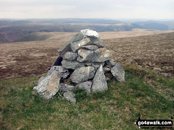
29. Drygarn Fawr
645m (2,116ft)
Drygarn Fawr is on interactive maps:
A downloadable go4awalk.com PDF Peak Bagging Map featuring Drygarn Fawr will be available soon. |

![]()
30. Esgair Cloddiad
532m (1,746ft)
Esgair Cloddiad is on interactive maps:
A downloadable go4awalk.com PDF Peak Bagging Map featuring Esgair Cloddiad will be available soon. |
View these 66 Mountains, Peaks, Tops and Hills:
- On an Interactive Google Map (loads faster)
- On an Interactive Google Map with a list of tops below it.
(makes it easier to locate a particular top) - On a Detailed List in:
Alphabetical Order | Height Order - On one page with 'yet-to-be-bagged' listed 1st & then 'already-bagged' tops listed 2nd in:
Alphabetical Order | Height Order - On one page with 'already-bagged' tops listed 1st & then 'yet-to-be-bagged' tops listed 2nd in:
Alphabetical Order | Height Order
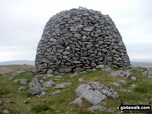 Drygarn Fawr in The South Western Area of Mynyddoedd Cambria (The Cambrian Mountains)
Photo: Colin France
Is there a Mountain, Peak, Top or Hill missing from the above google map or list?
Let us know an we will add it to our database.

To contribute to go4awalk.com or to contact us about anything at all - see Talk To Us.
For help see Help.
go4awalk.com and go4awalk.co.uk are registered trademarks of TMDH Limited.
Copyright © 2000-2026 TMDH Limited. All rights reserved.
Copyright Terms & Conditions Privacy Statement
A - Z Walks Home Log On/Accounts Photo Gallery Walk Ideas and Collections Fell Facts Hill Skills Walking Questions and Answers Your Stories News Competitions Product Reviews/Gear Tests Walking Gear Guides Peaks and Mountains Peak Bagging Find New Walking Friends Camping GPS Waypoints for Walking Contents Walk Search Talk To Us go4awalk.com Help Free Example Walks Newsletter


