The North East region of England - a fully detailed list of all the Mountains, Peaks, Tops and Hills (Page 2 of 2)
The North East region of England comprises the traditional counties of County Durham, Tyne and Wear and Northumberland and includes most of Northumberland National Park and The Northern Pennines.
If you include all the Mountains (Hewitts), the Deweys, the Nuttalls, the Marilyns, the Bridgets (Hills) and all the Mountains, Tops, Peaks and Hills with a Trig Point on them there are 85 tops to climb, bag & conquer and the highest point is The Cheviot at 815m (2,674ft).
To see these Mountains, Peaks, Tops and Hills displayed in different ways - see the options in the left-hand column and towards the bottom of this page.
LOG ON and RELOAD this page to show which Mountains, Peaks, Tops and Hills you have already climbed, bagged & conquered [. . . more details]
Page 2 of 2 Go to page: 1 2 |
See this list in: Alphabetical Order‡
| Height Order
To reverse the order select the link again.
Mountain, Peak, Top or Hill:
Bagged
31. Eggleston Common
488m (1,601ft)
Eggleston Common is on interactive maps:
Eggleston Common is on downloadable PDF you can Print or Save to your Phone: |
32. Dunmoor Hill
569m (1,867ft)
Dunmoor Hill is on interactive maps:
A downloadable go4awalk.com PDF Peak Bagging Map featuring Dunmoor Hill will be available soon. |
33. Dry Rigg (Redburn Common)
566m (1,857ft)
Send it in and we'll publish it here.
Dry Rigg (Redburn Common) is on interactive maps:
Dry Rigg (Redburn Common) is on downloadable PDF you can Print or Save to your Phone: |
34. Dod Law (Doddington Moor)
200m (656ft)
Send it in and we'll publish it here.
See the location of Dod Law (Doddington Moor) and walks up it on a google Map Dod Law (Doddington Moor) is on interactive maps:
|
35. Deadwater Fell
569m (1,867ft)
Deadwater Fell is on interactive maps:
A downloadable go4awalk.com PDF Peak Bagging Map featuring Deadwater Fell will be available soon. |
36. Cushat Law
616m (2,022ft)
See the location of Cushat Law and walks up it on a google Map Cushat Law is on interactive maps:
A downloadable go4awalk.com PDF Peak Bagging Map featuring Cushat Law will be available soon. |
37. Currock Hill
259m (850ft)
Currock Hill is on interactive maps:
|
38. Comb Fell
652m (2,139ft)
See the location of Comb Fell and walks up it on a google Map Comb Fell is on interactive maps:
A downloadable go4awalk.com PDF Peak Bagging Map featuring Comb Fell will be available soon. |
39. Collier Law
517m (1,697ft)
See the location of Collier Law and walks up it on a google Map Collier Law is on interactive maps:
Collier Law is on downloadable PDF you can Print or Save to your Phone: |
40. Chapelfell Top
700m (2,298ft)
See the location of Chapelfell Top and walks up it on a google Map Chapelfell Top is on interactive maps:
Chapelfell Top is on downloadable PDF you can Print or Save to your Phone: |
41. Catterick Moss
426m (1,398ft)
Catterick Moss is on interactive maps:
Catterick Moss is on downloadable PDF you can Print or Save to your Phone: |
42. Carter Bar (Carter Fell)
579m (1,900ft)
Send it in and we'll publish it here.
Carter Bar (Carter Fell) is on interactive maps:
A downloadable go4awalk.com PDF Peak Bagging Map featuring Carter Bar (Carter Fell) will be available soon. |
43. Bulbeck Common
427m (1,401ft)
Bulbeck Common is on interactive maps:
Bulbeck Common is on downloadable PDF you can Print or Save to your Phone: |
44. Brownley Hill (Kevelin Moor)
533m (1,749ft)
Send it in and we'll publish it here.
Brownley Hill (Kevelin Moor) is on interactive maps:
Brownley Hill (Kevelin Moor) is on downloadable PDF you can Print or Save to your Phone: |
45. Brownhart Law
508m (1,667ft)
Brownhart Law is on interactive maps:
A downloadable go4awalk.com PDF Peak Bagging Map featuring Brownhart Law will be available soon. |
46. Broadhope Hill
517m (1,696ft)
See the location of Broadhope Hill and walks up it on a google Map Broadhope Hill is on interactive maps:
A downloadable go4awalk.com PDF Peak Bagging Map featuring Broadhope Hill will be available soon. |
47. Bolt's Law (Hunstanworth)
541m (1,776ft)
Send it in and we'll publish it here.
See the location of Bolt's Law (Hunstanworth) and walks up it on a google Map Bolt's Law (Hunstanworth) is on interactive maps:
Bolt's Law (Hunstanworth) is on downloadable PDF you can Print or Save to your Phone: |
48. Bollihope Carrs
541m (1,775ft)
Bollihope Carrs is on interactive maps:
|
49. Bloodybush Edge
610m (2,001ft)
See the location of Bloodybush Edge and walks up it on a google Map Bloodybush Edge is on interactive maps:
A downloadable go4awalk.com PDF Peak Bagging Map featuring Bloodybush Edge will be available soon. |
50. Blackhill Edge (Westernhope Moor)
559m (1,834ft)
Send it in and we'll publish it here.
Blackhill Edge (Westernhope Moor) is on interactive maps:
|
51. Black Hag (Hethpool)
549m (1,801ft)
See the location of Black Hag (Hethpool) and walks up it on a google Map Black Hag (Hethpool) is on interactive maps:
A downloadable go4awalk.com PDF Peak Bagging Map featuring Black Hag (Hethpool) will be available soon. |
52. Birnie Brae
508m (1,667ft)
See the location of Birnie Brae and walks up it on a google Map Birnie Brae is on interactive maps:
A downloadable go4awalk.com PDF Peak Bagging Map featuring Birnie Brae will be available soon. |
53. Bink Moss
619m (2,032ft)
See the location of Bink Moss and walks up it on a google Map Bink Moss is on interactive maps:
Bink Moss is on downloadable PDF you can Print or Save to your Phone: |
54. Beefstand Hill
562m (1,844ft)
Beefstand Hill is on interactive maps:
A downloadable go4awalk.com PDF Peak Bagging Map featuring Beefstand Hill will be available soon. |
55. Ayle Common
524m (1,720ft)
Ayle Common is on interactive maps:
Ayle Common is on downloadable PDF you can Print or Save to your Phone: |
Page 2 of 2 Go to page: 1 2 |
View these 85 Mountains, Peaks, Tops and Hills:
- On an Interactive Google Map (loads faster)
- On an Interactive Google Map with a list of tops below it.
(makes it easier to locate a particular top) - On a Detailed List in:
Alphabetical Order | Height Order - On one page with 'yet-to-be-bagged' listed 1st & then 'already-bagged' tops listed 2nd in:
Alphabetical Order | Height Order - On one page with 'already-bagged' tops listed 1st & then 'yet-to-be-bagged' tops listed 2nd in:
Alphabetical Order | Height Order
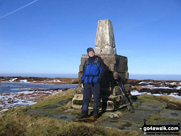 The summit of The Cheviot in The North Pennines
Photo: Julian Whitley
Is there a Mountain, Peak, Top or Hill missing from the above google map or list?
Let us know an we will add it to our database.


