The South East region of England - a fully detailed list of all the Mountains, Peaks, Tops and Hills
The South East region of England comprises the traditional counties of East Sussex, Hampshire, The Isle of Wight, Kent, Surrey and West Sussex.
If you include the Marilyns, the Bridgets (Hills) and all the Mountains, Tops, Peaks and Hills with a Trig Point on them there are 46 tops to climb, bag & conquer and the highest point is Leith Hill at 295m (968ft).
To see these Mountains, Peaks, Tops and Hills displayed in different ways - see the options in the left-hand column and towards the bottom of this page.
![]() Your Personal Bagging Record for South East
Your Personal Bagging Record for South East
When logged on, you can mark each Mountain, Peak, Top or Hill as 'bagged' by either:
- if you opt to display the tops in this area using a google map, click or tap on its symbol on the map below. This will open a text window. Click or tap on the 'Record [mountain name] as Bagged, Climbed & Conquered' link towards the bottom of the text window, or
- if you opt to display the tops in this area as a list, click or tap on the red 'not yet' symbol to the right of the name of each 'top'
Either method will open a new page where you can complete all your details such as:
- when you bagged the Mountain, Peak, Top or Hill;
- which route you took
- who you went with
- what the weather was like
- any other comment that will remind you of the day
Once you have completed your details and click or tap the submit button, you will automatically return to this page and the top you bagged will show with a green tick.
NB. None of the above fields are 'mandatory' - you can leave them blank if you wish.
NNB. You also have the option whether to display your peak bagging exploits to other users of this site or keep them private so only you can see them when you are logged on.
Furthermore, since you can also access your Personal Mountain & Hill Bagging Record via go4awalk Mobile you can quickly & easily record, edit and view your achievements - whether you are at home/work on your desktop computer or in the pub/at the top of a mountain with your Mobile Phone. (You can even download your Personal Mountain & Hill Bagging Record as a .csv file for importing into and saving with spreadsheet software like Excel or NeoOffice!)
This facility costs one credit to initially access your personal bagging record. Once accessed, all other interactions, such as recording other Mountains, Peaks, Tops and Hills as 'bagged' or altering an existing bagging record, are free.
Click REGISTER to register and purchase credits.
LOG ON and RELOAD this page to show which Mountains, Peaks, Tops and Hills you have already climbed, bagged & conquered. [ . . . remove this text]
See this list in: Alphabetical Order
| Height Order‡
To reverse the order select the link again.
Mountain, Peak, Top or Hill:
Bagged

![]()
1. Leith Hill
295m (968ft)
Leith Hill is on interactive maps:
A downloadable go4awalk.com PDF Peak Bagging Map featuring Leith Hill will be available soon. |

![]()
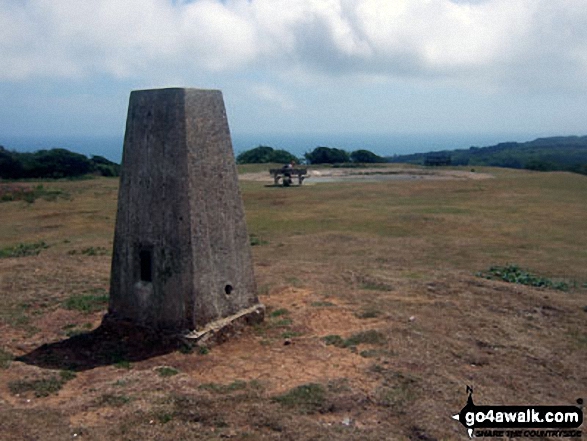
2. Pilot Hill
286m (938ft)
Pilot Hill is on interactive maps:
A downloadable go4awalk.com PDF Peak Bagging Map featuring Pilot Hill will be available soon. |

![]()
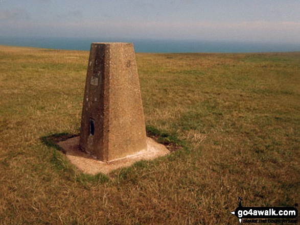
3. Black Down (Blackdown)
280m (918ft)
Send it in and we'll publish it here.
Black Down (Blackdown) is on interactive maps:
A downloadable go4awalk.com PDF Peak Bagging Map featuring Black Down (Blackdown) will be available soon. |
![]()
4. Hindhead (Gibbet Hill)
272m (892ft)
Send it in and we'll publish it here.
Hindhead (Gibbet Hill) is on interactive maps:
|
![]()
5. Butser Hill
270m (886ft)
Butser Hill is on interactive maps:
A downloadable go4awalk.com PDF Peak Bagging Map featuring Butser Hill will be available soon. |
![]()
6. Botley Hill
267m (876ft)
Botley Hill is on interactive maps:
A downloadable go4awalk.com PDF Peak Bagging Map featuring Botley Hill will be available soon. |

![]()
7. Holmbury Hill
261m (856ft)
Holmbury Hill is on interactive maps:
|
![]()
8. Littleton Down
255m (836ft)
Littleton Down is on interactive maps:
A downloadable go4awalk.com PDF Peak Bagging Map featuring Littleton Down will be available soon. |
![]()
9. Ditchling Beacon
248m (813ft)
Ditchling Beacon is on interactive maps:
A downloadable go4awalk.com PDF Peak Bagging Map featuring Ditchling Beacon will be available soon. |
![]()
10. Linch Ball (Linch Down)
248m (813ft)
Send it in and we'll publish it here.
Linch Ball (Linch Down) is on interactive maps:
|
![]()
11. Toy's Hill
248m (813ft)
Toy's Hill is on interactive maps:
|
![]()
12. Warren Corner (Wheatham Hill)
246m (807ft)
Send it in and we'll publish it here.
Warren Corner (Wheatham Hill) is on interactive maps:
|
![]()
13. Crowborough
242m (794ft)
Crowborough is on interactive maps:
A downloadable go4awalk.com PDF Peak Bagging Map featuring Crowborough will be available soon. |
![]()
14. St Boniface Down (Wroxall Down)
241m (790ft)
Send it in and we'll publish it here.
St Boniface Down (Wroxall Down) is on interactive maps:
|
![]()
15. St Catherine's Hill (Niton Down)
239m (784ft)
Send it in and we'll publish it here.
St Catherine's Hill (Niton Down) is on interactive maps:
|
![]()
16. Chanctonbury Ring (Chanctonbury Hill)
238m (781ft)
Send it in and we'll publish it here.
Chanctonbury Ring (Chanctonbury Hill) is on interactive maps:
A downloadable go4awalk.com PDF Peak Bagging Map featuring Chanctonbury Ring (Chanctonbury Hill) will be available soon. |
![]()
17. Reigate Hill
235m (771ft)
Reigate Hill is on interactive maps:
|
![]()
18. Wrotham Hill (Exedown)
235m (771ft)
Send it in and we'll publish it here.
Wrotham Hill (Exedown) is on interactive maps:
|
![]()
19. Dunley Wood (Dunley Hill)
226m (741ft)
Send it in and we'll publish it here.
Dunley Wood (Dunley Hill) is on interactive maps:
|
![]()
20. Devil's Dyke
217m (712ft)
Devil's Dyke is on interactive maps:
|
![]()
21. Firle Beacon
217m (712ft)
Firle Beacon is on interactive maps:
A downloadable go4awalk.com PDF Peak Bagging Map featuring Firle Beacon will be available soon. |
![]()
22. Brighstone Down
214m (702ft)
Brighstone Down is on interactive maps:
|
![]()
23. Wilmington Hill
214m (702ft)
Wilmington Hill is on interactive maps:
A downloadable go4awalk.com PDF Peak Bagging Map featuring Wilmington Hill will be available soon. |
![]()
24. Kithurst Hill
213m (699ft)
Kithurst Hill is on interactive maps:
|
![]()
25. Wolstonbury Hill
207m (679ft)
Wolstonbury Hill is on interactive maps:
|
![]()
26. Willingdon Hill
201m (659ft)
Willingdon Hill is on interactive maps:
|
![]()
27. Newmarket Hill
200m (656ft)
Newmarket Hill is on interactive maps:
|
![]()
28. Thurnham Court Estate (Detling Hill)
200m (656ft)
Send it in and we'll publish it here.
Thurnham Court Estate (Detling Hill) is on interactive maps:
|
![]()
29. Rackham Hill
193m (633ft)
Rackham Hill is on interactive maps:
|
![]()
30. Steyning Round Hill
189m (620ft)
Steyning Round Hill is on interactive maps:
|

![]()
31. Paddlesworth (Cheriton Hill)
188m (617ft)
Send it in and we'll publish it here.
Paddlesworth (Cheriton Hill) is on interactive maps:
A downloadable go4awalk.com PDF Peak Bagging Map featuring Paddlesworth (Cheriton Hill) will be available soon. |
![]()
32. Cheesefoot Head (Matterley Bowl)
176m (577ft)
Cheesefoot Head (Matterley Bowl) is on interactive maps:
A downloadable go4awalk.com PDF Peak Bagging Map featuring Cheesefoot Head (Matterley Bowl) will be available soon. |
![]()
33. North's Seat (Fairlight Down)
175m (574ft)
Send it in and we'll publish it here.
North's Seat (Fairlight Down) is on interactive maps:
|
![]()
34. St Martha's Hill
175m (573ft)
St Martha's Hill is on interactive maps:
A downloadable go4awalk.com PDF Peak Bagging Map featuring St Martha's Hill will be available soon. |
![]()
35. Box Hill
172m (564ft)
Box Hill is on interactive maps:
|
![]()
36. East Dean Hill
168m (551ft)
East Dean Hill is on interactive maps:
|
![]()
37. Cliffe Hill
164m (538ft)
Cliffe Hill is on interactive maps:
A downloadable go4awalk.com PDF Peak Bagging Map featuring Cliffe Hill will be available soon. |
![]()
38. Beachy Head
163m (535ft)
Beachy Head is on interactive maps:
|
![]()
39. Flexham Park (Bedham Hill)
151m (508ft)
Send it in and we'll publish it here.
Flexham Park (Bedham Hill) is on interactive maps:
|
![]()
40. Tennyson Down
147m (482ft)
Tennyson Down is on interactive maps:
|
![]()
41. Arreton Down
135m (443ft)
Arreton Down is on interactive maps:
|
![]()
42. Pipers Wait
133m (436ft)
Pipers Wait is on interactive maps:
|
![]()
43. Halnaker Hill
127m (417ft)
Halnaker Hill is on interactive maps:
|
![]()
44. The Folly (Nore Folly)
112m (368ft)
Send it in and we'll publish it here.
The Folly (Nore Folly) is on interactive maps:
|
![]()
45. Bembridge Down
104m (341ft)
Bembridge Down is on interactive maps:
|
![]()
46. Richmond Park (Richmond Park)
56m (184ft)
Send it in and we'll publish it here.
Richmond Park (Richmond Park) is on interactive maps:
|
View these 46 Mountains, Peaks, Tops and Hills:
- On an Interactive Google Map (loads faster)
- On an Interactive Google Map with a list of tops below it.
(makes it easier to locate a particular top) - On a Detailed List in:
Alphabetical Order | Height Order - On one page with 'yet-to-be-bagged' listed 1st & then 'already-bagged' tops listed 2nd in:
Alphabetical Order | Height Order - On one page with 'already-bagged' tops listed 1st & then 'yet-to-be-bagged' tops listed 2nd in:
Alphabetical Order | Height Order
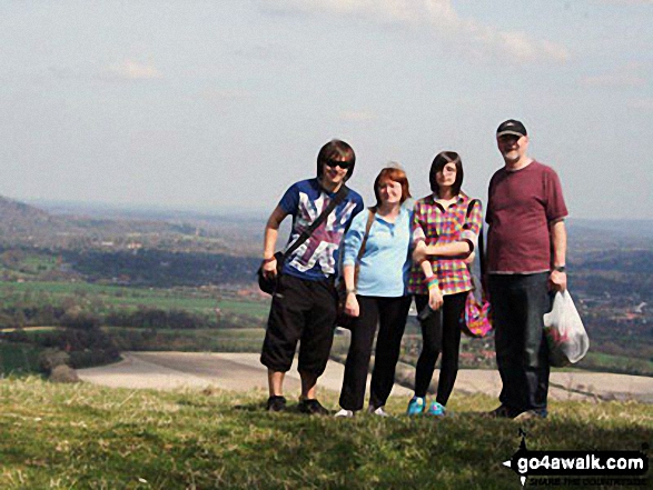
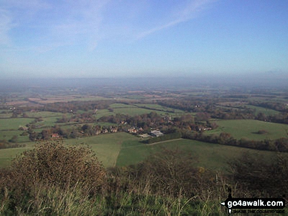
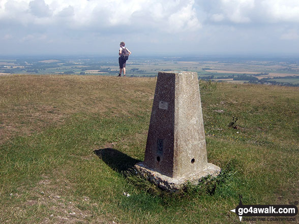
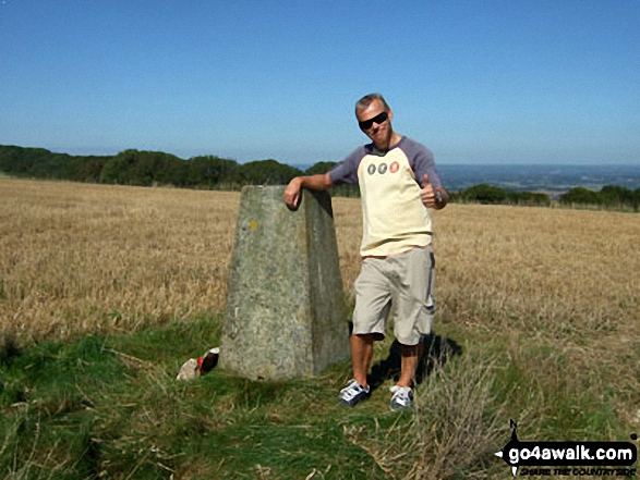
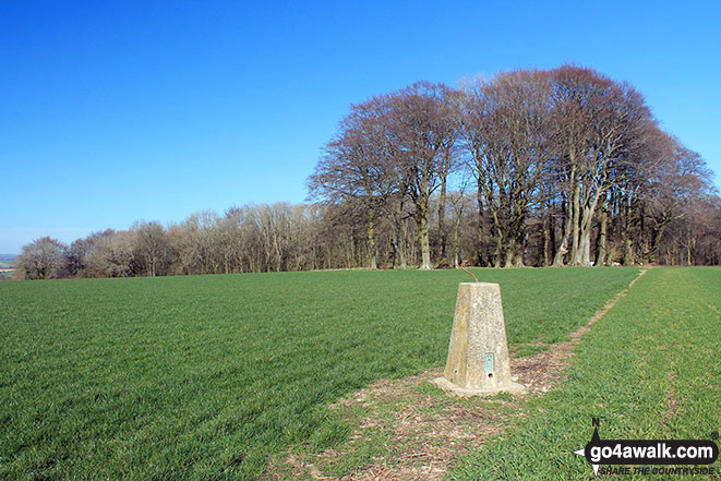
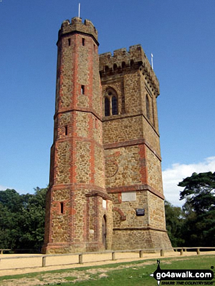 The summit of Leith Hill in
Photo: Colin Featherstone
Is there a Mountain, Peak, Top or Hill missing from the above google map or list?
Let us know an we will add it to our database.
To contribute to go4awalk.com or to contact us about anything at all - see Talk To Us.
For help see Help.
go4awalk.com and go4awalk.co.uk are registered trademarks of TMDH Limited.
Copyright © 2000-2025 TMDH Limited. All rights reserved.
Copyright Terms & Conditions Privacy Statement
A - Z Walks Home Log On/Accounts Photo Gallery Walk Ideas and Collections Fell Facts Hill Skills Walking Questions and Answers Your Stories News Competitions Product Reviews/Gear Tests Walking Gear Guides Peaks and Mountains Peak Bagging Find New Walking Friends Camping GPS Waypoints for Walking Contents Walk Search Talk To Us go4awalk.com Help Free Example Walks Newsletter


