The Mountains, Peaks, Tops and Hills in Scotland as a detailed list

If you count only the Munros there are 282 tops to climb, bag & conquer and the highest point is Ben Nevis at 1,344m (4,411ft).

munro
282/0
Munros

corbett
222/0
Corbetts

graham
219/0
Grahams

donald
89/0
Donalds

murdo
442/0
Murdos

marilyn
1557/0
Scottish
Marilyns

Bridget
0/0
Scottish
Bridgets

Trig Point
1398/0
Trig
Points


To see all Mountains, Peaks, Tops and Hills displayed in different ways - see the options in the left-hand column and towards the bottom of this page.


LOG ON and RELOAD this page to show which Mountains, Peaks, Tops and Hills you have already climbed, bagged & conquered [. . . more]


Page 2 of 10    Go to page: 1 2 3 4 5 6 7 8 9 10 Next Last


See this list in: Alphabetical Order | Height Order
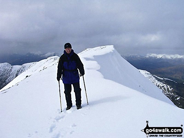
To reverse the order select the link again.


Mountain, Peak, Top or Hill:

Bagged


31. Ben Cruachan

1,126m (3,696ft)

  • Munro (No. 31)
  • Murdo (42nd)
  • Marilyn (26th in Scotland, 26th in GB)
  • OS Trig Point
  • Ben Cruachan is used for hydro-electric power production with turbines located in a man-made cavern several hundred metres under the mountainside.


    To walk, climb & bag Ben Cruachan use this easy to follow walk:

    Google Maps Icon
    See the location of Ben Cruachan and walks up it on a google Map

    Ben Cruachan is on interactive maps:

  • OS Explorer (Orange Covers): 377
  • OS Landranger (Pink Covers): 50

  • A go4awalk.com Peak Bagging Map and Hill Tick List featuring Ben Cruachan will be available soon.


    32. Meall Garbh (Loch Tay)

    1,123m (3,685ft)

  • Munro (No. 32)
  • Murdo (44th)
  • Marilyn (27th in Scotland, 27th in GB)

  • We hope to have walks that climb & bag Meall Garbh (Loch Tay) very soon

    Google Maps Icon
    See the location of Meall Garbh (Loch Tay) and walks up it on a google Map

    Meall Garbh (Loch Tay) is on interactive maps:

  • OS Explorer (Orange Covers): OL48
  • OS Landranger (Pink Covers): 51

  • A go4awalk.com Peak Bagging Map and Hill Tick List featuring Meall Garbh (Loch Tay) will be available soon.


    33. Beinn a' Ghlo (Carn nan Gabhar)

    1,121m (3,679ft)

  • Munro (No. 33)
  • Murdo (45th)
  • Marilyn (28th in Scotland, 28th in GB)
  • OS Trig Point

  • We hope to have walks that climb & bag Beinn a' Ghlo (Carn nan Gabhar) very soon

    Google Maps Icon
    See the location of Beinn a' Ghlo (Carn nan Gabhar) and walks up it on a google Map

    Beinn a' Ghlo (Carn nan Gabhar) is on interactive maps:

  • OS Explorer (Orange Covers): OL51
  • OS Landranger (Pink Covers): 43

  • A go4awalk.com Peak Bagging Map and Hill Tick List featuring Beinn a' Ghlo (Carn nan Gabhar) will be available soon.


    34. A' Chraileag (A' Chralaig)

    1,120m (3,676ft)

  • Munro (No. 34)
  • Murdo (46th)
  • Marilyn (29th in Scotland, 29th in GB)

  • We hope to have walks that climb & bag A' Chraileag (A' Chralaig) very soon

    Google Maps Icon
    See the location of A' Chraileag (A' Chralaig) and walks up it on a google Map

    A' Chraileag (A' Chralaig) is on interactive maps:

  • OS Explorer (Orange Covers): 414
  • OS Landranger (Pink Covers): 33

  • A go4awalk.com Peak Bagging Map and Hill Tick List featuring A' Chraileag (A' Chralaig) will be available soon.


    35. An Stuc (Ben Lawers)

    1,118m (3,669ft)

  • Munro (No. 36)
  • Murdo (48th)

  • We hope to have walks that climb & bag An Stuc (Ben Lawers) very soon

    Google Maps Icon
    See the location of An Stuc (Ben Lawers) and walks up it on a google Map

    An Stuc (Ben Lawers) is on interactive maps:

  • OS Explorer (Orange Covers): OL48
  • OS Landranger (Pink Covers): 51

  • A go4awalk.com Peak Bagging Map and Hill Tick List featuring An Stuc (Ben Lawers) will be available soon.


    36. Sgor Gaoith

    1,118m (3,669ft)

  • Munro (No. 35)
  • Murdo (47th)
  • Marilyn (30th in Scotland, 30th in GB)

  • We hope to have walks that climb & bag Sgor Gaoith very soon

    Google Maps Icon
    See the location of Sgor Gaoith and walks up it on a google Map

    Sgor Gaoith is on interactive maps:

  • OS Explorer (Orange Covers): OL57
  • OS Landranger (Pink Covers): 36 and 43

  • A go4awalk.com Peak Bagging Map and Hill Tick List featuring Sgor Gaoith will be available soon.


    37. Aonach Beag (An Lairig)

    1,116m (3,663ft)

  • Munro (No. 37)
  • Murdo (49th)

  • We hope to have walks that climb & bag Aonach Beag (An Lairig) very soon

    Google Maps Icon
    See the location of Aonach Beag (An Lairig) and walks up it on a google Map

    Aonach Beag (An Lairig) is on interactive maps:

  • OS Explorer (Orange Covers): OL50
  • OS Landranger (Pink Covers): 42

  • A go4awalk.com Peak Bagging Map and Hill Tick List featuring Aonach Beag (An Lairig) will be available soon.


    38. Stob Coire an Laoigh

    1,116m (3,663ft)

  • Munro (No. 38)
  • Murdo (50th)

  • We hope to have walks that climb & bag Stob Coire an Laoigh very soon

    Google Maps Icon
    See the location of Stob Coire an Laoigh and walks up it on a google Map

    Stob Coire an Laoigh is on interactive maps:

  • OS Explorer (Orange Covers): 392
  • OS Landranger (Pink Covers): 41

  • A go4awalk.com Peak Bagging Map and Hill Tick List featuring Stob Coire an Laoigh will be available soon.


    39. Stob Coire Easain (Loch Treig)

    1,115m (3,659ft)

  • Munro (No. 39)
  • Murdo (51st)
  • Marilyn (31st in Scotland, 31st in GB)

  • We hope to have walks that climb & bag Stob Coire Easain (Loch Treig) very soon

    Google Maps Icon
    See the location of Stob Coire Easain (Loch Treig) and walks up it on a google Map

    Stob Coire Easain (Loch Treig) is on interactive maps:

  • OS Explorer (Orange Covers): 392
  • OS Landranger (Pink Covers): 41

  • A go4awalk.com Peak Bagging Map and Hill Tick List featuring Stob Coire Easain (Loch Treig) will be available soon.


    40. Monadh Mor

    1,113m (3,653ft)

  • Munro (No. 40)
  • Murdo (53rd)

  • To walk, climb & bag Monadh Mor use this easy to follow walk:

    Google Maps Icon
    See the location of Monadh Mor and walks up it on a google Map

    Monadh Mor is on interactive maps:

  • OS Explorer (Orange Covers): OL57
  • OS Landranger (Pink Covers): 36

  • A go4awalk.com Peak Bagging Map and Hill Tick List featuring Monadh Mor will be available soon.


    41. Tom a' Choinich (Carn Eige)

    1,112m (3,650ft)

  • Munro (No. 41)
  • Murdo (54th)

  • We hope to have walks that climb & bag Tom a' Choinich (Carn Eige) very soon

    Google Maps Icon
    See the location of Tom a' Choinich (Carn Eige) and walks up it on a google Map

    Tom a' Choinich (Carn Eige) is on interactive maps:

  • OS Explorer (Orange Covers): 415
  • OS Landranger (Pink Covers): 25

  • A go4awalk.com Peak Bagging Map and Hill Tick List featuring Tom a' Choinich (Carn Eige) will be available soon.


    42. Carn a' Choire Boidheach

    1,110m (3,643ft)

  • Munro (No. 43)
  • Murdo (57th)

  • We hope to have walks that climb & bag Carn a' Choire Boidheach very soon

    Google Maps Icon
    See the location of Carn a' Choire Boidheach and walks up it on a google Map

    Carn a' Choire Boidheach is on interactive maps:

  • OS Explorer (Orange Covers): OL53
  • OS Landranger (Pink Covers): 44

  • A go4awalk.com Peak Bagging Map and Hill Tick List featuring Carn a' Choire Boidheach will be available soon.


    43. Sgurr Mor (Fannich Forest)

    1,110m (3,643ft)

  • Munro (No. 42)
  • Murdo (56th)
  • Marilyn (32nd in Scotland, 32nd in GB)

  • We hope to have walks that climb & bag Sgurr Mor (Fannich Forest) very soon

    Google Maps Icon
    See the location of Sgurr Mor (Fannich Forest) and walks up it on a google Map

    Sgurr Mor (Fannich Forest) is on interactive maps:

  • OS Explorer (Orange Covers): 436
  • OS Landranger (Pink Covers): 20

  • A go4awalk.com Peak Bagging Map and Hill Tick List featuring Sgurr Mor (Fannich Forest) will be available soon.


    44. Sgurr nan Conbhairean

    1,109m (3,640ft)

  • Munro (No. 44)
  • Murdo (58th)
  • Marilyn (33rd in Scotland, 33rd in GB)
  • OS Trig Point

  • We hope to have walks that climb & bag Sgurr nan Conbhairean very soon

    Google Maps Icon
    See the location of Sgurr nan Conbhairean and walks up it on a google Map

    Sgurr nan Conbhairean is on interactive maps:

  • OS Explorer (Orange Covers): 414
  • OS Landranger (Pink Covers): 34

  • A go4awalk.com Peak Bagging Map and Hill Tick List featuring Sgurr nan Conbhairean will be available soon.


    45. Meall a' Bhuiridh

    1,108m (3,636ft)

  • Munro (No. 45)
  • Murdo (59th)
  • Marilyn (34th in Scotland, 34th in GB)

  • To walk, climb & bag Meall a' Bhuiridh use either of these easy to follow walks:

    Google Maps Icon
    See the location of Meall a' Bhuiridh and walks up it on a google Map

    Meall a' Bhuiridh is on interactive maps:

  • OS Explorer (Orange Covers): 384
  • OS Landranger (Pink Covers): 41

  • A go4awalk.com Peak Bagging Map and Hill Tick List featuring Meall a' Bhuiridh will be available soon.


    46. Stob a' Choire Mheadhoin

    1,105m (3,627ft)

  • Munro (No. 46)
  • Murdo (63rd)

  • We hope to have walks that climb & bag Stob a' Choire Mheadhoin very soon

    Google Maps Icon
    See the location of Stob a' Choire Mheadhoin and walks up it on a google Map

    Stob a' Choire Mheadhoin is on interactive maps:

  • OS Explorer (Orange Covers): 392
  • OS Landranger (Pink Covers): 41

  • A go4awalk.com Peak Bagging Map and Hill Tick List featuring Stob a' Choire Mheadhoin will be available soon.


    47. Beinn Ghlas (Breadalbane)

    1,103m (3,620ft)

  • Munro (No. 47)
  • Murdo (65th)

  • We hope to have walks that climb & bag Beinn Ghlas (Breadalbane) very soon

    Google Maps Icon
    See the location of Beinn Ghlas (Breadalbane) and walks up it on a google Map

    Beinn Ghlas (Breadalbane) is on interactive maps:

  • OS Explorer (Orange Covers): OL48
  • OS Landranger (Pink Covers): 51

  • A go4awalk.com Peak Bagging Map and Hill Tick List featuring Beinn Ghlas (Breadalbane) will be available soon.


    48. Beinn Eibhinn

    1,102m (3,617ft)

  • Munro (No. 49)
  • Murdo (67th)

  • We hope to have walks that climb & bag Beinn Eibhinn very soon

    Google Maps Icon
    See the location of Beinn Eibhinn and walks up it on a google Map

    Beinn Eibhinn is on interactive maps:

  • OS Explorer (Orange Covers): OL50
  • OS Landranger (Pink Covers): 42

  • A go4awalk.com Peak Bagging Map and Hill Tick List featuring Beinn Eibhinn will be available soon.


    49. Mullach Fraoch-choire

    1,102m (3,617ft)

  • Munro (No. 48)
  • Murdo (66th)
  • Marilyn (35th in Scotland, 35th in GB)

  • We hope to have walks that climb & bag Mullach Fraoch-choire very soon

    Google Maps Icon
    See the location of Mullach Fraoch-choire and walks up it on a google Map

    Mullach Fraoch-choire is on interactive maps:

  • OS Explorer (Orange Covers): 414
  • OS Landranger (Pink Covers): 33

  • A go4awalk.com Peak Bagging Map and Hill Tick List featuring Mullach Fraoch-choire will be available soon.


    50. Creise

    1,100m (3,610ft)

  • Munro (No. 50)
  • Murdo (68th)
  • Marilyn (36th in Scotland, 36th in GB)

  • To walk, climb & bag Creise use either of these easy to follow walks:

    Google Maps Icon
    See the location of Creise and walks up it on a google Map

    Creise is on interactive maps:

  • OS Explorer (Orange Covers): 384
  • OS Landranger (Pink Covers): 41

  • A go4awalk.com Peak Bagging Map and Hill Tick List featuring Creise will be available soon.


    51. Sgurr a' Mhaim

    1,099m (3,607ft)

  • Munro (No. 51)
  • Murdo (69th)
  • Marilyn (37th in Scotland, 37th in GB)

  • We hope to have walks that climb & bag Sgurr a' Mhaim very soon

    Google Maps Icon
    See the location of Sgurr a' Mhaim and walks up it on a google Map

    Sgurr a' Mhaim is on interactive maps:

  • OS Explorer (Orange Covers): 392
  • OS Landranger (Pink Covers): 41

  • A go4awalk.com Peak Bagging Map and Hill Tick List featuring Sgurr a' Mhaim will be available soon.


    52. Sgurr Choinnich Mor

    1,094m (3,591ft)

  • Munro (No. 52)
  • Murdo (72nd)
  • Marilyn (38th in Scotland, 38th in GB)

  • We hope to have walks that climb & bag Sgurr Choinnich Mor very soon

    Google Maps Icon
    See the location of Sgurr Choinnich Mor and walks up it on a google Map

    Sgurr Choinnich Mor is on interactive maps:

  • OS Explorer (Orange Covers): 392
  • OS Landranger (Pink Covers): 41

  • A go4awalk.com Peak Bagging Map and Hill Tick List featuring Sgurr Choinnich Mor will be available soon.


    53. Sgurr nan Clach Geala

    1,093m (3,587ft)

  • Munro (No. 53)
  • Murdo (73rd)
  • Marilyn (39th in Scotland, 39th in GB)
  • OS Trig Point

  • We hope to have walks that climb & bag Sgurr nan Clach Geala very soon

    Google Maps Icon
    See the location of Sgurr nan Clach Geala and walks up it on a google Map

    Sgurr nan Clach Geala is on interactive maps:

  • OS Explorer (Orange Covers): 436
  • OS Landranger (Pink Covers): 20

  • A go4awalk.com Peak Bagging Map and Hill Tick List featuring Sgurr nan Clach Geala will be available soon.


    54. Bynack More

    1,090m (3,577ft)

  • Munro (No. 54)
  • Murdo (74th)
  • Marilyn (40th in Scotland, 40th in GB)

  • To walk, climb & bag Bynack More use this easy to follow walk:

    Google Maps Icon
    See the location of Bynack More and walks up it on a google Map

    Bynack More is on interactive maps:

  • OS Explorer (Orange Covers): OL57 and OL58
  • OS Landranger (Pink Covers): 36

  • A go4awalk.com Peak Bagging Map and Hill Tick List featuring Bynack More will be available soon.


    55. Stob Ghabhar

    1,090m (3,577ft)

  • Munro (No. 55)
  • Murdo (75th)
  • Marilyn (41st in Scotland, 41st in GB)

  • To walk, climb & bag Stob Ghabhar use this easy to follow walk:

    Google Maps Icon
    See the location of Stob Ghabhar and walks up it on a google Map

    Stob Ghabhar is on interactive maps:

  • OS Explorer (Orange Covers): 377
  • OS Landranger (Pink Covers): 50

  • A go4awalk.com Peak Bagging Map and Hill Tick List featuring Stob Ghabhar will be available soon.


    56. Beinn a' Chlachair

    1,087m (3,568ft)

  • Munro (No. 56)
  • Murdo (76th)
  • Marilyn (42nd in Scotland, 42nd in GB)

  • We hope to have walks that climb & bag Beinn a' Chlachair very soon

    Google Maps Icon
    See the location of Beinn a' Chlachair and walks up it on a google Map

    Beinn a' Chlachair is on interactive maps:

  • OS Explorer (Orange Covers): OL50
  • OS Landranger (Pink Covers): 42

  • A go4awalk.com Peak Bagging Map and Hill Tick List featuring Beinn a' Chlachair will be available soon.


    57. Beinn Dearg (The Ullapool Hills)

    1,084m (3,558ft)

  • Munro (No. 57)
  • Murdo (77th)
  • Marilyn (43rd in Scotland, 44th in GB)
  • OS Trig Point

  • We hope to have walks that climb & bag Beinn Dearg (The Ullapool Hills) very soon

    Google Maps Icon
    See the location of Beinn Dearg (The Ullapool Hills) and walks up it on a google Map

    Beinn Dearg (The Ullapool Hills) is on interactive maps:

  • OS Explorer (Orange Covers): 436
  • OS Landranger (Pink Covers): 20

  • A go4awalk.com Peak Bagging Map and Hill Tick List featuring Beinn Dearg (The Ullapool Hills) will be available soon.


    58. Beinn a' Chaorainn (Cairngorms)

    1,083m (3,554ft)

  • Munro (No. 58)
  • Murdo (78th)
  • Marilyn (44th in Scotland, 45th in GB)

  • We hope to have walks that climb & bag Beinn a' Chaorainn (Cairngorms) very soon

    Google Maps Icon
    See the location of Beinn a' Chaorainn (Cairngorms) and walks up it on a google Map

    Beinn a' Chaorainn (Cairngorms) is on interactive maps:

  • OS Explorer (Orange Covers): OL57 and OL58
  • OS Landranger (Pink Covers): 36

  • A go4awalk.com Peak Bagging Map and Hill Tick List featuring Beinn a' Chaorainn (Cairngorms) will be available soon.


    59. Schiehallion

    1,083m (3,554ft)

  • Munro (No. 60)
  • Murdo (80th)
  • Marilyn (45th in Scotland, 46th in GB)
  • OS Trig Point

  • We hope to have walks that climb & bag Schiehallion very soon

    Google Maps Icon
    See the location of Schiehallion and walks up it on a google Map

    Schiehallion is on interactive maps:

  • OS Explorer (Orange Covers): OL49
  • OS Landranger (Pink Covers): 42 and 51 and 52

  • A go4awalk.com Peak Bagging Map and Hill Tick List featuring Schiehallion will be available soon.


    60. Sgurr a' Choire Ghlais

    1,083m (3,554ft)

  • Munro (No. 59)
  • Murdo (79th)
  • Marilyn (46th in Scotland, 47th in GB)
  • OS Trig Point

  • We hope to have walks that climb & bag Sgurr a' Choire Ghlais very soon

    Google Maps Icon
    See the location of Sgurr a' Choire Ghlais and walks up it on a google Map

    Sgurr a' Choire Ghlais is on interactive maps:

  • OS Explorer (Orange Covers): 430
  • OS Landranger (Pink Covers): 25

  • A go4awalk.com Peak Bagging Map and Hill Tick List featuring Sgurr a' Choire Ghlais will be available soon.


    Page 2 of 10    Go to page: 1 2 3 4 5 6 7 8 9 10 Next Last


    View all 1674 Mountains, Peaks, Tops and Hills in Scottish Region : Glen Cannich to Glen Carron:


    Is there a Mountain, Peak, Top or Hill missing from the above google map or list?

    Let us know an we will add it to our database.


    Follow go4awalk.com on Twitter Follow go4awalk.com on Facebook


    Home


    Find new Friends to go walking with

    Walk all 214 Wainwrights in just 59 Walks. Download GPS Waypoints - Great Walks you must not miss!

    Walk The Yorkshire Three Peaks Challenge Walk - All the Latest Route Information, GPS Waypoints and Split Times to keep you on Schedule

    Walk The British Three Peaks Challenge Walk - All the Latest Route Information and GPS Waypoints

    See our pick of The Best Walks in The Lake District - Great Walks you must not miss!

    Walk our pick of the Best Lake District Ridge Walks - Great Walks you must not miss!

    Walk our pick of the Best Lake District Walks to do in the rain - Great Walks you must not miss!

    Walk our pick of The Best Walks in Snowdonia - Great Walks you must not miss!

    Walk our pick of The Best Ridge Walks in Wales - Walks you must not miss!

    Walk our pick of The Best Walks in The Brecon Beacons - Great Walks you must not miss!

    Walk our pick of The Best Walks in The Yorkshire Dales - Walks you must not miss!

    Walk our pick of The Best Walks in The Peak District - Walks you must not miss!

    Walk our pick of The Best Walks in The Forest of Bowland - Walks you must not miss!

    Walk our pick of The Best Walks in Shropshire - Walks you must not miss!

    Walk our pick of The Best Walks in Cheshire - Walks you must not miss!

    Walk our pick of The Best Walks in Lancashire - Walks you must not miss!

    Not sure where to walk next? Try Peak Bagging - Great Walks you must not miss!

    Not sure where to walk next? Walk part of a National Trail - Great Walks you must not miss!

    Walks with Downloadable and Uploadable GPS Waypoint Data

    Walking Kit and Gear Tested by Walkers

    Full Site Search