   |
Vital Statistics:
| Length: | 12¼mls (19.5km) |
| Ascent: | 4,322ft (1,317m) |
| Time: | 8¾hrs |
| Grade: |  |
Route outline for walk h193:
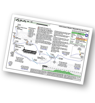
A82 - Lochan na Stainge - Ba Cottage - Sron Nam Forsair - Clach Leathad (Creise) - Mam Coire Easain (Creise) - Creise - Stob a' Ghlais Choire (Creise) - Meall a' Bhuiridh - Ba Cottage - Lochan na Stainge - A82
Peaks, Summits and Tops reached on this walk:
 2 Munros |
 0 Corbetts |
 0 Grahams |
 4 Murdos |
 0 Donalds |
 2 Scottish Marilyns |
 0 Bridgets |
Peak Bagging Statistics for this walk:
The highest point of this walk is Meall a' Bhuiridh at 1108m (3636ft). Meall a' Bhuiridh is classified as a Munro (No. 45) and a Scottish Marilyn (34th highest in Scotland, 34th highest in the UK). Meall a' Bhuiridh is also known as a Murdo (59th highest in Scotland). Meall a' Bhuiridh means 'Hill of the Rutting Stags' and is pronounced 'mowl-a-vooree'.
The summit of Meall a' Bhuiridh is marked by a cairn.
Completing this walk will also take you to the top of Creise at 1100m (3610ft). Creise is classified as a Munro (No. 50) and a Scottish Marilyn (36th highest in Scotland, 36th highest in the UK). Creise is also known as a Murdo (68th highest in Scotland). Creise is pronounced 'kraysh'. The summit of Creise is marked by a cairn.
You will also reach the summit of Clach Leathad (Creise) at 1099m (3607ft). Clach Leathad (Creise) is known as a Murdo (70th highest in Scotland).
Along the way you will also bag:
- Stob a' Ghlais Choire (Creise) at 996m (3269ft). Stob a' Ghlais Choire (Creise) is known as a Murdo (208th highest in Scotland).
You can find this walk and other nearby walks on these unique free-to-access Interactive Walk Planning Maps:
1:25,000 scale OS Explorer Map (orange/yellow covers):
1:50,000 scale OS Landranger Maps (pink/magenta covers):
Some Photos and Pictures from Walk h193 Creise and Meall a' Bhuiridh from A82 at Lochan na Stainge
In no particular order . . .
Send us your photographs and pictures from your walks and hikes
We would love to see your photographs and pictures from walk h193 Creise and Meall a' Bhuiridh from A82 at Lochan na Stainge. Send them in to us as email attachments (configured for any computer) along with your name and where the picture was taken to:
and we shall do our best to publish them.
(Guide Resolution = 300dpi. At least = 660 pixels (wide) x 440 pixels (high).)

You can also submit photos from walk h193 Creise and Meall a' Bhuiridh from A82 at Lochan na Stainge via our Facebook Page.
NB. Please indicate where each photo was taken.


