UK Postcode TD9 - The 30 nearest easy-to-follow, circular walk route maps to you
The thirty nearest easy-to-follow, circular walk route maps to you in UK Postcode TD9 in Walk Grade Order
The UK cities, towns and villages in The Borders, Scotland that have TD9 in their UK Postcode include:
• Abbotrule • Appletreehall • Ashybank • Bedrule • Bonchester Bridge • Borthwickbrae • Borthwickshiels • Branxholm Bridgend • Branxholme • Broadhaugh • Buccleuch • Burnfoot • Castleweary • Chesters • Clarilaw • Cleuch Head • Craik • Deanburnhaugh • Denholm • Dinlabyre • Hallrule • Harwood on Teviot • Hassendean • Hawick • Hermitage • Hobkirk • Howpasley • Hyndlee • Kirkton • Knowetownhead • Larriston • Linhope • Minto • Newcastleton • Newlands • Newmill • Northhouse • Roberton • Saughtree • Shankend • Singdean • Southdean • Steele Road • Teviothead • Wilton • Wolfelee •
Not familiar with the area around TD9?
See these 30 nearest walks to UK Postcode TD9 on a google map
   |
Vital Statistics:
| Length: | 8.25 miles (13 km) |
| Ascent: | 1,520ft (463m) |
| Time: | 4½ hrs |
| Grade: |  |
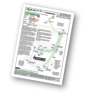
Route Summary:
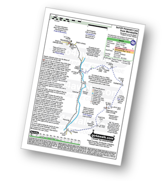
Buccleuch Estates (Teviothead - Teviotdale) - Fouledge Syke - Alderybar Cottage - Harwood Rigg - Grey Pen - Skelfhill Pen - Greatmoor Hill - Knowes Head - Coltercleugh Shiel Cottage - Goat Hill - Buccleuch Estates (Teviothead).
|
Vital Statistics:
| Length: | 4.5 miles (7 km) |
| Ascent: | 1,503ft (458m) |
| Time: | 3.25hrs |
| Grade: |  |
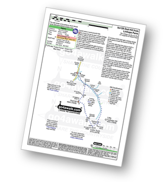
Route Summary:
Linhope Farm - Linhope Burn - Dod Hill (Teviothead) - Bye Hill - Carlin Tooth (Teviothead) - Sunhope Hass - Linhope Burn - Elygrain Farm - Linhope Farm
|
Vital Statistics:
| Length: | 8.75 miles (14 km) |
| Ascent: | 2,793ft (851m) |
| Time: | 6 hrs |
| Grade: |  |
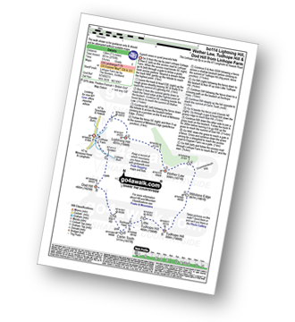
Route Summary:
Linhope Farm - Lightning Hill - Wether Law (Teviothead) - Crummiecleuch Rig - Millstone Edge (Tudhope Hill) - Tudhope Hill - Little Tudhope Hill - Sunhope Hass - Carlin Tooth (Teviothead) - Bye Hill - Dod Hill (Teviothead) - Linhope Burn - Linhope Farm
|
Vital Statistics:
| Length: | 7.25 miles (11.5 km) |
| Ascent: | 2,009ft (612m) |
| Time: | 4.75hrs |
| Grade: | |
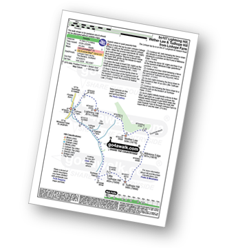
Route Summary:
Linhope Farm - Lightning Hill - Wether Law (Teviothead) - Crummiecleuch Rig - Millstone Edge (Tudhope Hill) - Tudhope Hill - Little Tudhope Hill - Sunhope Hass - Elygrain Farm - Linhope Burn - Linhope Farm
|
Vital Statistics:
| Length: | 5.75 miles (9 km) |
| Ascent: | 1,877ft (572m) |
| Time: | 4 hrs |
| Grade: | |
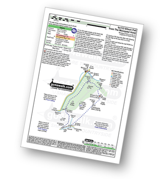
Route Summary:
Mosspaul Hotel - Mosspaul Burn - Glenrief Rig - Ellson Fell - Castlewink - Glenrief Cottage - Bught Knowe - Glenrief Rig - Mosspaul Burn - Mosspaul Hotel
|
Vital Statistics:
| Length: | 7.5 miles (12 km) |
| Ascent: | 2,018ft (615m) |
| Time: | 4.75hrs |
| Grade: | |
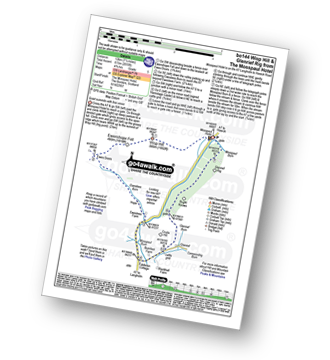
Route Summary:
Mosspaul Hotel - Wisp Hill (Teviothead) - Ewenshope Fell - Ewes Doors - Ewelees Farm - Fiddleton Cottage - Bught Knowe - Glenrief Rig - Mosspaul Burn - Mosspaul Hotel
|
Vital Statistics:
| Length: | 8.5 miles (13.5 km) |
| Ascent: | 2,832ft (863m) |
| Time: | 5.75hrs |
| Grade: | |
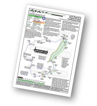
Route Summary:
Mosspaul Hotel - Wisp Hill (Teviothead) - Ewenshope Fell - Ewes Doors - Pikethaw Hill - Frodaw Height - Dan's Hags - Upper Hill (Fiddleton Cottage) - Fiddleton Cottage - Bught Knowe - Glenrief Rig - Mosspaul Burn - Mosspaul Hotel
|
Vital Statistics:
| Length: | 8.75 miles (14 km) |
| Ascent: | 3,482ft (1,061m) |
| Time: | 7 hrs |
| Grade: |  |
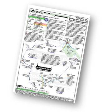
Route Summary:
Mosspaul Hotel - Wisp Hill (Teviothead) - Ewenshope Fell - Ewes Doors - Pikethaw Hill - Frodaw Height - Dan's Hags - Upper Hill (Fiddleton Cottage) - Fiddleton Cottage - Glenrief Cottage - Castlewink - Ellson Fell - Glenrief Rig - Mosspaul Burn - Mosspaul Hotel
|
Vital Statistics:
| Length: | 14.5 miles (23 km) |
| Ascent: | 2,018ft (615m) |
| Time: | 7.25hrs |
| Grade: | |
Route Summary:
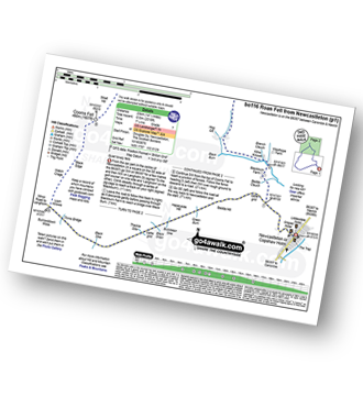
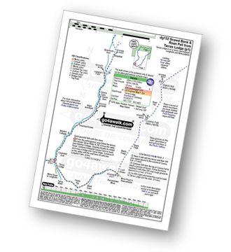
Newcastleton or Copshaw Holm - Bedda Cleuch - Blackburn Farm - Kiln Knowe - Black Burn - Hog Gill - Rigging Sike - Millstone Edge (Roan Fell) - Roan Fell - Watch Hill - Strait Hill - Cooms Fell - Black Edge - Watch Crags - Loch Knowe - Tinnis Bridge - Hazelyside Hill - Bedda Hill - Newcastleton
|
Vital Statistics:
| Length: | 6.25 miles (10 km) |
| Ascent: | 758ft (231m) |
| Time: | 3 hrs |
| Grade: |  |
Route Summary:
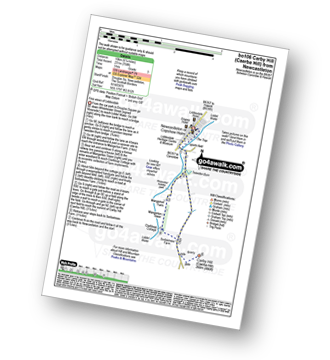
Newcastleton - Liddesdale - Liddel Water - Tweeden Burn - Mangerton Tower - Sorbietrees Farm - Carby Hill (Caerba Hill) - Newcastleton or Copshaw Holme.
|
Vital Statistics:
| Length: | 7 miles (11 km) |
| Ascent: | 1,408ft (429m) |
| Time: | 4 hrs |
| Grade: | |
Route Summary:
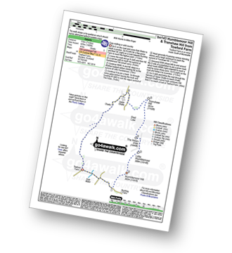
Towford Farm - Kale Water - Buchtrig Farm - Humblemoor Hill - Little Humblemoor - The Hows - Tronshaw Hill - Upper Chatto - Chatto - Towford Farm
|
Vital Statistics:
| Length: | 10 miles (16 km) |
| Ascent: | 2,238ft (682m) |
| Time: | 6 hrs |
| Grade: | |
Route Summary:
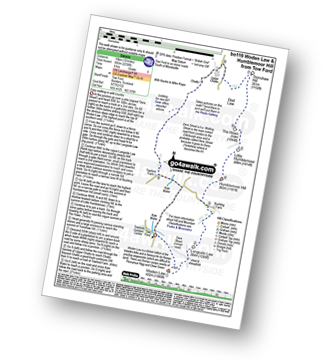
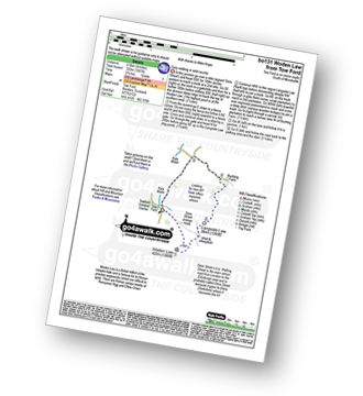
Tow Ford - Dere Street - Woden Law - Langside Law - Buchtrig Farm - Humblemoor Hill - Little Humblemoor - The Hows - Tronshaw Hill - Upper Chatto - Chatto - Towford Farm - Kale Water - Tow Farm.
|
Vital Statistics:
| Length: | 4 miles (6.5 km) |
| Ascent: | 1,057ft (322m) |
| Time: | 2.75hrs |
| Grade: | |
Route Summary:
Tow Ford - Dere Street - Woden Law - Langside Law - Buchtrig Farm - Kale Water - Tow Farm.
|
Vital Statistics:
| Length: | 13.75 miles (22 km) |
| Ascent: | 1,861ft (567m) |
| Time: | 6.75hrs |
| Grade: | |
Route Summary:
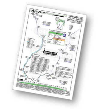
Tarras Lodge - Tarras Water - Coomsfell End - Arkleton Cottage - Greenlea Knowe - Cooms Farm - Lodgegill Farm - Byrecleuch Burn - Hawknest Rig - Ludsgill Sware - Watch Knowe - Scawd Bank - The Pikes - Hartsgarth Fell - Roan Fell - Millstone Edge (Roan Fell) - Watch Hill - Strait Hill - Cooms Fell - Black Edge - Watch Crags - Loch Knowe - Burrowstown Moss - Perter Rig - Tarras Lodge
|
Vital Statistics:
| Length: | 14.75 miles (23.5 km) |
| Ascent: | 2,609ft (795m) |
| Time: | 8 hrs |
| Grade: | |
Route Summary:
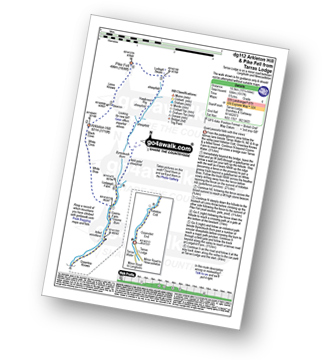
Tarras Lodge - Tarras Water - Arkleton Cottage - Greenlea Knowe - Cooms Farm - White Brae - White Cove - Black Cove - Arkleton Hill - Linns Knowe - Pike Fell - Ludsgill Sware - Watch Knowe - Scawd Bank - The Pikes - Hartsgarth Fell - Roan Fell - Millstone Edge (Roan Fell) - Watch Hill - Strait Hill - Cooms Fell - Black Edge - Watch Crags - Loch Knowe - Burrowstown Moss - Perter Rig - Tarras Lodge
Not familiar with the area around TD9?
See these 30 nearest walks to UK Postcode TD9 on a google map
|
Vital Statistics:
| Length: | 10.25 miles (16.5 km) |
| Ascent: | 1,917ft (584m) |
| Time: | 5.75hrs |
| Grade: | |
Route Summary:
Tarras Lodge - Tarras Water - Coomsfell End - Arkleton Cottage - Greenlea Knowe - Cooms Farm - White Brae - White Cove - Black Cove - Arkleton Hill - Linns Knowe - Pike Fell - Ludsgill Sware - Hawknest Rig - Byrecleuch Burn - Lodgegill Farm - Cooms Farm - Greenlea Knowe - Arkleton Cottage - Coomsfell End - Tarras Lodge
|
Vital Statistics:
| Length: | 8.75 miles (14 km) |
| Ascent: | 1,260ft (384m) |
| Time: | 4½ hrs |
| Grade: | |
Route Summary:
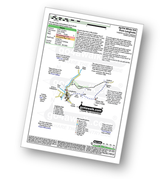
Morebattle - The St Cuthbert's Way - Kale Water - Grubbit Law - Cushat End - Hownam Law - South Cote - Howgate - Heavyside - Gateshaw - Morebattle
|
Vital Statistics:
| Length: | 8.5 miles (13.5 km) |
| Ascent: | 945ft (288m) |
| Time: | 4 hrs |
| Grade: | |
Route Summary:
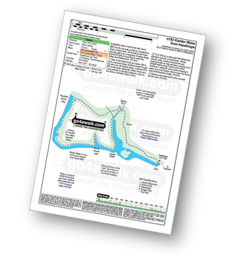
Hawkhope Car Park - Starsley Burn - Falstone Mine - Flastone Forest - Belling Burn - Goodwell Syke - Soney Gap - Plashetts Incline Jetty - Kielder Water - Benny Shanks Jetty - Pot Burn - Cock Soor - Whinny Hill - Belling Burn - The Belling - Bastle - Kielder Water Dam - Hawkhope Car Park
|
Vital Statistics:
| Length: | 4 miles (6.5 km) |
| Ascent: | 958ft (292m) |
| Time: | 2½ hrs |
| Grade: | |
Route Summary:
Langholm - Ewes Water - River Esk - Whita Hill - Sir John Malcolm Monument Obelsik - Charlie's Moss - Hugh MacDiarmid Memorial - Hillhead - Ewes Water - Langholm
|
Vital Statistics:
| Length: | 13.25 miles (21 km) |
| Ascent: | 2,586ft (788m) |
| Time: | 7.25hrs |
| Grade: | |
Route Summary:
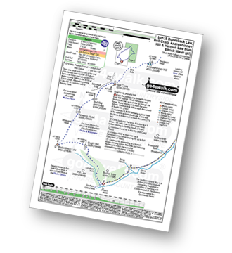
Ettrick Water,Longhope Burn - Bught Hill - Bodesbeck Law - Nowtrig Head - Mid Rig (Bell Craig) - Salmongill Craig - Bald Craig - Bell Craig - Mirk Side - Andrewhinney Hill - Brockhope Head - Trowgrain Middle - Herman Law - Fala Grain - Back Beck - Brockhoperig - Ettrick Water
|
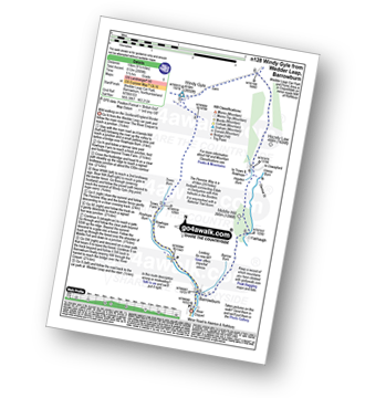
Vital Statistics:
| Length: | 7.5 miles (12 km) |
| Ascent: | 1,753ft (534m) |
| Time: | 4½ hrs |
| Grade: | |
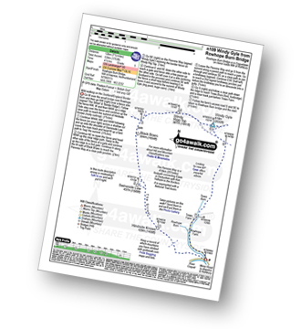
Route Summary:
Rowhope Burn Bridge - River Coquet - Hindside Knowe - The Street - Swineside Law - Black Braes - Windy Rigg Top - Windy Gyle - Trows Burn - Rowhope Burn - Rowhope Burn Bridge
|
Vital Statistics:
| Length: | 9.5 miles (15 km) |
| Ascent: | 2,009ft (612m) |
| Time: | 5½ hrs |
| Grade: | |
Route Summary:
Wedder Leap - River Coquet - Rowhope Burn - Trows Burn - Windy Gyle - The Pennine Way - Hazely Law - Hepden Burn - Clennel St - Middle Hill - Fairhaugh - Barrow Burn - Barrowburn.
|
Vital Statistics:
| Length: | 11.25 miles (18 km) |
| Ascent: | 2,311ft (704m) |
| Time: | 6½ hrs |
| Grade: | |
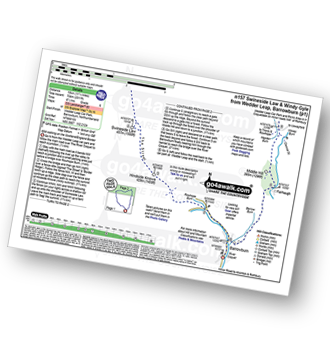
Route Summary:
Wedder Leap - River Coquest - Rowhope Burn - Hindside Knowe - The Street - Swineside Law - Black Braes - Windy Rigg Top - Windy Gyle - Hazely Law - Usway Burn - Middle Hill - Fairhaugh - Barrow Burn - Barrowburn.
|
Vital Statistics:
| Length: | 8.75 miles (14 km) |
| Ascent: | 3,236ft (986m) |
| Time: | 6½ hrs |
| Grade: | |
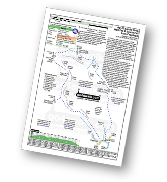
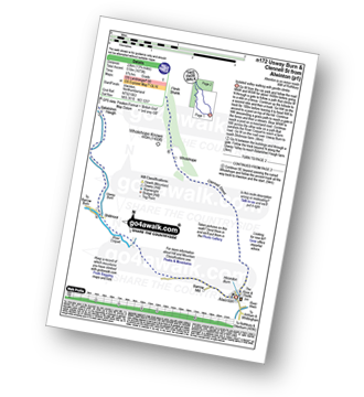
Route Summary:
Capplegill - Blackhope Burn - Saddle Yoke - Under Saddle Yoke - Whirly Gill - Saddle Craigs - Harfell Rig - Hart Fell (Moffat) - Hartfell Craig - Falcon Craig - Upper Comb Craig - Swatte Fell - Nether Comb Craig - Black Craig - Hang Burn - Hang Gill - Capplegill
|
Vital Statistics:
| Length: | 9.75 miles (15.5 km) |
| Ascent: | 2,206ft (672m) |
| Time: | 5.75hrs |
| Grade: | |
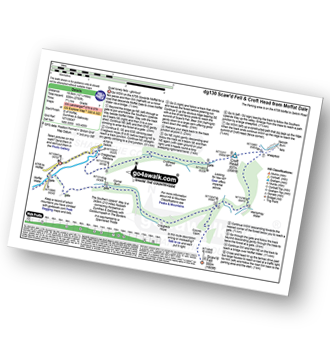
Route Summary:
Parking Area A708 NE of Moffat - Moffat Water - Moffat Dale - The Southern Upland Way - Cornal Burn - Craigbeck Hope - Eskdalemuir - Wamphrey Burn - Sheepfold - Slecoth Burn - Croft Head - Corfthead Burn - Craiglochan Gardens - Parking Area.
|
Vital Statistics:
| Length: | 14.5 miles (23 km) |
| Ascent: | 3,781ft (1,152m) |
| Time: | 9 hrs |
| Grade: |  |
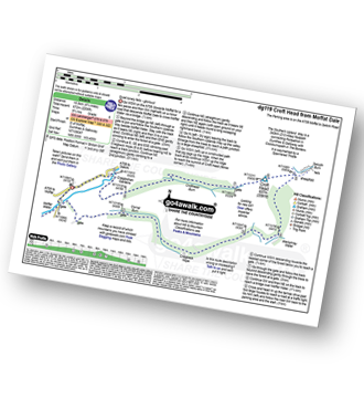
Route Summary:
Parking Area A708 NE of Moffat - Moffat Water - Moffat Dale - The Southern Upland Way - Cornal Burn - Craigbeck Hope - Coomb Cairn - Scaw'd Fell - Eskdalemuir - Wamphrey Burn - Sheepfold - Slecoth Burn - Loch Fell - Croft Head - Corfthead Burn - Craiglochan Gardens - Parking Area.
|
Vital Statistics:
| Length: | 12.25 miles (19.5 km) |
| Ascent: | 2,750ft (838m) |
| Time: | 7½ hrs |
| Grade: | |
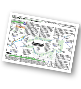
Route Summary:
Parking Area A708 NE of Moffat - Moffat Water - Moffat Dale - The Southern Upland Way - Cornal Burn - Craigbeck Hope - Coomb Cairn - Scaw'd Fell - Eskdalemuir - Wamphrey Burn - Sheepfold - Slecoth Burn - Croft Head - Corfthead Burn - Craiglochan Gardens - Parking Area.
|
Vital Statistics:
| Length: | 13.5 miles (21.5 km) |
| Ascent: | 2,504ft (763m) |
| Time: | 7½ hrs |
| Grade: | |
Route Summary:
Alwinton - Hosedon Burn - The Creel - Clennelstreet Farm - Clennell Street (Track) - Cross Dyke - Uplaw Knowe - Hare Sheds - Wholehope - Wholehope Knowe - Saughy Hill - Nettlehope Hill - Usway Burn - The Middle - Middle Hill - Fairhaugh - Hoseden Law - The Castles - Batailshiel Haugh - Shillmoor - The Knocks - Pass Peth - Alwinton
|
Vital Statistics:
| Length: | 4.75 miles (7.5 km) |
| Ascent: | 735ft (225m) |
| Time: | 2½ hrs |
| Grade: | |
|
Vital Statistics:
| Length: | 17 miles (27 km) |
| Ascent: | 3,463ft (1,055m) |
| Time: | 9½ hrs |
| Grade: | |
Route Summary:
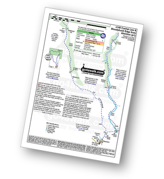
Alwinton - River Alwin - Alwindale - Kidland Forest - Yoke Burn - Cushat Law - Bloodybush Edge - Uswayford Farm - Usway Burn - Nettlehope Hill - Flesh Shank - Wholehope - Clennell Street - Howedon Burn - Alwinton
Not familiar with the area around TD9?
See these 30 nearest walks to UK Postcode TD9 on a google map


