Walks Routes Maps from Thirlmere in The Central Fells, The Lake District, Cumbria in Walk Grade Order
Route maps for Walks that start, or go through, Thirlmere in The Central Fells, The Lake District, Cumbria, England in Walk Grade Order
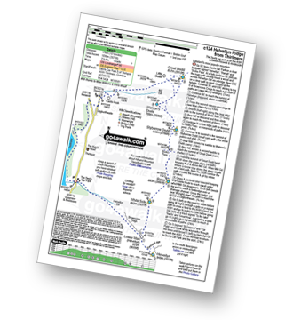
Details of refreshments, pubs & parking are included on each Thirlmere walk description.
   |
Vital Statistics:
| Length: | 10 miles (16 km) |
| Ascent: | 492ft (150m) |
| Time: | 4 hrs |
| Grade: |  |
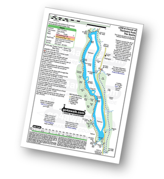
Route Summary:
The Swirls Car Park - Thirlmere - Dalehead Hall - Thirlspot - Valve Houses - Beech Grove - Armboth - Hause Point - Dobgill Bridge - Wythburn - Stockhow Bridge - Wyth Burn - Helvellyn Screes - Highpark Wood - The Swirls Car Park - Thirlmere
|
Vital Statistics:
| Length: | 8.5 miles (13.5 km) |
| Ascent: | 2,181ft (665m) |
| Time: | 5.25hrs |
| Grade: |  |
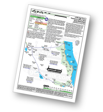
Route Summary:
Watendlath - High Tove - Cockrigg Crags - Thirlmere - Harrop Tarn - Blea Tarn (Watendlath Fell) - Brimming Knott - Robinbank Crag - Rough Knott - Watendlath
|
Vital Statistics:
| Length: | 8.5 miles (13.5 km) |
| Ascent: | 2,368ft (722m) |
| Time: | 5½ hrs |
| Grade: | |
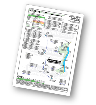
Route Summary:
Thirlmere - Armboth - Armboth Fell - High Tove - High Seat (Ashness Fell) - Bleaberry Fell - Raven Crag (Thirlmere) - Thirlmere
|
Vital Statistics:
| Length: | 8.75 miles (14 km) |
| Ascent: | 3,296ft (1,005m) |
| Time: | 6½ hrs |
| Grade: |  |
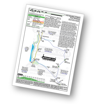
Route Summary:
The Swirls Car Park Thirlmere - Browncove Crags - Lower Man (Helvellyn) - Helvellyn - White Side - Raise (Helvellyn) - Sticks Pass - Sticks Gill - Stanah Gill - Legburthwaite - Thirlmere - Thirlspot - The Swirls Car Park Thirlmere.
|
Vital Statistics:
| Length: | 10.5 miles (17 km) |
| Ascent: | 3,575ft (1,090m) |
| Time: | 7½ hrs |
| Grade: | |
Route Summary:
The Swirls Car Park Thirlmere - Browncove Crags - Lower Man (Helvellyn) - Helvellyn - White Side - Raise (Helvellyn) - Sticks Pass - Stybarrow Dodd - Watson's Dodd - Great Dodd - Legburthwaite - Thirlmere - Thirlspot - The Swirls Car Park Thirlmere.
See more easy-to-follow circular walks in The Lake District
See more easy-to-follow circular walks in Cumbria


