
![]()
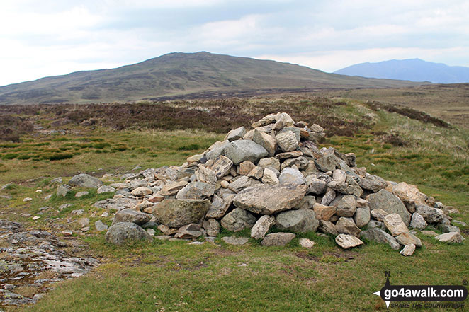
High Tove
515m (1690ft)
The Central Fells, The Lake District, Cumbria, England
Not familiar with this top?
   |
|---|
Vital Statistics:
| Length: | 7.75ml (12.5km) |
|---|---|
| Ascent: | 2,247ft (685m) |
| Time: | 5 hrs |
| Grade: |  (Moderate) (Moderate) |
Route Summary:
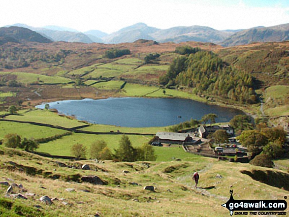
Watendlath - High Tove - Middle Crag - Shivery Man - Shivery Knott - Long Moss - Blea Tarn (Watendlath Fell) - Ullscarf - High Saddle (Coldbarrow Fell) - Low Saddle (Coldbarrow Fell) - Lord's How - Green Combe - Dock Tarn - Great Crag - Watendlath
|
|---|
Vital Statistics:
| Length: | 8.5ml (13.5km) |
|---|---|
| Ascent: | 2,181ft (665m) |
| Time: | 5.25hrs |
| Grade: | (Moderate) |
Route Summary:
Watendlath - High Tove - Cockrigg Crags - Thirlmere - Harrop Tarn - Blea Tarn (Watendlath Fell) - Brimming Knott - Robinbank Crag - Rough Knott - Watendlath
|
|---|
Vital Statistics:
| Length: | 8.5ml (13.5km) |
|---|---|
| Ascent: | 2,368ft (722m) |
| Time: | 5½ hrs |
| Grade: | (Moderate) |
Route Summary:
Thirlmere - Armboth - Armboth Fell - High Tove - High Seat (Ashness Fell) - Bleaberry Fell - Raven Crag (Thirlmere) - Thirlmere
See High Tove and the surrounding tops on our free-to-access 'Google Style' Peak Bagging Maps:
The Central Fells of The Lake District National Park
Less data - quicker to download
The Whole of The Lake District National Park
More data - might take a little longer to download
See High Tove and the surrounding tops on our downloadable Peak Bagging Maps in PDF format:

NB: Whether you print off a copy or download it to your phone, these PDF Peak Baggers' Maps might prove incredibly useful when your are up there on the tops and you cannot get a phone signal.
*This version is marked with the walk routes you need to follow to Walk all 214 Wainwrights in just 59 walks.
You can find High Tove & all the walks that climb it on these unique free-to-access Interactive Walk Planning Maps:
1:25,000 scale OS Explorer Map (orange/yellow covers):
1:50,000 scale OS Landranger Maps (pink/magenta covers):
 Fellow go4awalkers who have already walked, climbed, summited & bagged High Tove
Sarah Gunn walked up High Tove on April 14th, 2025 [with] Martin Gunn [weather] Wet & windy
Nick Tippins climbed High Tove on March 22nd, 2025 [from/via/route] c318: High Seat & Bleaberry Fell from Armboth [with] Fran
James Hughes bagged High Tove on March 2nd, 2025 [from/via/route] c318 High Seat & Bleaberry Fell from Armboth [weather] Cloudy but generally good visibility, some mist ascending High Seat. - Very boggy in places. Cold on tops. Off piste descent from Bleaberry Fell to Raven Crag.
David Higginbottom hiked High Tove on January 30th, 2025 [from/via/route] Route 318 [with] Carolyn [weather] Clear but cold & icy - Nice walk , frozen boggy ground a bit slippy
Mr M A Blanchard summited High Tove on October 4th, 2024 [from/via/route] > [with] Ted, Florence, Millie and Woodie [weather] Dry cool
Dan Collins conquered High Tove on July 30th, 2023 [from/via/route] As part of c318 walk [with] Family (just the lads) [weather] Overcast & rainy - Very boggy & marshy on the top ridge. My right leg vanished into a bog at one point, much to the amusement of the kids. Descent from Raven crag is steep, & generally the main part of the walk was hard to navigate with limited pathways (I assume partly based on the extent of rain recently)
Geoff Hand scaled High Tove on July 7th, 2023 [from/via/route] Nipped out to Watendlath on Friday afternoon & climbed up to High Tove, Armboth fell & back down to the farm very nice. Exciting drive to Watendlath. Must be one of the most remote NT spots around. Good to pick thse up after missing them earlier in the year. [weather] Warm muggy day.
Charlotte Hewson walked up High Tove on June 3rd, 2023 [from/via/route] The base of raven cragg, Thirlmere, along the lake [with] Rosie [weather] Sunny! - Quick paddle in Thirlmere after
Christine Shepherd climbed High Tove on October 4th, 2009 [from/via/route] Used walk c318 from Armboth [with] On my own [weather] Clear but wet underfoot - I had some wonderful long distance views on this walk to distract me from the decidedly boggy conditions underfoot. Climbed again on 23.9.19 & 25.9.19 while bagging Bell Crags. Repeated walk c318 21-04-2021. Climbed again on 03.12.2022. Fantastic views all day.
Ian Ashton bagged High Tove on August 27th, 2022 [with] Jph [weather] Sunny
To add (or remove) your name and experiences on this page - Log On and edit your Personal Mountain Bagging Record
. . . [see more walk reports]
More Photographs & Pictures of views from, on or of High Tove


The Coledale Horseshoe from Crag Hill (Eel Crag) trig point featuring: Grasmoor, Grasmoor, Whiteside (Crummock) (West Top), Whiteside (Crummock), Gasgale Crags, Hopegill Head, Sand Hill, The top of Hobcarton Crag, Grisdale Pike, The Skiddaw massif, Blencathra (or Saddleback), Keswick, Sleet How, Outerside, Stile End, Sail, Causey Pike, Bleaberry Fell, High Seat, High Tove, The Southern Fells and The Western Fells
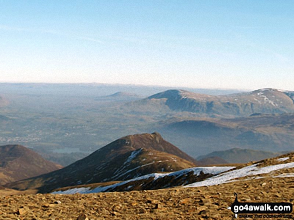
Sail and Causey Pike (foreground) & The Central Fells - Bleaberry Fell, High Seat and High Tove from Crag Hill (Eel Crag) trig point
Send us your photographs and pictures on, of, or from High Tove
If you would like to add your walk photographs and pictures featuring views from, on or of High Tove to this page, please send them as email attachments (configured for any computer) along with your name to:
and we shall do our best to publish them.
(Guide Resolution = 300dpi. At least = 660pixels (wide) x 440 pixels (high).)

You can also submit photos via our Facebook Page.
NB. Please indicate where each photo was taken and whether you wish us to credit your photos with a Username or your First Name/Last Name.
Not familiar with this top?


