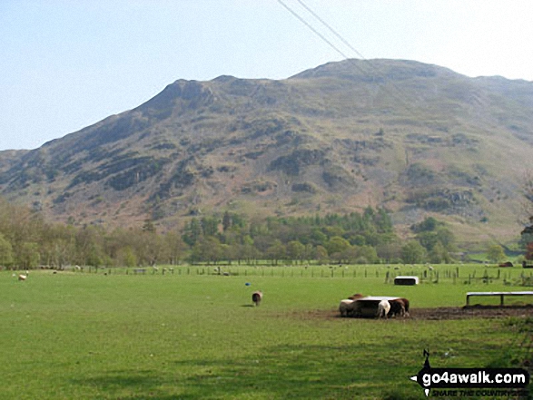
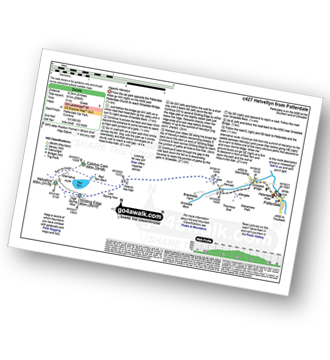
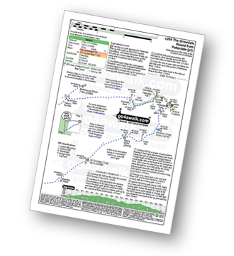
Place Fell from Patterdale
The Eastern Fells,
The Lake District National Park,
Cumbria, England
See views like this by using any of these 14 easy-to-follow circular walk route maps:
   |
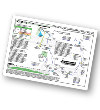
Vital Statistics:
| Length: | 6.5 miles (10.5 km) |
| Ascent: | 643ft (196m) |
| Time: | 3 hrs |
| Grade: |  |
Route Summary:
Patterdale - Noran Bank Farm - Greenbank Farm - Lane Head - Deepdale Bridge - Low Wood - Cow Bridge - Brothers Water - Hartsop Hall - Sykeside - Brothers Water - Hartsop - Eden Beck - Hartsop Fold - Angletarn Beck - Beckstones - Crookabeck - Dubhow - Rooking - Patterdale
|
Vital Statistics:
| Length: | 3 miles (5 km) |
| Ascent: | 922ft (281m) |
| Time: | 2 hrs |
| Grade: | |
|
Vital Statistics:
| Length: | 7 miles (11 km) |
| Ascent: | 1,299ft (396m) |
| Time: | 3.75hrs |
| Grade: |  |
Route Summary:
Glenridding - Glenridding Pier - Ullswater Steamer - Howtown Pier - Geordie's Crag - Halinhag Wood - Sandwick - Long Crag (Ullswater) - Silver Point - Ullswater - Blowick - Rooking - Side Farm - Patterdale
|
Vital Statistics:
| Length: | 3.75 miles (6 km) |
| Ascent: | 1,571ft (479m) |
| Time: | 3 hrs |
| Grade: | |
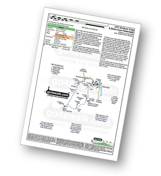
Route Summary:
Patterdale - Arnison Crag - Glenamara Park - Birks - Thornhow End - Grisedale Bridge - Patterdale
|
Vital Statistics:
| Length: | 7 miles (11 km) |
| Ascent: | 1,273ft (388m) |
| Time: | 3.75hrs |
| Grade: | |
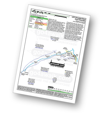
Route Summary:
Patterdale - Glenamara Park - Braesteads Farm - Elmhow Farm - Grisedale Bridge - Grisedale Beck - Ruthwaite Lodge (Bothy) - Grisedale Beck - Nethermostcove Beck - Grisedale Bridge - Patterdale
|
Vital Statistics:
| Length: | 8.5 miles (13.5 km) |
| Ascent: | 2,552ft (778m) |
| Time: | 6 hrs |
| Grade: |  |
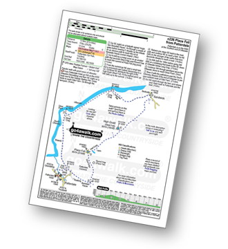
Route Summary:
Patterdale - Rooking - Boredale Hause - Place Fell - High Dodd (Sleet Fell) - Martindale - Sandwick - Long Crag (Ullswater) - Silver Point - Ullswater - Blowick - Rooking - Side Farm - Patterdale
|
Vital Statistics:
| Length: | 9 miles (14.5 km) |
| Ascent: | 2,619ft (798m) |
| Time: | 6 hrs |
| Grade: | |
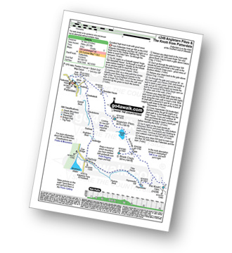
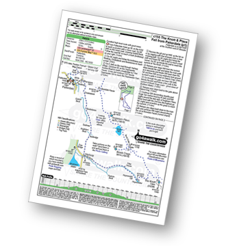
Route Summary:
Patterdale - Side Farm - Boredale Hause - Angletarn Pikes - Angle Tarn (Martindale) - Satura Crag - Brock Crags - Satura Crag - The Knott - Hayeswater Reservoir - Hayeswater Gill - Hartsop - Dubhow - Beckstones - Crookabeck - Rooking - Side Farm - Patterdale
|
Vital Statistics:
| Length: | 8 miles (12.5 km) |
| Ascent: | 2,990ft (911m) |
| Time: | 6 hrs |
| Grade: | |
Route Summary:
Patterdale - Patterdale Church - Grisedale Bridge - Grisedale Beck - Brownend Plantation - Lanty's Tarn - Hole-in-the-Wall - Red Tarn (Helvellyn) - Bleaberry Crag - Low Spying How - High Spying How - Striding Edge (High Spying How) - Helvellyn - Swirral Edge (optional) - Hole-in-the-Wall - Grisedale Beck - Patterdale
|
Vital Statistics:
| Length: | 10 miles (16 km) |
| Ascent: | 3,979ft (1,213m) |
| Time: | 7½ hrs |
| Grade: |  |
Route Summary:
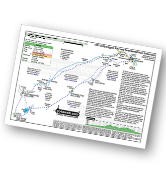
Patterdale - Grisedale Bridge - Ruthwaite Lodge - The Tongue - Dollywaggon Pike - Seat Sandal - Grisedale Tarn - Deepdale Hause - St Sunday Crag - Birks - Patterdale
|
Vital Statistics:
| Length: | 9.75 miles (15.5 km) |
| Ascent: | 3,516ft (1,072m) |
| Time: | 7 hrs |
| Grade: | |
Route Summary:
Patterdale - Arnison Crag - Birks - St Sunday Crag - Deepdale Hause - Cofa Pike - Fairfield - Rydal Head - Hart Crag - Blake Brow - Hartsop Above How - Hoggill Brow - Gale Crag - Bleaberry Knott - Cockley How - Bridgend - Patterdale
|
Vital Statistics:
| Length: | 11.5 miles (18.5 km) |
| Ascent: | 4,582ft (1,396m) |
| Time: | 8.75hrs |
| Grade: |  |
Route Summary:
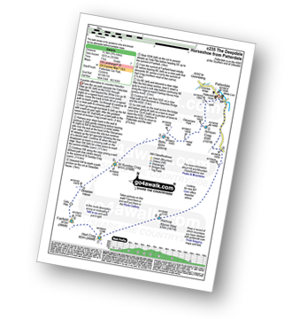
Patterdale - Grisedale Bridge - Grisedale Beck - Brownends Plantation - Hole-in-the-Wall - Birkhouse Moor - Hole-in-the-Wall - Red Tarn (Helvellyn) - Bleaberry Crag - Low Spying How - High Spying How - Striding Edge (High Spying How) - Helvellyn - Nethermost Pike - High Crag (Helvellyn) - Dollywaggon Pike - Grisedale Tarn - Deepdale Hause - St Sunday Crag - Birks - Patterdale
|
Vital Statistics:
| Length: | 12.5 miles (20 km) |
| Ascent: | 3,889ft (1,185m) |
| Time: | 8½ hrs |
| Grade: | |
Route Summary:
Cow Bridge - Brothers Water - Hartsop - Hartsop Dodd - Stony Cove Pike - Caudale Head - Caudale Moor - Stony Cove Pike (Caudale Moor) - Threshthwaite Mouth - Thornthwaite Crag - High Street - Straits of Riggindale - The Knott - Angle Tarn (Martindale) - Angletarn Pikes - Boredale Hause - Patterdale
|
Vital Statistics:
| Length: | 15.5 miles (25 km) |
| Ascent: | 4,293ft (1,308m) |
| Time: | 10 hrs |
| Grade: |  |
Route Summary:
Patterdale - Rooking - Crookabeck - Beckstones - Dubhow - Hartsop - Hayswater Gill - Hayswater - The Knott - Brock Crags - Angle Tarn (Martindale) - Angletarn Pikes - Boredale Hause - Place Fell - High Dodd (Sleet Fell) - Sandwick - Long Crag - Silver Point - Ullswater - Blowick - Rooking - Side Farm - Patterdale
|
Vital Statistics:
| Length: | 13.25 miles (21 km) |
| Ascent: | 5,189ft (1,581m) |
| Time: | 10 hrs |
| Grade: | |
Route Summary:
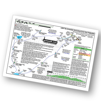
Patterdale - Grisedale Bridge - Grisedale Beck - Brownend Plantation - Hole-in-the-Wall - Birkhouse Moor - Hole-in-the-Wall - Red Tarn (Helvellyn) - Bleaberry Crag - Low Spying How - High Spying How - Striding Edge (High Spying How) - Helvellyn - Nethermost Pike - High Crag (Helvellyn) - Dollywaggon Pike - Seat Sandal - Grisedale Tarn - St Sunday Crag - Birks - Arnison Crag - Patterdale
Send us your photographs and pictures of walks and hikes in the British countryside
If you would like to see your digital photographs as part of this collection, please send them as email attachments (configured for any computer) along with your name to:
and we shall do our best to publish them.
(Guide Resolution = 300dpi. At least = 587 pixels (wide) x 440 pixels (high).)

You can also submit photos via our Facebook Page.
NB. Please indicate where each photo was taken.
NB. To see photographs and pictures from a particular walk choose your walk from Walks or use our Walk Search facility.
To see photographs and pictures on, of or from a particular Mountain, Peak, Top or Hill select from Peaks & Mountains' or enter the Mountain, Peak, Top or Hill Name into our 'Photo Search facility.


