Mountain (Hewitt) & Nuttall Icon

Striding Edge (High Spying How)
863m (2831ft)


The Eastern Fells, The Lake District, Cumbria, England


Record Striding Edge (High Spying How) as Bagged, Climbed & Conquered

English Mountain Icon

English Mountain
19th highest in England,
42nd in England & Wales

English Nuttall Icon

English Nuttall
23rd highest in England,
49th in England & Wales

Walk Striding Edge (High Spying How) walking UK Mountains in The Eastern Fells The Lake District National Park Cumbrian, England

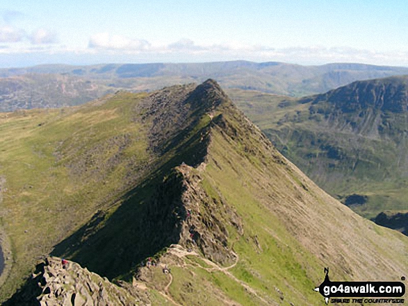
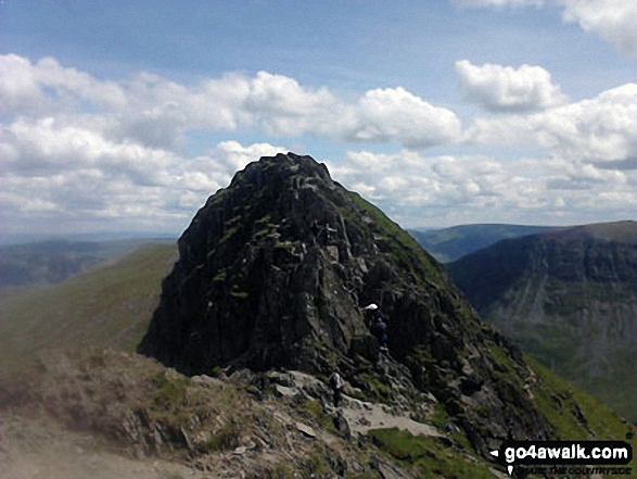
Striding Edge (High Spying How) basking in glorious September Sun viewed from Helvellyn

Photo: Dean Richardson

Striding Edge (High Spying How) gained Mountain (Hewitt) status in September, 2018.


Not familiar with this top?

How is Striding Edge (High Spying How) classified?

Download 5 easy-to-follow, circular walks that climb Striding Edge (High Spying How)

See the location of Striding Edge (High Spying How) and all 5 walks on an interactive Google Map

See the location of Striding Edge (High Spying How) on an interactive Google Bagging Map

See downloadable Bagging Map in PDF format that includes Striding Edge (High Spying How)

Read walk reports from hikers who have already bagged Striding Edge (High Spying How)

View more photographs & pictures of views from, on or of Striding Edge (High Spying How)


You can walk to the top of Striding Edge (High Spying How) by using any of these 5 easy‑to‑follow route maps:
Walking Boot Print Icon

Walk c427 Helvellyn via Striding Edge (High Spying How) from Patterdale

Lakeland's 3rd highest via the infamous Striding Edge

Walk GPS Icon
Walk GPX Icon
Walk PDF Icon

Vital Statistics:

Length: 8ml (12.5km)
Ascent:2,990ft (911m)
Time:6 hrs
Grade:Walk Grade 6 Icon (Moderate)
Walking Boot Print Icon

Walk c213 Helvellyn from Glenridding

Lakeland's 3rd highest via the infamous Striding & Swirral Edges - not for the faint hearted

Walk GPS Icon
Walk GPX Icon
Walk PDF Icon

Vital Statistics:

Length: 8.5ml (13.5km)
Ascent:3,278ft (999m)
Time:6½ hrs
Grade:Walk Grade 7 Icon (Hard)
Walking Boot Print Icon

Walk c220 Helvellyn via Striding Edge (High Spying How) from Glenridding

Lakeland's most climbed mountain via the infamous Striding Edge - not for the faint hearted

Walk GPS Icon
Walk GPX Icon
Walk PDF Icon

Vital Statistics:

Length: 10ml (16km)
Ascent:3,382ft (1,031m)
Time:7 hrs
Grade:Walk Grade 7 Icon (Hard)
Walking Boot Print Icon

Walk c269 The Grisedale Horseshoe from Patterdale

Lakeland's most climbed mountain - not for the faint hearted

Walk GPS Icon
Walk GPX Icon
Walk PDF Icon

Vital Statistics:

Length: 11.5ml (18.5km)
Ascent:4,582ft (1,396m)
Time:8.75hrs
Grade:Walk Grade 8 Icon (Hard)
Walking Boot Print Icon

Walk c264 The Grisedale Round from Patterdale

Superb high level ridge walk

Walk GPS Icon
Walk GPX Icon
Walk PDF Icon

Vital Statistics:

Length: 13.25ml (21km)
Ascent:5,189ft (1,581m)
Time:10 hrs
Grade:Walk Grade 9 Icon (Very Hard)

See Striding Edge (High Spying How) and the surrounding tops on our free-to-access 'Google Style' Peak Bagging Maps:

Find Google Maps Peak Bagging Map Icon

The Whole of The Lake District National Park

Find Google Maps Peak Bagging Map Icon

The Eastern Fells of The Lake District National Park


See Striding Edge (High Spying How) and the surrounding tops on our downloadable Peak Bagging Maps in PDF format:

Find PDF Peak Bagging Map Icon

The Eastern Fells area of The Lake District National Park

Find PDF Peak Bagging Map Icon

Walk & bag all 35 Wainwrights in The Eastern Fells area of
The Lake District in just 8 easy-to-follow circular walks*

NB: Whether you print off a copy or download it to your phone, these PDF Peak Baggers' Maps might prove incredibly useful when your are up there on the tops and you cannot get a phone signal.

*This version is marked with the walk routes you need to follow to Walk all 214 Wainwrights in just 59 walks.


You can find Striding Edge (High Spying How) & all the walks that climb it on these unique free-to-access Interactive Walk Planning Maps:

The Lake District National Park


1:25,000 scale OS Explorer Map (orange/yellow covers):

OS Explorer OL5 The English Lakes - North Eastern area


1:50,000 scale OS Landranger Map (pink/magenta covers):

OS Landranger 90 Penrith & Keswick, Ambleside


Other walkers who hiked, climbed, bagged and summited Striding Edge (High Spying How) Fellow go4awalkers who have already walked, climbed, summited & bagged Striding Edge (High Spying How)

Neil Walker walked up on June 1st, 1982 [from/via/route] Enroute to Helvellyn [with] Doddridge Church - 1st Mountain

Nick Tippins climbed it on December 31st, 2019 [from/via/route] Helvellyn Circular from Glenridding via Birkhouse Moor, Striding Edge, & Catstye Cam [with] Fran

Neil Heywood bagged it on September 9th, 2024 [from/via/route] Glenridding

Chris Faulkner hiked it on August 19th, 2011 [from/via/route] Patterdale [with] Michelle Chandler [weather] Bright & blustery.

Christina Lander summited on June 3rd, 2017 [from/via/route] Glenridding - Striding Edge - Helvellyn - Raise - Sticks Pass - Glenridding [with] Dick [weather] Perfect sunny day during our 1st holiday at Wordsworth Barn, Patterdale

Chris Hughes conquered it on June 28th, 2023 [from/via/route] Thirlmere car park [weather] mist / drizzle

Darren Mortimer scaled on April 20th, 2019 [from/via/route] Walked this many times but didn't know it was a mountain. [with] Dermot Palmer [weather] Warm & sunny.

Melfyn Parry walked up on May 23rd, 2023 [from/via/route] Started walk from the car park at the Patterdale Hotel, followed route C427 with a couple of changes. Climbed over Striding Edge & then on to Helvellyn but then took a detour to walk out to Lower Man then doubled back to Helvellyn before descending Swirral Edge to then climb too summit of Catstye Cam. From here we descended to Hole in the Wall & then went out to Birkhouse Moor & rather than doubling back to Hole in the Wall to repeat the path back to the carpark we continued beyond the summit along easy to follow paths which led back down to join the return route at NY377158, making a total of 16.4Km [with] With DS [weather] Sunny spells & quite warm at times especially on uphill sections when in lea of the breeze. On the tops the breeze was chilly. - Stunning views in all directions.

Claire Kirk climbed it on September 1st, 2010 [from/via/route] Patterdale [with] Larry [weather] Warm, clear day

Caroline Winter bagged it on August 9th, 2018 [from/via/route] Glenridding, Stiding Edge, Helvellyn, Swirral Edge, Catsye Cam [with] Becky [weather] Warm, clear skies, light breeze - After battling with the new Ticket machine at Glenridding CP for 20 mins, we eventually got away. Hot & sticky long ascent. Rather than doubling back, should have taken a direct line to hole in the wall. Third time lucky, due to poor weather, did Striding-perfect conditions. No problem for Becky on tricky climb section. Others struggling! Made for Dolly Waggon Pike, but time & energy against us, so came back to top Helvellyn, & Catsye Cam via Swirral. Enjoyed a needed drink in Hole in the Wall cafe at YH. My boots painful-time for a new Pair.

To add (or remove) your name and experiences on this page - Log On and edit your Personal Mountain Bagging Record

. . . [see more walk reports]


More Photographs & Pictures of views from, on or of Striding Edge (High Spying How)

Striding Edge (High Spying How) (left), Helvellyn and Catstye Cam from the summit of Birkhouse Moor

Striding Edge (High Spying How) (left), Helvellyn and Catstye Cam from the summit of Birkhouse Moor

Photo: Katherine Horrex (3)

Starting the climb from Striding Edge (High Spying How) up onto Helvellyn

Starting the climb from Striding Edge (High Spying How) up onto Helvellyn

Photo: Terry Maddocks (3)

Striding Edge (High Spying How) with Helvellyn beyond

Striding Edge (High Spying How) with Helvellyn beyond

Photo: William Ringwood (66)

Striding Edge (High Spying How) and Red Tarn from Helvellyn Summit

Striding Edge (High Spying How) and Red Tarn from Helvellyn Summit

Photo: Richard Nicholls (39)

Taking a breather before tackling Striding Edge (High Spying How)

Taking a breather before tackling Striding Edge (High Spying How)

Photo: Dean Richardson (12)

Emma Cooper & Rachel Hargreaves tackling Striding Edge (High Spying How)

Emma Cooper & Rachel Hargreaves tackling Striding Edge (High Spying How)

Photo: David Cooper (1)

Striding Edge (High Spying How) (left) and Helvellyn from near Hole-in-the-wall

Striding Edge (High Spying How) (left) and Helvellyn from near Hole-in-the-wall

Photo: Richard Heeley (2)

Striding Edge (High Spying How) from Helvellyn in all its glory

Striding Edge (High Spying How) from Helvellyn in all its glory

Photo: Roger Nunns (1)

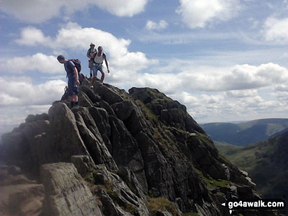
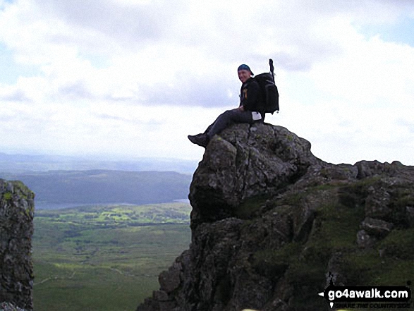
On Striding Edge (High Spying How)

On Striding Edge (High Spying How)

Photo: Dean Richardson (3)

*Striding Edge (High Spying How) (left), Helvellyn, Swirral Edge and Catstye Cam (far right) from near Hole-in-the-wall

*Striding Edge (High Spying How) (left), Helvellyn, Swirral Edge and Catstye Cam (far right) from near Hole-in-the-wall

Photo: Richard Heeley (4)

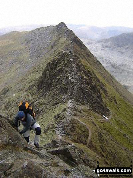
On Striding Edge (High Spying How) in mist

On Striding Edge (High Spying How) in mist

Photo: Dean Richardson (13)

Rescue Helicopter above a frozen Red Tarn from Striding Edge (High Spying How)

Rescue Helicopter above a frozen Red Tarn from Striding Edge (High Spying How)

Photo: Tony Price (7)

Grisedale Hause, Dollywaggon Pike (centre), Nethermost Pike, Helvellyn and Striding Edge (High Spying How) (far right) from Great Rigg

Grisedale Hause, Dollywaggon Pike (centre), Nethermost Pike, Helvellyn and Striding Edge (High Spying How) (far right) from Great Rigg

Photo: David Hayter (316)

Birkhouse Moor summit cairn - with Striding Edge (High Spying How), Helvellyn, Swirral Edge and Catstye Cam beyond

Birkhouse Moor summit cairn - with Striding Edge (High Spying How), Helvellyn, Swirral Edge and Catstye Cam beyond

Photo: Alan Wainwright (13)

The Helvellyn Ridge featuring Dollywaggon Pike, Nethermost Pike, Helvellyn and Striding Edge (High Spying How) from Fairfield

The Helvellyn Ridge featuring Dollywaggon Pike, Nethermost Pike, Helvellyn and Striding Edge (High Spying How) from Fairfield

Photo: Mike Walker (334)

Striding Edge (High Spying How) and Helvellyn above Red Tarn from the col between Swirral Edge and Catstye Cam

Striding Edge (High Spying How) and Helvellyn above Red Tarn from the col between Swirral Edge and Catstye Cam

Photo: Brian Balfe (15)

Striding Edge (High Spying How) (left), Helvellyn and Catstye Cam from the Birkhouse Moor

Striding Edge (High Spying How) (left), Helvellyn and Catstye Cam from the Birkhouse Moor

Photo: Katherine Horrex (4)

Red Tarn (Helvellyn) with Catstye Cam beyond from Striding Edge (High Spying How)

Red Tarn (Helvellyn) with Catstye Cam beyond from Striding Edge (High Spying How)

Photo: Stella Whittaker (16)

Pete approaching one of the high points of Striding Edge (High Spying How)

Pete approaching one of the high points of Striding Edge (High Spying How)

Photo: Jill Smythe (2)

Striding Edge (High Spying How) (Helvellyn)

Striding Edge (High Spying How) (Helvellyn)

Photo: John Friskney (1)


. . . see all 119 walk photographs & pictures of views from, on or of Striding Edge (High Spying How)


Send us your photographs and pictures on, of, or from Striding Edge (High Spying How)

If you would like to add your walk photographs and pictures featuring views from, on or of Striding Edge (High Spying How) to this page, please send them as email attachments (configured for any computer) along with your name to:


and we shall do our best to publish them.

(Guide Resolution = 300dpi. At least = 660pixels (wide) x 440 pixels (high).)

Send us your photographs and pictures on, of, or from Striding Edge (High Spying How) via Facebook

You can also submit photos via our Facebook Page.

NB. Please indicate where each photo was taken.


Not familiar with this top?

How is Striding Edge (High Spying How) classified?

Download 5 easy-to-follow, circular walks that climb Striding Edge (High Spying How)

See the location of Striding Edge (High Spying How) and all 5 walks on an interactive Google Map

See the location of Striding Edge (High Spying How) on an interactive Google Bagging Map

See downloadable Bagging Map in PDF format that includes Striding Edge (High Spying How)

Read walk reports from hikers who have already bagged Striding Edge (High Spying How)

View more photographs & pictures of views from, on or of Striding Edge (High Spying How)


Do not miss our pick of the Best Walks in Britain


Follow go4awalk.com on Twitter Follow go4awalk.com on Facebook


Home


Find new Friends to go walking with

Walk all 214 Wainwrights in just 59 Walks. Download GPS Waypoints - Great Walks you must not miss!

Walk The Yorkshire Three Peaks Challenge Walk - All the Latest Route Information, GPS Waypoints and Split Times to keep you on Schedule

Walk The British Three Peaks Challenge Walk - All the Latest Route Information and GPS Waypoints

See our pick of The Best Walks in The Lake District - Great Walks you must not miss!

Walk our pick of the Best Lake District Ridge Walks - Great Walks you must not miss!

Walk our pick of the Best Lake District Walks to do in the rain - Great Walks you must not miss!

Walk our pick of The Best Walks in Snowdonia - Great Walks you must not miss!

Walk our pick of The Best Ridge Walks in Wales - Walks you must not miss!

Walk our pick of The Best Walks in The Brecon Beacons - Great Walks you must not miss!

Walk our pick of The Best Walks in The Yorkshire Dales - Walks you must not miss!

Walk our pick of The Best Walks in The Peak District - Walks you must not miss!

Walk our pick of The Best Walks in The Forest of Bowland - Walks you must not miss!

Walk our pick of The Best Walks in Shropshire - Walks you must not miss!

Walk our pick of The Best Walks in Cheshire - Walks you must not miss!

Walk our pick of The Best Walks in Lancashire - Walks you must not miss!

Not sure where to walk next? Try Peak Bagging - Great Walks you must not miss!

Not sure where to walk next? Walk part of a National Trail - Great Walks you must not miss!

Walks with Downloadable and Uploadable GPS Waypoint Data

Walking Kit and Gear Tested by Walkers

Full Site Search
Do not miss our pick of the Best Walks in Britain