
![]()
Whiteside (Crummock)
719m (2360ft)
The North Western Fells, The Lake District, Cumbria, England
Not familiar with this top?
   |
|---|
Vital Statistics:
| Length: | 7.25ml (11.5km) |
|---|---|
| Ascent: | 3,180ft (969m) |
| Time: | 5.75hrs |
| Grade: |  (Moderate) (Moderate) |
Route Summary:
Hopebeck - Hope Beck - Swinside (Whinlatter) - Hope Gill - Ladyside Pike - Hopegill Head - Hobcarton Crag - Grisedale Pike - Hopegill Head - Gasgale Crags - Whiteside (Crummock) - Whiteside (Crummock) (West Top) - Dodd (Whiteside) - Hopebeck
|
|---|
Vital Statistics:
| Length: | 7.25ml (11.5km) |
|---|---|
| Ascent: | 3,164ft (964m) |
| Time: | 5.75hrs |
| Grade: | (Moderate) |
Route Summary:
Lanthwaite Green - Liza Beck - Whin Ben - Whiteside (Crummock) (West Top) - Whiteside (Crummock) - Gasgale Crags - Hopegill Head - Hobcarton Crag - Sand Hill - Coledale Hause - Grasmoor - Liza Beck - Gasgale Gill - Lanthwaite
|
|---|
Vital Statistics:
| Length: | 9ml (14.5km) |
|---|---|
| Ascent: | 3,699ft (1,127m) |
| Time: | 7 hrs |
| Grade: |  (Hard) (Hard) |
Route Summary:
Lanthwaite Green - Liza Beck - Whin Ben - Whiteside (Crummock) (West Top) - Whiteside (Crummock) - Gasgale Crags - Hopegill Head - Hobcarton Crag - Sand Hill - Coledale Hause - Grasmoor - Wandope - Whiteless Edge - Whiteless Pike - Whiteless Breast - Squat Beck - High Rannerdale - Crummock Water - Lanthwaite Green
|
|---|
Vital Statistics:
| Length: | 9.75ml (15.5km) |
|---|---|
| Ascent: | 4,043ft (1,232m) |
| Time: | 7.75hrs |
| Grade: | (Hard) |
Route Summary:
Lanthwaite Green - Liza Beck - Whin Ben - Whiteside (Crummock) (West Top) - Whiteside (Crummock) - Gasgale Crags - Hopegill Head - Sand Hill - Coledale Hause - Grasmoor - Wandope - Whiteless Edge - Whiteless Pike - Whiteless Breast - Low Bank - Rannerdale Knotts - Crummock Water - Hause Point - Lanthwaite Green
See Whiteside (Crummock) and the surrounding tops on our free-to-access 'Google Style' Peak Bagging Maps:
The North Western Fells of The Lake District National Park
Less data - quicker to download
The Whole of The Lake District National Park
More data - might take a little longer to download
See Whiteside (Crummock) and the surrounding tops on our downloadable Peak Bagging Maps in PDF format:

NB: Whether you print off a copy or download it to your phone, these PDF Peak Baggers' Maps might prove incredibly useful when your are up there on the tops and you cannot get a phone signal.
*This version is marked with the walk routes you need to follow to Walk all 214 Wainwrights in just 59 walks.
You can find Whiteside (Crummock) & all the walks that climb it on these unique free-to-access Interactive Walk Planning Maps:
1:25,000 scale OS Explorer Map (orange/yellow covers):
1:50,000 scale OS Landranger Map (pink/magenta covers):
 Fellow go4awalkers who have already walked, climbed, summited & bagged Whiteside (Crummock)
Pete George walked up Whiteside (Crummock) on August 30th, 2025 [from/via/route] Crummock Water [with] Roco [weather] Chilly on tops & slight rain
James Hughes climbed Whiteside (Crummock) on July 12th, 2025 [from/via/route] c196 Grasnoor & Rannerdale Knotts from Lanthwaite Green. [weather] Boi-ling... Got hotter as day progressed. Clear skies with big yellow disc. - Epic day. Started early (8amish). Steep ascent up Whiteside & pleasant ridge walk to Hopegill Head. Familiar descent off Sand Hill due to last walk before stopping & cooling in Liza Beck. Brief ascent to Grasmoor, stunning views both of Whiteside & towards Red Pike range. Direct down & up to Wandope. Impressive drop off. Returned to main path to Whiteless Pike & beginning to feel the heat. Tricky, steep & draining descent over Whiteless Breast for final climb of Rannerdale Knotts. Completely spent at this point & needed to summon all energy to climb & descend Rannerdale Knotts to edge of Crummock water. Hot but easier road walk with break in the shade. Finished with dip in beck near footbridge at start. Pint of Buttermere Beauty Lager at Kirkstile Inn.
Adrian Howard bagged Whiteside (Crummock) on July 29th, 2024 [from/via/route] Parked near High Swinside Farm - Swinside - Ladyside Pike - Hopegill Head - Sand Hill - Whiteside (East & West tops) - Dodd - Hope Beck - Car.
Christina Lander hiked Whiteside (Crummock) on July 27th, 2016 [from/via/route] Lanthwaite Green - Whin Ben - Whiteside - Whiteside east top - Hopegill Head - Grasmoor - Whiteless Pike - Squat Beck - Rannerdale Bridge - Lanthwaite Green [with] Dick, Kath & Mick [weather] Lovely day
Ian Ashton summited Whiteside (Crummock) on April 27th, 2024 [with] Solo - Ì
Geoff Hand conquered Whiteside (Crummock) on February 26th, 2024 [from/via/route] Walk c196,Walked up from Lanthwaite Green on the Banks of Crummock Water climbed Whiteside West Top then Whiteside.Then West to Hopegill Head, South to Sandside & then struck out Southwest to Grasmore.Retraced my steps uptowards Wandope, then SW to Whiteless Pike, continued SW past Whiteless Breast & onto Low Bank & upto Rannadale Knotts.Then North up the road & water shore back to the carpark. [weather] Sunny Intervals, warm in the sun. Windy at times - Excellent walk, very challenging after a long rest from walking. Great contrast between the big mountains (however very quiet) & the tranquil banks of Crummock Water.
Christine Shepherd scaled Whiteside (Crummock) on September 22nd, 2007 [from/via/route] Walked from Braithwaite [with] On my own [weather] Sunny & clear - Looking at my peak bagging record I thought I had done this peak with Grasmoor but realised it was more likely added on to The Coledale Round.With these doubts I decided I had better do it again so I climbed it on 18.6.12 from Braithwaite just to make sure! Climbed this with Jenny from Lanthwaite Green on a trip to see the bluebells on 22.5.18. Climbed Whiteside again on my own using walk c246 on a glorious Autumn day on 11.11.23
Tim Winn walked up Whiteside (Crummock) on October 23rd, 2023 [with] Steve, John, Andy, Dave and John [weather] Sunny Day
Paul Macey climbed Whiteside (Crummock) on June 14th, 2023 [from/via/route] Using walk c196 [with] Luke [weather] Sunny & warm 23 degrees at start 27 at end no cloud
Angeline Grieveson bagged Whiteside (Crummock) on May 30th, 2023 [with] Dotty
Kate Peacock hiked Whiteside (Crummock) on August 28th, 2022 [from/via/route] Car park on Whinlatter bank [with] Me & Sheila [weather] No breeze at all. Humid all day. Hotter on the morning, rain toward the end which I was glad about but it didn't really cool down - Couldn't really enjoy a lot of the tops because of flying ants.
Richard Fulcher summited Whiteside (Crummock) on August 27th, 2022 [from/via/route] Parked in a little space before the second gate on the old road joined to Whinlatter Pass. We set off through the bracken opposite the entrance to High Swinside farm & trudged up to meet a wall (gathering ticks along the way). Slogged up the steep grassy slope to Ladyside Pike & then onwards to Hopegill Head - looks intimidating but isn't bad in ascent. From there we traversed along the ridge to Whiteside, descending from the east top down a steep (in places) path to Dodd Pass & then back to the car. [with] Jen [weather] Low cloud covered the high ground until we reached the 'Head' providing atmospheric photography possibilities! The day then became warm with blue skies & puffy clouds, providing good visibility for the outstanding views. - A strenuous but enjoyable walk taking us about 7.5 hours - slow, because we take a lot of photos & generally faff about!
Claire Murray conquered Whiteside (Crummock) on June 18th, 2022 [from/via/route] Whiteside from NT Woods car park then along Hopegill Head & back by the waterfalls & crystal clear river [with] Vitor - River was so beautiful! Path was falling away
Richard Marchant scaled Whiteside (Crummock) on June 16th, 2022 [from/via/route] Early start from Lanthwaite Green Farm north up Whin Ben & then on to Whiteside. From here it was just a case of following the narrow ridge around to Hopegill Head down Sand Hill to Coledale Hause. From here I headed South to the top of Wandope Moss then headed West up on to the summit of Grasmoor. I then back tracked to Wandope & proceeded South along Whiteless Edge on to Whiteless Pike. Continued South to Whiteless Breast before eventually turning West & climbing the ridge to Rannerdale Knotts. From here I dropped down to the B5289 & followed the road back to my car. [with] On my Own [weather] Clear hot sunny day with little or no breeze.
Chris Sheard walked up Whiteside (Crummock) on May 19th, 2022 [from/via/route] Up from Lanthwaite via Whin Ben [with] George [weather] Pleasant at ground level, heavy gusting winds, no rain brightened later later with sunshine as we completed the round - Made this ascent as part of a nice circular coming down the other side of a horse shoe
Richard Annett climbed Whiteside (Crummock) on February 26th, 2022 [from/via/route] Parking place near Crummock Water [with] Euan [weather] 50 mph winds, very hard. - Wheatsheaf Inn, cider
Wayne Baxter bagged Whiteside (Crummock) on August 18th, 2021 [from/via/route] From car park near Lanthwaite Green farm follow the path to Whin Ben & onto Whiteside. Returned by same path [with] Sue [weather] very low cloudy - Just before Whin Ben we went into the cloud & did not see any more than 6feet in front of us until we return to Whin Ben
Michael Nolan hiked Whiteside (Crummock) on April 16th, 2021 [from/via/route] Lorton [with] Morag [weather] Brilliant bright day!
Catherine Hill summited Whiteside (Crummock) on September 28th, 2020 [from/via/route] Near the top of Crummock water - Hopegill Pike via Whiteside East Top & followed by Grassmore & Whiteless Pike [with] Alone [weather] Dry,windy
Nick Christian conquered Whiteside (Crummock) on September 18th, 2020 [from/via/route] 1st of the Day. [with] Karen Brown [weather] Good Sunny
Caroline Winter scaled Whiteside (Crummock) on August 31st, 2020 [from/via/route] Lanthwaite Green car park, Whin Ben, Whiteside, Hopegill Head, Hobcarton Crag, Coledale Hause, Grasmoor, Liza Beck [with] Becky [weather] Very good views. Warm day 12 degrees on tops - Glorious walk. Heather in bloom & great views along ridge. One of the largest shelters on Grasmoor to enjoy lunch. Pretty waterfalls on descent
Richard Marshall walked up Whiteside (Crummock) on August 6th, 2020 [from/via/route] From Crummock Water [with] Bo and Dave Jones [weather] Hot, Sunny/Cloudy little bit of drizzle for 20 mins
Kevin Foster climbed Whiteside (Crummock) on May 20th, 2020 [from/via/route] Whiteside West Top (Crummock). [with] By myself. [weather] Very sunny & very hot. - A very easy & pleasant ridge walk of about a quarter of a mile takes you to the higher of Whitesides two tops. Great views all round.
Simon Boddy bagged Whiteside (Crummock) on September 16th, 2019 [from/via/route] Crummock [with] HF Holidays [weather] Sunny & clear
Dave Eyes hiked Whiteside (Crummock) on June 17th, 2019 [from/via/route] Parked at Lanthwaite farm layby on the road to Buttermere. Crossed the road & headed up Whiteside. Onwards from Whiteside to Hopegill Head & then further on to the top of Grisedale Pike. The return journey took us via the top of Grasmoor & we descended via Lad How to the road & walked back to the car. [with] Christine Eyes [weather] good visibility but very windy once up high.
Craig Steeland summited Whiteside (Crummock) on June 29th, 2019 [from/via/route] From Langthwaite [with] With Sue [weather] Partly cloudy, warm & dry apart from a few patches of light rain
Andrew Johnson conquered Whiteside (Crummock) on January 28th, 2019 [from/via/route] Cinderdale car park, Buttermere [weather] Clear & snowy
Bay Wan scaled Whiteside (Crummock) on August 2nd, 2018 [from/via/route] Whiteside, Hopegill Head & Grisedale Pike & return through the valley bypassing Force Crag Mine [with] Cocoa dog - 7 yrs old [weather] Cloudy with sunny intervals. 20 degrees - Waaaaay too much scrambling, scree, ridges & one of the shitest pathways in the valley. Went round in circles near the end cos it wasn't obvious where the path had gone! This walk is doable but challenging & not for the faint hearted!
John Tippins walked up Whiteside (Crummock) on March 28th, 2018 [from/via/route] Started at Lanthwaite Green, go4awalk c196. [with] Solo [weather] Sleet & rain showers on the way there, thick low cloud with the sun breaking through very occasionally. Quite windy on top making it cold enough for gloves - fingers freezing! Walking through fresh hail (or was it sleet?) near the summits. Towards late afternoon, as I was coming back down, the cloud lifted & the sun came out - a really beautiful day then.
Andy Jakob climbed Whiteside (Crummock) on April 22nd, 2017 [from/via/route] up west side of Crummock water & then Langthwaite green to Whiteside [with] AFWC Me and Colin [weather] Sunny
Richard Wilkinson bagged Whiteside (Crummock) on May 5th, 2017 [from/via/route] 6 Peak Circular from Lanthwaite NT Car Park - Whiteside, Hopegill Head, Grasmoor, Wandope, Whiteless Pike & Rannerdale Knotts (finishing with a detour into the secret valley of Rannerdale). [weather] Sunny day, but with strong winds. - Good ridge walk from Whiteside to Hopegill Head - fantastic lake views from the top of Grasmoor, but difficult to stay still in the wind - enjoyable descent from Whiteless giving views of the Bluebells in the secret valley. Camera battery went on Wandope, only for me to realise that I was already using the spare!... best part of the walk with no camera! DOH!
Leon Harvey hiked Whiteside (Crummock) on May 29th, 2016 [with] Solo
Darren Wilson summited Whiteside (Crummock) on December 4th, 2016 [from/via/route] from buttermere [with] Anthony
Mark Davidson conquered Whiteside (Crummock) on March 12th, 2014 [with] Alone [weather] Gloriously sunny
Jon Mapp scaled Whiteside (Crummock) on October 8th, 2016 [from/via/route] walk C196 [with] Suzzann�, Caroline and Robin [weather] Glorious day, light wind, good sunshine - Great views, a strenuous walk over 4000ft of climb
Tracey Cowell walked up Whiteside (Crummock) on October 2nd, 2016 [from/via/route] Lanthwaite Green/ Whin Ben/Whiteside/Hopegill Head/ Gasgale Gill [with] Solo [weather] Sunny - Path on Gasgale Gill very eroded in places due to floods in Dec 15 ... making path quite treacherous near the end near to the bad step.
Anthony Scott climbed Whiteside (Crummock) on July 18th, 2016 [from/via/route] B5289 [with] me [weather] Humid!
Victoria Bates bagged Whiteside (Crummock) on February 23rd, 2016 [from/via/route] C196 from Buttermere [with] Mark [weather] Beautiful - Horrendous way down! Wainwright 150 :)
Clive Ward hiked Whiteside (Crummock) on January 21st, 2016 [from/via/route] Lanthwaite, Whin Ben, Whiteside, Hopegill Head, Grisedale Pike, Gasgale Gill [with] Ben, Chris, Ian [weather] Overcast, dry until about 2pm. No snow at valley level, increasing rapidly on ascent. Completely covered with deep snow from about 450m. About 2 deg. - Conditions much better than forecast.
Kevin Parnham summited Whiteside (Crummock) on October 31st, 2015 [from/via/route] Pantywaists Green & Whinn Ben [with] Jo [weather] Clear low down but cloudy from around 300m
Christine Knowles conquered Whiteside (Crummock) on September 25th, 2015 [from/via/route] From Rannerdale car park over Whin Ben [with] Graham [weather] Very pleasant.
Joanne Mcgawley scaled Whiteside (Crummock) on July 30th, 2015 [with] Rich [weather] Cold tops, Warm lower - 9.4 miles
Claire Lloyd walked up Whiteside (Crummock) on August 27th, 2007 [from/via/route] Ben Whin [with] Family
Elaine Evans climbed Whiteside (Crummock) on May 5th, 2015 [from/via/route] From car park at Lanthwaite Green, up Whiteside, along ridge to Hopegill Head & Sand Hill, back by Coledale Hause & Gasgale Gill. [with] Sue and Christine [weather] Fair on way up, foggy at summit & very windy along ridge. Lots of rain on way back. - Missed out on the views from summit & along ridge due to fog. Several areas of path erosion along Gasgale Gill which meant some scrambles necessary.
David Noble bagged Whiteside (Crummock) on April 17th, 2015 [from/via/route] Lanthwaite Green [with] Jack [weather] Sunny - Came up Whin Ben
Ann Davis has hiked Whiteside (Crummock) [from/via/route] Grisedale pike. Hope gill head [weather] Hot - Lovely chat with vet & physio with their four rescue dogs from portugal
Phillip Bulley summited Whiteside (Crummock) on July 10th, 2014 [from/via/route] Via Lanthwaite Green. [with] Judith and Toby. [weather] Baking Hot.
Michael Vaughn conquered Whiteside (Crummock) on June 1st, 2014 [from/via/route] Ravensdale [with] alone [weather] partly sunny
Raymond Barnett scaled Whiteside (Crummock) on March 13th, 2014 [with] self [weather] fine
Harry Meijer walked up Whiteside (Crummock) on June 11th, 2014 [from/via/route] Rannerdale Knotts,Grasmoor,Whiteside (Crummock) [with] The Lake District Walker
Tim Buckley climbed Whiteside (Crummock) on August 26th, 2013 [from/via/route] From the car park at Lanthwaite Green. [with] Solo walk. [weather] Very hot & sunny. - Set off at 9.20 got to the top at 11.03. The toughest initial climb I've done in a long time. To the east I was above the clouds - semi inversion (?).
Beth Webster bagged Whiteside (Crummock) on June 17th, 2012 [with] Hannah Phillips
Jeanette Coward hiked Whiteside (Crummock) during July, 2013 [weather] hot
Derek Parkin summited Whiteside (Crummock) on May 24th, 2013 [with] Lynn Parkin [weather] showers
David Short conquered Whiteside (Crummock) on February 17th, 2013 [from/via/route] Braithwaite [with] own [weather] Excellent
Darren Mortimer scaled Whiteside (Crummock) on February 23rd, 2013 [from/via/route] Lanthwaite Green [with] Dermot Palmer [weather] Sunshine & snow showers
Dale Verrall walked up Whiteside (Crummock) on March 17th, 2012 [from/via/route] Crummock Water - walk number C196 [with] Les & Amber [weather] Nice to start then snow
Iain Taylor climbed Whiteside (Crummock) on April 11th, 2010 [from/via/route] Lanthwaite Green Farm (NY 15906 20780)
Charlie Housley bagged Whiteside (Crummock) on July 5th, 2012 [from/via/route] As part of an extended Coledale Round which included Grisedale Pike, Hopegill Head, Grasmoor, Wandope, Whiteless Pike, Eel Crag (Crag Hill), Sail & Scar Crags. [with] Solo. [weather] A proper mixture today. Started out with the sun glaringly hot & no cloud, then later, lots of dark clouds & the threat of thunder & lightning. One thing that was constant was the humidity; which was a cracking 90% apparently.
Tony Aspden hiked Whiteside (Crummock) on July 3rd, 2008 [with] Andy [weather] Sunny - Thunderstorm later in the day!
Matthew Thomas, Stephen Byrne, Patrick Rogozinski, Jenny Godfrey, Wendy Sockett, Melanie Dunn, Jane Wilkinson, Jonathan Tobin, Paul Woodhouse, Mr M A Blanchard, David Watson, Adrian Roberts, Linda Mckeogh, Paul Kendell, Louis Smith, Robert Maclean, David Shaw, John Walter, David Laws, Claire Rigg, Elaine Grayson, Adam Shewry, Louise Sandwith, Patricia Dilley, Simon Duerden, Colin Egan, Paul Booth, Helen Marrs, Richard Price, Tracey Cordes, Rod Cove, Trevor Williams, Alan Davidson, Paul Henderson, John Cuthbert, Chris Bramley, Rob Barklamb, Stephen Millington, Andy Nicholls and Ray O'hara have all walked, climbed & bagged Whiteside (Crummock).
To add (or remove) your name and experiences on this page - Log On and edit your Personal Mountain Bagging Record
. . . [see less walk reports]
More Photographs & Pictures of views from, on or of Whiteside (Crummock)
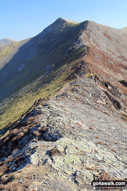
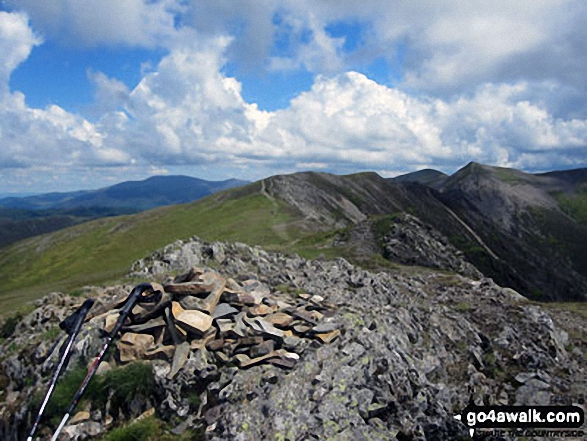
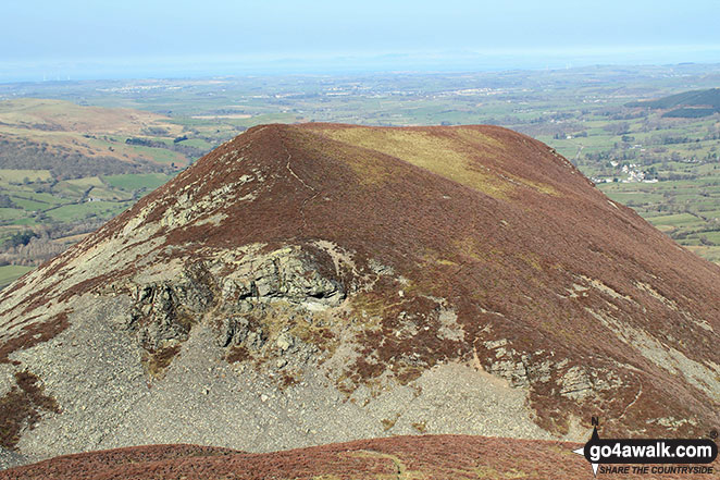
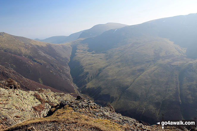
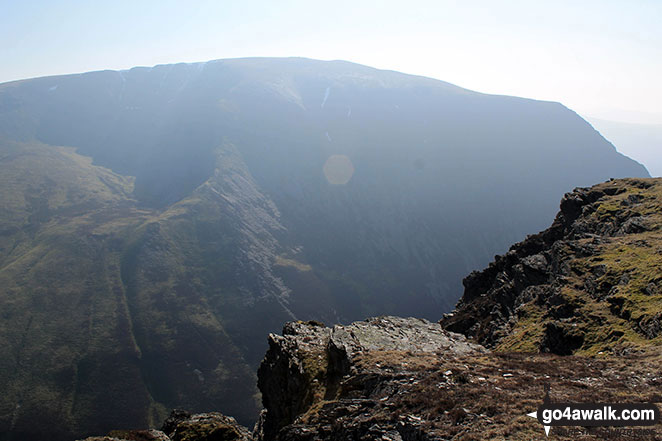
Hopegill Head from the col between Whiteside (Crummock) and Hopegill Head
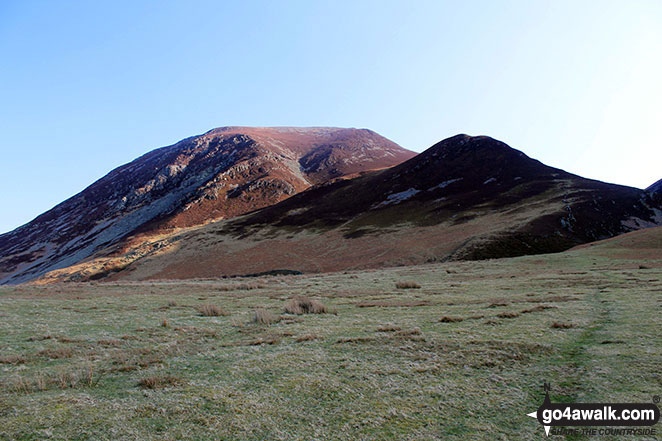
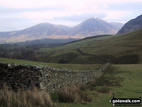
Early morning sun on Whiteside (Crummock) (left) and Whin Ben (right) from Lanthwaite Green
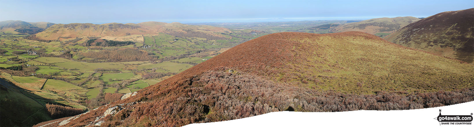
Dodd (Crummock) and the Loweswater Fells (Darling Fell, Low Fell and Fellbarrow) from the upper slopes of Whiteside (Crummock)
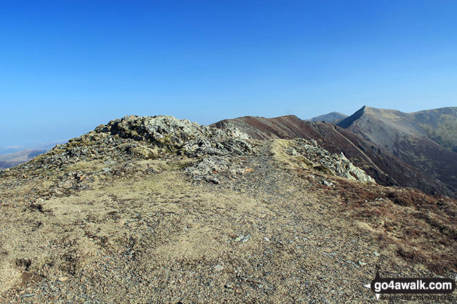
Whiteside (Crummock) (West Top), Whiteside (Crummock) and Gasgale Crags from Crag Hill (Eel Crag) trig point
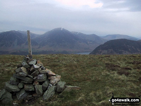
The cairn on the North West end of the Carling Knott ridge with Whiteside (Crummock), Grasmoor, Crummock Water and Mellbreak beyond
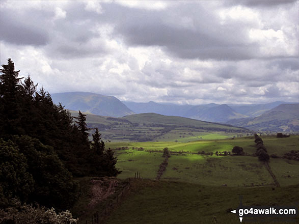
Harrot (centre) and Whiteside (Crummock) (centre left), Mellbreak (centre right) and Fellbarrow (far right) from Setmurthy Common (Watch Hill)
Whiteside (Crummock) (West Top), Whiteside (Crummock), Hopegill Head and Gasgill Crags from Grasmoor
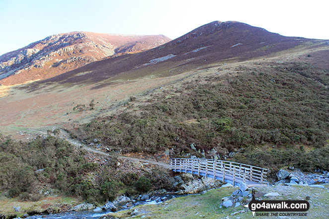
Footbridge over Liza Beck with Whiteside (Crummock) (left) and Whin Ben (right) beyond
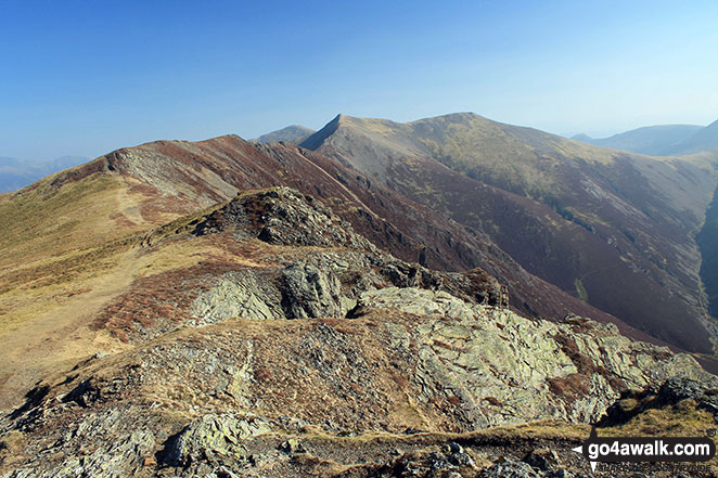
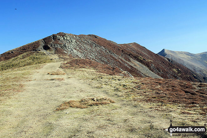
Whiteless Edge, Hopegill Head and Sand Hill from The Whiteside (Crummock)
Gasgale Gill (bottom left), Whin Ben, Whiteside (Crummock) (West Top) and Whiteside (Crummock) from Sand Hill
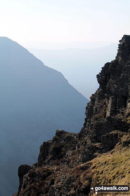
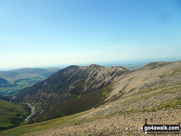
On top of Whiteside (Crummock) looking along Gasgale Crags to Hopegill Head - our route along the ridge
Whiteside (Crummock) (centre left) and Grasmoor (centre right) and the shoulder of Mellbreak (far right) from above High Nook Farm, Loweswater

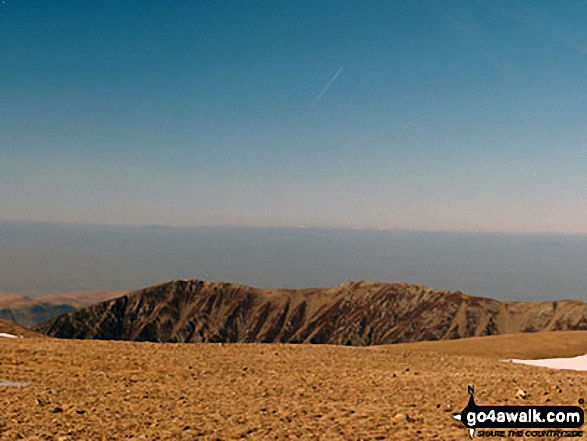
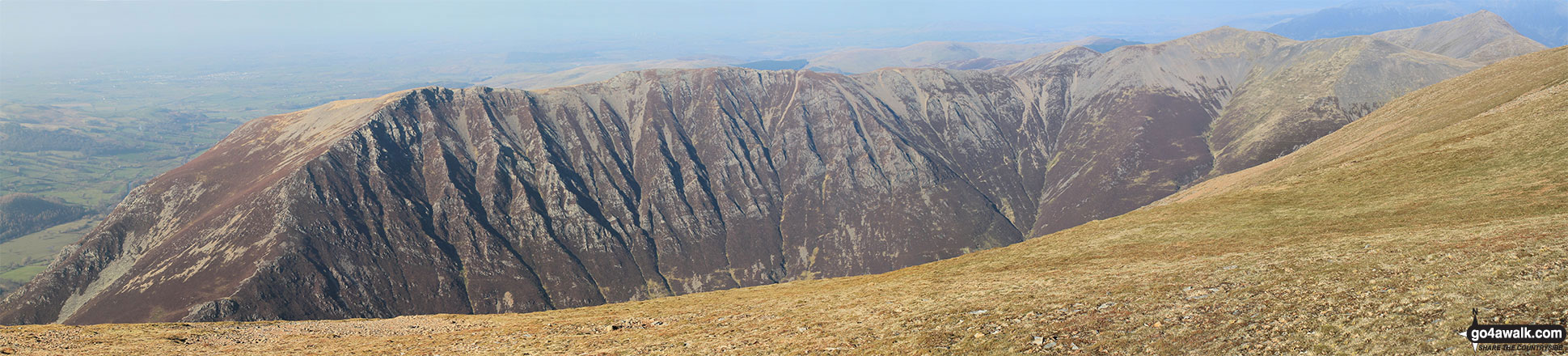
The Coledale Horseshoe from Crag Hill (Eel Crag) trig point featuring: Grasmoor, Grasmoor, Whiteside (Crummock) (West Top), Whiteside (Crummock), Gasgale Crags, Hopegill Head, Sand Hill, The top of Hobcarton Crag, Grisdale Pike, The Skiddaw massif, Blencathra (or Saddleback), Keswick, Sleet How, Outerside, Stile End, Sail, Causey Pike, Bleaberry Fell, High Seat, High Tove, The Southern Fells and The Western Fells
. . . see all 25 walk photographs & pictures of views from, on or of Whiteside (Crummock)
Send us your photographs and pictures on, of, or from Whiteside (Crummock)
If you would like to add your walk photographs and pictures featuring views from, on or of Whiteside (Crummock) to this page, please send them as email attachments (configured for any computer) along with your name to:
and we shall do our best to publish them.
(Guide Resolution = 300dpi. At least = 660pixels (wide) x 440 pixels (high).)

You can also submit photos via our Facebook Page.
NB. Please indicate where each photo was taken and whether you wish us to credit your photos with a Username or your First Name/Last Name.
Not familiar with this top?


