
![]()
Sand Hill
756m (2481ft)
The North Western Fells, The Lake District, Cumbria, England
Tap/mouse over a coloured circle (1-3 easy walks, 4-6 moderate walks, 7-9 hard walks) and click to select.
Not familiar with this top?
   |
|---|
Vital Statistics:
| Length: | 7.25ml (11.5km) |
|---|---|
| Ascent: | 3,164ft (964m) |
| Time: | 5.75hrs |
| Grade: |  (Moderate) (Moderate) |
Route Summary:
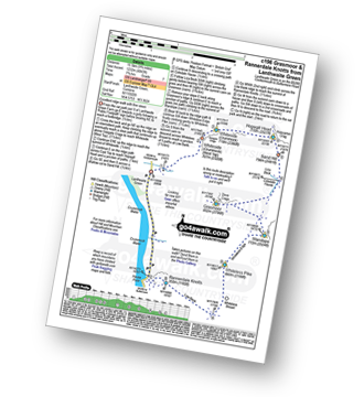
Lanthwaite Green - Liza Beck - Whin Ben - Whiteside (Crummock) (West Top) - Whiteside (Crummock) - Gasgale Crags - Hopegill Head - Hobcarton Crag - Sand Hill - Coledale Hause - Grasmoor - Liza Beck - Gasgale Gill - Lanthwaite
|
|---|
Vital Statistics:
| Length: | 8.5ml (13.5km) |
|---|---|
| Ascent: | 3,840ft (1,170m) |
| Time: | 7 hrs |
| Grade: |  (Hard) (Hard) |
Route Summary:
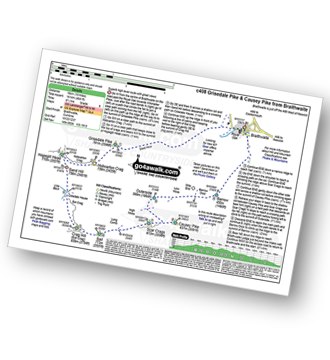
Braithwaite - Sleet How - Grisedale Pike - Hobcarton Crag - Hopegill Head - Sand Hill - Coldale Hause - Eel Crag - Crag Hill (Eel Crag) - Sail (Derwent Fells) - Long Comb - High Moss - Low Moss - Barrow Door - Braithwaite
|
|---|
Vital Statistics:
| Length: | 9ml (14.5km) |
|---|---|
| Ascent: | 3,699ft (1,127m) |
| Time: | 7 hrs |
| Grade: | (Hard) |
Route Summary:
Lanthwaite Green - Liza Beck - Whin Ben - Whiteside (Crummock) (West Top) - Whiteside (Crummock) - Gasgale Crags - Hopegill Head - Hobcarton Crag - Sand Hill - Coledale Hause - Grasmoor - Wandope - Whiteless Edge - Whiteless Pike - Whiteless Breast - Squat Beck - High Rannerdale - Crummock Water - Lanthwaite Green
|
|---|
Vital Statistics:
| Length: | 9.75ml (15.5km) |
|---|---|
| Ascent: | 4,043ft (1,232m) |
| Time: | 7.75hrs |
| Grade: | (Hard) |
Route Summary:
Lanthwaite Green - Liza Beck - Whin Ben - Whiteside (Crummock) (West Top) - Whiteside (Crummock) - Gasgale Crags - Hopegill Head - Sand Hill - Coledale Hause - Grasmoor - Wandope - Whiteless Edge - Whiteless Pike - Whiteless Breast - Low Bank - Rannerdale Knotts - Crummock Water - Hause Point - Lanthwaite Green
|
|---|
Vital Statistics:
| Length: | 10ml (16km) |
|---|---|
| Ascent: | 4,641ft (1,414m) |
| Time: | 8½ hrs |
| Grade: |  (Hard) (Hard) |
Route Summary:
Braithwaite - Sleet How - Grisedale Pike - Hobcarton Crag - Hopegill Head - Sand Hill - Coledale Hause - Crag Hill (Eel Crag) - Sail (Derwent Fells) - Scar Crags - Causey Pike - Outerside - Stile End - Barrow (Newlands) - Braithwaite
|
|---|
Vital Statistics:
| Length: | 12ml (19km) |
|---|---|
| Ascent: | 5,261ft (1,603m) |
| Time: | 9.75hrs |
| Grade: |  (Very Hard) (Very Hard) |
Route Summary:
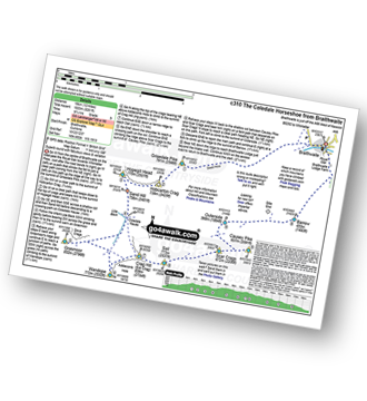
Braithwaite - Sleet How - Grisedale Pike - Hobcarton Crag - Hopegill Head - Sand Hill - Coledale Hause - Grasmoor - Wandope - Crag Hill (Eel Crag) - Sail (Derwent Fells) - Scar Crags - Causey Pike - Outerside - Stile End - Barrow (Newlands) - Braithwaite
See Sand Hill and the surrounding tops on our free-to-access 'Google Style' Peak Bagging Maps:
The North Western Fells of The Lake District National Park
Less data - quicker to download
The Whole of The Lake District National Park
More data - might take a little longer to download
See Sand Hill and the surrounding tops on our downloadable Peak Bagging Maps in PDF format:

NB: Whether you print off a copy or download it to your phone, these PDF Peak Baggers' Maps might prove incredibly useful when your are up there on the tops and you cannot get a phone signal.
*This version is marked with the walk routes you need to follow to Walk all 214 Wainwrights in just 59 walks.
You can find Sand Hill & all the walks that climb it on these unique free-to-access Interactive Walk Planning Maps:
1:25,000 scale OS Explorer Map (orange/yellow covers):
1:50,000 scale OS Landranger Maps (pink/magenta covers):
 Fellow go4awalkers who have already walked, climbed, summited & bagged Sand Hill
Adrian Howard walked up Sand Hill on July 29th, 2024 [from/via/route] Parked near High Swinside Farm - Swinside - Ladyside Pike - Hopegill Head - Sand Hill - Whiteside (East & West tops) - Dodd - Hope Beck - Car.
Christina Lander climbed Sand Hill on July 27th, 2016 [from/via/route] Lanthwaite Green - Whin Ben - Whiteside - Whiteside east top - Hopegill Head - Sand Hill - Grasmoor - Whiteless Pike - Squat Beck - Rannerdale Bridge - Lanthwaite Green [with] Dick, Kath & Mick [weather] Lovely day
Sarah Gunn bagged Sand Hill on March 30th, 2024 [from/via/route] Grisedale Pike & Causey Pike from Braithwaite [with] Martin Gunn
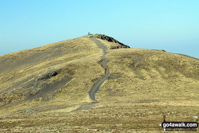
Kevin Foster hiked Sand Hill on May 20th, 2020 [from/via/route] Hopegill Head. [with] By myself. [weather] Very sunny & very hot. - After returning to Hopegill Head from Ladyside Pike it is then an easy stroll to the grassy mound of Sand Hill. A good spot to survey the Coledale Horseshoe (done previously). On the steep descent from Sand Hill to Coledale Hause (over loose scree) I realised that I have never climbed Sand Hill from the Hause...and looking back up the slope I'm glad!
Stephen Reader summited Sand Hill on July 7th, 2019 [from/via/route] Unlisted peak on Coledale 10 peak challenge. [with] Mountain Walks [weather] Mixture of cloud & sunshine
Simon Myerscough conquered Sand Hill on September 21st, 2008 [from/via/route] C408 [weather] Cloudy but warm at times
Mark Davidson scaled Sand Hill on March 11th, 2014 [with] Alone [weather] Gloriously sunny
Stephen Eddy walked up Sand Hill on June 13th, 2015 [from/via/route] Braithwaite via Grasmoor [with] Mike Woodhouse, Tony Harris [weather] Warm
Joanne Mcgawley climbed Sand Hill on August 23rd, 2013 [with] Rich [weather] Muggy then windy & cold, then muggy again! - 11.58 miles. 8 Wainwrights.
Iain Taylor bagged Sand Hill on April 11th, 2010 [from/via/route] Lanthwaite Green Farm (NY 15906 20780)
To add (or remove) your name and experiences on this page - Log On and edit your Personal Mountain Bagging Record
. . . [see more walk reports]
More Photographs & Pictures of views from, on or of Sand Hill
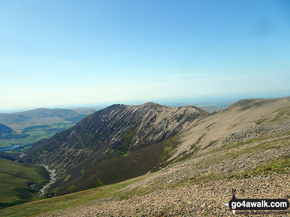
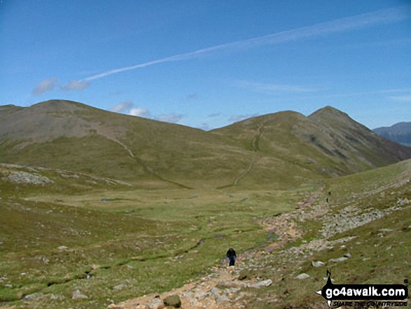
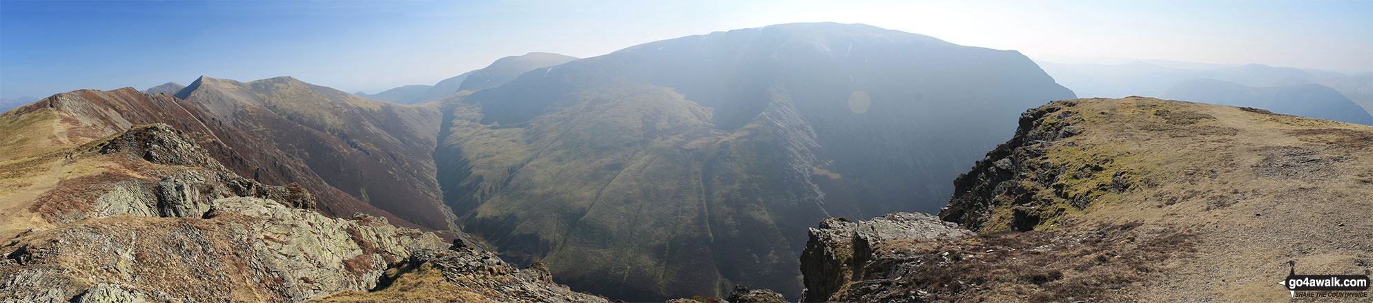
Gasgale Gill (bottom left), Whin Ben, Whiteside (Crummock) (West Top) and Whiteside (Crummock) from Sand Hill
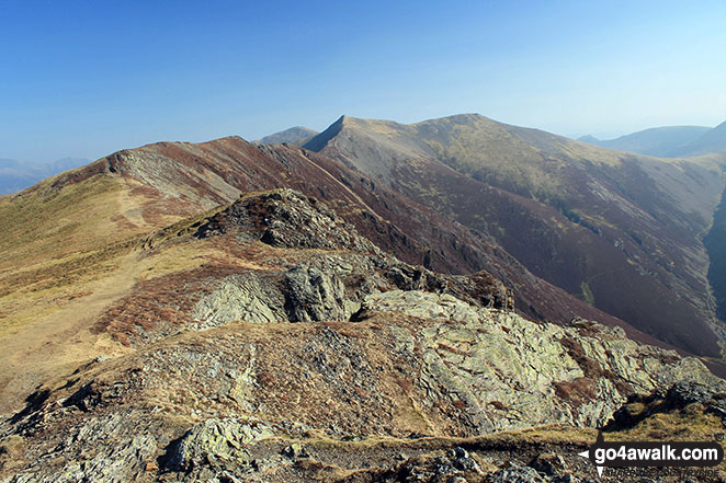
Whiteless Edge, Hopegill Head and Sand Hill from The Whiteside (Crummock)
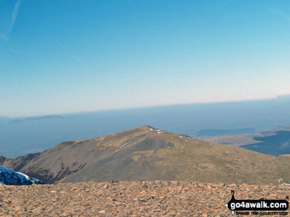

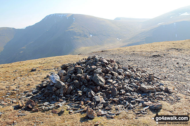
The Coledale Horseshoe from Crag Hill (Eel Crag) trig point featuring: Grasmoor, Grasmoor, Whiteside (Crummock) (West Top), Whiteside (Crummock), Gasgale Crags, Hopegill Head, Sand Hill, The top of Hobcarton Crag, Grisdale Pike, The Skiddaw massif, Blencathra (or Saddleback), Keswick, Sleet How, Outerside, Stile End, Sail, Causey Pike, Bleaberry Fell, High Seat, High Tove, The Southern Fells and The Western Fells
Whiteside (Crummock), Hopegill Head, Sand Hill, Crag Hill (Eel Crag), Grasmoor and Whiteside (Crummock) (West Top) from Whiteside (Crummock)
Send us your photographs and pictures on, of, or from Sand Hill
If you would like to add your walk photographs and pictures featuring views from, on or of Sand Hill to this page, please send them as email attachments (configured for any computer) along with your name to:
and we shall do our best to publish them.
(Guide Resolution = 300dpi. At least = 660pixels (wide) x 440 pixels (high).)

You can also submit photos via our Facebook Page.
NB. Please indicate where each photo was taken and whether you wish us to credit your photos with a Username or your First Name/Last Name.
Not familiar with this top?


