A Google Peak Bagging Map of Scottish Region 16: Assynt and The Far North in Reverse Alphabetical Order
Scottish Region 16: Assynt and The Far North is the area enclosed by an imaginary line connecting:
- Cape Wrath to John o' Groats via Durness, Loch Eriboll, Kyle of Tongue, Portskerra, Thurso and Dunnet to the North
- John o' Groats to Dornoch via Wick, Dunbeath and Helmsdale to the South East
- Dornoch to Rhue Lighthouse via Dornich Firth, the A949, Inveran, the A837, Linsidemore, Doune, Langwell, Oykel Bridge, Loubcroy, Ledmore, the A835, Elphin and Strathcanaird to the South
- Rhue Lighthouse to Cape Wrath to the North West
If you count only the Marilyns there are 84 tops to climb, bag & conquer and the highest point is Ben More Assynt at 998m (3,275ft).
To see these Mountains, Peaks, Tops and Hills displayed in different ways - see the options in the left-hand column and towards the bottom of this page.
![]() Your Personal Bagging Record for Scottish Region 16: Assynt and The Far North
Your Personal Bagging Record for Scottish Region 16: Assynt and The Far North
LOG ON and RELOAD this page to show which Mountains, Peaks, Tops and Hills you have already climbed, bagged & conquered [. . . more details]
NB. If a Google Map does not appear below, or the icons do not respond, click here to refresh the page. If that doesn't work, try deleting your browser's cache.
Scroll down this list of mountains, peaks, tops & hills below and tap/click on each name (in blue) to locate it's position on the map above.
See this list in: Alphabetical Order‡ | Height Order
To reverse the order select the link again.
Mountain, Peak, Top or Hill:
Bagged

![]()
1. Suilven (Caisteal Liath)
731m (2,399ft)
Marilyn
See more details, photos, trip reports and easy-to-follow walks up Suilven (Caisteal Liath)
![]()
2. Stac Pollaidh
612m (2,009ft)
Marilyn
See more details, photos, trip reports and easy-to-follow walks up Stac Pollaidh
![]()
3. Spidean Coinich (Quinag)
764m (2,507ft)
Marilyn
See more details, photos, trip reports and easy-to-follow walks up Spidean Coinich (Quinag)
![]()
4. Smean
511m (1,677ft)
Marilyn
See more details, photos, trip reports and easy-to-follow walks up Smean
![]()
5. Sgurr an Fhidhleir
705m (2,314ft)
Marilyn
See more details, photos, trip reports and easy-to-follow walks up Sgurr an Fhidhleir
![]()
6. Sgribhis-bheinn
371m (1,218ft)
Marilyn
See more details, photos, trip reports and easy-to-follow walks up Sgribhis-bheinn
![]()
7. Scaraben
626m (2,055ft)
Marilyn
See more details, photos, trip reports and easy-to-follow walks up Scaraben
![]()
8. Sail Ghorm (Quinag)
776m (2,547ft)
Marilyn
See more details, photos, trip reports and easy-to-follow walks up Sail Ghorm (Quinag)
![]()
9. Sail Gharbh (Quinag)
809m (2,654ft)
Marilyn
See more details, photos, trip reports and easy-to-follow walks up Sail Gharbh (Quinag)
![]()
10. Sabhal Beag
732m (2,402ft)
Marilyn
See more details, photos, trip reports and easy-to-follow walks up Sabhal Beag
![]()
11. Morven (Langwell Forest)
706m (2,317ft)
Marilyn
See more details, photos, trip reports and easy-to-follow walks up Morven (Langwell Forest)
![]()
12. Meallan Liath Coire Mhic Dhughaill
801m (2,629ft)
Marilyn
![]()
13. Meallan a' Chuail
750m (2,462ft)
Marilyn
See more details, photos, trip reports and easy-to-follow walks up Meallan a' Chuail
![]()
14. Meall nan Clach Ruadha
335m (1,099ft)
Marilyn
See more details, photos, trip reports and easy-to-follow walks up Meall nan Clach Ruadha
![]()
15. Meall Meadhonach (Loch Eriboll)
423m (1,388ft)
Marilyn
See more details, photos, trip reports and easy-to-follow walks up Meall Meadhonach (Loch Eriboll)
![]()
16. Meall Horn
777m (2,550ft)
Marilyn
See more details, photos, trip reports and easy-to-follow walks up Meall Horn
![]()
17. Meall Dola
323m (1,060ft)
Marilyn
See more details, photos, trip reports and easy-to-follow walks up Meall Dola
![]()
18. Meall an Fhuarain (Strath Vagastie)
472m (1,549ft)
Marilyn
![]()
19. Meall an Fheur Loch
613m (2,012ft)
Marilyn
See more details, photos, trip reports and easy-to-follow walks up Meall an Fheur Loch
![]()
20. Meall an Fheadain
203m (666ft)
Marilyn
See more details, photos, trip reports and easy-to-follow walks up Meall an Fheadain
![]()
21. Meall a' Chaise (Strath Brora)
372m (1,220ft)
Marilyn
See more details, photos, trip reports and easy-to-follow walks up Meall a' Chaise (Strath Brora)
![]()
22. Meadie Ridge
414m (1,358ft)
Marilyn
See more details, photos, trip reports and easy-to-follow walks up Meadie Ridge
![]()
23. Maovally (Loch Shin)
511m (1,677ft)
Marilyn
See more details, photos, trip reports and easy-to-follow walks up Maovally (Loch Shin)
![]()
24. Maiden Pap
484m (1,588ft)
Marilyn
See more details, photos, trip reports and easy-to-follow walks up Maiden Pap
![]()
25. Glas Bheinn (Ben More Assynt)
776m (2,547ft)
Marilyn
See more details, photos, trip reports and easy-to-follow walks up Glas Bheinn (Ben More Assynt)
![]()
26. Ghlas-bheinn
332m (1,090ft)
Marilyn
See more details, photos, trip reports and easy-to-follow walks up Ghlas-bheinn
![]()
27. Foinaven (Ganu Mor)
911m (2,989ft)
Marilyn
See more details, photos, trip reports and easy-to-follow walks up Foinaven (Ganu Mor)
![]()
28. Feinne-bheinn Mhor
465m (1,526ft)
Marilyn
See more details, photos, trip reports and easy-to-follow walks up Feinne-bheinn Mhor
![]()
29. Fashven
460m (1,510ft)
Marilyn
See more details, photos, trip reports and easy-to-follow walks up Fashven
![]()
30. Farrmheall
521m (1,710ft)
Marilyn
See more details, photos, trip reports and easy-to-follow walks up Farrmheall
![]()
31. Cul Mor
849m (2,786ft)
Marilyn
See more details, photos, trip reports and easy-to-follow walks up Cul Mor
![]()
32. Cul Beag
769m (2,524ft)
Marilyn
See more details, photos, trip reports and easy-to-follow walks up Cul Beag
![]()
33. Creag Thoraraidh
405m (1,329ft)
Marilyn
See more details, photos, trip reports and easy-to-follow walks up Creag Thoraraidh
![]()
34. Creag Scalabsdale
555m (1,822ft)
Marilyn
See more details, photos, trip reports and easy-to-follow walks up Creag Scalabsdale
![]()
35. Creag Riabhach
485m (1,592ft)
Marilyn
See more details, photos, trip reports and easy-to-follow walks up Creag Riabhach
![]()
36. Creag nam Fiadh
387m (1,270ft)
Marilyn
See more details, photos, trip reports and easy-to-follow walks up Creag nam Fiadh
![]()
37. Creag Mhor (Ben Armine Forest)
713m (2,340ft)
Marilyn
See more details, photos, trip reports and easy-to-follow walks up Creag Mhor (Ben Armine Forest)
![]()
38. Creag Dhubh Mhor (Loch Flag)
553m (1,815ft)
Marilyn
See more details, photos, trip reports and easy-to-follow walks up Creag Dhubh Mhor (Loch Flag)
![]()
39. Creag Dhubh Bheag
472m (1,549ft)
Marilyn
See more details, photos, trip reports and easy-to-follow walks up Creag Dhubh Bheag
![]()
40. Creag an Amalaidh
261m (856ft)
Marilyn
See more details, photos, trip reports and easy-to-follow walks up Creag an Amalaidh
![]()
41. Creag a' Ghobhair
346m (1,136ft)
Marilyn
See more details, photos, trip reports and easy-to-follow walks up Creag a' Ghobhair
![]()
42. Creag a' Choire Ghlais (Ben Armine)
705m (2,314ft)
Marilyn
![]()
43. Cranstackie
801m (2,628ft)
Marilyn
See more details, photos, trip reports and easy-to-follow walks up Cranstackie
![]()
44. Cnoc nan Cuilean
557m (1,828ft)
Marilyn
See more details, photos, trip reports and easy-to-follow walks up Cnoc nan Cuilean
![]()
45. Cnoc na Maoile
402m (1,319ft)
Marilyn
See more details, photos, trip reports and easy-to-follow walks up Cnoc na Maoile
![]()
46. Cnoc an Liath-bhaid Mhoir
434m (1,424ft)
Marilyn
See more details, photos, trip reports and easy-to-follow walks up Cnoc an Liath-bhaid Mhoir
![]()
47. Cnoc an Daimh Mor
357m (1,171ft)
Marilyn
See more details, photos, trip reports and easy-to-follow walks up Cnoc an Daimh Mor
![]()
48. Carn Garbh
545m (1,789ft)
Marilyn
See more details, photos, trip reports and easy-to-follow walks up Carn Garbh
![]()
49. Carn an Tionail
759m (2,489ft)
Marilyn
See more details, photos, trip reports and easy-to-follow walks up Carn an Tionail
![]()
50. Canisp
847m (2,780ft)
Marilyn
See more details, photos, trip reports and easy-to-follow walks up Canisp
![]()
51. Breabag
815m (2,675ft)
Marilyn
See more details, photos, trip reports and easy-to-follow walks up Breabag
![]()
52. Braigh na h-Eaglaise
424m (1,390ft)
Marilyn
See more details, photos, trip reports and easy-to-follow walks up Braigh na h-Eaglaise
![]()
53. Ben Stack
721m (2,366ft)
Marilyn
See more details, photos, trip reports and easy-to-follow walks up Ben Stack
![]()
54. Ben More Assynt
998m (3,275ft)
Marilyn
See more details, photos, trip reports and easy-to-follow walks up Ben More Assynt
![]()
55. Ben Mor Coigach
743m (2,439ft)
Marilyn
See more details, photos, trip reports and easy-to-follow walks up Ben Mor Coigach
![]()
56. Ben Klibreck (Meall nan Con)
962m (3,157ft)
Marilyn
See more details, photos, trip reports and easy-to-follow walks up Ben Klibreck (Meall nan Con)
![]()
57. Ben Hutig
408m (1,339ft)
Marilyn
See more details, photos, trip reports and easy-to-follow walks up Ben Hutig
![]()
58. Ben Horn
520m (1,706ft)
Marilyn
See more details, photos, trip reports and easy-to-follow walks up Ben Horn
![]()
59. Ben Hope
927m (3,042ft)
Marilyn
See more details, photos, trip reports and easy-to-follow walks up Ben Hope
![]()
60. Ben Hiel
535m (1,755ft)
Marilyn
See more details, photos, trip reports and easy-to-follow walks up Ben Hiel
![]()
61. Ben Hee (Sutherland)
873m (2,865ft)
Marilyn
See more details, photos, trip reports and easy-to-follow walks up Ben Hee (Sutherland)
![]()
62. Ben Griam Mor
590m (1,936ft)
Marilyn
See more details, photos, trip reports and easy-to-follow walks up Ben Griam Mor
![]()
63. Ben Griam Beg
580m (1,904ft)
Marilyn
See more details, photos, trip reports and easy-to-follow walks up Ben Griam Beg
![]()
64. Ben Dreavie
510m (1,674ft)
Marilyn
See more details, photos, trip reports and easy-to-follow walks up Ben Dreavie
![]()
65. Beinn Stumanadh
527m (1,730ft)
Marilyn
See more details, photos, trip reports and easy-to-follow walks up Beinn Stumanadh
![]()
66. Beinn Spionnaidh
773m (2,537ft)
Marilyn
See more details, photos, trip reports and easy-to-follow walks up Beinn Spionnaidh
![]()
67. Beinn Sgeireach
476m (1,562ft)
Marilyn
See more details, photos, trip reports and easy-to-follow walks up Beinn Sgeireach
![]()
68. Beinn Reidh
567m (1,861ft)
Marilyn
See more details, photos, trip reports and easy-to-follow walks up Beinn Reidh
![]()
69. Beinn Mhealaich
592m (1,943ft)
Marilyn
See more details, photos, trip reports and easy-to-follow walks up Beinn Mhealaich
![]()
70. Beinn Lunndaidh
447m (1,467ft)
Marilyn
See more details, photos, trip reports and easy-to-follow walks up Beinn Lunndaidh
![]()
71. Beinn Leoid
792m (2,599ft)
Marilyn
See more details, photos, trip reports and easy-to-follow walks up Beinn Leoid
![]()
72. Beinn Dubhain
417m (1,369ft)
Marilyn
See more details, photos, trip reports and easy-to-follow walks up Beinn Dubhain
![]()
73. Beinn Domhnaill
349m (1,145ft)
Marilyn
See more details, photos, trip reports and easy-to-follow walks up Beinn Domhnaill
![]()
74. Beinn Direach
689m (2,260ft)
Marilyn
See more details, photos, trip reports and easy-to-follow walks up Beinn Direach
![]()
75. Beinn Dhorain
628m (2,061ft)
Marilyn
See more details, photos, trip reports and easy-to-follow walks up Beinn Dhorain
![]()
76. Beinn Dearg (Cape Wrath)
424m (1,390ft)
Marilyn
See more details, photos, trip reports and easy-to-follow walks up Beinn Dearg (Cape Wrath)
![]()
77. Beinn an Eoin (Glen Cassley)
544m (1,785ft)
Marilyn
See more details, photos, trip reports and easy-to-follow walks up Beinn an Eoin (Glen Cassley)
![]()
78. Beinn an Eoin (Coigach)
619m (2,032ft)
Marilyn
See more details, photos, trip reports and easy-to-follow walks up Beinn an Eoin (Coigach)
![]()
79. Beinn Akie
288m (945ft)
Marilyn
See more details, photos, trip reports and easy-to-follow walks up Beinn Akie
![]()
80. Arkle (Sutherland)
787m (2,583ft)
Marilyn
See more details, photos, trip reports and easy-to-follow walks up Arkle (Sutherland)
![]()
81. An Socach (Strath Shinary)
362m (1,188ft)
Marilyn
See more details, photos, trip reports and easy-to-follow walks up An Socach (Strath Shinary)
![]()
82. An Lean-charn
521m (1,710ft)
Marilyn
See more details, photos, trip reports and easy-to-follow walks up An Lean-charn
![]()
83. An Grianan (Strath Shinary)
467m (1,533ft)
Marilyn
See more details, photos, trip reports and easy-to-follow walks up An Grianan (Strath Shinary)
![]()
84. An Caisteal (Ben Loyal)
764m (2,507ft)
Marilyn
See more details, photos, trip reports and easy-to-follow walks up An Caisteal (Ben Loyal)
See this list in: Alphabetical Order‡ | Height Order
To reverse the order select the link again.
View these 84 Mountains, Peaks, Tops and Hills:
- On an Interactive Google Map (loads faster)
- On an Interactive Google Map with a list of tops below it.
(makes it easier to locate a particular top) - On a Detailed List in:
Alphabetical Order | Height Order - On one page with 'yet-to-be-bagged' listed 1st & then 'already-bagged' tops listed 2nd in:
Alphabetical Order | Height Order - On one page with 'already-bagged' tops listed 1st & then 'yet-to-be-bagged' tops listed 2nd in:
Alphabetical Order | Height Order
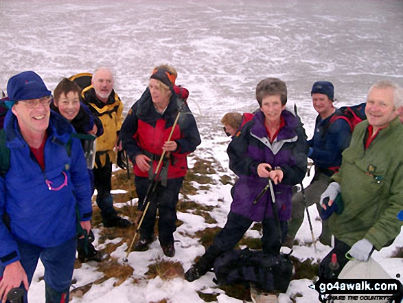 Ben More Assynt in Assynt and The Far North
Photo: Elizabeth Maitland
Is there a Mountain, Peak, Top or Hill missing from the above google map or list?
Let us know an we will add it to our database.

To contribute to go4awalk.com or to contact us about anything at all - see Talk To Us.
For help see Help.
go4awalk.com and go4awalk.co.uk are registered trademarks of TMDH Limited.
Copyright © 2000-2025 TMDH Limited. All rights reserved.
Copyright Terms & Conditions Privacy Statement
A - Z Walks Home Log On/Accounts Photo Gallery Walk Ideas and Collections Fell Facts Hill Skills Walking Questions and Answers Your Stories News Competitions Product Reviews/Gear Tests Walking Gear Guides Peaks and Mountains Peak Bagging Find New Walking Friends Camping GPS Waypoints for Walking Contents Walk Search Talk To Us go4awalk.com Help Free Example Walks Newsletter


