
![]()
Spidean Coinich (Quinag)
764m (2507ft)
Assynt and The Far North, Highland, Scotland
Not familiar with this top?
You can walk/hike to the top of Spidean Coinich (Quinag) by using this easy‑to‑follow route map:
Walk h197 Spidean Coinich (Quinag), Sail Ghorm (Quinag) and Sail Gharbh (Quinag) from Lairig Unapool
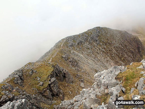
Fantastic panoramic views
   |
|---|
Vital Statistics:
| Length: | 8.75mls (14km) |
|---|---|
| Ascent: | 4,050ft (1,234m) |
| Time: | 7½ hrs |
| Grade: |  (Hard) (Hard) |

Route Summary:
Lairig Unapool - Allt Sgiathaig - Spidean Coinich (Quinag) - Lochan Ruadh - Bealach A Connaich - Sail Ghorm (Quinag) - Bealach A Connaich - Sail Gharbh (Quinag) - Lochan Bealach Connaich - Allt Sgiathaig - Lairig Unapool
See Spidean Coinich (Quinag) and the surrounding tops on our free-to-access 'Google Style' Peak Bagging Maps:
The Assynt-Coigach Mountains area of Scottish Region 16: Assynt and The Far North
Less data - quicker to download
Scottish Region 16: Assynt and The Far North
Less data - quicker to download
A go4awalk.com downloadable Peak Bagging Map in PDF format featuring Spidean Coinich (Quinag) should be available soon.
Free-to-access Interactive Walk Planning Maps:
1:25,000 scale OS Explorer Map (orange/yellow covers):
An Interactive Walk Planning Map for OS Explorer 442 Assynt & Lochinver is not currently available
1:50,000 scale OS Landranger Map (pink/magenta covers):
An Interactive Walk Planning Map for OS Landranger 15 Loch Assynt, Lochinver & Kylesku is not currently available
 Fellow go4awalkers who have already walked, climbed, scaled, summited, hiked & bagged Spidean Coinich (Quinag)
Trevor Williams walked up Spidean Coinich (Quinag) on May 25th, 2018 [with] alone [weather] Great sunshine
Mark Davidson climbed it on May 29th, 2016 [with] Alone [weather] Cloudy at first but brightened up later into a lovely day - This is a fantastic walk!
To add (or remove) your name and experiences on this page - Log On and edit your Personal Mountain Bagging Record
More Photographs & Pictures of views from, on, or of, Spidean Coinich (Quinag)


Spidean Coinich (Quinag), Sail Gharbh (Quinag) and Sail Ghorm (Quinag) from the Assynt viewpoint on the A838 (North Coast NC500 route) at Bealach Strome

Panoroama featuring Glas Bheinn (Ben More Assynt) and the shoulder of Spidean Coinich (Quinag) from the Assynt viewpoint on the A838 (North Coast NC500 route) at Bealach Strome

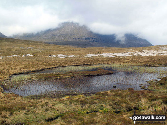
Footbridge at Lairig Unapool with Spidean Coinich (Quinag) shrouded in mist on the horizon
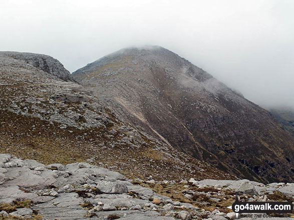
Sail Gharbh (Quinag) reflected in a pool from the lower slopes of Spidean Coinich (Quinag)

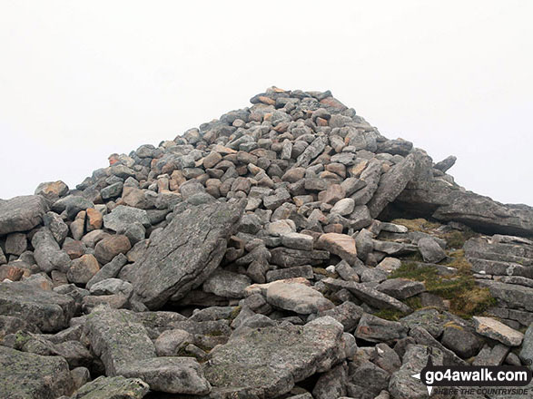
Cairn beside the path in Lairig Unapool with a mist topped Spidean Coinich (Quinag) centre left
Send us your photographs and pictures on, of, or from Spidean Coinich (Quinag)
If you would like to add your walk photographs and pictures to this page, please send them as email attachments (configured for any computer) along with your name to:
and we shall do our best to publish them.
(Guide Resolution = 300dpi. At least = 660pixels (wide) x 440 pixels (high).)

You can also submit photos via our Facebook Page.
NB. Please indicate where each photo was taken and whether you wish us to credit your photos with a Username or your First Name/Last Name.


