Scottish Region 16: Assynt and The Far North - a fully detailed list of all the Mountains, Peaks, Tops and Hills (Page 1 of 4)
Scottish Region 16: Assynt and The Far North region is the area enclosed by an imaginary line connecting:
- Cape Wrath to John o' Groats via Durness, Loch Eriboll, Kyle of Tongue, Portskerra, Thurso and Dunnet to the North
- John o' Groats to Dornoch via Wick, Dunbeath and Helmsdale to the South East
- Dornoch to Rhue Lighthouse via Dornich Firth, the A949, Inveran, the A837, Linsidemore, Doune, Langwell, Oykel Bridge, Loubcroy, Ledmore, the A835, Elphin and Strathcanaird to the South
- Rhue Lighthouse to Cape Wrath to the North West
If you include the Marilyns, the Bridgets (Hills), and all the Mountains, Tops, Peaks and Hills with a Trig Point on them there are 91 tops to climb, bag & conquer and the highest point is Ben More Assynt at 998m (3,275ft).
To see these Mountains, Peaks, Tops and Hills displayed in different ways - see the options in the left-hand column and towards the bottom of this page.
![]() Your Personal Bagging Record for Scottish Region 16: Assynt and The Far North
Your Personal Bagging Record for Scottish Region 16: Assynt and The Far North
LOG ON and RELOAD this page to show which Mountains, Peaks, Tops and Hills you have already climbed, bagged & conquered [. . . more details]
See this list in: Alphabetical Order
| Height Order‡
To reverse the order select the link again.
Mountain, Peak, Top or Hill:
Bagged

![]()
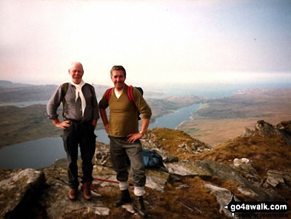
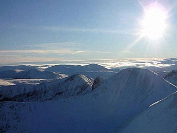
1. Ben More Assynt
998m (3,275ft)
Ben More Assynt is on interactive maps:
A downloadable go4awalk.com PDF Peak Bagging Map featuring Ben More Assynt will be available soon. |

![]()
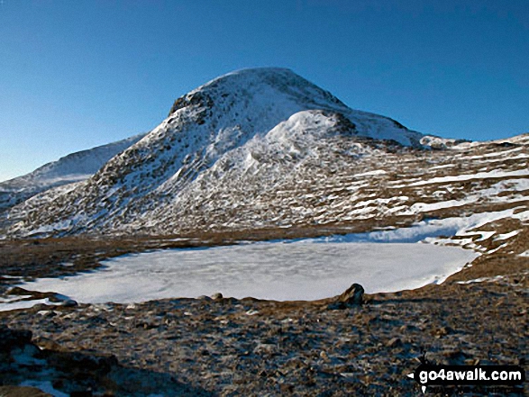
2. Conival
987m (3,239ft)
Conival is on interactive maps:
A downloadable go4awalk.com PDF Peak Bagging Map featuring Conival will be available soon. |

![]()
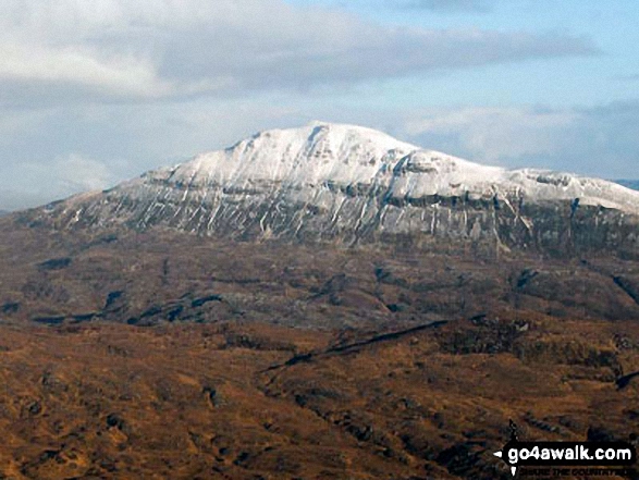
3. Ben Klibreck (Meall nan Con)
962m (3,157ft)
Send it in and we'll publish it here.
Ben Klibreck (Meall nan Con) is on interactive maps:
A downloadable go4awalk.com PDF Peak Bagging Map featuring Ben Klibreck (Meall nan Con) will be available soon. |
![]()
4. Ben Hope
927m (3,042ft)
Ben Hope is on interactive maps:
A downloadable go4awalk.com PDF Peak Bagging Map featuring Ben Hope will be available soon. |
![]()
5. Foinaven (Ganu Mor)
911m (2,989ft)
Foinaven (Ganu Mor) is on interactive maps:
A downloadable go4awalk.com PDF Peak Bagging Map featuring Foinaven (Ganu Mor) will be available soon. |
![]()
6. Ben Hee (Sutherland)
873m (2,865ft)
Send it in and we'll publish it here.
Ben Hee (Sutherland) is on interactive maps:
A downloadable go4awalk.com PDF Peak Bagging Map featuring Ben Hee (Sutherland) will be available soon. |
![]()
7. Cul Mor
849m (2,786ft)
Cul Mor is on interactive maps:
A downloadable go4awalk.com PDF Peak Bagging Map featuring Cul Mor will be available soon. |
![]()
8. Canisp
847m (2,780ft)
Canisp is on interactive maps:
A downloadable go4awalk.com PDF Peak Bagging Map featuring Canisp will be available soon. |
![]()
9. Breabag
815m (2,675ft)
Breabag is on interactive maps:
A downloadable go4awalk.com PDF Peak Bagging Map featuring Breabag will be available soon. |
![]()
10. Sail Gharbh (Quinag)
809m (2,654ft)
Send it in and we'll publish it here.
Sail Gharbh (Quinag) is on interactive maps:
A downloadable go4awalk.com PDF Peak Bagging Map featuring Sail Gharbh (Quinag) will be available soon. |
![]()
11. Meallan Liath Coire Mhic Dhughaill
801m (2,629ft)
Send it in and we'll publish it here.
Meallan Liath Coire Mhic Dhughaill is on interactive maps:
A downloadable go4awalk.com PDF Peak Bagging Map featuring Meallan Liath Coire Mhic Dhughaill will be available soon. |
![]()
12. Cranstackie
801m (2,628ft)
Cranstackie is on interactive maps:
A downloadable go4awalk.com PDF Peak Bagging Map featuring Cranstackie will be available soon. |
![]()
13. Beinn Leoid
792m (2,599ft)
Beinn Leoid is on interactive maps:
A downloadable go4awalk.com PDF Peak Bagging Map featuring Beinn Leoid will be available soon. |
![]()
14. Arkle (Sutherland)
787m (2,583ft)
Arkle (Sutherland) is on interactive maps:
A downloadable go4awalk.com PDF Peak Bagging Map featuring Arkle (Sutherland) will be available soon. |

![]()
15. An T-Sail Mhor (Plat Reidh)
779m (2,556ft)
Send it in and we'll publish it here.
An T-Sail Mhor (Plat Reidh) is on interactive maps:
|
![]()
16. Meall Horn
777m (2,550ft)
Meall Horn is on interactive maps:
A downloadable go4awalk.com PDF Peak Bagging Map featuring Meall Horn will be available soon. |
![]()
17. Glas Bheinn (Ben More Assynt)
776m (2,547ft)
Glas Bheinn (Ben More Assynt) is on interactive maps:
A downloadable go4awalk.com PDF Peak Bagging Map featuring Glas Bheinn (Ben More Assynt) will be available soon. |
![]()
18. Sail Ghorm (Quinag)
776m (2,547ft)
Send it in and we'll publish it here.
Sail Ghorm (Quinag) is on interactive maps:
A downloadable go4awalk.com PDF Peak Bagging Map featuring Sail Ghorm (Quinag) will be available soon. |
![]()
19. Beinn Spionnaidh
773m (2,537ft)
Beinn Spionnaidh is on interactive maps:
A downloadable go4awalk.com PDF Peak Bagging Map featuring Beinn Spionnaidh will be available soon. |
![]()
20. Cul Beag
769m (2,524ft)
Cul Beag is on interactive maps:
A downloadable go4awalk.com PDF Peak Bagging Map featuring Cul Beag will be available soon. |
![]()
21. An Caisteal (Ben Loyal)
764m (2,507ft)
An Caisteal (Ben Loyal) is on interactive maps:
A downloadable go4awalk.com PDF Peak Bagging Map featuring An Caisteal (Ben Loyal) will be available soon. |
![]()
22. Spidean Coinich (Quinag)
764m (2,507ft)
Spidean Coinich (Quinag) is on interactive maps:
A downloadable go4awalk.com PDF Peak Bagging Map featuring Spidean Coinich (Quinag) will be available soon. |
![]()
23. Carn an Tionail
759m (2,489ft)
Carn an Tionail is on interactive maps:
A downloadable go4awalk.com PDF Peak Bagging Map featuring Carn an Tionail will be available soon. |
![]()
24. Meallan a' Chuail
750m (2,462ft)
Meallan a' Chuail is on interactive maps:
A downloadable go4awalk.com PDF Peak Bagging Map featuring Meallan a' Chuail will be available soon. |
![]()
25. Ben Mor Coigach
743m (2,439ft)
Ben Mor Coigach is on interactive maps:
A downloadable go4awalk.com PDF Peak Bagging Map featuring Ben Mor Coigach will be available soon. |
![]()
26. Sabhal Beag
732m (2,402ft)
Sabhal Beag is on interactive maps:
A downloadable go4awalk.com PDF Peak Bagging Map featuring Sabhal Beag will be available soon. |
![]()
27. Suilven (Caisteal Liath)
731m (2,399ft)
Suilven (Caisteal Liath) is on interactive maps:
A downloadable go4awalk.com PDF Peak Bagging Map featuring Suilven (Caisteal Liath) will be available soon. |
![]()
28. Ben Stack
721m (2,366ft)
Ben Stack is on interactive maps:
A downloadable go4awalk.com PDF Peak Bagging Map featuring Ben Stack will be available soon. |
![]()
29. Meall an Aonaich [Eagle Rock]
715m (2,346ft)
Send it in and we'll publish it here.
Meall an Aonaich [Eagle Rock] is on interactive maps:
|
![]()
30. Creag Mhor (Ben Armine Forest)
713m (2,340ft)
Send it in and we'll publish it here.
Creag Mhor (Ben Armine Forest) is on interactive maps:
A downloadable go4awalk.com PDF Peak Bagging Map featuring Creag Mhor (Ben Armine Forest) will be available soon. |
View these 91 Mountains, Peaks, Tops and Hills:
- On an Interactive Google Map (loads faster)
- On an Interactive Google Map with a list of tops below it.
(makes it easier to locate a particular top) - On a Detailed List in:
Alphabetical Order | Height Order - On one page with 'yet-to-be-bagged' listed 1st & then 'already-bagged' tops listed 2nd in:
Alphabetical Order | Height Order - On one page with 'already-bagged' tops listed 1st & then 'yet-to-be-bagged' tops listed 2nd in:
Alphabetical Order | Height Order
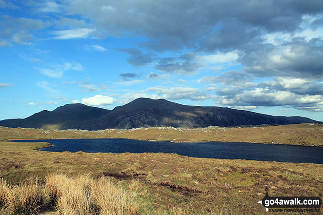
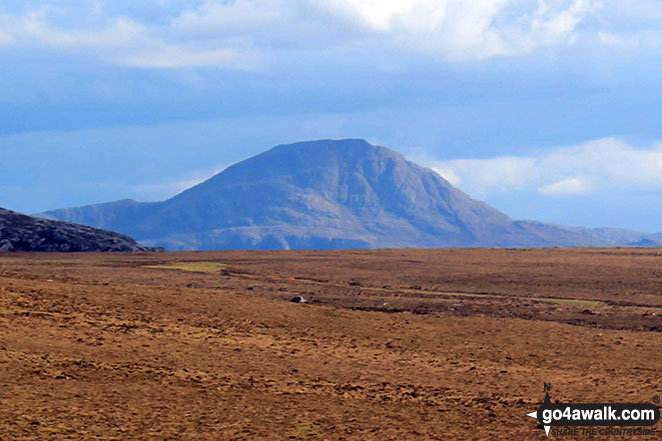
 Ben More Assynt in Assynt and The Far North
Photo: Elizabeth Maitland
Is there a Mountain, Peak, Top or Hill missing from the above google map or list?
Let us know an we will add it to our database.
To contribute to go4awalk.com or to contact us about anything at all - see Talk To Us.
For help see Help.
go4awalk.com and go4awalk.co.uk are registered trademarks of TMDH Limited.
Copyright © 2000-2025 TMDH Limited. All rights reserved.
Copyright Terms & Conditions Privacy Statement
A - Z Walks Home Log On/Accounts Photo Gallery Walk Ideas and Collections Fell Facts Hill Skills Walking Questions and Answers Your Stories News Competitions Product Reviews/Gear Tests Walking Gear Guides Peaks and Mountains Peak Bagging Find New Walking Friends Camping GPS Waypoints for Walking Contents Walk Search Talk To Us go4awalk.com Help Free Example Walks Newsletter


