England - a fully detailed list of all the Mountains, Peaks, Tops and Hills (Page 5 of 6)
England is defined as the whole of the country of England which includes the National Parks of Dartmoor, Exmoor, The Lake District, The Peak District, The North York Moors, Northumberland, The South Downs and The Yorkshire Dales, as well as The Chilterns, The Cotswolds, The Forest of Bowland, The North Peninnes, The Shropshire Hills and The South Peninnes.
If you count only the Marilyns there are 173 tops to climb, bag & conquer and the highest point is Scafell Pike at 978m (3,210ft).
To see these Mountains, Peaks, Tops and Hills displayed in different ways - see the options in the left-hand column and towards the bottom of this page.
LOG ON and RELOAD this page to show which Mountains, Peaks, Tops and Hills you have already climbed, bagged & conquered [. . . more details]
Page 5 of 6 Go to page:
1 2 3 4 5 6 |
See this list in: Alphabetical Order
| Height Order‡
To reverse the order select the link again.
Mountain, Peak, Top or Hill:
Bagged
121. Beacon Batch (Mendip Hills)
325m (1,066ft)
Marilyn (121st in England, 1340th in GB)
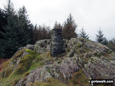
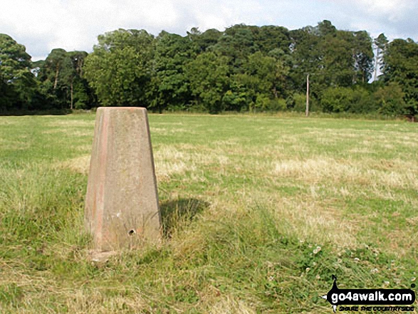
OS Trig Point
To walk, climb & bag Beacon Batch (Mendip Hills) use this easy-to-follow walk:
See the location of Beacon Batch (Mendip Hills) and walks up it on a google MapBeacon Batch (Mendip Hills) is on interactive maps:
OS Explorer (Orange Covers): 141
OS Landranger (Pink Covers): 172 and
182
A downloadable go4awalk.com PDF Peak Bagging Map featuring Beacon Batch (Mendip Hills) will be available soon. |
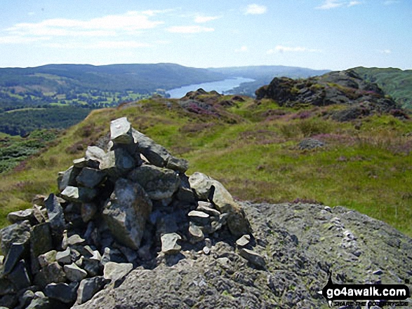
122. Gummer's How
321m (1,054ft)
Wainwright Outlying Fell (No. 67)
Marilyn (122nd in England, 1344th in GB)
OS Trig Point
We hope to have walks that climb & bag Gummer's How very soon
See the location of Gummer's How and walks up it on a google MapGummer's How is on interactive maps:
OS Explorer (Orange Covers): OL7
OS Landranger (Pink Covers): 96 and
97
A downloadable go4awalk.com PDF Peak Bagging Map featuring Gummer's How will be available soon. |
123. View Edge (Weo Edge)
321m (1,054ft)
Marilyn (123rd in England, 1345th in GB)
To walk, climb & bag View Edge (Weo Edge) use either of these easy-to-follow walks:
See the location of View Edge (Weo Edge) and walks up it on a google MapView Edge (Weo Edge) is on interactive maps:
OS Explorer (Orange Covers): 217
OS Landranger (Pink Covers): 137
View Edge (Weo Edge) is on downloadable PDF you can Print or Save to your Phone:
|
124. Long Crag
319m (1,046ft)
Marilyn (124th in England, 1350th in GB)
OS Trig Point
To walk, climb & bag Long Crag use this easy-to-follow walk:
See the location of Long Crag and walks up it on a google MapLong Crag is on interactive maps:
OS Explorer (Orange Covers): 332
OS Landranger (Pink Covers): 81
|
125. Holme Fell
317m (1,040ft)
Wainwright (No. 213)
Marilyn (125th in England, 1351st in GB)
To walk, climb & bag Holme Fell use this easy-to-follow walk:
See the location of Holme Fell and walks up it on a google MapHolme Fell is on interactive maps:
OS Explorer (Orange Covers): OL7
OS Landranger (Pink Covers): 90
Holme Fell is on downloadable PDF you can Print or Save to your Phone:
*Version including the walk routes marked on it that you need to follow to Walk all 214 Wainwrights in just 59 walks. |
126. Walton Hill
316m (1,037ft)
Marilyn (126th in England, 1354th in GB)
OS Trig Point
We hope to have walks that climb & bag Walton Hill very soon
See the location of Walton Hill and walks up it on a google MapWalton Hill is on interactive maps:
OS Explorer (Orange Covers): 219
OS Landranger (Pink Covers): 139
|
127. Ros Castle (Ross Castle)
315m (1,033ft)
Marilyn (127th in England, 1355th in GB)
OS Trig Point
To walk, climb & bag Ros Castle (Ross Castle) use this easy-to-follow walk:
See the location of Ros Castle (Ross Castle) and walks up it on a google MapRos Castle (Ross Castle) is on interactive maps:
OS Explorer (Orange Covers): 340
OS Landranger (Pink Covers): 75
|
128. Staple Hill
315m (1,033ft)
Marilyn (128th in England, 1356th in GB)
OS Trig Point
We hope to have walks that climb & bag Staple Hill very soon
See the location of Staple Hill and walks up it on a google MapStaple Hill is on interactive maps:
OS Explorer (Orange Covers): 128
OS Landranger (Pink Covers): 193
A downloadable go4awalk.com PDF Peak Bagging Map featuring Staple Hill will be available soon. |
129. Hensbarrow Beacon
312m (1,023ft)
Marilyn (129th in England, 1365th in GB)
OS Trig Point
We hope to have walks that climb & bag Hensbarrow Beacon very soon
See the location of Hensbarrow Beacon and walks up it on a google MapHensbarrow Beacon is on interactive maps:
OS Explorer (Orange Covers): 106
OS Landranger (Pink Covers): 200
|
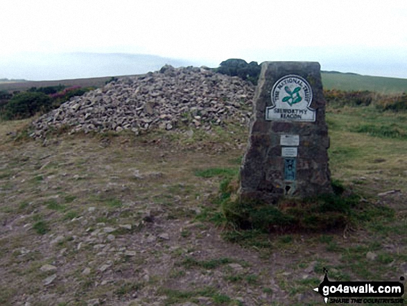
130. Selworthy Beacon
308m (1,010ft)
Marilyn (130th in England, 1369th in GB)
OS Trig Point
To walk, climb & bag Selworthy Beacon use this easy-to-follow walk:
See the location of Selworthy Beacon and walks up it on a google MapSelworthy Beacon is on interactive maps:
OS Explorer (Orange Covers): OL9
OS Landranger (Pink Covers): 181
A downloadable go4awalk.com PDF Peak Bagging Map featuring Selworthy Beacon will be available soon. |
131. Bredon Hill
299m (981ft)
Marilyn (131st in England, 1378th in GB)
We hope to have walks that climb & bag Bredon Hill very soon
See the location of Bredon Hill and walks up it on a google MapBredon Hill is on interactive maps:
OS Explorer (Orange Covers): 190
OS Landranger (Pink Covers): 150
|
132. Periton Hill
297m (974ft)
Marilyn (132nd in England, 1381st in GB)
OS Trig Point
We hope to have walks that climb & bag Periton Hill very soon
See the location of Periton Hill and walks up it on a google MapPeriton Hill is on interactive maps:
OS Explorer (Orange Covers): OL9
OS Landranger (Pink Covers): 181
A downloadable go4awalk.com PDF Peak Bagging Map featuring Periton Hill will be available soon. |
133. Walbury Hill
297m (974ft)
Marilyn (133rd in England, 1382nd in GB)
OS Trig Point
Walbury Hill is the highest point in the county Berkshire.
We hope to have walks that climb & bag Walbury Hill very soon
See the location of Walbury Hill and walks up it on a google MapWalbury Hill is on interactive maps:
OS Explorer (Orange Covers): 158
OS Landranger (Pink Covers): 174
|
134. May Hill
296m (971ft)
Marilyn (134th in England, 1384th in GB)
OS Trig Point
We hope to have walks that climb & bag May Hill very soon
See the location of May Hill and walks up it on a google MapMay Hill is on interactive maps:
OS Explorer (Orange Covers): OL14
OS Landranger (Pink Covers): 162
|
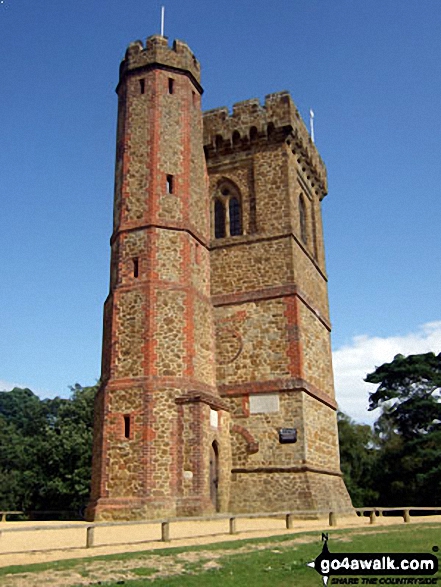
135. Leith Hill
295m (968ft)
Marilyn (135th in England, 1387th in GB)
At 994m (965ft) Leith Hill is not only the highest point in Surrey but the highest point in South East of England. On a clear day you can see 13 counties as well as St Paul's Cathedral and the English Channel from the top of the tower.
To walk, climb & bag Leith Hill use this easy-to-follow walk:
See the location of Leith Hill and walks up it on a google MapLeith Hill is on interactive maps:
OS Explorer (Orange Covers): 146
OS Landranger (Pink Covers): 187
A downloadable go4awalk.com PDF Peak Bagging Map featuring Leith Hill will be available soon. |
136. Burton Hill
294m (964ft)
Marilyn (136th in England, 1389th in GB)
OS Trig Point
We hope to have walks that climb & bag Burton Hill very soon
See the location of Burton Hill and walks up it on a google MapBurton Hill is on interactive maps:
OS Explorer (Orange Covers): 201
OS Landranger (Pink Covers): 148 and
149
|
137. Ruardean Hill
290m (951ft)
Marilyn (137th in England, 1396th in GB)
OS Trig Point
We hope to have walks that climb & bag Ruardean Hill very soon
See the location of Ruardean Hill and walks up it on a google MapRuardean Hill is on interactive maps:
OS Explorer (Orange Covers): OL14
OS Landranger (Pink Covers): 162
A downloadable go4awalk.com PDF Peak Bagging Map featuring Ruardean Hill will be available soon. |
138. Long Knoll
288m (945ft)
Marilyn (138th in England, 1400th in GB)
OS Trig Point
We hope to have walks that climb & bag Long Knoll very soon
See the location of Long Knoll and walks up it on a google MapLong Knoll is on interactive maps:
OS Explorer (Orange Covers): 142
OS Landranger (Pink Covers): 183
A downloadable go4awalk.com PDF Peak Bagging Map featuring Long Knoll will be available soon. |
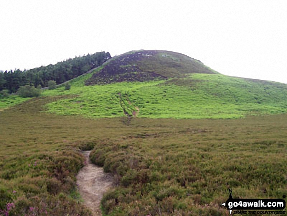
139. Black Down (Blackdown)
280m (918ft)
Marilyn (139th in England, 1415th in GB)
OS Trig Point
Black Down (Blackdown) is the highest point in county of West Sussex.
We hope to have walks that climb & bag Black Down (Blackdown) very soon
See the location of Black Down (Blackdown) and walks up it on a google MapBlack Down (Blackdown) is on interactive maps:
OS Explorer (Orange Covers): OL33
OS Landranger (Pink Covers): 186 and
197
A downloadable go4awalk.com PDF Peak Bagging Map featuring Black Down (Blackdown) will be available soon. |
140. Lewesdon Hill
279m (915ft)
Marilyn (140th in England, 1418th in GB)
Lewesdon Hill is the highest point in the county of Dorset.
We hope to have walks that climb & bag Lewesdon Hill very soon
See the location of Lewesdon Hill and walks up it on a google MapLewesdon Hill is on interactive maps:
OS Explorer (Orange Covers): 116
OS Landranger (Pink Covers): 193
A downloadable go4awalk.com PDF Peak Bagging Map featuring Lewesdon Hill will be available soon. |
141. Bardon Hill
278m (912ft)
Marilyn (141st in England, 1419th in GB)
OS Trig Point
Bardon Hill is the highest point in the county of Leicestershire.
To walk, climb & bag Bardon Hill use this easy-to-follow walk:
See the location of Bardon Hill and walks up it on a google MapBardon Hill is on interactive maps:
OS Explorer (Orange Covers): 245
OS Landranger (Pink Covers): 129
|
142. Win Green
277m (909ft)
Marilyn (142nd in England, 1422nd in GB)
OS Trig Point
We hope to have walks that climb & bag Win Green very soon
See the location of Win Green and walks up it on a google MapWin Green is on interactive maps:
OS Explorer (Orange Covers): 118
OS Landranger (Pink Covers): 184
|
143. Aconbury Hill (Aconbury Camp)
276m (905ft)
Marilyn (143rd in England, 1424th in GB)
OS Trig Point
We hope to have walks that climb & bag Aconbury Hill (Aconbury Camp) very soon
See the location of Aconbury Hill (Aconbury Camp) and walks up it on a google MapAconbury Hill (Aconbury Camp) is on interactive maps:
OS Explorer (Orange Covers): 189
OS Landranger (Pink Covers): 149
|
144. Hutton Roof Crags
274m (899ft)
Marilyn (144th in England, 1427th in GB)
OS Trig Point
We hope to have walks that climb & bag Hutton Roof Crags very soon
See the location of Hutton Roof Crags and walks up it on a google MapHutton Roof Crags is on interactive maps:
OS Explorer (Orange Covers): OL7
OS Landranger (Pink Covers): 97
Hutton Roof Crags is on downloadable PDF you can Print or Save to your Phone:
|
145. Seager Hill (Bunker's Hill)
272m (892ft)
Marilyn (145th in England, 1431st in GB)
OS Trig Point
We hope to have walks that climb & bag Seager Hill (Bunker's Hill) very soon
See the location of Seager Hill (Bunker's Hill) and walks up it on a google MapSeager Hill (Bunker's Hill) is on interactive maps:
OS Explorer (Orange Covers): 189
OS Landranger (Pink Covers): 149
|
146. Butser Hill
270m (886ft)
Marilyn (146th in England, 1432nd in GB)
OS Trig Point
We hope to have walks that climb & bag Butser Hill very soon
See the location of Butser Hill and walks up it on a google MapButser Hill is on interactive maps:
OS Explorer (Orange Covers): OL33 and
120
OS Landranger (Pink Covers): 197
A downloadable go4awalk.com PDF Peak Bagging Map featuring Butser Hill will be available soon. |
147. Claife Heights (High Blind How)
270m (886ft)
Wainwright Outlying Fell (No. 83)
Marilyn (147th in England, 1433rd in GB)
OS Trig Point
To walk, climb & bag Claife Heights (High Blind How) use this easy-to-follow walk:
See the location of Claife Heights (High Blind How) and walks up it on a google MapClaife Heights (High Blind How) is on interactive maps:
OS Explorer (Orange Covers): OL7
OS Landranger (Pink Covers): 96 and
97
A downloadable go4awalk.com PDF Peak Bagging Map featuring Claife Heights (High Blind How) will be available soon. |
148. Botley Hill
267m (876ft)
Marilyn (148th in England, 1436th in GB)
OS Trig Point
We hope to have walks that climb & bag Botley Hill very soon
See the location of Botley Hill and walks up it on a google MapBotley Hill is on interactive maps:
OS Explorer (Orange Covers): 146
OS Landranger (Pink Covers): 187
A downloadable go4awalk.com PDF Peak Bagging Map featuring Botley Hill will be available soon. |
149. Wendover Woods (Haddington Hill)
267m (876ft)
Marilyn (149th in England, 1437th in GB)
OS Trig Point
Wendover Woods (Haddington Hill) is the highest point in the county of Buckinghamshire.
We hope to have walks that climb & bag Wendover Woods (Haddington Hill) very soon
See the location of Wendover Woods (Haddington Hill) and walks up it on a google MapWendover Woods (Haddington Hill) is on interactive maps:
OS Explorer (Orange Covers): 181
OS Landranger (Pink Covers): 165
|
150. Housedon Hill
266m (873ft)
Marilyn (150th in England, 1439th in GB)
We hope to have walks that climb & bag Housedon Hill very soon
See the location of Housedon Hill and walks up it on a google MapHousedon Hill is on interactive maps:
OS Explorer (Orange Covers): 339
OS Landranger (Pink Covers): 74 and
75
|
Page 5 of 6 Go to page:
1 2 3 4 5 6 |
View these 173 Mountains, Peaks, Tops and Hills:
Is there a Mountain, Peak, Top or Hill missing from the above google map or list?
Let us know an we will add it to our database.

 The view from Scafell Pike in England


