Walk Photographs and views from British Walks published during & before 2006

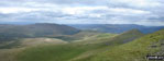
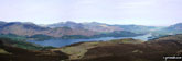
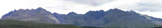
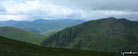
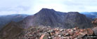
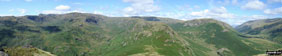
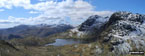
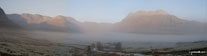
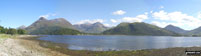
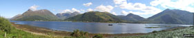
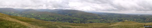
Scar Crags with Sail (Derwent Fells) and Crag Hill (Eel Crag) beyond from Causey Pike

Disused quarry at Winspit, The South West Coast Path


War memorial on the South West Coast Path near St Aldhelm's Head (St Alban's Head)

Disused quarry at Winspit, The South West Coast Path

The South West Coast Path above St Aldhelm's Head (St Alban's Head)

The South West Coast Path close to St Aldhelm's Head (St Alban's Head)

The South West Coast Path milepost near St Aldhelm's Head (St Alban's Head)

The South West Coast Path near St Aldhelm's Head (St Alban's Head)

Circular Sheep Fold on the lower slopes of Loch Fell from Croft Head


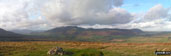
The Ettrick Hills from Croft Head


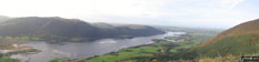
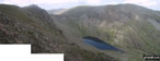
Coniston Village and Lake Coniston from The Old Man of Coniston


The Old Man of Coniston (left) and Brim Fell from near Low Water

Coniston Village and Coniston Water from The Old Man of Coniston

Disused Quarry workings near Low Water below The Old Man of Coniston

The summit cairn on The Old Man of Coniston

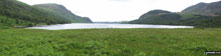
Sow How Tarn near Gummer's How

Brown Willy Summit cairn and Trig Point

Little Rough Tor from Brown Willy


The First and Last House at Land's End

Sennan Cove with Whitesand Bay beyond, Land's End

Cottage in Sennan Cove, Land's End

Sennan Cove and Whitesand Bay, Land's End


Whitesand Bay from Sennan Cove, Land's End


The Langdale Pikes from Holme Fell

Heather and crags on Holme Fell

Coniston Water from Holme Fell


The Langdale Pikes from Holme Fell

The Old Man of Coniston from Holme Fell

Helvellyn and Fairfield from Holme Fell


Ollie, Max and James on top of Lingmell before climbing Scafell Pike to round off the day

Buzz, Sharky and Yorkie on top of Lingmell before climbing Scafell Pike to round off the day

Father and Sons on top of Scafell Pike

Father and Sons on top of Great Gable


High above Hodge Close Quarry from Low Tilberthwaite

High above Hodge Close Quarry from Low Tilberthwaite

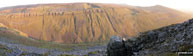
Hodge Close Quarry from Low Tilberthwaite


Hodge Close Quarry, High Tilberthwaite

Disused track bed in Hodge Close Quarry, High Tilberthwaite

Water in the bottom of Hodge Close Quarry, High Tilberthwaite

Entrance to Hodge Close Quarry, High Tilberthwaite

The Steep Sides of Hodge Close Quarry, High Tilberthwaite

Hodge Close Quarry, High Tilberthwaite

Hodge Close Quarry, High Tilberthwaite

Disused track bed in Hodge Close Quarry, High Tilberthwaite

Disused track bed in Hodge Close Quarry, High Tilberthwaite

In Hodge Close Quarry, High Tilberthwaite


Ambleside and Lake Windermere from Black Fell (Black Crag) summit

Lake Windermere from Black Fell (Black Crag) summit

Ambleside and Lake Windermere from Black Fell (Black Crag)

Lake Windermere from Black Fell (Black Crag)

Lake Windermere from Black Fell (Black Crag)

Southern Lake Windermere from Black Fell (Black Crag)

Tarn Hows from Black Fell (Black Crag)

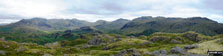
The Consiton Fells from Black Fell (Black Crag)

Wetherlam and Pike of Blisco (Pike o' Blisco) from Black Fell (Black Crag)

The Langdale Pikes from Black Fell (Black Crag)


Haworth Parsonage - home of the Bronte Sisters

Map showing the locations of the graves of the Bronte sisters, Haworth Church


Looking South West from Strans Wood

Stepping Stones at The White Lion, Cray


Helicopter rescue on Crib Goch

Highlow Hall from Bretton Clough

Foolow and Tansley Dale from Bretton


Climbers on Sgurr Thormaid from Sgurr na Banachdich, The Cuillin Hills

Descending along the razor thin path on Sgurr nan Gobhar, The Cuillin Hills


Loch an Eilein (Rothiemurchus) Visitors Centre


The ruined castle on Loch an Eilein (Rothiemurchus)

Loch an Eilein (Rothiemurchus) and the castle ruins

Loch an Eilein (Rothiemurchus)

Loch an Eilein (Rothiemurchus)

Loch an Eilein (Rothiemurchus)

Loch Morlich with Cairn Gorm beyond

Cairn Gorm from the shores of Loch Morlich

The Weather Station on the summit of Cairn Gorm in mist

Cairn Gorm summit cairn in mist


The summit of An Caisteal (Glen Falloch)

An Caisteal (Glen Falloch) from Beinn a' Chroin

Garbh Uisge looking North from The Falls of Leny

Garbh Uisge looking South towards The Falls of Leny

Looking East across Garbh Uisge from The Rob Roy Way

Beinn Each beyond Loch Lubnaig from The Rob Roy Way and Garbh Uisge

Ben Ledi from the top of Mullach Buidhe

Ben Ledi summit cairn and trig point


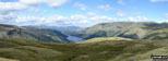
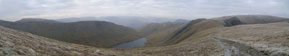
Small Water with Haweswater Reservoir beyond from Nan Bield Pass

Speaking Crag from The Rigg, Haweswater Reservoir


Stoodley Pike from Erringdon Moor

Stoodley Pike from Erringden Moor


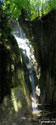
Waterfalls along the Afon Mellte

Waterfalls along the Afon Mellte

Waterfalls along the Afon Mellte

Waterfalls along the Afon Mellte

Waterfalls along the Afon Mellte

Sgwd yr Elra Waterfall, Afon Mellte

Sgwd yr Elra Waterfall, Afon Mellte

Two guys taking a chance at Sgwd yr Elra Waterfall, Afon Mellte in the background


Pen y Fan and Corn Du from Bwlch Duwynt

My 12 year old son on Pen y Fan


Coming off Pen y Fan the hard way via Nant Crew

The Cheviots from Thrunton Wood


Grass Snake (or is it a Slow Worm?) in Thrunton Wood

Adder (Snake) in Thrunton Wood

Approaching Pen y Fan from Neuadd Reservoir

Pen y Fan from Neuadd Reservoir

Pen y Fan from Neuadd Reservoir


Gwaun Perfedd (left) and Gwaun Taf (right) from Pen y Fan


Neuadd Reservoir from Graig Fan Du


Looking to Neuadd Reservoir from Craig Gwaun Taf


Looking back across to Bleaklow Hill from Millstone Rocks (Lad's Leap)


Looking North back towards Bakewell from nr Haddon Hall


The Cork Stone on Stanton Moor

Above Highstone Rocks, looking across to Rhodeswood Reservoir

Looking down Coombs Clough to Bramah Edge from Lad's Leap
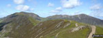
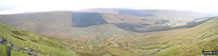
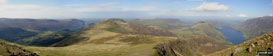
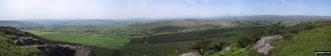
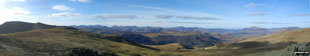
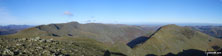
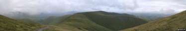
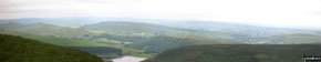
*Looking back along Scar Crags to Sail (Derwent Fells) and Crag Hill (Eel Crag) from Causey Pike

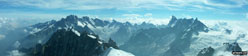
*360° panorama from the summit of Scar Crags

Eel Tarn taken en-route to Sca Fell from Eskdale


El Chorro - nr Alora, North of Malaga


Lagunas de Fuenta de Piedra y Campillos

Heading for The Cloud (Bosley Cloud)

Buttermere from Warnscale Beck on the way to Hay Stacks

Great Gable and Pillar from Innominate Tarn, Hay Stacks

Snow on High Street from Haweswater Reservoir

The Rigg and Haweswater Reservoir from the lower slopes of Branstree (Artlecrag Pike)


An empty Woodhead Reservoir from Crowden

The summit cairn on Lambrigg Fell

Docker Fell from Lambrigg Fell


St Ann's Head, Pembrokeshire Coast

Dale Point, St Ann's Head, Pembrokeshire Coast

Castlebeach Bay, St Ann's Head, Pembrokeshire Coast

Castlebeach Bay, St Ann's Head, Pembrokeshire Coast

Watwick Bay, St Ann's Head, Pembrokeshire Coast

Mill Bay, St Ann's Head, Pembrokeshire Coast

Lighthouse on St Ann's Head, Pembrokeshire Coast

St Ann's Head, Pembrokeshire Coast

St Ann's Head, Pembrokeshire Coast

Me and my wife Sue at the summit of Scafell Pike

Wasdale Head with Pillar beyond from the lower slopes of Lingmell & Scafell Pike


On Snowdon with Y Lliwedd beyond

On Snowdon with Y Lliwedd beyond


Glaslyn and Llyn Llydaw from Snowdon

Llyn Padarn and Llanberis from Snowdon

Bla Bheinn (Blaven) from Sgurr nan Gillean

Am Bastier from Sgurr nan Gillean

Sgurr na Stri from Sgurr nan Gillean


Windermere from Skelghyll Wood


The famous Bridge House in Ambleside


Wansfell Pike from Baystones (Wansfell) summit

Baystones (Wansfell) from Wansfell Pike summit


Mungrisdale Common from Blencathra

Sharp Edge from Foule Crag, Blencathra


Disused quarry below Tarn Crag (Sleddale)


Survey Post on Tarn Crag (Sleddale)


Shipman Knotts and Longsleddale from Great Howe


Path towards Mill Bridge from Seat Sandal


Castle Crag from the Cumbria Way above Seatoller


The Swan Hotel near Grasmere with Stone Arthur beyond


Wast Water from Lingmell Gill on the way up Scafell Pike. The fell to the right is Middle Fell

St Sunday Crag (left), Fairfield (right) and Grisedale Hause from Seat Sandal

Grisedale Tarn from Seat Sandal


Ashness Bridge over Barrow Beck with Skiddaw in the distance
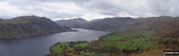
*Derwent Water from Bleaberry Fell


Crummock Water (far left) and Buttermere with Grasmoor beyond from Hay Stacks


Crummock Water (far left) and Buttermere with Grasmoor beyond from Hay Stacks

High Crag (left), Crummock Water (left distance) and Buttermere with Grasmoor beyond from Hay Stacks

Crummock Water (far left) and Buttermere with Grasmoor beyond from Hay Stacks

Innominate Tarn, Hay Stacks with Great Gable, Kirk Fell and Scafell Pike in the distance

Innominate Tarn, Hay Stacks with Great Gable beyond

On Heron Pike - with a view all the way from Lake Windermere to Morecambe Bay

Solomon's Temple in Buxton Country Park

Me on Kinder Downfall wondering what happened to the waterfall

Old Mill Cottages in Ravensdale Wood just up from Cressbrook


Me at the summit trig point on Helvellyn

The River Lune half mile upstream from Devil's Bridge, Kirkby Lonsdale


Looking over the edge of Malham Cove

Looking south from Cam Head towards Kettlewell

Looking West onto Starbotton village from Cam Head

Richie and I on the summit of Ben Nevis

Tryfan from the top of Bristley Ridge, Glyder Fach

Looking toward Hay Bluff from Sugar Loaf (Y Fal)


Brown Hill and Muska Fell from Cuns Fell


Muska Fell and Cuns Fell from Melmerby Fell


Melmerby Fell from Knapside Hill

Little Knapside Hill from Knapside Hill

Fiend's Hill from Little Knapside Hill


Fiend's Fell summit Trig Point

Melmerby Fell from Fiend's Fell

Beacon on Fiend's Fell with Black Fell (Haresceugh Fell) in the distance

Black Fell (Haresceugh Fell) and the A686 near Hartside Cafe from Fiend's Fell


A spectacular visita from The Quiraing on the lower slopes of Meall na Suiramach

San Michele near the Monte Baldo Mid station on the lower slopes of Monte Baldo

San Michele near the Monte Baldo Mid station on the lower slopes of Monte Baldo

Col di Piombi mountain refuge hut on the lower slopes of Monte Baldo

Cime di Valdritta from Col di Piombi on the lower slopes of Monte Baldo

The Il Signor mountain refuge hut on the lower slopes of Monte Baldo

The square arched shrine at Il Signor on the lower slopes of Monte Baldo

Cime di Ventrar from near Il Signor on the lower slopes of Monte Baldo

Cime di Ventrar and the Monte Baldo Cable Car on the lower slopes of Monte Baldo

The Cima della Nara (Cima dei Col) mossif across Lake Garda from the lower slopes of Monte Baldo

Lake Garda and the Monte Baldo Cable Car from the lower slopes of Monte Baldo

Malga Fiabio on the lower slopes of Monte Baldo

Monte Baldo from the col at Malga Fiabio

Mountain path on the lower slopes of Monte Baldo above Malga Fiabio

Mountain path on the lower slopes of Monte Baldo above Malga Fiabio

Malcesine and Lake Garda from near Col di Piombi on the lower slopes of Monte Baldo

The Mountain Track near Col di Piombi on the lower slopes of Monte Baldo

The Mountain refuge at Col di Piombi on the lower slopes of Monte Baldo

Eilean Donnan Castle near Kyle of Lochalsh

Loch Coruisk and The Cuillin Hills from Sgurr na Stri

The Five Sisters of Kintail from Beinn a' Chuirn (Glen More)

Looking skywards up the Great Stone Chute in Corrie Lagan


Marsco from the Sligachan path


My son, two friends and their dogs and me on the summit of Cadair Idris

My two suns on Sugar Loaf (Y Fal)

Me on the summit of Sugar Loaf (Y Fal)

John, Andy and myself on High Street in the snow

Brothers Water from Middle Dodd


*360 Degree Panorama from the summit of Red Screes
*Great Knott, Crinckle Crags and Bow Fell (Bowfell) from the Red Tarn (Langdale)


Easedale from the summit of Sergeant Man


Deep Slack and Codale Head (right) from Sergeant Man summit

The Langdale Pikes with Wetherlam and Swirl How in the distance from Sergeant Man summit

Slapestone Edge from across Easedale Tarn

Ullswater from summit of Hallin Fell

The next challenge awaits, Mel and Rick approaching Wetherlam


The Old Man of Coniston (left) and Swirl How (right) from Wetherlam summit

The Langdale Pikes reflected in Blea Tarn on a cold early morning.


The Tickled Pink Tea Rooms in Lavenham


Great Whernside from Scar House Reservoir

Scar House Reservoir from Little Whernside


One of the many streams that flow into Stone Beck on the lower slopes of Great Whernside

Ingleborough and Simon Fell as seen from Pen-y-Ghent during temperature inversion


Llyn Cau from the Minffordd Path on the upper slopes of Cadair Idris

The Cadair Idris massiff from near Brithdir


The Broom in bloom in Abney Clough

The View from Sir William Hill

Bretton Clough through the trees

Pointing the way up Sir William Hill

Looking south west from Curbar Edge

Curbar Edge from the bridge over the River Derwent on the A625 near Calver

The Carn Mor Dearg arete from Carn Mor Dearg

Carn Dearg Meadhonach (Carn Mor Dearg) bars the way to Carn Mor Dearg and the CMD arete

Ben Nevis from The Carn Mor Dearg arete


Beinn Eich and Beinn Dubh from Balmaha, Loch Lomond


Looking South East to Cushat End and Hownam Law from Grubbit Law

Crossing Kale Water on St Cuthbert's Way

South Cote with Hownam Law beyond

Salo on the shores of Lago di Garda (Lake Garda)

Salo on the shores of Lago di Garda (Lake Garda)


Madonna del Rio (Shrine) near Renzano
Waterfall behind Madonna del Rio (Shrine) near Renzano

Footpath above Valle Madonna del Rio


Salo and Lago di Garda (Lake Garda) from near San Bartolomeo (Shrine)

One of Salo's many narrow streets, Lago di Garda (Lake Garda)

Isola del Garda from the Lago di Garda (Lake Garda) Ferry

Salo from the Lago di Garda (Lake Garda) Ferry

Salo from the Lago di Garda (Lake Garda) Ferry

nr Salo from the Lago di Garda (Lake Garda) Ferry

Gardone from the Lago di Garda (Lake Garda) Ferry

Maderno from the Lago di Garda (Lake Garda) Ferry

Malcesine & Monte Baldo from the Lago di Garda (Lake Garda) Ferry

Monte Altissimo from Cime di Ventrar (Monte Baldo)

Bocca del Creer and Corna Piana from Cime di Ventrar (Monte Baldo)

Colma di Malcesine from Cime di Ventrar (Monte Baldo)


Malcesine, Lago di Garda (Lake Garda)

Malcesine, Lago di Garda (Lake Garda)

Malcesine, Lago di Garda (Lake Garda)

Dusano, Lago di Garda (Lake Garda)

Dusano, Lago di Garda (Lake Garda)

Dusano, Lago di Garda (Lake Garda)

Rocca di Manerba from Via Agello

Olive grove near Rocca di Manerba

Footpath near Rocca di Manerba


Isola del Garda with Monte Baldo beyond across Lago di Garda (Lake Garda) from Rocca di Manerba

Lago di Garda (Lake Garda) and Salo from Rocca di Manerba


Sirmione Port and Castle from the Desenzano del Garda Ferry, Lake Garda


Le Grotte di Catullo (Roman Ruins), Sirmione, Lake Garda

Le Grotte di Catullo (Roman Ruins), Sirmione, Lake Garda


Le Grotte di Catullo (Roman Ruins), Sirmione, Lake Garda


Desenzano del Garda, Lago di Garda (Lake Garda)

Desenzano del Garda, Lago di Garda (Lake Garda)

Desenzano del Garda, Lago di Garda (Lake Garda)

Desenzano del Garda, Lago di Garda (Lake Garda)

Desenzano del Garda, Lago di Garda (Lake Garda)

Desenzano del Garda, Lago di Garda (Lake Garda)

Desenzano del Garda, Lago di Garda (Lake Garda)

Rocca Vacchia from the Lake Garda Ferry, Lago di Garda (Lake Garda)

Garda, Lago di Garda (Lake Garda)

Lake Garda Ferry at Garda with Rocca Vacchia beyond, Lago di Garda (Lake Garda)

Rocca Vacchia from Garda, Lago di Garda (Lake Garda)

Path to Madonna del Pigna, Garda, Lago di Garda (Lake Garda)

Garda from the Madonna del Pigna, Lago di Garda (Lake Garda)

Madonna del Pigna, Lago di Garda (Lake Garda)

Garda from Rocca Vecchia, Lago di Garda (Lake Garda)

Bardolino from Rocca Vecchia, Lago di Garda (Lake Garda)

Rocca Vecchia, Lago di Garda (Lake Garda)

Bardolino, Lago di Garda (Lake Garda)

Bardolino, Lago di Garda (Lake Garda)


The Shropshire Countryside near Bentley Farm


Buckden Pike from the track above Cray


Chapman's Pool and Houns-tout Cliff from Emmetts Hill, The South West Coast Path

Red Squirrel in Dockray Meadow

St Aldhelm's Head (or St Alban's Head), The South West Coast Path

Cliffs East of St Aldhelm's Head (or St Alban's Head), The South West Coast Path


Little Rough Tor from Rough Tor


Yewbarrow and Yewbarrow (North Top) beyond Wast Water from Illgill Head


The Wast Water Screes below Illgill Head and Whin Rigg


The Trig Point on the summit of Gun (Staffordshire)


Fishing Boats in Sennen Cove, The South West Coast Path

Fishing Boats in Sennen Cove, The South West Coast Path

Fishing Boats in Sennen Cove, The South West Coast Path


The scree slope on the western slope of Great Gable

Approaching the summit of Carnedd Moel Siabod


A frozen Low Water - with The Old Man of Coniston beyond

Little Langdale from Wetherlam


Ironstone workings slitt vein, Westgate, Weardale

Ironstone workings slitt vein, Westgate, Weardale


Llyn Llydaw from The Watkin Path route up Mount Snowdon

Me and my dad (Dave) on Garnedd Ugain having just climbed across Crib Goch

View from Pwll Deri near Strumble Head


The Langstrath Valley from Stonethwaite Beck

High Crag and Stonethwaite Fell from Stonethwaite Beck

Beinn na h-Eaglaise (Ben-Damph Forest) across Loch Torridon from the lower slopes of Beinn Damh


*The Black Cuillin Hills taken from North of Glen Drynoch

St Aldhelm's Head (or St Alban's Head) from Emmetts Hill, The South West Coast Path


Gorge de la Jonte, looking westwards towards the junction with the Gorge du Tarn

The waterfall at the village of Salles la Source

Walking trail in the Parc Naturel Regional des Grands Causses

The beautiful village of Peyreleau, at the junction of Gorge du Tarn and Gorge de la Jonte

Rock outcrops and pine forest near the junction of Gorge du Tarn and Gorge de la Jonte

Looking along the valley of the river Aveyron from the hilltop hamlet of Mirabel

The view eastwards along the Gorge de la Jonte

Climbing the trail through the pine forests towards the causse noir, above the Gorge de la Jonte

View from the causse noir north westwards across the Gorge de la Jonte


Cairn on Loughrigg Fell above Loughrigg Tarn

Loughrigg Tarn from Loughrigg Fell

The Langdale Pike from Loughrigg Fell


Cave above Rydal Water on Loughrigg Fell

Rydal Water from Loughrigg Fell

Stepping Stones across the River Rothay near Ambleside


Troutbeck Tongue and Park Fell Head from Sour Howes


Great Gable (left) and Kirk Fell (centre right) from Black Sail Pass


Great Gable from Burnthwaite, Wasdale Head

The Langdale Pikes from the lower slopes of Loughrigg Fell

Cat Bells (Catbells) with Dale Head (Newlands) & Hindscarth beyond from Latrigg


Loughrigg Tarn from the lower slopes of Loughrigg Fell
*Blencathra and the Northern Fells from the summit of Great Mell Fell
*Looking across St John's in the Vale to Blencathra

Low Arnside from near Black Fell (Black Crag)
*Place Fell, Ullswater and Glencoyne Park from Gowbarrow Fell (Airy Crag)

Wast Water from a misty Great Gable

Climbing Great Gable in the mist

Climbing Great Gable in the mist

Climbing Great Gable in the mist

Climbing Great Gable in the mist

Climbing Great Gable in the mist

Great Langdale Beck, Great Langdale


Side Pike and Lingmoor Fell from Redacre Gill below Pike of Blisco (Pike o' Blisco)

Thirlmere from Browncove Crags (Helvellyn)

Above Browncove Crags (Helvellyn)


Raise (Helvellyn) summit cairn

Heading for Sticks Pass from Raise


Helvellyn Gill Waterfalls near Thirlmere

Back at Thirlspot - and happy!


Wast Water with Middle Fell & Seatallan beyond from Scafell Pike

Nearing the top of Scafell Pike


Relaxing on Scafell Pike summit

Cyfrwy with Barmouth beyond from the top of Cadair Idris (Penygadair)

Moel Famau summit from The Offa's Dyke Path

Glyder Fach (centre left), Glyder Fawr (centre) and Tryfan (centre right) from Pen Llithrig y Wrach

Bwlch Eryl Farchog with Carnedd Llewelyn beyond from Pen yr Helgi Du

Temerature Inversion from Crib Goch

Temperature inversion seen from Snowdon (Yr Wyddfa)


Temerature Inversion from Crib Goch

Cnicht (left) and Y Lliwedd poking through a Temerature Inversion seen from Crib Goch


Glaslyn (bottom left) and Snowdon (Yr Wyddfa) from Crib Goch in the snow

Glaslyn (partially frozen) from Crib Goch


Snowdon (Yr Wyddfa) in the snow from Crib Goch
*Glamaig in sunset taken from Sligachan

Looking south from The Old Man of Storr at approaching storm


The Black Cuillin from Sligachan

Marsco at sunrise from Sligachan


Leaving A' Mharconaich summit on a good winters day

The Cheviot summit in the snow


Cribyn with Pen Y Fan beyond from Fan y Big


On the path descending Graig Fan Ddu

Cribyn (left) and Fan y Big from Neuadd Reservoir


Striding Edge (left), Helvellyn and Swirral Edge (right) from above Hole-in-the-Wall


Stunning sunset over Malham Tarn

Chelker Reservoir from Beamsley Beacon (Howber Hill)

Gunnerside and Swaledale from Blea Barf


Wild horses on Llanddwyn Island

Looking down to Striding Edge from Helvellyn

Dollywaggon Pike from Nethermost Pike

Striding Edge with Helvellyn beyond

Ladybower Reservoir with Crook Hill beyond

The view from the top of Mulhacen


Moffat Water with Hunterheck Hill beyond


The Southern Upland Way through Eskdalemuir

Capel Fell from The Southern Upland Way in Eskdalemuir


North towards Capel Fell and Bodesbeck Law from Scaw'd Fell


Knock Pike from The Pennine Way near Dufton

The Tracking Station on Great Dun Fell from The Pennine Way at Great Rundale Beck

The Pennine Way crossing Great Rundale Beck with Knock Pike beyond

Cloud and snow on Cross Fell from The Pennine Way at Great Rundale Beck

Dufton Pike from Threlkeld Side

Dufton Pike from Threlkeld Side

Dufton with Dufton Pike beyond


Knock Pike from The Pennine Way near Dufton

Brownber Hill from The Pennine Way near Dufton

The Eden Valley from Dufton Pike

The Eden Valley bathed in winter sunshine from Dufton Pike


Cross Fell and Great Dun Fell from Dufton Pike

Brownber Hill (left), Threlkeld Side and Bluethwaite Hill (right) from Dufton Pike


Brownber Hill from Great Rundale Beck and Threlkeld Side

Knock Pike from Great Rundale Beck and Threlkeld Side

Brownber Hill from Great Rundale Beck and Threlkeld Side

Great Rundale Beck and Threlkeld Side


Stream emerging from a mine entrance on the lower slopes of High Scald Fell, Threlkeld Side

Threlkeld Side with Backstone Edge beyond from Brownber Hill

Dufton Pike from Brownber Hill


Threlkeld Side with Backstone Edge beyond from Brownber Hill

Knock and The Vale of Eden from Brownber Hill

Great Rundale Tarn and Bothy on Backstone Edge (Dufton Fell)

Shooting Butt on Backstone Edge (Dufton Fell)

Backstone Edge (Dufton Fell) summit

Backstone Edge (Dufton Fell) trig point

Narrowgate Beacon on Backstone Edge (Dufton Fell) near High Cup

High Cup with Murton Fell beyond from Backstone Edge (Dufton Fell)

The Head of High Cup from Backstone Edge (Dufton Fell)
*High Cup with Murton Fell beyond from The Pennine Way

High Cup Nick with the High Cup valley beyond from The Pennine Way

The Head of High Cup from The Pennine Way
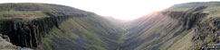
*High Cup from The Pennine Way

The High Cup Valley with Murton Fell beyond from The Pennine Way

Clouds over the Langdale Pikes from near Sergeant Man

Easedale Tarn from Codale Head


Towards Blea Rigg from Tarn Crag (Easedale)

Tarn Crag (Easedale) Summit Cairn

Easedale Tarn from Tarn Crag (Easedale)


Tarn Crag (Easedale) from Easedale


The Slate Mine on Honister Pass


Footbridge over Mickleden Beck

The Langdale Pikes from Pike of Blisco (Pike o' Blisco)

Red Tarn (Langdale) below Pike of Blisco (Pike o' Blisco)


Reflections in Yew Tree Tarn below Holme Fell

Fleetwith pike from Buttermere

Cat Bells (Catbells) from near Barrow Bay on the Eastern shore of Derwent Water

Seat and Hay Stacks with Great Gable beyond from High Stile

Red Pike (Buttermere), Dodd and Bleaberry Tarn from High Stile

Pike of Blisco (Pike o' Blisco) from The Band

Wrynose Bottom from the lowers slopes of Little Stand (Ulpha Fell)

High Stile and High Crag from near Black Sail Hut (Youth Hostel)


Pike of Stickle (Pike o' Stickle) from Stool End, Great Langdale

Water being blown UP Kinder Downfall by the wind

Burrow Head and the Isle of Whithorn from Carleton Fell

Bluebells in woodland on the Monreith Estate


Temperature Inversion in the Rydal Valley from near Heron Pike

Temperature Inversion from the summit of Snowdon (Yr Wyddfa)

The Skiddaw Massif from the village of Prospect

My Wife Sue with Pendle Hill beyond from nr Barley Green


Stony Cove Pike (Caudale Moor) from Hartsop Dodd

Thornthwaite Crag & High Street from below Stony Cove Pike (Caudale Moor)

High Street from Thornthwaite Crag

Knott & Rest Dodd from the Straits of Riggindale


The Lake District getting closer


Red Pike (Buttermere) and High Stile from Ennerdale Water

Ennerdale Water and St Bees from Red Pike (Buttermere)


Dave Munro and Red Tarn from Helvellyn with Striding Edge beyond

Approaching Kidsty Pike from Rampsgill Head

Haweswater Reservoir from near Bowderthwaite Bridge


Looking down Rigg Beck from Dukerdale Head


Descending by Ney Gill towards Ravenseat


White Cairn above Applegarth and The River Swale

On Cringle Moor, The Cleveland Hills


Passing Fat Betty (White Cross) on Danby High Moor


Arbury Hill from near Staverton Lodge,

The Northamptonshire Countryside near Arbury Hill,


Well Head Gliding Club from Dunstable Downs,


Dunstable Downs from Five Knolls,

Five Knolls from the base of Dunstable Downs,

Fields near Well Head, Dunstable Downs,


Old Railway Gate sign on farm gate near Weston,

The Shropshire Countryside near Lee Brockhurst,


Milldale Village from Achas Bank,

Dove Dale from Achas Bank above Milldale,

Dove Dale from Achas Bank above Milldale,


Dove Holes in Dove Dale near Milldale,

Ilam Rock Bridge, Dove Dale near Milldale,

Ilam Rock, Dove Dale near Milldale,

Ilam Rock Bridge with Ilam Rock beyond, Dove Dale near Milldale,

The River Dove, Dove Dale near Milldale,

Gayle Beck in the centre of Hawes


Gayle Beck, Gayle and Drumaldrace (Wether Fell) beyond from Hawes


Drumaldrace (Wether Fell) across Sleddale from The Pennine Way south of Gayle

Inquistitive sheep on The Pennine Way in Selddale south of Gayle

The Yorkshire Dales from The Pennine Way on Gaudy Lane south of Gayle

Drumaldrace (Wether Fell) across Sleddale from The Pennine Way on Gaudy Lane south of Gayle

Sleddale from The Pennine Way on the northern lower slopes of Dodd Fell Hill
*Widdale from The Pennine Way on the northern lower slopes of Dodd Fell Hill

Ingleborough from Dodd Fell Hill

Pen-y-ghent from Dodd Fell Hill


Cairn on lower slopes of Dodd Fell Hill

Cairn on Drumaldrace (Wether Fell)

Widdale from The Pennine Way on the northern lower slopes of Dodd Fell Hill

A Brocken Spectre (almost) with Red Screes beyond from the lower slopes of Yoke

Troutbeck Tongue with Wansfell Pike (Baystones) beyond from Ill Bell

Crinkle Crags (centre left) with Bow Fell (Bowfell) beyond from near Prison Band below Swirl How

The Scafell Massif laced by low cloud from Great Carrs


Great Gable from the Corridor Route below Scafell Pike

Blencathra from High Snab Bank, above Little Town

Skiddaw (left) and Blencathra (right) from the slopes of Robinson

Whiteless Pike (foreground) and Grasmoor (background) from Robinson

Hindscarth (left), Scope End (centre) and Robinson (right) from above Little Town


Lingmell (left) and Kirk Fell in sunlight from near Dropping Crag below Scafell Pike

The Cheviot Hills from Woden Law

Alston from Park Fell (Alston) summit trig point


Santa bags Pike Rigg (Whitfield Moor)

My daughter Ffion (aged 8) on the summit of Pen y Fan

My daughter Ffion (aged 8) on the way back down from Pen y Fan

Tittesworth Reservoir, Meerbrook

Stanage Edge featuring High Neb


Looking South from the summit of Ill Bell across cloud trapped by a temperature inversion


Detail on a cottage near Turvey Church

On Sgorr Dhonuill (Beinn a' Bheithir)

Skye (my fellow walker) on Bannerdale Crags in the snow

Skye (my fellow walker) on Clough Head

On Sgorr Dhonuill (Beinn a' Bheithir)


The Welsh Coast from Great Orme (Great Ormes Head), Llandudno


Below Great End near Sprinkling Tarn

Thirlemere from Steel Fell (Dead Pike)


Grey Knotts (left) Seatoller and Base Brown (right) from Green Gable

Glenridding Dodd (left), Glenridding and Ullswater from Birkhouse Moor

Dollywaggon Pike, Nethermost Pike and Helvellyn from Cofa Pike near the summit of Fairfield

St Sunday Crag from Nethermost Pike

The head of Eskdale from Great Moss

Looking up Grisedale with St Sunday Crag (left) and Dollywagon Pike (centre)


Great Gable (centre) and Kirk Fell (right) from below Black Sail Hut (Youth Hostel) Ennerdale

Looking over Buttermere to High Snockrigg with Grasmoor in the distance from Scarth Gap

Pillar from High Crag (Buttermere)

Fleetwith Pike from Buttermere

Bowfell from near Scale Bridge, Eskdale


*Barf and Crummock Water from Dodd (Skiddaw)

Crummock Water, Rannerdale Knotts and Robinson beyond from Black Beck


Great End and Styhead Tarn catching the light

The footbridge at Park Neb at the southern end of Derwent Water - cut off by flood waters


The famous Blue Lagoon, Grindavik

Will at Lake Ljotipollur which lies within the Caldera of an extinct volcano

Lake Ljotipollur lying within the Caldera of an extinct volcano

Glacier off Myrdalsjokull the main Ice cap

The main Myrdalsjokull Ice cap

Kirkjufellsvaun (or Kirkjufell Lake)


Our campside is in the bottom left corner by the river

Wild horses encountered as we walked to base camp


Ben A'an summit with Loch Katrine in the background

Ben A'an summit just before the final climb

Moody view of Ben A'an across Loch Achray
*Ben Nevis and the Carn Mor Dearg (CMD) Arete (left) from the summit of Carn Mor Dearg


Old pieces of iron below Attermire Scar


Sunset over Dunoon and The Isle of Arran from Clach MacKenny, nr Rosneath

The Langdale Pikes from Loughrigg Tarn


Malt bread on the top of Scafell Pike summit

The ascent up to Foxes Tarn (Sca Fell)


Illgill Head and Wast Water from Sca Fell

Burnmoor Tarn and Illgill Head from Sca Fell

Wast Water from near Lingmell Gill (Wasdale Head)

Green lane across Matterdale Common

Clough Head from Matterdale Common


Green Side (White Stones) summit with Ullswater beyond


Ullswater from the cairn on Birkett Fell near Hart Side


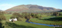
Yew Tree Farm with Raven Crag (Holme Crag) beyond


Low Arnside from Black Fell (Black Crag)

Sheep on Black Fell (Black Crag)

North from Black Fell (Black Crag)

Ambleside and Windermere from Black Fell (Black Crag)

Loughrigg Fell from High Oxenfell Farm


Haweswater Reservoir, The Rigg with Branstree (Artlecrag Pike) beyond from near Castle Crag

The River South Tyne near Tynehead


Hull Pot near Horton in Ribblesdale

Pen-y-ghent from Hull Pot near Horton in Ribblesdale


Walking behind Ashgill Force near Garrigill

Looking across Greenburn Bottom to Helm Crag from Steel Fell (Dead Pike)

Grasmere from the summit of Steel Fell (Dead Pike) with Helm Crag right of centre

Thirlmere from Steel Fell (Dead Pike)

Loughrigg Fell and Loughrigg Tarn

Glaramara and The Borrowdale Fells from Langstrath Beck

Styhead Tarn, Great Gable and Green Gable from the path below Sprinkling Tarn

Yewbarrow (left) Great Gable (centre) and Lingmell (right) from across Wast Water in Wasdale
*Whernside and The Howgill Fells from Ingleborough summit


Widdop Reservoir from Gorple Gate

East from Cobby Farm nr Shackleton Knoll


The officers of HMS Ramsey on Buachaille Etive Mor (Stob Dearg)

Hay Bluff and Twmpa (Lord Hereford's Knob) from Rhos Dirion

Hay Bluff, Black Mountain and The Offa's Dyke path from Capel-y-ffin


Schiehallion poking out of the mist


Caer Caradoc Hill from Church Stretton

The Vale of Edale from Lord's Seat (Rushup Edge)

Climbing Crib Goch with Llyn Llydaw in the background

A RAF Helicopter above Y Lliwedd and the Watkin Path from Mount Snowdon (Yr Wyddfa)

Yr Aran at the end of the Allt Maenderyn Ridge from Snowdon (Yr Wyddfa)

Llyn Ogwen and Nant y Benglog from Pen yr Ole Wen


On Snowdon (Yr Wyddfa) with Llyn Llydaw beyond

Low cloud over Nant Beglong, Gallt yr Ogof and Tryfan from Craig Wen

Carnedd Moel Siabod from Pen-y-gwryd


Y Lliwedd and the Watkin Path from Mount Snowdon (Yr Wyddfa)

On Black Hill (Soldier's Lump)

Crowden and Longdendale from Dun Hill

On Black Chew Head (Laddow Rocks)

Laddow Rocks with Bleaklow Hill beyond from Black Hill (Soldier's Lump)

Dove Stone Reservoir overflow with snow on Great Dove Stone Rocks in the distance

The Berwyns from Pistyll Rhaeadr

The huge Pistyll Rhaeadr Waterfall at Tan y pistyll


The River Kinder just before it tumbles down Kinder Downfall

Castlerigg Stone Circle near Keswick at Sunset

Looking back up to The Devil's Kitchen (Twll Du) from Llyn Idwal

Pen yr Ole Wen and Llyn Idwal from the top of The Devil's Kitchen (Twll Du)

Glyder Fach in mist from Glyder Fawr

Bwlch y Ddwy-Glyder, Castell y Gwynt and Glyder Fach from Glyder Fawr in mist

Castell y Gwynt (Castle of the Wind) from Glyder Fach

Y Gribin (Glyderau) and Glyder Fach from Glyder Fawr

Cwm Cneifion (The Nameless Cwm) from Glyder Fawr


Snowdon (Yr Wyddfa) and Crib Goch from Glyder Fawr

Pen y Pass and Llyn Cwmffynnon from Glyder Fawr

Castell y Gwynt and Glyder Fach from Glyder Fawr


Castell y Gwynt from Glyder Fach


Garnedd Ugain (Crib y Ddysgl) and Snowdon (Yr Wyddfa) from Glyder Fawr


Crib Goch, The PYG Track (centre), The Miners' Track (lower right) and Llyn Llydaw from Bwlch Glas

Snowdon (Yr Wyddfa) and Bwlch Glas from near Garnedd Ugain

Llyn Llydaw with Y Lliwedd beyond from Bwlch y Moch

Nant y Benglog, Llyn Ogwen and Tryfan from Pen yr Ole Wen


Y Garn (Glyderau) from near Llyn Idwal

The Devil's Kitchen (Twll Du) and Y Garn (Glyderau) from near Llyn Idwal

Pen Yr Ole Wen from near Llyn Idwal

The Devil's Kitchen (Twll Du) from near Llyn Idwal

The Devil's Kitchen (Twll Du) from above Llyn Idwal


Llyn Idwal with Y Garn (Glyderau) beyond


Anglesey from Y Garn (Glyderau) ascent

Llyn Ogwen (left) and Llyn Idwal with Tryfan beyond from Y Garn (Glyderau)

Pen yr Ole Wen, Llyn Ogwen and Nant y Benglog from Y Garn (Glyderau)

Pen yr Ole Wen from Y Garn (Glyderau)


Y Garn (Glyderau) and Cwm Clyd

Pen Yr Ole Wen and Nant Ffrancon from Y Garn (Glyderau)

Llyn Clyd with Llyn Idwal beyond from Y Garn (Glyderau)


The view from Y Garn (Glyderau) summit

The view from Y Garn (Glyderau) summit

Llyn Ogwen and Tryfan from Y Garn (Glyderau) summit

Tryfan and Glyder Fach from Y Garn (Glyderau) summit

View from Y Garn (Glyderau) summit

Snowdon (Yr Wyddfa) from Y Garn (Glyderau) summit

Me on Y Garn (Glyderau) summit

Snowdon (Yr Wyddfa) from Y Garn (Glyderau) summit

Llyn y Cwm with Glyder Fawr beyond from Y Garn (Glyderau)

Llyn y Cwm from Y Garn (Glyderau)


Snowdon (Yr Wyddfa) from Y Garn (Glyderau)

Llyn Y Cwm and Y Garn from Glyder Fawr


Snowdon (Yr Wyddfa) and Garnedd Ugain (Crib y Ddysgl) from Glyder Fawr

Fell Runner climbing Glyder Fawr


Angler's Crag from the shores of Ennerdale Water

Ben Gill and Ennerdale Weir from Crag Fell


Ennerdale Water from Crag Fell


Great Borne and Starling Dodd from Caw Fell

Sellafield and the Irish Sea from Grike summit


Robin Hood's Chair, Ennerdale Water

Steeple and Pillar from Ennerdale Water


Ennerdale Weir, Ennerdale Water

Green Gable (left) and Great Gable from Brandreth

Stickle Tarn from Harrison Stickle in The Langdale Pikes


Crummock Water, Rannerdale Knotts and Robinson beyond from Black Beck
*Grasmoor (left of centre) and Red Pike (Buttermere) (right of centre) from Great Borne

The church of St. Michael, Coningsby


Public Footpath number 3, which runs from Fen Road to Walcott Road, Billinghay

Public Footpath number 3, which runs from Fen Road to Walcott Road, Billinghay

Public Footpath number 3, which runs from Fen Road to Walcott Road, Billinghay

Public Footpath number 3, which runs from Fen Road to Walcott Road, Billinghay

Public Footpath number 3, which runs from Fen Road to Walcott Road, Billinghay


Raven Hall Hotel, Ravenscar from The Cleveland Way

On The Cleveland Way near Ravenscar

Robin Hood's Bay from Boggle Hole

Robin Hood's Bay from Ravenscar

The Cleveland Way in Robin Hood's Bay

Sunflowers on The Cleveland Way at Stoupe Beck

Toadstool in woods on the Ravenscar Estate

Ashopton Bridge with Crook Hil beyond, Ladybower Reservoir

Kinder Scout and the Edale Valley from Hollins Cross

Back Tor (Hollins Cross) from Hollins Cross


Admiring the view at the top of a windless Ingleborough

The edge of Loweswater ,Crummock Water and Buttermere taken from Darling Fell

Darling Fell across Loweswater

Crummock Water with Mellbreak beyond from Robinson

Watendlath Tarn and High Tove from near Watendlath


Dunmallard Hill (Dunmallet) summit


Pooley Bridge and The River Eamont

Pooley Bridge and The River Eamont

Aira Force Waterfall (near Glenridding and Ullswater)

Gowbarrow Fell (Airy Crag) summit

Aira Force near Glenridding and Ullswater

The bridge over Riddings Beck below Aira Force near Glenridding and Ullswater

Riddings Beck above Aira Force

Riddings Beck above Aira Force

Riddings Beck above Aira Force

Riddings Beck above Aira Force

Riddings Beck above Aira Force


Watermillock Common with Hart Side beyond from below Gowbarrow Fell (Airy Crag)

Ullswater and Patterdale from Green Hill (Gowbarrow Fell)

Watson's Dodd, Great Dodd and Clough Head and Dockray from Gowbarrow Fell (Airy Crag)

Gowbarrow Fell (Airy Crag) summit

Ullswater and Patterdale from Gowbarrow Fell (Airy Crag)

Ullswater and Patterdale from the lower slopes of Gowbarrow Fell (Airy Crag)

Barn in a field near Dunham Massey Deer Park

Bridge over The Bridgewater Canal


Narrow Boat on The Bridgewater Canal


Embsay Reservoir with Embsay Crag beyond

Rough Haw and Sharp Haw from Crookrise Crag Top


Embsay Reservoir from Crookrise Crag Top
*The panoramic view south from Crookrise Crag Top featuring Rough Haw, Sharp Haw and Skipton


Rylstone Cross on Rylstone Fell

Waterfall Gill Beck from the top of the waterfall

Weathered rock formations on Rylstone Fell


Angler's Crag across Ennerdale Water
*Angler's Crag across Ennerdale Water


The Side and Angler's Crag from the South Eastern shore of Ennerdale Water


Sheltering from the rain in Ennerdale


More climbing beside Loft Beck

Ennerdale Water from the top of Loft Beck

The setting sun on Honister Pass

The setting sun on Honister Pass

The winding road up Honister Pass

The setting sun on Honister Pass

The setting sun on Honister Pass

The winding Honister Pass road


Grisedale Pike from Lord's Seat (Whinlatter)

Lord's Seat (Whinlatter) summit

Bassenthwaite Lake and Skiddaw from Barf

Barf and The Bishop from Bassenthwaite Lake


Lord's Seat (Whinlatter) summit with Barf beyond


Leaving Whinlatter Forest on route to Whinlatter (Whinlatter Top) and Whinlatter (Brown How)


Comb Beck in Whinlatter Forest
*Thirlmere from the summit of Steel Fell (Dead Pike)

The Howitzer on Helm Crag summit

Looking down the ridge from Steel Fell (Dead Pike) with Helm Crag to the right
*Grasmere Common, Easedale and The Greenburn Horseshoe from Helm Crag

Green Gable and Great Gable from Grey Knotts

Green Gable and Great Gable from Brandreth


Buttermere and Crummock Water from Moses' Trod below Brandreth


Rough Crag (Riggindale) from High Street


Small Water from Harter Fell (Mardale)

Mardale Ill Bell and High Street from Harter Fell (Mardale)

Haweswater from above Adam Seat

Gasgale Gill from the North West flank of Grasmoor


Rannerdale Knotts and Crummock Water from Grasmoor

Whiteless Pike from above Wandope

Crummock Water from below Rannerdale Knotts


Kinder Reservoir and Hayfield from Kinder Scout

Kinder Reservoir and Hayfield from Kinder Downfall

Kinder Reservoir and Hayfield from Sandy Heys, Kinder Scout


Chew Brook with Hoarstone Edge beyond from Dove Stone Reservoir

West Stow Country Park, Suffolk

West Stow Country Park, Suffolk


West Stow Country Park, Suffolk

West Stow Country Park, Suffolk


A very dry Shivery Gill from Pike Hill


Looking North West from Pike Hill

Looking South down Wensleydale from Pike Hill

Looking back up Pike Hill from near Sedbusk

On the Kilnsea clays, Spurn Head


The Old and New Lighthouses, Spurn Head

Ships in The Mouth of the Humber, Spurn Head

The Old Lighthouse, Spurn Head

The New Lighthouse, Spurn Head

Buachaille Etive Mor (left) and Beinn a' Chrulaiste (right) from the A82

The Dales Way South of Ings on the way to School Knott

The Dales Way near Hag End Farm

The Dales Way near Crag House Farm

Lake Windermere from School Knott summit

The Newlands Valley from (half-way up) Cat Bells (Catbells)

Lake Windermere (South) from Orrest Head

Lake Windermere (North) from Orrest Head

Looking across Buttermere Lake to a Cottage below Hay Stacks (Haystacks) from Hassness

Fleetwith Pike (left) and Hay Stacks (right) across Buttermere Lake from Hassness

Elter Water and The Langdale Pikes

Loughrigg Tarn and the Langdale Pikes from below Ivy Crag

Thirlmere from Browncove Crags


Striding Edge from the Helvellyn summit ridge

On the summit of Knott (Uldale Fells)

Hester on Middle Fell (Wasdale)

Arnison Crag (left) and Place Fell from Hartsop above How


Ullswater from the path to Arnison Crag

Shaun, Tetley & Grizzly on High Raise (Langdale)


Snow on St Sunday Crag as the mist clears

Brothers Water under mist with Angletarn Pikes and Place Fell beyond from the Kirkstone Pass

Burnmoor Tarn, Whin Rigg and Illgill Head from Sca Fell


Looking towards the Isle of Man (Sellafield rather spoils the view) from Sca Fell


Loughrigg Tarn from Loughrigg Fell


Kesick with Skiddaw beyond from Cat Bells (Catbells)


Malham Tarn in the grip of Winter - 7th March, 2006

Malham Tarn in Spring - 16th April, 2006

Cautley Crag, Cautley Spout, Bowderdale Head and Yarlside from Great Dummacks


Wildboar Clough with Bleaklow Hill beyond from the Pennine Way near Crowden


Bareholme Moss and Hey Moss from near Black Chew Head (Laddow Rocks)

Hey Edge, Crowden with Bleaklow Hill beyond from near Black Chew Head (Laddow Rocks)

Approaching Black Chew Head (Laddow Rocks)

Black Hill (Soldier's Lump) from near Black Chew Head (Laddow Rocks)

Bareholme Moss and Holme Moss TV Mast from near Black Chew Head (Laddow Rocks)

Bleaklow, Woodhead and Crowden from Black Chew Head (Laddow Rocks)

Crowden Great Brook and Crowden from Black Chew Head (Laddow Rocks)

Crowden Great Brook at Castles

Crowden Castles from near Dun Hill

Approaching Black Hill (Soldier's Lump) summit

On Black Hill (Soldier's Lump) sumit

Britland Edge Hill from Tooleyshaw Moss

Torside Reservoir from Hey Edge

Looking back up to Hey Edge from Crowden

Approaching Black Hill (Soldier's Lump) summit

Llyn Dinas with Snowdon and Crib Goch beyond from Grib Ddu


Looking East towards Loch Lyon from Coire an Dothaidh

Climbing Beinn Dorain (Beinn na Caillich)

Ben Nevis from Beinn Dorain (Beinn na Caillich) summit

South towards Crianlarich from Beinn Dorain (Beinn na Caillich) summit

Stonethwaite beck in the Langstrath Valley

Stonethwaite beck in the Langstrath Valley

Stonethwaite beck in the Langstrath Valley

Stonethwaite beck in the Langstrath Valley

Bridge over Stonethwaite Beck in the Langstrath Valley


Yewbarrow, Great Gable and Lingmell from Wast Water

Looking across the bluebells and Crummock Water towards Mellbreak from Rannerdale Knotts


Bluebells on Rannerdale Knotts with Grasmoor beyond

Crib Goch with Garnedd Ugain (Crib Ddysgl) and Snowdon (Yr Wyddfa) beyond

Y Lliwedd from the Pyg Track path on the lower slopes of Crib Goch


Scafell Pike, Mickledore and Sca Fell from Buckbarrow summit

The Scafell massif from Middle Fell (Wasdale)

Mount Snowdon from Glyder Fach

Nant Ffrancon from Glyder Fach


View from the Warden's Way near Brockhill Farm


Locks on the Kennet and Avon Canal


Wilton Windmill from near Bedwyn Brail

Approaching Lower Slaughter village


Approaching Silver Point on the shores of Ullswater


Shasta Dam, Redding with the ice covered Mount Shasta in the background


Derwent Reservoir with Margery Hill beyond from Rowlee Pasture


Langdale (Howgills) from just below Docker Knott


Mellbreak and Crummock Water from Buttermere


Ampton Water and Great Levermere

Ampton Water and Great Levermere

Ampton Water and Great Levermere

Ampton Water and Great Levermere

Ampton Water and Great Levermere

Ampton Water and Great Levermere

Hay Bluff from Lord Hereford's Knob (Twmpa)

Picws Du (Bannau Sir Gaer) and Fan Foel in the snow from Waun Lefrith (Bannau Sir Gaer)

Llyn y Fan Fach below the Picws Du (Bannau Sir Gaer) crags from Fan Foel


Long Crag from The Ullswater Steamer


Glenridding and The Helvellyn Massiff from Long Crag on the shores of Ullswater

Approaching Silver Point on the shores of Ullswater

West across Ullswater to Glenridding from Blowick
*Bluebells with Grasmoor, Las Hows and Whiteless Pike from Rannerdale
*Ilgill Head, Whin Rigg and The Wast Water Screes from below Buckbarrow

On the Malvern (Worcestershire Beacon)


On the Malvern (Worcestershire Beacon)

Heading for Pen-y-ghent during the Yorkshire Three Peaks Challange

On the Malvern (Worcestershire Beacon)

At Llyn Cau below Cadair Idris (Penygadair)

On the Malvern (Worcestershire Beacon)

Ennerdale Water from near Bleach Green Cottages at the Western end of the lake

Great Mell Fell Summit cairn with Sharp Edge (left) clearly visible beyond

The much smaller upper waterfall at Aira Point, High Force (Aira Force)

Gowbarrow Fell (Airy Crag) Summit and Great Mell Fell

Little Mell Fell from Gowbarrow Fell (Airy Crag)

Shooting lodge below Gowbarrow Fell (Airy Crag)

Watermillock Church from below Priest' s Crag


Clough Head and the Dodds from Little Mell Fell

Looking across Great Langdale to Side Pike and Lingmoor Fell from Stickle Ghyll, The Langdale Pikes


Blencathra and the Northern Fells from Skiddaw summit

Blencathra or Saddleback (Hallsfell Top) and Sharp Edge from Little Mell Fell


Pavey Ark and Jack' s Rake from Stickle Tarn, The Langdale Pikes

Stickle Tarn, The Langdale Pikes

Pavey Ark and Stickle Tarn, The Langdale Pikes

Pavey Ark and Stickle Tarn, The Langdale Pikes

Lake Windermere from Bowness-on-Windermere

Lake Windermere from nr Bowness-on-Windermere


The Mountain Rescue climbing Stickle Ghyll near Stickle Tarn The Langdale Pikes, Great Langdale

The Langdale Pikes, Great Langdale

Great Langdale from The Langdale Pikes, Great Langdale

Path to Great Mell Fell near Matterdale End

Ullswater from Green Hill (Gowbarrow Fell)

Gowbarrow Fell (Airy Crag) from Great Mell Fell

Great Mell Fell Summit cairn with Sharp Edge , Blencathra or Saddleback (Hallsfell Top) beyond

Stickle Tarn from Harrison Stickle


Pavey Ark, Stickle Tarn & Harrison Stickle from nr Blea Rigg

Ullswater, Glenridding and the Helvellyn Ridge from Place Fell

Looking across an unnamed tarn below Great Castle How to Wetherlam and the Furness Fells

Looking up Great Langdale from near Swinescar Pike


Stickle Tarn, Harrison Stickle and Pavey Ark from near Blea Rigg

Stickle Tarn from near Blea Rigg

Sunburst on Great Langdale from near Blea Rigg

*Stickle Tarn, Harrison Stickle and Pavey Ark from near Blea Rigg

Great Langdale from Pike of Stickle


Temperature Inversion on Fan Fawr

Llwyn-on Reservoir on a crisp February winter morning

Pen y Fan from Neuadd Reservoir

Usk Reservoir with Black Mountain in the background


On The Pembrokeshire Coast Path between Fishgaurd and Newport

On The Pembrokeshire Coast Path between Fishgaurd and Newport

Solomon's Temple from Grin Low Car Park, Buxton Country Park

North from within Solomon's Temple, Buxton Country Park

Solomon's Temple from Grin Low Wood, Buxton Country Park

The Isle of Arran from Beinn Tharsuinn (Glen Luss)

SE from Beinn Chaorach (Glen Luss)

Looking east from Beinn Dubh (Loch Chon)

Looking north from Beinn Dubh (Loch Chon)

An Sgarsoch from Carn a' Chlamain


Beinn a' Ghlo from Gleann Feartnach


The River Tarf and The Tarf Hotel


Wild Camping - The Water of Tarf


Glyder Fawr and Twll Du (The Devil's Kitchen) from Llyn Idwal


Angle Tarn with the Helvellyn range beyond

Brothers Water from Boredale Hause

Early Morning Mist nr Hartsop Village with The Angletarn Pikes and Place Fell in the background

Bowfell from the second Crinkle (Long Top)

Crinkle Crags (South Top), Crinkle Crags (Long Top) & Gunson Knott after leaving Red Tarn (Langdale)

Oxendale and Langdale from Gunson Knott (Crinkle Crags)


Beacon Tarn (The Blawith Fells) near Coniston Water

Sharp Edge from Blencathra or Saddleback (Hallsfell Top)

Bannerdale View Cottage, Mungrisdale

Blencathra from Bannerdale Crags

Blencathra from Bannerdale Crags

Thirlmere and Blencathra from Steel Fell (Dead Pike)

Steel Fell (Dead Pike) summit (featuring Harvey)

Harvey on Steel Fell (Dead Pike)


Me and my walking friends from work on Scafell Pike


Clouds gathering over Birker Fell & Harter Crag (Eskdale) from Eskdale


The Scafell Range and Great Moss (foreground) from Hard Knott

Esk Pike and Great Moss (foreground) from Hard Knott


Me on High Pike (Caldbeck) Summit


Kinder Scout (The Edge) in the snow from Mill Hill (Ashop Head)


Me on a snowy Simon's Seat (Wharfedale)

Blease Fell (Howgills) summit with the M6 and Grayrigg Forest beyond


Stretchneck Sheep Shepherd on his 'ski-bike' on The Dodd


Cairnsmore of Fleet from Pibble Hill


Mount Famine and South Head from Cracken Edge


Chapel-en-le-Frith from Chinley Churn

Mount Famine and Kinder Scout from Chinley Churn


Chinley Churn summit trig point


Ann Strain, Kevin Finn, Jill Willcockson and Theresa Howard at St Bees at the start of

The Irish Sea and South Head, St Bees

Collecting the traditional pebble (and getting soaked in the process!), St Bees

The first climb up South Head, St Bees


Leaving Sandwith Village - only 185 miles to go!


Taking a breather by Ennerdale Water

Starling Dodd and Red Pike in mist from Ennerdale Water


Little Langdale from Great Carrs


Swirl How, Top of Broad Slack and Great Carrs from Little Carrs

Walna Scar and White Maiden from Brown Pike

Dow Crag from Brown Pike summit


Brown Pike and Blind Tarn from Dow Crag
*Dow Crag, Goat's Hawse, Goast's Water and The Old Man of Coniston from Brown Pike


Dow Crag (foreground) and Brown Pike


The Old Man of Coniston summit trig point

Low water from The Old Man of Coniston

The Old Man of Coniston from Swirl How summit cairn

Great Carrs from Top of Broad Slack

The WW2 Halifax Bomber Memorial on Great Carrs

The WW2 Halifax Bomber Memorial on Great Carrs

The WW2 Halifax Bomber Memorial on Great Carrs


Swirl How and The Old Man of Coniston from Grey Friar


Seathwaite Tarn from (the lower slopes of) Grey Friar


Fleetwith Pike and Buttermere Lake from Buttermere

Lady Clough from Seal Stones (Kinder Scout)

The run off at the southern end of Yew Tree Tarn near Tarn Hows

Holme Fell from Yew Tree Tarn near Tarn Hows

Hale Head Lighthouse with Helsby Hill beyond the River Mersey

Wetherlam with the Langdale Pikes beyond from Iron Keld near Tarn Hows

Lingmore Fell and the Langdale Pikes from Iron Keld near Tarn Hows

Partially frozen Yew Tree Tarn near Tarn Hows


Crummock Water, Rannerdale Knotts (left) and The High Stile Ridge from Cinderdale Common

Crummock Water, Rannerdale Knotts (left) and The High Stile Ridge from nr Cinderdale Common


The Grand Tetons from Swan Lake

The Grand Tetons from Hermitage Point

The Grand Canyon of the Yellowstone


Half Dome from The John Muir Trail

Panorama from Half Dome summit


Pike of Stickle and the Langdale Pikes from Gunson Knott (Crinkle Crags)

Approaching The Band and Stool End Farm from Great Langdale


The Transmitter on the top of The Wrekin

Looking Northwest from The Wrekin

The summit Trig Point on The Wrekin


Woodland on the lower slopes of The Wrekin

Cardigan Bay from Snowdon summit

Snow on Y Lliwedd from the summit of Snowdon

Cardigan Bay from Snowdon summit

Approaching Crib Goch from the east

Lanberis Pass from the Pyg track above Pen y Pass

Climbing Snowdon via the Pyg track

Climbing Snowdon via the Pyg track

Low Water - on the way up The Old Man of Coniston

Above Low Water on the way up The Old Man of Coniston

The Old Man of Coniston summit

Dove Stone Reservoir with snow on Great Dove Stone Rocks beyond

The Edale Valley from Back Tor (Hollins Cross)

Hadleigh Castle, Southend on Sea


Lower Laithe Reservoir from Penistone Hill near Haworth

The High Stile Ridge and Buttermere from Fleetwith Pike

Stile End, Outerside and Causey Pike from Sleet How

The Sleet How Ridge with Skiddaw beyond from Grisedale Pike
*Panorama looking North West from Stybarrow Dodd
*The Helvellyn summit ridge, Whiteside, Thirlmere and Watson's Dodd from Raise (Helvellyn) summit

Thirlmere from Raise (Helvellyn)


Looking towards Bassenthwaite and The Skiddaw Massif from Raise (Helvellyn)

*360° Panorama from Fleetwith Pike

Innominate Tarn (Hay Stacks) with a snow-capped Pillar beyond


Llechog (Llanberis Path) and the lesser known Tryfan (Snowdon) from The Pass of Llanberis

Taking a breather near Clogwyn Station on the Llanberis Path up Snowdon

An unscheduled halt on Llechog (Llanberis Path) on the way up Snowdon (Yr Wyddfa)

Crib Goch from Llechog (Llanberis Path) on the way up Snowdon (Yr Wyddfa)

Glyder Fawr from Llechog (Llanberis Path) on the way up Snowdon (Yr Wyddfa)

Early morning frost on Rannoch Moor

Lochan Beinn Chabhair from (the slower slopes of) Beinn Chabhair

Temperature Inversion on the Dalmally horseshoe

Stob Diamh and Stob Garbh from Sron an Isean - on the Dalmally Horseshoe

A snowy Dovestone Reservoir with Dick Hill beyond from Chew Brook


The Roaches and Hen Cloud from Gun (Staffordshire)


Unusual building on the shores of Rudyard Reservoir

Cliffe Park, Rudyard Reservoir

Watlowes dry valley above Malham Cove

On the Yorkshire Three Peaks below Pen-y-ghent


Wensledale from Swaledale in the snow

Sean, Rosie and Bess in Swaledale near Reeth

The Ingleton Waterfalls - Thornton Force

The Ingleton Waterfalls - Small Thornton Force from behind

The Ingleton Waterfalls - Thornton Force from the side

The River Doe near The Ingleton Waterfalls

The River Doe near The Ingleton Waterfalls

Norber from Crummack Lane (Track)

Thwaite Scars from near Crummack


Quarry pool by the Miners' track on the lower NE slopes of Carnedd Moel Siabod

Hadrian's Wall at Steel Rigg with Crag Lough beyond


Walking The Hadrian's Wall National Trail


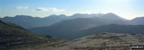
Altnafeidh from the lower slopes of Beinn a' Chrulaiste


Buchaille Etive Mor from Beinn a' Chrulaiste

Ben Nevis and Aonach Mor from the summit of Beinn a' Chrulaiste

Ben Nevis and Aonach Mor from Beinn a' Chrulaiste summit

Glen Coe from Beinn a' Chrulaiste


The famous cantilever stone on Glyder Fach

Brocken Spectre with Tryfan beyond


The summit of Snowdon (Yr Wyddfa) from the air

Snowdon (Yr Wyddfa) from Y Lliwedd

Foel-goch from Ogwen Cottage, Nant Ffrancon

Y Garn (Glyderau) (left) and Foel Goch (far right) across Llyn Ogwen from Glan Dena


Carnedd Moel Siabod from near Llyn Geirionydd

The Snowdon Horseshoe from Llynnau Mymbyr, Capel Curig

The South Ridge of Snowdon from The Watkin Path

Y Garn (Glyderau), Elidir Fawr (centre) and Foel-goch from near Y Foel Goch

The Karwendal Mountains, Mittenwald

The Karwendal Mountains, Mittenwald

Mittenwald Hut, The Karwendal Mountains

Cwm Idwal featuring Glyder Fawr (left), Twll Du or The Devil's Kitchen (centre) and Y Garn (right)

Llyn Idwal with Twll Du or The Devil's Kitchen beyond

Pen yr Ole Wen and Llyn Idwal from the top of Twll Du or The Devil's Kitchen in the snow


Stickle Tarn and Pavey Ark, The Langdale Pikes

Snowdon from Llynnau Mymbyr, Capel Curig

Ashdon Windmill near Saffron Walden

Carrock Fell from Stone Ends, Mosedale (Mungrisdale)

Bowscale Fell from Carrock Fell


Blencathra (or Saddleback) from Carrock Fell


Northern Mosedale from slopes of Carrock Fell

Mosedale and the Mells from Carrock Fell


Stone Ends from the Rake Trod path on Carrock Fell


Llan y Fan Fawr from Fan Brycheiniog

Llan y Fan Fawr from Fan Brycheiniog

Llan y Fan Fawr from Fan Brycheiniog

Llan y Fan Fawr from Fan Brycheiniog

Llan y Fan Fawr from Fan Brycheiniog


Looking South from the summit of Pen-y-ghent (Christmas Eve 2005)

Mam Tor from near Hollins Cross

Mam Tor from The Limestone Way SE of Castleton


Pen yr Helgi Du from Craig yr Ysfa

Craig yr Ysfa from Pen yr Helgi Du

Craig yr Ysfa with Carnedd Llewelyn beyond from Pen yr Helgi Du

Craig Eigiau and Llyn Eigiau from Pen yr Helgi Du


Thornthwaite Crag from below Froswick

Ill Bell and Froswick from Kentmere Pike

Hayeswater with the Fairfield and Helvellyn Ridges beyond from High Street

Small Water and Haweswater from near Mardale Ill Bell summit


*Hayeswater with the Fairfield and Helvellyn Ridges beyond from High Street


Winter Hill (Rivington Moor) from near Lead Mines Clough

SW from nr the lower slopes of Great Hill

Looking towards Blackpool from the lower slopes of Great Hill

Looking towards Chorley from the lower slopes of Great Hill

Looking towards Preston with Barrow beyond from Great Hill summit


Pen Llithrig y Wrach and Carnedd Llewelyn from Creigiau Gleision

Glyder Fach, Tryfan and Glyder Fawr from Creigiau Gleision (North Top)


The track to Llyn Anafon in September

Llyn Anafon from the 700m contour on Llwytmor

Anglesea and Ynys Seiriol (Puffin Island) from Llwytmor

Distant view of Holyhead Mountain from Llwytmor

Elidir Fawr, Bera Bach and Bera Mawr, with Yr Eifl in the distance from Llwytmor


A distant view of Cadair Idris and The Rhinogs from the SE ridge of Carnedd Moel Siabod

The SE ridge of Carnedd Moel Siabod

The summit ridge on Carnedd Moel Siabod

Sgurr Alasdair and Sgurr Dubh Mor from Sgurr Nan Eag

*Looking South to Grasmere from Steel Fell (Dead Pike)

Tryfan from nr Glan Dena, Nant y Benglog

Tryfan & Glyder Fach (in cloud) from Y Garn (Glyderau)


Fairfield from Hard Tarn (below Nethermost Pike)

*The Helvellyn Ridge and St Sunday Crag from Fairfield
*Cinkle Crags, Bow Fell (Bowfell) and the Langdale Pikes from Great Langdale in the early morning


Wind Pump, Wicken Fen Nature Reserve


The former Whitegate Station on the Whitegate Way

The former Whitegate Station on the Whitegate Way

Sunset over Cheshire from Foxwist Green

A very snowy Helvellyn in early March!

Early Morning mist on Thirlmere

Early Morning mist on Thirlmere

Early Morning mist on Thirlmere

Woodland on the shores of Thirlmere


High Tove and High Seat (Ashness Fell) from Armboth Fell summit

Raven Crag (Thirlmere) summit with Raise beyond

Derwent Water, Keswick, Bassenthwaite Lake and The Skiddaw Massif from High Seat

Rydal Water with Langdale Pikes beyond from High Sweden Coppice

Autumn sunshine on Dale Head (left) and Fleetwith Pike (right) from Burtness Wood

Rydal Water and Grasmere from the shoulder of Nab Scar


The Langdale Pikes (left) and Great Langdale from Pike of Blisco (Pike o' Blisco)

The Langdale Pikes (left) and Side Pike (right) from Blea Tarn (Langdale)


The Fox Memorial on Buckden Pike

Embsay Reservoir from Embsay Moor

Lower Barden Reservoir from Shooters Hut, Embsay Moor


Back of Houghton Mill, near Huntingdon


Cottage at Hemingford Abbots, near Huntingdon


River Ouse at Hemingford Grey, near Huntingdon


River Ouse by Houghton Mill, near Huntingdon


Houghton Mill, near Huntingdon


Sunset over Boats outside the Pike and Eel at Holywell


On The South Downs Way - Gander Down nr Winchester

On The South Downs Way - One mile from the end nr Winchester

Derwent Water from Cat Bells (Catbells)

Fleetwith Pike (centre) and Buttermere from Crummock Water


Autumn sunshine on Dale Head (left) and Fleetwith Pike (right) from Burtness Wood

On Pennine Bridleway/Burnley Way heading towards Gorple Stones

Upper Gorple Reservoir from Gorple Stones on the Pennine Bridleway/Burnley Way

Cyclist on Pennine Bridleway/Burnley Way near Gorple Stones


Stepping Stones near Worsthorne


The Lawers Group from Ben Chonzie

The Bronte Wateralls near Haworth


David J Pinder and Peter Marwood on Pen y Fan

David J Pinder and Peter Marwood on Pen y Fan

Scope End with Hindscarth beyond from Newlands

Fairfield and Red Screes from Wansfell Pike

Stickle Tarn and Harrison Stickle from Easy Gully in the Langdale Pikes


Hopegill Head and Hobcarton Crag from Grisedale Pike

Ullswater Steamer from the Ullswater Shore path

Having fun on Cat Bells (Catbells) in the pouring rain


Small Water and Haweswater from Nan Bield Pass


High Raise and Raven Howe from Rampsgill Head


Chipping with Parlick and Paddy's Pole (Fair Snape Fell) beyond from Jeffrey Hill

Packhorse Bridge at Moulton, near Newmarket

Old Bridge at Moulton, near Newmarket

Ford at Moulton, near Newmarket

St Peters Church at Moulton, near Newmarket

Old kiln at Dalham, near Newmarket

Church at Dalham, near Newmarket

Gazeley Village Green (on The Icknield Way), near Newmarket

Gazeley Church, near Newmarket


Hartington from Hartington Station on the Tissington Trail

The Langdale Pikes from Crinkle Crags (South Top)


Me and my best friend Sam on Nethermost Pike

Snow on Dean Rocks and Hoarstone Edge from Dove Stone Reservoir

Duddon Valley and Harter Fell from Grey Friar

The Scafell Range from Great Carrs


Greenburn Valley and Little Langdale from Great Carrs


Seathwaite Tarn from Grey Friar


The S for Sugar Aircraft Crash Memorial between Swirl How, Great Carrs and Grey Friar


The infamous Striding Edge from Helvellyn

Arnside Pier - the start of an alternative coast to coast walk

Woods near Swainby - on an alternative coast to coast walk

Roseberry Topping - The Yorkshire Matterhorn - on an alternative coast to coast walk

On Roseberry Topping - The Yorkshire Matterhorn - on an alternative coast to coast walk

Mount Grace Priory - on an alternative coast to coast walk

Moors Hill & Wood - on an alternative coast to coast walk

Sheep in the Vale of York - on an alternative coast to coast walk

Ribblehead Viaduct - on an alternative coast to coast walk

Kingsdale Beck - on an alternative coast to coast walk

The cliffs and sea at Saltburn - on an alternative coast to coast walk

Llyn Peris, Llanberis and the Snowdon Mountain Railway from Snowdon (Yr Wyddfa)


Approcahing Llanberis and Llyn Peris on the Llanberis Path up Snowdon (Yr Wyddfa)

Coed Victoria (with a disused Slate Quarries beyond) from the Llanberis Path up Snowdon (Yr Wyddfa)


Pete and Andy on Scafell Pike (at 4am) during the Three Peaks Challenge

Andy Brown on Snowdon during the Three Peaks Challenge

Pete and Andy on Ben Nevis during the Three Peaks Challenge


Braithwaite, Keswick and Derwent Water from Grisedale Pike

Steve and Andrew on Beda Head (Beda Fell)

Grisedale Pike and Hopegill Head from Crag Hill (Eel Crag)


South East from Grisedale Pike summit

Skiddaw and Blencathra from Grisedale Pike summit


Me and my two sons Neil and Andrew on Tal y Fan

Scafell Pike (left) and Sca Fell (right) from Wasdale

God's Bridge over Sleightholme Beck

Dick Hill and Dovestones Reservoir from Chew Reservoir

Hoarstone Edge from Chew Reservoir


Dick Hill and Dovestones Reservoir from Hoarstone Edge


Whitesands Bay, St David's Head

The Howgill Fells from Cautley Spout


Meall na Lice from across Loch Ossian


Loch Levan from nr Na Gruagaichean
*Loch Levan from nr Na Gruagaichean


Early Morning in The Cairngorms from near Ryvoan Bothy


Flowering Heather on Edmundbyers Common

On the summit of The Old Man of Coniston


Towards Elterwater from (partway up) Loughrigg Fell


Fly Agaric Fungi found in Tunstall Forest

Approaching Gordale Scar nr Malham Cove


Climbing Gordale Scar nr Malham Cove


Limestone Pavement at the top of Malham Cove
*Aiguilles du Midi, La Vallée de Chamonix and Massif du Mont Blanc


Parascenders in front of Mont Blanc


Grisedale Tarn, St Sunday Crag and the shoulder of Fairfield from Seat Sandal

Striding Edge, Helvellyn, Swirral Edge and Catstye Cam from Birkhouse Moor

Ullswater from (just below) Birks


Mam Sodhail and Carn Eige from Sgurr na Lapaich


On Sleet How between Grisedale Pike from Braithwaite

Hopegill Head and Hobcarton Crag from Grisedale Pike


Robinson from Sail (Derwent Fells)

Outerside and Causey Pike from Sail (Derwent Fells)

Grisedale Pike from Causey Pike

On Bleaklow Stones (Bleaklow Hill)


Alport Dale from Alport Castles


Howden Dam and Derwent Reservoir


High Crag, High Stile, Red Pike and Buttermere from Hindscarth Edge

Butler's Cross from Coombe Hill

On the Ridgeway between Coombe Hill and Chequers


Coombe Hill Monument from Ellesborough Church Tower


Swirral Edge and Catstye Cam from Helvellyn


Striding Edge and St Sunday Crag from Helvellyn

Coniston and Coniston Water from Dow Crag

Cat Bells (Catbells) from Skelgill Bank

Derwent Water from Cat Bells (Catbells)


The Newlands Valley from Dale Head (Newlands)

Hindscarth from Dale Head (Newlands)


Windy Standard from The Southern Upland Way


Scar Water Valley from Cairnkinna Hill


Heading for the climb up Gordale Scar near Malham

Above Gordale Scar near Malham


Limestone Pavement on top of Malham Cove

Looking over the edge of Malham Cove

*Arant Haw from (just below) Calders summit

Sedbergh from Arant Haw with Long Rigg Fell and Holme Fell beyond


Overwater (left) and Binsey (right) from The Cumbria Way near Longlands


Meal Fell and Great Cockup from Great Sca Fell


Waiting with an injured walker on Half Dome


Looking towards Colvend from White Hill


Derwent Water with Cat Bells (Catbells) beyond

Sergeant's Crag from Eagle Crag


*Derwent Water with Walla Crag, Bleaberry Fell and High Seat beyond from Cat Bells (Catbells)
*Striding Edge and Helvellyn from Nethermost Pike


Eagle Crag from Sergeant's Crag


Blaxhall Heath, Tunstall Forest

River Alde near Iken, Tunstall Forest


The Hereward Way/St Edmund Way (through Thetford Forest - Santon Downham)

Weeting Castle, Thetford Forest


Fellbarrow Summit and Solway Firth


Burnbank Fell across Loweswater

Loweswater from path to Darling Fell


Low Fell (South Top) and Crummock Water

Loweswater from path above Holme Wood

Loweswater with Fellbarrow and Low Fell from Hen Comb


Loweswater from Mellbreak (North Top)


Buttermere, Fleetwith Pike and Dale Head from Hen Comb


*Kinder Reservoir from Kinder Downfall


Looking North from Simon's Seat (Wharfedale)

Simon's Seat (Wharfedale) summit


Land's End from The South West Coast Path

The Armed Knight from The South West Coast Path, Land's End


Views from the South West Coast Path, Land's End

On the South West Coast Path, Land's End

On the South West Coast Path, Land's End

Land's End - from the South West Coast Path


Mill Bay or Nanjizal near Land's End

Mill Bay or Nanjizal on The South West Coast Path near Land's End


Rough Tor from King Arthur's Hall


Sunset over Dunham Massey Park

Inside St Aldhelm's Chapel on the South West Coast Path

St Aldhelm's Chapel on the South West Coast Path


Rivington Reservoir from Winter Hill (Rivington Moor)

Yarrow Reservoir and Anglezarke Reservoir from Winter Hill (Rivington Moor)


Gallt y Wenallt from Llyn Gwynant

Snowdon (Yr Wyddfa) from Llyn Gwynant


Embsay Crag from Embsay Reservoir


Chapman's Pool from St Aldhelm's Head (or St Alban's Head), The South West Coast Path


Lonscale Fell from (above) Gale Road

Little Man (Skiddaw) and Skiddaw from Jenkin Hill

Skiddaw from Little Man (Skiddaw)

Keswick, Derwent Water and the North Western Fells from Skiddaw


Sizewell Beach, Minsmere Haven

Boats at Sizewell Beach, Minsmere Haven


Striding Edge from Helvellyn summit


Rosthwaite from (King's How (Grange Fell)

Skiddaw from The River Derwent


The Yorkshire Three Peaks Challenge - approaching Pen-y-ghent from Brackenbottom

The Yorkshire Three Peaks Challenge - approaching Pen-y-ghent from Brackenbottom

The Yorkshire Three Peaks Challenge - approaching Pen-y-ghent

The Yorkshire Three Peaks Challenge - approaching Whernside from Ribblehead

The Yorkshire Three Peaks Challenge - Pen-y-ghent from Whernside

The Yorkshire Three Peaks Challenge - Ingleborough from Whernside

The Yorkshire Three Peaks Challenge - approaching Ingleborough


Flasby and Rylstone from Rylstone Cross


Rylstone Cross from Cracoe War Memorial Obelisk

Cracoe from Cracoe War Memorial Obelisk

Upper Barden Reservoir from Cracoe War Memorial Obelisk

My little boy Marc on Gowbarrow Fell


Sunset from the High Peak Trail


Westend Moss and Hey Moss from the Pennine Way below Black Chew Head (Laddow Rocks)

Approaching Black Chew Head (Laddow Rocks)

Oakenclough Brook near Black Chew Head (Laddow Rocks)

Bleaklow Hill from Black Chew Head (Laddow Rocks)

Crowden Great Brook near Laddow Rocks

Black Hill (Soldier's Lump) summit


Bleaklow Hill and Lad's Leap from Tooleyshaw Moor

Crowden and Woodhead & Torside Reservoirs from Hey Edge

Back Tor (Hollins Cross) from below Hollins Cross

Back Tor (Hollins Cross) from below Hollins Cross

The Vale of Edale from Mam Tor

Hollins Cross, Back Tor (Hollins Cross) and Lose Hill (Ward's Piece) from Mam Tor


Rushup Edge and Lord's Seat from Mam Tor

The Vale of Edale from Mam Tor


The River Derwent in Chatsworth Park


Elizabethan Hunting Tower, Chatsworth Park

Ducks on Emperor Lake, Chatsworth Park


Whitesands Bay, St David's Head


Heather in bloom on The Pembrokeshire Coast Path


The Pembrokeshire Coast Path at Whitesands Bay, St David's Head

Whitesands Bay, St David's Head whilst walking The Pembrokeshire Coast Path

Whitesands Bay, St David's Head from The Pembrokeshire Coast Path

Aber Mawr, The Pembrokeshire Coast Path

Aber Mawr, The Pembrokeshire Coast Path

Aber Mawr, The Pembrokeshire Coast Path

Aber Mawr, The Pembrokeshire Coast Path


Looking North-West up Derwent Water from just above Ashness Bridge

Goat Gills from Hassnesshow Beck

Crummock Water from Rannerdale Knotts summit

Crummock Water from Buttermere

Crummock Water from Buttermere Hause

The Scafell Massif and Great Gable from Robinson summit

Road Sign near Buttermere Village


Buttermere and Red Pike from Robinson slopes


Anniversary Waltz Fell Race leader on Robinson summit


Crummock Water and Rannerdale Knotts from High Snockrigg

The Southern end of Derwent Water from part way up Walla Crag

Derwent Water, Keswick and beyond from Walla Crag

Crowden Beck from Highstone Rocks


Descent to Llyn Dinas from Grib Ddu nr Beddgelert

Old Ore Transport Pylon on Grib Ddu nr Beddgelert

Old Mine Entrance on Grib Ddu nr Beddgelert

More Old Ore Transport Pylons in Grib Ddu nr Beddgelert


Harberry Hill from Hudeshope Beck


Looking South across Derwent Water from Friar's Crag


Pen-y-ghent summit during the Yorkshire Three Peaks of Challenge Walk

Whernside summit during the Yorkshire Three Peaks of Challenge Walk

Ingleborough summit during the Yorkshire Three Peaks of Challenge Walk

Ingleborough summit shelter during the Yorkshire Three Peaks of Challenge Walk

The final stile in Horton in Ribblesdale at the end of the Yorkshire Three Peaks of Challenge Walk


Swirral Edge, Catstye Cam and Red Tarn from Striding Edge

Dartmoor from North Hessary Tor


Illgill Head and Wasdale from Kirk Fell

Mullach nan Coirean from Stob Ban (The Mamores)

Creag Mhor from Ben Shean near Strathyre

The Old Man of Coniston from Windermere

The Old Man of Coniston from Windermere


The River Cam between Clayhithe and Horningsea

The River Cam between Clayhithe and Horningsea

Clayhithe Bridge over The River Cam

Baits Bite Lock Weir, The River Cam, Horningsea

Bottisham Lock, The River Cam, Waterbeach

The River Cam between Bottisham and Clayhithe


Me at Baits Bite Lock Weir, The River Cam, Horningsea

Sunset over Ely Cathedral and the River Great Ouse

Sunset over the River Great Ouse near Ely

Ely Marina on the River Great Ouse

Derwent Water from a snowy Blencathra or Saddleback (Hallsfell Top)

Blencathra or Saddleback (Hallsfell Top) in the Snow

Blencathra or Saddleback (Hallsfell Top) in the Snow

Derwent Water from Blencathra or Saddleback (Hallsfell Top) in the Snow

Andy Brown on Blencathra or Saddleback (Hallsfell Top)

Langstrath and Eagle Crag (right)


Hopegill Head and Hopcarton Crag from Dodd (Whiteside)

Monument en-route to Skiddaw from Gale Road


Skiddaw from Whinlatter (Brown How)


A Frozen Red Tarn from Striding Edge in the Snow

Rescue Helicopter above a frozen Red Tarn from Striding Edge


Fleetwith Pike from Scarth Gap


Seat, Gamlin End and High Crag from Scarth Gap


Seat, Gamlin End and High Crag from Scarth Gap

Fleetwith Pike from Buttermere


Gatesgarth and Fleetwith Pike (with Robinson and Dale Head (Newlands) beyond) from High Stile

Gatesgarth and Fleetwith Pike (with Robinson and Dale Head (Newlands) beyond) from High Stile

Red Pike (Buttermere) from Dodd (Buttermere)

Buttermere and the High Stile Ridge (left) from Fleetwith Pike

The Final Push onto The Old Man of Coniston

Rock Formation near Lud's Church, The Roaches

Shining Tor from nr The Roaches

Tittesworth Reservoir from The Roaches


Dandelion Field between Stanshope & Milldale


Stone Arch near Reynard's Cave, Dove Dale


Descent into Milldale from Stanshope

The Track between Milldale and Stanshope

Beddgelert from the lower slopes of Moel Hebog

Beddgelert from the lower slopes of Moel Hebog

Snowdon and Beddgelert from Moel Hebog

Porthmadog Bay from the lower slopes of Moel Hebog


Pant-y-Goitre Bridge over The River Usk


Blorens (Blorenge) from The River Usk


Mynydd Garnclochdy from The River Usk


Mynydd Garnclochdy from The River Usk

Clytha Hill from The River Usk

Mynydd y Garn-fawr and Llanover from The River Usk

Blorens (Blorenge) from The River Usk

Llangatwg Dyffryn Wysg from The River Usk


King Arthur's Cave, Lord's Wood

Seven Sisters Rocks, Lord's Wood

Wigwam in the Biblins Campground by The River Wye

The River Wye and Coppet Hill from Symonds Yat Rock

Details of the Ancient Hand Ferry across the The River Wye at Symonds Yat

The Ancient Hand Ferry across the The River Wye from Symonds Yat West

The River Wye and Huntsham Hill from Symonds Yat Rock

The River Wye Coldwell Rocks from Symonds Yat Rock

The River Wye and Coppet Hill from Symonds Yat Rock

The River Wye and Symonds Yat West from Symonds Yat Rock

Woodland near Seven Sisters Rocks

Suspension Bridge over the River Wye

Near Hearkening Rock, Highmeadow Woods

Near Hearkening Rock, Highmeadow Woods

The Suck Stone, Highmeadow Woods

The Suck Stone, Highmeadow Woods

The Suck Stone, Highmeadow Woods

Near Hearkening Rock, Highmeadow Woods

The Black Mountains in the Brecon Beacons from Near Hearkening Rock, Highmeadow Woods

Martindale Church near Christy Bridge

The Nab (centre) and Beda Head (Beda Fell) (right) from Christy Bridge

Steel Knotts (Pikeawassa) from Dale Head Farm

Bannerdale, Martindale and Ullswater from Heck Crag

Angletarn Pikes from Angle Tarn


Gray Crag (Hayeswater) from Brock Crags

Brothers Water from Brock Crags

Gray Crag (Hayeswater) from Satura Crag

The Nab (Martindale) from the access point West of Rest Dodd

Rest Dodd (centre), The Knott and Rampsgill Head (left) from The Nab (Martindale)

Beda Head (Beda Fell) from The Nab (Martindale)

Martindale and Ullswater from The Nab (Martindale)

The Nab (Martindale) from Rest Dodd

Rampsgill Head from Rest Dodd summit

Rampsgill Head from The Knott summit


Kidsty Pike from Rampsgill Head

Twopenny Crag from Kidsty Pike

Mardale Head and Haweswater Reservoir from Kidsty Pike

High Raise (Mardale) summit cairn


Martindale from the lower slopes of Beda Head (Beda Fell)

Hallin Crag and Ullswater from Beda Head (Beda Fell)

The Nab (Martindale) from Beda Head (Beda Fell)

Hartsop above How and Patterdale from Angletarn Pikes

Brothers Water from Angletarn Pikes


Brothers Water and Patterdale from Boredale Hause

Patterdale and Ullswater from Boredale Hause

Boredale from nr High Dodd (Sleet Fell)

Hallin Fell and Ullswater from High Dodd (Sleet Fell)

Sandwick and Ullswater from High Dodd (Sleet Fell)

Ullswater from Hallin Fell summit

Place Fell summit with Ullswater in the distance

Howtown, Ullswater and Bonscale Pike from near Geordie's Crag

Waternook, Howtown and Ullswater from near Geordie's Crag

Waternook, Howtown and Ullswater with Bonscale Pike beyond from near Geordie's Crag

Swarthbeck Gill from Ullswater

Ullswater from Whinney Crag near Arthur's Pike

Ullswater from Whinney Crag near Arthur's Pike

Ullswater from Whinney Crag near Arthur's Pike


Bonscale Pike with Bonscale Tower beyond

Loadpot Hill Trig Point in thick weather!


Steel Knotts (Pikeawassa) from the South

Steel Knotts (Pikeawassa) summit

Cairn on the North end of Steel Knotts (Pikeawassa) ridge

Howtown and Ullswater from Steel Knotts (Pikeawassa)

The Salt Cellar (Boulder) and Ladybower Reservoir


Haweswater Reservoir from The Rigg

Mardale Beck and High Street from Mardale Head, Haweswater Reservoir

Haweswater Reservoir near Mardale Head

Harter Fell, Mardale Head and Haweswater Reservoir

Harter Fell from The Rigg, Haweswater Reservoir
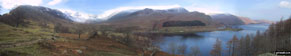

Haweswater Reservoir from Rough Crag (Riggindale)

Kidsty Pike from Rough Crag (Riggindale)

Riggindale and Haweswater Reservoir from Riggindale Crag

Blea Water from Rough Crag (Riggindale)

Kidsty Pike from Riggindale Crag

Rough Crag (Riggindale) from Riggindale Crag


Yoke, Ill Bell and Froswick from High Street

High Street from Mardale Ill Bell

Harter Fell from Mardale Ill Bell

Small Water and Haweswater Reservoir from Nan Bield Pass

Yoke, Ill Bell and Kentmere Reservoir from Nan Bield Pass

Small Water with Rough Crag (Riggindale) beyond from Nan Bield Pass

Haweswater Reservoir from Adam Seat


High Street, The Rigg and Rough Crag (Riggindale) across Haweswater Reservoir

Harter Fell, Mardale Head and The Rigg across Haweswater Reservoir

Gateway to Boredale Hause at Rooking

Patterdale and Glenridding from Place Fell

Brothers Water and High Hartsop Dodd from Place Fell


High Dodd (Sleet Fell) from Place Fell

Sandwick and Ullswater from the lower slopes of High Dodd (Sleet Fell)

Ullswater Shore Path between Howtown and Patterdale

Ullswater Shore Path between Howtown and Patterdale

Ullswater Shore Path between Howtown and Patterdale

Ullswater Shore Path between Howtown and Patterdale

Ullswater Shore Path between Howtown and Patterdale

Ullswater Shore Path at Side Farm, Patterdale


East from the lower slopes of Gowbarrow Fell

Stream at Collier Hagg (Gowbarrow Fell)

East from Collier Hagg (Gowbarrow Fell)

Ullswater Steamer from Yew Crag (Gowbarrow Fell)

Swinburn's Park, Watermillock and Ullswater from Yew Crag (Gowbarrow Fell)

Ullswater from Yew Crag (Gowbarrow Fell) with Arthur's Pike and Bonscale Pike beyond

Ullswater from Hind Crag (Gowbarrow Fell)

Skiddaw (left) and Longside Edge from Ullock Pike

Sale How (foreground) Blencathra (centre) and Lonscale Fell (right) from Skiddaw


The River Wye at Ashford in the Water

Bamford Moor from Ladybower Reservoir

Winhill Pike (Win Hill) from Ladybower Reservoir

Ladybower Reservoir from Derwent Edge

The Wheel Stones, Derwent Edge

The Wheel Stones, Derwent Edge

The Wheel Stones, Derwent Edge

The Salt Cellar (Boulder), Derwent Edge

The Dove Stone (Boulder), Derwent Edge

The Cakes of Bread (Boulder), Derwent Edge


Winhill Pike (Win Hill) from Ladybower Reservoir

Ladybower Reservoir from Derwent Edge

The Wheel Stones on Derwent Edge

The Wheel Stones on Derwent Edge

The Wheel Stones on Derwent Edge

Derwent Edge from the Wheel Stones

Ladybower Reservoir from Derwent Edge

Ladybower Reservoir from Derwent Edge

Winhill Pike (Win Hill) and Ladybower Reservoir from Derwent Edge

Back Tor (Derwent Edge) summit

The Derwent Edge path from Back Tor (Derwent Edge) summit

The cairn at Lost Lad, Derwent Edge

Bamford House (ruin) and Derwent Reservoir

Howden Reservoir Dam from Bamford House, Little Howden Moor

Talybont Reservoir from Twyn Du (Waun Rydd)

Bwlch y Ddwyallt from Waun Rydd


Climbing towards Pen Rhiw-calch

Talybont Reservoir from Twyn Du (Waun Rydd)

Darren Fach from Pant y Creigiau

Pen y Fan from Gwaun Cerrig Llwydion (Bwlch y Ddwyallt)


Talybont Reservoir from Darren Fach

Talybont Reservoir from the path to Pen Rhiw-calch

Pen-y-ghent from Horton in Ribblesdale

Pen-y-ghent from Brackenbottom Scar


Cadair Idris (Penygadair) from Craig Cwm Arnarch


Crib Goch from Garnedd Ugain (Crib y Ddysgl)

Great Mell Fell from the old coach road nr Barbary Rigg

Bowscale Fell, Carrock Fell and Souther Fell from the old coach road nr Barbary Rigg

Dodd (Skiddaw), Carl Side, Skiddaw and Lonscale Fell from Clough Head

Dow Crag from the path to Goat's Water

Goat's Water from Goat's Hawse

Blencathra from Little Mell Fell


Blencathra (or Saddleback) from Clough Head


Ullswater from Gowbarrow Fell (Airy Crag)

Skiddaw and Keswick from Skelgill Bank on the way to Cat Bells (Catbells)

Skiddaw, Blencathra (or Saddleback) and Derwent Water from Cat Bells (Catbells)


Hindscarth, Scope End and Robinson from Newlands Church


Stickle Tarn from the path up Pavey Ark and The Langadale Pikes

The Pennine Way to Upper Booth from the top of Jacob's Ladder (Edale)

The River Noe and The Pennine Way from the top of Jacob's Ladder (Edale)

Noe Stool from the top of Jacob's Ladder (Edale)


Bow Fell (Bowfell) from Scafell Pike

Great Gable (right) and The Buttermere Fells (centre) from Scafell Pike

Scafell (left) and Wast Water (centre) from Scafell Pike

Glen Nevis from the Ben Nevis Tourist Path

Glen Nevis from the Ben Nevis Tourist Path

Views from the Ben Nevis Tourist Path

Views from the Ben Nevis Tourist Path


Icy dismantled railway at Redgate Head on Bolt's Law (also C2C cycle path)


Rookhope Arch looking E towards Rookhope

Cutting at the top of Bolt's Law incline


Holly in Bloom on Devil's Dyke


Ditchling Beacon from Ditchling

Birling Gap and the Seven Sisters from Beachy Head


Ravenscar from the beach at Robin Hood's Bay


Cleveland Way National Trail sign at Robin Hood's Bay, with Ravenscar beyond

Robin Hood's Bay from The Cleveland Way

Robin Hood's Bay and Ravenscar from The Cleveland Way


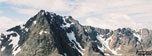
*Ben Nevis from Carn Mor Dearg
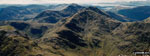
*Mullach nan Coirean and Meal a' Chaorainn from Ben Nevis
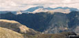
*Ben Nevis and The Aonach Eagach Ridge from Beinn Fhada

The Carn Mor Dearg (CMD) Arête

The Carn Mor Dearg (CMD) Arête

The North Face of Ben Nevis from Carn Mor Dearg

Approaching Swirral Edge in the Snow


Catstye Cam (shoulder left) and Raise (Helvellyn) above Keppel Cove from Red Tarn Beck in the snow

Birkhouse Moor from Hole-in-the-Wall in the snow


St Sunday Crag above Grisedale from Hole-in-the-Wall in the snow

Embsay Crag from SE corner of Embsay Reservoir

Embsay Crag from Embsay Reservoir


Unusual signpost near Embsay Reservoir

High Pike (Caldback) from Carrock Fell

Skiddaw amd Little Man (Skiddaw) from Carrock Fell


Carrock Fell from High Pike (Caldbeck)

Llyn Cau and Craig Cwm Amarch from the Minffordd Path

Llyn Cau from the Minffordd Path

Cadair Idris (Penygadair) Summit from the Minffordd Path

Cadair Idris (Penygadair) Summit from the Pony Path

Cadair Idris (Penygadair) summit from Cyfrwy

Tyrrau Mawr (Craig-las) and The Coast from the summit of Cyfrwy

Mynydd Moel and Cadair Idris (Penygadair) from the Pony Path near Cyfrwy summit

Craig Cwm Amarch and Llyn Cau from Mynydd Moel


*Mullach nan Coirean and Meal a' Chaorainn from Ben Nevis

Trow Gill just beyond Ingleborough Cave

The Ravine at Trow Gill nr Ingleborough Cave

Fell Beck pouring into Gaping Gill

Fell Beck just before pouring into Gaping Gill


Clapham and Newby Moss from Little Ingleborough

Paddy's Pole (Fair Snape Fell) from Parlick
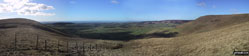
*South West from Blindhurst Fell

Parlick from Paddy's Pole (Fair Snape Fell)

Fiendsdale Head from Paddy's Pole (Fair Snape Fell)

Beacon Fell from Paddy's Pole (Fair Snape Fell)

Paddy's Pole (Fair Snape Fell) and Parlick from Fiendsdale Head

Parlick from Higher Snape Farm


Knotteranum from Bowland Knotts

Bowland Knotts (Crutchenber Fell)

Looking South from Bowland Knotts (Crutchenber Fell)

West End of the Woodhead Tunnel


Waterfall on Middle Black Clough


The Pennine Way on Clough Edge above Torside Clough


Fire Damaged Stile on Yellowslacks


The famous 'kissing' Wain Stones


Glossop from Higher Shelf Stones


19th Centuary Grafitti on Higher Shelf Stones

19th Centuary Grafitti on Higher Shelf Stones


Illgill Head and Wast Water from Sca Fell

Wast Water from summit of Sca Fell

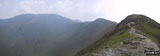
*Skiddaw, Little Man (Skiddaw), Carl Side, Longside Edge and Ullock Pike from The Edge

Little Man (Skiddaw), Carl Side and Longside Edge from Ullock Pike
*Bassenthwaite Lake from Ullock Pike


Little Man (Skiddaw) from Carl Side Tarn

Longside Edge and Ullock Pike from Carl Side Tarn


Derwent Water and Keswick from Skiddaw

Great Calva from Lonscale Fell

Burnt Horse from Lonscale Fell
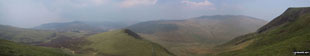
*Great Calva, Burnt Horse, Blencathra (Saddleback) and Lonscale Crags from (North of) Lonscale Fell
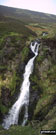
Whitewater Dash (Waterdall) on the Cumbria Way, Back o' Skiddaw

The Cumbria Way and Dash Beck from the top of Whitewater Dash (Waterfall), Back o' Skiddaw

Great Calva and Whitewater Dash from The Cumbria Way at Melbecks, Back o' Skiddaw


Gunson Knott, Crinkle Crags (Long Top) and Crinkle Crags (South Top) from Slight Side

Esk Pike and Bow Fell (Bowfell) from Slight Side

Burnmoor Tarn from Slight Side


Yewbarrow (centre) and Pillar (right) from Sca Fell

Pillar (left), Kirk Fell and Great Gable (right) from Sca Fell

Great Gable (back), Lingmell, the shoulder of Scafell Pike and Mickeldore from Symonds Knott

Knott and Over Water from Binsey
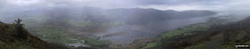
*Bassenthwaite Lake from Dodd (Skiddaw)


North to The Solway Firth from Binsey

Skiddaw from Whittas Park, North of Binsey

Windblown tree in Whittas Park, North of Binsey


Skill Beck Waterfall at the Old Sawmill Tearooms, Dodd Wood

Southern End of Bassenthwaite Lake from Dodd (Skiddaw)

Derwent Water from Dodd (Skiddaw) summit

Braithwaite from Dodd (Skiddaw)
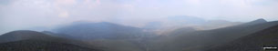
*Bakestall, Great Calva, Skiddaw House, Blencathra (Saddleback) and Lonscale Fell from Skiddaw


Little Man (Skiddaw) from Gale Road, near Applethwaite


Disused Quarry Pool near Pont Cyfyng

Carnedd Moel Siabod summit in mist
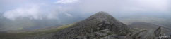

Llyn y Foel from Carnedd Moel Siabod

The Moel Siabod Ridge from Carnedd Moel Siabod

Llyn y Foel from the Moel Siabod Ridge

Descending the Moel Siabod Ridge

The Carneddau from the Plas y Brenin path up Moel Siabod

Carnedd Moel Siabod and Llynnau Mymbyr from Plas y Brenin, Capel Curig

Eglwys Santes Julitta (Church of St Julitta), Capel Curig

Great Calva, Burnt Horse, Blencathra and Lonscale Crags from (North of) Lonscale Fell

Descending Carnedd Llewelyn via the Bwlch Eryl Farchog ridge

Stonechat at Llyn Idwal Nature Reserve


Chinook Helipcopter landing astride the Bwlch Eryl Farchog ridge

Llyn Bochlyd through the cloud from Glyder Fach

Llyn Idwal and Pen yr Ole Wen from below Glyder Fawr

Glyder Fach, Glyder Fawr and Idwal Cottage from Pen yr Ole Wen


Climbing Foel Meirch and Carnedd Dafydd via Mynydd Du

The Cwm Llafar Horseshoe via Mynydd Du


Cefn Ysgolion Duon from Carnedd Dafydd

Carnedd Llewelyn from Bwlch Cyfryw-drum

Carnedd Dafydd from Bwlch Cyfryw-drum


Foel Ganol and Yr Elen from Braich y Brysgyll

Carnedd Dafydd from Gwaun-y-gwiail, Bethesda


Lake Windermere from Sour Howes

Troutbeck Tongue, Thornthwaite Crag, Yoke and Ill Bell from Hagg Bridge


Blencathra (Saddleback) from High Rigg


Helvellyn and Thirlmere from High Rigg


Foel Meirch from Carnedd Dafydd

The Rochdale Canal (Lobb Mill - Lock 16)

Sunset on Scafell Pike, Mickledore and Sca Fell from Wasdale


The famous Striding Edge from Helvellyn


The Cantilever Stone near summit of Glyder Fach


Embsay Crag from Embsay Reservoir

Pendle Hill from Crookrise Crag


Waterfall Gill Beck, Embsay Moor

Old quarry workers dwellings at Crowberry Haws near the foot of The Old Man of Coniston

Grasmere from Loughrigg Terrace

Rydal Water from Loughrigg Terrace


Trout Beck, Thornthwaite Crag, Froswick and Ill Bell from Troutbeck Park

Stony Cove Pike (Caudale Moor), Threshthwaite Mouth and Thornthwaite Crag from Troutbeck Park


Thornthwaite Crag and Yoke from Hagg Gill

Troutbeck Tongue, Thornthwaite Crag, Yoke and Ill Bell from Lowther Brow


Plaque at the bottom of Castle Crag


Derwent Water and Borrowdale from Castle Crag

Shepherds Crag from Castle Crag

Derwent Water from the lower slopes of Castle Crag

Lake Windermere and Ambleside from the lower slopes of Snarker Pike

Grasmere from the lower slopes of Snarker Pike

Lake Windermere from Snarker Pike

The Kirkstone Pass from Snarker Pike summit

Lake Windermere from Snarker Pike summit

Brothers Water from the summit of Red Screes
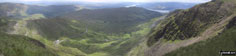
*The Kirkstone Pass from Red Screes

Middle Dodd and Brothers Water from Red Screes


Brothers Water from Middle Dodd


Mosedale (Mungrisdale) from Carrock Fell

Carrock Fell from High Pike (Caldbeck)

Bowscale Fell from High Pike (Caldbeck)

Lingy Hut (Bothy) with Mosedale beyond

Knott and Skiddaw from Great Lingy Hill

Great Calva from Knott (Uldale Fells)

Mosedale (Mungrisdale) from Great Calva

Grainsgill Beck from Grainsgill Beck Bridge

Grainsgill Beck from Grainsgill Beck Bridge

Little Hart Crag from The Scandale Pass

Brothers Water and Hartsop from Dove Crag

High Pike (Scandale) and Lake Windermere from Dove Crag

Low Pike (Scandale) and Lake Windermere from High Pike (Scandale)

Low Pike (Scandale) and Lake Windermere from High Pike (Scandale)


High Pike (Scandale) from Low Pike (Scandale)


Windmill near Little Wilbraham


The Sussex Downs near Ditchling Beacon

The Sussex Downs near Ditchling Beacon

The Sussex Downs near Ditchling Beacon

The Sussex Downs near Ditchling Beacon
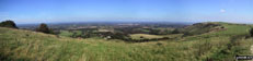
*The Sussex Downs near Ditchling Beacon


View Point nr Norbury Park House

Wood Sculptures nr Norbury Park House


Stepping Stones across the River Mole on the North Downs Way
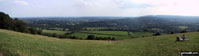
*The North Downs from Box Hill

Ruined Chapel, Minsmere Nature Reserve

Suffolk Coast at Minsmere Nature Reserve (with Sizewell in the distance)

Minsmere New Cut Canal, Eastbridge


Old Railway Line near Morridge Side


Pedders Way and Norfolk Coast Path West of Sheringham


The North Norfolk Railway (Poppy Line), Sheringham

Shakespeare's Monument in Stratford-upon-Avon


The River Stour at Clifford Chambers

The River Avon near Stratford-upon-Avon

The River Avon near Stratford-upon-Avon

Holy Trinity Church (Shakespeare's Burial Place), Stratford-upon-Avon

The River Avon, Stratford-upon-Avon


The Totem Pole, Virginia Water

Information on The Totem Pole, Virginia Water

Information on The Totem Pole, Virginia Water


Information on the Roman Ruins, Virginia Water


Hellman's Cross village stocks

Hellman's Cross village stocks information board

Country Track near Taverners Green

Hatfield Broad Oak Village Sign


(Converted) Oast House nr Penshurst


Seat Sandal with Fairfield beyond from Grasmere


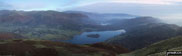
*Grasmere Village and Grasmere from Silver How


Great Langdale from Silver How


On the summit of Meall a' Bhuiridh


West into Borrowdale from Huck's Bridge
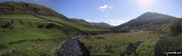
*Borrowdale from Huck's Bridge - with Winash (left), Borrow Beck (centre) and Mabbin Crag (right)


SE into Borrowdale from Mabbin Crag

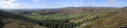


Whinfell Tarn from Whinfell Beacon

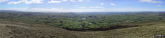
*Kendal and Morecambe Bay from Whinfell Beacon

Borrowdale from Whinfell Beacon


An abandoned car on Cowpe Lowe

Waugh Well Reservoir from Cowpe Lowe


Waugh Well Reservoir Dam and Outflow


Boarsgreave and Cowpe Reservoir from Cowpe Moss


The Bridgewater Canal nr Dunham Town


Darnall Radio Telescope nr Wettenhall

Some (slightly too) inquisitive Cows!

More (definitely too) inquisitive Cows!

Darnall Radio Telescope nr Wettenhall


The Hill at Grinshill from Clive

Church Stretton from Pole Bank (Long Mynd)

Red Screes (left), Thornthwaite Crag, Froswick, Ill Bell and Yoke from Baystones (Wansfell)

Windermere (with Blenham Tarn far right) from Baystones (Wansfell)

Ullswater and Hallin Fell from Little Mell Fell

Great Mell Fell from Little Mell Fell

Little Mell Fell from Great Mell Fell


Keswick and Bassenthaite Lake from High Rigg

Ladybower Reservoir from the lower slopes of Winhill Pike

Lose Hill (Ward's Piece) and Ladybower Reservoir from Winhill Pike (Win Hill)

Abney Clough from Sir William Hill above Eyam

Staffordshire and Worcestershire Canal

Whernside from near Braithwaite Wife Hole

North from the Corridor Route en-route to Scafell Pike

High Pike (Scandale) from Low Pike (Scandale)

High Stile and Red Pike from the Gatesgarth, SE of Buttermere

Dove Crag from High Pike (Scandale)

Fairfield and Hart Crag from Dove Crag


Ambleside and Windermere from Nab Scar

Hay Stacks from Gatesgarth, SE of Buttermere


Derwent Water, Blencathra, Walla Crag and Bleaberry Fell from High Spy


Derwent Water and Bleaberry Fell from Maiden Moor


Grasmere from Loughrigg Terrace


The River Kinder on Kinder Scout near Kinder Downfall

The bottom of Jacob's Ladder (Edale)

Edale from Kinder Low (Kinder Scout)


Wolfscote Dale from above Coldeaton Bridge

Wolfscote Dale from Biggin Dale


Oaken Clough nr Black Chew Head (Laddow Rocks)

North East from Bla Bheinn (Blaven)


Windermere from Baystones (Wansfell)

Moss covered wall in Robin Lane nr Troutbeck

The famous pub sign at The Mortal Man, Troutbeck
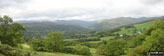
*Ambleside from the lower slopes of Baystones (Wansfell)
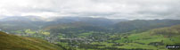
*Ambleside from the upper slopes of Baystones (Wansfell)

Bla Bheinn (Blaven) from An Dorus


Cefn-Du, Moel Eilio (Llanberis), Foel Gron, Foel Goch and Moel Cynghorion from Snowdon (Yr Wyddfa)


Scafell, Scafell Pike, and Great End from White Maiden and Walna Scar

Coniston Valley Inversion from White Maiden and Walna Scar

Broughton Moor Inversion from White Maiden and Walna Scar

Red Gill Beck ravine SE of Walna Scar


Striding Edge from the top of Swirral Edge on Helvellyn

Ullswater from Glenridding Dodd


Striding Edge and Red Tarn from Swirral Edge


Yoke, Ill Bell and Froswick seen from the path to Harter Fell

Froswick and Thornthwaite Crag seen from Ill Bell


Froswick and Ill Bell from the path to Thornthwaite Crag


Angle Tarn Pikes, Place Fell and Hartsop from Hartsop Dodd


Dove Crag, Hart Crag and Fairfield from Hartsop Dodd

Froswick, Ill Bell and Yoke from Stony Cove Pike (Caudale Moor)

Troutbeck from Stony Cove Pike (Caudale Moor)


Mellbreak from Mellbreak (North Top) with Red Pike beyond


Robinson and Buttermere from Mellbreak

Grasmoor across Crummock Water


Grasmoor summit from Mellbreak


Frozen path on Mellbreak North end


Llyn Llydaw from Snowdon (Yr Wyddfa)


Bowness-on-Windermere from Claife Heights (High Blind How)

Climbing Beacon (Blawith Fells) with Coniston Water beyond

Beacon (Blawith Fells) from Beacon Tarn

Blawith Common, Torver Low Common and The Coniston Fells from Beacon (Blawith Fells)

Peel Island and Coniston Water from Beacon (Blawith Fells)

Forestry Works on Harter Fell (Eskdale)

Eskdale from Ill Crag (Scafell Massif)

The Langdale Pikes and Windermere from Great End (Scafell Massif)

Seathwaite Fell from Great End (Scafell Massif)


Ill Crag (left) Broad Crag (centre) and Scafell Pike (right) from Great End (Scafell Massif)


Duddon Estuary from Stickle Pike (Dunnerdale Fells)


The Greenburn Valley from Great Carrs


Little Langdale from Wet Side Edge


The Old Man of Coniston, Brim Fell and Dow Crag from Swirl How

Pike of Blisco (Pike o' Blisco) and the Wrynose Pass from Wet Side Edge

The Scafell Massif from Great Carrs

Buck Barrow from Kinmont Buck Barrow

Burnmoor (left) and Whitfell (Whit Fell) (centre) from Kinmont Buck Barrow

The Duddon Estuary from Whitfell (Whit Fell)

The Esk Estuary from Whitfell (Whit Fell)

The Duddon Valley from Whitfell (Whit Fell)

Meldon Viaduct from Meldon Reservoir

Yes Tor from High Willhays (foreground)


Parlick from Paddy's Pole (Fair Snape Fell)

Parlick and Paddy's Pole (Fair Snape Fell) from Longridge Fell (Spire Hill)


Glen Nevis from Glen Nevis Youth Hostel

Glen Nevis from Glen Nevis Youth Hostel

Hartsop and Ullswater beyond from Hartsop Dodd

Stony Cove Pike (Caudale Moor) and Thornthwaite Crag from Hartsop

The Yorkshire Three Peaks from Fountains Fell

Pen-y-ghent from Horton in Ribblesdale

The River Swale with Muker beyond


Gill Head and Swaledale from Gunnerside

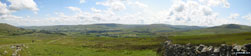
*Wensleydale from Great Shunner Fell

Rannerdale Knotts, Crummock Water, Mellbreak and Loweswater from Robinson

The Newlands Valley from Dale Head (Newlands)

Hindscarth, Scope End (foreground) and Robinson from Little Town

Helvellyn (left) High Rigg (foreground) and Thirlmere from Lonscale Fell

Keswick and Derwent Water from Latrigg

Errwood Reservoir in the Goyt Valley

Ben Nevis from the top of the Aonach Mor Ski Chair Lift


Swirral Edge and Catstye Cam from Helvellyn

Striding Edge from the top of Helvellyn

Swirral Edge (Helvellyn) and Catstye Cam

Kirk Fell (left), Great Gable (centre) and Lingmell from across Wast Water


Cat Bells (Catbells) and Derwent Water from Surprise View nr Ashness Bridge


Farmcote from Campden Lane (Track)

Lynes Barn Farm from Campden Lane (Track)


Ravenscar across Robin Hood's Bay

Robin Hood's Bay from Ravenscar

Lighthouse nr Robin Hood's Bay


Stone waymark to Darwen Tower, Darwen Moor


The famous sign post featuring John O'Groats at Land's End

The First and Last House, Land's End

On The South West Coast Path, Land's End

Views from The South West Coast Path, Land's End

Unusual stone wall seen from The South West Coast Path near Land's End

Walking The South West Coast Path near Land's End

Heading for Trevilley, Land's End

Whitesand Bay, The South West Coast Path, Land's End


Higher Tor and Belstone Tor from Steeperton Tor


The South West Coast Path, Land's End

Dr Johnson's Head on The South West Coast Path at Land's End

Looking East from Bull Hill (Holcombe Moor)

Looking East to Hail Storm Hill from Bull Hill (Holcombe Moor)

Ascending Bull Hill (Holcombe Moor)

Pilgrim's Cross, Holcombe Moor


West from Peel Tower, Holcombe


The Old Lighthouse on Spurn Head


The New Lighthouse on Spurn Head

The Lifeboat Jetty on Spurn Head


Weir Cottage, near Eythrope Park


The Official Entrance to Chequers


River Barle Valley between Simonsbath and Cow Castle

River Barle Valley between Simonsbath and Cow Castle


Lawn Hill on the way to Habberley

Carn Kez on The South West Coast Path at Land's End

Sgurr Dearg, Isle of Mull from Oban

Waterfalls above Kinlochmore (Grey Mares Trail)

Loch Leven from the top of the Waterfalls above Kinlochmore (Grey Mares Trail)

Allt Coire na Ba and Kinlochleven

Early morning sunrise at Connel, Oban


Yellow Craig Wood, Bridge of Allan


Kirk Logie from Yellow Craig Wood on the lower slopes of Dumyat

Airthrey Castle and Stirling University from Dumyat


Lossburn Reservoir from Dumyat


Boarding the The Cal Mac Ferry at Oban


Howemoore Hostel on South Uist

Inside Howemoore Hostel on South Uist

Loch Lomond at Rowcoish Bothy on the West Highland Way

Loch Lomond at Dovne Bothy on the West Highland Way

Rowcoish Bothy The West Highland Way

Glen Shiel from Biod an Fhithich

Near Rowcoish Bothy on The West Highland Way


The Bridge over the River Cree at Newton Stewart

Cardoness Castle near Gatehouse of Fleet


Looking over the Machars near Wigtown

Wimbleball Lake from Hadborough


Wildboarclough and Shutlingsloe from Teggs Nose


Kerridge from Rainow in the snow

The Cheshire Plain from Mow Cop


Lose Hill (Ward's Piece) and Back Tor (Hollins Cross) from The Edale Valley

Mam Tor and Lord's Seat (Mam Tor) from The Edale Valley

The Mam Tor Ridge from the Edale Valley

The remains of a crashed aircraft on Mill Hill (Ashop Head)


Packhorse Bridge at the North end of Howden Reservoir


The Perils of getting lost on the Kinder Scout


Milldale Bridge and River Dove

Washgate Bridge over The River Dove near Hollinsclough


Earl Sterndale and High Wheeldon


River Derwent from Darley Bridge

Westend Moss from Crowden Brook


Views from The Tissington Trail nr Tissington Village

Views from The Tissington Trail nr Tissington Village

Views from The Tissington Trail nr Tissington Village

Views from The Tissington Trail nr Tissington Village

Views from The Tissington Trail nr Tissington Village

The Tissington Trail nr Tissington Village

The Tissington Trail nr Tissington Village


Black Hill (Soldier's Lump) Summit

Black Hill (Soldier's Lump) from Black Chew Head (Laddow Rocks)


Whitesand Bay, St David's Head


Snow on Kinder Scout from Alport Castles

Snow on Kinder Scout from Alport Castles

Snow on Kinder Scout from Alport Castles


Great Dove Stones from Yeoman Hey Reservoir

Dovestones Reservoir from Ashway Rocks

Dovestones Reservoir from Hoarstone Edge

Dove Stone Reservoir with Great Dove Stone Rocks (top right)

Bramah Edge from Millstone Rocks (Lad's Leap)

Deepclough Farm from Bramah Edge

Valehouse Reservoir and Bottoms Reservoir from Lad's Leap

Woodhouse Reservoir from Highstone Rocks

Rye Loaf Hill from Attermire Scar
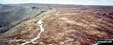
*Aerial Panorama above Grindslow Knoll (Kinder Scout) looking towards Crowden Tower (Kinder Scout)
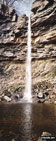
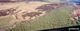
*Aerial Panorama of Stanage Edge
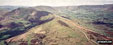
*Aerial Panorama of Hollins Cross and Mam Tor from above Back Tor

Aerial Shot of Castleton and Winnats Pass

Aerial Shot of Castleton with Winnats Pass and Lord's Seat (Mam Tor) and Mam Tor

Aerial view of Kinder Reservoir, Hayfield

Aerial view looking West to Hurst Reservoir, Glossop
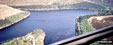
*Aerial Panorama looking East across Howden Reservoir
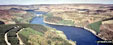
*Aerial Panorama looking North up Derwent Reservoir to Howden Dam with Howden Reservoir beyond
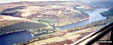
*Aerial Panorama Looking South East down Ladybower Reservoir

Aerial view looking North up Derwent Reservoir

Aerial view looking South East down Ladybower Reservoir

Swarth Fell summit cairn in the snow with Wild Boar Fell in the background

The Mallerstang Valley from The Nab, Wild Boar Fell

Little Fell (Lunds Fell) (Mallerstang) from a snowy Wild Boar Fell

Pen-y-ghent from Brackenbottom on The Yorkshire Three Peaks Challenge

West along Swaledale to Gunnerside from High Harker Hill

Iron Age Defences on High Harker Hill

Stepping Stones across River Swale

Dovestones and Yeoman Hey Reservoirs from Dean Rocks

Greenfield Reservoir from Raven Stones Brow

Dovestones Reservoir from Bramley's Cot


Yeoman Hey and Greenfield Reservoirs with Raven Stones Brow beyond


Entrance to Jingle Pot in Chapel-le-Dale

Jingle Pot Gill, Chapel-le-Dale

Bridge Out! - River Swale nr Reeth


River Swale from Harkerside Place, Fremington


River Swale and High Harker Hill from Reeth

High Harker Hill from nr Reeth


Pen-y-ghent from Brackenbottom


North East from Easterside Hill

Easterside Hill from Moor Gate


Pot Hole Entrance above Pen-y-ghent Gill


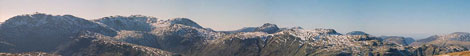
*Bowfell, Esk Pike and (the end of) The Scafell Massif from Langdale
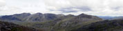
*The Scafell Ridge from Crinkle Crags (Long Top)

Linton Falls at Linton near Grassington

Linton Falls at Linton near Grassington

Leeds and Liverpool Canal at East Marton


Cracoe Fell, Flasby Fell, Skipton Moor and Pendle Hill from Harrows Hill

Shooters cabin on Embsay Moor looking over Lower Barden Reservoir to Simon's Seat

Knowlemere Manor near Dunsop Bridge

Burnsall Bridge from Burnsall Village Green


Castlerigg Stone Circle nr Keswick


Looking North to Stockley Bridge from Sprinkling Tarn


View of the coast from (just below) The Table, Quirang

Loch Brittle from (near) Sgurr Dearg summit


Bow Fell (Bowfell) from Red Tarn (Langdale)


The Langdale Pikes from Wetherlam


The Langdale Pikes from Prison Band


Snow on The Old Man of Coniston

River Derwent from Crow Stone Edge

Wilfrey Edge towards Bleaklow Hill from Howden Edge


Towards Edale Valley from Howden Edge

Ladybower Reservoir from nr Alport Castles

Bleaklow Stones (Bleaklow Hill)

Bleaklow Stones (Bleaklow Hill)

Derwent Dam and Ladybower Reservoir

Woodland above Ladybower Reservoir

Derwent Valley from Bleaklow Stones (Bleaklow Hill)

Black Ashop Moor from Seal Edge

Looking down the Langdale Valley from Loft Crag

Mist in the Langdale Valley from Loft Crag

Honister Pass from Dale Head (Newlands)

The Newlands Valley from Dale Head (Newlands)

Cat Bells (Catbells) and Derwent Water from Maiden Moor


Burbage Edge from Goyt's Moss in the snow

Coniston Water from The Old Man of Coniston


Snow on Helvellyn from Fairfield

The Old Man of Coniston beyond Great Rigg from Fairfield

Snow on The col between Hart Crag and Fairfield

Snow on Fairfield and Hart Crag from Dove Crag


Stybarrow Dodd from Sticks Pass

Keppel Cove and Catstye Cam from White Side

Raise (Helvellyn) from White Side


Red Tarn and Striding Edge from Helvellyn

Thirlmere from Browncove Crags


The setting sun on Scafell Pike from Wasdale Head


Burnmoor Tarn from the approach to Illgill Head

Great Gable and Kirk Fell (left) from Illgill Head

Wast Water from Illgill Head and Whin Rigg

Above Sour Milk Falls nr Grasmere

Above Sour Milk Falls nr Grasmere


The Newlands Valley from Dale Head (Newlands)

Newlands Church nr Little Town

Dalehead Tarn from Dale Head (Newlands)

The High Stile Ridge (High Crag, High Stile and Red Pike) beyond Buttermere from Hindscarth Edge

Honister Pass from Hindscarth Edge


Skiddaw and Keswick from Robinson

Maiden Moor from High Snab Bank


Pike of Stickle from Loft Crag

Slater Bridge, Little Langdale


Waterfall en-route to Ben Nevis


Heather and Rock en-route to Ben Nevis

Lochan Meall an t-Suidhe en-route to Ben Nevis

Waterfall en-route to Ben Nevis


Lochan Meall an t-Suidhe en-route to Ben Nevis

Climbing Ben Nevis from Achintee

Kinder Downfall on Kinder Scout

Snow on The Old Man of Coniston

Snow on The Old Man of Coniston

Snow on The Old Man of Coniston


Snow on The Old Man of Coniston


Towards Elterwater from Loughrigg Fell

Towards Elterwater from Loughrigg Fell


Wolfscote Dale at Coldeaton Bridge


Blue Bells in the Beech Woods on the Wormsley Estate nr Turville


Ascending Pen Y Fan via Corn Du

Ascending Pen Y Fan via Corn Du


The Buckinghamshire Countryside


The Buckinghamshire Countryside

The Buckinghamshire Countryside


Looking East at Carn Ingli, The Preseli Hills

Heading South from Carn Edward in the Preseli Hills

Carn Edward in the Preseli Hills on the approach to Carn Ingli

Just North of Sychbant in the Preseli Hills


Waterfalls next to the Blaen y Glyn Car Park

Waterfalls next to the Blaen y Glyn Car Park

Talybont Reservoir from (near) the summit of Cefn Tarenni

Approaching Corn Du from Pen y Fan


Cribyn and Neuadd Reservoir from Pen y Fan


Crag Lough from Hadrian's Wall


Crag Lough seen from Hadrian's Wall


Shelter on the Pennine Way, The Cheviot


Scald Hill, Broadhope Hill and Cold Law from The Cheviot

Views of Scotland from The Cheviot

Hedgehope Hill from The Cheviot


Broadhope Hill and The Cheviot from Cold Law

Bamburgh and The Farnes from Cold Law

Grindsbrook Clough from Kinder

Jacob's Ladder (Edale) and the Edale Valley from the Kinder Plateau


Backside Wood at Jagger's Clough near Edale


Win Hill Pike from Ollerbrook Booth


Lose Hill (Ward's Piece) from Mam Tor


The River Wye in Water-cum-Jolly Dale


Mardale Ill Bell, High Street and Rough Crag (Riggindale) above Blea Tarn from Nan Bield Pass

Small Water and Hayeswater Reservoir from Nan Bield Pass


Hayeswater from the col between Thornthwaite Crag and High Street

Ill Bell (front) and Yoke from Froswick

Froswick (right) and Red Screes (back) from Ill Bell

Froswick (front), Thornthwaite Crag and High Street from Ill Bell


The Langdales from High House Tarn

Derwent Water and Borrowdale from Glaramara

Derwent Water and Borrowdale from Glaramara
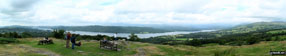

Buttermere with Fleetwith Pike beyond

Sca Fell (left) and Scafell Pike (centre) from Crinkle Crags (Long Top)

Great Gable from Red Pike (Wasdale)

Harrison Stickle from Thunacar Knott

Seathwaite Tarn and Duddon Valley from Grey Friar


Skiddaw from High Raise (Langdale)


Watendlath Tarn from the path to High Tove and High Seat

Red Pike and Wasdale Head from Lingmell


The Snowdon Mountain Railway with Llyn Padarn and Llanberis beyond

Wast Water with Great Gable beyond


Illgill Head and Wast Water from Lingmell

Wast Water and Wasdale Head from Lingmell


Approaching Mickledore and Scafell Pike from Wasdale Head


Llyn Llydaw from Snowdon (Yr Wyddfa)

Snowdon (Yr Wyddfa) from Crib Goch


Kinder Reservoir with Kinder Scout beyond

Ffynnon Lloe from Pen yr Ole Wen

Carnedd Llewelyn from Carnedd Dafydd

Nant Ffrancon from Pen yr Ole Wen


Y Garn (Glyderau) from Glan Dana


Views from Bla Bheinn (Blaven)


Bla Bheinn (Blaven) beyond Loch Slapin


Sgurr Na Stri and Camasunary from Bla Bheinn (Blaven)

Fairoak Pool in winter, Cannock Chase


Rock Formations on The Roaches


Llyn Ogwen and Y Garn (Glyderau) from Glan Dena

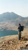
Lynn Llydaw with Y Lliwedd beyond from Crib Goch

Glas Llyn from Snowdon (Yr Wyddfa)

Descending the Pyg Track, Snowdon (Yr Wyddfa)

Descending the Pyg Track, Snowdon (Yr Wyddfa)

Cwm Clogwyn from Snowdon (Yr Wyddfa)


Approaching Snowdon (Yr Wyddfa) Summit

Approaching Snowdon (Yr Wyddfa) Summit


Glaslyn and Llyn Llydaw from Snowdon (Yr Wyddfa)
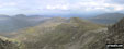
*Looking SE towards Capel Curig from Glyder Fawr

Y Garn (Glyderau) from Llyn Idwal


The Cantilever Stone on Glyder Fach

Llyn Bochlywd from Glyder Fach


Looking SE towards Capel Curig from Glyder Fawr


The Glyderau from Llyn Bochlwyd

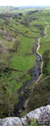
*Looking Over Malham Cove, Malham


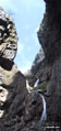


Jack and Jill Windmills from Clayton


Western Brow from Ditchling Beacon

Ditchling from Ditchling Beacon

Y Lliwedd Summit (with Y Lliwedd East Top beyond)

Buttermere from Honister Crag, Fleetwith Pike

River Alport nr Hayridge Farm, Alport Dale

River Alport nr Hayridge Farm, Alport Dale
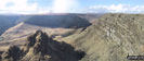
*Alport Dale from Alport Castles (looking West)
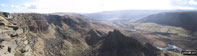
*Alport Dale from Alport Castles (looking South)

Alport Dale from Alport Castles (looking North West)

Ladybower Reservoir from Lockerbrook

Looking Down Red Brook from Kinder Scout

Kinder Downfall on Kinder Scout

Derwent Reservoir Dam (overflowing)

High Stile and Gatesgarthdale Beck from Honister Pass

Buttermere from Fleetwith Pike

Hathersage Valley from Over Owler Tor, Hasthersage Moor in the snow


Alport Dale from Alport Castles
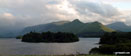
*High Spy, High Spy (North Top) and Cat Bells (Catbells) and Derwent Water from Latrigg
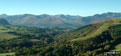
*Derwent Water, Cat Bells (Catbells) and The Newlands Fells from Castlerigg

Sunset from the beach at Tokavaig


Red Cuillin from across Loch Chrioso

Bla Bheinn (Blaven) from across Loch Chrioso

Waterfall en-route to Bla Bheinn (Blaven)

Isle of Rum from Bla Bheinn (Blaven)

Marsco and Sgurr Nan Gillean from Bla Bheinn (Blaven)

Sgurr Na Stri and Camasunary from Bla Bheinn (Blaven)
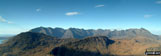
*The Cuillin from near the Summit of Bla Bheinn (Blaven)

The Gabro on the main Cuillin Ridge

Bla Bheinn (Blaven) beyond Loch Slapin


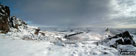


Snow on Tithesworth Reservoir from The Roaches
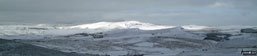


Snow on St Sunday Crag from Gray Crag (Hayeswater)

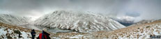
*Snow on Hayeswater from High Street
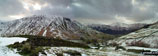
*Snow on Gray Crag (Hayeswater) from High Street

Sunset on Derwent Water from Friar's Crag

Snow on Catstye Cam from Birkhouse Moor

Sharp Edge, Blencathra or Saddleback (Hallsfell Top) from Bannerdale Crags

Blencathra or Saddleback from Gategill Fell


Sheffield Pike from the lower slopes of Birkhouse Moor


Striding Edge and Red Tarn from Helvellyn Summit


Catstye Cam (centre) and Helvellyn from Birkhouse Moor

Sheffield Pike from the lower slopes of Birkhouse Moor

Ullswater and Glenridding from the lower slopes of Birkhouse Moor

Skiddaw from The Newlands Valley
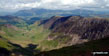
*The Newlands Valley from Dale Head (Newlands)

The Newlands Valley from Dale Head (Newlands)


The Newlands Valley from Hindscarth

The Newlands Valley from Scope End

Carl Side and Skiddaw Lower Man

Monument on the Cumbria Way near Applethwaite

Derwent Water and Cat Bells (Catbells) from Skiddaw


Ullock Pike and Longside Edge from Skiddaw
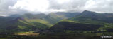
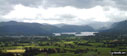
*Keswick, Derwent Water and Borrowdale from Doups

The North Eastern Corrie of Ben Lui from Cononish


View from the summit of Beinn a' Ghlo (Carn nan Gabhar)


Heron Pike and Windermere from Great Rigg


Grasmere from the lower slopes of Stone Arthur

Great Rigg (left) Fairfield (centre) and Dove Crag (right) from Heron Pike


Scafell Pike, Mickledore and Sca Fell from Wasdale Head


Thirlmere from Lower Man (Helvellyn)

Swirral Edge and Catstye Cam from Helvellyn
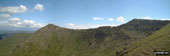
*Catstye Cam (left), Swirral Edge and Helvellyn from White Side


Wast Water and Wasdale Head from the lower slopes of Great Gable and Kirk Fell

Yewbarrow (centre) and Kirk Fell (right) from Sca Fell
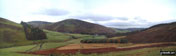
*Lamington Hill, Knowe Dod, Birthwood and the road to Culter Allers Farm from Culter Fell

The Wallace Monument and Stirling from Dumyat
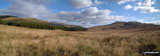
*Glen Menstrie from Lossburn Reservoir

White Side from Helvellyn Lower Man

*Lamington Hill and Knowe Dod from Culter Fell

Riggindale and Kidsty Pike from Selside Pike


Mardale Head and Riggindale from Selside Pike

The Rigg, Wood Howe and Haweswater from Selside Pike

Survey Post on Branstree (Artlecrag Pike)

Mardale Head from Selside Pike

Haweswater from Branstree (Artlecrag Pike)

Branstree (Artlecrag Pike) Summit

Cairn on Branstree (Artlecrag Pike)

Haweswater and Harter Fell from Selside Pike

Sunset on Blencathra or Saddleback from Birkrigg

Keskadale Farm from Knott Rigg

Whiteless Pike from Knott Rigg

Causey Pike and Blencathra or Saddleback from Knott Rigg


Wandope and the Hanging Valley from Ard Crags


Blencathra or Saddleback from Ard Crags

Sail (Derwent Fells) and Wandope from Ard Crags


Frosty fields across Keskadale from Ard Crags

Early morning sun on High Snab from Ard Crags


The Lion and the Lamb on Helm Crag


Easedale and Helm Crag from Calf Crag

Steel Fell and Seat Sandal from Gibson Knott


Greenburn Bottom and Helm Crag from Calf Crag

Dunmail Raise from Steel Fell (Dead Pike)

Helm Crag from Steel Fell (Dead Pike)

The Angle Tarn Pikes from Middle Dodd

The Kirkstone Pass from Kirkstone Beck

Brothers Water, Place Fell and the Angle Tarn Peaks from Middle Dodd

Ullswater and Great Mell from Red Screes

Windermere and Morecambe Bay from Red Screes


Brothers Water and Angle Tarn Pikes from High Hartsop Dodd

Dovedale and Hartsop above How from High Hartsop Dodd

The Brothers Water Valley from Kirkstone Beck on the lower slopes of High Hartsop Dodd

High Hartsop Dodd and Middle Dodd from Hartsop Hall

High Hartsop Dodd from Brothers Water


Rannerdale Knotts from Lanthwaite Green

Squat Beck below Rannerdale Knotts


Crag Hill and Wandope from Coledale Hause


Hopegill Head and Grisedale Pike from Wandope


Gasgale Gill at Coledale Hause


Blencathra or Saddleback from Great Calva


Binsey and Over Water from Great Sca Fell


Skiddaw and Bakestall from Little Calva

Brockle Crag and Bassenthwaite Lake from Great Cockup

Horsemoor Hills and Bassenthwaite Water from Brockle Crags


Blackbeck Tarn on Hay Stacks with Great Gable beyond


Dodd and Robinson from Lingcomb Edge

Crummock Water and Whiteside from Scale Beck


Low Ling Crag and Crummock Water from Blea Crag


Stonethwaite Valley from Sergeant's Crag

Rosthwaite Fell from Sergeant's Crag


The Cumbria Way near Stonethwaite

Ghyll nr Little Town, Newlands Valley


Lowthwaite Crag from Scope End

High Spy (North Top) and High Spy from Hindscarth


Cat Bells (Catbells) and Skiddaw from Maiden Moor

Cat Bells (Catbells) and Skiddaw from Maiden Moor

Crag Hill Wandope and Grasmoor from Cat Bells (Catbells)

Moel Cynghorion from the Llanberis path

Snowdon (Yr Wyddfa) Summit Cafe


Llyn Llydaw from the Pyg Track

On the Pyg track heading for Snowdon (Yr Wyddfa)


Snowdon (Yr Wyddfa) from the Miners Track

Snowdon (Yr Wyddfa) from the Miners Track

Minffordd Path to Cadair Idris

Cyfrwy from Cadair Idris (Penygadair)

Cadair Idris (Penygadair) Summit

Cadair Idris (Penygadair) and Llyn Cau from the Minffordd Path


Ashness Bridge with Skiddaw in the background

Cat Bells (Catbells) and Derwent Water from Friar's Crag
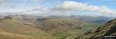
*Little Langdale with the Langdale Pikes, Helvellyn and Fairfield beyond from Wetherlam
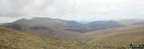
*Skiddaw from Blencathra or Saddleback (Hallsfell Top) with the Solway Firth in the distance

Sharp Edge, Blencathra or Saddleback (Hallsfell Top)

Sharp Edge, Blencathra or Saddleback (Hallsfell Top)
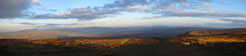
*Ingleborough and Whernside from Pen-y-ghent in the early morning light

Simon Fell from nr Broadrake Farm

Whernside from nr Broadrake Farm

Ribblehead Viaduct with Whernside beyond

A brooding Pen-y-ghent from Horton in Ribblesdale


Castle Bolton and St Oswalds Church

Muker from The Pennine Way on Great Shunner Fell

The Southern Fells from Black Combe to The Old Man of Coniston from Kirkby-in-Furness
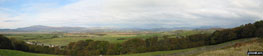
*The Southern Fells from Black Combe to The Old Man of Coniston from Kirkby-in-Furness
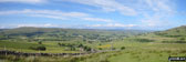
*Looking down into Hawes from The Pennine Way
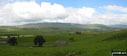
*Ingleborough and Whernside from The Pennine Way near Hull Pot
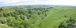
*View from the from the top of Malham Cove


Pen-y-Ghent from Horton in Ribblesdale

Nab Scar, Heron Pike, Great Rigg and Fairfield from Rydal Park

The famous Waterfalls at Rydal Hall
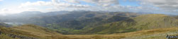
*The Old Man of Coniston (left) and The Scafell Massif from Fairfield
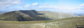
*Dollywaggon Pike, Nethermost Pike and Helvellyn from Fairfield
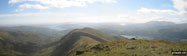
*Heron Pike and Nab Scar from Fairfield
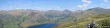

Blooming Heather on Yewbarrow with Wast Water below
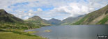

Crinkle Crags (South Top) and the infamous bad step from Great Knott

The Langdale Pikes from Great Langdale


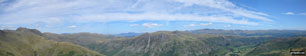
*Bow Fell (Bowfell), Rosett Pike and The Langdale Pikes from Pike of Blisco (Pike o' Blisco)
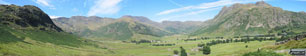
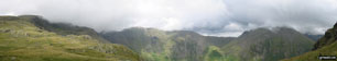
*Red Pike, Pillar and Kirk Fell from Dore Head
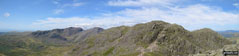
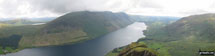
*Illgill Head (left), Wast Water (centre) and Middle Fell (right) from Yewbarrow
*Great Gable (centre) and Lingmell (left) from Scafell Pike
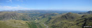
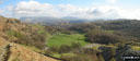
*Tilberthwaite with Helvellyn and Fairfield beyond from Wetherlam
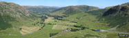
*The Langdale Valley from The Band
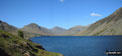

Packhorse Bridge over Mosedale Beck, Wasdale Head, Wast Water
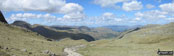
*Great Gable (left) and Skiddaw (far distance) from Esk Hause
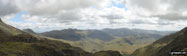
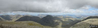
*Kirk Fell and Great Gable from Scafell Pike,

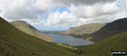
*Illgill Head, Wast Water, Middle Fell and Yewbarrow from Lingmell
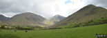
*Kirk Fell, Great Gable and Lingmell from Wasdale Head, Wast Water

Ennerdale Water from Lingmell Plantation

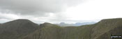

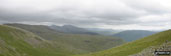
*Red Pike, Illgill Head, Scafell Pike and Scafell from Haycock
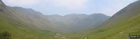
*Red Pike, Black Crag, Pillar and Looking Stead from Mosedale, Wasdale


Wast Water and Wasdale Head from Westmorland Cairn, Great Gable
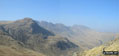

Pike of Blisco (Pike o' Blisco) Summit


Gunson Knott from Crinkle Crags (Long Top)

Sca Fell and Scafell Pike from Crinkle Crags

Great Langdale from Bow Fell (Bowfell)

Scafell Pike (right) and Sca Fell (left) with Mickledore (centre) from Bow Fell (Bowfell)

The Langdale Pikes from Crinkle Crags (Long Top)

Great Langdale from Crinkle Crags (South Top)

The Langdale Pikes from Crinkle Crags (South Top)

The Scafell Massif from Crinkle Crags (Long Top)

Great Langdale from Crinkle Crags (Long Top)


The Road to Curbar from Curbar Edge

Views from Froggatt Edge and Curbar Edge

Views from Froggatt Edge and Curbar Edge

Views from Froggatt Edge and Curbar Edge

Views from Froggatt Edge and Curbar Edge

Bradwell from Robin Hoods Cross

Coastal Defences along Spurn Head
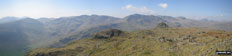
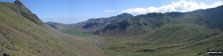


Blea Moor Signal Box with Whernside beyond
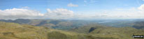
*Fairfield, Grasmere, Windermere and Coniston Water Sergeant Man
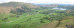


Looking 0ver Sour Milk Gill Falls


Views of the Borrowdale Fells from Green Combe near Dock Tarn

Little Langdale Valley from near Dale End

The Borrowdale Fells from Green Combe near Dock Tarn

The River Conquet with Shillmoor in the Distance


Beezley Falls, The Ingleton Waterfalls


Approaching Ingleborough from Crina Bottom


Levers Water and The Old Man of Coniston from Swirl Hawse

The Old Man of Coniston Summit

Coniston from The Old Man of Coniston

Goat’s Water from Goat's Hawse

High Spy (North Top) and High Spy from Hindscarth

Hindscarth from Dale Head (Newlands) The Newlands Horseshoe

High Spy (North Top) and Maiden Moor from High Spy

Cat Bells (Catbells) from Maiden Moor The Newlands Horseshoe with Keswick and Skiddaw beyond

Derwent Water from Cat Bells (Catbells) The Newlands Horseshoe


Tithesworth Reservoir from The Roaches


The Nab (Martindale) from Rampsgill Head

Kidsty Pike from Straits of Riggindale


Angle Tarn (Martindale) from Angletarn Pikes


Rescue Helicopter with Place Fell from Beda Head (Beda Fell)

Martindale from Nickles, just north of Beda Head


On The Saddle (Glenshiel) with Forcan Ridge ridge beyond

Hartshead Pike above Ashton-Under-Lyne

Celebrating at the top of Blencathra (or Saddleback) having successfully negotiated Sharp Edge

This is me scrambling to the summit of Helvellyn after surviving Striding Edge!

Reach Your Peak Competition Entries
To contribute to go4awalk.com or to contact us about anything at all - see Talk To Us.
For help see Help.
go4awalk.com and go4awalk.co.uk are registered trademarks of TMDH Limited.
Copyright © 2000-2026 TMDH Limited. All rights reserved.
Copyright Terms & Conditions Privacy Statement
A - Z Walks Home Log On/Accounts Photo Gallery Walk Ideas and Collections Fell Facts Hill Skills Walking Questions and Answers Your Stories News Competitions Product Reviews/Gear Tests Walking Gear Guides Peaks and Mountains Peak Bagging Find New Walking Friends Camping GPS Waypoints for Walking Contents Walk Search Talk To Us go4awalk.com Help Free Example Walks Newsletter


