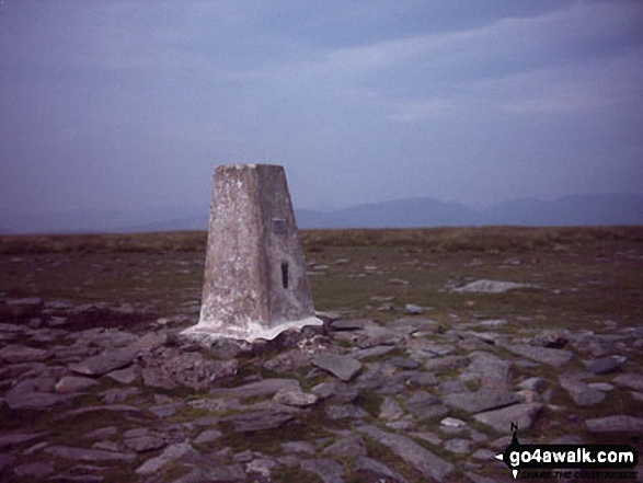
High Street summit
The Far Eastern Fells,
The Lake District National Park,
Cumbria, England
See views like this by using any of these 7 easy-to-follow circular walk route maps:
   |
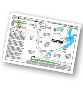
Vital Statistics:
| Length: | 6 miles (9.5 km) |
| Ascent: | 2,202ft (671m) |
| Time: | 4½ hrs |
| Grade: |  |
Route Summary:
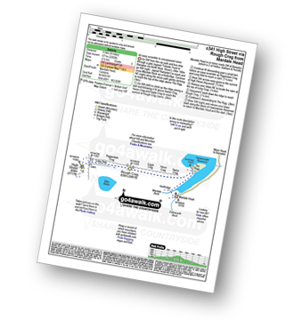
Mardale Head - Haweswater Reservoir - The Rigg - Swine Crag (Riggindale) - Heron Crag (Riggindale) - Eagle Crag (Riggindale) - Rough Crag (Riggindale) - Caspel Gate - Riggindale Crag - Long Stile - High Street - Rough Crag (Riggindale) - Eagle Crag (Riggindale) - Heron Crag (Riggindale) - Swine Crag (Riggindale) - Dudderwick - The Rigg - Mardale Head
|
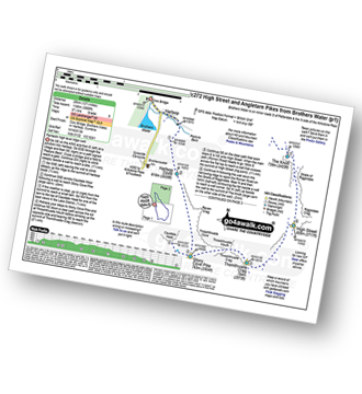
Vital Statistics:
| Length: | 7.25 miles (11.5 km) |
| Ascent: | 2,745ft (837m) |
| Time: | 5½ hrs |
| Grade: |  |
Route Summary:
Mardale Head - Haweswater Reservoir - The Rigg - Dudderwick - Swine Crag (Riggindale) - Heron Crag (Riggindale) - Rough Crag (Riggindale) - Caspel Gate - Riggindale Crag - Long Stile - High Street - Mardale Ill Bell - Nan Bield Pass - Harter Fell (Mardale) - Adam Seat - Gatescarth Pass - Mardale Head
|
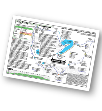
Vital Statistics:
| Length: | 11.25 miles (18 km) |
| Ascent: | 3,436ft (1,047m) |
| Time: | 7½ hrs |
| Grade: | |
Route Summary:
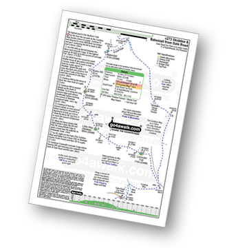
Mardale Head - Haweswater Reservoir - Rowantreethwaite Beck - Old Corpse Road - Selside Pike - Branstree (North East Top) - Branstree (Artlecrag Pike) - Gatescarth Pass - Adam Seat - Harter Fell (Mardale) - Nan Bield Pass - Mardale Ill Bell - High Street - Riggindale Crag - Caspel Gate - Rough Crag (Riggindale) - Eagle Crag (Riggindale) - Heron Crag (Riggindale) - Swine Crag (Riggindale) - Dudderwick - The Rigg - Mardale Head
|
Vital Statistics:
| Length: | 14.5 miles (23 km) |
| Ascent: | 3,364ft (1,025m) |
| Time: | 8½ hrs |
| Grade: |  |
Route Summary:
Mardale Head (Haweswater Reservoir) - Small Water - Nan Bield Pass - Mardale Ill Bell - High Street - Straits of Riggindale - The Knott - Rampsgill Head - Kidsty Pike - High Raise (Mardale) - Raven Howe - Red Crag - Keasgill Head - Wether Hill (South Top) - Wether Hill - Bampton Common - Low Kop - Measand Beck - Haweswater Reservoir - Wainwright's Coast to Coast Walk - Bowderthwaite Bridge - The Rigg - Mardale Head
|
Vital Statistics:
| Length: | 11.25 miles (18 km) |
| Ascent: | 3,843ft (1,171m) |
| Time: | 8 hrs |
| Grade: | |
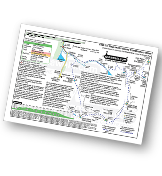
Route Summary:
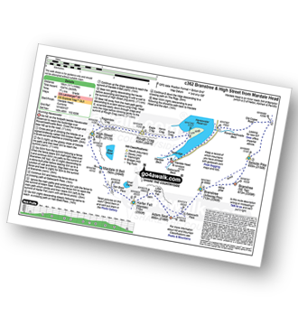
Cow Bridge - Brothers Water - Hartsop - Hartsop Dodd - Caudale Moor - Stony Cove Pike (Caudale Moor) - Caudale Head - Stony Cove Pike - Threshthwaite Mouth - Thornthwaite Crag - High Street - Straits of Riggindale - Rampsgill Head - Kidsty Pike - High Raise (Mardale) - The Knott - Hayeswater Reservoir - Hayeswater Gill - Hartsop - Cow Bridge - Brothers Water.
|
Vital Statistics:
| Length: | 12.5 miles (20 km) |
| Ascent: | 3,814ft (1,162m) |
| Time: | 8½ hrs |
| Grade: | |
Route Summary:
Mardale Head - Haweswater - Rowantreethwaite Beck - Old Corpse Road - Selside Pike - Branstree (North East Top) - Branstree (Artlecrag Pike) - Gatescarth Pass - Adam Seat - Harter Fell (Mardale) - Nan Bield Pass - Mardale Ill Bell - High Street - Riggindale - Rampsgill Head - Wainwright's Coast to Coast Walk - Kidsty Pike - Kidsty Howes - Bowderthaite Bridge - The Rigg - Mardale Head
|
Vital Statistics:
| Length: | 12.5 miles (20 km) |
| Ascent: | 3,889ft (1,185m) |
| Time: | 8½ hrs |
| Grade: | |
Route Summary:
Cow Bridge - Brothers Water - Hartsop - Hartsop Dodd - Stony Cove Pike - Caudale Head - Caudale Moor - Stony Cove Pike (Caudale Moor) - Threshthwaite Mouth - Thornthwaite Crag - High Street - Straits of Riggindale - The Knott - Angle Tarn (Martindale) - Angletarn Pikes - Boredale Hause - Patterdale
Send us your photographs and pictures of walks and hikes in the British countryside
If you would like to see your digital photographs as part of this collection, please send them as email attachments (configured for any computer) along with your name to:
and we shall do our best to publish them.
(Guide Resolution = 300dpi. At least = 587 pixels (wide) x 440 pixels (high).)

You can also submit photos via our Facebook Page.
NB. Please indicate where each photo was taken.
NB. To see photographs and pictures from a particular walk choose your walk from Walks or use our Walk Search facility.
To see photographs and pictures on, of or from a particular Mountain, Peak, Top or Hill select from Peaks & Mountains' or enter the Mountain, Peak, Top or Hill Name into our 'Photo Search facility.


